Pompton Valley Rail Trail Photos


You might also consider
More like Pompton Valley Rail Trail
Recommended Reviews - Pompton Valley Rail Trail
Start your review...

Great local, flat trail that is nicely marked and paved. Right off of the bustling Route 23 corridor you'll find quiet, birds singing, and friendly folks out getting some exercise. The path is only about 5.3 miles I each direction, but great for an hour ride out and back. Lots of walkers, bikers, families, and dog walkers. Use a bell to let walkers know you're approaching and everyone will be happy. Enjoy your walk or ride and give this trail a try!! read more


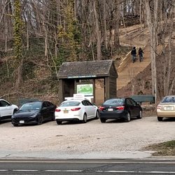
This was a bit of a redemption walk - I chose this trail for my First of the Year Hike two and a half months ago, only for it to be coated in snow and ice, making for a very uncomfortable and slightly treacherous hour or so. The material on the ground clearly didn't do it justice, so for my first Saunter Training of the year, I came back to do the whole trail top to bottom, totaling a little over 10 miles. Full disclosure - I did this in two parts, taking a brunch break in the middle. The first leg took place at the southern terminus/trailhead in Mountain View up to its intersection with the Newark Pompton Turnpike and back, and then later on I parked on the Newark Pompton Turnpike and walked up to the northern terminus/trailhead at River Drive and back. I'd guess though if you did this all in one fell swoop, it would take you three plus hours to accomplish at my pace. The best aspect of this trail, at least for now, is its overall quality. The path is paved and very smooth and hasn't had an opportunity to get dinged up yet. It's also accessible to civilization, which is a nice perk on a long walk - you're walking right past the downtown area of Pompton Plains and can easily diverge to a QuickChek or a restaurant if needed. I will say that the parking for this is a little meh; the Mountain View side has some street parking on a busy stretch of 202, but there's an area by the trailhead that would be perfect for parking that doesn't allow access. I'm assuming it's state-owned or something but if they could figure out a way to utilize that, it would be a big plus. It IS easier in my opinion to park on Newark Pompton, which has a lot of street parking as well as a nearby shopping center parking lot. The bathroom situation isn't ideal. I always bring a roll of toilet paper because you just never know, and had to use it by the northern end (conveniently/appropriately by the compost facility). There are no port-a-potties on the trail, at least not when I did this (maybe they'll add one or two when the weather gets warmer?) It's possible there's a public facility at Greenwood Corners Public Park, but I didn't see an obvious one from my vantagepoint. Also, this might be a young pup trail thing, but the kiosks were inconsistent - I'd say about half of them were completely barren, while the other half at least had a trail map. An easy fix. In terms of optics, mid-March is not the best for that generally speaking. The southern part of the trail is pretty desolate and goes through some of the flood zone areas by Lincoln Park/Pequannock, before changing over to suburban industrial areas and then just flat out suburbia. Interestingly towards the northern part, there's a legit farm situation going on with horses right before you cross under Route 23. Was not expecting to get a whiff of manure on this adventure. There's also a cool little painted rock garden by the downtown Pompton Plains area that seems to be growing - good luck to that. Not a bad addition to the area at all, especially given that this section of NJ unfortunately has a lot of highways and densely populated shizzle going on. This feels like a good compromise in that regard. read more
More info about Pompton Valley Rail Trail
You might also consider


Pompton Valley Rail Trail - hiking - Updated June 2026
Best of Pompton Plains
People found Pompton Valley Rail Trail by searching for…
Things to Do in Pompton Plains, NJ
Walking Trails in Pompton Plains, NJ
Hiking Trails in Pompton Plains, NJ
Scenic View in Pompton Plains, NJ
Beautiful Views in Pompton Plains, NJ
Running Trails in Pompton Plains, NJ
Places to Walk in Pompton Plains, NJ
Running Tracks Open to the Public in Pompton Plains, NJ
Fun Places to Go in Pompton Plains, NJ
Easy Hikes in Pompton Plains, NJ
Hiking With Kids in Pompton Plains, NJ
Off Leash Dog Hikes in Pompton Plains, NJ
Jogging Trails in Pompton Plains, NJ
Browse Nearby
BEST of Pompton Plains, New Jersey Coffee near Pompton Valley Rail Trail
BEST of Pompton Plains, New Jersey Restaurants near Pompton Valley Rail Trail
BEST of Pompton Plains, New Jersey Things to Do near Pompton Valley Rail Trail
BEST of Pompton Plains, New Jersey Walking Trails near Pompton Valley Rail Trail
BEST of Pompton Plains, New Jersey Breakfast near Pompton Valley Rail Trail
BEST of Pompton Plains, New Jersey Parks near Pompton Valley Rail Trail
BEST of Pompton Plains, New Jersey Campgrounds near Pompton Valley Rail Trail
BEST of Pompton Plains, New Jersey Ski Resorts near Pompton Valley Rail Trail
BEST of Pompton Plains, New Jersey Taxis near Pompton Valley Rail Trail
Browse Brands
Browse Articles
People who viewed Pompton Valley Rail Trail also viewed
Morris Canal
1 review
Franklin Lakes Nature Preserve
16 reviews
Ramapo Mountain State Forest
24 reviews
Reeves Meadow Information Center
6 reviews
Rockefeller Lookout
9 reviews
Great Oak Park
1 review
Abram S Hewitt State Forest
5 reviews
Back Beach Park
2 reviews
Norvin Green State Forest
29 reviews
Davis Johnson Park & Gardens
1 review