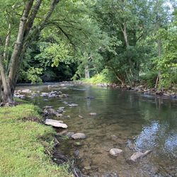
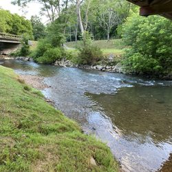
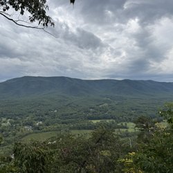
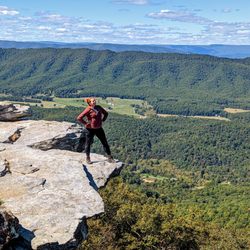
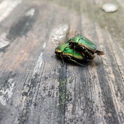
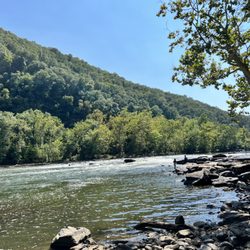
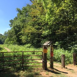
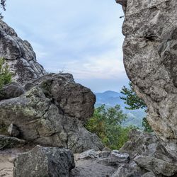
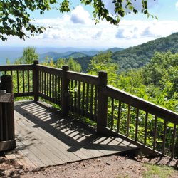
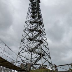
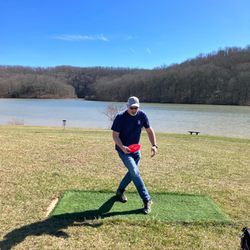
Cancel

    Open app

    Search

    Giles County

    5.0 (1 review)
    Closed 9:00 am - 5:00 pm

    Giles County Photos

    Recommended Reviews - Giles County

    Your trust is our priority, so businesses can't pay to alter or remove their reviews. Learn more about reviews.
    Yelp app icon
    Browse more easily on the app
    Review Feed Illustration

    8 years ago

    I absolutely love Giles County Great hiking, delicious restaurants, and some of the friendliest people you will ever meet.

    Helpful 0
    Thanks 0
    Love this 0
    Oh no 0

    Ask the Community - Giles County

    Verify this business for free

    Get access to customer & competitor insights.

    Verify this business

    Sinking Creek New River Tributary - Sinking Creek near Link Farm Covered Bridge (5 miles from where it goes dry)

    Sinking Creek New River Tributary

    5.0(1 review)
    7.5 mi

    While vacationing in Pembroke, VA we discovered an unusual creek that I simply had to yelp about…read more What makes a simple ordinary creek yelp worthy you ask? Well, it disappears! At the time of our visit, we had no idea of this phenomenon. As we drove to our Air B&B location, we simply thought the creek along the way had dried up from lack of rainfall and didn't give it another thought. Later, after exploring the area we learned that the two covered bridges we visited were actually on the SAME RIVER as the dried up one near our accommodations. How could that be? The dried creek bed is located approx. 5 miles downstream from the covered bridges, and less than a mile from where it reappears and actually flows into the larger New River. ~ CONFUSED? We were too until we discovered this area of Virginia is rich in what is called KARST TOPOGRAPHY. To avoid complicated scientific terms, just simply picture one of those multi-level bridges you see in cities like New York, San Francisco, Philadelphia and even Portland. Imagine an opening in the top layer causing all the traffic to flow to the lower level. However, when the bottom layer is full, the excess traffic is forced back up to the upper layer (hypothetically speaking). When there is sufficient water flow, you would never know the water is actually leeching underground to a cave-like drainage system. The water would fill the underground system to the point where all of the excess water stays above ground in the rivers basin. But when the water flow is lower and there is not enough water to fill the cavity, the water disappears underground (not visible on the surface) only to reappear as if from a spring near New River into which it flows. ~~~ Most people would probably find this sort of information nerdy and underwhelming, but I found it to be absolutely fascinating. I only wish I had taken pictures of the dried creek bed, but at the time of our visit, I had no idea of what was actually occurring. Our host home told us the creek was full just two weeks prior from heavy rainfall. Not to mention we saw with our own eyes a significant amount of water in the creek below the bridges just a few miles away. I swear, you are never too old to learn something new. 2020 / 32

    Photos
    Sinking Creek New River Tributary - Sinking Creek near Sinking Creek Covered Bridge (6 miles from where it goes dry)

    See all

    Sinking Creek near Sinking Creek Covered Bridge (6 miles from where it goes dry)

    Mcafee Knob Appalachian Trail

    Mcafee Knob Appalachian Trail

    4.9(27 reviews)
    37.5 mi

    My husband and I like to hike so on our recent visit to Roanoke we started exploring options. We…read morelearned that McAfees Knob is the most photographed spot on Appalachian trail. We were a bit nervous about an 8 mile hike, but decided we were going to take it on. That hike was no joke, it kicked my butt. However, I did it and I am not someone in amazing shape by any means. There were some very steep/uphill parts and some stretches that were mostly flat. Trail was well marked. I was happy for the variation and we stopped as needed. It is doable, its just long. They say it takes you about 4 hours, which was accurate for us as we arrived around 10am, finished about 2pm. We did the AT trial up and decided to go for the fire road (runs basically parallel but isn't as strenuous) back as we were already tried. I highly recommend this if you not a serious hiker. Most everything I read kept saying you need to get their early as it gets so busy. That wasn't our experience, but it was an unseasonably colder, windy day so that probably deterred people. We also went on a Thursday to help reduce crowd as recommended. Note there are no bathrooms near parking. We found an outhouse near one of the camping sites about 2/3 way up, which we were grateful for. I am not sure it is being maintained regularly, so bring your own TP and hand sanitizer. Now, the view once you get to the top is absolutely beautiful. You can see out so far while you sit/stand on the rocky overlook. I even slowly inched my way out to the very tip of the rock to get the full 360 view. Breathtaking! We brought some snacks to eat up there to replenish (do this) and enjoy the views. We didn't stay up there as long as I would have liked as it was quite cold with the wind when we no longer had the tree cover. Dress appropriately! After we finished the hike, we took a long nap at our Airb&B. I am not sure I would choose to do it again, but I feel very accomplished that we completed this trail and enjoyed the views and our picutres very much.

    What an awesome hike. Our new Thanksgiving tradition has been to go on a hike and this was our pick…read morethis year. We got there around 10am since it's a 3 hour drive from Charlotte. I thought it would be empty on Thanksgiving, but it was pretty crowded. We got a parking spot just fine, but the lot was fairly full. The hike is rated as strenuous, but I thought it was moderate. It's about 4 miles to Mcafee Knob from the parking lot making it 8 miles round trip. We took the Appalachian Trail on the way there and the fire road on the way back. The fire road is flatter and wider--an easier hike overall. Parts of the AT were covered in leaves making it a bit hard to hike. Everyone says the last mile is hard. It's uphill but I didn't find it to be too steep. The views at the end are gorgeous. Luckily it wasn't too crowded and we didn't have to wait to get our picture. We didn't stay at the top long because it was incredibly windy which made it pretty cold even though the rest of the hike was comfortable. The whole hike with stops took us just under 4 hours. With views and difficulty combined, we thought it was a great hike!

    Photos
    Mcafee Knob Appalachian Trail
    Mcafee Knob Appalachian Trail
    Mcafee Knob Appalachian Trail

    See all

    Claytor Lake State Park - Claytor Lake Medium Cabin's New Floors

    Claytor Lake State Park

    4.3(32 reviews)
    19.7 mi

    This park is one of those ones that feels like a private to public site; the majestic house at the…read morelakefront has been turned into a visitor center. The visitor center has a room or two of exhibitions on hydrology and wildlife but is not anything big. I came seeking a New Year's hike and expecting some scenery while being unsure if the amount of trails available would be enough. I managed to spend a solid two hours circumnavigating the place. In summer, swimming and boating are more likely the activities du jour, and it appears to be an excellent place for such activities. While the park looks close to the highway on the map, it feels like being at a park and there isn't any road noise. Like most VA state parks, they do charge for parking (waived for New Year's Day).

    Don't let all my NJ posts fool you. I was born and raised in southwest Virginia and most of my…read morefamily still lives there. Although I am forever grateful that my parents moved us out of the area when we were younger - especially when I get a peek at the local electoral maps - my heart remains in the mountains. Can't say my brains remain here though because it took until today to realize Claytor Lake was 1) a state park and 2) gorgeous and amazing. All these years I just thought it was nowhere special that my cousins would go fishing. And to think I road trip all the way to NH and Maine every year and could have just driven 7 miles from my grandmother's for an equally rewarding experience. I had cabin fever today at my granny's and caught the local Outdoors magazine write up about Claytor Lake. There's camping?? Swimming?? Trails?? I watched a few videos on YouTube then got in the car to see for myself. Need to know: -There's a booth at the entrance - closed after 4pm. $7 parking fee for most paid by the honor system with cash or check or by card through the QR code during after hours. There are 4 campgrounds - I only saw Campground D open and it was overwhelmingly being used by those with RVs, teardrops, and campers. These are NOT wooded lots, rather gravel pull-ins and you'll likely be very close to your neighbor. A lil too close for me but I can see it not being a huge deal since everyone had campers to sleep in. I took a drive through this campground to see if I would feel comfortable and I didn't see any displays that would make me think I wouldn't (you picking up what I'm putting down?) Trails and paved paths galore. I saw one trail today but didn't get to explore much. Apparently the only shoes I packed for this trip were Crocs. Paved paths snake through the park and are accessible for those with mobility devices. The "lake" was created by damming the river. The water is clear by the shore. We love clean river water! Tons of shelters, grills, benches. There is something for everyone! Not sure if shelters are first come first serve or if you need to book them in high season - check the website. There's a gift shop but it was closed. I was bummed because you know I love stickers! I am counting down the days until I can return in the warmer weather. I would not be opposed to camping here or swimming once they reopen the beach for the season. I also look forward to exploring the trails. Fantastic solo outing. What a gem in my little country corner of the world.

    Photos
    Claytor Lake State Park - Claytor Lake Medium Cabin Living Room

    Claytor Lake Medium Cabin Living Room

    Claytor Lake State Park - Claytor Lake Medium Cabin Kitchen and Dining Area

    Claytor Lake Medium Cabin Kitchen and Dining Area

    Claytor Lake State Park - Hmmmm. On my picnic table? Oh man!

    See all

    Hmmmm. On my picnic table? Oh man!

    Giles County - hiking - Updated June 2026

    Loading...
    Loading...
    Loading...