1. Golden Throne Trail

    1. Golden Throne Trail

    0

    Torrey, UT

    Cancel

    Open app

    Search

    Golden Throne Trail

    5.0 (2 reviews)

    Golden Throne Trail Photos

    You might also consider

    Recommended Reviews - Golden Throne Trail

    Your trust is our priority, so businesses can't pay to alter or remove their reviews. Learn more about reviews.
    Yelp app icon
    Browse more easily on the app
    Review Feed Illustration
    Photo of Kaori M.
    269
    1740
    1484

    2 years ago

    Helpful 3
    Thanks 1
    Love this 2
    Oh no 0
    Photo of James R.
    4987
    1275
    4657

    5 years ago

    Helpful 28
    Thanks 0
    Love this 23
    Oh no 0

    Verify this business for free

    Get access to customer & competitor insights.

    Verify this business

    Goblin Valley State Park

    Goblin Valley State Park

    4.8(72 reviews)
    35.7 mi

    We took this as a side trip and we really should have given this more time. If you are thinking of…read morecoming here, I recommend looking at all the activities offered to see how much is here to do so you won't feel as though you missed out on some of what makes this park FUN! As for us, we ran around the valley, played hide and seek, marveled at how these "goblins" were made and just had a great adventure with the time we had.

    A triumph of both western topography and federalism. This is one of those awesome parks that would…read morein some ways be less special if it were "upgraded" to a national park. It's great the way it is. Just a few notes: -- the campsite is just amazing; you are nestled in among caves and washes, and your kids can merrily wander off "to the kids cave" or climb up onto a crest and watch the sunset or the rhythm of the campsite. They do have a shared bathroom with running water, which keeps the place just civilized enough for moderately experienced car campers. -- at the same time, this place is really remote. If you realize at campside that your propane stove doesn't work, you would have to drive an hour each way to Green River to get more. Instead, you will just have to figure out how to boil coffee and macaroni and cheese over a campfire. -- the stars. The city lights are far far far away, and the desert sky is clear, so you can see so so many stars. And if you sit and stare at them you see more. The only place I have ever seen so many stars in my life is standing on the side of the road outside Marfa, TX. -- two decades ago this was one of the first camping trips of my life, and it remains a special place in my heart.

    Photos
    Goblin Valley State Park
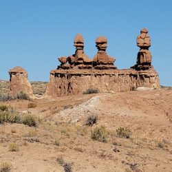
    Goblin Valley State Park - Close up of the Three Sisters.

    Close up of the Three Sisters.

    Goblin Valley State Park - The start of Valley 1. Valley of the Goblins basin has 3 total sections for you to explore however you want.

    See all

    The start of Valley 1. Valley of the Goblins basin has 3 total sections for you to explore however you want.

    Goosenecks Overlook - Instagram: @telephonesmoothie

    Goosenecks Overlook

    5.0(4 reviews)
    9.3 mi

    Definitely cool overlook that lets you take in the unique landscape of a very squiggly Sulphur…read moreCreek that is slowly and surely carving out the canyon it meanders over. It's such an amazing view, as the canyons have bands of yellow, red, and browns. They denote (from descending order) the Moenkopi formation, Kaibab limestone, and the White Rim sandstone. It's such a dramatic vista. It was also snowing a little bit when I visited, so everything was capped with a thin layer of white snow too. Such a beautiful view. It's an easy hike with a roundtrip distance of 0.6 mi and minimal elevation gain. The hardest part was the unpaved road to get to the trailhead! I did it in a 2WD sedan, but there were some pits in the road I had to navigate around. Not too hard though, just go slow.

    Such a dope vista point! The Goosenecks Overlook is located just a couple miles before you reach…read morethe Capitol Reef National Park Visitor's Center. Goosenecks Canyon is filled with limestone and sandstone dating back to over 270 million years old! You will have a clear view of the millions of years of erosion right from this viewpoint. The canyon is about 800 feet deep and Sulphur Creek runs along the bottom. It's almost like a mini Grand Canyon. In fact, some of the oldest rock layers of this canyon are the same rock layers that you'll find within the Grand Canyon (Kaibab Limestone). You'll have to drive a short distance up a rough and unpaved road to get here, but it's absolutely worth it for the views. From the parking lot, it's a short little hike up to the actual vista point. There's lot of room to roam around and explore the areas beyond the vista point. You'll be presented with stunning views with each and every turn. 360 degrees of pure bliss right before your eyes. If you're planning a trip to Capitol Reef National Park, this is an excellent place to stop on your way into and out of the park.

    Photos
    Goosenecks Overlook - Instagram: @telephonesmoothie

    Instagram: @telephonesmoothie

    Goosenecks Overlook - Instagram: @telephonesmoothie

    Instagram: @telephonesmoothie

    Goosenecks Overlook - Instagram: @telephonesmoothie

    See all

    Instagram: @telephonesmoothie

    Capitol Reef National Park - Hickman's Bridge

    Capitol Reef National Park

    4.8(165 reviews)
    6.7 mi

    This is an amazing national park. One thing I noted about the park is that it offers things for…read morepeople to do regardless of their activity level. If you're super fit and want to do hikes, good for you as there's plenty of strenuous hikes! If you aren't as active or use a mobility assistive device, you can travel on the very, very scenic drive and also learn about the ghost town of Fruita (although the NPS employees live there). If you time your visit right, you can even pick fruits from the orchards. I combined the Rim Overlook trail with the trail to Hickman Bridge to get amazing views, as well as hiked the Cassidy Arch trail. The trails weren't too crowded, so it was a great place to listen to nature and focus on hiking. You're rewarded with amazing views. Definitely hit up Gifford Homestead for fruit pies. They often sell out in the afternoon.

    Capitol reef is a stunner of a place, and a perfect visit spot for a short trip (1-2 days, imo)…read more You could definitely do a longer trip and REALLY see everything but I was satisfied to get a taste via some popular hikes including Cassidy arch, Hickman bridge, and the grand wash. I also was recommended to check out the Gifford Homestead where you can buy some EXCELLENT homemade pies and other goodies. I'm addicted to sugar so this was actually the highlight for me - the cinnamon roll, mixed berry and cherry pies that I bought were honestly some of the best pies I've had in my life. I had to eat them over the course of four days though since I was by myself and they are decently sizable (about the size of a large saucer/small dinner plate). As for the hikes - the arches were a bit strenuous but very doable in the span of a morning. Do beware that the trail is kind of hard to follow on the Cassidy arch trail - I got QUITE confused at one of the confluence areas of trails and ended up wasting a good 30 mins trying to figure out where I was/where the trail actually is. I saw a couple hikers coming down eventually and that's how I figured out where I was supposed to go. The Cassidy arch viewpoint is REALLY cool though, and of course the view of the vista at the arch itself is lovely. The Hickman bridge is also very impressive. I came on a random weekday in April and there were a handful of other hikers but really the trails were quite empty, and the trailhead lots had TONS of parking available, no issue. No traffic going in or out of the park either. The weather was decent; cloudy but wasn't rainy (it had been raining/sleeting just west of the park where my airbnb was though, so come prepared!). By the end of the grand wash hike in the early afternoon I was already getting pretty hot, and felt ready to move along on my NP road trip. Overall - if you're taking a tour of Utah I think it would be a travesty to miss this park, they're all incredible and unique in different ways!

    Photos
    Capitol Reef National Park - Some of the amazing petroglyphs!

    Some of the amazing petroglyphs!

    Capitol Reef National Park - Some of the amazing petroglyphs!

    Some of the amazing petroglyphs!

    Capitol Reef National Park - Gifford Homestead Pie

    See all

    Gifford Homestead Pie

    Fremont River Trail - The view from the top, looking back at campground river valley

    Fremont River Trail

    5.0(1 review)
    6.6 mi

    This is one of those hiking trails that sorta becomes what you make of it. Want an easy little…read morestroll along the river? Go for it. This trail leaves directly from the campground and heads downriver along the Fremont, wandering past the orchards, the group campground, and eventually enters a small canyon with walls. If you've got little ones, you could easily stop here and it will have been a nice, flat stroll. But waiting for you downstream, and atop those walls, is a nice panoramic view of the Fremont River valley, orchards, and main hub of Capitol Reef National Park. Once you reach the narrowed canyon walls, you start an ascent that rises above the river and gives you some great looks at the downstream vista. You can stop at the first overlook and no one would judge you for it, and you'll get great views. But press on to the full mile and after departing that overlook, you'll again rise on a less rocky trail before summiting out on a point that overlooks the campground valley in one direction, and the canyons in all others. From there, you go back out a mile on the same trail you came in on, and you're back at camp. The park lists this one as "moderate" in its scale of difficulty. That feels like a bit much until you do that climb to the overlook. But it does wind around some rugged rocks and you will pant a bit, so take that seriously, especially if it's warm out. There's no cover once you pass the riparian corridor and head into the rocks, so it will be hot. Sunblock and water are highly recommended. It's not the most written-about or awe-inspiring hike in the park, but it will probably take you less than an hour (and that includes the time you will walk from your campsite) so if you've got the time, grab a camera and go for a little hike along the river.

    Photos
    Fremont River Trail - View from partway through the hike

    View from partway through the hike

    Fremont River Trail - View only from partway up, looking back at campground

    View only from partway up, looking back at campground

    Fremont River Trail - Closer view of canyon walls (opposite of trail)

    See all

    Closer view of canyon walls (opposite of trail)

    Capitol Gorge - Pioneer Register

    Capitol Gorge

    4.8(4 reviews)
    0.0 mi

    Found at the end of the Scenic Drive, Capitol Gorge begins with a dirt road that weaves through the…read morebeautiful rocks and mountains of Capitol Reef. While the scenic drive in and of itself was wonderful, this dirt road to the Capitol Gorge trailheads had that beat. We drove this in a compact car without any issue, just make sure to take it slow as there are some tight, blind turns on this two-way road. If it's busy, parking can be a bit difficult at the end of the road to hike the trails. We came to hike to The Tanks, and the trail to the beginning of the The Tanks portion is super easy. You'll get to see some petroglyphs as well as the Pioneer Register - which is a cool section of rocks with signatures dating back 100+ years. There's plenty of shade in this area as you're walking between two mountain walls, and it can get pretty windy. I'd recommend bringing a jacket for this area if you're going on cooler days. The actual The Tanks hike we had planned to do was super disappointing. This 0.2 miles add-on is probably considered a moderate hike. While it had nice views, there was nothing special about the views, and you would be better off spending your time at another one of the better hikes in Capitol Reef. The other part of the Capitol Gorge Trail I previously discussed is worth it, just not the additional hike to The Tanks.

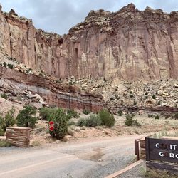
    This is the wondrous Capitol Gorge area of Capitol Reef National Park at the end of the paved road…read moreportion of the Scenic Drive. This Capitol Gorge is fantastic for grasping the true essence of what makes Capitol Reef NP so special. The red rocks and canyon cliffs are simply stunning! I was visiting here in late July 2021 and unfortunately the overcast skies did darken the scenic setting somewhat, but I was still able to capture some beautiful examples of vintage Utah scenery. I'd put the Scenic Drive to arrive at this Capitol Gorge along with hiking Chimney Rock Trail as 2 of the best activities I did while exploring the park. The Scenic Drive starts right beside the Visitor Center and runs for 10 miles each way into the heart of the Capitol Reef landscape. Along the drive there'll be plenty of opportunities to pull your car off to the side, get out and snap amazing picture moments including standing at Capitol Gorge. Also of note...the Scenic Drive runs on paved road for about the first 7 - 8 miles and the last 2 - 3 miles are set on dirt/gravel road. Unfortunately, I had a compact car with me and didn't want to chance driving on the rough road in this remote part of the country. So...after stopping here at Capitol Gorge, I turned around and headed back the 7 - 8 miles towards the Visitor Center. It is a $20 fee to drive the Scenic Road, otherwise to enter and do anything within Capitol Reef it's absolutely free! You pay an attendant during normal business hours that they're open but when the Visitor Center closes, they use the "honor system" and ask you to drop the $20 into a box as proof of payment. Btw, the Visitor Center is great for buying souvenirs and picking up a park pamphlet and map of all the trails. I highly recommend stopping at the VC for any questions you may have and general advice about exploring around. Lastly, while in this Capitol Gorge area...I'd suggest hiking the Grand Wash Trail as well as the Rim Overlook Trail for 2 different, yet unique perspectives for appreciating Capitol Reef from high above and also down below in between the rugged canyon walls. Alright well, this is the Capitol Gorge section of Capitol Reef National Park!

    Photos
    Capitol Gorge - Enjoying the Capitol Gorge setting.

    Enjoying the Capitol Gorge setting.

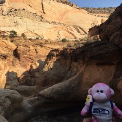
    Capitol Gorge - GMonkey do: Tanks Trail Oct 2020

    GMonkey do: Tanks Trail Oct 2020

    Capitol Gorge - The cliff-faced walls hover all around you here at Capitol Gorge.

    See all

    The cliff-faced walls hover all around you here at Capitol Gorge.

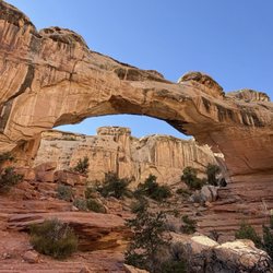
    Hickman Bridge - Hickman Bridge

    Hickman Bridge

    4.9(15 reviews)
    6.3 mi

    I combined the Rim Overlook trail with the trail to Hickman Bridge to get the most out of my hike…read more Unfortunately, the sky was threatining rain so I didn't want to risk it hiking to Navajo Knobs. The Hickman Natural Bridge is a 125-foot-tall natural bridge in Capitol Reef National Park. It's an 1.8 mile out-and-back trail, with some switchbacks, but it's an easy trail if you don't have any trouble climbing a few flights of stairs as baseline daily activity. The first part of the trail is the steepest with some stairs, but it gets more level afterwards as it follows a dry riverbed. You are hiking from the canyon floor to the rim! On the way up, you get to see the rock formation that reminded travelers of the Capitol dome that inspired part of the national park's name. It's a much better name than "Wayne Wonderland" which was what the region was called before it became a national park. The natural bridge is absolutely amazing. Climbing on it is prohibited, but you get to go up close and personal with the bridge to satisfy your photo-taking cravings. Vault toilets are at the trailhead, otherwise you're on your own.

    This is a lovely hike. It's not too steep, not very hard, and the bridge is pretty massive and…read morebeautiful when you reach it! It was recommended to me by friends and the volunteer at the visitor center because it's easy to do in a short time/on a short trip. There was plenty of trailhead parking as well. Would definitely recommend if you're passing through Capitol reef NP!

    Photos
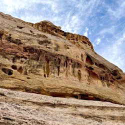
    Hickman Bridge - More interesting rock formations - these depressions in the canyon walls are formed by weather ("cavernous weathering")

    More interesting rock formations - these depressions in the canyon walls are formed by weather ("cavernous weathering")

    Hickman Bridge - Fun on the trail!! Some wide open sky along the way!

    Fun on the trail!! Some wide open sky along the way!

    Hickman Bridge - Fremont River rushes along the first part of the trail

    See all

    Fremont River rushes along the first part of the trail

    Golden Throne Trail - hiking - Updated July 2026

    Loading...
    Loading...
    Loading...