Cancel

    Open app

    Search

    Great Allegheny Passage GAP

    5.0 (6 reviews)

    Great Allegheny Passage GAP Photos

    More like Great Allegheny Passage GAP

    Recommended Reviews - Great Allegheny Passage GAP

    Your trust is our priority, so businesses can't pay to alter or remove their reviews. Learn more about reviews.
    Yelp app icon
    Browse more easily on the app
    Review Feed Illustration

    1 year ago

    Helpful 0
    Thanks 0
    Love this 0
    Oh no 0

    7 years ago

    Helpful 1
    Thanks 0
    Love this 0
    Oh no 0
    Photo of Kim R.
    132
    7
    0

    6 years ago

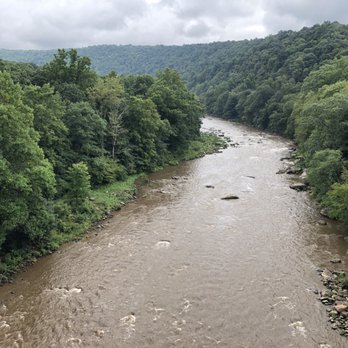
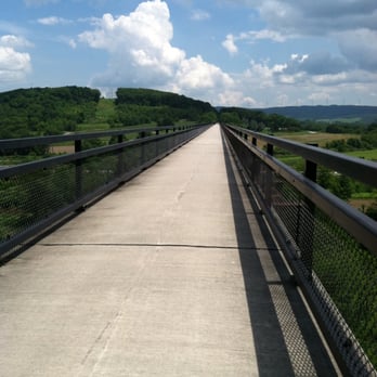
    Beautiful Trail to Bike or Hike. I've road from Ohiopyle to Continental divide. Breath taking views! Loved every minute of it!

    Helpful 0
    Thanks 0
    Love this 0
    Oh no 0
    Photo of Rebecca B.
    6
    211
    2614

    12 years ago

    Helpful 0
    Thanks 0
    Love this 1
    Oh no 0
    Photo of Andrea W.
    112
    264
    286

    10 years ago

    Helpful 1
    Thanks 0
    Love this 1
    Oh no 0

    10 years ago

    Helpful 0
    Thanks 0
    Love this 0
    Oh no 0

    Ask the Community - Great Allegheny Passage GAP

    Verify this business for free

    People searched for Hiking 196 times last month within 15 miles of this business.

    Verify this business

    Coopers Rock State Forest - Campsite canopy

    Coopers Rock State Forest

    4.7(54 reviews)
    42.2 mi

    We had a wonderful few days camping at Coopers Rock! The…read moresites are a good size and decently spaced apart so we have a good amount of privacy. The campsite bathroom was clean, well stocked and regularly maintained. All of the employees at the trading post were friendly as well! Park rangers drove around regularly (4-5 time through the campsite a day I'd say). My only wish would be adding closure information onto the website so people know ahead of time. During our visit the main overlook was under construction/maintenance so there was no access to it. Which was a little disappointing since it looks beautiful online! But it was a short 5 minute walk out to the overlook so it was easy to get back to a different trail. (It is clear the individuals who work and manage the park take great pride in it, and take care of the facilities wonderfully!).

    My husband and I just went on a camping trip to Coopers Rock and loved our time there! The views…read morewere beautiful, the trails were well cleared, and the bathroom at the main overlook site was one of the cleanest bathrooms we've ever been in. The Ravens Rock trail has a beautiful outlook with cool, large rock structures. And the rock city trail was super fun too! The free maps of all the trails are very helpful. Some blazes could've been marked a bit clearer and some signs for trail heads could be adjusted as well. There is limited parking at trail heads so be sure to get there early to beat the crowds. The trading post was a fun addition with Coopers Rock merch, stickers (our personal fav), some local goods, firewood, some camping supplies, and even some ice cream treats! Overall we had a really nice stay!

    Photos
    Coopers Rock State Forest - Ravens Rocks trail

    Ravens Rocks trail

    Coopers Rock State Forest - Woodpecker

    Woodpecker

    Coopers Rock State Forest - Almost heaven

    See all

    Almost heaven

    Green Ridge State Forest

    Green Ridge State Forest

    4.4(21 reviews)
    32.4 mi

    While I'm sure there is excellent hunting, fishing, trapping, hiking, camping - etc. - etc. - etc…read more going on here, we just came for the overlook. For years I've seen the signs, the same as everyone that traverses 68, about a scenic overlook, this time, it was finally time to see just how scenic is scenic. First off, super easy to find the overlook. Exit 64 off of 68, this applies to either direction, then it's just two right turns to the main park office. Plenty of offseason parking in winter, as you would expect, and there is good signage telling you where to go for the office, the overlook, outside seasonal restrooms and some of the nearby trails. From there it's maybe a fifty or sixty yard walk down a small sloped path to the wooden planked overlook. Kudos to the staff that even though it had just snowed the day prior, they had a small path cleared so that you could walk out on to the platform. Granted, the platform was also coated in thick ice, but that's another story. Excellent views of the forest landscape and of Fifteen Mile Creek. We didn't last long as even though it was sunny, it was still below freezing with a hell of a stiff breeze. On the way back up the trail we did stop briefly in the park office looking for a map as a souvenir/memento and while the door was open and there was a state vehicle parked outside (just our car and that one), nobody was there so we left as it felt...odd. The park itself is massive and hopefully in the future we can make the time to come back and explore more. Park website: dnr.maryland.gov/forests/pages/publiclands/western_greenridgeforest.aspx First picture is the Greenridge Overlook: www.mdmountainside.com/blog/post/green-ridge-state-forest-scenic-overlooks-tour/

    Yelp Fam!!!! A…read moredifferent review for the start of this month. Camping is one of my favorite things in the world. Especially since I live in the city being able to have silence is few and far between. GRSF is a gem, you have the bare necessities to have a great authentic camping experience. You can register for a camp site at the self service station. Sign up for a site, pay your money, get camping. Tip*- you must take your trash with you. You can dispose of it at the rangers station Each site has : bench Fire pit Cleared area for tents/hammocks We always stop off at Belle Grove Store- They carry all the essentials and food if you need some grub. This go round we were at site 5. Truly perfect, tons of fire wood around, very quiet and peaceful. Take advantage of this beautiful state forest while the weather is nice!

    Photos
    Green Ridge State Forest
    Green Ridge State Forest
    Green Ridge State Forest

    See all

    Swallow Falls State Park

    Swallow Falls State Park

    4.7(86 reviews)
    30.5 mi

    Nice paths, old-growth trees, waterfalls, slow waters, wild birds, dragonflies!…read more Swallow Falls State Park near Deep Creek Lake, MD, is a nice park with well-marked paths and plenty of parking. We hiked half-a-day (Jun 2026) from the parking lot to scenic waterfalls in forests where Thomas Edison, Henry Ford, and Harvey Firestone camped-in 1921. We saw some of the 37-acres of 360-year-old eastern hemlock and white pine trees, the largest of the few areas in Maryland that have never been logged, bypassed during the eastern-US logging boom of the the late 1800s and early 1900s. They tended to look a little scraggly around the base, i suppose from living an un-trimmed life in the un-tamed weather and climate. We were thrilled to read that, on June 16, 2026, the removal of old-growth forests that were threatened by bridge construction on Swallow Falls Road was blocked by the courts. Thank-you to the folks of Garrett County and the Chesapeake Legal Alliance!!! We love these old trees :-) We heard twittering birds, possibly blackburnian warblers, chickadees, nuthatches, and kinglets. We followed a rising rumbling sound, and found ourselves at a tall waterfall that roars and mists. We were careful to avoid rushing waters, and found that wading and crossing were pleasantly refreshing and not too slippery. We saw kayakers, and one paused to explain they liked these calmer waters for beginners and for staying in condition in less challenging settings. We loved the gold and black "black-shouldered spinylegs" dragonflies, we and may have glimpsed a rare all-black "sable clubtail" dragonfly, who flitted about but didnt wait for a photo or an entomology app. Let's say we saw one :-). It was a lovely cooler half-day deep in nature in a not-too-challenging environment in rare-these-days old-growth forests.

    What a wonderful afternoon out in nature! The falls were beautiful and the hike was pretty easy. We…read morewere visiting some friends up in deep creek and we decided to take it outside and enjoy this beautiful day. So glad we did, it was one of the first "nice" days of spring when we attended. It was pretty crowded, but we still had no issues parking and even enjoyed the scenic drive to the park.

    Photos
    Swallow Falls State Park
    Swallow Falls State Park
    Swallow Falls State Park

    See all

    Laurel Hill State Park - You can see wood frogs here during the Spring season.

    Laurel Hill State Park

    4.6(14 reviews)
    17.2 mi

    As if there wasn't enough parks in the Laurel Highlands, there is Laurel Hill State Park a 3,935…read moreacre natural area of beautiful forest, overlooks, ponds and streams. My recent visit was promising at first, but the rain just kept coming all day long and it "dampened" my spirits completely. I stopped by the main office and got directions to the Jones Mill Dam. Since it was raining so much I gave it some time to clear up, but to no avail. This park is certainly worth checking out and it will be super beautiful later on in the Spring. The wood frogs, spring peepers and other animals will be active. On the same road that this park lies on is two other parks: Kooser State Park and Laurel Ridge State Park, so it is possible to hit those up while in the area. I will certainly make the trip out here later on towards May.

    I was staying at Hidden Valley recently and I was looking for a cool place to hike in the area that…read moreI hadn't been to before and I happen to discover this gem. What a great spot for a hike, but an even better place for a swim, relaxing, a picnic on the grass or some sun on the sand by the water. So after we arrived we hit the trail that ran along the water while taking in the small but beautiful lake. We then proceeded to head into the woods. It was a great little hike and the trails were very easy. After we were done hiking we got the huge blanket and the cooler with snacks and drinks in it out of the car and headed over to a shaded spot under the trees. We sat in the grass area in the left corner of the parking lot and listened to music, ate, drank and enjoyed each other's company for a good while. Then after that we packed up our stuff in the car and headed down to the water and enjoyed the lake which is very clean and refreshing and the scenery is absolutely beautiful. I love that they have sand and everyone looked so happy. They also have an area where you can purchase food and beverages but they also have many other great amenities which I am sure can be discovered on here or on their website. I am so glad I discovered this place. I will most definitely be stopping by again when I am in the area. Enjoy :)

    Photos
    Laurel Hill State Park - A wood frog in their vernal pool near the stream.

    A wood frog in their vernal pool near the stream.

    Laurel Hill State Park
    Laurel Hill State Park - Three pic panorama of the Jones Mill Dam on this cloudy, rainy afternoon.

    See all

    Three pic panorama of the Jones Mill Dam on this cloudy, rainy afternoon.

    Eagle Rock / Tuscarora Trail - WV to the west. Wardensville.

    Eagle Rock / Tuscarora Trail

    5.0(3 reviews)
    56.8 mi

    Absolutely beautiful landscapes and views of the valley and ridge lines. The hike is a short…read moredistance (0.8 miles) to the view point, but the change in elevation makes it a great workout.

    - Update - *Several…read morepeople have advised me that the bird that tried to attack me is a Ruffled Grouse!* Apparently, they are well known in the area and confirmed to be aggressive and make strange noises! *Don't say you haven't been warned! :-) Saturday for the Memorial Weekend, I went to Wardensville WV to hike the Eagle Rock. AKA Tuscarora Trail. It's a simple 1 hour from my house. It's part of the Great North Mountain that acts as part of a natural border of WV and VA for some miles. The total miles of the Tuscarora Trail is 252 miles. It runs through PA/MD/WV and VA. It catches some of the Appalacian Trail at the Matthew's Arm Campground area. This trail was built as an alternative route for the Appalacian Trail due to the fear of the AT being shut down from development along the areas. The Tuscarora Trailhead for this location starts on the tippy top of The Great North Mtn on US48/VA55. At this location also you are in George Washington National Forest. You honestly can't miss it. 66w to 81s. Strasburg Exit to US48/VA55 follow for about 17 miles and you crest the mountain. There is a sign at the crest on the left near the wooods saying Tuscarora Trail. You can see it from the road. It slightly catches your eye but on the right side, you will see a big brown sign that says Entering Wardensville Cooperative Wildliffe Management Area. Park at the sign. Do not block the fire gates. I started out a little upset by the amount of hiker garbage on the o/s guardrail. Tons of Ice tea and water bottles littering the entire area. Not just a couple. It's like a ground of plastic bottles here. Also a bit worrisome was the constant gunshots. Over and Over until about the 1.5 mile stretch ends. I even saw Shot gun casings on the path, but I guess the sign did say Wildlife management Area. Geeze. The first mile was strenuous. There, I passed my first and only group of people I ever saw. They seemed to be teens chaperoned by 3 adults. They were catching their breath on the first mile. It was steep. Afterward, it leveled out and you could see you were walking the ridgeline of the mountain by looking o/s the trees to the mountain next door. Same height. From here it went from breathlessly uphill to muscle scortching downhill and leveling out.. over and over.. so overall there was give and take. A lot of the path became weedy and made my legs itchy. Some times it was almost knee length weeds. and the bugs. oh... the bugs. Don't stop for too long. I was breathing in a lot of bug protien on Saturday, let me tell you I had bugs for prelunch, lunch and snack! You could hear them around your head like a beehive. It was very much more wild than SNP. You could feel the wildness out here... I swear I am surprised I didn't see a bear. It was definately Bear Country! Speaking of this, let me also tell you what scared the living heck out of me up there. (Turns out after the scare I was laughing out loud all to myself but at the the time... I thought I was going to die) I heard some leaves russling... I slowed down and made a little noise...This...This... Turkey Bird Thing races out of the woods at full turkey bird speed and is coming right at me. It puffs up it's whole body and the tail spreads out like a Turkey but it's not big like a Turkey, more of a chicken size but fatter.... anyway this thing runs to me with his body puffed out and all I could do was walk backward and shout No over and over and over.. It's amazing I didn't fall down! That bird was litterally attacking me. I guess there was a nest along the patch in the woods and I was a bit close but OMG, If it were a bear, I'd be dead. That simple. Freaking Bird. OMG.... so it went off to the right and made this sound like a beaten dog.. wimpering..it was terrible. and When I started on my way, it followed me ! It was walking in the woods making that sickening noise for a good couple yards...That whole situation made me wonder about this dumb whistle I brought with me for safety. wow. wth is this whistle going to do! I forgot it was even in my hand! and that was a bird! lol. So later at a rock outcrop I almost sit on the one snake I saw the entire time. He was identical to the rock. Identical. I looked right at him and sat next to him. (?!?) The views were nice. A good change from SNP views. I'm glad I chose to hike this mountain this summer. There's so much more of it to hike and it even meets up with the Stairway to Heaven I did a couple weeks prior. I'm interested in exploring it a bit more. I may need to invest in a bigger whistle and perhaps a nice size knife as well. In the end, I was trying to outhike the storm on the way back to the car. I almost made it. But I was dripping wet once I turned the key! It was a great day and a great hike.

    Photos
    Eagle Rock / Tuscarora Trail - Trail grass can get high and is pretty itchy.

    Trail grass can get high and is pretty itchy.

    Eagle Rock / Tuscarora Trail - More scenery

    More scenery

    Eagle Rock / Tuscarora Trail - Scenery

    See all

    Scenery

    Hollow Brook Trail - Waterfall

    Hollow Brook Trail

    4.5(12 reviews)
    78.5 mi

    A great day for a hike on the A.T. This one is just o/s Fauquier County on Mt Weather. I took the…read moreSOBO trail a couple years ago. This time I went North to the waterfall. Let me give some mad respect to whomever dug out the spot to put in a rather large parking area for us! For years we've been on side of this narrow dirt road. * Thank. (Virtual fist pump). This was 3 miles out and 3 miles back. The waterfall is around 1 mile mark. It's off to the right. *please understand, ricks are slippery whether they're wet ot not. How someone brings three toddlers here with no backpack, water or first aid is beyond me. I had to leave the area. But it was really nice. Very relaxing and you did have to hand/foot climb to get up there. Be careful please. I double backed and got on the A.T. Couple more miles to the secret cliff I saw in another Yelp post. :) . Lots of people walked by, no one knew I was there. I had it all to myself. Its better than the actual lookout. Anyway. I scanned the rocks for danger, shot some pics and sat down for water and dry crackers. I look over and there are 2 snakes curled up by a small tree about 6 feet from me. I spoke to them. "Thought you'd hide from me. I got you!" It was funny. I took a couple pics and kept my eyes on them. Only takes a second to lose track and they end up right at me saying, "HA got you back!" I sat a while then headed back down. I enjoyed it! I'd like to section hike and have a car waiting to take me back to my own car where I started. They should have an Uber Hikes App available for that. ;) This way I can hike for as far as I want without turning around to come straight back.

    Short trail, pretty and cool, but the waterfall wasn't what I expected. The trail was well kept,…read moreand trimmed back, some areas were steep, and can be slick if it rains.

    Photos
    Hollow Brook Trail - Waterfall on the AT

    Waterfall on the AT

    Hollow Brook Trail - Waterfall

    Waterfall

    Hollow Brook Trail - Huge parking area. Thank you!

    See all

    Huge parking area. Thank you!

    Great Allegheny Passage GAP - hiking - Updated August 2026

    Loading...
    Loading...
    Loading...