1. Hoodoos Viewpoint

    1. Hoodoos Viewpoint

    0

    Improvement District No. 9, AB

    Cancel

    Open app

    Search

    Hoodoos Viewpoint Photos

    Recommended Reviews - Hoodoos Viewpoint

    Your trust is our priority, so businesses can't pay to alter or remove their reviews. Learn more about reviews.
    Yelp app icon
    Browse more easily on the app
    Review Feed Illustration

    7 years ago

    Helpful 0
    Thanks 0
    Love this 0
    Oh no 0

    9 years ago

    Helpful 21
    Thanks 0
    Love this 16
    Oh no 0

    9 years ago

    Helpful 1
    Thanks 0
    Love this 0
    Oh no 1
    Photo of Carl F.
    4832
    2935
    20329

    9 years ago

    Helpful 13
    Thanks 0
    Love this 15
    Oh no 0
    Photo of Julie L.
    19
    139
    71

    8 years ago

    Helpful 0
    Thanks 0
    Love this 0
    Oh no 0

    Verify this business for free

    Get access to customer & competitor insights.

    Verify this business

    Lake Minnewanka

    Lake Minnewanka

    4.7(26 reviews)
    6.3 km

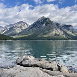
    There is nothing more beautiful than visiting a glacial lake in the middle of Banff National Park…read more This lake was one of our first stops for viewing and hiking. Lake Minnewanka is 142 meters deep (465 feet) and 21 kilometers (13 miles) long. It is the closest lake to the town of Banff and it is the largest lake in the park. The color of the lake is so striking with jewel tones of emerald, it is so clear and clean. The beautiful color comes from the glacial meltwater. Minnewanka means "Water of the Spirits" and there is a legend that when the Stoney people would travel in the neighborhood of the lake, they could hear voices of the resident spirits. The lake offers plenty of recreation opportunities such as picnicking, hiking, taking a cruise, renting a canoe or kayak, rent a motorboat, or fishing for lake trout and mountain whitefish, and relaxing lakeside. Swimming is not recommended as the water is pretty frigid. The most unique thing about this lake is the town of Minnewanka Landing. In the early 1800's, it was once a thriving resort town. When the lake was dammed in 1941 to provide power to Banff and Calgary the water rose and now all that's left is a ghost town underwater. We decided to take a trail and hike. We were there in September and we were cautiously aware that bear season was approaching. We did not hike too far just about five miles around the lake's perimeter and returned as we had no bear spray. The scenery with the surrounding mountains was absolutely stunning and gorgeous. I believe the trail was the Stewart Canyon - Aylmer Pass Junction. On our way out, we got to see a couple of big horn sheep roadside. So cute! So much to see here and a great way to start our trip in Banff National Park. Love CANADA!!
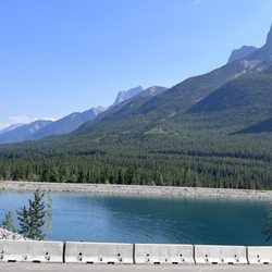
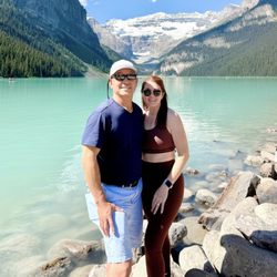
    I know Moraine Lake and Lake Louise get all the glory, but I actually really liked Lake Minnewanka…read more It was less crowded and there were more things to do. They had boat cruises and you could rent a canoe, kayak, or motorized boat. Also, it was convenient and fast to take the Roam Transit 6 bus here. Also, it seems like all the wedding photoshoots were here since it's less crowded and you don't have to hike very far to get really great pictures. My tip - just follow the wedding photographers, they know the best spots to get good shots. The pier was just nice to hang out and take pictures as well.

    Photos
    Lake Minnewanka
    Lake Minnewanka
    Lake Minnewanka - September 2022

    See all

    September 2022

    Johnston Canyon & Ink Pots

    Johnston Canyon & Ink Pots

    4.6(90 reviews)
    23.2 km

    The hike to the waterfalls and the hike to the Inkpots are two different tales..but both…read morespectacular. The hike to the falls are on a paved or finely-crushed gravel path, or on a causeway that walks you above the water. Either way, it is a relatively easy walk for most able-bodied persons. The falls are spectacular, but be prepared...in August, it will be busy with people, and you will spend a lot of time brushing elbows as people head the other way. And, at lower falls, there will be a 45 minute wait to look at the falls through a natural window opening in the rock. Personally, I'm not in the "selfie" crowd, so I will make better use of my time. Upper falls is another few minutes up the trail, and is equally powerful. Obviously, since water flows downhill, you are hiking uphill from the parking lot to see the falls. Continue past the upper falls, and now you are on the way to the Inkpots. This is where you will really start working. It is wide, well marked, but with much less humanity...we were never completely alone, but usually we didn't have anyone within 50 yards of us. It is about 3.5 mi from parking to the Inkpots, and it is uphill 2/3 of the way from the falls to the Inkpots, before descending back downhill to the river and Inkpots. The Inkpots were not as colorful as I had hoped, but they were an interesting natural phenomenon that we wanted to see. There are some benches, no toilets, and the river runs nearby. the walk back was 1/3 uphill and 2/3 downhill to the falls before the final (and crowded) stretch to the parking lot. Speaking of parking, we arrived at 8:20AM and were lucky to grab the last parking spot. It fills up quickly. More parking is nearby, but it adds to your walk. A cafe/store at the start of the trail sells food, coffee, and souvenirs. Bathrooms are also near the cafe. This is a must-see destination at Banff, but in peak season, arrive early- with good hiking shoes, if going to the Inkpots- and bring your food, water, bear spray, and camera. Our round trip was 7.8 miles in 3.5 hours.

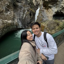
    We're excited to have an early morning start. Ample time to hike Johnston Canyon Lower Falls. Our…read morebiggest surprise included entering and exiting the cave. Amazing waterfalls! Would love to return and hike Upper Falls in the future.

    Photos
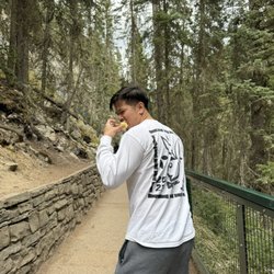
    Johnston Canyon & Ink Pots - Apple? no ty ITS GOOOD

    Apple? no ty ITS GOOOD

    Johnston Canyon & Ink Pots - The line to enter the cave at the lower falls

    The line to enter the cave at the lower falls

    Johnston Canyon & Ink Pots - 0.5

    See all

    0.5

    Troll Falls

    Troll Falls

    4.7(3 reviews)
    37.3 km

    A lovely, easy hike with a HUGE beautiful pay off at the end! It's a family friendly stroll with…read moreplenty of parking at the trailhead and it's easy to do in a couple of hours at most. The elevation is easy, and the stroll through the forest is leisurely and beautiful. In the winter you may want cramp ons or hiking poles since the packed down snow can get slick, but they're not necessary. At the end you'll find the beautiful Troll Falls. In the winter they're frozen the most miraculous bright blue and ice climbers have a great time climbing it's relatively easy verticals. Unlike the Johnston Canyon hike in Banff National Park, the Troll Falls hike allows you to get right up to the water falls, which makes for a truly special experience. Check my photos for proof!

    In the mountains and wanna go hiking, but need a spot that's not too difficult and also…read moreentertaining for wee kids? This is it. We were looking at different trail maps and unsure where to take our two year old for a hike that would grasp her attention span and also would be able to drag her along in a sled if she gets tired from all the walking. When Troll Falls popped out and had everything e were looking for. It's right at the bottom of the ski slope so if you find yourself driving up the mountain, you've gone too far. There is a decent sized parking lot by the entrance to the trail. The secret weapon for kids entertainment (aside from nature chats) are the hidden Troll Dolls around. Fun for everyone to try to be the first to spot them along the way! Even in December this was a fantastic crisp walk to do and at the end you come to a frozen waterfall. It was the most amazing thing to see, and to be able to walk on the frozen river. Just breathtaking! My husband is a geologist so he gives me all the geology chat along the way too. Really fantastic walk, I can't wait to do it again in summer and have a totally different experience. We seen a wolf run across the main road as we drove down to the trail so remember to stay safe when you are out there!

    Photos
    Troll Falls - Spot the troll dolls

    Spot the troll dolls

    Troll Falls
    Troll Falls

    See all

    Grassi Lakes

    Grassi Lakes

    4.7(16 reviews)
    15.1 km

    Grassi Lakes are amazing!!!! Truly emerald color and crystal clear waters. Since the easy trail was…read moreunder construction and closed, we took the difficult trail, which was much more steep. Totally worth the climb. Loved it.

    So grateful for the recommendation we received from a local Calgarian Canadian to try this trail!…read moreThe views are absolutely spectacular!! This hike is located near a residential area in Canmore. Follow your GPS navigation which ultimately will take you down a single road, surrounded by tall evergreen trees, and a small dirt lot on the left for parking before you embark on the trail. A few recommendations: Park on the street as the lot fills up quick, bring sunscreen, and take the harder trail. Initially when starting the hike there will be two signs for the "Easy" and "More Difficult" trail paths. Trust me when I say the more difficult path is worth the extra strenuous steps. We had no idea that halfway through the path you stumble upon a gorgeous waterfall and incredible views of a giant lake surrounded by beautiful mountains. Then as you continue on this trail, you'll ultimately come to a clearing with emerald and turquoise lakes which is the perfect spot to stop, indulge in a quick snack, and soak in all those spectacular views. All in all if you take the not so easy trail you'll complete the entire thing within an hour and a half, including those moments where you stop and contemplate just gorgeous this country is. One final tip: bring Bear spray and attach bells to your hiking gear. The last thing you want to do is startle a bear and end up in a frightening situation. Luckily we did not see any bears on the trail, but we did see a Black Bear crossing the road as we were leaving the parking lot! We heard from locals that Canmore has a lot of Bear sightings so just plan ahead, be aware of your surroundings, and enjoy your fantastic hike on this beautiful trail!

    Photos
    Grassi Lakes
    Grassi Lakes
    Grassi Lakes

    See all

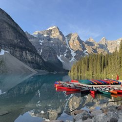
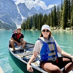
    Moraine Lake - Moraine Lake - rent canoe 1 hr $170 CAD

    Moraine Lake

    4.8(106 reviews)
    48.5 km

    Serene, tranquil and picturesque views of waterfalls, glaciers and lake. Easy hike and walk…read more I saw a ground squirrel running twice. Do not approach and feed any wildlife. Too quick for me to capture a photo moment. I loved hiking and walking round trip at Moraine Lake. Stunning! Great cardiovascular exercise from head to toes. Designated areas for benches. If I lived closer, I'd be here often. Highly recommend.

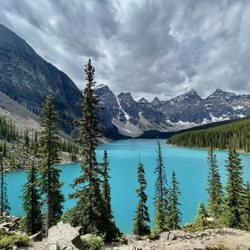
    After spending time at Lake Louise, our shuttle took us over to Moraine Lake. Seeing both of these…read morebeautiful lakes in person was awesome. Moraine Lake is only open during the summer season and requires a park shuttle to reach. It can get really crowed here. Moraine Lake is at an elevation of 6,181 ft and is situated in the Valley of Ten Peaks. There is an info sign in the front that shows you where the ten peaks are. Moraine Lake has a beautiful torquiest blue color to it. The color comes from the sunlight bouncing off the rock sediment in the lake and the surrounding glaciers. The water comes from the snow that melts in the glaciers. Moraine Lake has no dam and has not been altered by humans. The views of the lake are incredible. Because of the crowds, I hiked up to a higher point on top of a rock pile to get a better view. It was cloudy when I was here and it added to the beauty of the photos that I took. I really enjoyed my brief time at Moraine Lake and hope to come back and explore it a little more next time.

    Photos
    Moraine Lake
    Moraine Lake - Moraine Lake with Valley of the Ten Peaks

    Moraine Lake with Valley of the Ten Peaks

    Moraine Lake

    See all

    Hoodoos Viewpoint - landmarks - Updated September 2026

    Loading...
    Loading...
    Loading...