Sulphur Mountain Photos
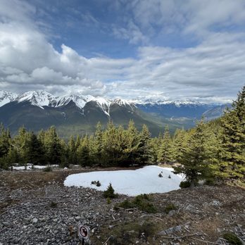

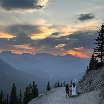

More like Sulphur Mountain
Recommended Reviews - Sulphur Mountain
Start your review...


Reviews With Photos


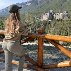
Pretty nice trails just outside of downtown Banff. Plenty of shaded trails to hike through that is off the beaten path and without very many tourists/ hikers. Nice hidden gem.


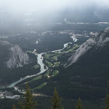
Sulphur Mountain is a mountain in Banff National Park in the Canadian Rockies, that overlooks the town of Banff. The mountain was named in 1916 for the hot springs on lower slopes. Two hot springs have been commercially developed. The lowest is the Cave & Basin National Historic Site and the highest is the Banff Upper Hot Springs. A gondola on the eastern slope took me to the summit ridge which has an upper terminal containing 3 restaurants, a gift shop, and multiple observation decks. The summit ridge provides views both westward up & east down the Bow Valley. A boardwalk can be followed on the north side to the top of Sanson's Peak 7,402 ft above. This mountain has been the site of 2 research facilities. In 1903, a meteorological observatory building was completed atop Sanson Peak. This building still exists with a window to see the rustic interior with original furnishings. In the winter of 1956-57, the National Research Council built a small lab to study cosmic rays as part of Canada's contribution to the International Geophysical Year. The Sulphur Mountain Cosmic Ray Station was removed in 1981, with a plaque marking the location.
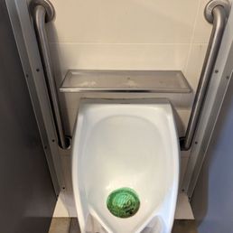

Very easy to ascend this summit as long as you take the gondola. Great washrooms at the top. Interestingly, they really take their grip bars at the urinals seriously. Not only is this great for accessibility, but it's also useful for people whose stream is so strong they would be launched across the bathroom if urinating unanchored. These urinals are specifically designed for those who must unzip their fly, TIGHTLY grip in with both hands on either side, and then unleash the torrential flow.


This mountain is in Banff and I highly enjoyed going there whenever possible. Recently I did the hike from the bottom to the top which is difficult especially because I did it in winter so so slippery and icy and there are many switchbacks it's very back-and-forth. However you also have the possibility to take the gondola up to the top which has lots to do up there you can see the view there are restaurants you can eat in. However even if you decide to hike to the top instead of taking the gondola to the top you are able to take the gondola down the one-way. The gondola is rather expensive to ride which I find I believe it's 50 or $90 a person I can't exactly remember.


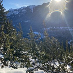
Sulphur Mountain is a grueling hike in the winter. Probably pretty tough for non-athletic types in the summer months, too, but in winter? MAN OH MAN. Get your crampons and get ready to take slow steps because it's about to get icy. 1/2 inch thick ice basically coated the trail all the way up. For roughly 3.5 miles you're going uphill, at an elevation gain of over 2,000 feet. I'm not the fittest or athletic person in the world but I've been running 5Ks the last year and most of my vacations the last two years have been centered around hiking and exploring the wilderness so I felt like I could handle this one. It was close, but I pulled it off. Thank God for those crampons and my hiking poles, though. I could not have done it without them. It was just too icy. It's a steep grade all the way up and I had the great Richard Thompson's song "Wall of Death" playing through my head throughout the whole hike. Now, that song is about a rollercoaster but the line, "the switchbacks will make you crazy" felt very applicable to us here. It was switchback after switchback, with seemingly no end in sight and as we seemingly got closer to the top it was maddening not knowing just how far away we were from the end. But the view on the way up is incredible. It makes every step so worth it, especially as you get higher and higher and can see more of the surrounding mountain ranges and wilderness below. The crampons were messing with my alignment and halfway up the hike, my right hip started to wail. I had to stop every 15 feet because every step forward on the incline was torture. There's no bailout once you get going and it's easier to go up than down (especially on the ice) so I just had to push through. About 2/3rds of the way up, the weather turned and it started to snow, the sky clouded up, and the winds began to blow. The view, that was once so incredible, was starting to cloud over. But it was beautiful in its own way and the silence was incredible. My hip might have been nearly bringing me to tears and I might have been cursing myself for beginning the journey, but I also never felt such peace and quiet. The falling snow on the trees was breathtaking. It was simultaneously the most physically challenging, difficult thing I'd ever done and one of the most stunning and rewarding experiences I've ever had. After nearly 3.5 hours I finally made it to the top. Sure, most of the view that we were heading to the top for was obscured because of the snow but I was so damn proud of myself for finishing it that I almost cried. I was greeted at the top by a huge ram snacking away and the beautiful creature combined with my sense of accomplishment and the majesty of the mountains did me in. I took my crampons off and, with my alignment back to normal, my hip felt totally ok again. And that's when it happened--between the dissipating pain and that damn hiker's euphoria kicking in, every curse word I said on the way up, every time I swore I would never do this hike again, suddenly was forgotten. It didn't really feel THAT bad in retrospect (although it was), and I could totally do that again (I could but I shouldn't). I was on top of the world, literally and figuratively! I found my other hikers and we high fived like crazy. We were in a tribe together. We climbed an effing mountain! I was a bad ass human! 5 stars for Sulphur Mountain! 5 stars for us! Additional info: At the top, you're greeted by a visitor's center with a shop, informational area, a small takeout market, and a restaurant complete with booze and warm beverages. And don't worry, you don't have to hike back down. The gondola will take you down. It's a much easier trip back to the base than up (unless you take the gondola up too, which is an option).


I found my favorite hike in Banff! Absolutely breath-taking view as reward after a moderate hike!! The 360 degree of surrounding snow mountain view is simply beyond description (see my pic pls)! Can't ask for more! Here are some stats for your reference: 500m elevation, 5.5km distance (took me 1hr20minutes at moderate speed. Average speed to finish is 2hr-2.5hr). Road might get a little slippery with ice as you get to the top.


We took the Banff Gondola up to the top of Sulphur Mountain. It was a fun ride and there's much to see at the top! There's an observation deck, which leads to a boardwalk that has amazing panoramic views of the town of Banff, Bow Valley and six mountain ranges. The boardwalk ends at the historic cosmic ray station, which is not longer in use. There is also a couple restaurants, gift shop and an interpretive center at the summit. This is a must while visiting this area. Would highly recommend! read more

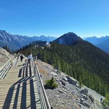
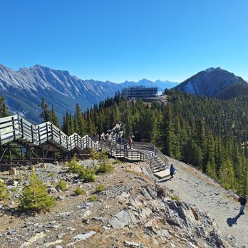


Going on a spontaneous, free hike, at your own risk is one of the perks after cruising observatory deck. Highest peak elevation level at 8,041 ft. Pros are getting 360 degree views and great cardiovascular exercise. Cons about hiking this area are some of the wooden steps are slightly loose and bugs at the top swarming around. read more


You get to Sulphur Mountain by taking the gondola ride. It's worth the cost and time to go up and see the sights. Lots of interesting things to check on in the building and the accompanying boardwalk to the weather station. Like the rest of the Canadian National Park, the entire area has been well cared for. The gondola ride is high quality. The building and observation deck are easily accessible for people with different mobility levels (they have an elevator to take you to the several floors in the building). The boardwalk is wide and well constructed. There is plenty of signage discussing the area and the history. Worth you time to check it out. read more


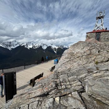


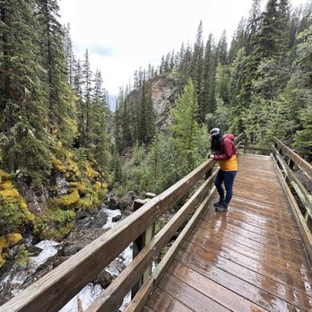

Sulphur Mountain is a mountain in Banff National Park in the Canadian Rockies, that overlooks the town of Banff. The mountain was named in 1916 for the hot springs on lower slopes. Two hot springs have been commercially developed. The lowest is the Cave & Basin National Historic Site and the highest is the Banff Upper Hot Springs. A gondola on the eastern slope took me to the summit ridge which has an upper terminal containing 3 restaurants, a gift shop, and multiple observation decks. The summit ridge provides views both westward up & east down the Bow Valley. A boardwalk can be followed on the north side to the top of Sanson's Peak 7,402 ft above. This mountain has been the site of 2 research facilities. In 1903, a meteorological observatory building was completed atop Sanson Peak. This building still exists with a window to see the rustic interior with original furnishings. In the winter of 1956-57, the National Research Council built a small lab to study cosmic rays as part of Canada's contribution to the International Geophysical Year. The Sulphur Mountain Cosmic Ray Station was removed in 1981, with a plaque marking the location. read more


3 years ago
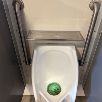
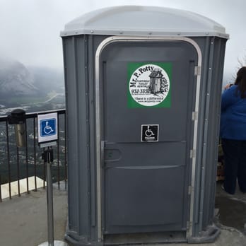
Very easy to ascend this summit as long as you take the gondola. Great washrooms at the top. Interestingly, they really take their grip bars at the urinals seriously. Not only is this great for accessibility, but it's also useful for people whose stream is so strong they would be launched across the bathroom if urinating unanchored. These urinals are specifically designed for those who must unzip their fly, TIGHTLY grip in with both hands on either side, and then unleash the torrential flow. read more

2 years ago


4 years ago

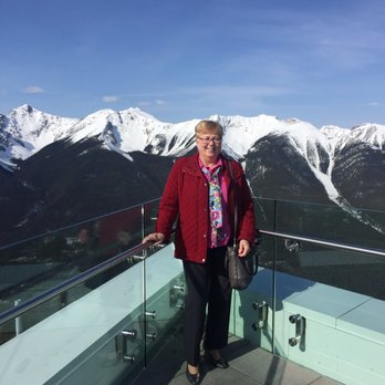
This mountain is in Banff and I highly enjoyed going there whenever possible. Recently I did the hike from the bottom to the top which is difficult especially because I did it in winter so so slippery and icy and there are many switchbacks it's very back-and-forth. However you also have the possibility to take the gondola up to the top which has lots to do up there you can see the view there are restaurants you can eat in. However even if you decide to hike to the top instead of taking the gondola to the top you are able to take the gondola down the one-way. The gondola is rather expensive to ride which I find I believe it's 50 or $90 a person I can't exactly remember. read more



9 years ago
Sulphur Mountain is a grueling hike in the winter. Probably pretty tough for non-athletic types in the summer months, too, but in winter? MAN OH MAN. Get your crampons and get ready to take slow steps because it's about to get icy. 1/2 inch thick ice basically coated the trail all the way up. For roughly 3.5 miles you're going uphill, at an elevation gain of over 2,000 feet. I'm not the fittest or athletic person in the world but I've been running 5Ks the last year and most of my vacations the last two years have been centered around hiking and exploring the wilderness so I felt like I could handle this one. It was close, but I pulled it off. Thank God for those crampons and my hiking poles, though. I could not have done it without them. It was just too icy. It's a steep grade all the way up and I had the great Richard Thompson's song "Wall of Death" playing through my head throughout the whole hike. Now, that song is about a rollercoaster but the line, "the switchbacks will make you crazy" felt very applicable to us here. It was switchback after switchback, with seemingly no end in sight and as we seemingly got closer to the top it was maddening not knowing just how far away we were from the end. But the view on the way up is incredible. It makes every step so worth it, especially as you get higher and higher and can see more of the surrounding mountain ranges and wilderness below. The crampons were messing with my alignment and halfway up the hike, my right hip started to wail. I had to stop every 15 feet because every step forward on the incline was torture. There's no bailout once you get going and it's easier to go up than down (especially on the ice) so I just had to push through. About 2/3rds of the way up, the weather turned and it started to snow, the sky clouded up, and the winds began to blow. The view, that was once so incredible, was starting to cloud over. But it was beautiful in its own way and the silence was incredible. My hip might have been nearly bringing me to tears and I might have been cursing myself for beginning the journey, but I also never felt such peace and quiet. The falling snow on the trees was breathtaking. It was simultaneously the most physically challenging, difficult thing I'd ever done and one of the most stunning and rewarding experiences I've ever had. After nearly 3.5 hours I finally made it to the top. Sure, most of the view that we were heading to the top for was obscured because of the snow but I was so damn proud of myself for finishing it that I almost cried. I was greeted at the top by a huge ram snacking away and the beautiful creature combined with my sense of accomplishment and the majesty of the mountains did me in. I took my crampons off and, with my alignment back to normal, my hip felt totally ok again. And that's when it happened--between the dissipating pain and that damn hiker's euphoria kicking in, every curse word I said on the way up, every time I swore I would never do this hike again, suddenly was forgotten. It didn't really feel THAT bad in retrospect (although it was), and I could totally do that again (I could but I shouldn't). I was on top of the world, literally and figuratively! I found my other hikers and we high fived like crazy. We were in a tribe together. We climbed an effing mountain! I was a bad ass human! 5 stars for Sulphur Mountain! 5 stars for us! Additional info: At the top, you're greeted by a visitor's center with a shop, informational area, a small takeout market, and a restaurant complete with booze and warm beverages. And don't worry, you don't have to hike back down. The gondola will take you down. It's a much easier trip back to the base than up (unless you take the gondola up too, which is an option). read more


10 years ago
I found my favorite hike in Banff! Absolutely breath-taking view as reward after a moderate hike!! The 360 degree of surrounding snow mountain view is simply beyond description (see my pic pls)! Can't ask for more! Here are some stats for your reference: 500m elevation, 5.5km distance (took me 1hr20minutes at moderate speed. Average speed to finish is 2hr-2.5hr). Road might get a little slippery with ice as you get to the top. read more


10 years ago
I agree with other reviewers - Hike up and take the Gondola down! The difficult level is Medium to severe and the hike is steep pretty much all the way. Park at the Gondola parking or in the hot springs parking lot. The trail begins in the hot springs parking lot. read more




More info about Sulphur Mountain
End Of Mountain Avenue
Banff, AB T0L
Canada
Directions
Hours
Outdoor Amenities
Review Highlights - Sulphur Mountain








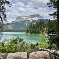


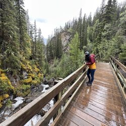


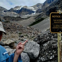
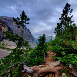
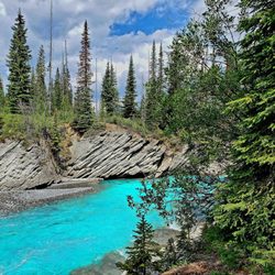

Sulphur Mountain - hiking - Updated September 2026
People found Sulphur Mountain by searching for…
Browse Articles
Browse Brands
Related Searches in Banff, AB
Affordable Canoe Rental Options in Banff, Alberta
Affordable Kayak Rental Services in Banff, Alberta
Best Fishing Locations and Guides in Banff, Alberta
Best Fun Things to Do in Banff, Alberta
Best Places for Horseback Riding in Banff, Alberta
Best Sightseeing Experiences Available in Banff, Alberta
Discover Top Boat Tours in Banff, Alberta for All Ages
Discover the Best Beaches in Banff, Alberta
Enjoy Camping Adventures Around Banff, Alberta
Enjoy Exciting Mountain Biking Adventures in Banff, Alberta
Enjoy Kayaking Adventures in Banff, Alberta
Enjoy Tent Camping Spots Around Banff, Alberta
Enjoy the Best Picnic Spots and Ideas in Banff, Alberta
Enjoy the Best Tubing Experiences in Banff, Alberta
Enjoy the Best Walking Trails in Banff, Alberta
Exciting Things to Do in Banff, Alberta Today
Experience Stunning Sunset Views in Banff, Alberta
Experience Thrilling White Water Rafting in Banff, Alberta
Explore Beautiful Parks and Green Spaces in Banff, Alberta
Explore Bike Rentals Throughout Banff, Alberta
Explore Fun Activities to Do in Banff, Alberta
Explore Popular Campgrounds Near Banff, Alberta
Explore Popular RV Parks Around Banff, Alberta
Explore Scenic Lakes to Visit in Banff, Alberta
Explore Top Dog Parks in Banff, Alberta Near You
Explore the Best Boating Spots in Banff, Alberta
Find Top-Rated Waterfalls in Banff, Alberta Now
Find the Best Playgrounds to Visit in Banff, Alberta
Fun Things for Kids in Banff, Alberta
Locate a Public Shower Facility in Banff, Alberta
Must-See Tourist Attractions Around Banff, Alberta
Plan a Scenic Drive Route Near Banff, Alberta
Popular Fishing Spots to Explore in Banff, Alberta
Popular Kids Activities in Banff, Alberta
Popular Things to Do in Banff, Alberta
Popular Things to See in Banff, Alberta
Relax at Natural Hot Springs Near Banff, Alberta
Top Hiking Trails to Explore in Banff, Alberta
Top Playgrounds for Kids to Enjoy in Banff, Alberta
Top RV Campgrounds to Visit in Banff, Alberta
Top Swimming Lakes to Enjoy in Banff, Alberta
Top Swimming Spots and Pools in Banff, Alberta
Top Things to Do With Kids in Banff, Alberta
Top-Rated Boat Rental Services in Banff, Alberta
Top-Rated Camping Sites in Banff, Alberta


