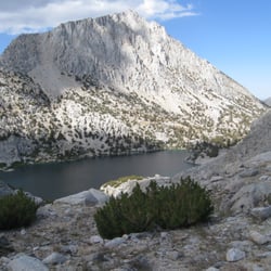
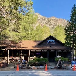
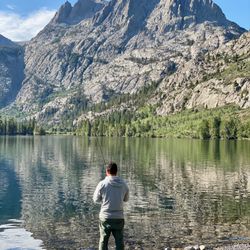
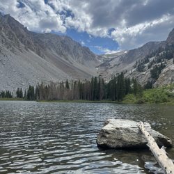
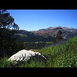
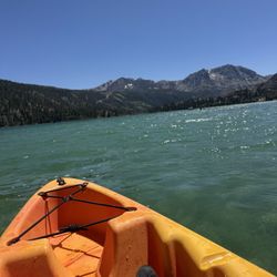
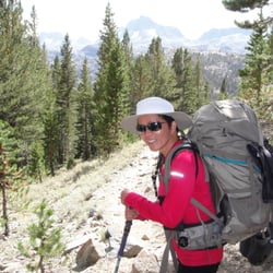
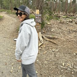
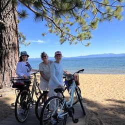
International Alpine Guides Photos


More like International Alpine Guides
Recommended Reviews - International Alpine Guides
Start your review...

Reviews With Photos

The Good:Ice climbing guides were safe and I really enjoyed learning in both the group and private ice climbs I did with them. Friendly guides and surprisingly good food on the Whitney winter climb. The Bad: The mountaineering guides were admittedly unsafe, inexperienced and dishonest. The Ugly: The Whitney Winter guides told us the night before summit day that due to the 3:1 ratio, if one person had to turn around we would all get together and decide as a group who would go back. This never happened as there was never a conversation or an opportunity to decide who was going back. The first (of 2) rope teams took off never to be seen again until late in the evening after they had summited. The lead guide apologized, admitting his mistake and inexperience and told me he would get me a refund. When this didn't happen, the office manager assured me on a Friday that she would call me back Saturday or Monday in order to resolve the situation. After one week passed, I sent an additional email and left a voicemail. The owner lied and said they called me back which never happened. I never received a reply to my email, a call or voicemail (verified through AT&T records.) Sadly, the dishonest owner takes an unprofessional and abrasive approach to resolving admitted mistakes made by his employees. The owner sent an email gaslighting me saying "summits are not guaranteed." Truth: I was more prepared and experienced than anyone on this trip, I never assumed or paid for a summit. I paid for a safe guided experience which I did not receive. When I emailed the owner saying that I would share my experiences with the online community, he implied that was trying to get extort him. I have AIARE 1, climbed Shasta 5 times(1 solo summit) and I have also summited Rainier via the Katz so trust me, I know that summited aren't guaranteed. I paid IAG for a safe guided climb, not a summit. Obviously I received neither. In the end Dave (the owner) refunded half my money and then asked me never to climb with IAG again. Talk about blaming the victim. I appreciate that they gave me the refund the inexperienced guide promised me after he admitted his mistakes. However, I do not trust this company to guide anyone for a safe mountaineering experience. After speaking with very seasoned professional guides from other companies about my experience, they strongly recommend that I do not climb with IAG again. Not only because the inexperienced guides and their lack of a safe approach to climbing but also because of their dishonesty and unprofessional attitude towards problem solving after they admitted they were in the wrong. Lastly, I feel it's worth mentioning that I was the only woman on this trip. I had more mountaineering experience, training and preparation that any of the guys on the trip. Given those facts, it's my belief that I was not given the opportunity to summit because I was the only woman on the trip. My preparation and fitness were exceptional and I was easily maintaining the pace with the 3 strong guys for the first 2 days of the climb. So ask yourself this: Why was I not given the opportunity to safely summit? It undeniably unsafe that they put a guide (140lb+-) in the front of a short rope and me (135lb) on the end with a guy (220lb+-) in between us who was an hour behind everyone on day 2 and continuously slipping, falling and stopping during the whole summit attempt. Fitness is safety and the guide admitted that he should have never let the obviously unprepared climber attempt a summit. Does it seem like they discriminated against me because I was the only woman? Not only was this unsafe, it was absolutely discriminatory. Bottom line: I want everyone to be aware of the safety issues with the inexperienced guides at IAG because those are dangerous. The whole reason we pay to climb with guides is to be safe. If you value your safety, please reconsider climbing with IAG for any mountaineering activities.You definitely have safer guiding choices than IAG. As someone who provides anesthesia for a living, I prioritize safety above all else. I feel it's what everyone deserves. Please feel free to reach out to me for verification of any of the facts in this review. Also, I am happy to make recommendations for safe guiding companies for future adventures.

10 months ago
Business owner information
Dave M.
We are sorry you felt this way and we truly wished you felt you had a…


2 years ago
These folks may provide a great service when everything goes as planned, but don't count on IAG to treat you fairly or follow through on their promises if something goes wrong. I had a medical emergency two days before I was scheduled with IAG. I knew the contract I signed had a strict no-cancelation policy, so I prepared to attend while in recovery from emergency surgery. But I got lucky: when I contacted IAG about my physical discomfort, I learned someone wanted to take my spot! Two different employees at IAG informed me (one in writing, one via voicemail) that because they had someone lined up to replace me they would be able to issue me a refund that day. Several days later, when the refund still hadn't cleared my bank, I reached out to follow up. Only then did IAG inform me that they had decided to stick with the contract and deny me a refund. They made this decision without informing me--and without giving me an opportunity to adapt my plans and receive the service I paid for. I've sent several polite emails to IAG to seek resolution. IAG has taken every possible path (explaining how their business model works, reminding me of their service to the outdoors community, recommending I purchase travel insurance next time, telling me I'm ruining the possibility they will assist future clients in similar circumstances) except the ethical one, which is simply to give me the refund they said they would. Last week (5/30), I sent IAG my voicemail transcripts and documentation of their agreement in writing to refund me in full. I made it clear I intend to contest these charges with my bank and the BBB. Today (6/4), IAG agreed to issue me a partial refund ($117 out of roughly $375), but state they will not refund me fully unless THEY get reimbursed from a third party. I'm disheartened that a local, outdoors-focused business would rather fight, gaslight, and stall than do the right thing. Bottom line: Based on my experience, I would not trust this company to treat you well if your adventure includes an accident, injury, or any other unforeseen circumstances. Expect them to communicate poorly, protect themselves first, use loopholes to duck responsibility for their actions, and shame/blame you for self-advocating. Proceed with caution. UPDATE: As of 6/10, IAG is agreeing to refund me in full provided I cancel the chargeback I made through my bank (IAG states that their credit card processor will not allow them to refund me as long as the chargeback remains open). My bank has rightly pointed out that if/when I cancel the chargeback I will lose the ability to self-advocate if there are further complications with the refund. It's a catch-22 that could have been avoided if IAG simply issued the refund on 5/16, when they said they would! At present, I am still working toward resolution with IAG. - P.S. IAG may respond to this review. I won't engage with them here, but I recommend potential customers read through IAG's responses on other low reviews and note the patterns of outright denial and blaming their clients. If you choose to work with this business, DOCUMENT EVERYTHING. read more

Business owner information
Dave M.
Yes, IAG will respond and will always respond to untrue and…
3 years ago
BE CAREFUL WHEN CONSIDERING IAG! I recently returned from a 5 day 50+ mile guided backpack trip with 3 others thru International Alpine Guides ("AIG"). This included summiting Donahue Pass at 11,000'. Due to the record snowfall this year, we were concerned about the trail conditions. We we inquired, we were told that "there would be a nice boot pack". Since nobody from IAG had been on this this trail prior to when this feedback was given, we were concerned about validity of this info. and the snow pack and difficulty. There was another IAG guided trip that went out a week before us and we asked, on several occasions, to speak to the guide upon their return to get real time info on the hike and trail conditions. We were never given access to that guide. Our hike turned about to be way more challenging than we could had imagined. While we all trained and were conditioned for this hike, we ended up hiking through snow pack, more specifically "snow cups" for approx. 40% of the entire hike where there was no boot pack at all. At higher elevations, mile after mile, there was no trail and at times had to wear boot spikes. At the end of day four after summiting Donahue Pass, I stepped in a snow cup which broke through and dropped about 4 feet. I ruptured my Achilles tendon and tore my MCL. Our guide followed protocol. We camped on the mtn while waiting for Yosemite Search & rescue to air lift me out the next morning where I was taken to the Mammoth airport then taken via ambulance to the Mammoth Hospital.. The Emergency Room took x rays & MRI. Almost 24 hrs after the accident, I was able to call my wife to check in. She asked how the hike was going. I then realized that NOBODY from IAG had reached out to her (she was my emergency contact) to tell her what had happened. I am now 6 weeks with a cast on and have a long recovery ahead. This injury could have happened to anyone as it was simply an accident To date, I have not received one email or call from IAG to see how I was doing? So, I decided to write IAG and share my thoughts about this experience. That was almost one week ago. To date, no reply at all. I would have been ok with some form of communication but since I haven't received any, I decided to write this review. It is unfortunate that I didnt vet IAG as thoroughly as I should have. IAG proved to be holding back valuable information about the trail conditions on several fronts. Perhaps, that with all the record snow fall and them having to cancel prior trips, they were not completely transparent with me in order to cash in on my trip cost. Now that this has been published, I expect to receive a damage control defensive response from IAG similar to the ones I have now read from other people on various review platforms. I HOPE THIS IS USEFUL WHEN CONSIDERING INTERNATIONAL ALPINE GUIDES. PS. We were told that out packs would be approx. 30 lbs, All of our packs were between 40-45 lbs. read more


Business owner information
Dave M.
While we are very sorry that this happened to Steve, much of this…
3 years ago
The Good:Ice climbing guides were safe and I really enjoyed learning in both the group and private ice climbs I did with them. Friendly guides and surprisingly good food on the Whitney winter climb. The Bad: The mountaineering guides were admittedly unsafe, inexperienced and dishonest. The Ugly: The Whitney Winter guides told us the night before summit day that due to the 3:1 ratio, if one person had to turn around we would all get together and decide as a group who would go back. This never happened as there was never a conversation or an opportunity to decide who was going back. The first (of 2) rope teams took off never to be seen again until late in the evening after they had summited. The lead guide apologized, admitting his mistake and inexperience and told me he would get me a refund. When this didn't happen, the office manager assured me on a Friday that she would call me back Saturday or Monday in order to resolve the situation. After one week passed, I sent an additional email and left a voicemail. The owner lied and said they called me back which never happened. I never received a reply to my email, a call or voicemail (verified through AT&T records.) Sadly, the dishonest owner takes an unprofessional and abrasive approach to resolving admitted mistakes made by his employees. The owner sent an email gaslighting me saying "summits are not guaranteed." Truth: I was more prepared and experienced than anyone on this trip, I never assumed or paid for a summit. I paid for a safe guided experience which I did not receive. When I emailed the owner saying that I would share my experiences with the online community, he implied that was trying to get extort him. I have AIARE 1, climbed Shasta 5 times(1 solo summit) and I have also summited Rainier via the Katz so trust me, I know that summited aren't guaranteed. I paid IAG for a safe guided climb, not a summit. Obviously I received neither. In the end Dave (the owner) refunded half my money and then asked me never to climb with IAG again. Talk about blaming the victim. I appreciate that they gave me the refund the inexperienced guide promised me after he admitted his mistakes. However, I do not trust this company to guide anyone for a safe mountaineering experience. After speaking with very seasoned professional guides from other companies about my experience, they strongly recommend that I do not climb with IAG again. Not only because the inexperienced guides and their lack of a safe approach to climbing but also because of their dishonesty and unprofessional attitude towards problem solving after they admitted they were in the wrong. Lastly, I feel it's worth mentioning that I was the only woman on this trip. I had more mountaineering experience, training and preparation that any of the guys on the trip. Given those facts, it's my belief that I was not given the opportunity to summit because I was the only woman on the trip. My preparation and fitness were exceptional and I was easily maintaining the pace with the 3 strong guys for the first 2 days of the climb. So ask yourself this: Why was I not given the opportunity to safely summit? It undeniably unsafe that they put a guide (140lb+-) in the front of a short rope and me (135lb) on the end with a guy (220lb+-) in between us who was an hour behind everyone on day 2 and continuously slipping, falling and stopping during the whole summit attempt. Fitness is safety and the guide admitted that he should have never let the obviously unprepared climber attempt a summit. Does it seem like they discriminated against me because I was the only woman? Not only was this unsafe, it was absolutely discriminatory. Bottom line: I want everyone to be aware of the safety issues with the inexperienced guides at IAG because those are dangerous. The whole reason we pay to climb with guides is to be safe. If you value your safety, please reconsider climbing with IAG for any mountaineering activities.You definitely have safer guiding choices than IAG. As someone who provides anesthesia for a living, I prioritize safety above all else. I feel it's what everyone deserves. Please feel free to reach out to me for verification of any of the facts in this review. Also, I am happy to make recommendations for safe guiding companies for future adventures. read more
Business owner information
Dave M.
This is quite the incindiary review! It is also full of half truths,…
2 years ago
Great time guiding at Donner Pass for my 16 year old gym climbing son. The guide Ryan was fantastic and took him up on some new routes. My boy learned a lot and got better as the day went on and is now psyched for more outdoor climbing. Would definitely recommend. read more
2 years ago
3 years ago
Business owner information
Dave M.
Thanks so much for the kind words Josiah and we are very happy to…
5 years ago
5 years ago
Business owner information
Dave M.
First of all this person, Sue R., has not used our services even…
5 years ago
9 years ago
5 years ago
5 years ago
11 years ago
7 years ago
9 years ago
10 years ago
9 years ago
More info about International Alpine Guides
June Lake, CA 93529
Directions
(877) 686-2546
Call Now
Visit Website
http://www.internationalalpineguides.com
Hours
Outdoor Amenities
From the Business
Ask the Community - International Alpine Guides
Review Highlights - International Alpine Guides


International Alpine Guides - hiking - Updated June 2026
Best of June Lake
People found International Alpine Guides by searching for…
Rock Climbing Gyms in June Lake, California
Campgrounds in June Lake, California
Sunrise View in June Lake, California
Indoor Rock Climbing in June Lake, California
Fishing Spots in June Lake, California
Tours in June Lake, California
Playgrounds in June Lake, California
Climbing Gear in June Lake, California
Things to Do With Kids in June Lake, California
Stargazing in June Lake, California
White Water Rafting in June Lake, California
State Park in June Lake, California
Cave Tour in June Lake, California
Waterfall in June Lake, California
Fitness Center in June Lake, California
Off Road Trails in June Lake, California
Hiking Trails in June Lake, California
Sunset View in June Lake, California
Things to Do on a Rainy Day in June Lake, California
Camping Sites in June Lake, California
Bouldering Gym in June Lake, California
Trending Searches in June Lake, CA
Bait And Tackle Shop near International Alpine Guides
Boat Rental near International Alpine Guides
Cliff Jumping near International Alpine Guides
Dog Friendly Beaches near International Alpine Guides
Fishing Spots near International Alpine Guides
Jet Ski Rental near International Alpine Guides
Kayak Rental near International Alpine Guides
Off Road Trails near International Alpine Guides
Outdoor Activities near International Alpine Guides
Public Shower near International Alpine Guides
River Tubing near International Alpine Guides
Scenic Drive near International Alpine Guides
Sunrise View near International Alpine Guides
Swimming Holes near International Alpine Guides
Swimming Lakes near International Alpine Guides
Browse Articles
Browse Brands
Related Searches in June Lake, CA
Affordable Kayak Rental Services in June Lake, California
Affordable Paddle Board Rental in June Lake, California
Best Fishing Locations and Guides in June Lake, California
Best Fun Things to Do in June Lake, California
Best Kids Birthday Places to Celebrate in June Lake, California
Best Places for Horseback Riding in June Lake, California
Best Rock Climbing Gyms to Try in June Lake, California
Best Sledding Spots and Fun in June Lake, California
Browse Yoga Classes and Schedules in June Lake, California
Check Out Off Road Trails in June Lake, California
Discover Dance Studios Available in June Lake, California
Discover Dog Friendly Trails to Explore in June Lake, California
Discover Fun Activities to Do in June Lake, California
Discover Fun Kid Activities to Enjoy in June Lake, California
Discover Fun Recreation Activities in June Lake, California
Discover Kids Indoor Play Area Venues in June Lake, California
Discover Popular Photo Spots in June Lake, California
Discover Scenic Waterfall Spots in June Lake, California
Discover Top Boat Tours in June Lake, California for All Ages
Discover Top Scenic Spots to Visit in June Lake, California
Discover Top Yoga Options and Studios in June Lake, California
Discover a Hiking Trail in June Lake, California
Discover the Best Night Hike Trails in June Lake, California
Enjoy Camping Adventures Around June Lake, California
Enjoy Exciting Mountain Biking Adventures in June Lake, California
Enjoy Hiking Adventures in June Lake, California
Enjoy Indoor Lap Pool Facilities in June Lake, California
Enjoy Kayaking Adventures in June Lake, California
Enjoy Tent Camping Spots Around June Lake, California
Enjoy a Refreshing Lap Pool in June Lake, California
Enjoy the Best Family Activities in June Lake, California
Enjoy the Best Tubing Experiences in June Lake, California
Enjoy the Best Walking Trails in June Lake, California
Exciting Cliff Jumping Spots in June Lake, California
Exciting Laser Tag Games and Venues in June Lake, California
Experience Bikram Yoga Studios in June Lake, California
Experience Stunning Sunset Views in June Lake, California
Experience Thrilling White Water Rafting in June Lake, California
Explore Beautiful Parks and Green Spaces in June Lake, California
Explore Bike Rentals Throughout June Lake, California
Explore Boxing Gyms in June Lake, California
Explore Easy Hikes Perfect for All in June Lake, California
Explore Fun Activities to Do in June Lake, California
Explore Martial Arts Options in June Lake, California
Explore Meditation Centers Near June Lake, California
Explore Popular Campgrounds Near June Lake, California
Explore Popular RV Parks Around June Lake, California
Explore Scenic Lakes to Visit in June Lake, California