1. John Wood 2 Side Trail

1. John Wood 2 Side Trail

0

Guelph, ON

Cancel

Open app

Search

John Wood 2 Side Trail

5.0 (1 review)

John Wood 2 Side Trail Photos

Recommended Reviews - John Wood 2 Side Trail

Your trust is our priority, so businesses can't pay to alter or remove their reviews. Learn more about reviews.
Yelp app icon
Browse more easily on the app
Review Feed Illustration

2 years ago

Helpful 0
Thanks 0
Love this 0
Oh no 0

Verify this business for free

People searched for Hiking 244 times last month within 15 miles of this business.

Verify this business

Joker's Hill Hiking Trail - Well marked trails

Joker's Hill Hiking Trail

4.0(1 review)
84.9 km

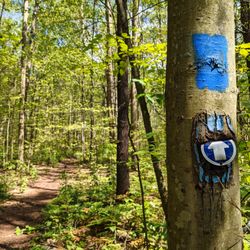
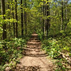
I had been to the Thornton Bales Conservation Area before and couldn't quite make it to Joker's…read moreHill due to rainfall in the area. However, today I found out that there's a parking lot for the Joker's Hill hiking trail. The parking lot is fairly large, but inconspicuous. There are no signs, so you just have to slow down as you near the entrance heading south on Bathurst because it's easy to miss. I recommend wearing bug spray and long sleeve shirts and pants because there are signs indicating that there are ticks in the area. I also recommend wearing proper hiking shoes because there are areas that get muddy, depending on how far you hike. Don't forget to bring water. The trail starts off on the right and is shaded. Another trail head starts heading straight from the parking lot. I took the one that went straight. That trail starts off very narrow and passes by residential houses until you eventually reach a wider trail. The trail markers are dark blue. It's important that you know how to follow a trail and know how to read the trail markers because I'd say 95% of the trail is marked well and it's easy to go off the trail if you're not paying attention. I used my phone's GPS and Google Maps to figure out where I was located, though Google Maps doesn't show the trail that I was on. The trail merges with other trails. The blue trail markers turned into red and white. I believe the red trail markers are for the loop that starts off to the right of the Joker's Hill trail parking lot. I followed the white trail markers to the end of the Joker's Hill hiking trail, where I entered the Thornton Bales Conservation Area. The trail markers turn light blue. At the end of that trail are the 99 Steps. In total, it's a little over 5,000 steps and about 50 minutes to hike from the Joker's Hill parking lot to the 99 Steps parking lot. Overall, a pretty decent hike.

Photos
Joker's Hill Hiking Trail - The trail is well marked

The trail is well marked

Joker's Hill Hiking Trail
Joker's Hill Hiking Trail - Wide trail

See all

Wide trail

Tiffany Falls

Tiffany Falls

4.1(15 reviews)
37.6 km

A bit more of a hike compared to Sherman Falls but still quite easy and definitely not handicapped…read moreaccessible. There is a parking area out front and it is paid parking. I don't know how well enforced it is, but feel free to give your parking receipt to someone else when you leave. $8 seems a lot for a waterfall! I was here in July so nothing frozen and no fall colors but still magnificent. a 21 meter (64 foot) cascade roars away. The path through the woods is very well marked and easy to follow up it's clear that some folks think it's okay to wander off the path. I stuck to the route and the observation platform. Partly because I'm a rule follow and partly because I'm the clumsy sort that would fall and hurt myself. Leave only footprints, take only photos. And if you can pick up some of the litter that others have left behind, you're a rockstar! [Review 1460 of 2024 - 138 in Ontario - 22483 overall]

I was in the area with family in August a couple of years back…read more The trail was really short from the parking lot. The Falls was pretty though a little crowded and busy. There will be people walking in the water. Be careful if you are walking through the water. Also, there are giant rocks and logs to sit on. I feel like Tiffany Falls is somewhere you go in the autumn. You would see the leaves being colors. There's a small fee enter (around $11/vehicle). It's done through a park kisok. You can use the same parking ticket at Sherman Falls within around 2 hours or so. The price not too bad for vehicle with at least 3 people. The parking area is really small. If you visit in the afternoon, you are going to wait a bit or park at Sherman Falls and walk (around 20 min) to Tiffany Falls. There isn't really a closer relatively larger parking lot.

Photos
Tiffany Falls - Tiffany Falls, Hamilton Ontario

Tiffany Falls, Hamilton Ontario

Tiffany Falls
Tiffany Falls - Tiffany Falls, Hamilton Ontario

See all

Tiffany Falls, Hamilton Ontario

Heart Lake Conservation Area

Heart Lake Conservation Area

3.9(12 reviews)
46.0 km

I'm really surprised I haven't reviewed this place - though I think I at least have reviewed the…read moreTree Top Trekking. The one thing I don't like is the notion of having to pay to enter a park. This might sound like an odd take since it's quite normal in Ontario, but being from BC originally, I can tell you that it was quite surprising (for here, and all other paid conservation parks). It's frustrating that the nicest park in the city - by far, which also has it's only natural lake, is gated and requires an entrance fee. I'll still give it 5 stars since it's part of a norm for the entire province, so I can't really hold that against it. I'll also have to admit that having a fee has perks which become apparent - namely: much cleaner, high staffing ratio (which helps cleanliness), no overcrowding, well maintained and even the configuration. It's similar to hating the cost of the 407 but having to admit you also love being able to cross the GTA in half the time. Heart Lake itself is a nice lake, and as mentioned the only natural lake in Brampton and probably one of the largest for quite some distance around it. Even without having visited, you may have seen it without realizing it since it was used in the movie Tommy Boy years ago (when Chris Farley is sailing and being taunted by kids). There is fishing, various types of boating, which now also includes boating at night with clear boasts that have bright neon lights around them. There are trails to walk along it too, but sadly not to go around it since city planners in their infinite wisdom years ago allowed a handful of houses to back onto the lake. There's also a some cross country trails in the wooded area for that type of running and cycling. The treetop trekking here is fantastic, but a completely different fee and business listing. But worth noting it is located here. There's an insane amount of picnicking spots. A perk with it being paid entry is that you're very likely to find a table and they even offer spots for charcoal disposal. They do offer being able rent out large spots for very big gatherings as well. They have a big splash pad and a nice large outdoor pool which has proper rope separation between shallow and deep ends. Again, the pool is quite large, so even on a busy hot Saturday in July, there was reasonable room in the shallow end - but considerably more space in the deep end. There is another fee for swimming, but it's quite reasonable. Good lifeguard ratio as well. So you've got to 'pay to play', but I also can't say there isn't value for the money. I'd highly recommend looking at an annual pass (family pass especially) which probably pays for itself within 2-3 visits here, or to any of the other TRCA conservation areas. I believe Brampton library does offer the ability to borrow a pass, but you'd want to plan ahead as I wouldn't be surprised there's holds for it.

The conservation park has a lot to offer: Tree Trekking, trails that continue along the lake,…read moreexercise equipment, lots of parking space and huge picnic and bbq area with lots of picnic tables, with all the safety measures in place; designated place to throw away ashes, big garbage bins. Good for all seasons

Photos
Heart Lake Conservation Area

See all

John Wood 2 Side Trail - hiking - Updated July 2026

Loading...
Loading...
Loading...