Kaiwi Shoreline Trail Photos


You might also consider


More like Kaiwi Shoreline Trail
Recommended Reviews - Kaiwi Shoreline Trail
Start your review...


Reviews With Photos


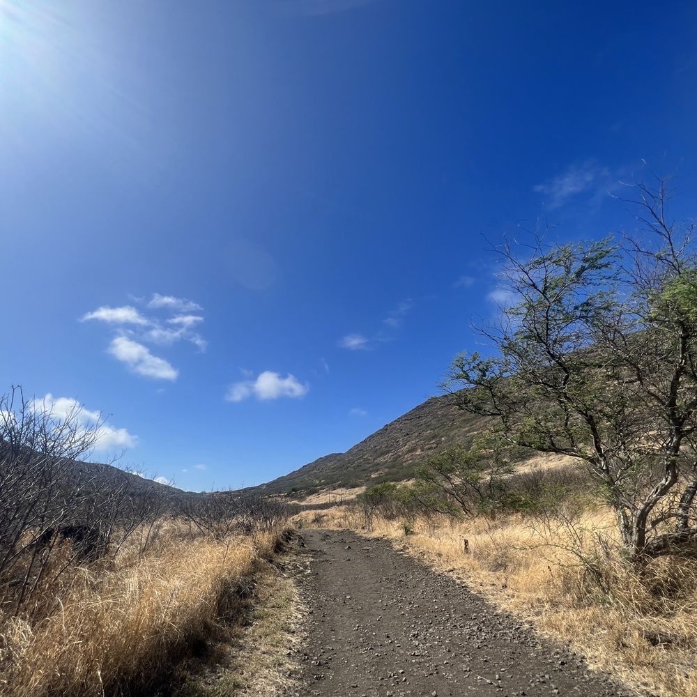
If you are going to hike Makapu'u Lighthouse, you'll see Kaiwi Shoreline Trail on the right side passing the entrance. Easy to spot and visible as it has dry brown trail going down. Obviously it's a dirt trail but clear and visible without any shade in most of your hike. When it's summer it's dry and brown however on rainy season it's chocolatey muddy and a challenge to hike to. Make sure to wear proper shoes and bring flip-flops as possible to wear it when you approach the beach side. Personally, I love this beach trail. Super easy to hike as the terrain is mostly flat. Then you'll arrive to this beach that is not that friendly as big waves tend to crashed on you but there are some spot where you can swim to a cozy mini lagoon. I find this beach also a perfect spot to do fun-shooting. If you decide to take a dip or snorkeling be cautious and don't dive if big waves are on. Mahalo for reading and happy juandering fellow yeeps!


Quality/Quantity - How does this get such great reviews? Where are the bathrooms? Very limited parking, and high break in area; yes I am extra cautious since my last SF JapanTown experience, see Yelp. Very easy paved walk. Perfect for beginners. Much more touristy than I expected. Wait, I am so confused, did I hike the wrong trail? Did we do the Makapu'u Lighthouse hike instead? Or Makapu'u point lighthouse trail or??? Or I need to start wearing my glasses??? Atmosphere - Very easy simple paved hike, I believe it was 4 miles round trip...? Service - None. Price - Free. Owner Comment - Hi, please invest a little more $$$ here to make it a more positive experience.


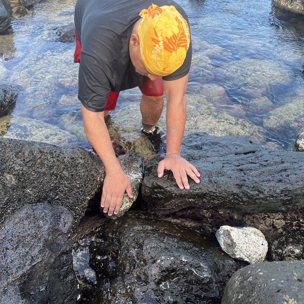
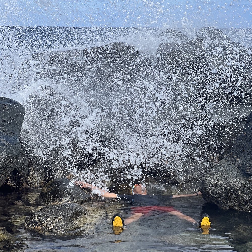
Never in my life I will forget this hike. It's where my iphone dropped in 6ft saltwater and was able to retrieved it after more than an hour chilling down with waves crashing on big boulders around it. Until now, I can't believed I moved those big rocks and was able to used the same phone doing this l review here on Yelp. Kaiwi shoreline trail is a pretty easy hike to do mostly dirt and no shade along. My bald head got sunburned the next day coz the sun is shining so bright at that time and it was humid as well. But luckily it was a shoreline trail so at the end of it I was able to cool off myself in a small lagoon we found at the very tip of the hike. Having a huge boulders around helped us protected away from those raging enormous waves crashing on. So it was a sweet awesome spot for me and the fact that only me and my wife are the only human swimming on that spot. On the other side of the beach I've seen a group of folks diving and snorkeling so I guess it's the spot to go snorkeling too? I've seen couples and a family doing picnic here under the shade which give me the idea to come back and bring my poke from Foodland and some refreshments to cool us off next time. A tip from Yarman: Do not ever use your phone while in water coz Goddess Nāmaka might take it out of the blue. Next thing you know, your phone will slip down in between those big boulders and will end up grabbing a can grabber back home! LoL. It was an experienced I cannot ever forget. I enjoyed the hike, the saltwater and above all , I was rejoicing as I retrieved my phone enjoying down in the ocean for a quite awhile. See yah later...


Don't want to give away too much as the beauty of this place is the solitude. Suffice to say if you know how to get off the beaten path and pay attention you'll find it. Don't gather here or party...be respectful of unmarked burials and heiau in this area. KAPU! Tread Lightly. Pack it out. Leave no trace. Be quiet and still in this sacred place. Listen and you might hear the guidance you've sought by coming to this unique spot of the gathering isle.


I initially wanted to hike up Makapu'u Lighthouse. But then I noticed the crowd of dogs, children, and tourists, that made me rethink my decision. I then proceeded to head down the mountain to Kaiwi Trailhead. Its rocky and has the potential for mud after it rains, so definitely wear shoes. It's very peaceful, aside from the sound of barking and groans coming from the Makapuu trail in the distance, lol. I ran into a few people, a couple fishermen, and beachgoers. I stopped and took pictures every chance I got, walking at my own pace. I even sat down by the shore and listened to the breaking waves. I wish I brought my coffee and book! Next time for sure! Solo adventures


This trip to Hawaii has been geared around exploring off the beaten path. We've successfully avoided the touristy locations as we did those on our first trip. This was our 1st hike of the trip. This hike is to the most westerly point of Oahu. It was rated as easy!?!?!?! Ok have to disagree with that one. Probably more an upper moderate. It may have just been the recent weather conditions rendering it hard to traverse. Elevation gain is 226ft over a 5 mile round trip. The ground is rocky, frequently muddy and the tip is sandy. I recommend something with ankle support because of the unevenness of the terrain. All that aside there was some great scenery. To include albatross mating dances and some nice up close shots. We were lucky enough to have one resting 6-10 ft away from us. We managed to get some good pics of that one. There are ropes to designate the trail and you are admonished against going off the trail and/or harassing the animals. In addition the nesting area is fenced and gated to keep the mongooses out. There are plenty of bait traps, they're well marked so leave those alone too. This is not a dog friendly venue - leave them at home. Take water - 2 qts is recommended. We have camel baks so no issues there. We found 3 monk seals sitting in a tide pool at the point. But no whales on this trip either. Hard trek but worth the walk.


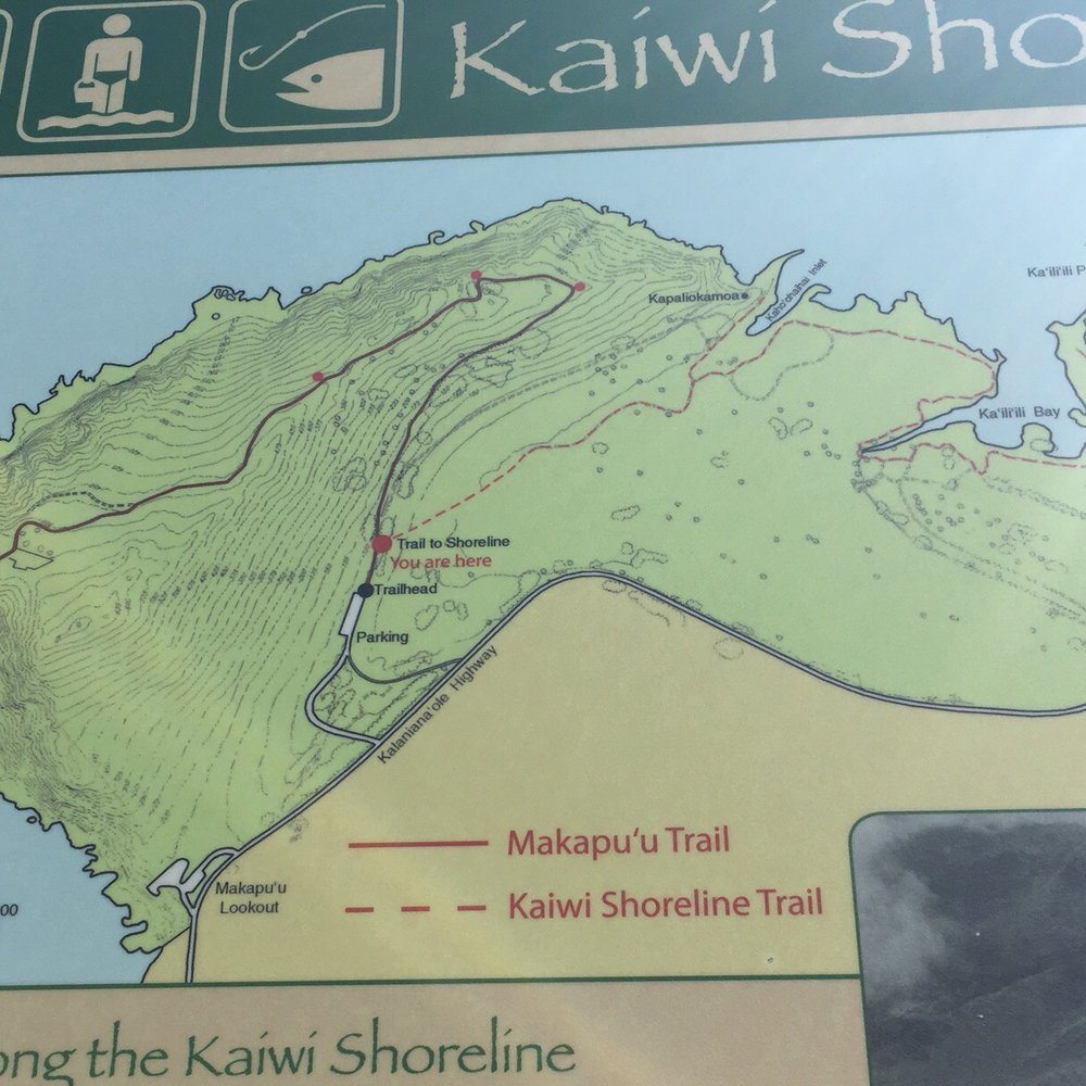
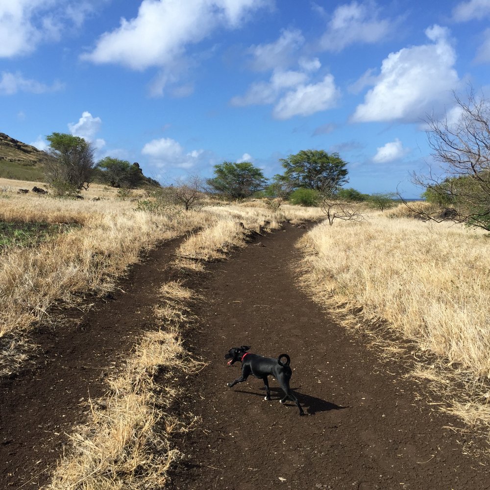
Walking up the concrete path, a trail map display of what didn't look like the Makapu'u Lighthouse Trail caught my eye. It's been years since I first hiked the lighthouse trail, but the thought of walking along the breezy shoreline of Ka'iwi Shoreline Trail seemed more refreshing than seeing a lighthouse, so I found myself making my way between the two wooden posts & down the rocky terrain. The ground levels out to a dirt path surrounded by a field of golden leaves of grass glinting in the wind. It was a peculiar sight knowing that you're in Hawaii walking in the dry desert of an African safari scene. After a while, the path leads to a secluded beach cove slightly obstructed by outstretched branches where you'll start asking yourself if this is the end of the trail. If you want to swim, then yes, it's the end. I'm not a beach person so I lugged on, taking a right before the beach. Apparently, it was a wrong turn because it seemed like it took me further into the middle of the field & I immediately sought out a path that looked like it led to the tide pools. If you walked through the beach, it'd take you to the shoreline (which is the right path anyway). From here, you'd see the other sandy beach which is where you want to go. Keep in mind that there'll be two paths in front of you at some points, but use trail markers like Pele's chair, which is the rock formation on the tip of the mountain where the lighthouse trail is, or the other mountain, which happens to be Koko Head Crater, to determine where you are. Or you can just follow any ol' dirt path you see. It doesn't really matter because the paths just loop around & are easy to follow. In this trail, I traveled through African-like fields, Hawaiian shorelines caked with glittering lava rocks & now a mangrove swamp. I couldn't help but skip rocks into this picture perfect scene. Aside from the scenery, there isn't much else to this hike. It's more of a walk that should be supplemented by doing the lighthouse trail if you have approximately an hour to kill or if you want to take a dip in an uncrowded beach. I got hungry so the lighthouse trail's for next time.


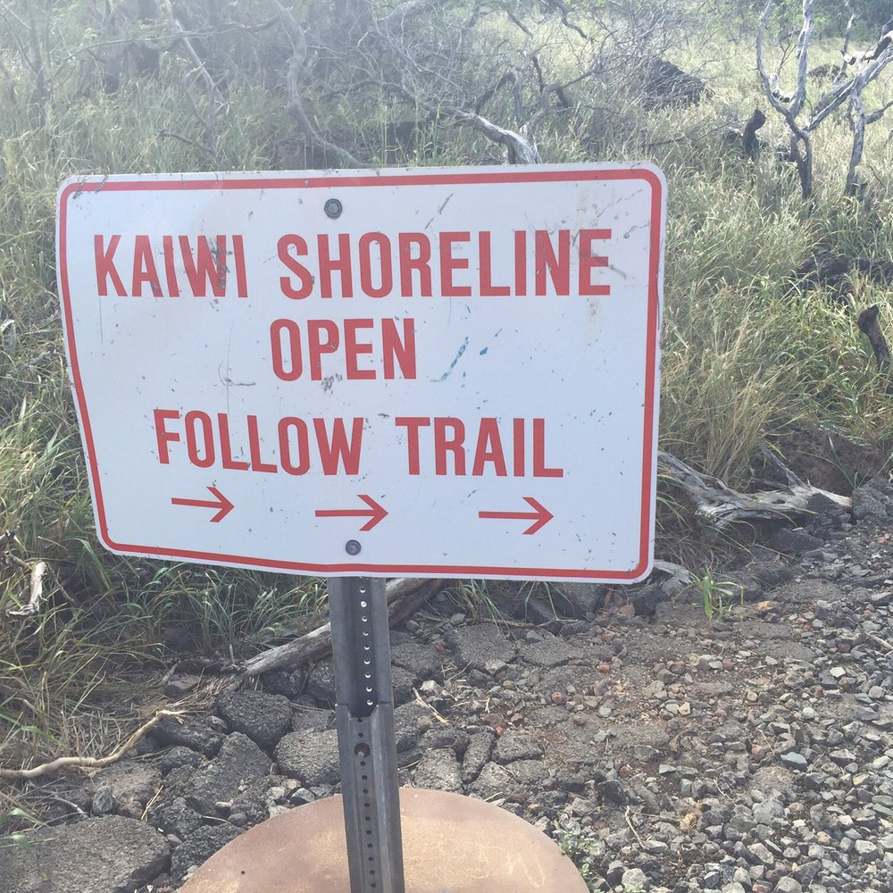
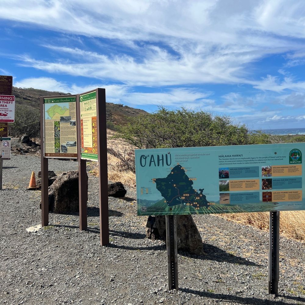
How does one rate a trail on Yelp? The only reason I'm going with a 1 star deduction is that it's not overly clear at the trailhead which "trail" to take. Don't get me wrong, it's not hard to figure out and if you do take the wrong "trail" it's not like your gonna get lost. 1) it's an island 2) the ocean is before you, the road behind you, the paved trail is to Makapu light house 3) that leaves just about any of the other not so well marked "trails" the Kaiwi Shoreline Trail, right? Of course, right! As you might have guessed, not knowing any better, we took the first paved trail that appeared to be the "low road" going toward the ocean. Wrong. It heads back toward the road, parallels it and if you take a rabbit trail / gully wash back across you can link back up with the "main" trail. Phew. Not that it was hard. But you do feel a little stupid at first. The trail you should take veers to the right as you start up the paved trail to Makapu light house. It's just past the informational kiosk and you'll see two "goal posts" sort of saying: "Over here, Dummy. This way!" The rocky terrain is not conducive to anyone with weak ankles or knees, but once in the "valley" it levels out into a pretty nice path. Again, no signs. Just follow the foot prints and path to the ocean. Where the trail forks? Pick your poison. You'll still get there. The reward is a rocky shoreline with waves crashing and a thunderous roar you can actually feel vibrating your bones! Be sure to explore the little estuary and mangrove swamp. This place is surreal in that it's so arid but your steps away from the surf. You're in Hawaii but feel like it could be the African Savannah. I expected to see a wildebeest or giraffe amongst the trees. It's a hot little hike. Pack in, pack out. We saw trash cans only in the parking lot. Follow up with a shave ice at Uncle Clay's House of Aloha.


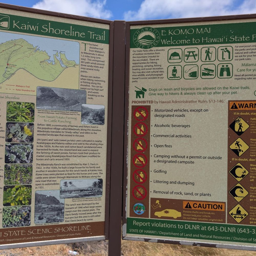
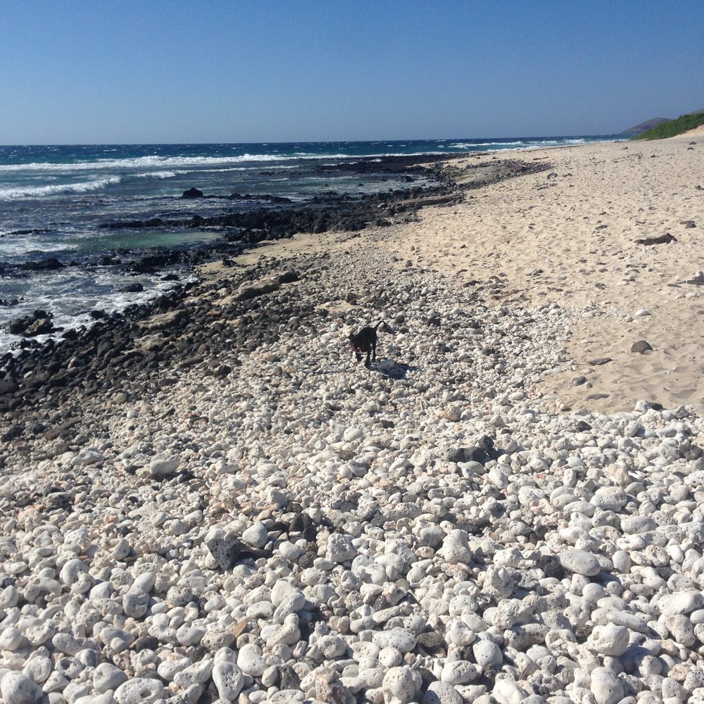
The Kaiwi Shoreline Trail is the lower trail at the Makapu'u Point Lighthouse Trail. The area was once home to both sweet potato farming and cattle ranching, as indicated by the sign at the trail head. This trail leads to the ocean via a hot dirty path and then continues on along the shoreline. There is a beach area that is mostly empty and secluded, even on the weekends. While we were there, there were also a few people fishing off of the beach/rocky area along the trail. This is a very easy and mostly flat hike, but there is little shade or cover so pack some sunblock. It is also VERY hot in the middle of the afternoon, so plan accordingly. If you want to spend some time at a secluded beach, this is the best trail for it. It is also great for pets!

EVERYBODY knows about Makapu'u Lighthouse Trail. EVERYBODY parks their car and walks up the paved path. BUT does everybody know about Kaiwi Shoreline Trail? The trailhead is right before Makapu'u Lighthouse Trail and is family friendly, though not stroller friendly. Instead of walking up the paved path like everybody else, make a right turn onto the dirt path. The path is dry crumbly dirt and rather boring. But just keep trekking and you'll soon find yourself a beautiful fork in the road: Veer to the left and then go up the hill to Pele's Chair or veer to the right for an amazing secluded beach. This isn't a hike but I strongly recommend you wear proper footwear, especially if you plan to climb Pele's Chair. We wore all weather sandals (Teva's and Keens) and our swimsuits under our clothes.


More of a pretty stroll along the beach than a hike. Not crowded if you go on a weekday, but it gets more popular on weekends. This area can be windy and/or hot. Bring sunscreen (if you are human).

This trail is located on the right side before the start of Makapuu lighthouse trail. Have been here a couple times and usually not very busy compared to the lighthouse trail. There's a few different pathways going toward the ocean, some people like to swim there but it's usually pretty rocky and dangerous waters here so I wouldn't recommend unless you're a strong swimmer. Popular for fishing too. No bathrooms or showers located here. P.S. it is rocky during the first part of the trail so I recommend wearing shoes so you don't twist an ankle or lose your slippa like I've seen others. Otherwise, it's pretty casual nature walk to enjoy on the east side. Enjoy! read more


We went here because my 5 year old nephew wanted to see the tide pools. It was a little difficult to find, becasue we didn't see any water when we arrived so we thought we were in the wrong location. There was a free parking lot once we arrived, so no issue with driving there. After you park you have to take the unpaved pathway and walk about 5 -10 minutes and you'll arrive at the tide pools. My nephew really enjoyed seeing all the snails, shells, rocks, and other creatures. Definitely should wear water shoes because a it's a lot of rocks. There is a place you can get in the water where the waves were low, but I would highly recommend not going too far in the water and being careful along the rock edges because the waves looked very very strong. Overall the views were pretty and the experience was nice. read more


1 year ago
We took a short, breezy walk toward the cozy beach by Pele's Chair. Flat and easy, but the rocky trail makes good walking shoes your best friend. As if the views weren't enough, two seals were just vibing in full sunbathing mode. Nature's version of chill. read more
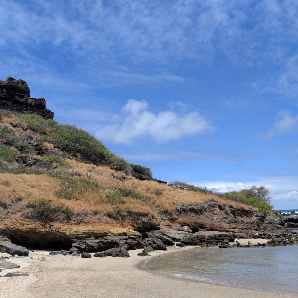


If you are going to hike Makapu'u Lighthouse, you'll see Kaiwi Shoreline Trail on the right side passing the entrance. Easy to spot and visible as it has dry brown trail going down. Obviously it's a dirt trail but clear and visible without any shade in most of your hike. When it's summer it's dry and brown however on rainy season it's chocolatey muddy and a challenge to hike to. Make sure to wear proper shoes and bring flip-flops as possible to wear it when you approach the beach side. Personally, I love this beach trail. Super easy to hike as the terrain is mostly flat. Then you'll arrive to this beach that is not that friendly as big waves tend to crashed on you but there are some spot where you can swim to a cozy mini lagoon. I find this beach also a perfect spot to do fun-shooting. If you decide to take a dip or snorkeling be cautious and don't dive if big waves are on. Mahalo for reading and happy juandering fellow yeeps! read more




Quality/Quantity - How does this get such great reviews? Where are the bathrooms? Very limited parking, and high break in area; yes I am extra cautious since my last SF JapanTown experience, see Yelp. Very easy paved walk. Perfect for beginners. Much more touristy than I expected. Wait, I am so confused, did I hike the wrong trail? Did we do the Makapu'u Lighthouse hike instead? Or Makapu'u point lighthouse trail or??? Or I need to start wearing my glasses??? Atmosphere - Very easy simple paved hike, I believe it was 4 miles round trip...? Service - None. Price - Free. Owner Comment - Hi, please invest a little more $$$ here to make it a more positive experience. read more



Never in my life I will forget this hike. It's where my iphone dropped in 6ft saltwater and was able to retrieved it after more than an hour chilling down with waves crashing on big boulders around it. Until now, I can't believed I moved those big rocks and was able to used the same phone doing this l review here on Yelp. Kaiwi shoreline trail is a pretty easy hike to do mostly dirt and no shade along. My bald head got sunburned the next day coz the sun is shining so bright at that time and it was humid as well. But luckily it was a shoreline trail so at the end of it I was able to cool off myself in a small lagoon we found at the very tip of the hike. Having a huge boulders around helped us protected away from those raging enormous waves crashing on. So it was a sweet awesome spot for me and the fact that only me and my wife are the only human swimming on that spot. On the other side of the beach I've seen a group of folks diving and snorkeling so I guess it's the spot to go snorkeling too? I've seen couples and a family doing picnic here under the shade which give me the idea to come back and bring my poke from Foodland and some refreshments to cool us off next time. A tip from Yarman: Do not ever use your phone while in water coz Goddess Nāmaka might take it out of the blue. Next thing you know, your phone will slip down in between those big boulders and will end up grabbing a can grabber back home! LoL. It was an experienced I cannot ever forget. I enjoyed the hike, the saltwater and above all , I was rejoicing as I retrieved my phone enjoying down in the ocean for a quite awhile. See yah later... read more


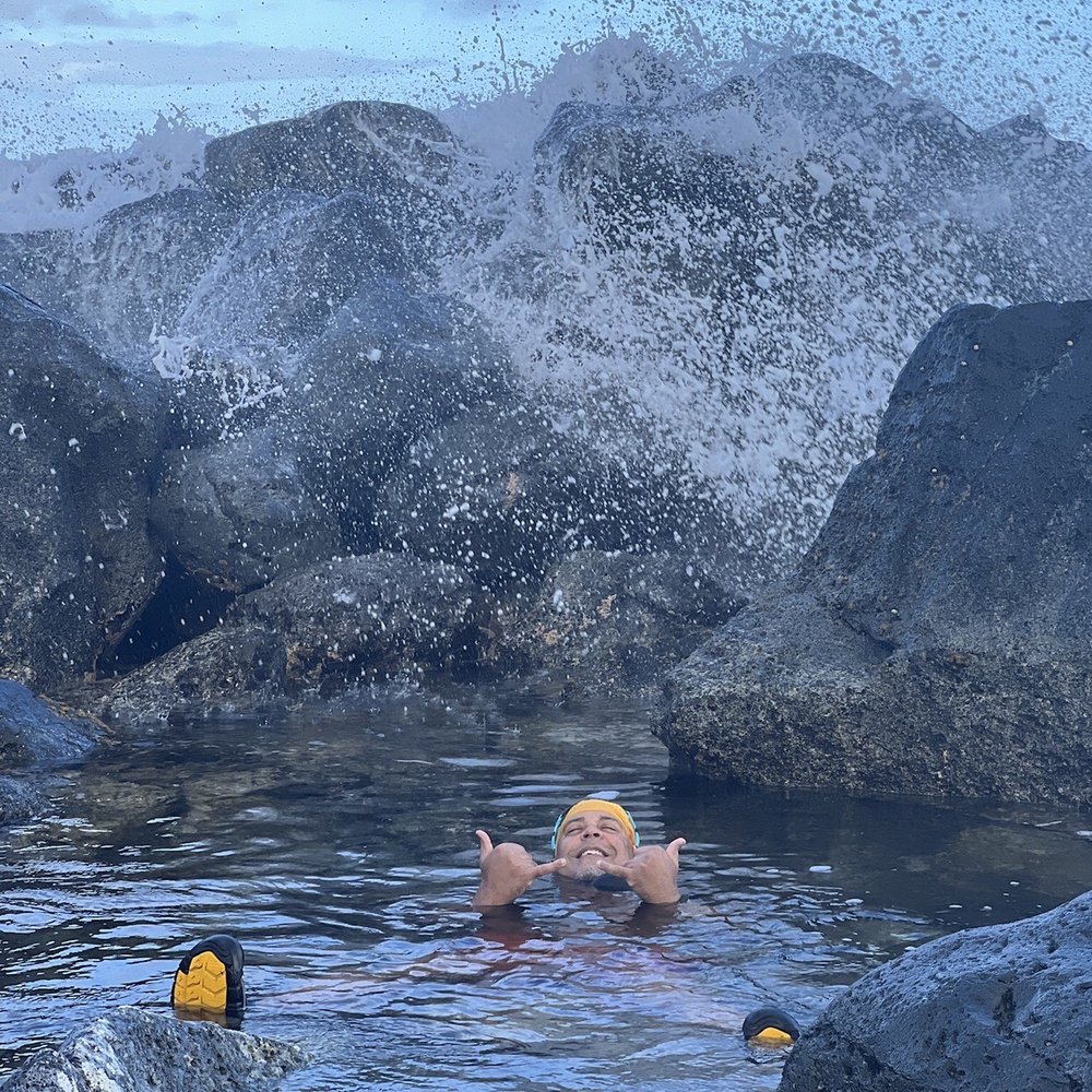

Don't want to give away too much as the beauty of this place is the solitude. Suffice to say if you know how to get off the beaten path and pay attention you'll find it. Don't gather here or party...be respectful of unmarked burials and heiau in this area. KAPU! Tread Lightly. Pack it out. Leave no trace. Be quiet and still in this sacred place. Listen and you might hear the guidance you've sought by coming to this unique spot of the gathering isle. read more


7 years ago
I initially wanted to hike up Makapu'u Lighthouse. But then I noticed the crowd of dogs, children, and tourists, that made me rethink my decision. I then proceeded to head down the mountain to Kaiwi Trailhead. Its rocky and has the potential for mud after it rains, so definitely wear shoes. It's very peaceful, aside from the sound of barking and groans coming from the Makapuu trail in the distance, lol. I ran into a few people, a couple fishermen, and beachgoers. I stopped and took pictures every chance I got, walking at my own pace. I even sat down by the shore and listened to the breaking waves. I wish I brought my coffee and book! Next time for sure! Solo adventures read more


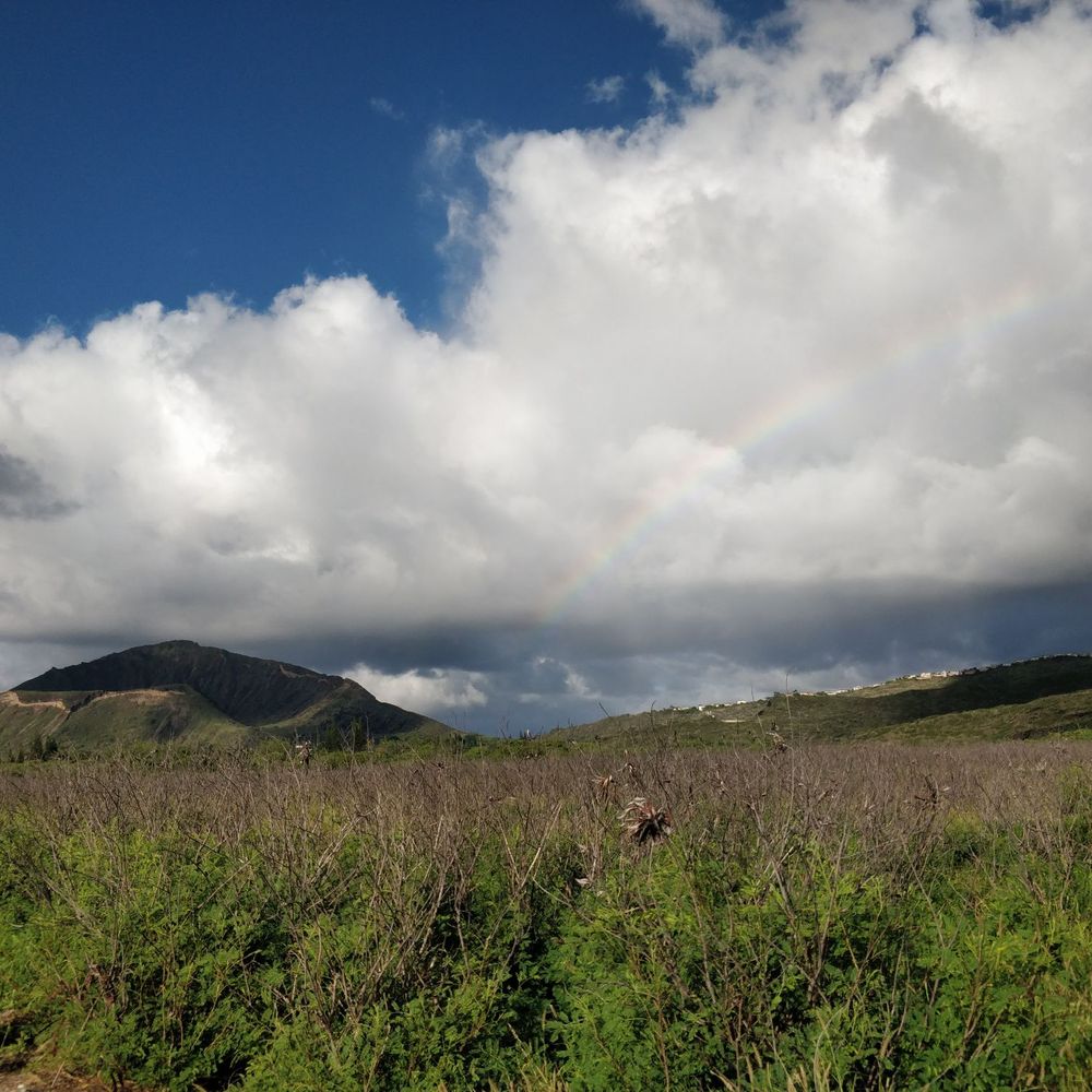


This trip to Hawaii has been geared around exploring off the beaten path. We've successfully avoided the touristy locations as we did those on our first trip. This was our 1st hike of the trip. This hike is to the most westerly point of Oahu. It was rated as easy!?!?!?! Ok have to disagree with that one. Probably more an upper moderate. It may have just been the recent weather conditions rendering it hard to traverse. Elevation gain is 226ft over a 5 mile round trip. The ground is rocky, frequently muddy and the tip is sandy. I recommend something with ankle support because of the unevenness of the terrain. All that aside there was some great scenery. To include albatross mating dances and some nice up close shots. We were lucky enough to have one resting 6-10 ft away from us. We managed to get some good pics of that one. There are ropes to designate the trail and you are admonished against going off the trail and/or harassing the animals. In addition the nesting area is fenced and gated to keep the mongooses out. There are plenty of bait traps, they're well marked so leave those alone too. This is not a dog friendly venue - leave them at home. Take water - 2 qts is recommended. We have camel baks so no issues there. We found 3 monk seals sitting in a tide pool at the point. But no whales on this trip either. Hard trek but worth the walk. read more

Walking up the concrete path, a trail map display of what didn't look like the Makapu'u Lighthouse Trail caught my eye. It's been years since I first hiked the lighthouse trail, but the thought of walking along the breezy shoreline of Ka'iwi Shoreline Trail seemed more refreshing than seeing a lighthouse, so I found myself making my way between the two wooden posts & down the rocky terrain. The ground levels out to a dirt path surrounded by a field of golden leaves of grass glinting in the wind. It was a peculiar sight knowing that you're in Hawaii walking in the dry desert of an African safari scene. After a while, the path leads to a secluded beach cove slightly obstructed by outstretched branches where you'll start asking yourself if this is the end of the trail. If you want to swim, then yes, it's the end. I'm not a beach person so I lugged on, taking a right before the beach. Apparently, it was a wrong turn because it seemed like it took me further into the middle of the field & I immediately sought out a path that looked like it led to the tide pools. If you walked through the beach, it'd take you to the shoreline (which is the right path anyway). From here, you'd see the other sandy beach which is where you want to go. Keep in mind that there'll be two paths in front of you at some points, but use trail markers like Pele's chair, which is the rock formation on the tip of the mountain where the lighthouse trail is, or the other mountain, which happens to be Koko Head Crater, to determine where you are. Or you can just follow any ol' dirt path you see. It doesn't really matter because the paths just loop around & are easy to follow. In this trail, I traveled through African-like fields, Hawaiian shorelines caked with glittering lava rocks & now a mangrove swamp. I couldn't help but skip rocks into this picture perfect scene. Aside from the scenery, there isn't much else to this hike. It's more of a walk that should be supplemented by doing the lighthouse trail if you have approximately an hour to kill or if you want to take a dip in an uncrowded beach. I got hungry so the lighthouse trail's for next time. read more


14 years ago
How does one rate a trail on Yelp? The only reason I'm going with a 1 star deduction is that it's not overly clear at the trailhead which "trail" to take. Don't get me wrong, it's not hard to figure out and if you do take the wrong "trail" it's not like your gonna get lost. 1) it's an island 2) the ocean is before you, the road behind you, the paved trail is to Makapu light house 3) that leaves just about any of the other not so well marked "trails" the Kaiwi Shoreline Trail, right? Of course, right! As you might have guessed, not knowing any better, we took the first paved trail that appeared to be the "low road" going toward the ocean. Wrong. It heads back toward the road, parallels it and if you take a rabbit trail / gully wash back across you can link back up with the "main" trail. Phew. Not that it was hard. But you do feel a little stupid at first. The trail you should take veers to the right as you start up the paved trail to Makapu light house. It's just past the informational kiosk and you'll see two "goal posts" sort of saying: "Over here, Dummy. This way!" The rocky terrain is not conducive to anyone with weak ankles or knees, but once in the "valley" it levels out into a pretty nice path. Again, no signs. Just follow the foot prints and path to the ocean. Where the trail forks? Pick your poison. You'll still get there. The reward is a rocky shoreline with waves crashing and a thunderous roar you can actually feel vibrating your bones! Be sure to explore the little estuary and mangrove swamp. This place is surreal in that it's so arid but your steps away from the surf. You're in Hawaii but feel like it could be the African Savannah. I expected to see a wildebeest or giraffe amongst the trees. It's a hot little hike. Pack in, pack out. We saw trash cans only in the parking lot. Follow up with a shave ice at Uncle Clay's House of Aloha. read more





The Kaiwi Shoreline Trail is the lower trail at the Makapu'u Point Lighthouse Trail. The area was once home to both sweet potato farming and cattle ranching, as indicated by the sign at the trail head. This trail leads to the ocean via a hot dirty path and then continues on along the shoreline. There is a beach area that is mostly empty and secluded, even on the weekends. While we were there, there were also a few people fishing off of the beach/rocky area along the trail. This is a very easy and mostly flat hike, but there is little shade or cover so pack some sunblock. It is also VERY hot in the middle of the afternoon, so plan accordingly. If you want to spend some time at a secluded beach, this is the best trail for it. It is also great for pets! read more

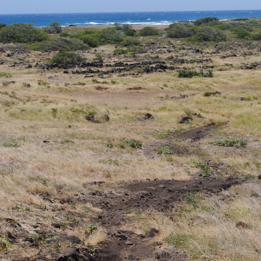


EVERYBODY knows about Makapu'u Lighthouse Trail. EVERYBODY parks their car and walks up the paved path. BUT does everybody know about Kaiwi Shoreline Trail? The trailhead is right before Makapu'u Lighthouse Trail and is family friendly, though not stroller friendly. Instead of walking up the paved path like everybody else, make a right turn onto the dirt path. The path is dry crumbly dirt and rather boring. But just keep trekking and you'll soon find yourself a beautiful fork in the road: Veer to the left and then go up the hill to Pele's Chair or veer to the right for an amazing secluded beach. This isn't a hike but I strongly recommend you wear proper footwear, especially if you plan to climb Pele's Chair. We wore all weather sandals (Teva's and Keens) and our swimsuits under our clothes. read more


12 years ago
More of a pretty stroll along the beach than a hike. Not crowded if you go on a weekday, but it gets more popular on weekends. This area can be windy and/or hot. Bring sunscreen (if you are human). read more





8 years ago


8 years ago
Super easy hike. Not to be confused with it's super easy neighbor, Makapuu. Don't take the paved path to the left if you want the easier hike it's this one on the right. Bring a hat and sunscreen! read more


13 years ago

13 years ago

10 years ago


11 years ago
More info about Kaiwi Shoreline Trail
Honolulu, HI 96795
Directions
Hours
Outdoor Amenities
Kaiwi Shoreline Trail Reviews in Other Languages
Ask the Community - Kaiwi Shoreline Trail
Review Highlights - Kaiwi Shoreline Trail
You might also consider















Why does Yelp recommend reviews?
1 review that is not currently recommended
The reviews below are not factored into the business's overall star rating.

12 years ago
Kaiwi Shoreline Trail - hiking - Updated September 2026
Best of Honolulu
People found Kaiwi Shoreline Trail by searching for…
Sea Shell Beaches in Honolulu, HI
Dog Friendly Beaches in Honolulu, HI
Secluded Beaches in Honolulu, HI
Beach Party Place in Honolulu, HI
Beach Chair Rentals in Honolulu, HI
Swimming Holes in Honolulu, HI
Crabbing Location in Honolulu, HI
Secluded Spots in Honolulu, HI
Walking Trails in Honolulu, HI
Dog Friendly Hiking Trails in Honolulu, HI
Off Road Trails in Honolulu, HI
Dog Friendly Parks in Honolulu, HI
Stroller Friendly Hikes in Honolulu, HI
Trending Searches in Honolulu, HI
Antiques near Kaiwi Shoreline Trail
Apple Orchards near Kaiwi Shoreline Trail
Apple Picking near Kaiwi Shoreline Trail
Barbershop near Kaiwi Shoreline Trail
Beaches near Kaiwi Shoreline Trail
Bike Shop near Kaiwi Shoreline Trail
Bird Sanctuary near Kaiwi Shoreline Trail
Boardwalk near Kaiwi Shoreline Trail
Boating near Kaiwi Shoreline Trail
Casinos near Kaiwi Shoreline Trail
Cliff Jumping near Kaiwi Shoreline Trail
Consignment Shops near Kaiwi Shoreline Trail
Crabbing Location near Kaiwi Shoreline Trail
Cruising Spots near Kaiwi Shoreline Trail
Deep Sea Fishing near Kaiwi Shoreline Trail
Dog Friendly Things To Do near Kaiwi Shoreline Trail
Dog Friendly Trails near Kaiwi Shoreline Trail
Dog Swimming near Kaiwi Shoreline Trail
Ear Piercing near Kaiwi Shoreline Trail
Eyebrow Threading near Kaiwi Shoreline Trail
Eyelash Extensions near Kaiwi Shoreline Trail
Fishing Tackle Shop near Kaiwi Shoreline Trail
Furniture Stores near Kaiwi Shoreline Trail
Hiking near Kaiwi Shoreline Trail
Kids Haircut near Kaiwi Shoreline Trail
Lakes near Kaiwi Shoreline Trail
Lighthouses near Kaiwi Shoreline Trail
Lookout Points near Kaiwi Shoreline Trail
Mattresses near Kaiwi Shoreline Trail
Parks near Kaiwi Shoreline Trail
Parks For Parties near Kaiwi Shoreline Trail
Picnic Areas near Kaiwi Shoreline Trail
Picnic Spots near Kaiwi Shoreline Trail
Private Schools near Kaiwi Shoreline Trail
Public Beach Access near Kaiwi Shoreline Trail
Public Shower near Kaiwi Shoreline Trail
Rock Quarry near Kaiwi Shoreline Trail
Salt Water Pool near Kaiwi Shoreline Trail
Scenic Night View near Kaiwi Shoreline Trail
Scenic Overlook near Kaiwi Shoreline Trail
Star Gazing near Kaiwi Shoreline Trail
Sunrise View near Kaiwi Shoreline Trail
Sunset near Kaiwi Shoreline Trail
Sunset Cruise near Kaiwi Shoreline Trail
Swimming Holes near Kaiwi Shoreline Trail
Trading Card Shops near Kaiwi Shoreline Trail
Trout near Kaiwi Shoreline Trail
Browse Nearby
BEST of Honolulu, Hawaii Coffee near Kaiwi Shoreline Trail
BEST of Honolulu, Hawaii Things to Do near Kaiwi Shoreline Trail
BEST of Honolulu, Hawaii Restaurants near Kaiwi Shoreline Trail
BEST of Honolulu, Hawaii Parks near Kaiwi Shoreline Trail
BEST of Honolulu, Hawaii Walking Trails near Kaiwi Shoreline Trail
BEST of Honolulu, Hawaii Breakfast near Kaiwi Shoreline Trail
Browse Brands
Related Searches in Honolulu, HI
Affordable Fishing Rental Services in Honolulu, Hawaii
Affordable Jet Ski Rental Options in Honolulu, Hawaii
Affordable Kayak Rental Services in Honolulu, Hawaii
Affordable Paddle Board Rental in Honolulu, Hawaii
Affordable Snorkel Rental Services in Honolulu, Hawaii
Best Crabbing Locations to Visit in Honolulu, Hawaii
Best Dog Hiking Trails Around Honolulu, Hawaii
Best Fishing Locations and Guides in Honolulu, Hawaii
Best Nature Trails for Hiking in Honolulu, Hawaii
Best Off Leash Dog Parks in Honolulu, Hawaii
Best Parks for Parties and Events in Honolulu, Hawaii
Best Places for Horseback Riding in Honolulu, Hawaii
Best Sightseeing Experiences Available in Honolulu, Hawaii
Best Waterfalls and Swimming Holes in Honolulu, Hawaii
Book Top Fishing Charters in Honolulu, Hawaii Today
Book Top Fishing Trips in Honolulu, Hawaii Today
Book a Dinner Cruise Experience in Honolulu, Hawaii
Book a Snorkeling Tour in Honolulu, Hawaii
Discover Dog Friendly Beaches Near Honolulu, Hawaii
Discover Dog Friendly Trails to Explore in Honolulu, Hawaii
Discover Easy Hiking Trails Near Honolulu, Hawaii
Discover Kid Friendly Beaches to Visit in Honolulu, Hawaii
Discover Kid Friendly Hiking Trails in Honolulu, Hawaii
Discover Lakes & Ponds to Explore in Honolulu, Hawaii
Discover Popular Bike Trails in Honolulu, Hawaii
Discover Public Beaches to Visit in Honolulu, Hawaii
Discover Scenic Beach Camping Sites in Honolulu, Hawaii
Discover Scenic Mountain Bike Trails Near Honolulu, Hawaii
Discover Sea Shell Beaches Near Honolulu, Hawaii
Discover Top Nature Parks to Visit in Honolulu, Hawaii
Discover Walking Parks in Honolulu, Hawaii Near You
Discover a Hiking Trail in Honolulu, Hawaii
Discover the Best Fishing Lake in Honolulu, Hawaii
Discover the Best Night Hike Trails in Honolulu, Hawaii
Discover the Best Sunset Cruise Tours in Honolulu, Hawaii
Dog-Friendly Hikes With Dogs in Honolulu, Hawaii
Enjoy Camping Adventures Around Honolulu, Hawaii
Enjoy Fishing Pier Spots in Honolulu, Hawaii With Scenic Views
Enjoy Fishing With Kids in Honolulu, Hawaii Safely
Enjoy Hiking Adventures in Honolulu, Hawaii
Enjoy Jet Ski Adventures in Honolulu, Hawaii
Enjoy Kayaking Adventures in Honolulu, Hawaii
Enjoy Off Leash Dog Hikes in Honolulu, Hawaii
Enjoy Sailing Adventures in Honolulu, Hawaii
Enjoy Surfing Adventures in Honolulu, Hawaii
Enjoy Tent Camping Spots Around Honolulu, Hawaii
Enjoy Water Activities and Fun in Honolulu, Hawaii
Enjoy Whale Watching Experiences in Honolulu, Hawaii


