
Palolo Valley Photos


You might also consider


More like Palolo Valley
Recommended Reviews - Palolo Valley
Start your review...


Reviews With Photos
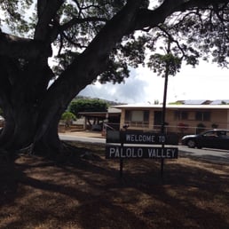

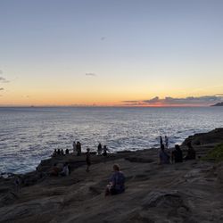
Palolo Valley is a residential area on the island of Oahu in urban Honolulu. It's zip code is 96816 and one of the more beautiful parts of town, especially deeper into the valley. What usually scares people away is the reputation Palolo has. Don't blame them at all. Palolo had been the focus of crime in the 1990's and 2000's, as the neighborhood had been subjected to random crime stuff that had plagued the area for a good while. Within the last 10 years, I've noticed there is a steep drop off in those statistics and Palolo seems to be in a better place since then. The main thoroughfare through Palolo valley is through 10th Avenue and Palolo Avenue. Both of them are essentially the same street, but they change names in the middle near La'i Road. The further you get back into the valley is where the scenic parts of the valley come into play. There is good hiking trails up at Ka'u Crater, where I've been in the past, but do so at your own risk, even though there are no trespassing signage along the beginning trail head. 90% of Palolo Valley is private residential and there is public housing here on Ahe Street. During the day and early evening hours is perfectly safe, but be warned when you're out and about after 10pm. Sometimes, stuff happens when you out that late. The last two or so years, I've discovered Palolo Valley as a good training grounds for marathon training. Up 10th avenue and out on Palolo avenue by the McDonald's. Around 5.5 miles, I think. That's usually the way I go, unless you like to on the side streets. Many of the streets are steep and it's kind of cool how people can live and drive up steep embankments when they commute from home to work and everywhere else. At the very back of Palolo Valley is as rugged as some rural sides of the island. A lot of trees and vegetation that makes you think you are in some rural town, but that's how it is. In the back of Palolo Valley is very pristine and very quiet. I guess that's how many residents like it over there. The quietness of the area helps residents live life to the fullest. It is really nice to have that peace instead of just having that reputation of being a place where random crime happens - like Kalihi and Waianae. Palolo elementary school and Jarret Middle school calls home in Palolo valley, as well as Palolo Chinese home too. There's a Korean temple near the back of the valley too. Ka'u crater is great for hikes and trails, although best bet is to just be mindful of where you are and try not to step into anything. Plenty of parking here as you have residential streets to park in. If you are like me, bus route 9S circles the valley and it's nice to see. For whatever business or pleasure you do in Palolo Valley, best bet is to enjoy the scenery and you're lucky to live Hawaii. There's a few businesses that operate in the area, most notably is the Palolo McDonald's, on Waialae Avenue, a couple of wash/dry shops, a few convenient shops, a couple of restaurants, and of course, a couple of gas stations. All of which are either on Palolo avenue or 10th Avenue. Whether or not you live here, visiting, or have friends or relatives here, it's always nice to visit here and see the island once in a while. Feel free to step into the valley and you may be pleasantly surprised. Just don't come late at night and you should be fine. My countless experiences here running through Palolo valley have been quite peaceful and tranquil. It was very quiet in the back of the valley and I could see why people love to live there. You can even hear birds chirping early in the morning while you run up 10th avenue. If you are ever on the upper side of palolo valley and looking out to diamond head, you can even probably see the sunrise or sunset there. 4.0 stars. Support local! B


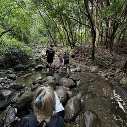
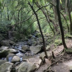
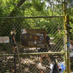
The reviews were pretty spot on. Me and the wifey hiked this one a couple days ago. The hike itself is not to difficult, but wouldn't recommend for anyone with kids under 10yrs old. We wore our flip flops and had no problem. But you really have to watch your step. Hiking shoes would have been better, but this was a spur of the moment excursion. Finding the entrance to the trail was difficult and we would have never found it if we hadn't asked a friendly local. TIP: The address will take you right to the location where you need to park. The road does continue but there are signs posted "no trespassing" and "beware of dog". The entrance to the trail is just to the right of the four or five mail box stand. Poke your head through the bushes and you'll find it. I will post pictures of the trail entrance and parking area. As far as the trail goes it's pretty easy to navigate. Just follow the ribbons. The trail does a few switch backs over the stream just keep following the ribbons. They will lead you in the right direction. TIP: Bring ribbon of your choice to help navigate the route back. There were a couple times the trail got a little confusing because of all the switch backs, and your really not paying attention to what was behind you. Using the Nike Run App the first Waterfall was 1.66 miles. The wifey had enough so we didn't carry on to the other two Waterfalls. I would definitely recommend this hike if your up for it. Just go on a dry day. Tip: Take lots of bug spray, some water, snacks and loads of pictures. Enjoy!!!


Great hike into Palolo valley with three waterfalls, a great view of the valley, some mud, and rope climbing. Difficulty: I'd say this hike is medium-hard difficulty. Hiking up to the top of the third waterfall and back took about 3hrs (6miles). There are areas that require some balance since you had to walk across thick pipes and use ropes or hands to climb. Trail path: The trail is fairly well defined with ribbons and ropes to guide you, but it definitely helps to go with someone who has hiked it before since there are alternative routes to go back after the third waterfall. The trail is well shaded but can get muddy when it rains. Each waterfall is about 15-20min apart. There is also an option to hike to the top of the mountain head that adds an extra hour. Though the view is supposed to be beautiful, that part of the trail can get particularly windy and muddy, which can get a little dangerous when it's raining and when the trail narrows. View: the three waterfalls are gorgeous picture taking spots as well as the view after the third waterfall. Parking: the road to the trail head is very narrow and parking is limited near the trail head. However, there is plenty of street parking down the road.


3 years ago
Absolutely gorgeous! Staying here in the rainforest overlooking Honolulu and the ocean but with a tropical jungle enveloping you, it's amazing! Wonderful gorgeous hike deep into the rainforest with waterfalls and to die for scenery. read more


4 years ago

11 years ago
This is actually the ka'au crater trail. I love this trail. It's easy- not too ridgy- up to the first waterfall. It's such a beautiful hike - forested, lush, green ... Muddy:) bring bug spray. read more


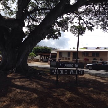
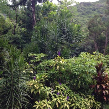
Palolo Valley is a residential area on the island of Oahu in urban Honolulu. It's zip code is 96816 and one of the more beautiful parts of town, especially deeper into the valley. What usually scares people away is the reputation Palolo has. Don't blame them at all. Palolo had been the focus of crime in the 1990's and 2000's, as the neighborhood had been subjected to random crime stuff that had plagued the area for a good while. Within the last 10 years, I've noticed there is a steep drop off in those statistics and Palolo seems to be in a better place since then. The main thoroughfare through Palolo valley is through 10th Avenue and Palolo Avenue. Both of them are essentially the same street, but they change names in the middle near La'i Road. The further you get back into the valley is where the scenic parts of the valley come into play. There is good hiking trails up at Ka'u Crater, where I've been in the past, but do so at your own risk, even though there are no trespassing signage along the beginning trail head. 90% of Palolo Valley is private residential and there is public housing here on Ahe Street. During the day and early evening hours is perfectly safe, but be warned when you're out and about after 10pm. Sometimes, stuff happens when you out that late. The last two or so years, I've discovered Palolo Valley as a good training grounds for marathon training. Up 10th avenue and out on Palolo avenue by the McDonald's. Around 5.5 miles, I think. That's usually the way I go, unless you like to on the side streets. Many of the streets are steep and it's kind of cool how people can live and drive up steep embankments when they commute from home to work and everywhere else. At the very back of Palolo Valley is as rugged as some rural sides of the island. A lot of trees and vegetation that makes you think you are in some rural town, but that's how it is. In the back of Palolo Valley is very pristine and very quiet. I guess that's how many residents like it over there. The quietness of the area helps residents live life to the fullest. It is really nice to have that peace instead of just having that reputation of being a place where random crime happens - like Kalihi and Waianae. Palolo elementary school and Jarret Middle school calls home in Palolo valley, as well as Palolo Chinese home too. There's a Korean temple near the back of the valley too. Ka'u crater is great for hikes and trails, although best bet is to just be mindful of where you are and try not to step into anything. Plenty of parking here as you have residential streets to park in. If you are like me, bus route 9S circles the valley and it's nice to see. For whatever business or pleasure you do in Palolo Valley, best bet is to enjoy the scenery and you're lucky to live Hawaii. There's a few businesses that operate in the area, most notably is the Palolo McDonald's, on Waialae Avenue, a couple of wash/dry shops, a few convenient shops, a couple of restaurants, and of course, a couple of gas stations. All of which are either on Palolo avenue or 10th Avenue. Whether or not you live here, visiting, or have friends or relatives here, it's always nice to visit here and see the island once in a while. Feel free to step into the valley and you may be pleasantly surprised. Just don't come late at night and you should be fine. My countless experiences here running through Palolo valley have been quite peaceful and tranquil. It was very quiet in the back of the valley and I could see why people love to live there. You can even hear birds chirping early in the morning while you run up 10th avenue. If you are ever on the upper side of palolo valley and looking out to diamond head, you can even probably see the sunrise or sunset there. 4.0 stars. Support local! B read more



12 years ago
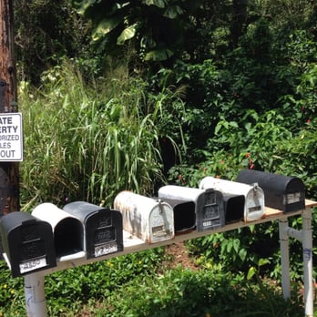
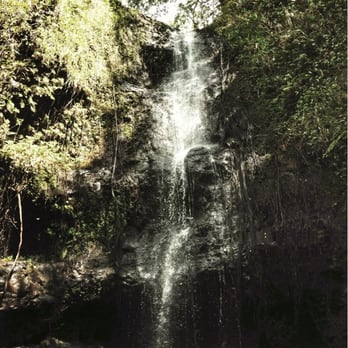
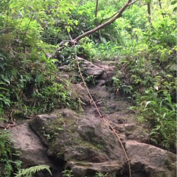
The reviews were pretty spot on. Me and the wifey hiked this one a couple days ago. The hike itself is not to difficult, but wouldn't recommend for anyone with kids under 10yrs old. We wore our flip flops and had no problem. But you really have to watch your step. Hiking shoes would have been better, but this was a spur of the moment excursion. Finding the entrance to the trail was difficult and we would have never found it if we hadn't asked a friendly local. TIP: The address will take you right to the location where you need to park. The road does continue but there are signs posted "no trespassing" and "beware of dog". The entrance to the trail is just to the right of the four or five mail box stand. Poke your head through the bushes and you'll find it. I will post pictures of the trail entrance and parking area. As far as the trail goes it's pretty easy to navigate. Just follow the ribbons. The trail does a few switch backs over the stream just keep following the ribbons. They will lead you in the right direction. TIP: Bring ribbon of your choice to help navigate the route back. There were a couple times the trail got a little confusing because of all the switch backs, and your really not paying attention to what was behind you. Using the Nike Run App the first Waterfall was 1.66 miles. The wifey had enough so we didn't carry on to the other two Waterfalls. I would definitely recommend this hike if your up for it. Just go on a dry day. Tip: Take lots of bug spray, some water, snacks and loads of pictures. Enjoy!!! read more



10 years ago
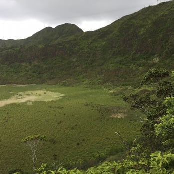
Great hike into Palolo valley with three waterfalls, a great view of the valley, some mud, and rope climbing. Difficulty: I'd say this hike is medium-hard difficulty. Hiking up to the top of the third waterfall and back took about 3hrs (6miles). There are areas that require some balance since you had to walk across thick pipes and use ropes or hands to climb. Trail path: The trail is fairly well defined with ribbons and ropes to guide you, but it definitely helps to go with someone who has hiked it before since there are alternative routes to go back after the third waterfall. The trail is well shaded but can get muddy when it rains. Each waterfall is about 15-20min apart. There is also an option to hike to the top of the mountain head that adds an extra hour. Though the view is supposed to be beautiful, that part of the trail can get particularly windy and muddy, which can get a little dangerous when it's raining and when the trail narrows. View: the three waterfalls are gorgeous picture taking spots as well as the view after the third waterfall. Parking: the road to the trail head is very narrow and parking is limited near the trail head. However, there is plenty of street parking down the road. read more


10 years ago
This is so far my favorite hike very muddy and hot so wear good hiking shoes, bring a lot of water and some snacks to keep your energy up. There's three amazing waterfalls the first one takes about an hour and a half to reach give or take. After you reach the first one you climb up the ropes and shortly you will reach the second one. As you climb up to the third one you have an option to climb the third waterfall itself and get to the top of the mountain and get a great view of the valley. Definitely gonna be going to the trail again AWESOME HIKE! read more


12 years ago

14 years ago

9 years ago
More info about Palolo Valley
Honolulu, HI 96816
Directions
Hours
Outdoor Amenities
Ask the Community - Palolo Valley
Review Highlights - Palolo Valley



















Why does Yelp recommend reviews?
3 reviews that are not currently recommended
The reviews below are not factored into the business's overall star rating.
3 years ago

10 years ago

Palolo Valley - hiking - Updated September 2026
Best of Honolulu
People found Palolo Valley by searching for…
Trending Searches in Honolulu, HI
Barbershop For Men near Palolo Valley
Bird Sanctuary near Palolo Valley
Cliff Jumping near Palolo Valley
Consignment Shops near Palolo Valley
Cruising Spots near Palolo Valley
Dog Friendly Things To Do near Palolo Valley
Ear Piercing near Palolo Valley
Elementary Schools near Palolo Valley
Eyebrow Threading near Palolo Valley
Flower Fields near Palolo Valley
Hair Braiding near Palolo Valley
Kids Haircut near Palolo Valley
Lookout Points near Palolo Valley
Picnic Areas near Palolo Valley
Public Golf Courses near Palolo Valley
Rock Quarry near Palolo Valley
Scenic Night View near Palolo Valley
Scenic Overlook near Palolo Valley
Sunrise View near Palolo Valley
Swimming Holes near Palolo Valley
Trading Card Shops near Palolo Valley
Browse Articles
Browse Nearby
BEST of Honolulu, Hawaii Coffee near Palolo Valley
BEST of Honolulu, Hawaii Things to Do near Palolo Valley
BEST of Honolulu, Hawaii Restaurants near Palolo Valley
BEST of Honolulu, Hawaii Parks near Palolo Valley
BEST of Honolulu, Hawaii Breakfast near Palolo Valley
BEST of Honolulu, Hawaii Walking Trails near Palolo Valley
BEST of Honolulu, Hawaii Campgrounds near Palolo Valley
Browse Brands
Related Searches in Honolulu, HI
Best Dog Hiking Trails Around Honolulu, Hawaii
Best Fishing Locations and Guides in Honolulu, Hawaii
Best Nature Trails for Hiking in Honolulu, Hawaii
Best Places for Horseback Riding in Honolulu, Hawaii
Best Sightseeing Experiences Available in Honolulu, Hawaii
Best Waterfalls and Swimming Holes in Honolulu, Hawaii
Discover Dog Friendly Trails to Explore in Honolulu, Hawaii
Discover Easy Hiking Trails Near Honolulu, Hawaii
Discover Kid Friendly Hiking Trails in Honolulu, Hawaii
Discover Popular Bike Trails in Honolulu, Hawaii
Discover Scenic Mountain Bike Trails Near Honolulu, Hawaii
Discover Top Nature Parks to Visit in Honolulu, Hawaii
Discover Walking Parks in Honolulu, Hawaii Near You
Discover a Hiking Trail in Honolulu, Hawaii
Discover the Best Night Hike Trails in Honolulu, Hawaii
Dog-Friendly Hikes With Dogs in Honolulu, Hawaii
Enjoy Camping Adventures Around Honolulu, Hawaii
Enjoy Kayaking Adventures in Honolulu, Hawaii
Enjoy Off Leash Dog Hikes in Honolulu, Hawaii
Enjoy Tent Camping Spots Around Honolulu, Hawaii
Enjoy a Beautiful Waterfall Hike in Honolulu, Hawaii
Enjoy the Best Walking Path in Honolulu, Hawaii
Enjoy the Best Walking Trails in Honolulu, Hawaii
Explore Easy Hikes Perfect for All in Honolulu, Hawaii
Explore Fun Activities to Do in Honolulu, Hawaii
Explore Popular Campgrounds Near Honolulu, Hawaii
Explore Popular State Park Destinations in Honolulu, Hawaii
Explore Top Dog Parks in Honolulu, Hawaii Near You
Explore the Best Beach Spots in Honolulu, Hawaii
Family Friendly Hiking With Kids in Honolulu, Hawaii
Find Cozy Camping Cabins in Honolulu, Hawaii
Find Popular Ziplining Spots Around Honolulu, Hawaii
Find Top Dog Friendly Parks to Visit in Honolulu, Hawaii
Find Top-Rated Waterfalls in Honolulu, Hawaii Now
Find the Best Parks for Picnics in Honolulu, Hawaii
Hiking Trails With Waterfalls in Honolulu, Hawaii
Off Leash Dog Hiking Trails in Honolulu, Hawaii
Picnic Areas With BBQ Pits Available in Honolulu, Hawaii
Popular Outdoor Activities to Try in Honolulu, Hawaii
Popular Picnic Spots to Visit in Honolulu, Hawaii
Popular Waterfall Hiking Trails in Honolulu, Hawaii
Safe and Fun Parks for Kids in Honolulu, Hawaii
Top Hiking Trails to Explore in Honolulu, Hawaii
Top Playgrounds for Kids to Enjoy in Honolulu, Hawaii
Top Running Trails to Explore in Honolulu, Hawaii
Top Swimming Spots and Pools in Honolulu, Hawaii
Top Things to Do With Kids in Honolulu, Hawaii
Top-Rated Camping Sites in Honolulu, Hawaii


