Koko Crater Trail Photos


You might also consider


More like Koko Crater Trail
Recommended Reviews - Koko Crater Trail
Start your review...


Reviews With Photos


1000+ Stairs is not for the weak or faint. So fun!! Stretch, take water, follow the guidelines of how people are on thw path up and back. Stay to the sides and let people who run up or down have the right of way. Take your time. There are plenty of spots to stepnoff to the side and rest when needed. People will check in with you, root you on, ensure you are ok, encourage you! Good vibes only!


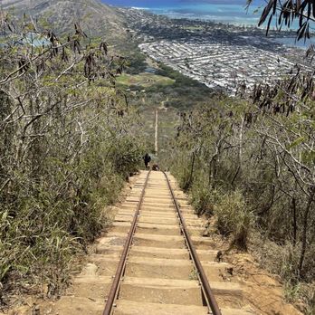
First off the answer is YES.... It's worth it. But this is really intense. I struggled and I'm in pretty good shape. Know your limits, someone needed to get rescued when I went. There are plenty of places to stop and rest right aside the tracks and there are small yellow numbers that tell you what step you're at. There are a total of 1048 and 1200 feet up. The views from the top are absolutely breathtaking, this was one of the highlights from my trip


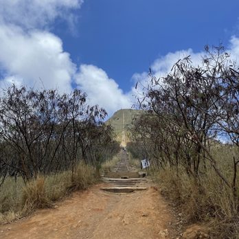
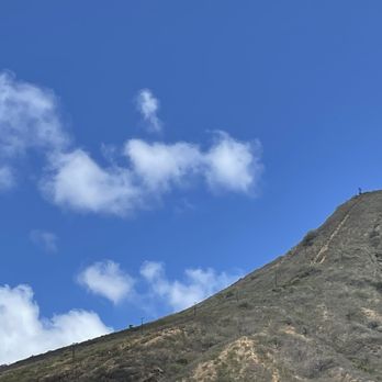
This is a big Kaiju hike - it's straight and steep and no tricks as you can see it climb to the sky with the last third of so of the hike at maybe 70 degree incline. Count your steps, take a breath, breathe, bring water, and do it earlier in the morning when it's much cooler. The photos you can take at the top will be fabulous.


I recently went back and realized they redid some of the steps so it feels more stable! If you haven't done this hike, it's definitely worth it but know that it's a killer workout. Sunset up there? Unreal. BUT it gets dark fast coming down so time it right or bring a light source. It's windy at the top which feels wonderful but if you're hanging out for a while bring a sweater. All in all, amazing workout, even better view.


Happy New Year & Happy 2026!! Keeping our family tradition going with hiking the brutal Koko Head Stairs on the first day of the new year. I tried to back out, but my son won't allow it. (haha) I am glad he stopped me from backing out. For last year's goals, I try to hike the stairs once a month and that has been going good, we missed a few months due to travels, but for 2026 goals I will try my best to keep & stick to it. For this recent New Years hike, as I am hiking up, I keep asking myself, why?!! What did I do to deserve this, hehe. It does not get easier for me despite hiking it up so many times. I did take my time going up, same old, same old, brutal, pain, hehe. but super HAPPY when I reached the top and so worth it. I got to see the Christmas tree, super cool to see it in real life. I took some time for myself, to take it all in and just enjoyed the views and the moments, "Lucky we live Hawaii moments" I wish I could enjoy it longer but we had to get back down, which I'm not bragging - but for me , going back down is much more easier. I am grateful to be able do this hike and look forward to many more this year. Happy 2026, wishing everyone a new year filled with blessings, stay safe & happy hiking! & YES. feeling the pains from the hike the next day is normal, its all good! I am ready to hike Koko again!


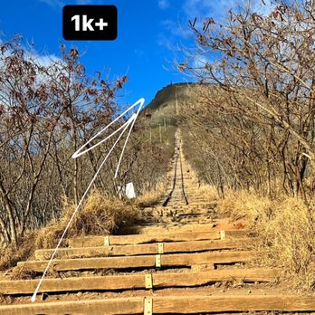
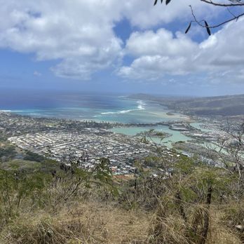
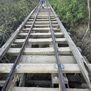
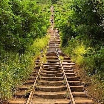
Koko Crater Trail is a steep hike up the actual Koko Crater and follows an abandoned World War II railway track with over 1,000 steps. Round trip is about 1.6 miles and it's a 1,000 feet elevation gain in only 0.8 miles, making it challenging regardless of your fitness level. On top of that, there's no shade so I recommend coming early before the sun is beaming. After parking at the parking lot, you'll walk a little bit to get to the base on the steps. You will most likely take breaks and there are small break areas off the tracks to step aside as to not block others. There's one section of the climb of about 50 steps where there's a steep drop; I did a bear crawl and held onto the rails going up. If you aren't comfortable doing that though, there's a bypass trail to the side going both up and down. After all the breaks we took getting up to the top took about 30 minutes. There were beautiful 360° views of the island from the mountains to the ocean and everything in between. There were a couple of different areas to view the landscape: one at the top and one just near the top. We actually liked the views of the latter more but it'll be nice no matter where you look. Going down is also challenging on your knees and after going up, your legs might be a little tired. It also took us about 30 minutes to get back down so you can complete this hike from start to finish in about 1-2 hours. I recommend bringing grippy shoes for traction, sunglasses, and water to get through the hike. It was definitely challenging but worth the effort to make it to the top and get rewarded with awesome views.


MUST SEE HONOLULU ATTRACTION!! originally an old railway, theres a part that's not stairs but a ladder. i got down on all fours to climb unless ur experiences and brave enough to walk it. u rly DO NOT WANNA BE joking around and falling on this climb! its a little scary NOT FOR THE WEAK, i had to crab walk my way down in fear of falling forward. only 2-3ish miles?? but took about 90 minutes here (including time sitting on top). finish is super rewarding, i rec going during sunset/sunrise. we went 10am sunday july 2023 and it was semi crowded. there are cut out mini resting spots/rocks to sit by along the way; my parents 50ish yrs old didnt feel safe going. lots of little kids who went faster than me omg.
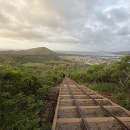

Let me start with saying my legs hurt. This hike is literally just straight up. With that said, it doesn't really take a long time. You go at your own pace and can stop and sit on the steps as much as you need. With stopping multiple times I made it up to the peak in 50 minutes. Beautiful views at the top, and very friendly people along the way.


Really enjoyed this hike because it felt so rewarding. If you do stair master (which I don't), you will be a professional at this. It's pretty much nonstop stairs all the way to the top where you will be rewarded with an amazing view. It's a difficult one and not good if you have weak knees, trouble with breathing in high altitudes, and scared of heights. There is an alternative route on the side if you are afraid of the large gaps (what is what I opted for). People do run up and down this route multiple times as a workout so watch out for the speedy ones! It was my first time here and I thoroughly enjoyed it. My friends and I came here around 6am which is perfect because by the time we finished it was about 8am (2 hour hike at a slow pace). We packed a spam masubi in our bag so we can reward ourselves with a treat at the top with a nice view. Highly recommend this hike and would definitely do it again next time I visit!


By far, the most memorable hike we have ever been on! My wife and I love to go hiking. We have hiked all over the world. It is a passion of ours. When we were planning our trip to Oahu, I decided it was the perfect time to propose. I suggested to her that we do this hike. I'll be honest, the hike is a bit difficult even though it is only 1.5 miles. It's nice to have stairs but it is a steep, constant incline. But once you reach the top, the views are absolutely stunning. I proposed at the top when we were overlooking the coastline. And now that we are married, this hike will always have a special place in our hearts. I would recommend this to anyone who enjoys hiking, especially if you plan to be in Oahu.


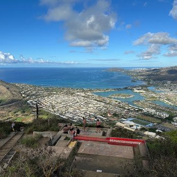
It's been almost 4yrs coming home from TX. That's how long I've done this hike. I love this hike. It is super hard, but very doable and free. Just take it slow and pace yourself. It's like doing the Stair Master 5000. Some get tired from walking from the parking lot to the beginning of the first track. This isn't your typical hike, it's a straight shot from earth to the heavens lol. It's basically train tracks used as stairs to walk straight up to the top. I used to do this hike in less than 16mins in my younger and in-shape days, but today took me about 30mins to include tons of breaks. It can get crowded so be respectful and move to the side. It goes from a pretty steep slant uphill until you reach a middle section that is like a scary bridge when you walk across, but if you don't want to, there's a small trail around it. Once you past this part, your above halfway there, where it'll be basically an incline straight into the heavens. I've seen small women carrying their infants, or old people going up and down passing me, so it's a very doable hike. It just depends on your body condition. It'll make your legs feel like jello and/or it'll shake because your muscles are spazzing out lol. But overall, I promise you, it's definitely worth the view up top. Go on a sunny day where the sky and view is clear. You can even bring a headlamp and/or flashlight to hike up before sunrise or sunset which are both beautiful, just be careful. They've changed the whole top side to a small little metal stage viewing area. And please don't do stupid stuff just for content and likes, a lot of people have gotten hurt and/or died doing the dumbest things like sitting on the edge of the cliff. Lots of park parking to include a restroom area.


3 years ago
The stairmaster from hell. Length: 1.6 miles Difficulty: Hell The trail is made from an abandoned railroad track from WW2. Ascend steep steps that become narrower as you travel further up. A section of the railroad, the tramline, has a 10+ feet void with bees below, so tread carefully or bypass this drop with the route on the side. The trek back down is also tiresome and slippery! Highly recommend wearing sneakers, carrying ample water, and generously slathering on sunscreen. There's barely any shade, just the sun slowly roasting everyone. That being said, hike super early before the crowds and sun make it suffocatingly more difficult. Also, try to pack lightly and SECURELY. Someone finished the hike, but frantically ran around asking others if they had seen keys on their way back down. She had to climb back up to find her car keys :( I adore all the people who carried buckets full of rocks and dirt to fill in gaps in the steps. I've seen elderly people gracefully float past us up the stairs - a mesmerizing and motivating sight to witness. At the end of this hike, you'll be rewarded with momentary self-loathing as you gasp for air, a strong sense of accomplishment, and spectacular panoramic views of the shoreline! read more

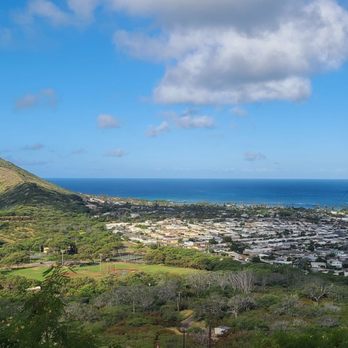


It was an amazing experience. I got there around 7:30a and already some people coming down from top. It was steep and yes stairs. I recommend wear at least sneaker not flip flops. I took about bit less than 30min without taking a break to the top. I see some people like firefighters train at this place to go up and down several times with a hose. Impressive. The view from the top was amazing and I love 360 view. I recommend to wear a hat for chance of rain and for the sun. Also recommend to wear sun glasses. Of course the water for you to drink. No shade. Go early so less people on the top, up and down. read more

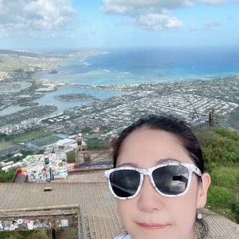


Yelpers. . . Get pumped and leggo! It's leg day! Get that warm up stretch in, pack light, bring that water, and get here early. You're going to step up 2 miles of stairs at about a 30-40 degree angle. EACH STEP IS WORTH IT! The reward is a killer 360 degree view at the top and fresh breeze to dry up all the sweat and tears along the way. Tips for the hike: - Bring lots of water. - bring a citrus fruit or an apple - hat to give you some shade - some motivational music - friends that suffer together stay together - rise and get up that mountain early to beat traffic - no shame in stepping aside to take lots of breaks - take the bypass for novices Happy leg day yelpers! read more

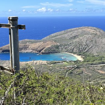

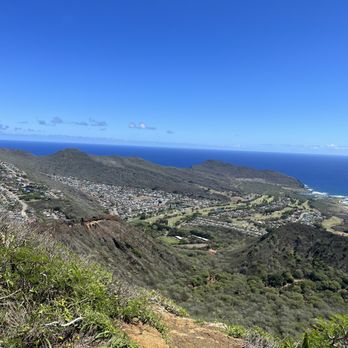
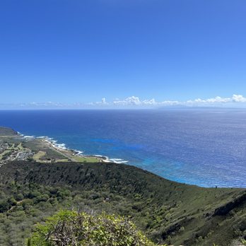


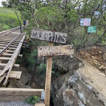

Great stunning views and a killer hike. Definitely worth the work and effort. Arrive before 7 am and bring a flashlight because it is dark. There are small markers on the side of the trail (26) I believe. It took me a while to get to the top because I had to do a lot of stops but it was well worth it. The views were stunning. Free parking, no fees, just make sure to carry your own trash down with you. read more


+ Great exercise + Relatively quick up and down + Great views at the top - Gun Range nearby so you'll hear loud and constant gunfire most of the way - Vibe is less "hike" and more "gym" so lots of young people blasting music and attention-seeking outfits, photo-snapping etc. - No variation, very little to see on the way up and down Overall, good to do one time as a fun little challenge and a novelty but much better hikes on the island. read more


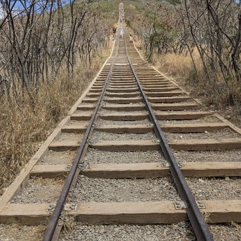

Love this trail!! Took awhile to get up since I took many breaks in between, but I finished and reached the top! That's the most important!! Last time I did this trail was back in 2018 and I was in much better shape with running half marathons. Trail was still the same from what I remembered except now they have a side part of the trail on rocks at a certain point. Overall I would come back every time I'm in Oahu to challenge myself! read more
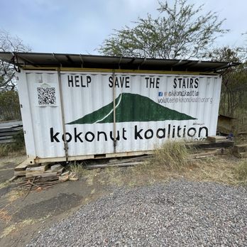


3 years ago
This review is not a brag. Instead I hope it serves as a reassurance for those who has doubt or trepidation of going. When I said I wanna go do the Koko Crater Trail, I was met with warnings and deterrents. I hesitated at first but decided that I should just go, and if I don't make it to the top, I dont make it to the top, NBD. Got there around 8:30am on Friday 8/25/23. The trail wasn't too busy and it wasn't too hot yet. The trail is consisted of endless ascending stairs going all the way up on a mountain. Don't wear white shoes, coz they will get very dirty. Bring water, but be conservative with consumption as there is no restroom along the trail. Definitely wear sunscreen coz there is barely any shade. It took about 45 minutes to get to the top with several short stops along the way to catch my breath. It wasn't easy breezy but it was definitely doable. The view at the end was spectacular and soothing. Descending the trail was a little more scary for me. The trail is steep and could be slippery. I felt like I had to orient at a 45 degree angle in order to secure my footing going down. There were some people running down the the steps. I was seriously worried that they would trip and tumble down, and we all be going down like dominoes. I stepped aside every time I heard someone running down behind me. lol. read more


Convenient East side location near Hanauma Bay. Big parking lot at Koko Head District Park but shared with baseball fields. Also very crowded so sometimes have to park in lower lots. Supposedly they made some improvements to the trail but it looks the same to me. I saw some 6-7 year olds on the hike. It only takes about 18 mins to get to the top and there are good views (see photos). There is one part where the rail goes over as a bridge which might be difficult for small dogs but there is an alternative route (see photos). Overall good quick exercise with good views. Some people do it multiple times at once because it is short. read more


It's been a while since I've been back here. The newly updated trail looks fantastic and makes it much easier to climb. The wood rail and gaps in the dirt has been filled. Im not that tall and you can imagine the bigger stride I have to make to move from rail to rail(I call them rail because these are not in fact stairs!). Go early in the morning or late afternoon. There is no shade and the sun can be brutal. Bring a hat, snacks, something to drink. And honestly I enjoyed it as it gives me the best leg workout ever. 10/10 would do it again. read more
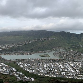

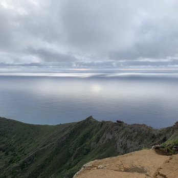


According to alltrails.com/hawaii/oahu, this is trail is #1. In deed it is when you get to the top. We attempted this trail about 7 years ago and gave up half way up. This time I came more prepared. We got to the park around 7:15am before the blazing sun and we made to the top close to 9am. It's 1.6 miles up and down. There's a clean restroom in the Kokohead community park. There's no admission fee. This trail is a hard one because of the stairs/big steps with high elevation. But don't let that stop you. We saw 2 fit people going up and down several times while we were just trying to make it up for one time. We also saw a retired Marine veteran who could be my grandfather going up and down passing us two times. That's a definite motivation right in front of you. Take many breaks with water and stops as you need. We must took at least a dozen breaks going up. I recommend not looking up at the top it will only make you anxious and impatient. The key is slow and steady. Once you get to the top, your reward is the gorgeous view of east side of Oahu. Be sure to soak it all up before heading down. read more

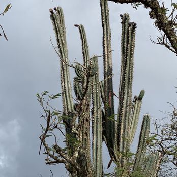

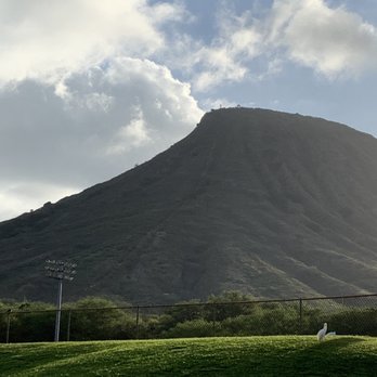


WHEEEW!!! This is the stair master from absolute hell, but it's SOOOO worth the achy muscles for the fabulous view and killer workout! I would say that I hike pretty regularly (sometimes I go on hiatus), but this hike definitely kicked my ass. It's literal steps all the way to the top. And these ain't no ordinary steps either. It's basically a steep ass railroad track with some pretty gnarly parts. I arrived around 6:15 am on a Thursday morning and there were still lots of parking spots open. I could actually see people hiking with headlamps right from the parking lot. Started on the trail around 6:35 am and reached the beginning of the stairs at 6:45 am. By this time, the sun was starting to rise. The entire trail is about 1.6 miles round trip which is pretty short, but it's the steepness and those steps that make it so difficult. The first part of the stairs isn't too bad as the incline at the lower level is gradual. But the higher you go up, the steeper and narrower it gets. Since this is a popular trail, you'll have to be comfortable with people constantly passing you by. There's not much room for two people to pass on the stairs, so someone will have to move to the side. But be careful because the steps are hella slippery and they get even more slippery as you get higher up. The steps are actually slanted downwards. Going up isn't so bad in terms of walking on the steps. It's going down where you'll have to deal with more slipping. On the way up, there's an almost halfway point where you'll have the choice of climbing up the tramline bridge, or taking the bypass to skip it. Call me a chicken, but I was NOT about to crawl on that bridge. It looked pretty exciting at first, but once I started crawling on it and looking down between the steps to the bottom, I had to back down and skip it. Too damn scary for me. If you're adventurous then by all means; do your thang. But not I! The views at the top are nice, but I honestly feel like the views that you get as you're hiking up the steps are much better. I wouldn't come here strictly for the views because you can find much better views on other hikes. It's more about the workout and the difficulty when it comes to this hike. Pushing yourself to get to the top (and back down to the bottom) and actually making it there is what's so rewarding and motivating. I might be the odd man out on this, but going down seemed waaay harder for me than going up. Think about it; your legs are basically jello at this point. Plus, you can't just casually walk back down. It's HELLA steep! And as I mentioned before, the stairs are slanted which makes it super easy to slip and very hard to stand directly on. Most people including myself had to hike back down sideways which was also another workout for my quads. We all slipped a few times. I don't think I saw one person NOT slip while I was up there. But sturdy shoes are a must! Also would not attempt during wet weather as it'll be too dangerous. Since I started around sunrise, it wasn't super hot by the way that I finished. But there's no shade, so sunscreen, hat/sunglasses, and water is an absolute must! This was definitely my favorite hike to partake in during my latest trip to Hawaii! It's definitely one for the bucket list and I'm so happy that I finally got to cross this one off. Would HIGHLY recommend! Just do it like Nike! read more


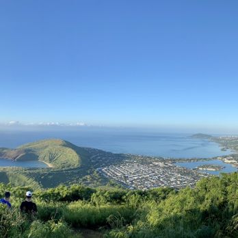


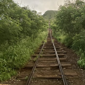


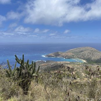
This is an intense workout, but the views from the top make it all worthwhile, including a look into Hanauma Bay. 1,048 steps. 1.3 km. Just under a 1,000 foot incline. Recommended items are water, sunblock and proper hiking shoes. Free admission. Free parking at the base. read more




3 years ago
It was a super high. I tried to go to the head of the trail. I got a bus from Waikiki. The bus was running close to the entrance of the trail. I asked the bus driver if the bus would go close to the entrance of the trail. The bus to Hawaii was kind of complicated. If you plan to use the bus, please ask the driver. It was very early morning. People were hiking to the trail. It was very dark. I used the flashlight of my cell phone. I could not lose my cell in the middle of the forest. The rail was very steep. I was 56 years old. When I reached the middle of the trail, I gave up. Even if you are young, please bring a water bottle. I gave up, but the views from the trail were super beautiful. If I had reached to the top of the trail, I would have enjoyed more beautiful views! It was a memorable hike. I stopped in the middle. But I still got wonderful views! read more


Love this place! I'm 57 now so I think this might be my last time doing it.......but you never know. Did it in just over 16 minutes. Not bad for an old man. To be honest it was harder going back down for me......I mean don't get me wrong it's tough going up as well but for me it was just harder on my old knees coming back down. Nature's stairmaster, 1048 steps and some pretty steep ones and scary ones (the bridge part) at that. I usually come around 10am and that seems like a pretty good time, lots of people are already finished and coming back down and it's not too hot yet. As hellish as it is, it's totally worth it once you reach the top. Really beautiful up there. There is 2 parking lots, the one closer to it is usually full, I usually park in the lower one and there are always spaces. Koko Head rocks! read more

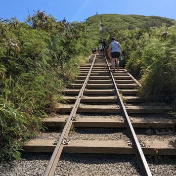

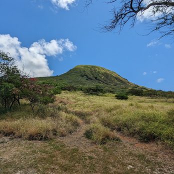


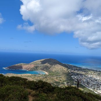


Definitely a hike to do at least once in your lifetime! It's not an easy hike, the railway ties, loose gravel, and steep incline definitely test your abilities but the view at the top makes the hike worth it! Bring water and some fruit to enjoy once you get to the top! read more

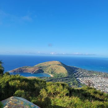

This trail is not for the faint of heart. Bring plenty of water and pack light. I would suggest being somewhat in shape or have your body be familiar with stairs. The amount of steps was insane. I nearly died 2/3 up the trail. I should've came more prepared for the trail Coming back down, my legs gave out a few times. We went here midday after snorkeling at Hanauma Bay. The sun was beaming and the temperature was in the 80's. I would not suggest doing this vigorous hike after a day of snorkeling. Plus, you're going to get toast by the sun! The view was amazing even though we didn't make it to the top. My fear of height got the best of me 2/3 up the trail. The stairs were pretty steep at the halfway mark. Maybe one day, I'll reach the top. read more


2 years ago
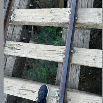
I'm guilty of this, don't ever skip leg day. This trail was definitely a leg workout. This isn't a long trail, but it goes incline up and about half way it's more of an incline. Don't be ashamed to take frequent breaks because that's what I did. At one point there about 20 steps, where there is a gap in between the railroad tracks where the wood sits, some of the are missing, so you do have to be careful where you step. Just before that thing, you can bypass those steps and continue on to the top. Overall it's worth it when you get to the top because you get a 360 degree view. Make sure you bring water with you. I did see some people wearing sandals, bad idea. Where good shoes for this hike. read more





3 years ago

This hike was not on my itinerary when visiting Oahu due to past reviews of how strenuous the hike was. Two years ago, I would've given up half way but new year new me haha. Whoever suggested on coming here before sunrise was a life saver b/c we felt the heat on our back when descending and saw so many folks struggling in the heat. It took us about 45mins to summit which included breaks after every 10-15 planks. There's no shame in taking breaks! I think the hike up was more difficult than coming back down due to the elevation and steepness 3/4 way up. I would recommend bringing a small bottle of water with some electrolytes or a hydration pack. The views from the top was probably the best next to Diamond head. read more

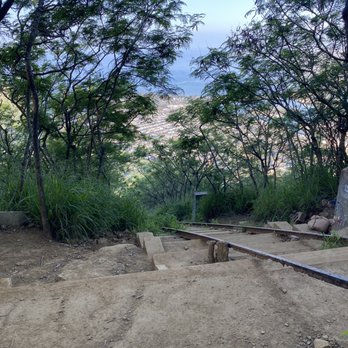
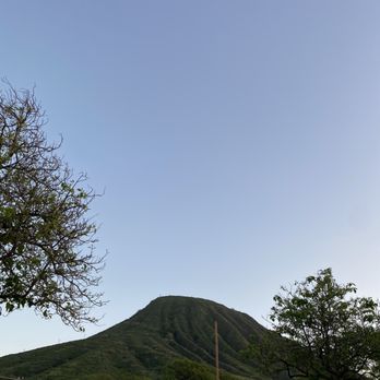


5 years ago
This railway trail is not a joke and definitely not for those with fear of heights. But for fitness junkies and those up for a challenge, Koko Crater Trail will absolutely be your cup of tea. After overcoming all the uneven steps with moderate to steep incline, sometimes with gaps too far and a drop at some point, you'll be rewarded with breathtaking views. Take note, you can avoid the part with a drop in between the slabs of wood. Just make a slight detour to the right and it'll lead you right back to the tracks. I must say, Hanauma Bay is quite the sight from up there. You just need to work for it first. And remember, what goes up, must come down. Don't beat yourself up, take as many breaks as you can and soak up all the views you can get. There's plenty of free parking available and the trailhead is just a short walk behind the baseball field. I would go early morning or late afternoon when the sun is not too intense as there is no shade at any part of this hike. That said, hydrate well and make sure you wear sunscreen. Good luck and enjoy the climb! read more


Difficulty: Moderate to Hard Mileage: ~2 RT Pets: Not sure but would not suggest it View: Waikiki, Haunauma bay, South side, everything! What to bring: At least 1 liters, snacks, hat Parking: Parking lot Fee: Free Time: 1-2 hours Elevation Gain: ~1000 ft Awesome exercise or step master exercise! It took us about 30 minutes to get to the top according to Apple Watch, hung out 25 minutes at the top for pictures and snacks then another 30 to get back down. The hike was beautiful! So many people though, so plan for that and plan for maneuvering around kids and slower people. One part was kinda of shady with nothing below the steps and you could fall down about 10-15 and break something. But just be careful, take your time if you have to. Views are amazing! You get everything, mountains to ocean to land. This was a great workout for us. Doing this every time I come to Oahu! read more


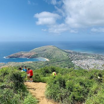


Be prepared for a leg work out! I didn't think I was that out of shape until I had to stop a fifth of the way up to rest and catch my breath. I was literally huffing and puffing. But I couldn't give up as I needed the exercise to work off all the food I have been eating on this trip. Bring good non-slip hiking shoes as some parts of the Koko Trail are steep and quite daunting. Allow yourself about 2.5 hours roundtrip. And if you didn't give up, you will be rewarded with wonderful 360 views of the city at the top! read more
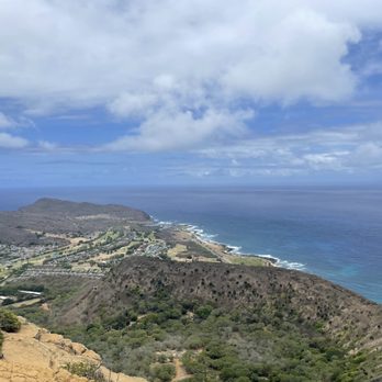


5 years ago
My friend told me to hike Koko Head a couple of months ago, but I didn't make it out until Christmas day. Trail head access is in a public park, so there is parking and a park grade restroom available, but that's about it. No issue there, I wasn't expecting anything fancy for a hike! There isn't a large marker for the trail head, but you can't miss it - there were a dozen or more people heading that direction at 7:30 AM on Christmas day. The trail itself is a very steep set of 1048 "stairs" made from gravel and railway ties headed straight up the mountain. The parks department (or somebody) maintains the stairs for safety purposes, but there are no rails, no accessibility, and no turnoffs. You want to make this hike in the morning or in the evening, when the sun isn't directly over head, and I personally wouldn't do it in the rain. I slipped a couple of times both ways. However, the views up top are fantastic! Somebody hauled a Christmas tree up there and it's at the very top of the mountain for extra fun. This was actually a really good activity for a single individual - there were a lot of friendly people because most of us were breathing hard and moving slowly the higher we got, and there was this awesome support system the closer to the top you got. I was able to chat with a handful of people I saw several times each, which really made the climb more of a fun activity. read more




Insane! Awesome! Steep! Definitely not a moderate hike- strenuous for sure. Get there early before it gets too hot. Free parking and a lot of it available. I wouldn't bring kids. Going up, you're out of breath and feel like you've hit your max amount of being out of breath, and then you look back and then forward to discover you are only 1/4 of the way up. It gets steeper as you go. Some railroad ties are missing, some are rotted out and there's about a 50' section that's like 10' off the ground where you have to step on the railroad ties (people made an off the trail path the avoid this). Also bees in this area. As you get higher and the grade gets more and more steep, there's sections I had to hold to the rail to keep myself from falling back. At the top there's a couple more climbs up rock and wow! 500% worth it! I got to watch a rain shower roll in. It was the most glorious and refreshing thing ever! Except it made the trip down very slippery. Be very careful going down. I did the crab walk across the part with the railroad ties off the ground. Be careful as there are bees in that area- I had to pay attention to not fall or put my hand where there were bees moving around. Totally recommended- you can see Hanauma Bay, the beach, the mountains and just everything. I'd advise to bring water! read more


Yes yes I did it! Whoo hoo...! I finally did the Koko Crater! It took me over 2 hrs up and down. Climbed up (sometimes crawled) over 1,048 stairs made from an abandoned railroad track called "Koko Head Stairs". The most grueling hike ever that gets progressively harder and steeper. There was a point along the hike that was extremely scary and I was afraid I would fall. I hung on tight and went super slow and let those more fit and able to pass by me. I stopped a few times to rest and catch the views along the way. But I never gave up and kept telling myself I can do this. The hike was very rewarding and I'm glad I didn't turn back like I did last time. The views of Honolulu shorelines from the summit were breathtaking!It felt amazing at the top. My top was drenched in sweat and my arms and face sunburnt but it was so worth it. Proud of myself for being able to make it to the top and all the way back down. The descent was just as hard as my knees were shaky and thighs were so sore. read more


This is the ultimate stair master to Koko Head! 1200 feet in elevation, over 1,000 steps to the top. The view overlooks Haunama Bay! A really damn good workout. I was sore for 2-3 days afterwards. In hindsight, I really should have stretched more before. I also haven't worked out as much the last few weeks, so that didn't help. The view is worth it though I promise! I did the sunset hike and started around 5:30pm. I would advise bringing headlamps if you do a sunrise hike or after sunset hike. Those rails can be dangerous I imagine in the dark. I did notice some really physically fit people who ran up all those stairs (so impressive! Goals) in 15 minutes. However, I also saw some people crawling up/down the stairs, so I guess that could tell you how difficult it could be. XD There are some people who have to be helicoptered out, so please please be prepared and bring lots of water, snacks, and go at your own pace. On average, I believe it takes people 1 hour going up, 30 minutes going down. I would advise really good footwear (hiking shoes, tennis shoes). I saw some people wear sandals and almost slipped on the rails. One woman said she regretted wearing sandals. If you have any heart problems, leg or knee problems, I would not recommend this hike for safety reasons. I wouldn't recommend eating right before this hike, I overheard some people throwing up their dinner. I did feel a bit nauseous and dizzy at some points, just gotta pace yourself and take it slow. Maintenance is needed on the railway stairs. read more


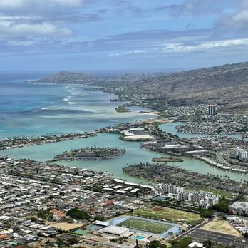
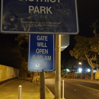
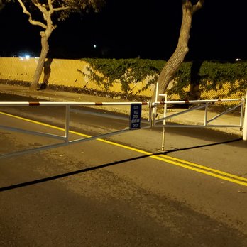
Did this as a sunrise hike in early September. Some things to keep in mind -- Parking: the entrance to the Koko Head District Park is gated closed to cars until 6:30am. So, if you want to do a sunrise hike, don't plan on parking at the Koko Head Parking Lot, but rather plan to park on Kaumakani St and walk about 0.7 miles to the trailhead. Thus, if trying to make it to the top before sunrise, don't forget to add in that 0.7 miles (which, funny enough is actually longer than the trail itself :) ). If you park outside, you are basically looking at a 2.6 mile hike (0.7mi from your car to to the trailhead, gaining a moderate 250ft in elevation, followed by a very steep 800 ft climb in a mere 0.6 miles from the trailhead to the peak,; and then another 1.3 miles back down to your car). I highly recommend doing it at Sunrise: If you are considering this hike, I highly recommend doing it at sunrise solely for the cooler temperatures as there is zero shade: We made it to the top 6 minutes prior to sunrise (50 minutes from car to the peak), and despite it being a nice cool temperature, hiking the tramway was very tiring and sweat inducing.... had I had to do this hike in full sun I think I would have been absolutely miserable. It was definitely worth setting the alarm for 4:15am so that we were parked by 5:18am (1 hour before sunrise)..... in retrospect, I'd have parked 10-15 minutes earlier so I cold have taken a less taxing pace up (I pushed myself as hard as I could to make it from the car to the peak in 50 minutes). I rate it 4 stars for a nice challenge and some very cool views. Overall this hike is a short steep workout with nice views at the top....if you are looking for better scenery throughout, there are many better hikes in Oahu, our favorite being Kuliouou. read more




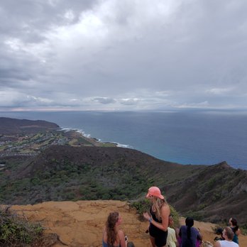


My favorite hike in Hawaii!! Not for beginners! It is a rigorous climb straight up 1000 feet. Wear good shoes, bring water, and take your time so you don't slip! Blessedly, the Friends of Koko Crater have been restoring the trail for the last year and it has made the steps many many times safer and easier to climb! Thank You to these wonderful volunteers and their efforts! The view from the top is glorious. Sweeping perspective of the entire southeast side of the island. And the workout is epic!!! Burn like 400 calories, woohoo! read more


Extremely strenuous and steep but straightforward trail with an extremely rewarding view at the end! However, the endless stairs were not only difficult and super steep, but it was really hard to navigate around people who were taking breaks at the steps...which I wish they'd take breaks to the side. With that being said, just be mindful and also be prepared to break your stride several times bc it is quite a busy trail! And ofc, bring plenty of water! Luckily this is still a pretty short/fast trail read more


This is the hardest, most fun, most everything hike I've ever done. You park at the softball field and take a short walk to the beginning of the trial. The over all hike is short, but the intensity level is 10 from 1-10. It is all incline. The steps are somewhat leveled until you get to the bridge. There's also a path to bypass the bridge if you choose to. The bridge is where you literally start to crawl. Once you get passed the bridge you are almost to the top. Once at the top you can explore and enjoy the views around you after all the hard work you just did. If you're hiking and need a break you can pull over to the side and catch your breath. Don't be a jerk and block the middle of the pathway making it difficult for other to pass. read more

2 years ago

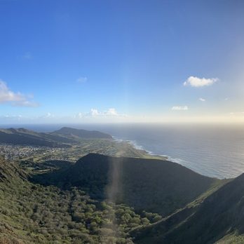
The reason to vacation in Hawaii right now is because it's cheap and the streets are empty. The downside is that a lot is closed including hiking trails. Do you want to hike Diamond Head? Sorry. How about tropical trails with waterfalls? Nope. Koko Crater? No problem but I'm not sure why this one is open. Perhaps, the question is how many crazy people want to climb old abandoned tram tracks to reach the top? On this Thanksgiving morning, the answer seems to be the entire population of Oahu. Should this trail exist? No. There is nothing safe about this mile-and-a-half trek. It's a series of dangerous tram trestles and pedestrian potholes at a 90-degree angle. You have to be healthy, muscular, and with a dancer's agility to even try to attempt this in the rumored 15-minute times. I got to the top in less than an hour and I consider that pretty good since, even setting out before sunrise, there were enough people here that we all had to be patient with each other's abilities and lack thereof. Reaching the top, though, on this Thanksgiving morning, it was easy to be grateful. As the sun rises, views are so truly spectacular that crying with joy is a natural expression. My Koko recommendations: 1. Don't hike this poor excuse for a trail. 2. If you must, don't do it if there is even a hint of rain. 3. Wear good and grippy shoes. 4. Carry two bottles of water; one to drink at the top and one to drink at the bottom. 5. Start the hike before sunrise because the sun shining on you won't make it any easier. 6. Rest at the top and take photos. You earned it. 7. Coming down may be harder than going up. read more




5 years ago
Sure, this is #1 rated oahu trail on alltrails...if one could actually call a broken, old-ass railroad that goes in one direction up and down on a steep incline with no shade whatsoever and minimal fauna a trail. You don't really stop to smell the flowers here, as there are none. You stop because you can't breathe and your legs are begging you to take a break. Yes, it's a hard trek if you're not in shape. But if you've trained with Navy Seal Ninja warriors for the past 15 years, this is a cakewalk. I'd say about 3/4 into the hike, there's about a five foot gap in the railroad that drops about 2.5 feet or so. You can traverse to the other side of the railroad by just dropping down and climbing back up, or you can hang to the right where some folks have created an alternate, roped path (probably easier to take the former). This is an important mark at the trail as everything after is steep and difficult. Take a break from time to time, drink lots of water, and at the top, enjoy some of the most beautiful vistas the island has to offer. That's the payoff and it's worth it for sure. read more


Oh man what a killer hike. Every time I come visit the island, this spot gets placed on the top of my list. One of the things anyone visiting the island should do is to go hiking. Although this hike may be difficult for some, I have seen older folks make it to the top. There definitely isn't any room for excuses! Man even my own mother made it to the top, what a trooper! Occasionally you'd see some volunteers working to restore the hike. If you see anywhere help is needed, I would highly suggest to lend them a hand. With the weather constantly causing damage to the trail, it causes more risk to people if left alone. For anyone new starting this hike -- take your time. If you're afraid of walking over the bridge, there's a side route you can take. Remember -- safety first! This is especially true during days when it's drizzling out or raining. The steps can get very slippery! Trust. The view up is worth it. If you're hiking on a hot day, you'll have some nice breeze from up top. Always remember to bring some water! Also there's a prayer box up top. Be sure to write something if you wish. read more


Intense stairs hike - walking on abandoned WWII railroad, except the wooden sleeper planks are not evenly spaced due to age and stress. Also the angles can be as steep as 40 degrees. ADVICES: Arrive by 7am when the trail is still in the shade. Once the sun hits the trail, it will literally drain you. Stretch legs before and after. Carry cold water in backpack bladder so your hands are free for balancing. I drank 32 oz during shaded morning. Wear gloves optional as most people will grab the metal rails at the really steep areas. I also see some people do the crab walk going down the really steep areas. Use momentum stride to save energy. Rest often to catch breath but keep it short so as not to loose adrenaline rush. Walk around on dirt trail for the scary "bridge" over crevice section, this will also avoid the beehives. Bring some spam musubi to reward yourself at the top, and to give yourself some instant energy. Compare to Half Dome in Yosemite, Koko is more technically challenging because no hand rails, bees, bridge over crevice, and its deteriorating conditions. I met a local middle-aged Japanese lady at the top, she said this hike is addicting, "the next day you feel so light and free, like floating". I thought to myself, the next day I will feel painful and tired but so satisfying to have accomplished this with friends. read more




Very challenging hike if you don't pace yourself. It's a great workout and best done when the sun is barely out. As others may have said, bring water and maybe some snacks, take your time and be careful not to injure yourself. While there's no running water to catch your eye like on other nearby hikes, finishing this trail has a reward in itself. Great views at the top at sunrise. You can also see Hanauma bay, the edge of the crater and even a pillbox from the last World War. Best advice is to go early (I started at 6am) so you don't have to really lookout for people on the way down and the sun doesn't have much of a chance to burn you. read more


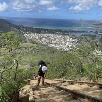
I am going to be blunt, this hike was hard lol. I personally do not like any kind of cardio, so that's probably why it was difficult for me. If you are great at cardio and/or stair master then this is for you. It was definitely a great workout and I was definitely sore the next two days. I have no regrets lol. I would bring lots of water, wear sunscreen, and go when the the weather isn't too hot. For example early in the morning. I went around 9am and finished almost 12pm or later in the afternoon. When you get to the top, the view was amazing. So totally worth the hike and amazing pictures. read more


More info about Koko Crater Trail
423 Kaumakani St
Koko Head District Park
Honolulu, HI 96825
Hawaii Kai
Directions
(808) 522-7060
Call Now
Hours
Indoor Amenities
Outdoor Amenities
Koko Crater Trail Reviews in Other Languages
Ask the Community - Koko Crater Trail
What does the yellow block with a number on it means?
Someone was saying it counts down how far it is to the top. I can't confirm but it's something like that.
Is drone allowed on top?
I hike this trail pretty often and there aren't any restrictions as far as I know and I've seen a number of them so far. However, I have seen some hikers become irritated with the noise constantly buzzing as it echos down the entire trail path. So…
Does anyone know why there's so many shoes on the power lines? Like what does that represent?
From seeing people do it here and other trails, it's more of a commemoration for those who have hiked the trail and no longer plan to hike anymore (usually done by visiting guests). I don't advise doing it as it becomes a hazard and it means someone…
Can I start this hike at 4-5pm? Are there any set hour of operation for this place, kind of like the Diamond Head Hike Trail?
Yes! Park closes at 11. My preferred time is 5:30 anyway to reach the top for sunset.
Where to park?
There's a parking lot just south of the biggest baseball field, that's the best place to park.
Are there any bike racks near Koko Head Crater Trail? If not, any good places to park a bike?
There are chain link fences around ball fields there...easy place to lock up a bike and a short walk to the trail head
Are there other hikes that are similar in effort and length that you'd recommend in/close to town? Looking for alternatives when Hawaii Kai is too far from where I am at the end of the day. Thanks!
Nope
Review Highlights - Koko Crater Trail
You might also consider


































Why does Yelp recommend reviews?
19 reviews that are not currently recommended
The reviews below are not factored into the business's overall star rating.

15 years ago

15 years ago


15 years ago

12 years ago

12 years ago

12 years ago

14 years ago

3 years ago

11 years ago

16 years ago

11 years ago


14 years ago

11 years ago

14 years ago

13 years ago
12 years ago

11 years ago
Koko Crater Trail - hiking - Updated August 2026
Best of Honolulu
People found Koko Crater Trail by searching for…
Abandoned Places in Honolulu, HI
Dog Friendly Beaches in Honolulu, HI
Public Running Track in Honolulu, HI
Swimming Holes in Honolulu, HI
Walking Groups in Honolulu, HI
Abandoned Buildings in Honolulu, HI
Stroller Friendly Hikes in Honolulu, HI
Outdoor Exercise Parks in Honolulu, HI
Full Moon Hike in Honolulu, HI
Stair Climbing in Honolulu, HI
Trending Searches in Honolulu, HI
Bird Sanctuary near Koko Crater Trail
Blueberry Picking near Koko Crater Trail
Cliff Jumping near Koko Crater Trail
Cruising Spots near Koko Crater Trail
Day Trips near Koko Crater Trail
Dog Friendly Things To Do near Koko Crater Trail
Flower Fields near Koko Crater Trail
Jet Ski Rental near Koko Crater Trail
Kids Activities Indoor near Koko Crater Trail
Kids Haircut near Koko Crater Trail
Movie Theater With Recliners near Koko Crater Trail
Outdoor Activities near Koko Crater Trail
Picnic Areas near Koko Crater Trail
Rainy Day Activities near Koko Crater Trail
River Swimming near Koko Crater Trail
Rock Quarry near Koko Crater Trail
Scenic Night View near Koko Crater Trail
Shopping Malls near Koko Crater Trail
Sports Card Shops near Koko Crater Trail
Sunrise View near Koko Crater Trail
Things To Do On A Rainy Day near Koko Crater Trail
Trading Card Shops near Koko Crater Trail
Used Book Stores near Koko Crater Trail
Browse Articles
Browse Nearby
BEST of Honolulu, Hawaii Coffee near Koko Crater Trail
BEST of Honolulu, Hawaii Restaurants near Koko Crater Trail
BEST of Honolulu, Hawaii Things to Do near Koko Crater Trail
BEST of Honolulu, Hawaii Parks near Koko Crater Trail
BEST of Honolulu, Hawaii Breakfast near Koko Crater Trail
BEST of Honolulu, Hawaii Campgrounds near Koko Crater Trail
BEST of Honolulu, Hawaii Walking Trails near Koko Crater Trail
BEST of Honolulu, Hawaii Sightseeing near Koko Crater Trail
BEST of Honolulu, Hawaii Free Public Shower near Koko Crater Trail
Browse Brands
Related Searches in Honolulu, HI
Best Dog Hiking Trails Around Honolulu, Hawaii
Best Fishing Locations and Guides in Honolulu, Hawaii
Best Nature Trails for Hiking in Honolulu, Hawaii
Best Places for Horseback Riding in Honolulu, Hawaii
Best Sightseeing Experiences Available in Honolulu, Hawaii
Best Waterfalls and Swimming Holes in Honolulu, Hawaii
Discover Dog Friendly Trails to Explore in Honolulu, Hawaii
Discover Easy Hiking Trails Near Honolulu, Hawaii
Discover Kid Friendly Hiking Trails in Honolulu, Hawaii
Discover Popular Bike Trails in Honolulu, Hawaii
Discover Scenic Mountain Bike Trails Near Honolulu, Hawaii
Discover Top Nature Parks to Visit in Honolulu, Hawaii
Discover Walking Parks in Honolulu, Hawaii Near You
Discover a Hiking Trail in Honolulu, Hawaii
Discover the Best Night Hike Trails in Honolulu, Hawaii
Dog-Friendly Hikes With Dogs in Honolulu, Hawaii
Enjoy Camping Adventures Around Honolulu, Hawaii
Enjoy Kayaking Adventures in Honolulu, Hawaii
Enjoy Off Leash Dog Hikes in Honolulu, Hawaii
Enjoy Tent Camping Spots Around Honolulu, Hawaii
Enjoy a Beautiful Waterfall Hike in Honolulu, Hawaii
Enjoy the Best Walking Path in Honolulu, Hawaii
Enjoy the Best Walking Trails in Honolulu, Hawaii
Explore Easy Hikes Perfect for All in Honolulu, Hawaii
Explore Fun Activities to Do in Honolulu, Hawaii
Explore Popular Campgrounds Near Honolulu, Hawaii
Explore Popular State Park Destinations in Honolulu, Hawaii
Explore Top Dog Parks in Honolulu, Hawaii Near You
Explore the Best Beach Spots in Honolulu, Hawaii
Family Friendly Hiking With Kids in Honolulu, Hawaii
Find Cozy Camping Cabins in Honolulu, Hawaii
Find Popular Ziplining Spots Around Honolulu, Hawaii
Find Top Dog Friendly Parks to Visit in Honolulu, Hawaii
Find Top-Rated Waterfalls in Honolulu, Hawaii Now
Find the Best Parks for Picnics in Honolulu, Hawaii
Hiking Trails With Waterfalls in Honolulu, Hawaii
Off Leash Dog Hiking Trails in Honolulu, Hawaii
Picnic Areas With BBQ Pits Available in Honolulu, Hawaii
Popular Outdoor Activities to Try in Honolulu, Hawaii
Popular Picnic Spots to Visit in Honolulu, Hawaii
Popular Waterfall Hiking Trails in Honolulu, Hawaii
Safe and Fun Parks for Kids in Honolulu, Hawaii
Top Hiking Trails to Explore in Honolulu, Hawaii
Top Playgrounds for Kids to Enjoy in Honolulu, Hawaii
Top Running Trails to Explore in Honolulu, Hawaii
Top Swimming Spots and Pools in Honolulu, Hawaii
Top Things to Do With Kids in Honolulu, Hawaii
Top-Rated Camping Sites in Honolulu, Hawaii


