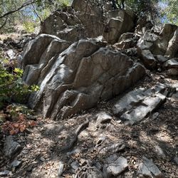
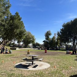
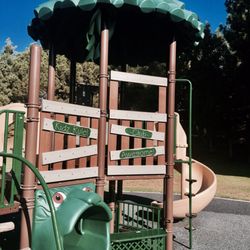
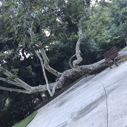
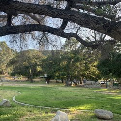
La Tuna Canyon Park Photos


You might also consider
More like La Tuna Canyon Park
Recommended Reviews - La Tuna Canyon Park
Start your review...

Reviews With Photos

One star for the people who attend this place and trash it. for the place itself. I'd like to shed light in this valley hiking area. Lots of trash everywhere in the front parking area. If any ladies are in connection with the @los angeles county - it would be amazing if we can collectively bring awareness to this. This was just a small section - there was more. Seriously, who throws this out of their car without a care? Just not too far apart I went on a hike today sighting two beautiful deers. We need actual surveillance cameras to take thrown the plates of ppl who do this. -- at La Tuna Canyon Trail.


There's plenty of free parking at the trailhead. We hiked this route counter clockwise a few hours before sundown which was a mistake. The route up was easy on a wide asphalt to dirt fire road. When the sun was setting and we passed the Tree of Life the trail became a steep down hill single track which was not too easy to do in the darkness.

Another hike of the list. I can't even begin to tell you how many times I've driven past this trail off the 210 fwy. Honestly, I didn't even know there was a trail for the longest until seeing people walking alongside the highway. First off, when we got there, parking is really bad. There's not much of a lot. Two small lot on either side of the entrance. People also parked under the freeway bridge which I assume was legal. Signs posted on the street said that's there wasn't any parking on the street except for a small strip at the entrance. But when we were finished with the hike, cars were lined along the street. I'm not sure if it was allowed or they don't really check. Either or, parking lots are tiny and apparently your allowed to park on the street when it said no parking. Just take your chances. The trail starts off on a paved road. Could have been a street beforehand. Once it official starts, probably quarter way or half mile. There's two options. You could stay on the main path, wide dirt road or take the shorter path. Which is basically a steep uphill path, narrow at some point. This path is shorter than the main path. There's certain spots where it does merge to the main path before connecting to the uphill path again. We stayed on the main path as it was our first time. There were lots of bend around the corner so we didn't quite know how far or how long the trail was. We ended up to the electric tower, which I believe the trail does continue on. But I think we had reach the top. The views are amazing, one side is all of Sunland, and surrounding areas while the other side is all of the valleys and even downtown and century city. It's still nice and lush so mountains is abundant with greenery. Trail was pretty moderate, uphill the whole way. This was for the main path. The steep path would be harder as the climb is basically steep uphill all the way without all the bends and turns. Overall, nice trail. It was pretty busy when we started around 5pm. But approaching the top it quiet down some. Coming down people seemed to pop of the nowhere on the trail. As we approach the base, it was pretty busy with people beginning the hike. Guess for sunset. Clocked it at 7 miles up and back. Good hike. Parking is luck of a draw.

This hike was more difficult than I thought. Very steep trail but you get a great workout. Lots of bikers so watch out specially if you are hiking with kids. There are several different trails and a small waterfall to take a break at. Nice views from the top. Be careful when coming down, gets slippery. Also go with a hiking buddy just for your safety in case you fall. Saw few rattle snakes on our way down. Take a lot of water and stay hydrated. It's a challenging hike. The parking is very small and it's hard to find street parking.

Easy to find- free parking but area is small but street parking also available- wear good shoes- this has steep inclines- no restrooms- nice view of San Gabriel mountains- there is also an alternative trail which is rocky and steep but will cut some time off hike but needs to be taken cautiously. Good hike.

This is the toughest hike I've gone on so far. La Tuna Canyon Park is 1,100 acres on the northwest side of the Verdugo Mountains. To get to the Hostetter Fire Road, one of the main fire roads that will take you to the top, look for the Intersection of the 210 Foothill Freeway and La Tuna Canyon Road. The fire road starts south of the freeway and you will most likely see a bunch of cars parked in the dirt on the edge of La Tuna Canyon. It is a pretty steep fire road and you will have elevation gains of 1,400 until you reach the top in about 3.5 miles. Here is some information from another hiking website: http://www.hikespeak.com/trails/la-tuna-canyon-in-the-verdugo-mountains/ Once you get to the top you will see the radio towers and you can look down on Burbank. The clouds were really low today, so it was hard to see too well. Tips: * Bring a couple bottles of water or one of those Camelbak things. I brought one full bottle of water and wished I had another by the time I got to the top. * Give yourself a few hours because it took my friend and I two and a half hours roundtrip. You might want to bring a snack with you for some energy. * Don't forget sunscreen. We started off and it was really foggy and it burned off quickly. I was glad I could take off my jacket and put some sunscreen on. * The easiest way up is the Hostetter Fire Road. There is a really steep fireroad that you will see about a mile up the road. That road is really steep. See my photos: http://www.yelp.com/biz_photos/la-tuna-canyon-park-sun-valley?select=AW_DqP8pnJx9u-y0qUYkIg#jEHAyIAnqkMHkBUTf6oPYg * If you are energetic you don't have to just stop at the top. You can take the Verdugo Motorway toward Glendale or head over toward Burbank. These mountains are full of trails and fire roads. Notes: * The Verdugo Mountains are similar to Griffith Park and are covered with trails and fire roads. * You don't have to worry about parking issues or too many people like Griffith Park. * You don't have to worry about getting lost. It is impossible. * If you see some young Pine trees near the top my son's Boy Scout pack planted them a few years ago.

Great trail for an intense and strenuous workout. You have three options. Option one: pick the gravel road to the right for beginners and mountain bikers. Option two: get ready to challenge yourself and hike a steep, dirt mountain top. I recommend Hiking shoes if you choose this option. Option three: start on option two and transition to option one half way up. I went with option three. I gave myself a challenge this morning to get over part of the steep hills. I haven't been hiking as often as I used to do so it was difficult. My hiking partner made it with ease and was great support. THANK YOU! Once we transitioned to option one it was still uphill and had incline but I could hang. You know you are about to reach completion when you see the radio towers. I think I saw three or four radio towers at different locations. Once you are there you can enjoy the amazing view of Burbank, Glendale, the San Fernando Valley and DTLA. We started at 6:00 am and reached the radio towers around 7:30ish. I am thankful to have been here and conquered this beast.
 weekend")
Until Joe E.'s review was featured as an ROTD, I never even knew this was, like, a real place. I'd been hiking here tons of times but Joe's review motivated me to go somewhat closer to the top today. And boy was it worth it! We've had a cool spring in LA and the wildflowers are blooming a bit late. Lucky me! What a profusion, a rainbow, a parade of purple, yellow, red, orange and white flowers lined the trail. And the trees in the ravine (oaks, sycamore) looked vibrantly green. You'd never know we're in a serious drought! Stunning views, beautiful breezes, and a great workout. Win-win-win.

Finally I was able to measure the distance of the hiking trail as well as the height. It's 3.55 miles with a 2,500 feet elevation. This is the just the trail and I would estimate a 4,000 feet or higher for the peak. I have reached the peak several times but I have not used an app before. And this will be my next goal. I punished myself by not bringing water and my own crazy way to determine if I could last. It's one of those experiments that I do and some sort of a challenge to myself. I do run already so the slow part was the climbing-hiking-dragging part. It's the best cardio work out and works on pulmo too. A cardiopulmonary exercise, to say the least. Very steep!! By the time I reached the top, I just followed the trail down and this is the time to run for another 2 miles. If you're a beginner, snacks,water and towel in a backpack will help. I do not advise a jacket because it gets warmer as you reach the top. And yes, for an hour, I wasn't thinking about water. :)

This hike was just ok. The entrance is literally right off the 210 freeway. There is a small parking lot of dirt and minimal street parking, but it is free. I grabbed the only spot left, right in front of a sigh " WARNING, high crime area". Great! I know enough not to bring valuables on a hike but this was a bit unsettling. Next, the first half mile up the paved road runs parallel to the 210 freeway with all it's noisy traffic. The road is also covered with a tremendous amount of graffiti which I find very disheartening. In the distance I see what all the reviews must be raving about. This hill does look like a beast and if I weren't on a juice only weekend I would attack it. Instead, I hook right for the lesser of two evils. It is a decent climb to the top and a great jog all tthe way back down. If you live in the area I'd say come here, but don't drive out of your way.


Incredible views!!! With amazing sunrises seems sunsets. A quick one hour, approximately 3.5 mile hike close to Burbank with easy access to the 210. A hike for all fitness levels, you can take the hills if your up to the challenge, bring water and a towel because you'll need it or you can take a leisure walk up the fire road at your place with an incline that is comfortable. Be careful with bikers coming down the hill. Not very crowded, though parking can be tricky if you go at peak hours, 8 a.m.-10 a.m. or 5 p.m.-7:30 p.m.

2 months ago
Los mejores jugos Naturales recomendados al 100 % después de una caminata algo muy saludable siempre read more


La Tuna Canyon Park is off the conveniently named La Tuna Canyon Road by the 210 freeway. I have hiked here a couple of times with colleagues after work, and yes parking can be limited during peak hours. Sometimes you'll have to jaywalk since street parking across the trailhead is the only option. The main trail is well maintained and pretty straightforward which we take coming down... ...while the trail going up that I've taken is slightly to the right of the trailhead and is a bit narrow with some bushwhacking involved due to overgrowth. Also, the dirt's a bit loose and the incline is intense. Thankfully, enough people have gone through so that the path is distinguishable, since this is the fastest way up the mountain. During the late autumn and winter seasons when daylight becomes scarcer, getting up to the top in time to watch the sunset is time-critical. With that said, I wouldn't recommend this trail unless you are wear decent hiking shoes and are clothed. Once you're atop, you're greeted with an impressive view of the land down below. If you're lucky and the sky is clear, the stars and lights from the city complement one another beautifully. As a side note, bring headlamps to help you on the trek down. read more

4 years ago
One star for the people who attend this place and trash it. for the place itself. I'd like to shed light in this valley hiking area. Lots of trash everywhere in the front parking area. If any ladies are in connection with the @los angeles county - it would be amazing if we can collectively bring awareness to this. This was just a small section - there was more. Seriously, who throws this out of their car without a care? Just not too far apart I went on a hike today sighting two beautiful deers. We need actual surveillance cameras to take thrown the plates of ppl who do this. -- at La Tuna Canyon Trail. read more


3 years ago


6 years ago
There's plenty of free parking at the trailhead. We hiked this route counter clockwise a few hours before sundown which was a mistake. The route up was easy on a wide asphalt to dirt fire road. When the sun was setting and we passed the Tree of Life the trail became a steep down hill single track which was not too easy to do in the darkness. read more

Another hike of the list. I can't even begin to tell you how many times I've driven past this trail off the 210 fwy. Honestly, I didn't even know there was a trail for the longest until seeing people walking alongside the highway. First off, when we got there, parking is really bad. There's not much of a lot. Two small lot on either side of the entrance. People also parked under the freeway bridge which I assume was legal. Signs posted on the street said that's there wasn't any parking on the street except for a small strip at the entrance. But when we were finished with the hike, cars were lined along the street. I'm not sure if it was allowed or they don't really check. Either or, parking lots are tiny and apparently your allowed to park on the street when it said no parking. Just take your chances. The trail starts off on a paved road. Could have been a street beforehand. Once it official starts, probably quarter way or half mile. There's two options. You could stay on the main path, wide dirt road or take the shorter path. Which is basically a steep uphill path, narrow at some point. This path is shorter than the main path. There's certain spots where it does merge to the main path before connecting to the uphill path again. We stayed on the main path as it was our first time. There were lots of bend around the corner so we didn't quite know how far or how long the trail was. We ended up to the electric tower, which I believe the trail does continue on. But I think we had reach the top. The views are amazing, one side is all of Sunland, and surrounding areas while the other side is all of the valleys and even downtown and century city. It's still nice and lush so mountains is abundant with greenery. Trail was pretty moderate, uphill the whole way. This was for the main path. The steep path would be harder as the climb is basically steep uphill all the way without all the bends and turns. Overall, nice trail. It was pretty busy when we started around 5pm. But approaching the top it quiet down some. Coming down people seemed to pop of the nowhere on the trail. As we approach the base, it was pretty busy with people beginning the hike. Guess for sunset. Clocked it at 7 miles up and back. Good hike. Parking is luck of a draw. read more


This hike was more difficult than I thought. Very steep trail but you get a great workout. Lots of bikers so watch out specially if you are hiking with kids. There are several different trails and a small waterfall to take a break at. Nice views from the top. Be careful when coming down, gets slippery. Also go with a hiking buddy just for your safety in case you fall. Saw few rattle snakes on our way down. Take a lot of water and stay hydrated. It's a challenging hike. The parking is very small and it's hard to find street parking. read more

Easy to find- free parking but area is small but street parking also available- wear good shoes- this has steep inclines- no restrooms- nice view of San Gabriel mountains- there is also an alternative trail which is rocky and steep but will cut some time off hike but needs to be taken cautiously. Good hike. read more


This is the toughest hike I've gone on so far. La Tuna Canyon Park is 1,100 acres on the northwest side of the Verdugo Mountains. To get to the Hostetter Fire Road, one of the main fire roads that will take you to the top, look for the Intersection of the 210 Foothill Freeway and La Tuna Canyon Road. The fire road starts south of the freeway and you will most likely see a bunch of cars parked in the dirt on the edge of La Tuna Canyon. It is a pretty steep fire road and you will have elevation gains of 1,400 until you reach the top in about 3.5 miles. Here is some information from another hiking website: http://www.hikespeak.com/trails/la-tuna-canyon-in-the-verdugo-mountains/ Once you get to the top you will see the radio towers and you can look down on Burbank. The clouds were really low today, so it was hard to see too well. Tips: * Bring a couple bottles of water or one of those Camelbak things. I brought one full bottle of water and wished I had another by the time I got to the top. * Give yourself a few hours because it took my friend and I two and a half hours roundtrip. You might want to bring a snack with you for some energy. * Don't forget sunscreen. We started off and it was really foggy and it burned off quickly. I was glad I could take off my jacket and put some sunscreen on. * The easiest way up is the Hostetter Fire Road. There is a really steep fireroad that you will see about a mile up the road. That road is really steep. See my photos: http://www.yelp.com/biz_photos/la-tuna-canyon-park-sun-valley?select=AW_DqP8pnJx9u-y0qUYkIg#jEHAyIAnqkMHkBUTf6oPYg * If you are energetic you don't have to just stop at the top. You can take the Verdugo Motorway toward Glendale or head over toward Burbank. These mountains are full of trails and fire roads. Notes: * The Verdugo Mountains are similar to Griffith Park and are covered with trails and fire roads. * You don't have to worry about parking issues or too many people like Griffith Park. * You don't have to worry about getting lost. It is impossible. * If you see some young Pine trees near the top my son's Boy Scout pack planted them a few years ago. read more


Great trail for an intense and strenuous workout. You have three options. Option one: pick the gravel road to the right for beginners and mountain bikers. Option two: get ready to challenge yourself and hike a steep, dirt mountain top. I recommend Hiking shoes if you choose this option. Option three: start on option two and transition to option one half way up. I went with option three. I gave myself a challenge this morning to get over part of the steep hills. I haven't been hiking as often as I used to do so it was difficult. My hiking partner made it with ease and was great support. THANK YOU! Once we transitioned to option one it was still uphill and had incline but I could hang. You know you are about to reach completion when you see the radio towers. I think I saw three or four radio towers at different locations. Once you are there you can enjoy the amazing view of Burbank, Glendale, the San Fernando Valley and DTLA. We started at 6:00 am and reached the radio towers around 7:30ish. I am thankful to have been here and conquered this beast. read more


Until Joe E.'s review was featured as an ROTD, I never even knew this was, like, a real place. I'd been hiking here tons of times but Joe's review motivated me to go somewhat closer to the top today. And boy was it worth it! We've had a cool spring in LA and the wildflowers are blooming a bit late. Lucky me! What a profusion, a rainbow, a parade of purple, yellow, red, orange and white flowers lined the trail. And the trees in the ravine (oaks, sycamore) looked vibrantly green. You'd never know we're in a serious drought! Stunning views, beautiful breezes, and a great workout. Win-win-win. read more
 weekend - Parks Near Me - Sun Valley, California")


Finally I was able to measure the distance of the hiking trail as well as the height. It's 3.55 miles with a 2,500 feet elevation. This is the just the trail and I would estimate a 4,000 feet or higher for the peak. I have reached the peak several times but I have not used an app before. And this will be my next goal. I punished myself by not bringing water and my own crazy way to determine if I could last. It's one of those experiments that I do and some sort of a challenge to myself. I do run already so the slow part was the climbing-hiking-dragging part. It's the best cardio work out and works on pulmo too. A cardiopulmonary exercise, to say the least. Very steep!! By the time I reached the top, I just followed the trail down and this is the time to run for another 2 miles. If you're a beginner, snacks,water and towel in a backpack will help. I do not advise a jacket because it gets warmer as you reach the top. And yes, for an hour, I wasn't thinking about water. :) read more


12 years ago
This hike was just ok. The entrance is literally right off the 210 freeway. There is a small parking lot of dirt and minimal street parking, but it is free. I grabbed the only spot left, right in front of a sigh " WARNING, high crime area". Great! I know enough not to bring valuables on a hike but this was a bit unsettling. Next, the first half mile up the paved road runs parallel to the 210 freeway with all it's noisy traffic. The road is also covered with a tremendous amount of graffiti which I find very disheartening. In the distance I see what all the reviews must be raving about. This hill does look like a beast and if I weren't on a juice only weekend I would attack it. Instead, I hook right for the lesser of two evils. It is a decent climb to the top and a great jog all tthe way back down. If you live in the area I'd say come here, but don't drive out of your way. read more


5 years ago
My friend and I went hiking here last Saturday. What a beautiful hiked. She clocked us at 5.2 miles. My friend liked the fact that there weren't that many people around 10am and the wide trails. We got a good workout and came across a few other friendly dogs. Very happy to do this trail. read more


Incredible views!!! With amazing sunrises seems sunsets. A quick one hour, approximately 3.5 mile hike close to Burbank with easy access to the 210. A hike for all fitness levels, you can take the hills if your up to the challenge, bring water and a towel because you'll need it or you can take a leisure walk up the fire road at your place with an incline that is comfortable. Be careful with bikers coming down the hill. Not very crowded, though parking can be tricky if you go at peak hours, 8 a.m.-10 a.m. or 5 p.m.-7:30 p.m. read more


6 years ago
Love it, minutes from my house , it helped keep working out during pandemic. There's a lot snakes FYI , if you hear a scream it's probably me... screaming at a snake. read more


4-28-19/Sunday morning I met up w Burbank Fleet Feet peeps for this awesome 7.23 miles up to Verdugo Point. I've been here a couple of times for hiking but this was a new route for me & I love it! Incline run/hike up & ran all the way down. It was a perfect day for a run w lots of fog & beautiful mother nature. Parking gets crowded but there is plenty street parking. I also spotted a guy in the parking lot selling fresh squished orange juice. I'll definitely be back! read more


9 years ago
Also one of my favorite trail to mountain bike. Early hikers and mountain bikers would go there and share the trail side by side. It takes approximately an hour to get to the top with your bike. Most hikers would venture of to the steeper trail that cuts the time shorter to get to the top. Unfortunately it burned a few months ago so some of the vegetation are still black and scorched. It was very dusty there last month when I went. read more


7 years ago
My favorite place to hike because it's actually a really good hike. It's not flat, so you get a good work out. I like walking it up all the way to top of the mountain and then running it down. I would say to get here early because it does get really hot in afternoon. Also the parking is not great, if you're not here early you struggle to find where to park. read more


If you're into climbing mountains, this is the place for you. About 2 hours of incline to the top that will get your legs to wake up. The first time we did the hike, we didn't go all the way to the top becuase it was mid summer and there is no escaping the sun on this trail and I almost ran out of sweat. The 2nd time the weather was perfect and I had no excuses and I'm glad I didn't. From the top you can wander beneath the satellites, travel to a bench that sits under a tree and view the Crescenta Valley, or relax and enjoy views of Burbank. The vantage point is really something. We saw some hikers on their way up from the Burbank side and the trail from there looked pretty nuts. Lots of steep sections. You can find those on the Crescenta side as well, but they're avoidable. Not from Burbank. The trail is very popular so don't expect a nice, quiet stroll alone. You will probably be saying hello to other hikers the whole way up. I read somewhere that the hike is supposed to be a loop. Haven't figured out that one yet. We've just gone up and down on the same trail. Can't wait to go back and do it again. read more


This review is for 03/24/2012. After my buddy and I had our little meal at CostCo, were on our way to Tuna Canyon Park. However, we both didn't have the right Tuna Canyon Park. My friend was wondering why I wanted to take the I-5 Freeway North versus going I-5 South. I told him we were going to La Tuna Canyon Park in Sun Valley. He told me were going to Malibu area. Now, I am just finding out that there are two. So, this review is for La Tuna Canyon Park in Sun Valley, not Tuna Canyon Park in Malibu. :) My friend and I arrived to La Tuna Canyon Park near the 210 Freeway around 12:20pm. As I am reading previous reviews, the entrance close to the freeway is a fire access road (Hostsetter), an UNOFFICIAL entrance. I've been reading other reviews and am wondering why this is difficult. Apparently, its not that bad at all. Compared to Hellman Park, this is NOTHING. The initial paved road is easy both going up and down. I am sure the bike riders hate going up, but love going down. The total time with small stops for our hike to the top of the Verdugo Mountains was about two hours. For the first hour, the view of the 210 Freeway was pretty boring. As we were approaching the radio towers, there was a spectacular view of the San Fernando Valley with a great view of Burbank. To even add to the value, you can see the skyline of Los Angeles in the back. This was a multi-billion dollar view. However, I may have to see if I am emitting radiation from the radio/signal towers. There was a ton of them. Throughout the two hours up the mountain, we rarely saw anyone finish their hike up. I am proud to say that my friend and I accomplished reaching the top. We've passed by so many people, but wondered where they went. There were a couple of hikers probably younger than me and gave up. The cyclists probably have a harder time since they have to pedal more to generate some speed. The return trip down is about one hour 15 minutes. There is a lot of braking and I think my soles and rubber of my shoes need some replacing. Just be careful of some loose rock, but the run down is pretty thrilling. One thing we forgot to do was warm up. I started cramping up on the return trip, but not as bad as cramping at Placerita Canyon in the rain. With the rain coming a day after our hike, the winds were no help. My legs were cold since I was wearing shorts and wind never made up its mind when to blow. Overall, the hike took us about 3 hours and 15 minutes with breaks. This hike was great even though this was not the intended place to hike. Remember, this is la Tuna Canyon Park in Sun Valley, not Tuna Canyon Park in Malibu. I wish more people would finish their hike rather than turn back and say I give up. The reason I said that was because of the people we passed by and by the time we reached the top, there was no one there to receive the reward. The reward to see the Los Angeles background with the dominant view of the San Fernando Valley. Yelp is My Review, My Story, and My Life. Its time to share it. read more


Great hike! I felt the burn going up and it was a wonderful jog down. My coworker and I came out to get some exercise in today and the weather could not have been any more perfect, high 70's/low 80's just great. It was a quick steep get-up I guess you can say, like it has a steep little hill up to get your heart pumping then after that it smooth's out and you don't even really notice that you're walking up a mountain. We made it all the way to the top which took us about an hour & a half since it was my first time. It was a little hazy but still really pretty; sun was about to set so the sky had its beautiful amber and blues, we could also see the beach from where we were standing so that was amazing. For you mountain bikers, probably a totally different story--saw some of you guys struggling up there; we even passed a pair like 3 times and made it to the top before they did. Watch your step both going up and coming down because you can slip, I did a couple times but thankfully didn't eat it. We already made plans to come back in the near future because it's really nice here and we both work down the freeway off Sunland. read more

Ok let me start of first by saying, I am in no possible way a fan of hiking up a mountain. I think it is the craziest idea ever when you have gyms lol. Well anyways I was tricked into doing this when I visited my girlfriends parents and they said they wanted to do a "little" hike....WRONG! I think the hike overall was a little over 3 hours from top back down to the bottom. I know the trail goes in a complete circle but no way was I even going to attempt that. Anyways, thank god it wasn't hot or anything or I would have died. I was wearing some jeans and a pair of vans, like I said I was tricked into this so dont judge. I am a pretty athletic guy and can run a couple miles before I need to stop for a walk or rest, but this trail def got my heart pumping. Most of it is uphill so I mean if you cant really walk up semi steep hills, don't even try. I give 4 stars based on the fact that it is a good workout, and that's what people do them for. If your doing it for the "view" at the top. Dont do it, I got to the top just to see a foggy los angeles....That's LA smog for ya. Bring a couple water bottles for yourself if it is a hot day because if something happens, its a long way down. Also look out for doggy doodoo as a lot of people walk their dogs. Another tip don't bring your dog if it is fat or out of shape, we saw one lady have to carry her bulldog down the mountain because when she would put him down he would nearly collapse. GO GET IN SHAPE!!!!! .xxxx. |(o)(o)| ( (__) ) | ( ) | \__/ Jordan read more

12 years ago
Went here today and i got my butt handed to me. First off we can start with parking; It is a tiny lot as everyone else states. Luckily, we found one spot on the street by the entrance and we were also fortunate not to find an overpriced parking ticket at our door upon return (I didnt even know about that until i read other reviews just now so, hallelujah!). Those hills are a killer! There are different routes to take ie service roadway or the steep rugged dirt trail. My friends and i took the steep rugged dirt trail so we knew we'd be in for a workout but this is like 5x harder than Veterans Park in Sylmar. Inclines inclines inclines. Be sure you're willing to get down and dirty at this hike! Its so steep in some areas my best friend slipped and ended up with some battle wounds. And there was rarely any shade!! Made it so much harder. We got here around 730am and the sun was already beaming its hot rays on us. Took us 2 hours to reach the very top. I advise people to not only bring plenty of water but also remember that your skin is your body's first line of defense. Wear your sunscreen!! Bring a hat and sunglasses. Protect that head and that beautiful face! Also, plan accordingly because it will take up half your day hiking here. I also noticed people bringing their dogs. Im sorry but it was like 95+ degrees out today. Your furry little animal is so close to the burning hot ground they can have a heat stroke / get sunburnt. Esp the ones i saw with dark coats. During these extreme temperatures i think its a little too risky to be putting your four legged friend thru that kind of terrain in this kind of heat. I just felt so bad because if i could barely withstand the heat alone, with no shade, what more them. read more

8 years ago
16 years ago
While riding my bike up La Tuna Canyon I decided to head up Hosteller fire road. The Verdugo ridgeline back to Glendale seemed a lot more appealing than riding in traffic and I decided I could use the extra climb up to Verdugo Peak after getting shut down on my attempt to ride through the Big Tujunga Canyon closure up to ACH. The fire road was in good condition despite the recent downpours and the grade was perfect for my cross bike (post 29 miles of road riding). The views of the San Gabriels were spectacular. It amazes me at how easy it is to find solitude in the Verdugos, on a weekend, given their proximity to the surrounding burbs as long as your willing to go a few miles from the trailhead. read more

7 years ago
Great hike and the park had plenty of parking. The park has a place to BBQ and the place is clean. We enjoyed the view. read more


4 years ago
16 years ago
This place is great to get a quick bicycle ride up to the towers and enjoy a very nice view. According to google my tracks, it's about 3.7 miles and 1,500' of climbing so great work out. One of my favorite spots along the fire road is the overlook at about mile 2.5, below is the La Crescenta Valley...it just looks spectacular. It never fails to wow me going up or down. Recently, after the rains water run off has been paralleling the fire road so it's been some what mystical. The hills are coming alive with green vegetation. By the way, Hostetter fire road is fine to ride after the rains. It seems to be composed of decomposed granite and it just drains well. Hiking or bicycling leaves no trace. Except for this year being an El Nino year, there has been major ruts on the road. However, as much damage the rain storms have left the San Gabriels, the Verdugos is doing well. I love the friendly people that hike here. I love just sitting at the radio tower make shift bench and enjoy the view. Lot's of options here. When my dog Kana used to peek out the car window and see this place, she goes berzerk along with her sister and her son. Rest in peace kana, I remember how much you like this place. read more

13 years ago
Love this place. Absolutely gorgeous, close to NoHo, very open and a FANTASTIC view of ALL of Los Angeles. From Burbank, Downtown, Silverlake, Century City to the beach! Immaculate. No water fountains anywhere along trail and set aside a couple of hours to do a full loop. read more


9 years ago
8 years ago
One of my favorite trails. It doesn't get too crowded here so that's a big plus. There's dirt parking or street parking at the bottom of the trail. You have to go a little under half a mile before you actually get on the trail. I will say the hills here are crazy steep so be careful and going with a friend. Also, it's good for mountain bikes! read more


Pretty treacherous but it was smooth sailing after the first couple of steep trails. Enjoyed the trails minus the doggy poops. Lots of mountain bikers. Pretty cool. Parking not so cool as Deukmejian Park but it's fine. It was nice seeing lots of kids all ages challenging the steep trails. read more


13 years ago
Very Narrow trail- not so great to go with a group since you end up in a single file line... Careful of the western diamond back rattle snakes!! (I posted a picture) read more


Page 1 of 3
More info about La Tuna Canyon Park
La Tuna Canyon Park Reviews in Other Languages
Ask the Community - La Tuna Canyon Park
Is the parking right off 210 fwy?
Yes, it's fairly close off the 210 fwy- small dirt lot across from a local nursery - street parking also available
Anyone know if the hikes were destroyed? Still good to hike there after the fire earlier this month?
Still pretty good
Review Highlights - La Tuna Canyon Park
You might also consider


Why does Yelp recommend reviews?
8 reviews that are not currently recommended
The reviews below are not factored into the business's overall star rating.
13 years ago
11 years ago
10 years ago
12 years ago
14 years ago
9 years ago
12 years ago
12 years ago
La Tuna Canyon Park - parks - Updated July 2026
Best of Sun Valley
People found La Tuna Canyon Park by searching for…
Hiking in Sun Valley, California
Things to Do in Sun Valley, California
Beaches in Sun Valley, California
Hiking Trails With Waterfalls in Sun Valley, California
Scenic View in Sun Valley, California
Dirt Bike Trails in Sun Valley, California
Running Track in Sun Valley, California
Abandoned Buildings in Sun Valley, California
Parks With Pull Up Bars in Sun Valley, California
Watch Sunset in Sun Valley, California
National Parks in Sun Valley, California
Sunrise View in Sun Valley, California
Beautiful Views in Sun Valley, California
Closest Beach in Sun Valley, California
Walking Trails in Sun Valley, California
Mountain Bike Trails in Sun Valley, California
Easy Hikes in Sun Valley, California
Off Road Trails in Sun Valley, California
Scenic Overlook in Sun Valley, California
Secluded Spots in Sun Valley, California
Photo Spots in Sun Valley, California
Fishing Spots in Sun Valley, California
Browse Nearby
BEST of Sun Valley, California Playgrounds near La Tuna Canyon Park
BEST of Sun Valley, California Coffee near La Tuna Canyon Park
BEST of Sun Valley, California Restaurants near La Tuna Canyon Park
BEST of Sun Valley, California Things to Do near La Tuna Canyon Park
BEST of Sun Valley, California Picnic Areas near La Tuna Canyon Park
BEST of Sun Valley, California Breakfast near La Tuna Canyon Park
BEST of Sun Valley, California Campgrounds near La Tuna Canyon Park
BEST of Sun Valley, California Natural Hot Springs near La Tuna Canyon Park
BEST of Sun Valley, California Restroom near La Tuna Canyon Park
Browse Brands
Browse Articles
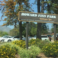
People who viewed La Tuna Canyon Park also viewed
Oro Vista Park
7 reviews
Sunland
Big Tujunga Canyon
5 reviews
Sunland
Colby Canyon Trail
3 reviews
Little Tujunga Canyon
4 reviews
Descanso Trail
18 reviews
Cherry Canyon Park
24 reviews
Chandler Bike Path
37 reviews
Wilson Canyon Park
25 reviews
Sylmar
Griffith Park Helipad
15 reviews
Griffith Park
La Canada Teepee
18 reviews