La Canada Teepee Photos


You might also consider


More like La Canada Teepee
Recommended Reviews - La Canada Teepee
Start your review...


Reviews With Photos


Hiking nature is the most powerful aphrodisiac. I say I have a restless soul. The need to roam and explore is in my blood. Without further delay let's start this review. La Cañada Teepee (via Crosstown trail) is a beautiful and popular local hiking destination. It's a 3 mile out-and-back trail near La Canada Flintridge, California. I considered this a moderate to extreme trail due to it's steep elevation change. Therefore, you must be in top shape and be fit! This is popular area for hiking, trail running, and walking, on the weekends. So you'll likely encounter other people while exploring. I went here on a hot Tuesday afternoon and not a single soul on the trail...Awesome! It took me about 2 h (with multiple rest stop; little to no shade on the trail) to get to Teepee destination; I went even further north to Mt Lukens Truck Trail where there is even a mailbox designating the area as "Bee Flat." Moreover, you'll see a miniature Observatory, Bees Crossing sign because there's a small Beehive farm nearby. Hiking back down to Harter Ln street-main entrance- took me 35 mins. Total elevation gain: 1,400 feet. Total mile: 4.4 miles (Street to Bee Flat mailbox) Total time: 02 hrs 35 mins. Degree of difficulty: Moderate to Hard (steepness and elevation gain) Heart rate: 135 bpm Overall, I'm glad I hiked this trail and get to see the beautiful view and smell of nature and see a beehive farm. I recommend this trail.


Trailhead Location: The trail starts near the "USFS Angeles Station 11 - Angeles Crest". Parking: There are 6-7 parking spots available near the "USFS Angeles Station 11" and also a parking area directly across the station. Trail Condition: The trail is really well maintained so it's not easy to get lost. Just pay attention to the trail map and make sure you make the proper turn as you approach the TeePee lookout. If you miss the turn, then you'll keep hiking towards the north side of the mountain and probably won't hit another fork road until 1.2-1.5 miles later. I noticed that there were "Bee Crossing" warning signs near the Teepee lookup, so I would suggest avoid wearing or bringing anything that would attract bees. And also, the trail is not really shaded so avoid hiking at noon if possible. Overall Impression: I really enjoyed hiking the Tee Pee Trail especially because it's not overly crowded. It is really not easy to find a trail with so little people close to LA and/or Pasadena lately.


Unless you've bagged Everest, you mountain climber you, this may just be the steepest and most challenging hike you'll ever complete. It feels like a total victory when you make it to the top and score a selfie with the Teepee itself. I know it was the hardest hike ever for me (third time's a charm, but the first time shouldn't count since I got lost. Don't get lost like me, follow these directions https://nobodyhikesinla.com/2012/12/27/la-canada-teepee-via-crosstown-trail-from-harter-lane/. ) Am I exaggerating? Maybe. I am a work-out wimp (and surely felt like a wimp as hard-core runners bounded past me up the steep slopes) but I have it on good authority that I am not the only one who feels this way. It is freaking steep, and just when you think you're almost there, another steep incline greets you right around the corner. And, yet, it's a fantastic hike. The views of the Los Angeles Basin are unequaled. It's incredibly clean, unlike some of the trash and graffiti-covered hikes around (Eaton Canyon, I am looking at you.) The trail is well-maintained and your fellow hikers, based on my experience, are respectful and wear their masks, trying to keep social distance as much as possible. But it truly is incredibly steep. Bring your hiking books with the best tread, an energy bar or two, and water. Walking sticks might help as well if you have any issues with balance. Free parking at the trailhead (see directions referenced above.) I have no idea who built the Teepee, so I can't say if it's been culturally appropriated or not. But it is a landmark and a destination for those who want to improve their physical fitness. My goal for 2021? Try to make it up and back in less than two hours :). Enjoy and stay safe.


BEAUTIFUL HIKE AND A REALLY GREAT WORKOUT ====================================== Details: Hiked to the La Canada Teepee on Saturday, January 4, 2019 with my good friend and hiking partner Jenny. I met Jenny years ago when we used to go on hikes with the Pasadena Hiking Pacers. The only thing we didn't like about those hikes is that they started at 7:00 a.m.. Even though I am a morning person it is still difficult getting to the trails at that time. Yesterday we decided to meet where the trail begins at 9:00 a.m.. I need to do some research on the elevation gain, but it is pretty intense and you end up at the top of the mountain near Mount Lukens Truck Road. Tips: 1) Wear good hiking shoes because the trail is very slippery with the decompressed granite. The fact that most of the trail is steep compounds this problem. 2) I recommend hiking poles, but ski poles work. I lost one of my ski poles on Echo Mountain a few years ago, so I just use one. It works, but two would be better. 3) I like using a camelbak so it's much easier to stay hydrated while using hiking poles. 4) Wear a hat and put on some sunscreen. Most of the hike is exposed. 5) Give yourself a good two and half hours to get to the top and back. Notes: 1) You can start on the trail behind the big sign or walk up to the left of the water tower. 2) If you start walking up to the left of the water tower you will be going up a fire road for a bit. You'll see a trail sign on your right and turn right up the trail. Check out my photos. If you look to your left you can see the water tower down below. 3) There are two picnic benches half way up to take a break. Bring some snacks or lunch with you. 4) The elevation gain is about 1,400 feet. 5) Here is some more info on the trail: https://www.google.com/amp/s/nobodyhikesinla.com/2012/12/27/la-canada-teepee-via-crosstown-trail-from-harter-lane/amp/
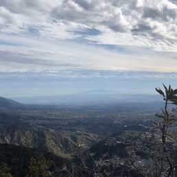

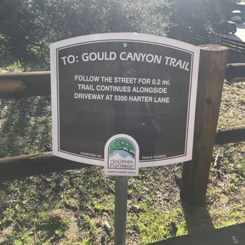
Came here to hike on a Sunday afternoon. It was a bit difficult for us to find the right trail initially, but thankfully (!) I still had some service at the start of the hike and followed directions from this website: https://nobodyhikesinla.com/2012/12/27/la-canada-teepee-via-crosstown-trail-from-harter-lane/. Parking is quite easy along the residential cul-de-sac. Overall, I would say to bring some hydration and proper footgear to help with your stability. It is largely unshaded along the way, so depending on the weather conditions of your day, I would pack accordingly with a hat and sun protection. The hike is a moderate one - about 1300 ft in elevation gain, 1.5 miles up, for a roundtrip of approx 3 miles. Keep in mind that it's a steep uphill all the way up! It took our crew 40 minutes up to the teepee. The views are pretty breathtaking all the way. As for coming down, this is where hiking poles and/or hiking shoes would be a plus, as the steep descent can be quite dangerous. We went with regular running shoes (really underprepared!), and it was a very slippery coming back down. Overall, a great short hike. Would recommend to hiking enthusiasts, but make sure to wear proper footwear!


This is one of my favorite short yet challenging hikes in the closer neighborhoods of mine. It's about a 1.5 mile hike, round trip. You got a great incline going up. Have a cool teepee to hang out around at the top. Only negative points about this hike is at the top your view is blocked mostly by trees. Also, part of the trail is fairly narrow and must be very careful on where to step.


Loved this hiking trail! It is moderately trafficked early in the morning and the 5.1 loop it totally doable in Nike sneakers. We brought 32 oz of water for two adults and one dog and it was plenty. My dog LOVED exploring this trail and we even had a nice little photo shoot for him up there. There is a small "parking lot" across from the trail head so come early to avoid a walk prior to your hike. Happy hiking!


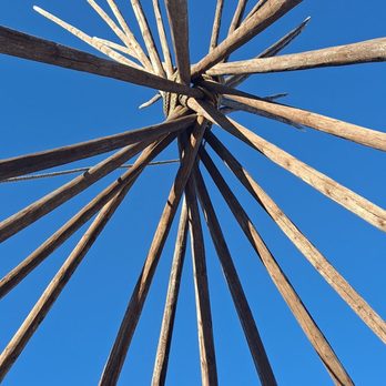
Great hike in La Canada with a Teepee at the top of the mountain! My friend and I go on hikes every month and we take turns picking places. She found this place on AllHikes, it was listed as a short but inclined 2.7 mile hike. AllHike almost always lists hikes as less than they are, because the sign I saw said it was over 3 miles. Got there on a Saturday morning and there was plenty of parking, probably because it had just rained. While I waited for my friend, I looked around and took some pictures. Some ladies were coming down from the hike and I asked if there was a restroom anywhere on the path - they said no and that I could go in the bushes, lol. Always good to know about restrooms or lack thereof on these hikes. My friend got there and we started our ascent up the mountain to the teepees! I will say, this was a more strenuous hike, lots of uphill. She brought her pup and the dog had to stop and rest a few times. But overall it was a great hike with awesome views. It was very green after the rain and the teepee at the top was really cool!


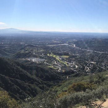
Did the 2-3 mile steep uphill climb to get to this awesome teepee! Beautiful views of the Crescenta valley! 10/10


What a marvelous hike. You are only going up the trail. You encounter a few inclines but I would rate this hike easy. The trail is pretty wide and it only takes 5.1 miles out and back. The scenery of the mountains and the view of La Cañada are beautiful. Spectacular views from where the Teepee is located. Very serene and peaceful.


This was easily one of my favorite hikes around LA, mostly because it was such an unexpected adventure. My friend originally wanted to hike the Brown Dam hike, but last minute suggested this trail and I'm so glad she did. We parked near the Angeles Crest Highway and followed the trail up to the La Cañada Teepee. The hike itself was long but relatively easy, and we were lucky that the weather was slightly overcast that day which it made the trek much more comfortable. We knew we were close when we saw the mailbox along the trail with a chain blockading the road to the teepee. That's when we ran into two Kenyan women who gave us a quick heads-up about what was ahead: stunning lavender fields, a cool telescope (I thought it was a model of the Griffith Observatory--haha), and even a little maze hidden within the flora and bushes as you get closer to the teepee structure. The sisters also mentioned that the area is actually private property, but the owners generously allow people to visit. We didn't run into the owner's, but we were able to explore and enjoy the incredible views and the massive teepee structure at the top. It truly felt like stumbling upon a hidden gem right in Los Angeles--one of the best surprises in such a long time. Highly recommended if you are an avid hiker. Best, Lina C. read more


7 months ago
This is a fun hiking destination! You can approach from the east or the south and you won't be disappointed. read more


It's an easy hike that features a bee farm, a small lavender field, a rock labyrinth, and a teepee. Dogs are allowed on this trail as long as they are leashed. It was very cloudy so we didn't see any views. We would come back to see a sunrise, many friends said it is beautiful. It's a easy/moderate hike with around 2,000 ft of elevation. We did it in less than 2 hours is 5.2 miles Here is the address where you can park USFS Angeles Station 11 - Angeles Crest La Cañada Filtridge. There are no restrooms, be ready for that. Enjoy the trails and please leave no trace. read more


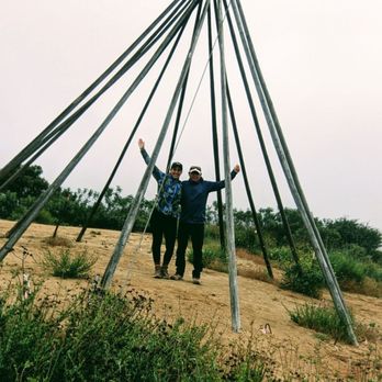
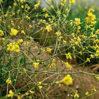
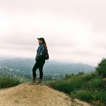
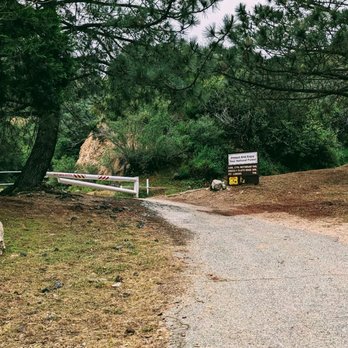


Hiking nature is the most powerful aphrodisiac. I say I have a restless soul. The need to roam and explore is in my blood. Without further delay let's start this review. La Cañada Teepee (via Crosstown trail) is a beautiful and popular local hiking destination. It's a 3 mile out-and-back trail near La Canada Flintridge, California. I considered this a moderate to extreme trail due to it's steep elevation change. Therefore, you must be in top shape and be fit! This is popular area for hiking, trail running, and walking, on the weekends. So you'll likely encounter other people while exploring. I went here on a hot Tuesday afternoon and not a single soul on the trail...Awesome! It took me about 2 h (with multiple rest stop; little to no shade on the trail) to get to Teepee destination; I went even further north to Mt Lukens Truck Trail where there is even a mailbox designating the area as "Bee Flat." Moreover, you'll see a miniature Observatory, Bees Crossing sign because there's a small Beehive farm nearby. Hiking back down to Harter Ln street-main entrance- took me 35 mins. Total elevation gain: 1,400 feet. Total mile: 4.4 miles (Street to Bee Flat mailbox) Total time: 02 hrs 35 mins. Degree of difficulty: Moderate to Hard (steepness and elevation gain) Heart rate: 135 bpm Overall, I'm glad I hiked this trail and get to see the beautiful view and smell of nature and see a beehive farm. I recommend this trail. read more


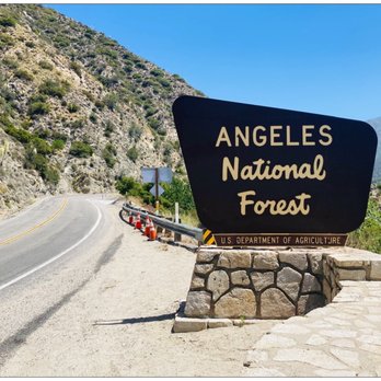


Trailhead Location: The trail starts near the "USFS Angeles Station 11 - Angeles Crest". Parking: There are 6-7 parking spots available near the "USFS Angeles Station 11" and also a parking area directly across the station. Trail Condition: The trail is really well maintained so it's not easy to get lost. Just pay attention to the trail map and make sure you make the proper turn as you approach the TeePee lookout. If you miss the turn, then you'll keep hiking towards the north side of the mountain and probably won't hit another fork road until 1.2-1.5 miles later. I noticed that there were "Bee Crossing" warning signs near the Teepee lookup, so I would suggest avoid wearing or bringing anything that would attract bees. And also, the trail is not really shaded so avoid hiking at noon if possible. Overall Impression: I really enjoyed hiking the Tee Pee Trail especially because it's not overly crowded. It is really not easy to find a trail with so little people close to LA and/or Pasadena lately. read more


Unless you've bagged Everest, you mountain climber you, this may just be the steepest and most challenging hike you'll ever complete. It feels like a total victory when you make it to the top and score a selfie with the Teepee itself. I know it was the hardest hike ever for me (third time's a charm, but the first time shouldn't count since I got lost. Don't get lost like me, follow these directions https://nobodyhikesinla.com/2012/12/27/la-canada-teepee-via-crosstown-trail-from-harter-lane/. ) Am I exaggerating? Maybe. I am a work-out wimp (and surely felt like a wimp as hard-core runners bounded past me up the steep slopes) but I have it on good authority that I am not the only one who feels this way. It is freaking steep, and just when you think you're almost there, another steep incline greets you right around the corner. And, yet, it's a fantastic hike. The views of the Los Angeles Basin are unequaled. It's incredibly clean, unlike some of the trash and graffiti-covered hikes around (Eaton Canyon, I am looking at you.) The trail is well-maintained and your fellow hikers, based on my experience, are respectful and wear their masks, trying to keep social distance as much as possible. But it truly is incredibly steep. Bring your hiking books with the best tread, an energy bar or two, and water. Walking sticks might help as well if you have any issues with balance. Free parking at the trailhead (see directions referenced above.) I have no idea who built the Teepee, so I can't say if it's been culturally appropriated or not. But it is a landmark and a destination for those who want to improve their physical fitness. My goal for 2021? Try to make it up and back in less than two hours :). Enjoy and stay safe. read more


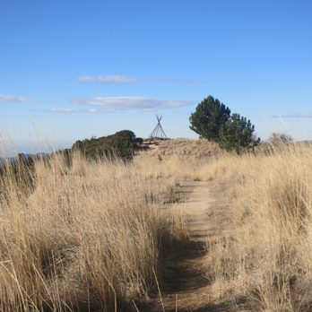


BEAUTIFUL HIKE AND A REALLY GREAT WORKOUT ====================================== Details: Hiked to the La Canada Teepee on Saturday, January 4, 2019 with my good friend and hiking partner Jenny. I met Jenny years ago when we used to go on hikes with the Pasadena Hiking Pacers. The only thing we didn't like about those hikes is that they started at 7:00 a.m.. Even though I am a morning person it is still difficult getting to the trails at that time. Yesterday we decided to meet where the trail begins at 9:00 a.m.. I need to do some research on the elevation gain, but it is pretty intense and you end up at the top of the mountain near Mount Lukens Truck Road. Tips: 1) Wear good hiking shoes because the trail is very slippery with the decompressed granite. The fact that most of the trail is steep compounds this problem. 2) I recommend hiking poles, but ski poles work. I lost one of my ski poles on Echo Mountain a few years ago, so I just use one. It works, but two would be better. 3) I like using a camelbak so it's much easier to stay hydrated while using hiking poles. 4) Wear a hat and put on some sunscreen. Most of the hike is exposed. 5) Give yourself a good two and half hours to get to the top and back. Notes: 1) You can start on the trail behind the big sign or walk up to the left of the water tower. 2) If you start walking up to the left of the water tower you will be going up a fire road for a bit. You'll see a trail sign on your right and turn right up the trail. Check out my photos. If you look to your left you can see the water tower down below. 3) There are two picnic benches half way up to take a break. Bring some snacks or lunch with you. 4) The elevation gain is about 1,400 feet. 5) Here is some more info on the trail: https://www.google.com/amp/s/nobodyhikesinla.com/2012/12/27/la-canada-teepee-via-crosstown-trail-from-harter-lane/amp/ read more


Came here to hike on a Sunday afternoon. It was a bit difficult for us to find the right trail initially, but thankfully (!) I still had some service at the start of the hike and followed directions from this website: https://nobodyhikesinla.com/2012/12/27/la-canada-teepee-via-crosstown-trail-from-harter-lane/. Parking is quite easy along the residential cul-de-sac. Overall, I would say to bring some hydration and proper footgear to help with your stability. It is largely unshaded along the way, so depending on the weather conditions of your day, I would pack accordingly with a hat and sun protection. The hike is a moderate one - about 1300 ft in elevation gain, 1.5 miles up, for a roundtrip of approx 3 miles. Keep in mind that it's a steep uphill all the way up! It took our crew 40 minutes up to the teepee. The views are pretty breathtaking all the way. As for coming down, this is where hiking poles and/or hiking shoes would be a plus, as the steep descent can be quite dangerous. We went with regular running shoes (really underprepared!), and it was a very slippery coming back down. Overall, a great short hike. Would recommend to hiking enthusiasts, but make sure to wear proper footwear! read more
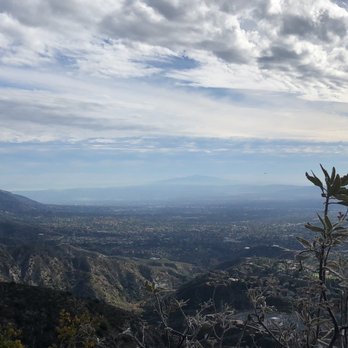


This is one of my favorite short yet challenging hikes in the closer neighborhoods of mine. It's about a 1.5 mile hike, round trip. You got a great incline going up. Have a cool teepee to hang out around at the top. Only negative points about this hike is at the top your view is blocked mostly by trees. Also, part of the trail is fairly narrow and must be very careful on where to step. read more


6 years ago
Loved this hiking trail! It is moderately trafficked early in the morning and the 5.1 loop it totally doable in Nike sneakers. We brought 32 oz of water for two adults and one dog and it was plenty. My dog LOVED exploring this trail and we even had a nice little photo shoot for him up there. There is a small "parking lot" across from the trail head so come early to avoid a walk prior to your hike. Happy hiking! read more


Great hike in La Canada with a Teepee at the top of the mountain! My friend and I go on hikes every month and we take turns picking places. She found this place on AllHikes, it was listed as a short but inclined 2.7 mile hike. AllHike almost always lists hikes as less than they are, because the sign I saw said it was over 3 miles. Got there on a Saturday morning and there was plenty of parking, probably because it had just rained. While I waited for my friend, I looked around and took some pictures. Some ladies were coming down from the hike and I asked if there was a restroom anywhere on the path - they said no and that I could go in the bushes, lol. Always good to know about restrooms or lack thereof on these hikes. My friend got there and we started our ascent up the mountain to the teepees! I will say, this was a more strenuous hike, lots of uphill. She brought her pup and the dog had to stop and rest a few times. But overall it was a great hike with awesome views. It was very green after the rain and the teepee at the top was really cool! read more






5 years ago

6 years ago

5 years ago
Did the 2-3 mile steep uphill climb to get to this awesome teepee! Beautiful views of the Crescenta valley! 10/10 read more


5 years ago
What a marvelous hike. You are only going up the trail. You encounter a few inclines but I would rate this hike easy. The trail is pretty wide and it only takes 5.1 miles out and back. The scenery of the mountains and the view of La Cañada are beautiful. Spectacular views from where the Teepee is located. Very serene and peaceful. read more



6 years ago
It's a tough hike but 100% worth it. Bring lots of water. There are some picnic benches around the halfway point if you need a little break. At the top there is a beautiful flat spot with views of the valley, a little bee farm, a lavender garden and the tee pee (of course). read more


4 years ago

7 years ago
More info about La Canada Teepee
5397 Harter Ln
La Cañada Flintridge, CA 91011
Directions
Hours
Outdoor Amenities
Ask the Community - La Canada Teepee
Review Highlights - La Canada Teepee
You might also consider










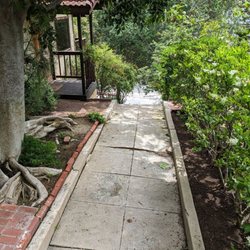


La Canada Teepee - hiking - Updated August 2026
Best of La Cañada Flintridge
People found La Canada Teepee by searching for…
Parks in La Cañada Flintridge, CA
Beautiful Views in La Cañada Flintridge, CA
Hiking Trails in La Cañada Flintridge, CA
Places to Take Pictures in La Cañada Flintridge, CA
Lookout Points in La Cañada Flintridge, CA
Star Gazing in La Cañada Flintridge, CA
Scenic Drives in La Cañada Flintridge, CA
Things to Do in La Cañada Flintridge, CA
Sunrise Hike in La Cañada Flintridge, CA
Scenic View in La Cañada Flintridge, CA
Easy Hikes in La Cañada Flintridge, CA
Sunrise View in La Cañada Flintridge, CA
Places to Walk Around in La Cañada Flintridge, CA
Walking Trails in La Cañada Flintridge, CA
Watch Sunset in La Cañada Flintridge, CA
Views in La Cañada Flintridge, CA
Off Road Trails in La Cañada Flintridge, CA
Scenic Overlook in La Cañada Flintridge, CA
Waterfall Hike in La Cañada Flintridge, CA
Hiking Club in La Cañada Flintridge, CA
Picnic Areas in La Cañada Flintridge, CA
Sunset View in La Cañada Flintridge, CA
Trending Searches in La Cañada Flintridge, CA
Barbershop For Men near La Canada Teepee
Bike Shop near La Canada Teepee
Cliff Jumping near La Canada Teepee
Consignment Shops near La Canada Teepee
Cruising Spots near La Canada Teepee
Dog Friendly Things To Do near La Canada Teepee
Ear Piercing near La Canada Teepee
Elementary Schools near La Canada Teepee
Eyebrow Threading near La Canada Teepee
Flower Fields near La Canada Teepee
Hair Braiding near La Canada Teepee
Kids Haircut near La Canada Teepee
Lookout Points near La Canada Teepee
Pedicure near La Canada Teepee
Picnic Areas near La Canada Teepee
Preschools near La Canada Teepee
Public Golf Courses near La Canada Teepee
Rock Quarry near La Canada Teepee
Running Trails near La Canada Teepee
Scenic Night View near La Canada Teepee
Scenic Overlook near La Canada Teepee
Sports Card Shops near La Canada Teepee
Sunrise View near La Canada Teepee
Swimming Holes near La Canada Teepee
Trading Card Shops near La Canada Teepee
Uniforms near La Canada Teepee
Browse Articles
Browse Nearby
BEST of La Cañada Flintridge, California Coffee near La Canada Teepee
BEST of La Cañada Flintridge, California Things to Do near La Canada Teepee
BEST of La Cañada Flintridge, California Restaurants near La Canada Teepee
BEST of La Cañada Flintridge, California Walking Trails near La Canada Teepee
BEST of La Cañada Flintridge, California Parks near La Canada Teepee
BEST of La Cañada Flintridge, California Breakfast near La Canada Teepee
BEST of La Cañada Flintridge, California Campgrounds near La Canada Teepee
BEST of La Cañada Flintridge, California Sledding near La Canada Teepee
BEST of La Cañada Flintridge, California Day Trips near La Canada Teepee
Browse Brands
Related Searches in La Cañada Flintridge, CA
Best Dog Hiking Trails Around La Cañada Flintridge, California
Best Fishing Locations and Guides in La Cañada Flintridge, California
Best Nature Trails for Hiking in La Cañada Flintridge, California
Best Places for Horseback Riding in La Cañada Flintridge, California
Check Out Off Road Trails in La Cañada Flintridge, California
Discover Dog Friendly Trails to Explore in La Cañada Flintridge, California
Discover Easy Hiking Trails Near La Cañada Flintridge, California
Discover Kid Friendly Hiking Trails in La Cañada Flintridge, California
Discover Popular Bike Trails in La Cañada Flintridge, California
Discover Scenic Mountain Bike Trails Near La Cañada Flintridge, California
Discover Walking Parks in La Cañada Flintridge, California Near You
Discover a Hiking Trail in La Cañada Flintridge, California
Discover the Best Night Hike Trails in La Cañada Flintridge, California
Dog-Friendly Hikes With Dogs in La Cañada Flintridge, California
Enjoy Camping Adventures Around La Cañada Flintridge, California
Enjoy Kayaking Adventures in La Cañada Flintridge, California
Enjoy Off Leash Dog Hikes in La Cañada Flintridge, California
Enjoy Scenic Places to Walk in La Cañada Flintridge, California
Enjoy a Beautiful Waterfall Hike in La Cañada Flintridge, California
Enjoy the Best Walking Path in La Cañada Flintridge, California
Enjoy the Best Walking Trails in La Cañada Flintridge, California
Explore Beautiful Parks and Green Spaces in La Cañada Flintridge, California
Explore Easy Hikes Perfect for All in La Cañada Flintridge, California
Explore Fun Activities to Do in La Cañada Flintridge, California
Explore Popular Campgrounds Near La Cañada Flintridge, California
Explore Popular Dog Walking Trails in La Cañada Flintridge, California
Explore Top Dog Parks in La Cañada Flintridge, California Near You
Explore the Best Beach Spots in La Cañada Flintridge, California
Family Friendly Hiking With Kids in La Cañada Flintridge, California
Find Beautiful Views in La Cañada Flintridge, California
Find Parks and Recreation Activities in La Cañada Flintridge, California
Find Top Dog Friendly Parks to Visit in La Cañada Flintridge, California
Find Top-Rated Waterfalls in La Cañada Flintridge, California Now
Find the Best Parks for Picnics in La Cañada Flintridge, California
Hiking Trails With Waterfalls in La Cañada Flintridge, California
Off Leash Dog Hiking Trails in La Cañada Flintridge, California
Popular Outdoor Activities to Try in La Cañada Flintridge, California
Popular Picnic Spots to Visit in La Cañada Flintridge, California
Popular Waterfall Hiking Trails in La Cañada Flintridge, California
Safe River Swimming Areas in La Cañada Flintridge, California
Safe and Fun Parks for Kids in La Cañada Flintridge, California
Top Hiking Trails to Explore in La Cañada Flintridge, California
Top Playgrounds for Kids to Enjoy in La Cañada Flintridge, California
Top Running Trails to Explore in La Cañada Flintridge, California
Top Swimming Lakes to Enjoy in La Cañada Flintridge, California
Top Swimming Spots and Pools in La Cañada Flintridge, California
Top-Rated Camping Sites in La Cañada Flintridge, California
Walk Dog Friendly Hiking Trails in La Cañada Flintridge, California
Walk the Best Paved Walking Trails in La Cañada Flintridge, California


