Lake Natoma Waterfront Access Trail Photos


You might also consider


More like Lake Natoma Waterfront Access Trail
Recommended Reviews - Lake Natoma Waterfront Access Trail
Start your review...


Reviews With Photos


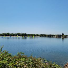
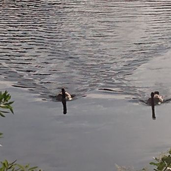
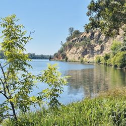
Lake Natoma Waterfront Access Trail is a beautiful, mostly shaded ADA accessible trail that runs along Lake Natoma behind Lake Natoma Inn in Historic Folsom. Since there is no trail parking allowed in the hotel parking lot, the best places to park are on Gold Lake Drive, Leidesdorff, or Sutter Street. The trail can be accessed from either Gold Lake Drive (across from Mike's Bikes), or from behind Lake Natoma Inn. The trail ends where it collides with the Lake Natoma Trail, which can also be accessed from Leidesdorff near Gold Lake Drive. Altogether, it is less than a mile long. After descending to the river, the trail runs along Lake Natoma, under blue oak and fig trees. Blackberry brambles abound, and it is not uncommon to see beavers or river otters early in the morning. My favorite reasons to visit this trail are to see the Canadian geese drift by just before sunrise, and to see the sunrise over Lake Natoma underneath Folsom Lake Crossing. I also love seeing the turkeys and the wildflowers behind Lake Natoma Inn, and the ducks that rest on the tiny beaches down there. Overall, this is a beautiful, accessible, family friendly trail by the river. Pro tips: Mosquitoes are living their best life right now. Did you know that they are attracted to perfume and scented body products? Wearing a little lemon eucalyptus oil will help keep them away.


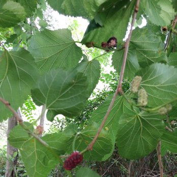
Paved bike and dirt hiking path that run semi-concurrently along the river. My plus here is the turkeys, Hawks, warblers, swallows, doves, geese, lizards, squirrels and wildlife that display themselves to you. I also enjoyed the mulberry, sour cherry and grapes plants that dot the trail. The cherries were tartly thirst quenching. The river looked so beautiful in the setting sun. **Use bug spray, for mosquitos, etc. during summer months!!

Loved this bike, long , but paved and peaceful. Saw some young bald eagles in a nest, lots of nature. The only negative is difficult navigation with few signs directing


3 years ago
Like it or not, the Lake Natoma waterfront and trail enhancement project was completed several years ago. The result is the Lake Natoma Waterfront Access Trail. It provides ADA access to Lake Natoma area that's next to the Folsom historic district. The trail is a loop that cuts a path down closer to the river's edge and connects the current American River trail. It was my first time exploring the waterfront access. It was within a hour before dusk (in the winter) so I didn't venture far out. There are no lights out. I used the Gold Lake Drive access point behind Lake Natoma Inn that's also near the Lake Natoma Bridge Crossing pedestrian walk. The upper path is an ADA trail. The trail loops in an oval. It's shared with cyclists and pedestrians. So if you have mobility issues and/or children, please be vigilant and watch out for those cyclists. The lower trail hugs the river which the body of water is called Lake Natoma in this particular area. Not to be confused with the Lake Natoma recreation area off Hazel Avenue. There is a variety of foliage and wildlife to observe. Nearby parking maybe hard to find. You might have to park further away and walk over. But the plus side is that parking is totally free in and around Historic Folsom. Just be aware of the posted time limits. read more


4 years ago
Lake Natoma Waterfront Access Trail is a beautiful, mostly shaded ADA accessible trail that runs along Lake Natoma behind Lake Natoma Inn in Historic Folsom. Since there is no trail parking allowed in the hotel parking lot, the best places to park are on Gold Lake Drive, Leidesdorff, or Sutter Street. The trail can be accessed from either Gold Lake Drive (across from Mike's Bikes), or from behind Lake Natoma Inn. The trail ends where it collides with the Lake Natoma Trail, which can also be accessed from Leidesdorff near Gold Lake Drive. Altogether, it is less than a mile long. After descending to the river, the trail runs along Lake Natoma, under blue oak and fig trees. Blackberry brambles abound, and it is not uncommon to see beavers or river otters early in the morning. My favorite reasons to visit this trail are to see the Canadian geese drift by just before sunrise, and to see the sunrise over Lake Natoma underneath Folsom Lake Crossing. I also love seeing the turkeys and the wildflowers behind Lake Natoma Inn, and the ducks that rest on the tiny beaches down there. Overall, this is a beautiful, accessible, family friendly trail by the river. Pro tips: Mosquitoes are living their best life right now. Did you know that they are attracted to perfume and scented body products? Wearing a little lemon eucalyptus oil will help keep them away. read more


Paved bike and dirt hiking path that run semi-concurrently along the river. My plus here is the turkeys, Hawks, warblers, swallows, doves, geese, lizards, squirrels and wildlife that display themselves to you. I also enjoyed the mulberry, sour cherry and grapes plants that dot the trail. The cherries were tartly thirst quenching. The river looked so beautiful in the setting sun. **Use bug spray, for mosquitos, etc. during summer months!! read more




3 years ago
Loved this bike, long , but paved and peaceful. Saw some young bald eagles in a nest, lots of nature. The only negative is difficult navigation with few signs directing read more


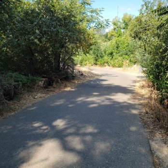

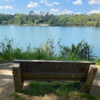
After three visits to this recently restored trailhead access below Old Folsom, I'd be remiss not to share this gem with the world. Beginning at the Lake Natoma bridge crossing, this winding web of lakefront trails takes you to lovely, lush and beautiful vistas where you can look out upon the lake, picnic or get in some serious exercise. Note: this is a different access point that the "Lake Natoma Trail", also listed on Yelp, which is the other end of the Jebediah Smith Memorial Trail, which stretches for miles along the south-eastern edge of Lake Natoma. As a family, we enjoy this trail most especially because there are many pathways, meaning we can cut back with our little one whenever he grows tired. The immediate trails below Old Folsom wind through lush greenery down steep slopes to the waterfront where there are occasional benches, picnic tables and hidden beaches along the way. My little guy got in some serious nature education this Spring with butterfly and duck sightings, following racoon footprints and learning about the different wildflowers. The Spring is definitely the best time to explore here, both while so much is in bloom and before the weather gets too hot, which translates to muggy by the water's edge. If you wanted, you could follow the trail in a westward direction and eventually hit the Lake Natoma reservoir where there is kayaking, beaches and a generally much more populous area. We enjoy this little find (recently restored thanks to all our tax dollars), especially before it becomes a common discovery. The only thing to look out for is bikers. Bikes are commonplace on these trails and the bike riders have a tendency to zoom down the pathways regardless of whether hikers are around. They also regularly disregard signage stating certain paths are for walking only. Just keep that in mind should you visit on a busy weekend afternoon! read more




4 years ago

6 years ago
More info about Lake Natoma Waterfront Access Trail
Gold Lake Dr
Folsom, CA 95630
Directions
Hours
Outdoor Amenities
Ask the Community - Lake Natoma Waterfront Access Trail
You might also consider













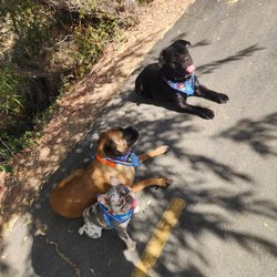
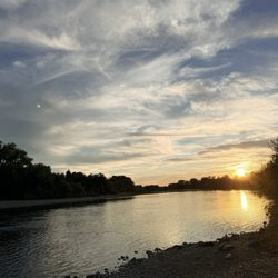



Lake Natoma Waterfront Access Trail - mountainbiking - Updated September 2026
Best of Folsom
People found Lake Natoma Waterfront Access Trail by searching for…
Trending Searches in Folsom, CA
Apple Orchards near Lake Natoma Waterfront Access Trail
Apple Picking near Lake Natoma Waterfront Access Trail
Barbershop near Lake Natoma Waterfront Access Trail
Beautiful Views near Lake Natoma Waterfront Access Trail
Bike Shop near Lake Natoma Waterfront Access Trail
Blowout near Lake Natoma Waterfront Access Trail
Boating near Lake Natoma Waterfront Access Trail
Casinos near Lake Natoma Waterfront Access Trail
Deep Sea Fishing near Lake Natoma Waterfront Access Trail
Dog Friendly Trails near Lake Natoma Waterfront Access Trail
Estheticians near Lake Natoma Waterfront Access Trail
Eyelash Extensions near Lake Natoma Waterfront Access Trail
Fishing Tackle Shop near Lake Natoma Waterfront Access Trail
Free Picnic Areas near Lake Natoma Waterfront Access Trail
Furniture Stores near Lake Natoma Waterfront Access Trail
Kids Birthday Party near Lake Natoma Waterfront Access Trail
Lakes near Lake Natoma Waterfront Access Trail
Lookout Points near Lake Natoma Waterfront Access Trail
Makeup Artists near Lake Natoma Waterfront Access Trail
Mattresses near Lake Natoma Waterfront Access Trail
Nature Trails near Lake Natoma Waterfront Access Trail
Night Hike near Lake Natoma Waterfront Access Trail
Off Road Trails near Lake Natoma Waterfront Access Trail
Outdoor Activities near Lake Natoma Waterfront Access Trail
Parks near Lake Natoma Waterfront Access Trail
Parks For Parties near Lake Natoma Waterfront Access Trail
Picnic Spots near Lake Natoma Waterfront Access Trail
Private Schools near Lake Natoma Waterfront Access Trail
River Swimming near Lake Natoma Waterfront Access Trail
Scenic Night View near Lake Natoma Waterfront Access Trail
Scenic Overlook near Lake Natoma Waterfront Access Trail
Sugaring near Lake Natoma Waterfront Access Trail
Sunset Cruise near Lake Natoma Waterfront Access Trail
Swimming Holes near Lake Natoma Waterfront Access Trail
Teeth Whitening near Lake Natoma Waterfront Access Trail
Trout near Lake Natoma Waterfront Access Trail
Watch Sunset near Lake Natoma Waterfront Access Trail
Waterfalls And Swimming Holes near Lake Natoma Waterfront Access Trail
Browse Nearby
BEST of Folsom, California Restaurants near Lake Natoma Waterfront Access Trail
BEST of Folsom, California Coffee near Lake Natoma Waterfront Access Trail
BEST of Folsom, California Things to Do near Lake Natoma Waterfront Access Trail
BEST of Folsom, California Hiking Trails near Lake Natoma Waterfront Access Trail
BEST of Folsom, California Parks near Lake Natoma Waterfront Access Trail
BEST of Folsom, California Breakfast near Lake Natoma Waterfront Access Trail
BEST of Folsom, California Star Gazing near Lake Natoma Waterfront Access Trail
BEST of Folsom, California Caves near Lake Natoma Waterfront Access Trail
BEST of Folsom, California Campgrounds near Lake Natoma Waterfront Access Trail
Browse Brands
Related Searches in Folsom, CA
Adventure With River Rafting in Folsom, California
Affordable Bike Repair Services in Folsom, California
Affordable Bike Tune Up Services in Folsom, California
Affordable Canoe Rental Options in Folsom, California
Affordable Cheap Bike Tune Up Services in Folsom, California
Affordable Fishing Rental Services in Folsom, California
Affordable Jet Ski Rental Options in Folsom, California
Affordable Kayak Rental Services in Folsom, California
Affordable Water Sports Rentals in Folsom, California
Best Boat Launch Spots in Folsom, California
Best Dirt Bike Riding Spots in Folsom, California
Best Electric Bike Rental Services in Folsom, California
Best Kayak Rentals for Your Trip in Folsom, California
Best Nature Trails for Hiking in Folsom, California
Best Paddleboard Rentals to Try in Folsom, California
Best Places for Horseback Riding in Folsom, California
Best Pontoon Boat Rentals Near Folsom, California
Best Rent a Boat Experiences in Folsom, California
Best Sledding Spots and Fun in Folsom, California
Book Exciting Whitewater Rafting Adventures in Folsom, California
Book Private Boat Charters for Trips in Folsom, California
Book Top Fishing Trips in Folsom, California Today
Book a Dinner Cruise Experience in Folsom, California
Check Out Off Road Trails in Folsom, California
Convenient Bike Sharing Programs in Folsom, California
Convenient Wetsuit Rental Services in Folsom, California
Discover Dog Friendly Beaches Near Folsom, California
Discover Lakes & Ponds to Explore in Folsom, California
Discover Popular Bike Tours in Folsom, California
Discover Popular Bike Trails in Folsom, California
Discover Scenic Bike Paths in Folsom, California
Discover Scenic Mountain Bike Trails Near Folsom, California
Discover Top Boat Rides in Folsom, California
Discover Top Fishing Lakes in Folsom, California for Your Next Trip
Discover the Best Fishing Lake in Folsom, California
Discover the Best Kayak Tour Options in Folsom, California
Discover the Best Sunset Cruise Tours in Folsom, California
Enjoy Biking Adventures Around Folsom, California
Enjoy Camping Adventures Around Folsom, California
Enjoy Fishing Pier Spots in Folsom, California With Scenic Views
Enjoy Fishing With Kids in Folsom, California Safely
Enjoy Hiking Adventures in Folsom, California
Enjoy Jet Ski Adventures in Folsom, California
Enjoy Kayaking Adventures in Folsom, California
Enjoy River Tubing Adventures in Folsom, California
Enjoy Scenic Dirt Bike Trails Around Folsom, California


