Cancel

    Open app

    Search

    Lawrence Veterans Memorial Park

    5.0 (1 review)

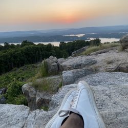
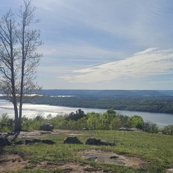
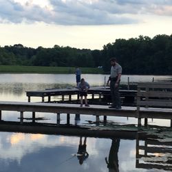
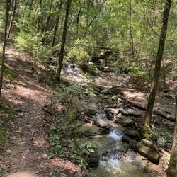
    Lawrence Veterans Memorial Park Photos

    More like Lawrence Veterans Memorial Park

    Recommended Reviews - Lawrence Veterans Memorial Park

    Your trust is our priority, so businesses can't pay to alter or remove their reviews. Learn more about reviews.
    Yelp app icon
    Browse more easily on the app
    Review Feed Illustration

    7 years ago

    Helpful 0
    Thanks 0
    Love this 0
    Oh no 0

    Verify this business for free

    Get access to customer & competitor insights.

    Verify this business

    Natural Bridge Park - Entrance to the gift shop where you buy your tickets

    Natural Bridge Park

    4.6(26 reviews)
    41.8 mi

    Under new ownership and they have done an amazing job! Store is well stocked, outside sitting area…read moreis nicely done with the creak meandering past. The paths are well marked and clear. Past the Natural Bridge is rooty, so take care with those not sure footed. I highly recommend the visit and will return. Hosts were very informative as well, so ask questions

    This was a last-minute stop based on a sign I saw along the side of the road, and it was absolutely…read moreworth it! I had some difficulty finding it, as there is a town called "Natural Bridge." Google directed me there, and not to the park, itself, which caused some confusion. Coming in from the I-10, take highway 13 North to road 278. Turning RIGHT takes you to the town. Turning LEFT takes you to the bridge. There are some signs, but they are worn, and obscured by vegetation. Arriving at the park, one is immediately greeted with picturesque views, and a trickling creek. The trees are majestic, and the parking ample. It's important to remember that this is rural Alabama, and not some big city. The admission is inexpensive, and the trails are simple. The people that run the gift shop are country folk, and are very kind. Mind your manners (and your children). Stay on the trails, walk carefully, and do what the sign says - "Take only pictures .....leave only footsteps. With that said, this place was amazing. The bridge is absolutely breathtaking, as is the rock formation called "Indian Head." Many inscriptions - some over 100 years old - are carved into the surrounding sandstone. There is dripping water under the bridge, so watch your step! The trail is primitive and there are roots sticking out here and there - be careful! Shoes with traction are a MUST here for safety reasons! Enough said - go enjoy this natural wonder for yourself!

    Photos
    Natural Bridge Park - Inside the natural Bridge cave

    Inside the natural Bridge cave

    Natural Bridge Park - The inside view of the natural Bridge

    The inside view of the natural Bridge

    Natural Bridge Park

    See all

    Rainbow Mountain

    Rainbow Mountain

    4.9(8 reviews)
    27.5 mi

    Trail blazing in Madison? Even minor scrambling (the use of your hands for balance and pulling up)…read moreoff small slick rocks? Who would have thought we could do this just a few miles from home?! Hubby and I have been blazing this gem for over 2 yrs now since relocating to the south, and never once have we not enjoyed Rainbow Mountain nor have we left w dry clothing on our backs no matter what season we're in. PARKING Recently developed by the Land Trust is a 12-spot parking lot right near the entrance to Stoneridge Park. It's free. Once the lot is full, your alternative would be street parking which, of course, is also free. TRAILS The main trailhead is located next to the water tower. The trails here on Rainbow Mountain are relatively easy but can be strenuous depending on your experience, speed, and which direction one starts off with. So at an average, I'd say this is an easy to moderate trail to hike. Covering about 4 miles of single-track trails across 130 acres with a peak elevation of 1,150 and an elevation loss/gain of 388 ft, you are sure to break a sweat here. There are 4 trails that interconnect some how or another. And if you plan your route in advance, you can get a good 5 miles out of these. Rainbow Mountain Loop 1.5mi Ja Moo Ko Loop 0.9mi Spring Trail 0.3mi Wild Trail 0.34mi On a good Saturday morning after some light down pour, we usually cover 2.35 miles in about an hour hiking across damp ground and with minor scrambling through slick rocks on the Rainbow Mtn Loop and Ja Moo Ko Loop Trails. This hour timeframe also includes about a few quick pauses to quench our thirsts and another short break by the stream below. Most peeps prefer starting off on the leisurely southern route and taking in the panoramic views of Madison and the awe'ness of Balance Rock. We prefer starting off on the northern route. This IMO eliminates being caught in the crowd which often slows our pace. If I don't carry my DSLR, I tend to hike at a fast speed so don't get in my way! ;D It's a relatively quick hike for us but we're always drenched with sweat and ready for a shower by the time we're done. GEOLOGY and POIs Rainbow Mountain, known to be part of the Southern Appalachian Plateau, has many beautiful rock outcrops. Even the nearby homes have them as part of their natural landscape beauty. Here you'll find the Hartselle Sandstone formation which consists of sandstone, limestone, and shale. The erosive resistance of these rocks have resulted in what you'll see here - bluffs, very small seasonal waterfalls, and caves. Balance Rock is a must see. If you're trekking too fast, you just might miss it. It's located on the southern route of Rainbow Mtn Loop. I always find it interesting to see the wavy line features and pebbles in the sandstone on Balance Rock which supposedly was caused by the actions of water from long ago seas. There are also two caves here - Rainbow Pit (a 65 feet deep vertical cave), and Belly-Up Cave. These are known to be the result of water leaching the limestone rock. We've yet to search these out and explore these caves ourselves in fear of possibly falling in. However, I've heard that people have rappelled these in years past. It's also suspected that the nearby subdivision developer will seal the cave (if they haven't already) by placing a large boulder over the entrance to avoid potential lawsuits from ignoramus'. Funny but sad. Sad that such a beautiful piece of land can't be preserved for those of us that appreciate it and the history and features it holds. RECOMMENDATIONS & VERDICT Hike in the mornings especially if the forecasts includes humidity in the afternoon. Bring a minimum of 16oz bottled water per person, a snack (if you prefer), sunblock, hat/cap, hiking stick (if you have one), and a smile. And don't forget to stretch before & afterwards. That's the norm if we lead a hike here. This is close to home so we'll be back as often as our schedule permits, and weather permitting too. Check it out yourself! These trails are worth exploring!!

    Great terrain for experienced hikers and other beautiful terrain for less experienced, older hikers…read moreand children. Be sure to bring camera... in the fall, this is called Rainbow Mountain for a reason. Balanced Rock is a just short walk down from the end of Stoneway Trail.

    Photos
    Rainbow Mountain - Map detail of the southern trails

    Map detail of the southern trails

    Rainbow Mountain - Picnic Pavilion

    Picnic Pavilion

    Rainbow Mountain

    See all

    Cullman County Parks - One of the playscapes

    Cullman County Parks

    5.0(4 reviews)
    31.2 mi

    How can you not love a park on a brisk morning looking over a lake!…read more The playground area is made of rock base and there is a sand pit. We went in the morning around 10am and the park was not too busy maybe around 5 kids. It wouldn't matter though the park is pretty big and spaced out with fencing. So it is pretty easy to keep up with your child and not feel over crowded.. Plus as an adorable little bonus they do have a swing that is a wheelchair swing for children who are handicapped Just on the off-chance you go on the offseason it can be a little noisy during clean up but I always see that as a good sign because they're keeping the park clean and not many beautiful places are kept as nice as this one was being kept.. The trail has photo opportunities for kids and workout equipment along the way! Also tons of rest stops picnic tables and just beautiful views.. it also looks like there is a stage that could potentially be for music and you can rent gazebos with picnic tables under it.

    I had asked some coworkers where to go for a simple pinic in Cullman. Two different people…read moresuggested Sportsman Lake which is behind the Cullman Fairgrounds. After going to a movie my husband and I picked up a pizza and set out to find Sportsman Lake. Heading north on 31 we found the sign and turned left. After passing the fairgrounds we headed into the park area. We found an empty picnic table and devoured our pizza. The small lake is beautiful with an elegant white pier. There were a lot of people but the park is spacious so we were still able to enjoy a peaceful meal by the water. There were several pavillions which are perfect for family gatherings, a playground for the children, and even a little train but I'm not sure of the operating hours. Several families were feeding the ducks and geese and couples were taking a stroll on the walking path. I definitely plan to come back the next time we are looking for a peaceful place to relax.
    Photos
    Cullman County Parks - They get pretty close

    They get pretty close

    Cullman County Parks - The rock base for the playground

    The rock base for the playground

    Cullman County Parks - Tiny bridge area to feed ducks

    See all

    Tiny bridge area to feed ducks

    Lawrence Veterans Memorial Park - parks - Updated May 2026

    Loading...
    Loading...
    Loading...