
Marymere Falls Photos


You might also consider

More like Marymere Falls
Recommended Reviews - Marymere Falls
Start your review...


Reviews With Photos


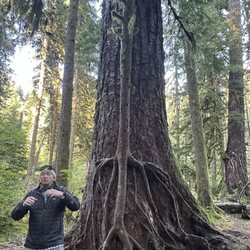
I chose this hike because my mother was with me and doesn't have a lot of stamina. The hike is only about a mile each way and it's fairly flat right up until the very end, where there is suddenly a pretty steep staircase. My mom made it to the staircase but didn't want to go up, and unfortunately you can't see the waterfall unless you go up. However, there's a cute bridge and little creek right at the bottom there where a lot of other families and older folks had stopped and it's still very enjoyable just to hang out there! If you do go up the stairs, it's only about 4 or 5 flights and then you're at the lookout right by the waterfall. It's quite pretty! Tbh one of my fav things about this trail though was an absolutely MASSIVE and photo-op worthy mossy tree near the beginning of the trail just after you cross under the road. Really liked that! Overall - if you want a shorter, easier walking trail, this is a good one up to the staircase! You can also forgo the whole walk and just take a lap around the lake near the trailhead to see wildflowers and pretty sights.


This 90-foot-high waterfall is totally worth the short hike to it. The trail to Marymere Falls is one of the most popular trails in Olympic National Park. I am glad that I was able to make some time in my already jam-packed day to check it out. This 1.5-mile long hike begins at the Storm King Ranger Station near Crescent Lake. It is an easy to moderate hike that will take you around an hour to complete. Your journey will start through a short tunnel under a roadway and into an old-growth forest where you will see some large towering trees. There is a large cedar that you will pass that is worth stopping at for photos. You will then reach some wooden footbridges that cross over a couple of creeks. This will lead you to some steps that eventually gets you to the waterfall. Once you arrive at Marymere Falls, the trail will form a loop and offer two viewpoints. One viewpoint looks down into the falls and other is at its base. You can go back the way you came or continue on the loop to return to the beginning of the hike. Marymere Falls is a gorgeous waterfall that is very picturesque. I spent about ten minutes at each of the viewpoints taking it in. Just keep in mind that dogs are not allowed on this trail. There are plenty of picnic tables and a restroom near the ranger station if you want to hang out in the Storm King area after the hike.


If Tim Burton ever built a hiking trail, it would be like this one! Gothic black root balls of twisted trees rise up out of blood-red debris on the forest floor - their sinuous branches stretching across the sky, dripping with thick, verdant moss. The nearest mountain is called Storm King - and the Storm King Ranger Station is a lonely little log cabin tucked away to the side - like one you'd see the main characters escaping to in a horror movie. Even the magnificent reward at the end - Marymere Falls - sits hidden away behind these moss covered guardians at the end of a tortured, winding staircase up the hill. All along the way, mist lingers amongst the trees, adding to the ominous ambiance. It's easy to see how ghost stories are born after wandering along this marvelously sinister and captivating trail. It will forever be one of my absolute favorites! Marymere falls is 90.5 feet tall and the creek that feeds the falls - Falls Creek - flows down into Barnes Creek which is beautiful in and of itself with is milky blue frigid waters. The two lovely wooden bridges on the trail cross each one and have more incredible views. According to AllTrails, the trail is just over 1.5 miles long with an elevation gain of just over 300 feet. However - there are lots of interesting trail offshoots and Lake Crescent is also in the same area so I ended up doing around 3.5 miles with over 400 feet elevation gain. The gains are gradual and the trails are so well maintained that I found them to be quite easy. So much to explore and I barely scratched the surface! The trailhead for Storm King is also along the way and definitely on my hiking bucket list. Not to mention how awesome Lake Crescent is - so I have no doubt I'll be back. This particular trail is one of the first just inside the entrance to Olympic National Park. So you have to pay to enter the park or use your parks pass. There are lots of clean restrooms, picnic tables with incredible views, and plenty of parking spots.


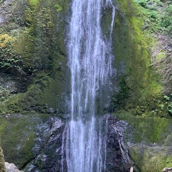
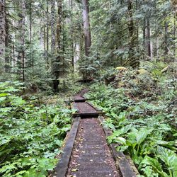
* Summer Flashback * If you're visiting Lake Crescent, it's worth hiking the trail to Marymere Falls. The trail is family-friendly and only 1.8 miles round trip. I enjoy hikes that are tame, don't require hiking boots, and are suitable for kids and seniors. This one fits the bill! Also, restrooms were conveniently located nearby, so that's a bonus. We arrived at about 9:00AM and parked in the lot by the boat launch. It definitely pays off to get there earlier in the morning. When we returned after our hike, the parking area was full. At the beginning of the trail, you'll walk adjacent to the lake for a bit before entering a tunnel that takes you into the old-growth forest. Approximately the first 75% of the trail follows a pretty flat dirt path that crosses over two short bridges. The final quarter of the trail involves some stairs that are sandy with wooden platforms. The steps are relatively tall and somewhat steep, but they were not too bad and I just used the railing for stability. Our short climb led us straight to the first viewpoint. The waterfall is nice with surrounding rockery, moss and forest as the backdrop. Most people stay for just a few minutes to snap a couple photos and then head back down the trail. You can continue up another set of stairs to view the falls from even higher up. At this point, you are almost reaching the height of some of the trees. However, the first viewpoint is honestly much better since you can clearly see a full view of the waterfall. I can't say this was the most stunning waterfall I've seen, but it was a pretty easy trek to get there. We didn't encounter many bugs either, and the forest provided a lot of shade. I couldn't ask for a better hiking experience!


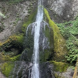

Nice, fairly short hike for those who want to experience the beauty of good sized waterfall without a long trek. Hubby and I enjoyed the hike, there were some cool trees to see on the way. About 2/3 of the way, there is a neat narrow wooden foot bridge (past the larger one). And then the workout begins! We were convinced this was a walk in the park before this point, as we saw lots of families with toddlers and older middle aged couples. But be warned there is a quite a climb as you near the falls. The trail is well done though, with steps carved into the earth. We're not avid hikers or athletes, but we made it. For those not in top shape, don't give up! Just take it slow and drink your water ( our mistake was not bringing any and being thirsty). Falls was nice, not the most grand we've seen, but we'll worth the quick trip.


The hike to the falls is incredible! A very well maintained trail meanders through dense old growth forest with dozens of evergreen trees with heights of 200 feet plus, and girths of ten feet in some cases. The trail is quite easy until the very last 100 yards to the falls which is steep and rough. I thought the prettiest view was from under the foot bridge where the roughest portion of the trail begins.


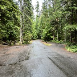
Marymere Falls were a nice, shorter option on our 2nd day in Olympic National Park. The day prior, we had done quite a few miles and not up for anything too long. Access to the falls are from the lot at the Storm King Ranger station at Lake Crescent. The ranger station isn't always staffed but there are water fountains and restrooms. On a Thursday morning, the lot was nearly full. The trail itself is mostly flat with a short staircase at the end. The forest leading up to the falls is quite scenic so it makes the whole journey fun. Once you're done at the falls, it's worth it to go down to the lakeshore dock for amazing views. The whole trail is 1.75 miles out and back and we saw people of varying ages along the trail enjoying the forest and falls.


A lovely falls in a beautiful setting accessed via a wonderful trail! We started the trail at the Storm King Rangers Station and completed a loop using the return trail back towards the lodge. The trail starts wide and flat in a stunning forest setting (once you cross under the road), narrowing as it crosses a couple bridges ascending stairs up Marymere. You take a small lollipop loop up to a higher viewing platform and back around. While the falls isn't huge by PNW standards, it is quaint with a sorta magical feel due to its positioning and the surrounding forest. There are gorgeous trees, scurrying critters, and the peaceful sounds of Barnes Creek from start to finish. While the stairs could be limiting to some, it's only a short trek to the falls...mostly flat and well-maintained. The gorgeous Lake Crescent to soak in and the nature trail around the lodge make for a fabulous stop. Definitely recommend!


Marymere Falls was definitely a more family-friendly hike compared to its neighbor Mount Storm King. They both start at the same trailhead until they fork off in different directions. The trailhead was just south of Lake Crescent which also had parking lots and restrooms. The total distance for the hike was about ~2 miles roundtrip and was mostly flat. There were a couple of bridges and a lot of stairs to get to the view point but it wasn't difficult. In fact, we saw multiple groups of elementary schoolers doing this hike. The waterfall itself was nice although it wasn't as big as others I've seen. Overall, if you're doing the Mount Storm King trail you might as well do this short hike too if you have the energy. Even if you don't go on Mount Storm King, you can still enjoy the waterfall with the entire family.



27 days ago

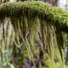
Anytime we get a chance to hike to a waterfall, we usually find away to make it happen! Marymere falls was our second hike of the day after we had a good meal in after hiking Mount Storm King. I generally like to embark on hikes early in the morning to get to see the sunrise and see everything wake up for the day as well as to beat the heat and crowds. But, Marymere hike was a much shorter hike and all descriptions stated it was pretty easy. We started from Lake Crescent lodge and headed our way there. The signs were somewhat easy to find and the map the hotel staff gave us helped us to find the trail head. The hike itself, though easy, had a lot to offer on the way to the waterfall. A clearing where there were river stones and sparkling water that birds seemed to wisp by, two wooden bridges to cross, one was a narrow one. Trekking across bridges like those are always a favorite for me, those bridges then lead you to a small loop trail that got you to a lower area to view the water fall and then you can head up further to a higher vantage point that pretty much took your breath away. The waterfall was so worth it to see and after doing such a strenuous hike in the morning this hike was a piece of cake. If you're heading to this area of Washington I highly recommend hopping out and hiking this trail. It's worth it! read more



25 days ago
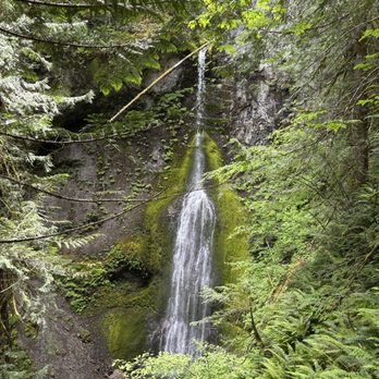
Beautiful hike! The last part, right before the waterfall can be a little intense. We also found it a little congested. The trails were pretty narrow (one way only) causing some waiting and congestion which wasn't a big deal for us but could be for other hikers. The view was beautiful! read more


1 year ago
I chose this hike because my mother was with me and doesn't have a lot of stamina. The hike is only about a mile each way and it's fairly flat right up until the very end, where there is suddenly a pretty steep staircase. My mom made it to the staircase but didn't want to go up, and unfortunately you can't see the waterfall unless you go up. However, there's a cute bridge and little creek right at the bottom there where a lot of other families and older folks had stopped and it's still very enjoyable just to hang out there! If you do go up the stairs, it's only about 4 or 5 flights and then you're at the lookout right by the waterfall. It's quite pretty! Tbh one of my fav things about this trail though was an absolutely MASSIVE and photo-op worthy mossy tree near the beginning of the trail just after you cross under the road. Really liked that! Overall - if you want a shorter, easier walking trail, this is a good one up to the staircase! You can also forgo the whole walk and just take a lap around the lake near the trailhead to see wildflowers and pretty sights. read more


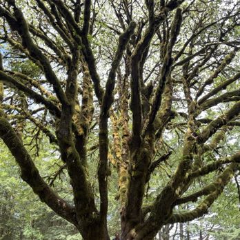


This 90-foot-high waterfall is totally worth the short hike to it. The trail to Marymere Falls is one of the most popular trails in Olympic National Park. I am glad that I was able to make some time in my already jam-packed day to check it out. This 1.5-mile long hike begins at the Storm King Ranger Station near Crescent Lake. It is an easy to moderate hike that will take you around an hour to complete. Your journey will start through a short tunnel under a roadway and into an old-growth forest where you will see some large towering trees. There is a large cedar that you will pass that is worth stopping at for photos. You will then reach some wooden footbridges that cross over a couple of creeks. This will lead you to some steps that eventually gets you to the waterfall. Once you arrive at Marymere Falls, the trail will form a loop and offer two viewpoints. One viewpoint looks down into the falls and other is at its base. You can go back the way you came or continue on the loop to return to the beginning of the hike. Marymere Falls is a gorgeous waterfall that is very picturesque. I spent about ten minutes at each of the viewpoints taking it in. Just keep in mind that dogs are not allowed on this trail. There are plenty of picnic tables and a restroom near the ranger station if you want to hang out in the Storm King area after the hike. read more

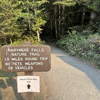


If Tim Burton ever built a hiking trail, it would be like this one! Gothic black root balls of twisted trees rise up out of blood-red debris on the forest floor - their sinuous branches stretching across the sky, dripping with thick, verdant moss. The nearest mountain is called Storm King - and the Storm King Ranger Station is a lonely little log cabin tucked away to the side - like one you'd see the main characters escaping to in a horror movie. Even the magnificent reward at the end - Marymere Falls - sits hidden away behind these moss covered guardians at the end of a tortured, winding staircase up the hill. All along the way, mist lingers amongst the trees, adding to the ominous ambiance. It's easy to see how ghost stories are born after wandering along this marvelously sinister and captivating trail. It will forever be one of my absolute favorites! Marymere falls is 90.5 feet tall and the creek that feeds the falls - Falls Creek - flows down into Barnes Creek which is beautiful in and of itself with is milky blue frigid waters. The two lovely wooden bridges on the trail cross each one and have more incredible views. According to AllTrails, the trail is just over 1.5 miles long with an elevation gain of just over 300 feet. However - there are lots of interesting trail offshoots and Lake Crescent is also in the same area so I ended up doing around 3.5 miles with over 400 feet elevation gain. The gains are gradual and the trails are so well maintained that I found them to be quite easy. So much to explore and I barely scratched the surface! The trailhead for Storm King is also along the way and definitely on my hiking bucket list. Not to mention how awesome Lake Crescent is - so I have no doubt I'll be back. This particular trail is one of the first just inside the entrance to Olympic National Park. So you have to pay to enter the park or use your parks pass. There are lots of clean restrooms, picnic tables with incredible views, and plenty of parking spots. read more


3 months ago
lovely hike - wide and mostly flat path until the steps to the falls viewing area. ample parking and close to path leading to lake crescent lodge which has a nice dining room overlooking the crystal blue lake. read more


Beautiful waterfall and hike Start at the parking lot by the storm king ranger stations. It is about a mile walk to the waterfall. There is a bridge to cross. Most of the trail is flat elevation until you get closer to the waterfall and then there is some incline. read more


3 years ago
* Summer Flashback * If you're visiting Lake Crescent, it's worth hiking the trail to Marymere Falls. The trail is family-friendly and only 1.8 miles round trip. I enjoy hikes that are tame, don't require hiking boots, and are suitable for kids and seniors. This one fits the bill! Also, restrooms were conveniently located nearby, so that's a bonus. We arrived at about 9:00AM and parked in the lot by the boat launch. It definitely pays off to get there earlier in the morning. When we returned after our hike, the parking area was full. At the beginning of the trail, you'll walk adjacent to the lake for a bit before entering a tunnel that takes you into the old-growth forest. Approximately the first 75% of the trail follows a pretty flat dirt path that crosses over two short bridges. The final quarter of the trail involves some stairs that are sandy with wooden platforms. The steps are relatively tall and somewhat steep, but they were not too bad and I just used the railing for stability. Our short climb led us straight to the first viewpoint. The waterfall is nice with surrounding rockery, moss and forest as the backdrop. Most people stay for just a few minutes to snap a couple photos and then head back down the trail. You can continue up another set of stairs to view the falls from even higher up. At this point, you are almost reaching the height of some of the trees. However, the first viewpoint is honestly much better since you can clearly see a full view of the waterfall. I can't say this was the most stunning waterfall I've seen, but it was a pretty easy trek to get there. We didn't encounter many bugs either, and the forest provided a lot of shade. I couldn't ask for a better hiking experience! read more

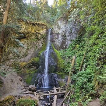


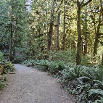

If you can do one hike in this area, make it this one! Old growth forest with tiny little mushrooms and moss, tall trees, the river, and then gorgeous steps leading up to a stunning cascading waterfall. It's such an easy hike compared to the views you get the whole way. read more


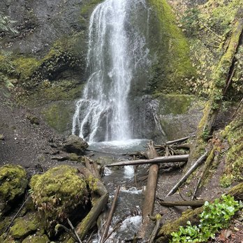


Nice, fairly short hike for those who want to experience the beauty of good sized waterfall without a long trek. Hubby and I enjoyed the hike, there were some cool trees to see on the way. About 2/3 of the way, there is a neat narrow wooden foot bridge (past the larger one). And then the workout begins! We were convinced this was a walk in the park before this point, as we saw lots of families with toddlers and older middle aged couples. But be warned there is a quite a climb as you near the falls. The trail is well done though, with steps carved into the earth. We're not avid hikers or athletes, but we made it. For those not in top shape, don't give up! Just take it slow and drink your water ( our mistake was not bringing any and being thirsty). Falls was nice, not the most grand we've seen, but we'll worth the quick trip. read more
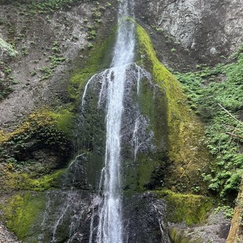


1 year ago
The hike to the falls is incredible! A very well maintained trail meanders through dense old growth forest with dozens of evergreen trees with heights of 200 feet plus, and girths of ten feet in some cases. The trail is quite easy until the very last 100 yards to the falls which is steep and rough. I thought the prettiest view was from under the foot bridge where the roughest portion of the trail begins. read more


3 years ago
Marymere Falls were a nice, shorter option on our 2nd day in Olympic National Park. The day prior, we had done quite a few miles and not up for anything too long. Access to the falls are from the lot at the Storm King Ranger station at Lake Crescent. The ranger station isn't always staffed but there are water fountains and restrooms. On a Thursday morning, the lot was nearly full. The trail itself is mostly flat with a short staircase at the end. The forest leading up to the falls is quite scenic so it makes the whole journey fun. Once you're done at the falls, it's worth it to go down to the lakeshore dock for amazing views. The whole trail is 1.75 miles out and back and we saw people of varying ages along the trail enjoying the forest and falls. read more


A lovely falls in a beautiful setting accessed via a wonderful trail! We started the trail at the Storm King Rangers Station and completed a loop using the return trail back towards the lodge. The trail starts wide and flat in a stunning forest setting (once you cross under the road), narrowing as it crosses a couple bridges ascending stairs up Marymere. You take a small lollipop loop up to a higher viewing platform and back around. While the falls isn't huge by PNW standards, it is quaint with a sorta magical feel due to its positioning and the surrounding forest. There are gorgeous trees, scurrying critters, and the peaceful sounds of Barnes Creek from start to finish. While the stairs could be limiting to some, it's only a short trek to the falls...mostly flat and well-maintained. The gorgeous Lake Crescent to soak in and the nature trail around the lodge make for a fabulous stop. Definitely recommend! read more


Marymere Falls was definitely a more family-friendly hike compared to its neighbor Mount Storm King. They both start at the same trailhead until they fork off in different directions. The trailhead was just south of Lake Crescent which also had parking lots and restrooms. The total distance for the hike was about ~2 miles roundtrip and was mostly flat. There were a couple of bridges and a lot of stairs to get to the view point but it wasn't difficult. In fact, we saw multiple groups of elementary schoolers doing this hike. The waterfall itself was nice although it wasn't as big as others I've seen. Overall, if you're doing the Mount Storm King trail you might as well do this short hike too if you have the energy. Even if you don't go on Mount Storm King, you can still enjoy the waterfall with the entire family. read more


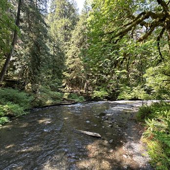


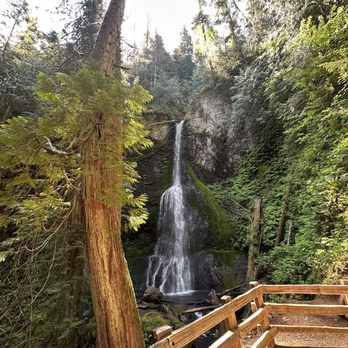


Fall of the Wild If you're in the Olympic Park area and only have time for one hike--then Marymere Falls is calling your name. The Good: *If you like waterfalls, then this is a good 'un! *Beyond the Falls themselves, this surrounding forest is just as spectacular--if not more so--than the actual Hoh Rainforest** section of Olympic. *Easy ±2-mile round-trip hike from start to finish *The trail itself is only a short 30-minute drive from Port Angeles and 45 minutes from Sequim. *Restrooms at the beginning of the trail The Meh: *There are some pretty steep steps once you get to the Falls, but if you have issues with stairs, you don't technically need to ascend them to enjoy the Falls. The Ugly: *We almost skipped this hike! We didn't initially plan on coming here but decided what the heck. Missing this is a travesty! TLDR: Must-see area when visiting the PNW! **I'm not 100% sure if this trail is technically part of the Hoh Rainforest, but as far as I could tell, it isn't, but I'm probably wrong. read more
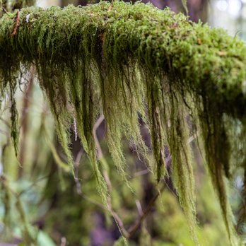


Such a gorgeous hike with the old growth forest, wooden bridges, wildlife and beautiful waterfalls. It's a relatively easy 2 mile roundtrip hike. I have to say I found it a lot easier when I was 20 yrs younger, even carrying my 2-1/2 month baby strapped to my chest, but I think that's a "me thing." Totally recommend. Arrive early for best parking, and consider a picnic lunch at Crescent lake afterward. read more
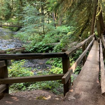



3 years ago
This is a great falls to visit in the Lake Crescent area. We did this hike after Mount Storm King (the 2 trailheads are the same for a little bit before branching apart). It was decently crowded since we were there later in the morning, but still very peaceful and enjoyable. The falls are TALL, beautiful, and you are surrounded by a gorgeous forest. What more could you ask for? read more


A short and mostly flat hike to Marymere falls, about 0.75mi each way. There are some stairs at the end leading up to the falls, but definitely very family + kids friendly. The trail to the falls starts from the parking lot by the ranger station and bathroom - also the same trailhead to Mount Storm King. Parking lot was only half full at 11am on a Saturday in January. Falls are beautiful and convenient if you are in the Lake Crescent area. Rainforest is similar but not as good as Hoh / Sol Duc area - although those are much further. read more


Beautiful payoff for such a short walk in the woods. Currently there are some fallen trees that you need to go around and over. But well worth the effort. Mostly flat until you get close to the falls, then there are some stairs. It's part of the Olympic national park, so don't forget the pass. read more


Next time you're near Lake Crescent, be sure to stop by to see Marymere Falls. Located right off of the road, it's an easy hike to get to the falls. It's about 1 1/2 miles to get there. After you get to the falls, check out another trail that will take you to Lake Crescent Lodge. Large parking lot, but beware of tour buses and it being extra busy in the summer. read more
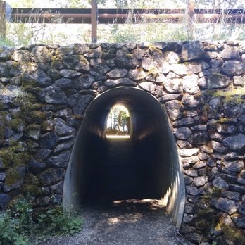


This is a super easy hike (1.5 mi total distance) with minor elevation gain at the waterfall. There are lots of areas to park near Lake Crescent and we easily found a spot at lunchtime near the trailhead. There were lots of people heading down to the lake and some bogging down the trail with large groups and no masks (really?). One person in the large group ahead of us had her phone on speakerphone and kept going from the front of the group to the back of the group without any trail etiquette to let us pass while they figured their sitch out. They were encouraging their friends to bring their dog when the friend expressed concern about the trail's no pets rule. All along the hike about 10% of the 100 or so people we encountered were wearing masks, including the 3 of us. The path is pretty narrow for most of the hike (definitely not 6 feet wide in total to even properly socially distance ourselves.) Luckily it's a short hike so we were only exposed for a short time. It was nice to get out into nature if even for a short while. We saw lots of shelf mushrooms on downed trees and the trail was well maintained. Currently not muddy despite recent rain. read more


6 years ago
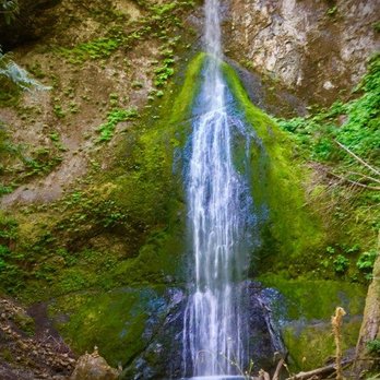
After getting down and dirty with the stacked n soulful Mt. Storm King, there was nothing more pleasant than this easy walk to the falls and a quick wash in the river leading up to the falls. These falls are along the same trail as the trailhead for Mt. Storm King so just continue to the left once you finish your hike. This 1.7 mile hike is a great cooldown once you've just come off the mountain, but if this is the only trail you have planned for the day rest assured it's quite easy and great for all ages. The trail is well maintained and has a couple of fun little wooden bridges to cross. The breathtaking waterfall can be viewed from a fenced off area but even from here you can still feel the coolness of the water spray and get a good look at the 90 ft falls. The backdrop is framed with lush PNW greenery and we really enjoyed the view. If you want a little taste of the water you can get into the river at the start of the trail and there were several families with kids playing on the rocky river bank. It's an easy and rewarding hike with a beautiful gem at the end. read more

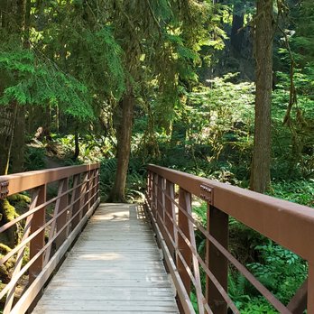


It's a small waterfall in width but tall. The hike to the falls wasn't too bad, mainly flat until the end when you had to go up the stairs to get to the falls. We arrived in the later afternoon, so it wasn't crowded. We had to pick up our pace before it got dark. We probably spent an hour here. read more


6 years ago
We visited Marymere Falls, as it's one of the hikes from Lake Crescent. Since we visited close to sunset, we wanted a short hike since it was getting dark, which this one is a good for. The Marymere Falls trail was about a mile, and it's super easy to do, as it's mostly flat. The only part where you get a workout is when you're climbing the stairs and the stairs to the observation area, to get a view of the waterfall. It was cool to see other parts of this forested area too, with many tall and older trees, wildflowers, etc. You also cross two bridges along the trail, walking above the creek that runs through. The view of Marymere Falls is nice and is worth checking out if you have the time do so while at Lake Crescent. There were two observation areas to check out the falls, and I thought the lower/first one was a better view. I'm glad we were able to visit as our last hike of a long day of exploring the national park. read more


5 years ago
It was a quick family friendly hike to see the falls. We bought our dog but decided to keep it in the car due to web said no pets allowed, but while we hiked we saw a lot of families had their dogs with them. Wish the instructions were more clear). Nothing super impressive about this hike and water fall. It was just something for us to do while we the Olympic national parks trails were mainly still closed for hike unless you have spikes and other equipments. read more



2 years ago


9 years ago
Marymere Falls is a easy, short & pretty PNW hike that also has a nice view of Lake Crescent. We did this trail in about an hour, with 6.5 people (just to the falls and back, although you Could make it longer by walking a couple of the other trails). We weren't able to go to Hoh Rainforest (I really wanted to do this), but my sister (who's been there) mentioned that there were lots of similar aspects within Marymere. This place was relatively quiet when we went on a weekday afternoon (which was great). It's great for tourists and photography lovers. *(paid) Parking lot & (free) restrooms available read more


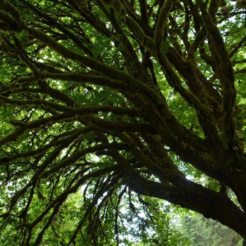

Some websites state this attraction is in Forks (Tripadvisor) and some state this is in Port Angeles (Yelp) so it can be a bit confusing but here's some advice: just keep driving on Hwy 20 from Port Angeles headed toward the Hoh Rainforest and you are sure to find Marymere Falls. This place was on my "to do list" when I visited and I wasn't even sure we'd be able to visit all of the "to do" place on my list, which looked like this: 1. Marymere Falls 2. Town of Forks (nothing there - Twilight is now a dusty memory) 3. Rialto Beach (found by accident due to having to hit the crapper - read my Rialto review on what not to do on a road trip) 4. Hoh Rainforest 5. Ruby Beach The really, really crazy thing = we did ALL of it in one day, which I didn't think was possible given the distances and the amount of driving and Marymere happened to be the first thing on my list and our first stop. PROS: - relatively flat, smooth trail - only 1.5 miles one way - great for kids and grandparents - you don't need to climb the stairs to see the falls, so even the older folk can do it - well maintained, immaculate trail - it was GREENER than the Hoh Rainforest and the moss was visit-worthy - we saw deer at the trail head - perfect place to take pictures. Nicer in person! CONS: - ranger station was closed on a week day, but it was Summer (July), so maybe they were all out surfing? - the waterfall was really small when we went, no fault of the waterfall (a very dry summer). Despite it being in July, it was chilly in the morning so we were glad we had jackets. Go early in the morning. The light of the morning sun shining through the trees on the pathway were breathtakingly beautiful... the "golden hour" couldn't be prettier at Marymere. My heart and soul were singing as I traveled this beautiful trail. read more


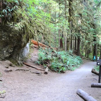


If you enjoy the outdoors, nature, and a good workout or hike, then the Marymere Falls are worth checking out. The 90-foot high Marymere Falls are located in the northern portion of the Olympic National Forest, just south of Lake Crescent. There is a parking lot at the Storm King Ranger Station where the Marymere Falls Trail begins. The hike from the Storm King Ranger Station (or Lake Crescent Lodge) to the Marymere Falls is approximately 1.5 miles roundtrip. The lower portion of the hard packed dirt trail is handicapped accessible, where along the way, the scenery of the tall trees in the forest is very nice. The upper portion of the trail is not handicapped accessible, where the trail crosses over the flowing Barnes Creek (narrow foot bridges). There is a loop trail towards the top of the trail which has quite a steep climb, so take it easy. Your big reward for taking this nature hike, is a breathtaking view of the 90 foot high waterfall with lower and upper viewing areas, though the lower viewing area is more visible and not obstructed by tree branches. From the Marymere Falls Trail, you can also hike 2 miles up Mount Storm King to the viewpoint overlooking Lake Crescent. Enjoy the hike if you decide to go! NOTE: The Storm King Ranger Station is usually staffed during the summer months. read more


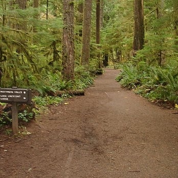


12 years ago
This is a super simple hike. Easily accessible for all levels. Whether you are a beginner or a well seasoned hiker you'll be sure to enjoy yourself. If you have kids, I'd definitely recommend this. There is ample parking with restrooms and a drinking fountain near the trailhead and rangers station. Three stars you may ask? I'm biased. That's pretty much it. I'm biased because Oregon has so many beautiful waterfalls, specifically speaking, Silver Falls State Park. While Marymere Falls is a short and lovely hike, I was hoping for something more and maybe a waterfall in comparison to Silver Falls, but let's be honest that isn't realistic. Oh Oregon, you've spoiled me. read more


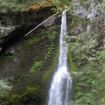

8 years ago
If you're driving around Washington's Olympic Peninsula, try to make time for the short hike to Marymere Falls. Park for free at Storm King Ranger Station and follow the signs. There are bathrooms available. The hike is gorgeous and you'll see quite a few awesome sights with a waterfall climax. If you have time, check out some of the other lake Crescent sights, like the hike to the devil's punch bowl. read more
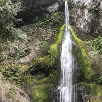


6 years ago
Almost everyone had a mask on so we were comfortable. It was on a Tuesday morning when we went. The trail was very easy. Many children and okder adults were also on the trail. The waterfall was ok. Although it was a sunny day, sunlight was almost nonexistent due to hovering beautiful trees. My favorite moment was the actual journey getting there and the view of the water in the beginning of the hike. read more


6 years ago
Enjoyed the hike through the old forest growth of cedar, fir, and alder trees to get to the 90ft falls. A total of 1.78 miles out and back. Easy trail through the forest then intermediate effort towards the falls, quite steep, the wooden built steps helped a lot. Happy nature trailing read more




Page 1 of 2
More info about Marymere Falls
Barnes Point Rd
Port Angeles, WA 98363
Directions
(360) 928-3380
Call Now
Visit Website
https://www.nps.gov/experiences/onp-waterfalls.htm
Hours
Indoor Amenities
Outdoor Amenities
Ask the Community - Marymere Falls
Review Highlights - Marymere Falls



















Why does Yelp recommend reviews?
3 reviews that are not currently recommended
The reviews below are not factored into the business's overall star rating.

4 years ago

8 years ago
9 years ago
Marymere Falls - hiking - Updated July 2026
Best of Port Angeles
People found Marymere Falls by searching for…
Things to Do in Port Angeles, WA
Hiking Trails With Waterfalls in Port Angeles, WA
Dog Friendly Beaches in Port Angeles, WA
Watch Sunset in Port Angeles, WA
Scenic Drive in Port Angeles, WA
Beautiful Views in Port Angeles, WA
Secret Spots in Port Angeles, WA
Things to Do on a Rainy Day in Port Angeles, WA
Natural Hot Springs in Port Angeles, WA
Stair Climbing in Port Angeles, WA
Attractions in Port Angeles, WA
Dog Friendly Hiking Trails in Port Angeles, WA
Fun Things to Do at Night in Port Angeles, WA
Swimming Lakes in Port Angeles, WA
Picnic Areas in Port Angeles, WA
Places to Take Pictures in Port Angeles, WA
Fishing Spots in Port Angeles, WA
Stairs Workout in Port Angeles, WA
Trending Searches in Port Angeles, WA
Berry Picking near Marymere Falls
Boat Tours near Marymere Falls
Cliff Jumping near Marymere Falls
Dog Friendly Beaches near Marymere Falls
Dog Friendly Things To Do near Marymere Falls
Kayak Rental near Marymere Falls
Kids Activities Indoor near Marymere Falls
Off Road Trails near Marymere Falls
Outdoor Activities near Marymere Falls
Peach Picking near Marymere Falls
Picnic Spots near Marymere Falls
Playgrounds near Marymere Falls
Public Shower near Marymere Falls
Rock Quarry near Marymere Falls
Splash Pad near Marymere Falls
Swimming Holes near Marymere Falls
Swimming Lakes near Marymere Falls
Teacher Supplies near Marymere Falls
Things To Do On A Rainy Day near Marymere Falls
Things To Do With Kids near Marymere Falls
U Pick Farms near Marymere Falls
Browse Articles
Browse Nearby
BEST of Port Angeles, Washington Coffee near Marymere Falls
BEST of Port Angeles, Washington Restaurants near Marymere Falls
BEST of Port Angeles, Washington Breakfast near Marymere Falls
BEST of Port Angeles, Washington Lakes near Marymere Falls
BEST of Port Angeles, Washington Bike Rentals near Marymere Falls
BEST of Port Angeles, Washington Campgrounds near Marymere Falls
Browse Brands
Related Searches in Port Angeles, WA
Affordable Kayak Rental Services in Port Angeles, Washington
Best Dog Hiking Trails Around Port Angeles, Washington
Best Fishing Locations and Guides in Port Angeles, Washington
Best Off Leash Dog Parks in Port Angeles, Washington
Best Parks for Parties and Events in Port Angeles, Washington
Best Places for Horseback Riding in Port Angeles, Washington
Best Sightseeing Experiences Available in Port Angeles, Washington
Best Water Parks for Kids in Port Angeles, Washington
Check Out Great Playgrounds in Port Angeles, Washington
Check Out Off Road Trails in Port Angeles, Washington
Discover Baseball Fields Around Port Angeles, Washington
Discover Beautiful Garden Spots in Port Angeles, Washington
Discover Dog Friendly Trails to Explore in Port Angeles, Washington
Discover Popular Photo Spots in Port Angeles, Washington
Discover Top Nature Parks to Visit in Port Angeles, Washington
Discover a Hiking Trail in Port Angeles, Washington
Discover the Best Beaches in Port Angeles, Washington
Discover the Best Night Hike Trails in Port Angeles, Washington
Dog-Friendly Hikes With Dogs in Port Angeles, Washington
Enjoy Camping Adventures Around Port Angeles, Washington
Enjoy Exciting Mountain Biking Adventures in Port Angeles, Washington
Enjoy Hiking Adventures in Port Angeles, Washington
Enjoy Kayaking Adventures in Port Angeles, Washington
Enjoy Off Leash Dog Hikes in Port Angeles, Washington
Enjoy Scenic Places to Walk in Port Angeles, Washington
Enjoy Tent Camping Spots Around Port Angeles, Washington
Enjoy a Beautiful Waterfall Hike in Port Angeles, Washington
Enjoy the Best Picnic Spots and Ideas in Port Angeles, Washington
Enjoy the Best Walking Trails in Port Angeles, Washington
Experience Stunning Sunset Views in Port Angeles, Washington
Explore Beautiful Parks and Green Spaces in Port Angeles, Washington
Explore Easy Hikes Perfect for All in Port Angeles, Washington
Explore Family-Friendly Zoos and Wildlife in Port Angeles, Washington
Explore Free Picnic Areas Around Port Angeles, Washington
Explore Fun Activities to Do in Port Angeles, Washington
Explore Parks With Pull Up Bars in Port Angeles, Washington
Explore Picnic Parks Near Port Angeles, Washington
Explore Popular Campgrounds Near Port Angeles, Washington
Explore Popular Picnic Areas Around Port Angeles, Washington
Explore Popular RV Parks Around Port Angeles, Washington
Explore Scenic Lakes to Visit in Port Angeles, Washington
Explore Top Dog Parks in Port Angeles, Washington Near You
Explore Top Trampoline Parks in Port Angeles, Washington
Explore Top Water Parks in Port Angeles, Washington Today
Explore the Best Beach Spots in Port Angeles, Washington
Explore the Best Swimming Holes Around Port Angeles, Washington
Family Friendly Hiking With Kids in Port Angeles, Washington
Find Beautiful Views in Port Angeles, Washington


