Mount Storm King Photos



You might also consider

More like Mount Storm King
Recommended Reviews - Mount Storm King
Start your review...


Reviews With Photos


This is one of the most challenging hikes that I have ever done, although the views are worth it. Lake Cresent and Olympic National Park had so many breathtaking trails and natural beauty. If you haven't gone, it's worth it! The hike is 4.1 miles roundtrip (out and back) and although the length of the hike is not that long, the incline is what will get you. It's about 2,000 feet of elevation gain with a lot of switchbacks. Expect that the two miles uphill will take longer than most hikes due to the incline. The views keep getting better as you hike farther up the trail. The views of Lake Cresent are breathtaking! To get to the very top, you will be met with ropes. You can pull yourself up to reach the top and enjoy the overlook. If climbing up the ropes is not your thing, there will be plenty of views that will be stunning leading up to it, so it is no worries. Towards the top of the trail it will narrow so that is something to be mindful of. Another thing to be mindful of is that this trail is unmaintained and the ropes leading up to the top are unmaintained as well, so that is something to be mindful of if you don't want to take that risk. I would recommend wearing hiking shoes, bringing lots of water because the steep incline will leave you thirsty, and allow time to soak in the stunning views. If you want, you can bring snacks and gloves for the ropes if you have them. We didn't go on this hike on a warm day, although if you do consider bringing a hat and wearing sunscreen. Consider wearing layers as well as you will warm up fast hiking up this trail. Most of all enjoy this beautiful part of the world and being surrounded by so much natural beauty in this area of Washington! Some extend their hike and go to Marymere Falls afterwards due to it's close proximity and because of the gorgeous waterfall. We didn't end up doing this due to seeing lots of beautiful waterfalls in the area on our trip, although many report enjoying adding this to their hike to really experience all the beauty in this area.


One of the more taxing, strenuous hikes that I have done, but the end view over Lake Crescent and Olympic National Park is so totally worth it. This hike is about 4 miles roundtrip with an elevation gain of about 2,000 feet. The hike up is no joke as you are constantly just hiking at a steep incline. Don't be afraid to take plenty of breaks, and pace yourself. You don't want to burn out at the beginning. The last 0.1 mile or so is a rock scramble and some rope climbing up the mountain - this can be rough. This portion does require a bit of coordination, and it can be very challenging if you're afraid of heights. Would definitely re-evaluate if you are afraid of heights. For the ropes, wearing gloves is recommended. They do have some gloves sitting around at the base to borrow. The view at the end is 100% worth the entire hike, though. You can see all of Lake Crescent and the surrounding beauty. Absolutely magnificent. Take some time to just soak it in after the hike. The trailhead for Storm King is on the trail to Marymere Falls. If you want to do that hike too, do it first - you will feel absolutely wrecked after Storm King and while Marymere isn't nearly the same difficulty, you're probably just gonna want to relax afterward. Pack plenty of water, some snacks, and sunscreen and a hat if it's sunny. And just remember to take it 1 step at a time.


This hike was actually fun and exhilarating to get to the top. Full of zig zags, rope climbs up, and great views. I saw kids running up and down the mountain. I think the hike itself was moderate and doable for all ages. Once you get to the ropes, just be careful not to slide. The ropes are there for a reason! I would say coming down from the ropes was slightly harder than going up. Once you get to the top of the rock, you will see amazing views of the lake and mountain. The only thing I didn't like were the slightly annoying kids taking selfies for hours and being in the way of getting some nice pics, but other than that, I enjoyed it! Or maybe some kids jumping their way down from the mountain giving me a heart attack because they were close to falling off the cliff... anyways... Bring food, water, hat, sunscreen, mosquito repellent, and good shoes. Very hot at the top in the summer!


Mount Storm King is a mountain and a hiking trail within Olympic National Park. The trailhead is located at the Storm King Ranger Station just south of Lake Crescent where there are parking lots, restrooms, and the Lake Crescent Lodge. The hike is ~4.1 miles roundtrip with 2,000 feet elevation. When you first start the hike, you'll be on the same trail at Marymere Falls which forks off after a couple minutes. After that, there were multiple switchbacks with pretty big incline which could make you think twice about continuing up, and it doesn't really stop after that. Most of the way up the ~2 miles is incline and I recommend taking multiple breaks throughout if needed. At about ~1.75 miles up we hit the first view point which was nice but was covered up by trees. After a couple minutes more of incline, we reached a pretty narrow and rocky portion which was the end of the maintained trail. This was where the ropes came into play. To get to the very top of Mount Storm King for the best view of Lake Crescent, there were a set of ropes that you needed to climb. It's recommended that you bring gloves for this part because the ropes and rocks can get slippery, but if you forget you can use communal ones left by other friendly hikers. The view is much better up there but it's up to you if you feel comfortable doing so. Half of the people we interacted with during the hike ended up not doing it for a variety of reasons, and these were some things that I noted from a variety of folks who did it and who didn't: - "You're this close you might as well" - "It's worth it" - "The journey was more worth than the view" - "I'm good, the accomplishment to get up here was enough" - "This is not for me" - "I'm not risking my life for that" I ended up not doing the ropes, and no one will blame you if you don't because it can be dangerous and uncomfortable for some. On the way back down, it was a steep decline with a lot of loose gravel and there was a high chance of slipping. It did a good number on my knees. The hike was pretty steep and challenging so we took breaks as needed. Luckily most of the hike was shaded so you don't have the sun beaming down on you. It took us about ~1.5 hours to get right before the ropes and about 1 hour to get back down. It wasn't the most challenging hike I've ever been on but it was above average with a lot of work on my knees and thighs. Although we didn't get views at the very top, it was still a rewarding hike.


Do not underestimate this hike. There's a reason that AllTrails rates this as HARD. In just 2 miles, you'll need experience over 2,000 ft. elevation gain which is no easy task. Make sure you bring plenty of water and start early in the day to avoid the heat. We got there around 10AM and I think we got lucky with parking. There's a dedicated lot but it's not big and when we finished the hike, there were a lot of cars circling around. Driving from Port Angeles, you don't pass any ticket booths but we had annual passes to hang from the rearview mirror. Double check the rules and find out if you actually need to pay a fee for Mount Olympic Park. The trail starts off by Lake Crescent and shares the beginning of the hike with the Marymere Falls. As soon as the paths diverge, the elevation begins. The majority of the hike is shaded until the very top. There's a couple of openings where you can see the lake but that's not the end of it! The hardest, and most dangerous part, is at the last 10 minutes and you'll have to pull yourself up some even steeper parts with ropes. Don't underestimate this section because it's even harder coming down and you wouldn't want to get stuck. I also see people bringing gloves to protect their hands from rope burns. At the very top, the view opens up and you get unobstructed, 360 views of the entire area. It's beautiful and you'll be able to take some great pictures but for the effort, I didn't think it was very worth it (hence 4 stars). There isn't that much space at the top too but there were many groups crouching in the area to rest and snack. By the time we left, there was kind of queue just to get to the overlook. What I regret doing, is not being prepared for the lake. After the hike, we walked by the lake and noticed people jumping in. That would've been the perfect, refreshing end to our long hike. I'm glad I got to experience it but I would never do it again!


The views are absolutely worth it! The hike up is STEEP (over 2,000 ft in ~2 miles) and in the dry summer months the way up (and especially the way down) can be a bit slippery due to the loose gravel. It's mostly a hike through the forest until the very end where there are some exposed cliff edges. I feel like the hike overall especially the ropes section at the very end that others have mentioned is far safer and more enjoyable the fewer people that there are. Really the only way to achieve this I think is to arrive early early in the day.


This was a very challenging and rewarding hike that ended up being everything we thought it would be and more! The hike is basically a 1000 miles of elevation a mile with the steepest at the top so it is not for the faint of heart. It is the most challenging hike I've done so far in the PNW. The trailhead has a great parking lot at Crescent Lake with plenty of space and clean well kept bathrooms. The start of the trailhead is accessible through a short underground tunnel that leads to it and Marymere Falls. This 5.3 mile round trip hike has a 2,076 ft elevation gain..and trust me, you feel it! There are gorgeous views throughout the hike both of the natural forest as well as peak-a-boos of the lake here and there. The trail is well maintained up until the final climb to the summit. The trail then has a sign letting you know you are heading off the maintained trail and there are ropes that have been set up for you the scale up the remainder of the trail. It's not exactly rock climbing status but if you let go you'll slide on the slippery tail, so not for those with fear of heights or for those without good upper body strength and core. The view from the top is epic and well worth it. The hike down takes its toll on the knees so poles aren't the worst idea. Once you get to the bottom you'll probably be sweaty..likely be tired..and definitely be dirty so do yourself a favor and snag a left to Marymere Falls and a close up to the river.


Second time climbing to the summit proved to be a bit more difficult. Must be getting old. The roped sections were fine, but the incline of the first quarter or so mile felt more difficult this time around. The views at the summit were gorgeous on a beautiful sunny day. Some scrambling required to get to the summit. Well worth the effort.
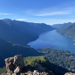

Hiked on a Saturday in January and WOW was it gorgeous out!! Started around 11am and there were still lots of spots in the parking lot. 5 mi hike with 2000 ft of elevation, so it's pretty much a steep uphill the entire way up. My legs were very tired by the time I made it to the top! The last 0.3mi or so are a scramble with ropes to assist you up. Bring gloves to help you grip the ropes. The view at the top is absolutely beautiful - although not a ton of space to sit around at the peak.


The view from the top is sick, but the trek up is a killer and a bit scary at times. It's a tough hike mostly because of how relentlessly steep it is, so be ready for some cardio. I would also recommend good hiking shoes. We did it in tennis shoes because that's all we had, but it would have been much easier / safer with better traction. Once you get to the ropes there is really nothing to grab onto for your hands or feet, other than the ropes. I would have literally slide of the side of the cliff without the ropes. It requires a bit of trust in the ropes and the trees they are tied to. Once you are to the top of the ropes, head to the left and carefully scramble up the rocky peak. There is another trail to the right, not sure where it goes. Five star views for sure.


The one place in all of PNW that had some sane air quality for a hike in sept of 2020! Be sure to drive to the ranger station of lake crescent and not just type in Mt storm king in the god to get there. After a 3 hr drive from Seattle area, made it here and really like the clean bathrooms with soap and plentiful parking when I arrived at 9:30 There are several hikes here: one to a waterfall, one to a creek, but was here for storm king The hike is brutal and if you haven't hiked much it will hurt haha: i had to take breaks once in awhile and I have already summited my ellinor and mailbox peak and found it challenging. It's short and sweet but painful: with not much endurance needed. The view is worth it and except for a couple hogging the main stone where people take pictures, it was beautiful. The lake is so crystal blue and it makes a great pic There are a lot of bees up here so be careful with your food and don't get stung! Note: for the last little bit of trek you will need to use some ropes to climb up to the very top - they are provided and you will see them: tread carefully and I highly recommend good hiking boots: my sportivas really helped out here A pretty unique hike would highly recommend! The lake is also amazing to check out after and a wonderful place to swim! You can also bring your boat and there is a boat launch! The water is so blue and clear it's unbelievable: reminds me of tahoe waters in northern Cali


If you're looking for a challenging but WELL WORTH IT hike, do this one. You have to go to the Mt. Storm King ranger station to start near Lake Crescent and it's a bit confusing if you GPS it on your Apple Maps. You need to park at the ranger station though and start on the Marymere Falls trail. It will loop under a bridge and be flat through a forest for maybe a quarter of a mile before it starts the serious INCLINE UP! A couple miles of switchbacks followed by some rope-assisted scrambles and some free-scrambles. I won't lie, it's not for the faint of heart, but also definitely not as difficult as a lot of people say. Unless you're afraid of heights or not surefooted. We hiked up with hiking boots and slapped some microspikes on to help with the loose rock, but saw some others in their regular day shoes so it's definitely possible. My boyfriend made the valid point that this can't be marked as strenuous or dangerous if people can make it up in Vans. Anyway, the view of Lake Crescent and beyond at the top is the ultimate reward. Also plenty of beautiful Canadian gray jays to come and keep you company. It was a beautiful hike and a wonderful end to our vacation.


I wish yelp would allow you to give 1/2 stars but unfortunately that is not the case. I would give this hike 3.5 but I feel generous to bump it up to 4. Please be mindful, this hike will knock the wind out of the unconditioned hiker. Also, please note, this trail can be dangerous because of its exposed ledges. While I consider myself and my partner to be in decent shape, we found this trail a butt kicker as Sherman W. puts it nicely. HOLY MOLY. I was deceived. Don't be like me and let the distance fool you. This is not an easy hike. And please, please, please for crying out loud pack the damn water. Mount Storm King round trip is 3.8 miles with 1700 - 2400 in elevation gain. At the first .5 mile the trail is shared with Marymere Falls, so be aware of the heavy foot traffic and other folks - no need to worry, most are headed to Marymere Falls. Mount Storm King trail sign will be on your left. You quickly gain in elevation, with switchbacks, as you rise above Barnes Creek - listen for the waterfall in the distance. As you increase in elevation you will FINALLY, make it to a viewpoint of Lake Crescent. I recommend stop, take some photos, drink some H2O, and head back. My only complaint is that there is no real sign or posting notifying you that you've reached the end of the trail. You seriously pop out of forested area and BOOM rocky cliffs on both sides of you. I'll be honest, once I reached this point my legs got a bit shaky and vertigo took over. I couldn't summon the courage to summit the top. A sign is posted stating "Maintained trail ends here." You can proceed forward for another 400 feet in elevation gain but no view of Lake Crescent at this point, why bother if you ask me. Overall, I would rate this trail a 5 out 5 in difficulty and a 3 out of 5 in the scenery and views.


Dang! For our first hike we decided to be quite a bit ambitious. We were blinded by the fact that it was a shorter hike despite it stating it was strenuous with switchbacks. I failed to read reviews on my trusty Yelp app and winged it. I wish I had done more research and read some reviews. Since we were visiting from a flattish state our love for hiking usually consists of traveling somewhere with more terrain and mountains, so let it be known that we were not quite ready to get the wind knocked out of us from the elevation and switchbacks. Despite all of this, we truly enjoyed every step of the way. We packed lots of water and took breaks when we needed to. It was easy to embrace the forest around us, breath in the crisp fresh air, and see unfamiliar plants, moss, and flowers. As soon as we got to the top my fear of edges took over, I wasn't mentally prepared and decided to wait for my boyfriend to come back from reaching the summit via a rope off a ledge. It started to get a little more busy with more people coming and the unsaid pressure got the best of me. I still enjoyed the moment I got to rest at the top before the rope, and the view was beautiful. No matter what, hiking will always be something I love. I may be on the slower side of hiking and perhaps more cautious than I was years ago, but this type of movement is always my favorite. Once my boyfriend got back we trekked the way down and were proud of ourselves. This experience just makes me want to travel to more places we can get a great hike in just like this. Lake Crescent from the top was amazing. Just as other hikers have said, take lots of water with you, some snacks, give yourself breaks when you need it and if you can make it to the summit, go for it! If you're not feeling it, give yourself grace, you trekked an arduous and beautiful hike, you made it! read more


5 months ago
Consistent incline the entire way but the view was worth it! A challenging hike but going end of March was actually the perfect weather. Start at the Mount Storm King ranger station to park and then keep walking to go under the street through a tunnel. You'll keep walking under you see a fork in the road that goes to the falls or the start of Mount Storm King. The incline is tough but you just keep going and starts in the woodsy area and as you keep going up switchbacks, you'll see rocks (and snow!) towards the top! Once you start reaching the top you'll start climbing over rocks and then hit the ropes section. PROTIP: Bring gloves! One with grip is best, but it definitely helps to grab the rope with them. I'm so glad we brought them. There's steep ledges where the rope is helpful and necessary, about 3-4 of them to pass. After you finish that section head towards right rocky area where it doesn't look like a path but actually is the top! The left side may look more level but is snowier and there's no actual end. Overall a really great hike that takes you through so many terrains of Olympic National Park in this one hike! read more
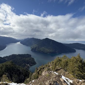
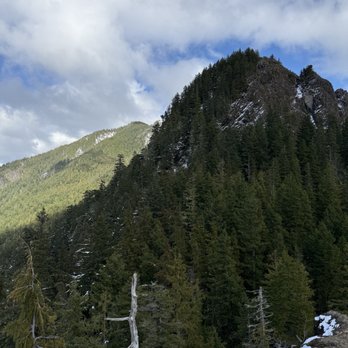

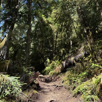
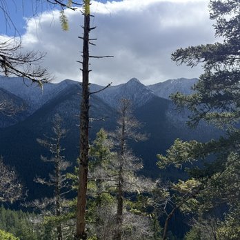


Hard hike I should not have tried running up it but I did and survived. What an amazing view point northwest Washington has to offer. Rewarding as you come down and take a left to see the waterfall then go take a dip in the lake as the cold waters will refresh your sore body. read more


This is one of the most challenging hikes that I have ever done, although the views are worth it. Lake Cresent and Olympic National Park had so many breathtaking trails and natural beauty. If you haven't gone, it's worth it! The hike is 4.1 miles roundtrip (out and back) and although the length of the hike is not that long, the incline is what will get you. It's about 2,000 feet of elevation gain with a lot of switchbacks. Expect that the two miles uphill will take longer than most hikes due to the incline. The views keep getting better as you hike farther up the trail. The views of Lake Cresent are breathtaking! To get to the very top, you will be met with ropes. You can pull yourself up to reach the top and enjoy the overlook. If climbing up the ropes is not your thing, there will be plenty of views that will be stunning leading up to it, so it is no worries. Towards the top of the trail it will narrow so that is something to be mindful of. Another thing to be mindful of is that this trail is unmaintained and the ropes leading up to the top are unmaintained as well, so that is something to be mindful of if you don't want to take that risk. I would recommend wearing hiking shoes, bringing lots of water because the steep incline will leave you thirsty, and allow time to soak in the stunning views. If you want, you can bring snacks and gloves for the ropes if you have them. We didn't go on this hike on a warm day, although if you do consider bringing a hat and wearing sunscreen. Consider wearing layers as well as you will warm up fast hiking up this trail. Most of all enjoy this beautiful part of the world and being surrounded by so much natural beauty in this area of Washington! Some extend their hike and go to Marymere Falls afterwards due to it's close proximity and because of the gorgeous waterfall. We didn't end up doing this due to seeing lots of beautiful waterfalls in the area on our trip, although many report enjoying adding this to their hike to really experience all the beauty in this area. read more


One of the more taxing, strenuous hikes that I have done, but the end view over Lake Crescent and Olympic National Park is so totally worth it. This hike is about 4 miles roundtrip with an elevation gain of about 2,000 feet. The hike up is no joke as you are constantly just hiking at a steep incline. Don't be afraid to take plenty of breaks, and pace yourself. You don't want to burn out at the beginning. The last 0.1 mile or so is a rock scramble and some rope climbing up the mountain - this can be rough. This portion does require a bit of coordination, and it can be very challenging if you're afraid of heights. Would definitely re-evaluate if you are afraid of heights. For the ropes, wearing gloves is recommended. They do have some gloves sitting around at the base to borrow. The view at the end is 100% worth the entire hike, though. You can see all of Lake Crescent and the surrounding beauty. Absolutely magnificent. Take some time to just soak it in after the hike. The trailhead for Storm King is on the trail to Marymere Falls. If you want to do that hike too, do it first - you will feel absolutely wrecked after Storm King and while Marymere isn't nearly the same difficulty, you're probably just gonna want to relax afterward. Pack plenty of water, some snacks, and sunscreen and a hat if it's sunny. And just remember to take it 1 step at a time. read more


3 years ago
This hike was actually fun and exhilarating to get to the top. Full of zig zags, rope climbs up, and great views. I saw kids running up and down the mountain. I think the hike itself was moderate and doable for all ages. Once you get to the ropes, just be careful not to slide. The ropes are there for a reason! I would say coming down from the ropes was slightly harder than going up. Once you get to the top of the rock, you will see amazing views of the lake and mountain. The only thing I didn't like were the slightly annoying kids taking selfies for hours and being in the way of getting some nice pics, but other than that, I enjoyed it! Or maybe some kids jumping their way down from the mountain giving me a heart attack because they were close to falling off the cliff... anyways... Bring food, water, hat, sunscreen, mosquito repellent, and good shoes. Very hot at the top in the summer! read more


Mount Storm King is a mountain and a hiking trail within Olympic National Park. The trailhead is located at the Storm King Ranger Station just south of Lake Crescent where there are parking lots, restrooms, and the Lake Crescent Lodge. The hike is ~4.1 miles roundtrip with 2,000 feet elevation. When you first start the hike, you'll be on the same trail at Marymere Falls which forks off after a couple minutes. After that, there were multiple switchbacks with pretty big incline which could make you think twice about continuing up, and it doesn't really stop after that. Most of the way up the ~2 miles is incline and I recommend taking multiple breaks throughout if needed. At about ~1.75 miles up we hit the first view point which was nice but was covered up by trees. After a couple minutes more of incline, we reached a pretty narrow and rocky portion which was the end of the maintained trail. This was where the ropes came into play. To get to the very top of Mount Storm King for the best view of Lake Crescent, there were a set of ropes that you needed to climb. It's recommended that you bring gloves for this part because the ropes and rocks can get slippery, but if you forget you can use communal ones left by other friendly hikers. The view is much better up there but it's up to you if you feel comfortable doing so. Half of the people we interacted with during the hike ended up not doing it for a variety of reasons, and these were some things that I noted from a variety of folks who did it and who didn't: - "You're this close you might as well" - "It's worth it" - "The journey was more worth than the view" - "I'm good, the accomplishment to get up here was enough" - "This is not for me" - "I'm not risking my life for that" I ended up not doing the ropes, and no one will blame you if you don't because it can be dangerous and uncomfortable for some. On the way back down, it was a steep decline with a lot of loose gravel and there was a high chance of slipping. It did a good number on my knees. The hike was pretty steep and challenging so we took breaks as needed. Luckily most of the hike was shaded so you don't have the sun beaming down on you. It took us about ~1.5 hours to get right before the ropes and about 1 hour to get back down. It wasn't the most challenging hike I've ever been on but it was above average with a lot of work on my knees and thighs. Although we didn't get views at the very top, it was still a rewarding hike. read more


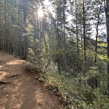
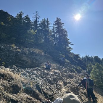


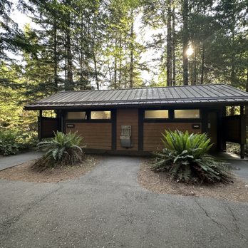


Do not underestimate this hike. There's a reason that AllTrails rates this as HARD. In just 2 miles, you'll need experience over 2,000 ft. elevation gain which is no easy task. Make sure you bring plenty of water and start early in the day to avoid the heat. We got there around 10AM and I think we got lucky with parking. There's a dedicated lot but it's not big and when we finished the hike, there were a lot of cars circling around. Driving from Port Angeles, you don't pass any ticket booths but we had annual passes to hang from the rearview mirror. Double check the rules and find out if you actually need to pay a fee for Mount Olympic Park. The trail starts off by Lake Crescent and shares the beginning of the hike with the Marymere Falls. As soon as the paths diverge, the elevation begins. The majority of the hike is shaded until the very top. There's a couple of openings where you can see the lake but that's not the end of it! The hardest, and most dangerous part, is at the last 10 minutes and you'll have to pull yourself up some even steeper parts with ropes. Don't underestimate this section because it's even harder coming down and you wouldn't want to get stuck. I also see people bringing gloves to protect their hands from rope burns. At the very top, the view opens up and you get unobstructed, 360 views of the entire area. It's beautiful and you'll be able to take some great pictures but for the effort, I didn't think it was very worth it (hence 4 stars). There isn't that much space at the top too but there were many groups crouching in the area to rest and snack. By the time we left, there was kind of queue just to get to the overlook. What I regret doing, is not being prepared for the lake. After the hike, we walked by the lake and noticed people jumping in. That would've been the perfect, refreshing end to our long hike. I'm glad I got to experience it but I would never do it again! read more


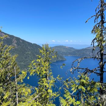


3 years ago

3 years ago
The views are absolutely worth it! The hike up is STEEP (over 2,000 ft in ~2 miles) and in the dry summer months the way up (and especially the way down) can be a bit slippery due to the loose gravel. It's mostly a hike through the forest until the very end where there are some exposed cliff edges. I feel like the hike overall especially the ropes section at the very end that others have mentioned is far safer and more enjoyable the fewer people that there are. Really the only way to achieve this I think is to arrive early early in the day. read more


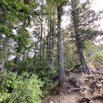

6 years ago
This was a very challenging and rewarding hike that ended up being everything we thought it would be and more! The hike is basically a 1000 miles of elevation a mile with the steepest at the top so it is not for the faint of heart. It is the most challenging hike I've done so far in the PNW. The trailhead has a great parking lot at Crescent Lake with plenty of space and clean well kept bathrooms. The start of the trailhead is accessible through a short underground tunnel that leads to it and Marymere Falls. This 5.3 mile round trip hike has a 2,076 ft elevation gain..and trust me, you feel it! There are gorgeous views throughout the hike both of the natural forest as well as peak-a-boos of the lake here and there. The trail is well maintained up until the final climb to the summit. The trail then has a sign letting you know you are heading off the maintained trail and there are ropes that have been set up for you the scale up the remainder of the trail. It's not exactly rock climbing status but if you let go you'll slide on the slippery tail, so not for those with fear of heights or for those without good upper body strength and core. The view from the top is epic and well worth it. The hike down takes its toll on the knees so poles aren't the worst idea. Once you get to the bottom you'll probably be sweaty..likely be tired..and definitely be dirty so do yourself a favor and snag a left to Marymere Falls and a close up to the river. read more


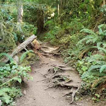


Second time climbing to the summit proved to be a bit more difficult. Must be getting old. The roped sections were fine, but the incline of the first quarter or so mile felt more difficult this time around. The views at the summit were gorgeous on a beautiful sunny day. Some scrambling required to get to the summit. Well worth the effort. read more


Hiked on a Saturday in January and WOW was it gorgeous out!! Started around 11am and there were still lots of spots in the parking lot. 5 mi hike with 2000 ft of elevation, so it's pretty much a steep uphill the entire way up. My legs were very tired by the time I made it to the top! The last 0.3mi or so are a scramble with ropes to assist you up. Bring gloves to help you grip the ropes. The view at the top is absolutely beautiful - although not a ton of space to sit around at the peak. read more
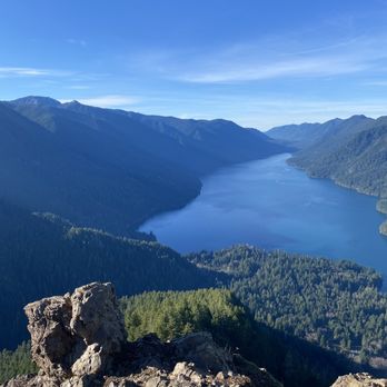


The view from the top is sick, but the trek up is a killer and a bit scary at times. It's a tough hike mostly because of how relentlessly steep it is, so be ready for some cardio. I would also recommend good hiking shoes. We did it in tennis shoes because that's all we had, but it would have been much easier / safer with better traction. Once you get to the ropes there is really nothing to grab onto for your hands or feet, other than the ropes. I would have literally slide of the side of the cliff without the ropes. It requires a bit of trust in the ropes and the trees they are tied to. Once you are to the top of the ropes, head to the left and carefully scramble up the rocky peak. There is another trail to the right, not sure where it goes. Five star views for sure. read more


The one place in all of PNW that had some sane air quality for a hike in sept of 2020! Be sure to drive to the ranger station of lake crescent and not just type in Mt storm king in the god to get there. After a 3 hr drive from Seattle area, made it here and really like the clean bathrooms with soap and plentiful parking when I arrived at 9:30 There are several hikes here: one to a waterfall, one to a creek, but was here for storm king The hike is brutal and if you haven't hiked much it will hurt haha: i had to take breaks once in awhile and I have already summited my ellinor and mailbox peak and found it challenging. It's short and sweet but painful: with not much endurance needed. The view is worth it and except for a couple hogging the main stone where people take pictures, it was beautiful. The lake is so crystal blue and it makes a great pic There are a lot of bees up here so be careful with your food and don't get stung! Note: for the last little bit of trek you will need to use some ropes to climb up to the very top - they are provided and you will see them: tread carefully and I highly recommend good hiking boots: my sportivas really helped out here A pretty unique hike would highly recommend! The lake is also amazing to check out after and a wonderful place to swim! You can also bring your boat and there is a boat launch! The water is so blue and clear it's unbelievable: reminds me of tahoe waters in northern Cali read more


7 years ago
If you're looking for a challenging but WELL WORTH IT hike, do this one. You have to go to the Mt. Storm King ranger station to start near Lake Crescent and it's a bit confusing if you GPS it on your Apple Maps. You need to park at the ranger station though and start on the Marymere Falls trail. It will loop under a bridge and be flat through a forest for maybe a quarter of a mile before it starts the serious INCLINE UP! A couple miles of switchbacks followed by some rope-assisted scrambles and some free-scrambles. I won't lie, it's not for the faint of heart, but also definitely not as difficult as a lot of people say. Unless you're afraid of heights or not surefooted. We hiked up with hiking boots and slapped some microspikes on to help with the loose rock, but saw some others in their regular day shoes so it's definitely possible. My boyfriend made the valid point that this can't be marked as strenuous or dangerous if people can make it up in Vans. Anyway, the view of Lake Crescent and beyond at the top is the ultimate reward. Also plenty of beautiful Canadian gray jays to come and keep you company. It was a beautiful hike and a wonderful end to our vacation. read more


12 years ago
I wish yelp would allow you to give 1/2 stars but unfortunately that is not the case. I would give this hike 3.5 but I feel generous to bump it up to 4. Please be mindful, this hike will knock the wind out of the unconditioned hiker. Also, please note, this trail can be dangerous because of its exposed ledges. While I consider myself and my partner to be in decent shape, we found this trail a butt kicker as Sherman W. puts it nicely. HOLY MOLY. I was deceived. Don't be like me and let the distance fool you. This is not an easy hike. And please, please, please for crying out loud pack the damn water. Mount Storm King round trip is 3.8 miles with 1700 - 2400 in elevation gain. At the first .5 mile the trail is shared with Marymere Falls, so be aware of the heavy foot traffic and other folks - no need to worry, most are headed to Marymere Falls. Mount Storm King trail sign will be on your left. You quickly gain in elevation, with switchbacks, as you rise above Barnes Creek - listen for the waterfall in the distance. As you increase in elevation you will FINALLY, make it to a viewpoint of Lake Crescent. I recommend stop, take some photos, drink some H2O, and head back. My only complaint is that there is no real sign or posting notifying you that you've reached the end of the trail. You seriously pop out of forested area and BOOM rocky cliffs on both sides of you. I'll be honest, once I reached this point my legs got a bit shaky and vertigo took over. I couldn't summon the courage to summit the top. A sign is posted stating "Maintained trail ends here." You can proceed forward for another 400 feet in elevation gain but no view of Lake Crescent at this point, why bother if you ask me. Overall, I would rate this trail a 5 out 5 in difficulty and a 3 out of 5 in the scenery and views. read more


Challenging hike with the need for technical skills that grow with increasing elevation. Strong cardio burner with stunning views of Crescent Lake along the way. Not for inexperienced hikers. Park at the ranger station then walk a half mile on the Marymeer route to the clearly marked moss-covered boulder on the left - see pic. It is a 2.1 mile climb from there, up approximately 2000 ft. The trail is straightforward despite there not being markers. The great part about this hike is that there are a number of gorgeous views along the way. What's challenging is the risk of death. Seriously, there are multiple places where a misplaced step or slip will end it all. Additionally, the series of 6 or 7 ropes require grip strength and some foot/ grip technique. Think twice about bringing young children. The top, while a spectacular location, was a bit too much for us. We stopped 20 vertical feet short but were satisfied that we had stretched ourselves. Make sure you bring hydration and shoes with great traction. The gravel/ dirt is slippery even when dry. I fell once and slipped a half dozen times. Marymere falls is a worthwhile visit after you have summitted. Cooler in the forest with refreshing water flowing from the falls. Good luck. Stay safe. Enjoy the journey! read more


What an amazing view at the top!! Totally worth it. First thing to note is that the trail starts about .5 miles in on the Marymere Falls trail. You'll see a giant moss-covered rock on the left with a sign that says Storm King trail. According to the WTA site, it's 3.8 miles round trip, which felt about right to me. This trail is steep and quite slippery at many points. There are a lot of small rocks and gravel that can cause you to lose footing and we saw several people fall. This is not a trail to hike with sneakers. Hiking boots with great traction will be very helpful. Also, hiking poles would be really beneficial both to help stabilize you on the steep/slippery trail and for shock absorption for knees. While the trail maybe a bit slippery, it is quite beautiful. Thick forest surrounds the trail and includes moss-covered trees as well as those cool red/green bark-peeling trees. The first clear lookout point is a short bit before the rope climb. You can get an absolutely spectacular view from this vantage point. The waves of tree-covered mountains rise high above multi-colored Lake Crescent. Amazing. For those of you wanting to see the entire crescent shape of the lake from a higher elevation, move onward toward the ropes section. Just before that point the ledge gets really steep and it can become intimidating. At the ropes section, be prepared to wait due to a traffic jam. Only one person should be on a rope at a time and you take turns with the people coming down. There are four ropes to traverse with the second one being the most challenging. It's at a pretty steep part of the mountain and there are no rocks or niches to put your feet so it's slippery. After you finish climbing the four rope sections, you can look forward to a short rock scramble climb before finally reaching the top. And for us, aggressive wasps greeted us too. But that view!! Seriously one of the most beautiful scenes I've had the honor to witness. Okay, you did it, you made to the top. Hard part done right? Wrong. The hardest part is navigating your way down. For this part, you're going to want to wear gloves. The rope will slip through your hands and cause rope burn without. And the last thing you want is to let go while you're sliding down that steep ledge. Speaking of sliding, I pretty much glissaded on my shoes while holding on to the ropes on the way down. It's slippery, a bit scary, and the feeling of falling is real. A few people had to have help getting down and tears could be seen in their eyes. This part of the hike is not fun for those with a strong fear of heights. But like I said, that view is worth pushing past the fear and the "hiking legs" pain felt the next two days. read more


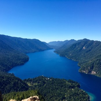


3 years ago
Ok, so this is rated the best mountain hike by most everyone, and I can definitely see why. But before I go any further, this is a very difficult, followed by very POTENTIALLY DANGEROUS hike. It's a beautiful flat trail at first, through forest, greenery, very peaceful and serene. Then it's a very steep climb up literally more than 6000 ft on a bunch of switchbacks, that are very easy to slip on/from. But if you're in shape, it's totally doable, just a work out. We wore regular walking shoes, no walking sticks, we definitely had a lot of water and snack bars. It was cold in the morning, so we had on a bunch of layers, but we stripped off those layers quick once we got to climbing. What's great is that about 3/4 of the way up, there is a gorgeous view of Crescent lake which you can sit on a rock and enjoy. The rest of the way requires maneuvering up and around boulders on a very narrow path at extremely high elevation with very steep sides in that if you slip and fall, you're not gonna make it. Then you need to belay yourself up the mountain side using a rope afixed to a fallen tree branch a few times over to get to the top to see the truly gorgeous full view. I did not make it up that far - I stopped where there was literally only inches of ground for me to step on separating me from a rock wall and air. I love my life too much to be doing that! My fiance made it the full way though and he said although it was potentially dangerous and he felt like he did without much issue. So just be warned that it is a truly magnificent hike in every way, but DONT do it if you're not looking for something truly risky, and I really would not recommend elderly, unfit, or children attempt it. read more


Gorgeous view of crescent lake. Definitely worth the sweat! Know your capabilities on this trail. The rope area gets a little sketchy and scrambling for the view after the ropes was a little too sketchy for me so we turned back after a snack below. Plenty of beautiful views though during the rest of the trail. If you're scared you can't get back down at any point, don't do it. A couple trees down along the trail, otherwise great trail condition. Please don't feed the wildlife! There were tons birds getting super close to us looking for handouts lol. read more


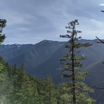
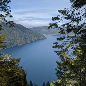



14 years ago

10 years ago
Being that this is only my second hike for the year, this mountain is no joke. It took a while to get there from Seattle, which you'd have to take the ferry to Bainbridge island, then from there is about another hour to the mountain. It was a tough climb for my entire group. It will be hard on your legs and muscles and you will sweat! It's very steep and ridged. You will need to make sure you bring lots of water. At least 2 liters per person. I brought only 750ml and totally ran out half way up. And make sure to bring lots of energy and power foods because the trail is long and you will stop many times to rest your body and power up. But you won't be disappointed by the views. I didn't go past the 'end of the un maintained' area because I value my life too much! But a few people in my group did and they said it was sketchy as there's only ropes you hang onto to get to the lookout where the ultimate view is. The views all around are beautiful and you'll have a few points where you see it on the climb up. The Marymere falls is close by and is visited by many people. I'd highly suggest this mountain to people who's hiked before and are in pretty good shape. Make sure to wear proper hiking attire such as hiking boots, gloves for grabbing and holding, hiking sticks, lightweight backpack with essential items, sunscreen, mosquito spray, hats, and sunglasses. Long sleeve pants and shirt wouldn't hurt to wear being there's lots of bugs on the trail. Happy hiking!! read more




9 years ago
A must-do in the Seattle/PNW area. This is not a hike for those with a fear of heights! Getting to the ropes section is a feat itself, and getting up the ropes and across the ledge to the top viewpoint is even tougher. But once you get there, it is so worth it. End your hike with a dip in Lake Crescent and lunch. read more


More info about Mount Storm King
Ask the Community - Mount Storm King
Review Highlights - Mount Storm King







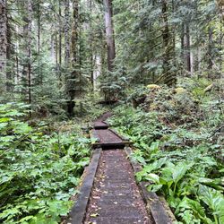



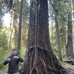








Mount Storm King - hiking - Updated September 2026
Best of Port Angeles
People found Mount Storm King by searching for…
Rock Climbing in Port Angeles, WA
Things to Do in Port Angeles, WA
Hiking Trails With Waterfalls in Port Angeles, WA
Beautiful Views in Port Angeles, WA
Fun Things to Do at Night in Port Angeles, WA
Playgrounds in Port Angeles, WA
Swimming Lakes in Port Angeles, WA
Things to Do on a Rainy Day in Port Angeles, WA
Picnic Areas in Port Angeles, WA
Places to Take Pictures in Port Angeles, WA
Scenic View in Port Angeles, WA
View Points in Port Angeles, WA
Natural Hot Springs in Port Angeles, WA
Sunset View in Port Angeles, WA
Off Road Trails in Port Angeles, WA
Hiking With Kids in Port Angeles, WA
Photo Spots in Port Angeles, WA
Dog Friendly Trails in Port Angeles, WA
Off Leash Dog Hikes in Port Angeles, WA
Walking Trails in Port Angeles, WA
Trending Searches in Port Angeles, WA
Apple Orchards near Mount Storm King
Apple Picking near Mount Storm King
Bike Shop near Mount Storm King
Cliff Jumping near Mount Storm King
Consignment Shops near Mount Storm King
Dog Friendly Things To Do near Mount Storm King
Ear Piercing near Mount Storm King
Eyebrow Threading near Mount Storm King
Eyelash Extensions near Mount Storm King
Hair Braiding near Mount Storm King
Kids Haircut near Mount Storm King
Picnic Areas near Mount Storm King
Preschools near Mount Storm King
Private Schools near Mount Storm King
Public Shower near Mount Storm King
Rock Quarry near Mount Storm King
Star Gazing near Mount Storm King
Sunrise View near Mount Storm King
Browse Articles
Browse Nearby
BEST of Port Angeles, Washington Restaurants near Mount Storm King
BEST of Port Angeles, Washington Coffee near Mount Storm King
BEST of Port Angeles, Washington Breakfast near Mount Storm King
BEST of Port Angeles, Washington Lakes near Mount Storm King
BEST of Port Angeles, Washington Bike Rentals near Mount Storm King
BEST of Port Angeles, Washington Campgrounds near Mount Storm King
Browse Brands
Related Searches in Port Angeles, WA
Affordable Kayak Rental Services in Port Angeles, Washington
Best Dog Hiking Trails Around Port Angeles, Washington
Best Fishing Locations and Guides in Port Angeles, Washington
Best Places for Horseback Riding in Port Angeles, Washington
Best Sightseeing Experiences Available in Port Angeles, Washington
Check Out Off Road Trails in Port Angeles, Washington
Discover Dog Friendly Trails to Explore in Port Angeles, Washington
Discover a Hiking Trail in Port Angeles, Washington
Discover the Best Beaches in Port Angeles, Washington
Discover the Best Night Hike Trails in Port Angeles, Washington
Dog-Friendly Hikes With Dogs in Port Angeles, Washington
Enjoy Camping Adventures Around Port Angeles, Washington
Enjoy Exciting Mountain Biking Adventures in Port Angeles, Washington
Enjoy Kayaking Adventures in Port Angeles, Washington
Enjoy Off Leash Dog Hikes in Port Angeles, Washington
Enjoy Scenic Places to Walk in Port Angeles, Washington
Enjoy Tent Camping Spots Around Port Angeles, Washington
Enjoy a Beautiful Waterfall Hike in Port Angeles, Washington
Enjoy the Best Picnic Spots and Ideas in Port Angeles, Washington
Enjoy the Best Walking Trails in Port Angeles, Washington
Experience Stunning Sunset Views in Port Angeles, Washington
Explore Beautiful Parks and Green Spaces in Port Angeles, Washington
Explore Easy Hikes Perfect for All in Port Angeles, Washington
Explore Fun Activities to Do in Port Angeles, Washington
Explore Picnic Parks Near Port Angeles, Washington
Explore Popular Campgrounds Near Port Angeles, Washington
Explore Top Dog Parks in Port Angeles, Washington Near You
Explore the Best Beach Spots in Port Angeles, Washington
Explore the Best Swimming Holes Around Port Angeles, Washington
Family Friendly Hiking With Kids in Port Angeles, Washington
Find Beautiful Views in Port Angeles, Washington
Find Cozy Camping Cabins in Port Angeles, Washington
Find Popular Ziplining Spots Around Port Angeles, Washington
Find the Best Playgrounds to Visit in Port Angeles, Washington
Hiking Trails With Waterfalls in Port Angeles, Washington
Off Leash Dog Hiking Trails in Port Angeles, Washington
Perfect Spots to Watch Sunset in Port Angeles, Washington
Plan a Scenic Drive Route Near Port Angeles, Washington
Popular Outdoor Activities to Try in Port Angeles, Washington
Popular Picnic Spots to Visit in Port Angeles, Washington
Relax at Natural Hot Springs Near Port Angeles, Washington
Safe and Fun Parks for Kids in Port Angeles, Washington
Top Dog Friendly Things to Do in Port Angeles, Washington
Top Hiking Trails to Explore in Port Angeles, Washington
Top Paddleboarding Activities in Port Angeles, Washington
Top Playgrounds for Kids to Enjoy in Port Angeles, Washington
Top Running Trails to Explore in Port Angeles, Washington
Top Things to Do With Kids in Port Angeles, Washington


