McCloud Nature Park Photos


You might also consider


More like McCloud Nature Park
Recommended Reviews - McCloud Nature Park
Start your review...


Reviews With Photos


McCloud Nature park was offering their annual maple syrup days festival on site. There are quite a few stations where you can learn about harvesting and processing maple syrup. I know they also offer a pancake breakfast but you need to get a ticket well in advance. There are plenty of trails to walk on around the park as well. We hiked a short 2 mile trail which was very nice as the weather is just now warming up from spring. There is a nature center as well as numerous programs you can sign up for led by staff. There is also a bird viewing room in the main house as well. Definitely a great stop particularly in March when the run the Maple Syrup days.


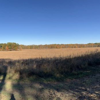
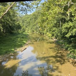
I really enjoyed hiking around this nature park in northwest Hendricks county. I am looking forward to a return trip once the spring flowers and buds add a bit of greenery to the place as well. Since my visit was during the first days of spring, my first impression was of a vast and seemingly empty prairie with a winding gravel road that worked its way around to the nature center in the middle of the park. But having seen pictures of what the prairie can turn into, I will definitely be back. But because the prairie didn't offer much visual appeal doesn't mean that I was missing out. This park has multiple habitats including a creek, forest, and pond life. Inside the nature center, the park attendant was very helpful explaining about the history and amenities that the park has. There is even a viewing area for bird watching where multiple feeders were attracting a number of songbirds. I highly recommend picking up a park brochure which shows an easy to read map of the trails and how long each trail is so that I was able to plan a route. I began hiking along the Big Walnut Crossing trail which includes a rejuvenated trestle bridge as part of the span crossing the Big Walnut Creek which passes through the park. Note that this bridge is the only way to get from one side of the park to the other. At the end of this trail, the path began to gain elevation as I got farther from the creek's edge. There are two trails that run somewhat parallel through a field/prairie for about a quarter mile that leads to another half mile loop called Woodland Way. Here you will walk along a prairie path that is surrounded by hardwood trees. I also noticed a shell of some old farm equipment left from when the park was a family farm. There was even a pair of trees on the north side that started with separate trunks but had intertwined and grown together farther up their trunks. On the south side of the Woodland path is a descending path that wanders through the lowlands near the creek. Be aware that the slope on this trail (Whitetail Ravine) is steep and may be quite challenging. Fortunately, it was dry on my visit so the gravel on the descent was holding and I was able to quickly make it down. (Not so quickly on the way back up though!) Although I didn't see any deer on my trip around the loop, I could see how it would be a shady space for deer to hang out. On my return toward the bridge, I stopped at one of the bird watching mini trails to watch eagles soaring over the creek. There are also places where woodpeckers and cardinals like to hang out. Although I covered nearly 2.5 miles on my trek, there were still several other trails that I didn't cover on the south and east end of the park. I think I will save those for when the foliage is in full color. With 232 acres, there is always something to see and more areas to wander through. Review #729


2 years ago
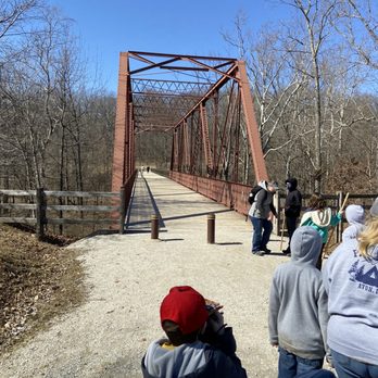
I don't get to this part of Central Indiana often, however, I had the chance to accompany a friend and we decided to do a bit of a detour and visit McCloud Nature Park in North Salem (Hendricks County). McCloud Nature Park is a 232-acre nature park established in 2003. It has over six miles of hiking trails, easy access to Big Walnut Creek, a nature center with year-round programs, and a pretty good chance you're going to see wildlife while here. The nature center has live reptiles, amphibians, insects, a bird-viewing room, a resource library, and interactive exhibits. In the late spring, summer, and early fall, you can observe live honeybee hives. There's a park pavilion available for rent (I believe it's only $50 a day). For a nature park, it's obvious much effort has been made to offer some contemporary amenities (modern restrooms/picnic facilities) and a surprising degree of accessibility including the availability of a GRIT Freedom Chair to borrow for two-hour increments (no charge). You can also rent a picnic pavilion with tables/grills. For those who don't know, GRIT chairs are capable of handling basic off-roading quite easily. They are manual chairs, but they have levers instead of the traditional wheel-push function. They're quite cool and ideal for hiking trails. While I was able to handle most of the ground here in my chair, a GRIT chair makes it MUCH easier. The trails are both gravel and natural surfaced trails - they are well marked. You can fish, wade, canoe, and kayak in Big Walnut Creek. The creek is known to have smallmouth bass, panfish, catfish, suckers, and carp (you do have to follow Indiana fishing laws and have an Indiana fishing license). As someone who loves bridges, I was in love with a restored iron truss bridge that is over 100 years old. There's also a swing set with belt, tire, infant, and ADA swings. The wetland habitat has a boardwalk and observation decks. While I'm impressed with how accessible Hendricks County has made this nature park, I'm also impressed with how much accessibility was actually just built into it. There was some clear thought. I sure wouldn't call all the trails accessible, though more advanced wheelchair users like myself can definitely have some fun here (and I did). The nature center admission is free. Hours for the nature center: November through March: Friday & Saturday only, 10am-4pm (closed noon to 1pm). April through October: Wednesday - Saturday, 10am - 4pm (closed noon to 1pm); Sundays, 1-5pm. This is definitely worth a visit to the westside to check out. I'd actually call it a destination nature park with enough features to keep folks happy. There's enough accessibility offerings to allow for all members of the family to enjoy the park. This is an absolute gem and I definitely recommend a visit. read more


McCloud Nature park was offering their annual maple syrup days festival on site. There are quite a few stations where you can learn about harvesting and processing maple syrup. I know they also offer a pancake breakfast but you need to get a ticket well in advance. There are plenty of trails to walk on around the park as well. We hiked a short 2 mile trail which was very nice as the weather is just now warming up from spring. There is a nature center as well as numerous programs you can sign up for led by staff. There is also a bird viewing room in the main house as well. Definitely a great stop particularly in March when the run the Maple Syrup days. read more


Business owner information

Eric I.
Thank you very much for your review, Paul! I'm glad that you had a…

I really enjoyed hiking around this nature park in northwest Hendricks county. I am looking forward to a return trip once the spring flowers and buds add a bit of greenery to the place as well. Since my visit was during the first days of spring, my first impression was of a vast and seemingly empty prairie with a winding gravel road that worked its way around to the nature center in the middle of the park. But having seen pictures of what the prairie can turn into, I will definitely be back. But because the prairie didn't offer much visual appeal doesn't mean that I was missing out. This park has multiple habitats including a creek, forest, and pond life. Inside the nature center, the park attendant was very helpful explaining about the history and amenities that the park has. There is even a viewing area for bird watching where multiple feeders were attracting a number of songbirds. I highly recommend picking up a park brochure which shows an easy to read map of the trails and how long each trail is so that I was able to plan a route. I began hiking along the Big Walnut Crossing trail which includes a rejuvenated trestle bridge as part of the span crossing the Big Walnut Creek which passes through the park. Note that this bridge is the only way to get from one side of the park to the other. At the end of this trail, the path began to gain elevation as I got farther from the creek's edge. There are two trails that run somewhat parallel through a field/prairie for about a quarter mile that leads to another half mile loop called Woodland Way. Here you will walk along a prairie path that is surrounded by hardwood trees. I also noticed a shell of some old farm equipment left from when the park was a family farm. There was even a pair of trees on the north side that started with separate trunks but had intertwined and grown together farther up their trunks. On the south side of the Woodland path is a descending path that wanders through the lowlands near the creek. Be aware that the slope on this trail (Whitetail Ravine) is steep and may be quite challenging. Fortunately, it was dry on my visit so the gravel on the descent was holding and I was able to quickly make it down. (Not so quickly on the way back up though!) Although I didn't see any deer on my trip around the loop, I could see how it would be a shady space for deer to hang out. On my return toward the bridge, I stopped at one of the bird watching mini trails to watch eagles soaring over the creek. There are also places where woodpeckers and cardinals like to hang out. Although I covered nearly 2.5 miles on my trek, there were still several other trails that I didn't cover on the south and east end of the park. I think I will save those for when the foliage is in full color. With 232 acres, there is always something to see and more areas to wander through. Review #729 read more




6 years ago

8 years ago

I'm an outdoorsy girl so this is right up my alley. McCloud Nature Park is a wonderful area to take in all that nature has to offer. There are hiking trails, a creek to dip your feet in, bird watching, picnic areas, many places to wander. The nature center has many displays to teach children about nature and also lends out gear for fishing, bird watching, and geocaching. read more


9 years ago

13 years ago
More info about McCloud Nature Park
8518 Hughes Rd
North Salem, IN 46165
Directions
(765) 676-5437
Call Now
Visit Website
http://www.hendrickscountyparks.org
Hours
Indoor Amenities
Outdoor Amenities
Other Amenities
From the Business
Ask the Community - McCloud Nature Park
Are there picnic tables besides the ones in the pavilion?
Review Highlights - McCloud Nature Park












McCloud Nature Park - parks - Updated August 2026
Best of North Salem
People found McCloud Nature Park by searching for…
Flower Fields in North Salem, IN
Places to Take Pictures in North Salem, IN
Dog Swimming in North Salem, IN
Hiking Trails in North Salem, IN
River Swimming in North Salem, IN
Secret Spots in North Salem, IN
Sunrise View in North Salem, IN
Off Road Trails in North Salem, IN
Playgrounds in North Salem, IN
Water Parks in North Salem, IN
Fishing Spots in North Salem, IN
Public Running Track in North Salem, IN
Parks for Kids in North Salem, IN
Photo Spots in North Salem, IN
Star Gazing in North Salem, IN
Nature Center in North Salem, IN
Swimming Lakes in North Salem, IN
Lakes & Ponds in North Salem, IN
Parks and Recreation in North Salem, IN
Parks BBQ Grills in North Salem, IN
Trending Searches in North Salem, IN
Browse Articles
Browse Brands
Related Searches in North Salem, IN
Best Dog Hiking Trails Around North Salem, Indiana
Best Lookout Points to Visit in North Salem, Indiana
Best Nature Trails for Hiking in North Salem, Indiana
Best Off Leash Dog Parks in North Salem, Indiana
Best Parks for Parties and Events in North Salem, Indiana
Best Spots for Star Gazing in North Salem, Indiana
Best Water Parks for Kids in North Salem, Indiana
Best Waterfalls and Swimming Holes in North Salem, Indiana
Check Out Great Playgrounds in North Salem, Indiana
Check Out Off Road Trails in North Salem, Indiana
Discover Baseball Fields Around North Salem, Indiana
Discover Dog Friendly Trails to Explore in North Salem, Indiana
Discover Fun Toddler Parks in North Salem, Indiana for Your Little One
Discover Popular Bike Trails in North Salem, Indiana
Discover Popular Photo Spots in North Salem, Indiana
Discover Scenic Mountain Bike Trails Near North Salem, Indiana
Discover Soccer Fields in North Salem, Indiana Near You
Discover Stunning Skyline View Spots in North Salem, Indiana
Discover Top Nature Parks to Visit in North Salem, Indiana
Discover a Hiking Trail in North Salem, Indiana
Discover the Best Beaches in North Salem, Indiana
Discover the Best Night Hike Trails in North Salem, Indiana
Dog-Friendly Hikes With Dogs in North Salem, Indiana
Effective Stairs Workout Spots in North Salem, Indiana
Enjoy Hiking Adventures in North Salem, Indiana
Enjoy Off Leash Dog Hikes in North Salem, Indiana
Enjoy Scenic Night View Experiences in North Salem, Indiana
Enjoy the Best Picnic Spots and Ideas in North Salem, Indiana
Enjoy the Best Walking Trails in North Salem, Indiana
Experience Stunning Sunset Views in North Salem, Indiana
Explore Beautiful Parks and Green Spaces in North Salem, Indiana
Explore Easy Hikes Perfect for All in North Salem, Indiana
Explore Free Picnic Areas Around North Salem, Indiana
Explore Landmarks & Historical Buildings in North Salem, Indiana
Explore Parks With Pull Up Bars in North Salem, Indiana
Explore Picnic Parks Near North Salem, Indiana
Explore Popular Picnic Areas Around North Salem, Indiana
Explore Popular Scenic Overlook Points in North Salem, Indiana
Explore Popular Scenic Views Near North Salem, Indiana
Explore Top Dog Parks in North Salem, Indiana Near You
Explore Venues & Event Spaces in North Salem, Indiana
Explore the Best Swimming Holes Around North Salem, Indiana
Family Friendly Hiking With Kids in North Salem, Indiana
Find Great Places to Feed Ducks in North Salem, Indiana
Find Parks and Recreation Activities in North Salem, Indiana
Find Top Dog Friendly Parks to Visit in North Salem, Indiana
Find Top Skating Rinks in North Salem, Indiana for All Ages
Find Top-Rated Waterfalls in North Salem, Indiana Now


