Cancel

    Open app

    Search

    Merced Grove Trail

    3.7 (3 reviews)

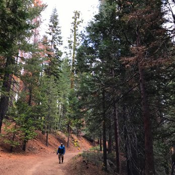
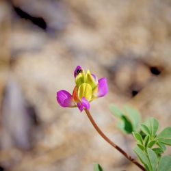
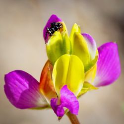
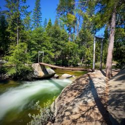
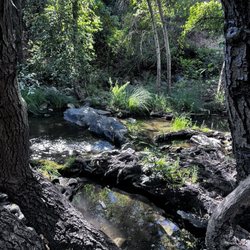
    Merced Grove Trail Photos

    Recommended Reviews - Merced Grove Trail

    Your trust is our priority, so businesses can't pay to alter or remove their reviews. Learn more about reviews.
    Yelp app icon
    Browse more easily on the app
    Review Feed Illustration

    3 months ago

    Helpful 0
    Thanks 0
    Love this 0
    Oh no 0

    8 months ago

    Helpful 0
    Thanks 0
    Love this 0
    Oh no 0

    10 years ago

    Helpful 3
    Thanks 0
    Love this 1
    Oh no 0

    Verify this business for free

    People searched for Hiking 183 times last month within 15 miles of this business.

    Verify this business

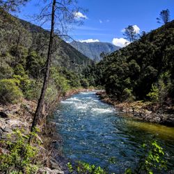
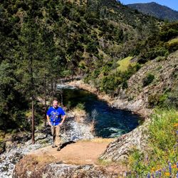
    Hite Cove Trail - 4.15.18

    Hite Cove Trail

    4.8(5 reviews)
    7.2 mi

    Beautiful trail just outside of Yosemite off of Highway 140 in El Portal. My husband and I hiked…read moreabout 2.5 miles of the trail mid June. The whole trail is 4.5 miles one way- about 9 miles round trip if you want to go all the way to Hite Cove. We wanted to go all the way to the end, however temperatures in the canyon rise fast during the summer and it was easily 100 degrees by noon. The trail follows up above the Merced River. There were a few times when you can get right down to the river. About 1.5-2 miles in, there is a section with rocks that looks like it is made for jumping in the river. The trail is entirely single track with some areas with steep drop offs. Make sure to pack plenty of water, sunscreen, and bug spray. There is very little shade and the trail is almost completely exposed. To find the trail, just look for the Red Bud Lodge and park right across the street. There is a sign that points just to the trailhead next to the lodge. I would recommend to come as early as possible if you are coming in the summertime.

    Considering that everything else in El Portal is some pee stained remnant from the Sears catalog,…read morewe didn't have high hopes for the 'trail' that came recommended. It's not that encouraging as you drive up either. Seems very average and nondescript. As it was our first night in the greater Yosemite area, we definitely wanted to get out and so we went for it. In retrospect, I would say it was one of the nicer hikes we went on. You walk high above the Merced River on a narrow trail amongst wild flowers and with a beautiful view of the mountains. The power of the river and the beauty of the land impressed all of us. It and easy/intermediate hike. One drawback is that it's not a loop. So you can go as long as you want (to the end even) and come back. We went and hour and turned around. Recommend.

    Photos
    Hite Cove Trail - 4.15.18

    4.15.18

    Hite Cove Trail - 4.15.18

    4.15.18

    Hite Cove Trail - 4.15.18

    See all

    4.15.18

    Carlon Falls Trail - Wildflowers, May 2023

    Carlon Falls Trail

    4.6(5 reviews)
    7.5 mi

    Carlon Falls Trail is one of the most rewarding hikes because at the end, there is a beautiful…read morewaterfall and cold pool of water to swim in. The hike is about 3 miles and starts off in Groveland, in Stanislaus National Forest, and goes into Yosemite National Park. You will have to go on a dirt trail and go up and down a couple of rocky hills so make sure to wear good hiking shoes. There are spots along the river that you can stop at if you don't want to hike all the way to the end. But it's worth it to go to the end. There are waterfalls (not super tall), but very pretty, especially with the surrounding trees and nature. In the summer, when the temperature is hot, the water is very refreshing, but it is very cold. A lot of people enjoy swimming in the waters at Carlon Falls. Not only is this one of the prettiest hikes in Yosemite, it's free to hike this trail. Also, if you park your car up the road, the parking would be free too. I've done this hike 3 times in the past 4 years and have enjoyed it each time.

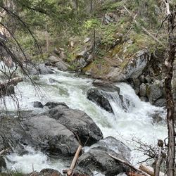
    Really beautiful river trail that ends at a spectacular waterfall, not too far from Hetch Hetchy…read more Carlon falls trail begins outside the Carlon Day Use area with a small roadside lot. If it's full, you can park, for a fee, in the day use area. That's $10, cash only. There was a remarkably clean pit toilet as well as some picnic areas in the day use area. The trail itself is easy to navigate and only goes one direction along the river and to the falls. It's mostly flat and well shaded, until the end when you have to scramble up a rocky hillside. In May 2023, the cascades prior to the falls are running pretty intensely as were the falls. The surrounding forest was a bit gloomy as it's recovering from the Rim Fire. Still, the tall trees, new growth and some pops of wildflowers made for a fun hike. You also get some lovely river views. My fitness tracker put it at almost 3.5 miles. Nice little side trip when in the area and don't want to go from Hetch Hetchy down to Yosemite valley but still want to get some miles in.

    Photos
    Carlon Falls Trail - Downstream from Carlon Falls

    Downstream from Carlon Falls

    Carlon Falls Trail - Downstream from the falls

    Downstream from the falls

    Carlon Falls Trail - Carlon Falls

    See all

    Carlon Falls

    Lewis Creek Trail - trunk and tree

    Lewis Creek Trail

    4.7(51 reviews)
    29.4 mi

    We were staying in Oakhurst with some friends over the weekend. After spending a long day in…read moreYosemite Valley the previous day, I wanted to do some more hiking and found this trail less than 10 minutes away. I started at the trailhead near Corlieu Falls, went north towards Red Rock Falls. It was a beautiful hike with some varied terrain going slightly uphill for parts of it. The fall foliage was beautiful, and it was nice to hear the running water all along the way. There is occasional highway noise since this runs parallel to the main road, but I didn't mind it. Went at 730a and didn't see another person for about two hours. Red Rock Falls was peaceful and beautiful. I crossed the stream a bit clumsily and ended up with wet feet, but it was worth it for the photos. I made my way back. Corlieu Falls had a good amount of debris around it, including part of a bridge. Round trip was less than 4 miles, and I got back in time for brunch.

    A nice and easy walk but make sure to bring water and sunscreen because it gets HOT and there are a…read morelot of areas on this trail that are not shaded so you're just getting beat down by the hot sun. Unfortunately, we had two small kids with us in tow so we didn't make it too far on the trail but I hear there are some nice waterfalls as a visual treat if you finish the trail. The trail itself had some slopes and elevations but nothing too crazy. There isn't a lot of parking available in the designated lot - we were lucky to grab a spot as someone was leaving right when we pulled up, otherwise I don't know where one would park to easily get to the trail head.

    Photos
    Lewis Creek Trail - Red rock falls

    Red rock falls

    Lewis Creek Trail - Lewis creek trail

    Lewis creek trail

    Lewis Creek Trail - Corlieu falls

    See all

    Corlieu falls

    Chilnualna Falls Trail - Chilnualna Falls Trailhead, Yosemite National Park: 2026 Jul 29

    Chilnualna Falls Trail

    4.6(18 reviews)
    18.4 mi

    Chilnualna Falls Trailhead, Yosemite National Park: 2026 Jul 29 (4.75 of 5)…read more Chilnualna Falls: Strenuous but Worth the Pain (9.23 mi) Chilnualna Falls is my favourite hike in Yosemite. Even before you begin your hike, the sounds of rushing water welcome you. Stay awhile and enjoy the mist before you climb the rock steps. The climb up Chilnualna Falls is strenuous and steep, with continuous uphill climbing and several switchbacks. In some areas you'll hear the waterfall but not see one. If you feel like challenging yourself, continue climbing to the top. Every time I reach the top, I want to stay awhile -- maybe because I'm too tired to climb back down... but also because reaching the top of Chilnualna Falls is not mere accomplishment, it's an exhilarating feeling. You'd want to stay and enjoy the sounds of water rushing below you. The water sliding over granite drops 240-feet down and is a sight to behold. Wear comfortable hiking shoes and cotton socks. Dress in layers. Wear a hat and sunglasses. Tips and What to Bring: 1) Start early. Preferably before 6:30 am. 2) Bring plenty of water: More than you think you need. Dehydration sets in pretty quickly. 3) Pack emergency items just in case. 4) Pack a light lunch. 5) Rubbish bags (take out what you bring in) 6) Horn (to scare wild animals away) 7) Sunscreen

    This review is for Chilnualna Falls Trail which was a ~7.7 miles round trip that took ~6 hours to…read morecomplete in the snow. Chilnualna Falls Trail was located near the south entrance of Yosemite National Park; away from the busy Yosemite Valley. Lower Chilnualna Fall was a short ~0.2 miles and gets crowded at this particular spot. For the most part, the trail was a steady incline on dirt and rock with snow at higher elevations. In addition, there were a few downed trees over the trail. Overall, stunning views throughout this hike! There was a ~3 minute walk from the parking to the trailhead. Restrooms available at the parking area. Short video of the hike for those interested! https://youtu.be/jACscCHBcOg

    Photos
    Chilnualna Falls Trail - View from the trail

    View from the trail

    Chilnualna Falls Trail - 2025 Apr 29: Chilnualna Falls

    2025 Apr 29: Chilnualna Falls

    Chilnualna Falls Trail

    See all

    Barney Lake

    Barney Lake

    5.0(1 review)
    48.0 mi

    I can't believe nobody has reviewed this awesome hike yet! The hike begins at Mono Village…read moreCampground which can be found by turning onto Twin Lakes road in Bridgeport and taking said road all the way to end, which is the Campground. You can park in the day use area if you're just doing a day hike but if you plan on doing backcountry camping, you'll need to pay them the $10 bucks to leave your car overnight. That $10 will buy you up to 7 days of parking. Follow the road between the maze of tents and motor homes until you reach the sign that marks the official beginning of the trail to Barney Lake. Take that trail roughly 4 miles up and you'll find it. It's simply gorgeous and an amazing view up there. From here, you can turn around and head back or continue up the trail to Robinson Lakes, Crown Lake, Snow Lake, and eventually, Yosemite National Park. The trail is very easy to follow and is mostly on an even level. There's switchbacks towards the end as you near the lake, but they're not bad incline wise. From car to lake and back to the car, it's just a hair over 9 miles. This is one of my favorite hikes in the area and I do it at least once or twice every season. Just please be respectful and leave no trace. Also, this area is known to be popular with Bears. I've personally never seen one here, but a lot of others have. That being said, you have nothing to be fearful of. If you do come across one, give it plenty of room and respect and you'll be fine and for god's sake DON'T FEED THEM! Or any wildlife for that matter. You have no idea how many moronic tourist I yell at for feeding squirrels and deer. Lol.

    Photos
    Barney Lake
    Barney Lake
    Barney Lake

    See all

    Merced Grove Trail - hiking - Updated August 2026

    Loading...
    Loading...
    Loading...