Mono Lake South Tufa Area Photos


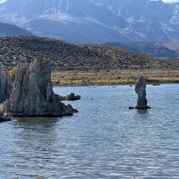

More like Mono Lake South Tufa Area
Recommended Reviews - Mono Lake South Tufa Area
Start your review...


Reviews With Photos


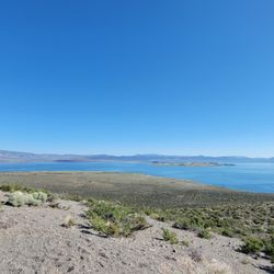
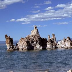
This is a really unique nature reserve with lots of cool tufa rock formations jutting out of the lake and beautiful mountains in the distance! The trail we did was short and flat but well worth the visit. There's a fee of $3/person or you can use the America the beautiful pass.
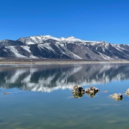

One of the must do things you can do in Mammoth besides snowboarding is to visit Mono lake. It's only 40 mins away from the city and right off the 395 highway. You can't miss it. Mono lake is often described as an oasis in the desert. The views are ridiculously amazing! Feels like we are on another planet. There are a few hiking trails, and we did the South tufa trail. It took us around an hour or so to explore most of the area, and it's guaranteed to be well worth it. Along the trails, there are several information signs, which are educational and informative. For those who want to explore more, would recommend to join the local kayaking or canoeing tour. There is an island in the center called "Paoha island." Mono lake is great for the sunset views, and also good for kids and families. Honestly, I'm so glad that we visited Mono before we headed back to L.A. A must visit!

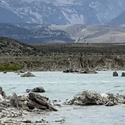

Just as I remembered it as a teenager. Well paved, maintained gravel road. Improved, maintained cement and gravel walking paths. Well preserved. Clean, great signage. Good for families with kids of all ages. Best to wear closed toe shoes, hiking boots. Easy walk from parking area to the beach. Also accessibility for wheelchairs, knee scooters, crutches. Dogs ok on leash (cats too, lol someone had one). Don't forget to pay the day use fee, it's an honor system. Remove your trash. Beautiful day, great weather.
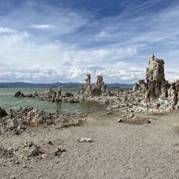

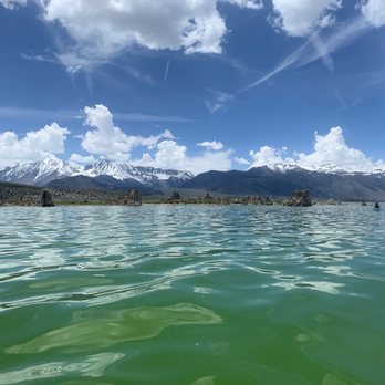
OMG- I can't believe I've been to Mammoth twice before and never visited this absolute GEM. It was like nothing I'd ever seen before- so different than all the other lakes. The tufa rock formations are varied in size and shape, absolutely incredible and the salt water lake (2.5x saltier than the sea!) is a beautiful green/light blue. Stunning views all around and especially this time of year with the snowy mountain backdrop! There are bathrooms and you also need to pay $3 cash or there is an app - but trust me, it's worth it!


1 of the many things to see and do in the Mammoth lakes area, and right off the 395 highway. The South Tufa area is over by Navy beach and you also pass Panum Crater on your way to the entrance. The parking fee is $3 but if you have a national park pass you don't have to pay the $3 fee. There is some information right at the parking area, telling you all about the tufas and the lake. The walk from the parking lot to the tufas, is very easy, mostly paved, and probably 1/2 mile at most. The tufas are neat and make for good photos. There is information about the lake, the wildlife, the tufas, and how they were formed. There are Osprey nests and other birds. The sunsets are incredible.


The short of Mono Lake with its limestone structures was like walking on another planet. I thought it was so cool. It's an easy walk on flat ground with marked trails. There's a lot of horse poop at parts. I saw a fair number of birds while I was there and could see the Osprey nests on the Tufa in the water.
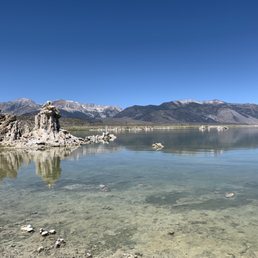

What a great place! The views here are pretty incredible. After parking, follow the trail down to the water. The trail is not too far or steep (we saw young children to seniors on this walk). I appreciated that this place was not crowded and was pretty peaceful. Some visitors were even seen SUPing on the water.
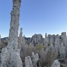

If you are traveling near Mono Lake, this is an absolute must-visit! There are multiple places to see the tufas up close, but the South Tufa Area is by far the best preserved & most scenic. It's just a short drive off of the 395, with a small section of well-maintained gravel road. The best time to visit is at twilight, when the formations look the most stunning and otherworldly with the dusk skies. Please DO NOT touch, climb on, or otherwise disturb the tufas, they are fragile & it's illegal!


Another cool, unique feature to be found just off of US 395! There's a few areas along the way where you can pull off and enjoy views of the lake for free, but why do that when you can pay just a few bucks and be able to see the Tufa's up close and personal? What are Tufa's? They're calcium-carbonate spires and knobs formed over time by a combination of freshwater springs and alkaline lake water. What's most awesome about these is that everything you'll see was once completely under water. It's always fascinating to me when I'm exploring an area that was part of a lake bed at one point in time. The lake is an ancient one and yes, swimming is permitted. However, do keep in mind that this is 2.5 times saltier than the ocean and VERY alkaline. So if you have any open wounds on your body, even small ones, you'll be in a world of hurt if this water comes in contact with them. It's a short, easy walk from the parking lot to the shore. You'll pay a small fee of $3.00 per adult to enter. Note that here, an adult is considered 16 or older. Anyone under the age of 16 may enter free of charge. They hold interpretive walks every so often. I've never taken part in one so check the website for more info on those. This is an awesome place to visit if you're into history, geology, nature, photography or any combination of such. It'll make your feel like you're in a whole other world. It's simply amazing to see.


Along the 395 just past the Tioga pass that goes to Yosemite is mono lake which has a land Mass of 1/5 of the United States. Hard to believe but you can't go in the water it's to dangerous. 100 times more alkaline than the Pacific Ocean. And more salt than the ocean. That's where all these pillars came from.


This place isn't for everyone but it's super interesting and great for other worldly photography.
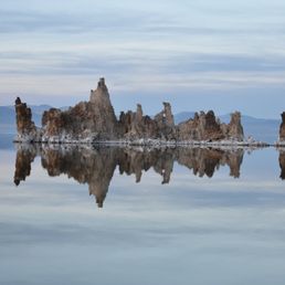

One of the Jewels of Eastern Sierras Mono Lake has a fascinating story. It is a story of survival against all odds. In 1941 the city of Los Angeles started diverting water from Mono Basin. 50 years later the lake had lost almost half of its volume. Had it not been for the efforts of David Allen Gaines, his wife Sally, and others the lake was very likely to turn into a dry salt lake, much like Owens Lake. In 1974 Gains was a graduate student who studied Mono Lake. By 1978 Gains, his wife Sally, David Winkler formed the Mono Lake Committee with the single goal of saving the lake and its immediate environment. Finally after many litigations in 1994 Los Angeles Department of Water and Power (LADWP) was ordered to let enough water into Mono Lake to raise the lake's water level. Sadly Gaines who started the effort did not live to see this victory. He died in a car accident in 1988. He was only 41. As of 2018, Mono Lake has regained 7.3 feet of the required 17.4 feet in 1994 ruling. The Mono Lake Committee continues to fight for the protection of Mono Lake and Mono Lake Basin, and thanks to their efforts the lake is there for many of us to visit and enjoy. The South Tufa Area is arguably one of the most scenic spots around the lake where visitors can enjoy one of the largest tufa groves on the lake. Visitors can walk an almost 1.5 mile path and enjoy the scenery. It is about 11 miles from Lee Vining off CA-120. There is a fee of $3.00 for every adult over the age of 16. However, National Park Passes are honored here. If you are into photography, the South Tufa Area is one of the best locations for taking photos at the right time of the day.


This is one of a kind lake . It was formed by underground fresh water . The lime stone formations are unique. When I first visited this lake many years ago, the lake was a lot bigger than now . We came around 5:30'pm amd the sun was setting . We saw the orange cloud in different shade and golden sun beam was reflected on the lake and he cloud at the same time . It was magical ! I am sad today to find out most of the lake water was re directed to Los Angeles area for other uses . The lake has shrink and the water becomes super salty . That affects the tiny shrimps that live inside the lake , the algae and the seabirds that eats the creatures that live in the water . I hope the situation would improve soon . We create a new problem to solve the existing problem. read more
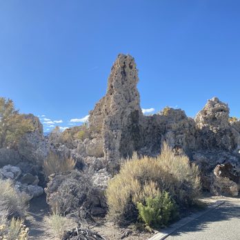


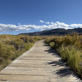

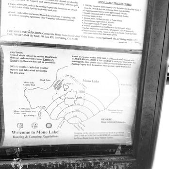
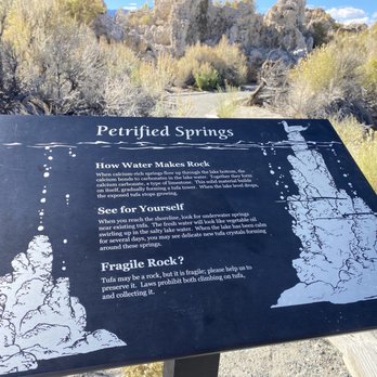


It is off the main road to access this area, but only by a few miles and it's worth it. An easy drive, plenty of parking. An easy hike to the lake, flat with a slight descent. At the waters edge you can see several of the tufa's. You get a nice view across the lake. At the parking lot are some kiosks with information pertaining to the lake. Along the trail are some placards with additional history and information. The waters edge was covered with thousands of the alkali flies. Kind of gross but memorable! Also on the trail down are markers showing dates and what water levels were at that time. That really is impressive to see how low the lake was from its original level. At the parking lot is a payment station. It's 3$ per adult. Also some pit toilets at the end of the parking lot. read more


This is a really unique nature reserve with lots of cool tufa rock formations jutting out of the lake and beautiful mountains in the distance! The trail we did was short and flat but well worth the visit. There's a fee of $3/person or you can use the America the beautiful pass. read more


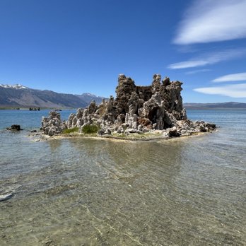


2 years ago

4 years ago
One of the must do things you can do in Mammoth besides snowboarding is to visit Mono lake. It's only 40 mins away from the city and right off the 395 highway. You can't miss it. Mono lake is often described as an oasis in the desert. The views are ridiculously amazing! Feels like we are on another planet. There are a few hiking trails, and we did the South tufa trail. It took us around an hour or so to explore most of the area, and it's guaranteed to be well worth it. Along the trails, there are several information signs, which are educational and informative. For those who want to explore more, would recommend to join the local kayaking or canoeing tour. There is an island in the center called "Paoha island." Mono lake is great for the sunset views, and also good for kids and families. Honestly, I'm so glad that we visited Mono before we headed back to L.A. A must visit! read more
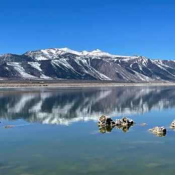
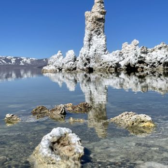

1 year ago
We were in a 24' RV & the roads are good. The path to the Tufa is wheelchair accessible & dogs allowed on leash. We did not camp there but glad to finally see them. The lake is large & there were many sand flies but worth the trip. read more


Just as I remembered it as a teenager. Well paved, maintained gravel road. Improved, maintained cement and gravel walking paths. Well preserved. Clean, great signage. Good for families with kids of all ages. Best to wear closed toe shoes, hiking boots. Easy walk from parking area to the beach. Also accessibility for wheelchairs, knee scooters, crutches. Dogs ok on leash (cats too, lol someone had one). Don't forget to pay the day use fee, it's an honor system. Remove your trash. Beautiful day, great weather. read more
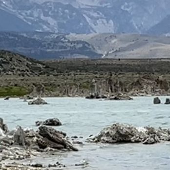


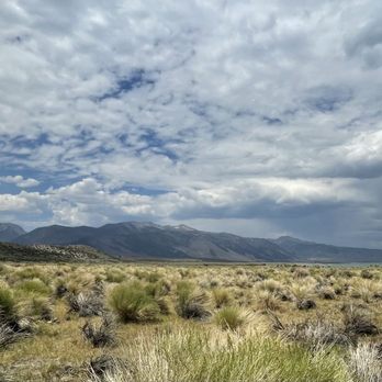

OMG- I can't believe I've been to Mammoth twice before and never visited this absolute GEM. It was like nothing I'd ever seen before- so different than all the other lakes. The tufa rock formations are varied in size and shape, absolutely incredible and the salt water lake (2.5x saltier than the sea!) is a beautiful green/light blue. Stunning views all around and especially this time of year with the snowy mountain backdrop! There are bathrooms and you also need to pay $3 cash or there is an app - but trust me, it's worth it! read more
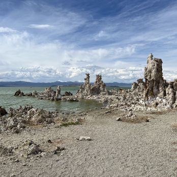


1 of the many things to see and do in the Mammoth lakes area, and right off the 395 highway. The South Tufa area is over by Navy beach and you also pass Panum Crater on your way to the entrance. The parking fee is $3 but if you have a national park pass you don't have to pay the $3 fee. There is some information right at the parking area, telling you all about the tufas and the lake. The walk from the parking lot to the tufas, is very easy, mostly paved, and probably 1/2 mile at most. The tufas are neat and make for good photos. There is information about the lake, the wildlife, the tufas, and how they were formed. There are Osprey nests and other birds. The sunsets are incredible. read more






1 year ago

The short of Mono Lake with its limestone structures was like walking on another planet. I thought it was so cool. It's an easy walk on flat ground with marked trails. There's a lot of horse poop at parts. I saw a fair number of birds while I was there and could see the Osprey nests on the Tufa in the water. read more


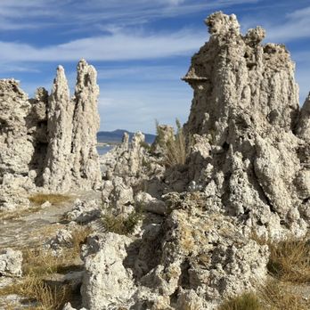


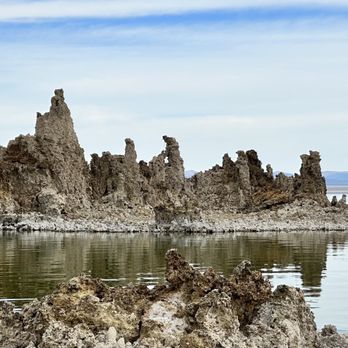

What a great place! The views here are pretty incredible. After parking, follow the trail down to the water. The trail is not too far or steep (we saw young children to seniors on this walk). I appreciated that this place was not crowded and was pretty peaceful. Some visitors were even seen SUPing on the water. read more
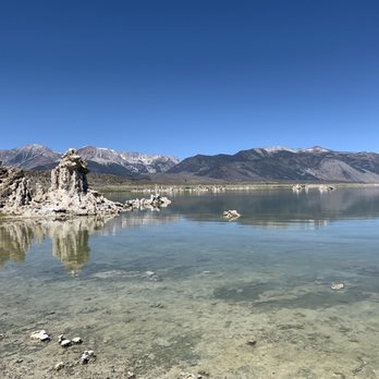

If you are traveling near Mono Lake, this is an absolute must-visit! There are multiple places to see the tufas up close, but the South Tufa Area is by far the best preserved & most scenic. It's just a short drive off of the 395, with a small section of well-maintained gravel road. The best time to visit is at twilight, when the formations look the most stunning and otherworldly with the dusk skies. Please DO NOT touch, climb on, or otherwise disturb the tufas, they are fragile & it's illegal! read more
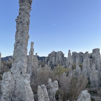


Another cool, unique feature to be found just off of US 395! There's a few areas along the way where you can pull off and enjoy views of the lake for free, but why do that when you can pay just a few bucks and be able to see the Tufa's up close and personal? What are Tufa's? They're calcium-carbonate spires and knobs formed over time by a combination of freshwater springs and alkaline lake water. What's most awesome about these is that everything you'll see was once completely under water. It's always fascinating to me when I'm exploring an area that was part of a lake bed at one point in time. The lake is an ancient one and yes, swimming is permitted. However, do keep in mind that this is 2.5 times saltier than the ocean and VERY alkaline. So if you have any open wounds on your body, even small ones, you'll be in a world of hurt if this water comes in contact with them. It's a short, easy walk from the parking lot to the shore. You'll pay a small fee of $3.00 per adult to enter. Note that here, an adult is considered 16 or older. Anyone under the age of 16 may enter free of charge. They hold interpretive walks every so often. I've never taken part in one so check the website for more info on those. This is an awesome place to visit if you're into history, geology, nature, photography or any combination of such. It'll make your feel like you're in a whole other world. It's simply amazing to see. read more


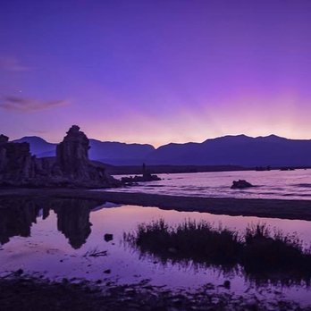


1 year ago

Along the 395 just past the Tioga pass that goes to Yosemite is mono lake which has a land Mass of 1/5 of the United States. Hard to believe but you can't go in the water it's to dangerous. 100 times more alkaline than the Pacific Ocean. And more salt than the ocean. That's where all these pillars came from. read more

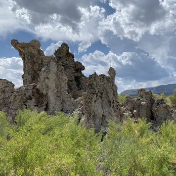


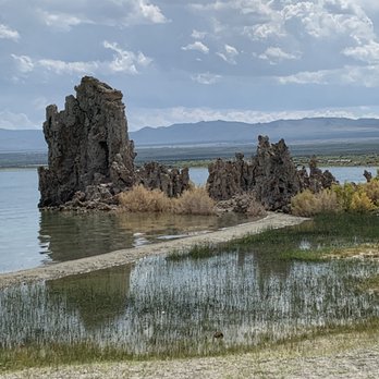


One of the Jewels of Eastern Sierras Mono Lake has a fascinating story. It is a story of survival against all odds. In 1941 the city of Los Angeles started diverting water from Mono Basin. 50 years later the lake had lost almost half of its volume. Had it not been for the efforts of David Allen Gaines, his wife Sally, and others the lake was very likely to turn into a dry salt lake, much like Owens Lake. In 1974 Gains was a graduate student who studied Mono Lake. By 1978 Gains, his wife Sally, David Winkler formed the Mono Lake Committee with the single goal of saving the lake and its immediate environment. Finally after many litigations in 1994 Los Angeles Department of Water and Power (LADWP) was ordered to let enough water into Mono Lake to raise the lake's water level. Sadly Gaines who started the effort did not live to see this victory. He died in a car accident in 1988. He was only 41. As of 2018, Mono Lake has regained 7.3 feet of the required 17.4 feet in 1994 ruling. The Mono Lake Committee continues to fight for the protection of Mono Lake and Mono Lake Basin, and thanks to their efforts the lake is there for many of us to visit and enjoy. The South Tufa Area is arguably one of the most scenic spots around the lake where visitors can enjoy one of the largest tufa groves on the lake. Visitors can walk an almost 1.5 mile path and enjoy the scenery. It is about 11 miles from Lee Vining off CA-120. There is a fee of $3.00 for every adult over the age of 16. However, National Park Passes are honored here. If you are into photography, the South Tufa Area is one of the best locations for taking photos at the right time of the day. read more
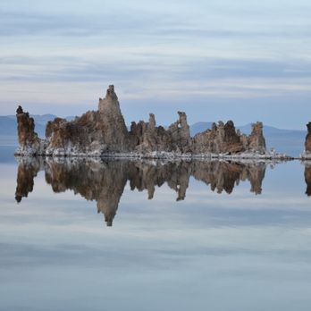


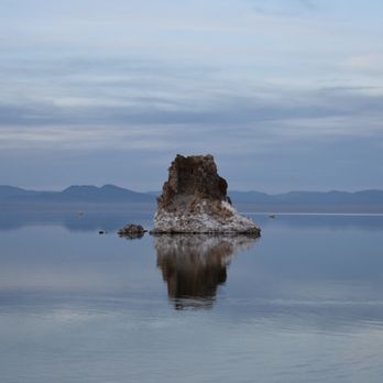


5 years ago
Such a nice place to take pictures at sunset! It's worth the visit if you are driving through the area. read more


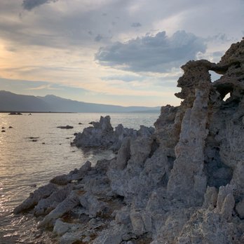

5 years ago
Funky! You can swim at Navy Beach and you'll float cause it's salt water for bring lots of fresh water to wipe off the salt afterwards. About 2 gallons per person. There's no water available. read more


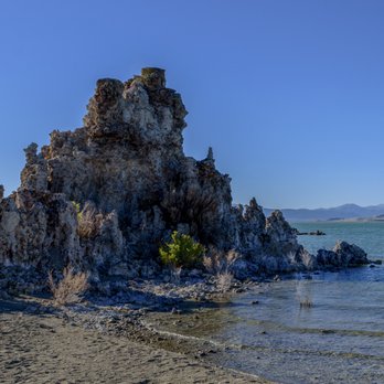
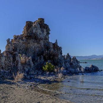
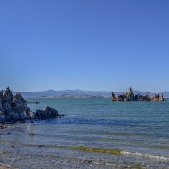
INTERESTING ATTRACTIONS AT AND NEAR MONO LAKE. Mono Lake is situated on Route 395 in the Eastern Sierras. From Route 395, you need to turn east on Route 120, where you can drive to a parking lot located near Mono Lake South Tufa, or to a parking lot located near Navy Beach. My visit to Mono Lake was part of a vacation trip having several destinations, including Mono Basin History Museum at 129 Mattly Ave. in the village of Lee Vining, Obsidian Dome, June Lake, the gondola ride at Mammoth Lakes, and Devil's Postpile Nat'l. Monument. Attractions at Mono Lake include the tufa towers (also called tufa spires), which resemble candles covered with gobs of melted wax, and sand tufa (found at Navy Beach), which resembles Gothic cathedrals. Other attractions at Mono Lake are bird-watching and opportunities to learn about the foods (alkali flies and brine shrimp) preferred by these birds. MY PHOTOGRAPHS. Attached are photographs showing the sand tufa at Navy Beach. In one of my photos, you can see the Sierra Mountains in the distance, where the nearest mountains include Mt. Warren (12,300 feet tall), Lee Vining Peak (6,800 feet), Mono Dome (10,600 feet), Williams Butte (8,400 feet), and Mt. Dana (13,000 feet). The brightly colored bushes in my photographs are Rubber Rabbitbrush, which is distinguished by its bright green color and yellow flowers in late summer. TUFA. Tufa is formed when fresh water rises upwards, through the porous ground, and where the fresh water (buoyant, because it is fresh) rises through the salty waters of Mono Lake. The porous ground takes the form of pumice (a volcanic mineral). As the fresh water rises from the bottom of the lake, there is a zone where the minerals (calcium carbonate; CaCO3) precipitate out of the lake's water and forms a spire-shaped structures made of cement. Two types of tufa occur at Mono Lake. One of these is found at the southwest corner of the lake, which resemble candles covered with lumpy melted wax. These are called, "Mono Lake South Tufa." The other kind of tufa, called "sand tufa," is found at Navy Beach, and this kind of tufa resembles a cluster of vertically-aligned branches (branches cut off from trees) that supports a flat pancake made of stone, and where this stone pancake supports another cluster of vertically-aligned branches, where this second cluster supports another stone pancake. BIRDS. The Red-Necked Phalarope stops in August and September, to eat brine shrimp until their body weight doubles. Then, these birds continue their migratory flight to South America. Another bird, the Eared Grebe, also stops at Mono Lake, and eats brine shrimp until their body weight triples. Then, this bird continues its migration. The Eared Grebe is distinguished by its bright red eyes. The California Gull builds its nest on Negit Island in Mono Lake. FLIES AND BRINE SHRIMP (yummy food for birds). During the summer, millions of alkali flies settle down at the edge of Mono Lake. The fly in swarms, a few inches above the ground, and the swarms look like little black clouds. A type of fly called, Ephydra hians, has many hairs on its body. These hairs are good at trapping air, and the air takes the form of a little bubble around the fly. The fly can stay under water for 15 minutes because it is able to breath the air in the bubble. The fly dives under water to feed and to lays its eggs. Regarding the brine shrimp, its population in Mono Lake decreases dramatically every autumn, shortly after the arrival of hundreds of thousands of Eared Grebes. BOATING. Visitors are permitted to take boats, such as canoes and kayaks, on Mono Lake. From April first to September first, boaters are not allowed to approach within 200 yards of offshore tufa towers, because these months are nesting season for ospreys. REFERENCES (1) M.R. Rosen (2015) Sixth International Limnogeology Congress Field Trip Guidebook. U.S. Geological Survey (see, page 76 of 99 pages). (2) Dickinson and van Breugel (2017) Proc. Nat'l. Acad. Sci. 114:13483-13488. (3) Johnson, Weber, and Worth (1983) At Mono Lake: A Photographic Expedition. (4) Wierzchos, Ascaso, Nealson (2015) Chemical Geology. 217:77-87. (5) Cooper, Winkler, Lenz (1984) J. Animal Ecology. 53:51-64. read more


I've always been fascinated by isolated, alien, and yet beautiful natural sceneries. Mono lake is one of them. This lake houses little life except from seasonal migratory birds, and breeds a lot of Alkali flies, but it's worth a visit. On a calm clear day, this lake reflects the very mountains and skies around it like a clear mirror. It's breathtaking to see and very picturesque. It is easy to find parking and the lake is just off the main road. Easy access and fun to discover. The strange calcified Tufas are definitely interesting to see in person and take a shot. You also get to learn about some conservation effort to keep Mono Lake alive, which is pertinent to environmental sustainability. read more


5 years ago
It is a beautiful place, I recommend it, it is something you cannot believe! the water is twice as salty as sea salt, my family liked it too much read more


6 years ago
Had a chance to explore this place since I missed out on my first trip due to fire back on 10/26/2020. Came here on a Sunday 12/6/2020 and there were around 4 ppl beside my group of 7. Also make sure to wear good shoes since the limestone can get stuck onto your shoes. The limestone from afar looks like snow but it isn't. This is a unique place to stop by and explore. read more
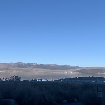


4 years ago
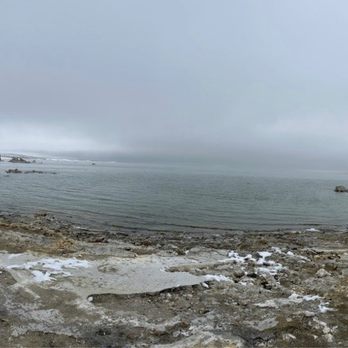
Visit one winter day early in the morning, cold and fog, quite different feeling than summer. read more


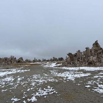

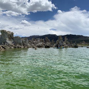
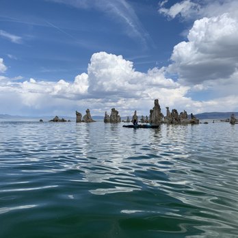
Wow - such an amazing experience to kayak among the Tufa. The water here is more alkaline and salty than the ocean and has such a cool color as a result. Like nothing I ever have seen or experienced. Such a contrast to the area that surrounds it. The Tufa rise above the water and provide a maze for kayaking within. It is a nesting area for Osprey and we could view and photograph them from a safe distance. I highly recommend a visit, even if you do not go out on the water. read more







More info about Mono Lake South Tufa Area
Ask the Community - Mono Lake South Tufa Area
Review Highlights - Mono Lake South Tufa Area














Mono Lake South Tufa Area - hiking - Updated August 2026
Best of Lee Vining
People found Mono Lake South Tufa Area by searching for…
Swimming Holes in Lee Vining, CA
Things to Do in Lee Vining, CA
Natural Hot Springs in Lee Vining, CA
Sunrise View in Lee Vining, CA
Gold Panning in Lee Vining, CA
Watch Sunset in Lee Vining, CA
Swimming Lakes in Lee Vining, CA
National Parks in Lee Vining, CA
Playgrounds for Kids in Lee Vining, CA
Fishing Spots in Lee Vining, CA
Trending Searches in Lee Vining, CA
Antiques near Mono Lake South Tufa Area
Barbershop For Men near Mono Lake South Tufa Area
Bike Shop near Mono Lake South Tufa Area
Boating near Mono Lake South Tufa Area
Cliff Jumping near Mono Lake South Tufa Area
Consignment Shops near Mono Lake South Tufa Area
Dog Friendly Beaches near Mono Lake South Tufa Area
Eyebrow Threading near Mono Lake South Tufa Area
Fishing Spots near Mono Lake South Tufa Area
Kids Haircut near Mono Lake South Tufa Area
Lakes near Mono Lake South Tufa Area
Lookout Points near Mono Lake South Tufa Area
Parks near Mono Lake South Tufa Area
Pedicure near Mono Lake South Tufa Area
Permanent Makeup near Mono Lake South Tufa Area
Picnic Areas near Mono Lake South Tufa Area
Playgrounds near Mono Lake South Tufa Area
Preschools near Mono Lake South Tufa Area
Sunrise View near Mono Lake South Tufa Area
Browse Articles
Browse Nearby
Browse Brands
Related Searches in Lee Vining, CA
Affordable Canoe Rental Options in Lee Vining, California
Affordable Kayak Rental Services in Lee Vining, California
Affordable Long Term RV Parking in Lee Vining, California
Affordable Paddle Board Rental in Lee Vining, California
Best Dog Hiking Trails Around Lee Vining, California
Best Fishing Locations and Guides in Lee Vining, California
Best Fun Things to Do in Lee Vining, California
Best Parks for Parties and Events in Lee Vining, California
Best Places for Horseback Riding in Lee Vining, California
Best Pontoon Boat Rentals Near Lee Vining, California
Best Spots for Star Gazing in Lee Vining, California
Best Water Parks for Kids in Lee Vining, California
Check Out Great Playgrounds in Lee Vining, California
Check Out Off Road Trails in Lee Vining, California
Discover Baseball Fields Around Lee Vining, California
Discover Dog Friendly Trails to Explore in Lee Vining, California
Discover Free Parking Options in Lee Vining, California
Discover Popular Bike Trails in Lee Vining, California
Discover Popular Photo Spots in Lee Vining, California
Discover Top Boat Tours in Lee Vining, California for All Ages
Discover Top Nature Parks to Visit in Lee Vining, California
Discover Top State Parks to Visit in Lee Vining, California
Discover a Hiking Trail in Lee Vining, California
Discover the Best Beaches in Lee Vining, California
Discover the Best Night Hike Trails in Lee Vining, California
Dog-Friendly Hikes With Dogs in Lee Vining, California
Enjoy Camping Adventures Around Lee Vining, California
Enjoy Kayaking Adventures in Lee Vining, California
Enjoy Off Leash Dog Hikes in Lee Vining, California
Enjoy Tent Camping Spots Around Lee Vining, California
Enjoy the Best Picnic Spots and Ideas in Lee Vining, California
Enjoy the Best Tubing Experiences in Lee Vining, California
Enjoy the Best Walking Trails in Lee Vining, California
Experience Thrilling White Water Rafting in Lee Vining, California
Experienced Fishing Guides Available in Lee Vining, California
Explore Beautiful Parks and Green Spaces in Lee Vining, California
Explore Boat Rentals for Every Need in Lee Vining, California
Explore Easy Hikes Perfect for All in Lee Vining, California
Explore Free Picnic Areas Around Lee Vining, California
Explore Fun Activities to Do in Lee Vining, California
Explore Parks With Lakes to Visit in Lee Vining, California
Explore Parks With Pull Up Bars in Lee Vining, California
Explore Picnic Parks Near Lee Vining, California
Explore Popular Campgrounds Near Lee Vining, California
Explore Popular Picnic Areas Around Lee Vining, California
Explore Popular RV Parks Around Lee Vining, California
Explore Scenic Lakes to Visit in Lee Vining, California
Explore Secret Spots Worth Visiting in Lee Vining, California


