Mount Bonnell Photos


You might also consider


More like Mount Bonnell
Recommended Reviews - Mount Bonnell
Start your review...


Reviews With Photos


I would say the view is probably one of the best you are going to find in South Texas! I am from Idaho where the mountains can be upwards of 12,000 feet, and after living here for two years it was nice being on top of an area I can look down at rather than just being on flat ground or the "hill country."


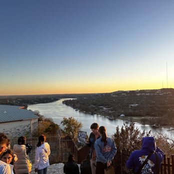
Mount Bonnell is a local gem, a perfect date spot or somewhere to just enjoy the sunset. It's a short walk up the stairs (maybe about 100 steps) from the parking to the pagoda-like terrace that overlooks some very scenic homes and has an excellent view of sunrise and sunset. I never actually did the full hike, only just went up to enjoy the scenery. It's less than 15 minutes from major Austin eateries and local spots, so it's a true gem within the city area as opposed to some hikes that are 30 minutes or an hour away. No bathrooms or garbage bins here is the one downside. Take your trash with you!


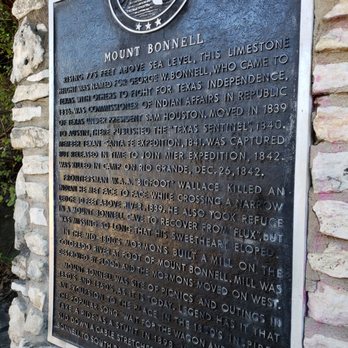
When time is of essence and you want to get in a short hike with views, make sure to hit this spot. The drive up was quite nice, lots of beautiful homes...multimillion dollar homes! You'll see an area with plenty of parking available, doused here and there with fruit/agua fresca stands. Anywhere you park, you'll hike up a steep short path and once you've reached the top, gorgeous river and Texas country views abound. Lots of photo opportunities everywhere. Also, a small historical area with information regarding Mount Bonnell was picture worthy. Check it out!


Super views good vibes ! Lots of nature that makes you feel so grounded to earth! Definitely need to go for a hike again!


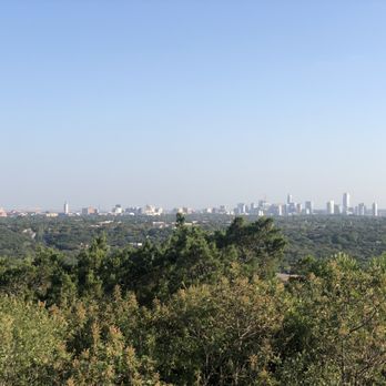
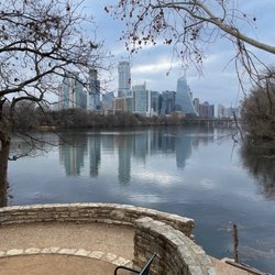
Highest point in Austin area. At the overlook you can see downtown Austin skyline, Colorado River and it's surrounding. You don't have to use the stairs to go up to the top, go to the other end of the parking lot and u can hike up to the top. It is a must see if u are in the area. Watch out for car break in tho.


I've been to Mount Bonnell a couple of times but it's been a long while since I've been recently. It really hasn't changed much over the last 4 years; it tends to be pretty packed most evenings and especially on the weekends! There is parking along the road but be VERY mindful of locking your car and keeping valuables out of site because this is a common place where people's cars get broken into unfortunately. The walk up to the lookout is relatively short, I wouldn't call this a hike, it's more a big outdoor staircase to a pretty overlook where you can see the river and downtown Austin in the distance. It is lovely at sunset though! And you can walk a little bit further down from the lookout but as far as I know there isn't a main trail or a longer hike (but maybe there is one and I just don't know). Overall if you're visiting Austin or here for a short period of time, you definitely should make at least one trip out to Mt. bonnell! It isn't a place you really need to come visit several times tho unless you just like the view at the overlook.


Anyone under the misunderstanding that Texas is flat,just needs to climb the Stairs of Mount Bonnell. While only 800 ft to the top,the stairs at almost a 45 degree angle can be moderately challenging if your over 40! If you're in the Austin area and want a break from the traffic, congestion and overbuilding,take a short trip to Mt Bonnell for a breather. Guaranteed to lower your blood pressure. Certainly a 5 Star View... Go!
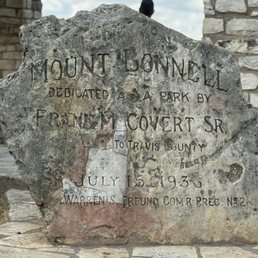

Texas is flat so this mount has a view Easy hike Panoramic views of city skyline and lake Austin. Almost 800ft elevation No restrooms Free Parking available Dogs allowed


Lots of steps to get to the point, but wow was it worth it! The view was gorgeous and perfect for photos. Just be careful of the steps and hold onto the rail, my young daughter tripped a few times since it's a bit uneven.


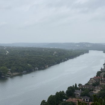
Loved visiting Mount Bonnell on an overcast day! My GPS took me right to the bottom of the steps, where it was easy to park. I was a little nervous about parking, but it was easy! The flight of steps is steep, but not too bad. Once at the top you can look out and see the river and beautiful houses. This attraction is free and there were people having picnics up at the top. I would go back here. I was SO nervous that people let their kids just run wild up on top of the cliff. It is definitely not safe since you can just walk or stumble right off of the edge. I'd love to go back when the sun comes up. Pretty spot to take in the scenery!


Such a special spot in Austin! The views never cease to be breathtaking. Highly recommend coming at sunset. There are some spots to sit for a cute picnic. Be warned that at peak times there might be a lot of people and you may need to wait to take a photo. The initial climb up is definitely a bit tiring, approximately 50 stairs.


Back at Mount Bonnel after 3 yrs. It's a wonderful little scenic stop over in the heart of Austin.


First time coming here!! There may be a short hiking path but we drove up to the parking spot where we just climbed up the stairs of 100 steps etc. from the top, the view was very nice and beautiful! You'll get to see either the scenery of the downtown Austin or the river! It's a nice location to look out the view and enjoy nature!! Come see it and have fun! Cheers


3 years ago
Fun little elevation with some decent views of the river and a few short trails to hike. It is also 'pet friendly', which is one of the reasons we went. read more


3 years ago
Okay the stairs were a killer lol. Other than that the view is amazing and there's a few trails and pic nic tables. Parking was easy during a Friday lunch the houses across the water are stunning im sure this place would be beautiful during sun set read more

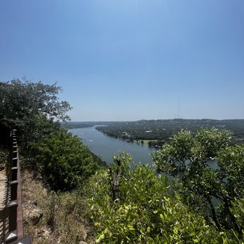


Great, easy spot for a beautiful view! We were worried it would be too much of a hike because of the humidity. However, it was extremely easy! Once you're up the stairs, the view is just to your right. I recommend coming in the afternoon for a sunset picnic. read more

6 years ago
Going up them stairs is on another level of suffering for my couch potato self. But getting to the top was well worth it! Those views are crazy good. Very romantic spot too. Even have tables up there if you want to have a small picnic. BUT CLEAN UP AFTER YOURSELF! read more


8 years ago
Mount Bonnell is really small and kind of hard to say it is a mountain but it is very pretty to go up the flight of stairs and see the view. The view is really nice and relaxing. A great place for a little picnic and some pictures. It is up high so be careful if you have kids or dogs and watch them since some areas of the cliff is only protected by the string. I love to visit here whenever I am in austin and do a little picnic with some sandwiches. read more


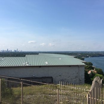
The first time I went I didn't get it. I was underwhelmed. The stairs are brief...not a workout on their own unless you go up and down them a bunch of times. I got to the top and there was no real reward. I walked to the left and saw the bench that would be an "awwww" spot if someone took you there for a picnic date but just a regular old bench without a basket full o' goodies. And then I kept walking and there was slanted/jagged edge rock formation that provided a vantage point to see the lake and some of downtown but it's pretty obstructed. I left thinking, nawstin...as in, Naw, Austin. I returned recently with a GF in tow so we could get fresh air and some steps in. We did the stairs a couple times to break a sweat and walked to the left again bracing myself for another sigh of that's nice. When we were about to go down the stairs to head out, I noticed people going to the right, so we decided to follow the herd (at a safe distance, of course). Oooooohhhhhhhhhhhhhhh! Now I get it. You can see much more of the lake and greenery, as well as the 360 bridge in the distance. The lesson here? Everything he owns in the box to the left BUT the great views are to the right! read more


4 years ago

2 years ago

I'm quarantined rn, and I'm craving a Freddy's Frozen Custard double cheeseburger AND a hotdog plus I'm going to eat a large order of french fries. I'm not playing.... I'm being fr. So don't be surprised if you see a Freddy's review coming soon just for the sake of reviewing things. So, I know it's the apocalypse and everything... but like, I had to get out yesterday. I've been locked in my apartment drinking germex and lathering in disinfectant for DAYYYYSSSS. My multivitamins are critical right now -- DO NOT LET YOURSELF GET VITAMIN D DEFICIENT. However pills don't beat the real thing. And Vitamin D or VD if you will ... actually comes from the sun. El sol as our friends from the south would say. AND NOTHING BEATS VD FROM THE SUN. Say it with me. I want the sun to give me VD.... Lol I actually hadn't been to bonnell in YEARS.... but like, I used to go all time -- and I may or may not have drank cab on the edge of a cliff wondering what it would be like if I had 78 million dollars and could live on the water with my own personal moat. Yesterday... I decided to take a visit. Say it with me. I want the sun to give me VD. I must say, it's changed a lot. It's uhh how do you say... colonized... no... corporate... idk. There's a fence now. And there's signs and stuff. It used to be untamed, but now if you really want to experience the real deal you may or may not have to hop a fence. I'm not condoning breaking the law. But remember... it's the apocalypse so like, if a bear does it business in the woods and no one is there to smell it, did it do it? I don't get that adage, but I think you're probably getting my point here. Anyways. Still beautiful, and I needed the VD. So, it's still a great place. Enjoy It still read more
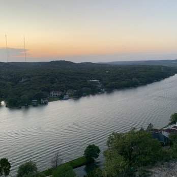


If you haven't taken a trip to Mount Bonnell and you have lived here longer than a year then you are missing out on the embracing of the up and down beauties of the sky's and how it hits the beautiful water during your time and visit. The stairs can be a little challenging if you are not used to going up so many however there is another entrance way where you can work your way up to the top. This is a great place for reading, meeting someone new, taking a short walk, distressing the excitement of our new days that we experience, or even going up to see the sunrise prior to a great breakfast in the morning read more


6 years ago
Asked a local where we could go to hike and he recommended this. Full disclosure, this is not a hike... Hardest part was the stairs that reminded you how in or out of shape your butt might be, but a good 30 minute walk for the view. Not hard and not long, but a nice sweat. Had a good time looking at the views of Lake Austin which is part of the Colorado River and the gorgeous houses surrounded. read more


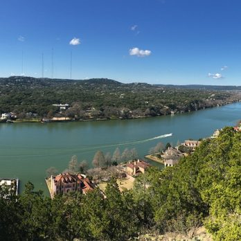

7 years ago

6 years ago
Lovely spot! Great for just gazing at the water view, hills, and multi million down houses nestled in them! We went on Sunday night and it wasn't crowded. Plenty of good spots to take pictures, sit down, and just chat. I recommend bringing a blanket because the pavilion can be rocky. This is a nice spot to spend an hour or two after a dinner or just for a cute hangout. Glad I experienced Mt. B! read more


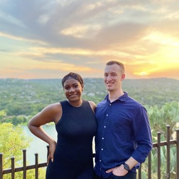

4 years ago


If you want very little exercise(probably 100 steps) and Amazing view then make sure to check this place out. It gives the same view from different points on the top but they are beautiful to watch.Been there are around 10.3O am and clicked some pics and relaxed for a bit on the rocks enjoying the views and the beautiful houses next to colorado river. Pros: -------- Amazing View Free Parking( No designated parking space but u can park near the steps) Great for photoshoots Nature preserve close by Cons: -------- None Probably Sunsets would be amazing to watch but could not stay due to time constraints. read more


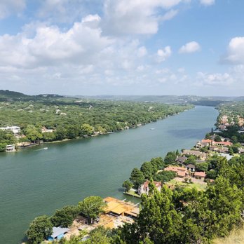


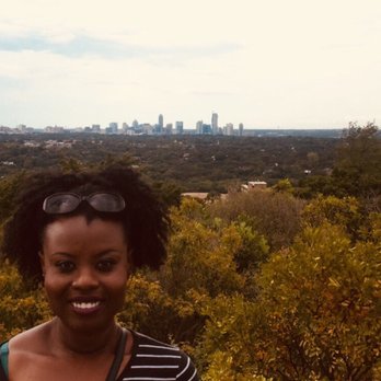


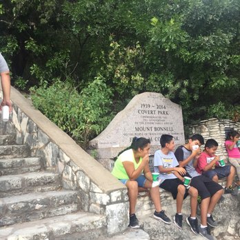


Great spot to take in panoramic views of Austin. Free parking, but limited. Sunset is the busiest time, but great spot to see a great sunset. There is no bathroom and 105 steps to the top. Trail head is rocky, but manageable If you don't want to take the stairs. The people that live in the neighbor drive too fast so be careful walking across the street or behind cars. Also be careful backing out as well. People bring their pets, so if you are afraid be mindful. read more


8 years ago
Mt Bonnell was a beautiful place to end the day, by watching the sunset! Although it was beautiful, I anticipated a nice hike but it was only a 5 min hike up to the top. The view was absolutely breath-taking, peaceful, scenic and it overlooks the Colorado River. It was worth a visit but not worth it if you are looking for a good hiking spot. I would recommend it to a friend to visit but not if they're looking for a good hiking trail. read more
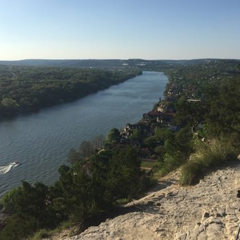


3 years ago
Literally can't say anything bad about this majestic yet locally hidden Mecca whether your a teenager trying to "escape" the confines of your TARRY TOWN rough life or just a visitor take a hike take a second and take a breath then take a pic! And of course bring the pups and maybe even some good wine or picnic accoutrements read more


5 years ago
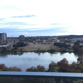
Incredible views. Downtown is visible from this place. Sunsets are the best from this hill read more
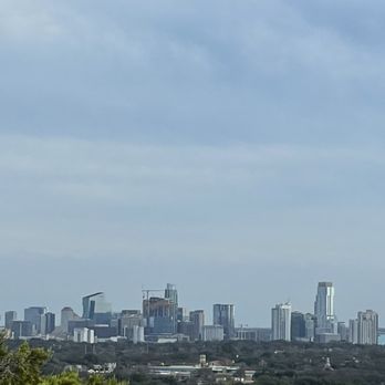


I would not consider this as a hike, but more of a stroll or walk. Its not hard at all as the beginning is mostly stairs. Once you reach the top where you can see river, thats when we stopped. I did it in sandals. However, I did notice that there was a trailer that went further along but not sure where that leads to. Good place to stop by for a nice view. read more
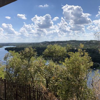
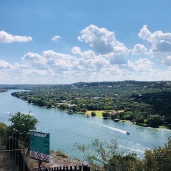


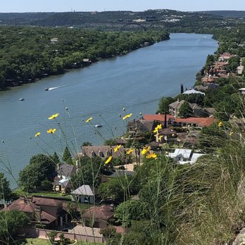


Mount Bonnell offers some of the best views in Austin and a quick morning hike that is manageable for all ages and hiking abilities. My friend took us here on a chilly weekend morning and the area was full of running groups, families with small children, and the curious tourist like myself. A short 200 step hike or so up to the top presents some amazing views of the river and million dollar mansions that I will likely never be able to afford myself. However, it's nice to dream right? After sulking in the views for a few moments, you can walk a little more to find a spot where you can reflect individually or with colleagues. The sites and colors are stunning on a beautiful, sunny day, and I would say this is definitely a must-do if you are in Austin. Whether you are a local or visiting for the first time, Mount Bonnell will always leave your breathless. read more


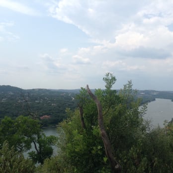
I'm sure if you aren't the adventurous type, you would have stayed on the directed path, walked up, viewed, and left. You wouldn't think to detour off the path unto the forest and find really cool nature things.. not many people have that drive to explore interesting things. Yeah, it's a lot of robot humans on this earth, and a few of the ones that dare for more. I'm the type that screams adventure; I adore rock hounding, undirected paths into the wilderness, I'm not afraid of flying bugs, or snakes. Now Austin has lots of nature outdoorsy things, one you'll have to visit is Mount Bonnell. You will fall in love with this place like I did. Do find yourself some minerals like I did, if you can't get them out the ground, use some knowledge like hitting two stones together and pop goes the weasel, you just discovered some calcite, celestine, and strontianite embedded within the limestone. I'm telling you geologists, rockhounds, nature lovers, or even archaeologist this will excite you. As it has excited me. The view from the top is truly breathtaking beautiful. The closest thing Houston has to this I would say at Buffalo Bayou park or if you are stuck in traffic on the freeway you can see such a view of the city. Oh and getting to Mount Bonnell, the streets wine in and out as if you are in California, you got yourself looking at limestone on side and great big hills on the other, zipping through the road. It was a ride! I'm glad my brother brought my family here, especially knowing he has two geology lovers as sisters. read more



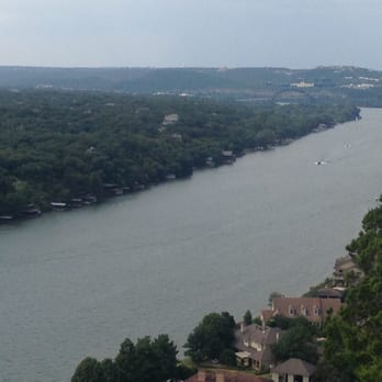


10 years ago
What an amazing adventure. We had a great time climbing this mountain. It's not really a mountain but it was a workout. Mount Bonnell is the perfect getaway for those wanting to hide from the city for a bit. There isn't a fee to enter the park or to park. Bring water with you. There aren't any vendors. This is a great place to bring the family. The view was phenomenal; I got a lot of great shots. read more
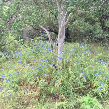


I love the view from this place. It is such a cool little secret spot that is only like 10 minutes from my apt. I don't thin a lot of people know about this place and how cool the view is from up there. If you are looking to impress a date with a beautiful sunset, this is the place to do it! I can tell you first hand, that bringing a date here for an evening sunset will score you many brownie points. :) It is perfect for a couple. Be warned though, even though it is not ridiculously packed with tourists most of the time, there will be a crowd around sunset time. During the day, it will be relatively empty. There are no restrooms or water fountains at this spot, so plan accordingly. read more


15 years ago
After an amazing dinner in Austin, we wanted to wait before we indulged in dessert. Mount Bonnell was the perfect place to see a sunset. We drove up and found lots of easy parking along the road. Within a couple of minutes we were looking out over the lake and watching the sun set. I loved that it was so accessible. No hiking shoes needed. I loved that it was free! No parking costs. I loved that you could see the lake, view, and sunset from anywhere and didn't have to climb to the top. We didn't climb to the top but we still had a great view. This is the perfect place to see a sunset or just hang out. read more


This is a hike for families, friends, lovers, man's best friend(s), and everyone in between. A simple, sweat-free (unless it's in the triple digits) tour of the beautiful community of Austin, TX. This is a great day hike for those who are in the area, and it's a MUST-SEE for those visiting. Watch the sun set and its a gorgeous view of Colorado River, and the beautiful estates that you can see around it. Mt. Bonnell is a must, for those touristy days in ATX. When you get almost to the tippity-top, go to the benches area, and stand on the top of the table. You'll get a stellar view of the skyline of downtown Austin, and this is where you should definitely take some nice snapshots of you, or just the skyline in all it's glory surrounded by trees. This is a great panorama opportunity. That, and of course, the Hope Outdoor Gallery where you can capture the Capitol, too. I've heard that if you hold hands with your love the whole way up here, that you'll have everlasting good luck in your relationship. So, tread on, lovely people. And spread the positivity. :) read more

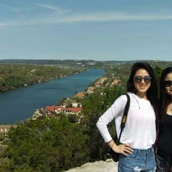

Mt Bonnell is just one of those places you have to visit when you are in Austin. It's scenic "Mountain" top view of the city and panoramic view of the Colorado river makes it worth the short stairway climb to get up there. (780 feet above sea level, however a lot of it is traveled by car) On top of Mt. Bonnell, they have a main trail that follows you to several scenic stopping points so you can take pictures or simply stand at awe. You would mostly find small groups of people, perhaps family or friends, take pictures at these spots. If you prefer an even closer view, they have smaller trails off the beaten path (in between shrubs and bushes) that would lead you closer to the edge (although, I'm sure it's not recommended). The trip here should only take about an hour, but mostly depends on if you are the person to sit on a rock in "zen" and meditate for hours on end. Parking has never really been an issue for me. They have plenty of spots just near the stairway entrance. If the parking lot is full, you normally see people pull out in no time. read more

More info about Mount Bonnell
3800 Mt Bonnell Rd
Austin, TX 78731
Directions
(512) 974-6700
Call Now
Visit Website
https://www.mountbonnell.com
Hours
Indoor Amenities
Outdoor Amenities
Ask the Community - Mount Bonnell
How long does it take to get to the top?
In a few minutes really. It should be easy for most.
I have a very active 4 n 5 yr old and was wondering if it would be too dangerous for them? is their fencing of any sort of just straight cliff down? Or should i have a stroller?
A stroller won't work, long flight of steps If they climb up they will be tired. No safety fence.
Is this place stroller friendly?
Maybe a foldable small one but I wouldn't recommend as there're steep stairs. I carried my 2yr old daughter up to the top and was glad I didn't bring the stroller :)
Review Highlights - Mount Bonnell
You might also consider





















Why does Yelp recommend reviews?
27 reviews that are not currently recommended
The reviews below are not factored into the business's overall star rating.
2 years ago


2 years ago

5 years ago
11 years ago

9 years ago

3 months ago

10 years ago

15 years ago

11 years ago

18 years ago

10 years ago

12 years ago
10 years ago

8 years ago

13 years ago
13 years ago

9 years ago

13 years ago

12 years ago
Mount Bonnell - hiking - Updated August 2026
Best of Austin
People found Mount Bonnell by searching for…
Trending Searches in Austin, TX
Cliff Jumping near Mount Bonnell
Consignment Shops near Mount Bonnell
Cruising Spots near Mount Bonnell
Dog Friendly Beaches near Mount Bonnell
Dog Friendly Things To Do near Mount Bonnell
Ear Piercing near Mount Bonnell
Eyebrow Threading near Mount Bonnell
Fishing Spots near Mount Bonnell
Flower Fields near Mount Bonnell
Hair Braiding near Mount Bonnell
Kids Haircut near Mount Bonnell
Permanent Makeup near Mount Bonnell
Picnic Areas near Mount Bonnell
Playgrounds near Mount Bonnell
Public Golf Courses near Mount Bonnell
Public Running Track near Mount Bonnell
Rock Quarry near Mount Bonnell
Running Trails near Mount Bonnell
Scenic Night View near Mount Bonnell
Scenic Overlook near Mount Bonnell
Sunrise View near Mount Bonnell
Swimming Holes near Mount Bonnell
Things To Do With Kids near Mount Bonnell
Trading Card Shops near Mount Bonnell
Used Furniture Stores near Mount Bonnell
Volleyball Courts near Mount Bonnell
Browse Nearby
BEST of Austin, Texas Coffee near Mount Bonnell
BEST of Austin, Texas Restaurants near Mount Bonnell
BEST of Austin, Texas Things to Do near Mount Bonnell
BEST of Austin, Texas Walking Trails near Mount Bonnell
BEST of Austin, Texas Breakfast near Mount Bonnell
BEST of Austin, Texas Parks near Mount Bonnell
BEST of Austin, Texas Caves near Mount Bonnell
Browse Brands
Related Searches in Austin, TX
Affordable Kayak Rental Services in Austin, Texas
Best Dog Hiking Trails Around Austin, Texas
Best Fishing Locations and Guides in Austin, Texas
Best Nature Trails for Hiking in Austin, Texas
Best Off Leash Dog Parks in Austin, Texas
Best Parks for Parties and Events in Austin, Texas
Best Places for Horseback Riding in Austin, Texas
Best Sightseeing Experiences Available in Austin, Texas
Best Water Parks for Kids in Austin, Texas
Best Waterfalls and Swimming Holes in Austin, Texas
Check Out Great Playgrounds in Austin, Texas
Check Out Off Road Trails in Austin, Texas
Discover Baseball Fields Around Austin, Texas
Discover Dog Friendly Trails to Explore in Austin, Texas
Discover Fun Toddler Parks in Austin, Texas for Your Little One
Discover Kid Friendly Hiking Trails in Austin, Texas
Discover Popular Bike Trails in Austin, Texas
Discover Soccer Fields in Austin, Texas Near You
Discover Top Nature Parks to Visit in Austin, Texas
Discover Top State Parks to Visit in Austin, Texas
Discover Walking Parks in Austin, Texas Near You
Discover a Hiking Trail in Austin, Texas
Discover the Best Beaches in Austin, Texas
Discover the Best Kids Park Spots in Austin, Texas
Discover the Best Night Hike Trails in Austin, Texas
Dog-Friendly Hikes With Dogs in Austin, Texas
Enjoy Camping Adventures Around Austin, Texas
Enjoy Kayaking Adventures in Austin, Texas
Enjoy Off Leash Dog Hikes in Austin, Texas
Enjoy Scenic Places to Walk in Austin, Texas
Enjoy Tent Camping Spots Around Austin, Texas
Enjoy a Beautiful Waterfall Hike in Austin, Texas
Enjoy the Best Picnic Spots and Ideas in Austin, Texas
Enjoy the Best Walking Path in Austin, Texas
Enjoy the Best Walking Trails in Austin, Texas
Explore Beautiful Parks and Green Spaces in Austin, Texas
Explore Easy Hikes Perfect for All in Austin, Texas
Explore Free Picnic Areas Around Austin, Texas
Explore Fun Activities to Do in Austin, Texas
Explore Parks With Pull Up Bars in Austin, Texas
Explore Popular Campgrounds Near Austin, Texas
Explore Popular Dog Walking Trails in Austin, Texas
Explore Popular Kids Parks Throughout Austin, Texas
Explore Popular Picnic Areas Around Austin, Texas
Explore Popular RV Parks Around Austin, Texas
Explore Scenic Lakes to Visit in Austin, Texas
Explore Top Dog Parks in Austin, Texas Near You


