Mount Woodson Trail Photos



You might also consider


More like Mount Woodson Trail
Recommended Reviews - Mount Woodson Trail
Start your review...


Reviews With Photos

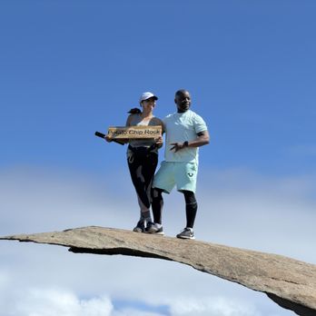
A killer hike but worth the trek for the outstanding views! Chances are if you're hiking this trail, you're on your way to the all too popular Potato Chip Rock. This is the trail that will get you there. Since Potato Chip Rock is located somewhat in the middle of this trailhead, you will have to decide how long that you want your hike to be to get there. The most popular way to get there (and also the longest and most difficult way) is to begin your hike from Lake Poway Park. Depending on where you're located, this route may be the fastest and easiest way to get to the trail. If beginning from Lake Poway Park, the hike to and from Potato Chip Rock will be about 7 miles roundtrip through a mostly sandy and rocky path and a higher elevation gain. The second way to reach Potato Chip Rock is to begin the trail from highway 67 near the Romona Cal Fire Station. This hike will be shorter (about 4.5 miles roundtrip) with less overall elevation gain, but much steeper and way less crowded. This part of the trail is mainly a fire road until you Potato Chip Rock. I took this trail to the rock, and it was peaceful and challenging without being overwhelming. There are a couple of things to be mentioned here. For one, this hike is completely exposed and should be avoided during hot, dry spells. Bring plenty of water even if it appears to not be super hot or sunny outside. The constant uphill climb will tire you pretty quickly. The obvious: lather up on the sunscreen and wear a hat and sunglasses. I was burning up once I starting reaching the top. There's not much of a breeze on the way up, so be prepared to sweat. If beginning your hike from highway 67, look for the Romona Cal Fire Station and then make a U-turn AFTER you pass it. You cannot park at the Fire Station, but you can park on the road in front of it. Depending on what time you start (which should definitely be as early as possible when it hot out), you will probably see a line of cars parked on the side of the road. There's a small handmade sign that will say Potato Chip Rock and it will guide you the start of the fire road trail. This highway 67 side of the trail doesn't start off with the best views. However, once you start ascending up the hill, you'll have some scenic views of the city on your way up. There's no sign or anything telling you that you've reached Potato Chip Rock. The only way that you'll really know is if and when you see other people lining up for a picture, or if you're really looking for it. When I made it up there, I saw a few people standing in the shade who were trying to figure out if that was the rock. Indeed it was, and I certainly would have passed it had I not stopped with them. If you want to get a picture with or on the rock, you will have to wait your turn. I made the mistake of resting and not taking pictures right away before more people started to arrive. I was also pretty freaked out trying to climb to the top. If you have any fear of heights, they will be activated while you're standing on the rock. It's pretty damn scary and I felt like the wind was going to blow me to the ground, but I was able to take a few pictures before my fears really started kicking in. But it's WORTH IT! Get that picture while you can! Also, the weekend is probably the worst time to come here. I was visiting so I had the luxury of coming here on a weekday morning when it was pleasantly uncrowded. If you don't have that option, you really need to strive to start your hike at the butt crack of dawn, otherwise you'll be enjoying Potato Chip Rock with half of the city right there with you! But yeah... definitely a killer hike with a neat landmark. Would definitely come back to do this hike again in the future, but I think i'll try the longer route next time.
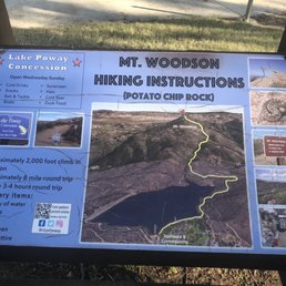

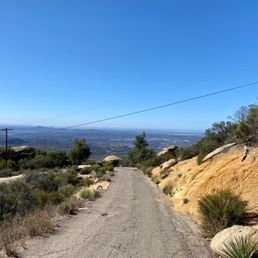
This is a fun hike with great views! Plus a fun photo op at the end! How to get here: The Lake Poway trail connects to the Mount Woodson trail, so you can park at Lake Poway. It's free on Saturdays and Sundays; otherwise $10 on weekdays. The trailhead begins to the right of the general store. Look for the yellow sign. You stay on Lake Poway trail for about a mile, and then follow the signs that direct you to Mount Woodson. The first part of the hike is paved dirt ish. Then it gets rocky, as in stairs/steps made by rocks. There is very little shade throughout, and there's a general incline the whole way. There is a vista point when you are halfway. At the peak, you will get to the potato chip rock. You will also see buttcheek rock on your way there. Coming back down is much easier; the last part without the rocks being the easiest. Bring a hat and plenty of water. Round trip is about 8 miles and 4 hours.


Review for mount Woodson hike only not the lake or park. Nice hike. I would suggest this hike to experienced hikers to those who are use to prolonged strenuous activity. Not a beginner hike but beginners would still have a lot of fun, however it is very steep and stopping too often for me is sometimes worse than just pushing through. Pros: -from the lake about 7-8 miles round trip - fresh air -great workout/training Cons: - not for those who require wheelchair or crutches,etc as the ground is naturally uneven. - parking fees $10


Do not underestimate this hike just because the mileage and elevation gain isn't as high as most of the other big trail hikes in So Cal. Mt. Woodson is a newer alternate peak addition. To the So Cal Six pack of peaks challenge, looking at the list of other hikes (7 of the 18 I've done) I figured this would be a breeze. While it's not as brutal as Mt. Baldy this trail is a workout for sure. There's 2 route that lead to the peak, a 7 mile total trail from the Lake Poway entrance (there's a charge for parking) or a 4 mile total fire road trail off road 67. We ended up taking the fire road route since lake Poway was only allowing online prepaid parking for their 4th if July event. Part of that trail feel way steeper than they look when going up. You'll have some great views of the area on the way up, & if you start your hike early enough in the day there probably won't be a long wait to take a picture on Potato Chip Rock.


Holy Moly Incline!! Fyi, the incline does not ease up or get easier, so be prepared. We showed up well before the sun in order to beat the large crowds that were certain to arrive as the day progresses. It was great having the trail almost to ourselves and not having to worry about walking up the mountain next to large crowds. Chose to take the shorter/paved trail at 4ish miles versus the longer route at more than 7 miles. Once we reached the potato chip rock, we were able to take our time enjoying the view and getting our pictures with the infamous rock! As I'm sure others have mentioned, be prepared to climb up a boulder and a jump across to reach the chip. It's a bit intimidating but it's not too bad. We helped each other so it was nice to have the extra support. Or the other option is to climb down around the boulder and then climb up onto the chip.


Did this hike the Friday before Labor Day weekend and there were only about 3 other groups on the trail, it was probably because we all did a risky (stupid) decision to hike this trail in the middle of the day, with a heat wave at that. Still, this trail deserves 5 stars bec it was a challenging, picturesque and well-kept trail. There is barely no shade so it took us 4 hours back and forth (until Potato Chip Rock) with a LOT of stops to take in a little bit of shade wherever possible. Clocked in around 7.6miles roundtrip. Reaching Potato Chip was a nice treat and we managed to enjoy it all for ourselves and rest a bit before heading back down. Getting to edge of the "potata chip" does require a small jump since there's a gap between the 2 rocks. It's perfectly safe/stable in my opinion but will need a little bit of courage to take that short leap. Personally preferred to "slide" down getting off the potato chip than jumping back up (short legs haha).


Awesome trail, for a great workout. A 7+miles out and back, with an elevation gain of 2000ft. Started at 6:30 before the sun was directly above my head, wished I would have started earlier, perhaps 5:30-6am. The trail is well maintained and trail markers through-out for easy navigation. It's an ascent all the way to the summit, with little breaks in between. This is classified as a moderate hike, very doable. If you are not accustomed to inclines, you might find this trail difficult. Take your time, take breaks, and stay well hydrated. There are no shaded section on this trail, you will be exposed to a lot of sun. The "potato chip rock" was underwhelming and the long line to snap a picture on it was discouraging. The summit is approx .50 mile up, past the rock near the towers. This is also a GREAT runners trail... Wear comfortable shoes, bring at least 2L of water and wear lots of sunscreen. Also, please, please, please wear head phones!!!


Super well maintained trail and much easier on your knees Vs other local trails. Did not see too many people (President day) and super easy to park at lake Poway. Went on cloudy day so bring layers as it was very windy at moment. Not very scenic per say (beside the small lake) and pretty much a 4 miles up and 4 miles down. The potato chip rock was so small compared to the illusion we saw from other photos. While this is a nice way to get your cardio, we still prefer iron mountain and especially via the Ellie lane trail which increased the r/t to 7.4 miles. All in all, a little disappointed a but still worth a visit.


Mount Woodson Trail to Potato Chip Rock was a pleasant 2 hour leisurely roundtrip trek (w/ another 0.5 hours spent at the rock formation). I liked it for the gradual incline (1,281 feet) and cardio that this trail offered, as well as the beautiful scenery of boulders, mountains, greenery and even saw a snow capped mountain from afar! (Anyone know what mountain this is? ) Went during mid afternoon on a weekday and there was ample street parking available. Getting to the potato chip platform can be challenging, make sure to wear hiking shoes with good grip. And bring a friend or two to help assist you down/ up . It's perfect to hike during San Diego's winter season, as it wasn't too hot, about high 50's to low 60's when I went. Limited areas with shade so bring a hat and sunscreen! Also, don't forget your water! Saw a family make hot coco at the summit with their thermos and though that was a clever idea!


Before there was a "potato chip rock" this was a nice trail to the telecommunication towers on top of Mount Woodson. Today, this trail is an international tourist trap. No, seriously...You'll find more tourist here than in Old Town. That's the downfall of this place, it's way too crowded. There are three ways to hike this trail. Most people park at Lake Poway for $10 (7 total miles) or the more adventurous will hike from the blue sky ecological reserve for free ( 10 miles ) but those looking for the shortest hike will take the backside trail to the top and it's also free (5 miles). I prefer the backside trail. - This is not an easy hike and if the weather is hot it can be very strenuous. That being said, people still bring dogs and strollers.. - Lime Bikes on top - There is wailing wall off the backside trail. You can put pebbles, ashes, or whatever in the small holes in the rock.


TLDR; you will be challenged 1) to get onto Potato Chip, the rocks curve in very deeply so be prepared to slowly inch down with just one leg and 2) to get off Potato Chip, there is no hand grip anywhere on the rock so first time I was able to inch down ok but second time I actually slid down, intentionally and unintentionally too (thigh all up against the rock) and got a bit bruised up, another hiker said she could've messed up her ankle coming back and I say my ankle almost was possible too the second time around so be careful -------------------------------- there's a long route that is easier since it has stairs (7mile) and there's a short route(4mile) that is more steep but is all up-hill... I came across the beautiful shorter route lol took about 90mins to 2hrs to complete and be back at my vehicle (reading the reviews, seems lots more have come across the 7mile hike...heh) Parking was "free" because everyone else pulled off of the highway (you know how you can only pull over for like emergencies on like a highway/freeway..yeah we all did that lol) how legal is it? I'm unsure lol was I worried about getting my car towed? Yes. But it's funny because there are 10 other cars with me too whom could've been towed lol I recommend at least 1 liter for this hike and to pack light. bring sunscreen and a hat and some snacks. There was about 5 minutes max of shade with all the gigantic rocks but other than that, it's all sun and all uphill. when you arrive at the top of this mountain, you'll be circling around the satellite towers before reaching Potato Chip. Have fun and Good luck!


If you're thinking about hiking Mount Woodson trail aka the famous Potato Chip Rock--just know... your legs are about to file a formal complaint. This hike is a little over 7 miles (round trip) and definitely on the "hard but worth it" side, with steady climbs, and rocky steps that will have you questioning "who's idea was this?" For trail details, I'd suggest checking out Alltrails before you go. Things to know: the trailhead starts at Lake Poway Recreation Area and there's a $10 entrance fee. Weather can be unpredictable--our hike started wet and ended sunny, so dress smart. Bring plenty of water, good shoes with traction, and a snack to reward yourself at the top (you earned it). The trail is fairly well marked, but pro tip: take pics at each fork unless you enjoy "bonus miles" on the way down. At the summit, expect a line to snap that iconic photo. And yes--you'll need to do a tiny "jump" onto the rock... which suddenly turns very intimidating when it's your turn. Some people bail, but it's totally doable. Challenging, a little chaotic, and 100% one of my favorite hikes. Your calves won't forgive you--but your camera roll will. read more



2 years ago
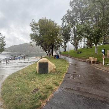
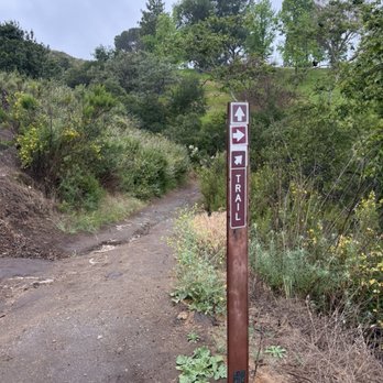
I know this trail as potato chip rock! We started the hike at 730am, ended at 11 All incline! There are a couple portable bathrooms along the trail. Beautiful view of the lake. Beautiful view of all SD on a clear day! Once you make it to the top you can take a picture on the chip! It's a little scary, but worth it just to say you did it! There's a 10 dollar parking fee. Bathrooms are clean. It's a very diverse park with lots to do! read more



2 years ago
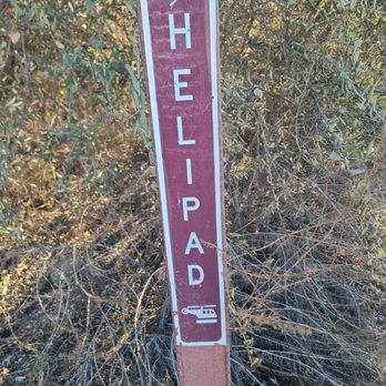
We arrived at the Lake Poway Recreation area around 10am; parking us $10 however they do offer free parking if you meet certain things like being in the military. There was plenty of parking when we arrived. Great views of the lake while you prepare for the hike and it looks like you can rent boats and paddle boats there too. A few families were enjoying this on their mother's day. The trail wasn't as busy as I'd thought it would be which was a good thing. There were dogs, kids, scrollers and all on the trail. Since there are a few different trails combined on this hike some may have not been going to up to potato chip rock. I clocked our hike to take nearly 3 hours and 30 minutes and nearly 7.27 miles from car to the turning point on the hike and back. I recommend anyone to try this trail but might not be the best for small kids and older pets. Bring plenty of water as there's no water during the hike but there is a snack shop at the starting point and it opens around 6am. Bring music and conversation for the long hike because you will need it. Hiking shoes not required but you feet will feel it on the way back. There seems to be a helipad around the 1.5 mile point, maybe for emergencies. Once we made it back down the trail it was very busy in the park and limited parking available (around 1:30pm). read more
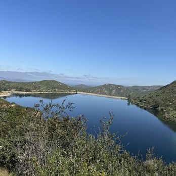


A killer hike but worth the trek for the outstanding views! Chances are if you're hiking this trail, you're on your way to the all too popular Potato Chip Rock. This is the trail that will get you there. Since Potato Chip Rock is located somewhat in the middle of this trailhead, you will have to decide how long that you want your hike to be to get there. The most popular way to get there (and also the longest and most difficult way) is to begin your hike from Lake Poway Park. Depending on where you're located, this route may be the fastest and easiest way to get to the trail. If beginning from Lake Poway Park, the hike to and from Potato Chip Rock will be about 7 miles roundtrip through a mostly sandy and rocky path and a higher elevation gain. The second way to reach Potato Chip Rock is to begin the trail from highway 67 near the Romona Cal Fire Station. This hike will be shorter (about 4.5 miles roundtrip) with less overall elevation gain, but much steeper and way less crowded. This part of the trail is mainly a fire road until you Potato Chip Rock. I took this trail to the rock, and it was peaceful and challenging without being overwhelming. There are a couple of things to be mentioned here. For one, this hike is completely exposed and should be avoided during hot, dry spells. Bring plenty of water even if it appears to not be super hot or sunny outside. The constant uphill climb will tire you pretty quickly. The obvious: lather up on the sunscreen and wear a hat and sunglasses. I was burning up once I starting reaching the top. There's not much of a breeze on the way up, so be prepared to sweat. If beginning your hike from highway 67, look for the Romona Cal Fire Station and then make a U-turn AFTER you pass it. You cannot park at the Fire Station, but you can park on the road in front of it. Depending on what time you start (which should definitely be as early as possible when it hot out), you will probably see a line of cars parked on the side of the road. There's a small handmade sign that will say Potato Chip Rock and it will guide you the start of the fire road trail. This highway 67 side of the trail doesn't start off with the best views. However, once you start ascending up the hill, you'll have some scenic views of the city on your way up. There's no sign or anything telling you that you've reached Potato Chip Rock. The only way that you'll really know is if and when you see other people lining up for a picture, or if you're really looking for it. When I made it up there, I saw a few people standing in the shade who were trying to figure out if that was the rock. Indeed it was, and I certainly would have passed it had I not stopped with them. If you want to get a picture with or on the rock, you will have to wait your turn. I made the mistake of resting and not taking pictures right away before more people started to arrive. I was also pretty freaked out trying to climb to the top. If you have any fear of heights, they will be activated while you're standing on the rock. It's pretty damn scary and I felt like the wind was going to blow me to the ground, but I was able to take a few pictures before my fears really started kicking in. But it's WORTH IT! Get that picture while you can! Also, the weekend is probably the worst time to come here. I was visiting so I had the luxury of coming here on a weekday morning when it was pleasantly uncrowded. If you don't have that option, you really need to strive to start your hike at the butt crack of dawn, otherwise you'll be enjoying Potato Chip Rock with half of the city right there with you! But yeah... definitely a killer hike with a neat landmark. Would definitely come back to do this hike again in the future, but I think i'll try the longer route next time. read more




1 year ago

1 year ago

4 years ago

This is a fun hike with great views! Plus a fun photo op at the end! How to get here: The Lake Poway trail connects to the Mount Woodson trail, so you can park at Lake Poway. It's free on Saturdays and Sundays; otherwise $10 on weekdays. The trailhead begins to the right of the general store. Look for the yellow sign. You stay on Lake Poway trail for about a mile, and then follow the signs that direct you to Mount Woodson. The first part of the hike is paved dirt ish. Then it gets rocky, as in stairs/steps made by rocks. There is very little shade throughout, and there's a general incline the whole way. There is a vista point when you are halfway. At the peak, you will get to the potato chip rock. You will also see buttcheek rock on your way there. Coming back down is much easier; the last part without the rocks being the easiest. Bring a hat and plenty of water. Round trip is about 8 miles and 4 hours. read more
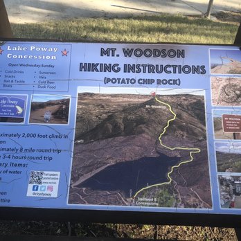
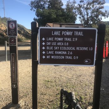


Review for mount Woodson hike only not the lake or park. Nice hike. I would suggest this hike to experienced hikers to those who are use to prolonged strenuous activity. Not a beginner hike but beginners would still have a lot of fun, however it is very steep and stopping too often for me is sometimes worse than just pushing through. Pros: -from the lake about 7-8 miles round trip - fresh air -great workout/training Cons: - not for those who require wheelchair or crutches,etc as the ground is naturally uneven. - parking fees $10 read more


Do not underestimate this hike just because the mileage and elevation gain isn't as high as most of the other big trail hikes in So Cal. Mt. Woodson is a newer alternate peak addition. To the So Cal Six pack of peaks challenge, looking at the list of other hikes (7 of the 18 I've done) I figured this would be a breeze. While it's not as brutal as Mt. Baldy this trail is a workout for sure. There's 2 route that lead to the peak, a 7 mile total trail from the Lake Poway entrance (there's a charge for parking) or a 4 mile total fire road trail off road 67. We ended up taking the fire road route since lake Poway was only allowing online prepaid parking for their 4th if July event. Part of that trail feel way steeper than they look when going up. You'll have some great views of the area on the way up, & if you start your hike early enough in the day there probably won't be a long wait to take a picture on Potato Chip Rock. read more


Holy Moly Incline!! Fyi, the incline does not ease up or get easier, so be prepared. We showed up well before the sun in order to beat the large crowds that were certain to arrive as the day progresses. It was great having the trail almost to ourselves and not having to worry about walking up the mountain next to large crowds. Chose to take the shorter/paved trail at 4ish miles versus the longer route at more than 7 miles. Once we reached the potato chip rock, we were able to take our time enjoying the view and getting our pictures with the infamous rock! As I'm sure others have mentioned, be prepared to climb up a boulder and a jump across to reach the chip. It's a bit intimidating but it's not too bad. We helped each other so it was nice to have the extra support. Or the other option is to climb down around the boulder and then climb up onto the chip. read more


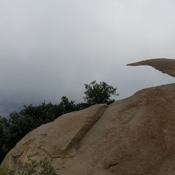


Did this hike the Friday before Labor Day weekend and there were only about 3 other groups on the trail, it was probably because we all did a risky (stupid) decision to hike this trail in the middle of the day, with a heat wave at that. Still, this trail deserves 5 stars bec it was a challenging, picturesque and well-kept trail. There is barely no shade so it took us 4 hours back and forth (until Potato Chip Rock) with a LOT of stops to take in a little bit of shade wherever possible. Clocked in around 7.6miles roundtrip. Reaching Potato Chip was a nice treat and we managed to enjoy it all for ourselves and rest a bit before heading back down. Getting to edge of the "potata chip" does require a small jump since there's a gap between the 2 rocks. It's perfectly safe/stable in my opinion but will need a little bit of courage to take that short leap. Personally preferred to "slide" down getting off the potato chip than jumping back up (short legs haha). read more


4 years ago
Awesome trail, for a great workout. A 7+miles out and back, with an elevation gain of 2000ft. Started at 6:30 before the sun was directly above my head, wished I would have started earlier, perhaps 5:30-6am. The trail is well maintained and trail markers through-out for easy navigation. It's an ascent all the way to the summit, with little breaks in between. This is classified as a moderate hike, very doable. If you are not accustomed to inclines, you might find this trail difficult. Take your time, take breaks, and stay well hydrated. There are no shaded section on this trail, you will be exposed to a lot of sun. The "potato chip rock" was underwhelming and the long line to snap a picture on it was discouraging. The summit is approx .50 mile up, past the rock near the towers. This is also a GREAT runners trail... Wear comfortable shoes, bring at least 2L of water and wear lots of sunscreen. Also, please, please, please wear head phones!!! read more


4 years ago
Super well maintained trail and much easier on your knees Vs other local trails. Did not see too many people (President day) and super easy to park at lake Poway. Went on cloudy day so bring layers as it was very windy at moment. Not very scenic per say (beside the small lake) and pretty much a 4 miles up and 4 miles down. The potato chip rock was so small compared to the illusion we saw from other photos. While this is a nice way to get your cardio, we still prefer iron mountain and especially via the Ellie lane trail which increased the r/t to 7.4 miles. All in all, a little disappointed a but still worth a visit. read more


Mount Woodson Trail to Potato Chip Rock was a pleasant 2 hour leisurely roundtrip trek (w/ another 0.5 hours spent at the rock formation). I liked it for the gradual incline (1,281 feet) and cardio that this trail offered, as well as the beautiful scenery of boulders, mountains, greenery and even saw a snow capped mountain from afar! (Anyone know what mountain this is? ) Went during mid afternoon on a weekday and there was ample street parking available. Getting to the potato chip platform can be challenging, make sure to wear hiking shoes with good grip. And bring a friend or two to help assist you down/ up . It's perfect to hike during San Diego's winter season, as it wasn't too hot, about high 50's to low 60's when I went. Limited areas with shade so bring a hat and sunscreen! Also, don't forget your water! Saw a family make hot coco at the summit with their thermos and though that was a clever idea! read more


8 years ago

2 years ago

Before there was a "potato chip rock" this was a nice trail to the telecommunication towers on top of Mount Woodson. Today, this trail is an international tourist trap. No, seriously...You'll find more tourist here than in Old Town. That's the downfall of this place, it's way too crowded. There are three ways to hike this trail. Most people park at Lake Poway for $10 (7 total miles) or the more adventurous will hike from the blue sky ecological reserve for free ( 10 miles ) but those looking for the shortest hike will take the backside trail to the top and it's also free (5 miles). I prefer the backside trail. - This is not an easy hike and if the weather is hot it can be very strenuous. That being said, people still bring dogs and strollers.. - Lime Bikes on top - There is wailing wall off the backside trail. You can put pebbles, ashes, or whatever in the small holes in the rock. read more


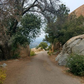


TLDR; you will be challenged 1) to get onto Potato Chip, the rocks curve in very deeply so be prepared to slowly inch down with just one leg and 2) to get off Potato Chip, there is no hand grip anywhere on the rock so first time I was able to inch down ok but second time I actually slid down, intentionally and unintentionally too (thigh all up against the rock) and got a bit bruised up, another hiker said she could've messed up her ankle coming back and I say my ankle almost was possible too the second time around so be careful -------------------------------- there's a long route that is easier since it has stairs (7mile) and there's a short route(4mile) that is more steep but is all up-hill... I came across the beautiful shorter route lol took about 90mins to 2hrs to complete and be back at my vehicle (reading the reviews, seems lots more have come across the 7mile hike...heh) Parking was "free" because everyone else pulled off of the highway (you know how you can only pull over for like emergencies on like a highway/freeway..yeah we all did that lol) how legal is it? I'm unsure lol was I worried about getting my car towed? Yes. But it's funny because there are 10 other cars with me too whom could've been towed lol I recommend at least 1 liter for this hike and to pack light. bring sunscreen and a hat and some snacks. There was about 5 minutes max of shade with all the gigantic rocks but other than that, it's all sun and all uphill. when you arrive at the top of this mountain, you'll be circling around the satellite towers before reaching Potato Chip. Have fun and Good luck! read more


4 years ago

3 years ago

Very good wide, uphill, clean, beautiful trail. Parking is $10. Went in the morning around 10am. For a trail it was pretty busy but it's such a wide and long trail, there was no bumping into people at all. It was a bit tiring going up if you take no breaks and really hike up it. Running back is so much easier and feels good due to the wind and it being downhill from there. I added some photos to show the potato chip rock (: *the line is pretty long but the photo on the rock but wait was about 13min. read more


Our group came the day after St. Patrick's Day which worked in our favor as it was less crowded than on a normal Sunday. Not only were people probably recovering from drinking the day/night before, but it had also rained on the 17th so the precipitation may have scared off hikers because of a possible muddy trek. A couple of us had permit stickers that allowed free entry into the park so we all piled into two vehicles to save on the admission fee. The weather was perfect as it was partly overcast, and the temperature only reached the upper 60s. There were a few puddles as we were rounding Lake Poway, but that was it for wet spots on the trail. It actually got really breezy and cooler near the summit which was unexpected for me. The last time I did this hike, the Santa Ana winds were howling and it was in the mid-90s. The line to get on the chip for a photo opportunity was very reasonable at about 20 minutes. The round-trip took a little under four hours which included the wait time at the top. A couple of the folks had never done Mount Woodson before so it was great that the newbies were able to experience this journey. It has the perfect blend of distance, incline, switchbacks and views for a hiking trail. read more


Mount Woodson has one of the more popular trails in the San Diego area, but it is nowhere as crowded as Cowles Mountain Trail at Mission Trails Regional Park. Advantages of Mount Woodson include the following: (1) It is a great place to explore, up close, the fields of roundish-looking boulders (kinda like fields of giant marshmallows). You can also find fields of marshmallow-shaped boulders just to the north of Route 8 (Kumeyaay Highway) in the vicinity of Sunrise Highway. Sunrise Highway takes you to Laguna Mountain. Please my attached photographs of a part of Mount Woodson that contains fields of scattered gigantic stone marshmallows. I used a 300 mm lens to take all of the photographs, and I set my tripod up next to Route 67. Route 67 gives you a great vantage point that best illustrates the fact that the scattered boulders look like fields of gigantic marshmallows. (2) Great exercise along scenic trails that take you through gulches and up a zig-zagging pathway with gigantic stone marshmallows on both sides of the trail. If you arrive early, your walk up the mountain will include romantic mists, and the ever-so-inspiring sight of the early morning sun breaking through these mists. (3) Friendly hikers who will engage in pleasant conversations. I wrote down some of these conversations (see, excerpts below) and I sent them home in a letter. (4) No threat of mountain lions on Mount Woodson, because its too crowded. In contrast, the threat of mountain lions at Rancho Cuyamaca State Park was so scary, that I decided to visit Cuyamaca Park only once. (5) There is no fee for residents of Poway, but if you are not a resident you can park for free in the region of LAKE POWAY ROAD that is just to the west of ESPOLA ROAD. Shown below are excerpts from my big letter about my hike up and down Mount Woodson. My letter has six different stories about this hike, but I only provide quotations from only two of my stories. FIRST STORY. Was it 2.6 miles or 2.9 miles? Upon reaching the east side of Lake Poway, I noticed a sign reading, "2.6 Miles to the summit from this point." On the same sign post was another sign, reading, "Mt. Woodson summit 2.9 miles. Elevation gain 1,843 feet." A group of 4 hikers approached. The 4 hikers were a chubby Latina, a very fat old man, an athletic old man wearing a T-shirt reading "TEXAS," and the man with the "Death Wish Coffee Co" T-shirt. They paused and also looked at the sign. Realizing that I had a captive audience, I pointed out the discrepancy between the "2.6 miles" and the "2.9 miles." Continuing, I pronounced, "My explanation for this discrepancy is that the distance from this sign to this other sign, on this particular sign post, is 0.3 miles." The fat old man laughed and a robust jolly laugh issued forth, and the athletic old man laughed too. And then, I added, "See, I went to college!" The two men laughed again, but even louder. SECOND STORY. This part of the trail featured many spherical boulders, some only the size of a Volkswagen and others the size of a 1-bedroom house, and the view from the trail revealed what could be considered to be a sculpture garden. I imagined that the roundest of the boulders were Godzilla eggs. Higher up, the trail became zig-zaggy, and I passed the laughing men again. They were taking a break. At that point, I had still not seen what was written below "TEXAS" on the T-shirt. "What does it say below Texas?" I asked. The athletic man answered, "GROWN." Also, I noticed that below the word "GROWN" in smaller writing, the T-shirt read, "HOMEBLOOM." Then the man spoke the words, "I am from Texas and so are my ex's." I knew right away that he was reciting words from a country and western song. The lyrics go like this: "All my ex's live in Texas. And Texas is the place I'd really love to be. But all my ex's live in Texas. And that's why I hang my hat in Tennessee. And Dimple's who now lives in Temple's got the law looking for me." And so I replied, "I think that you have been listening too much to country western singer, George Strait." Once again, my remarks caused the men to chuckle and laugh. read more


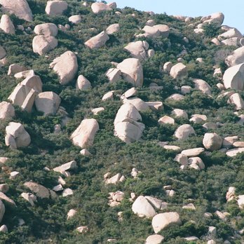


9 years ago
Worth every step and sweat! Been here quite a few times and each time is different. I personally like the longer way with the scenic view better. I remember coming here for the first time, and I cried like a baby. Yes, it was hard and was very strenuous for my first try. I wasn't mentally prepared and physically capable of hiking 7 miles. I was sore the following day and couldn't move my legs for days. Then my second time was the other way, which was shorter and just pavement all the way up. It was kinda boring and felt like I was walking on a treadmill with level 100 incline. It's still worth it once you get to the top. Then my third, fourth, and fifth was the best. We still took the longer route and literally stayed up there for hours. Went to the highest peak and took a picture of the geological marker. It was a lot more than a the potato chip, walk around further and you shall see. read more


This is a moderately strenuous hike of about 7.5 miles round trip, and 2300+/- feet in elevation. I started from lake Poway, and the wide, very well kept path, wound up and around the mountain above the lake; I was treated to some amazing views of San Marcos and beyond. I'm a tad out of shape so I did have to stop a couple of times to catch my breath, so be warned that if you are looking for an "easy" hike, you may need to look elsewhere. With all that said, this trail is very good. I hiked it today for the first time, and being a Saturday, Earth Day, and amazing weather-it was super packed with people, but I can tell that if I'd come on a week day-or earlier in the morning-it would be super quiet. Just please be very mindful of critters as you walk. I was lucky enough to see a rattlesnake today-and even luckier that he was crawling fast away from me. Snakes are shy, and if you leave them be, they will extend you the same courtesy. Happy hiking!!! read more


Mount Woodson is one of several great hiking spots in the Poway/Ramona area. I completed this hike in October 2018 and had a great time. My group and I met near the fire station and hiked up the back route, which is paved. We were finished in about two hours and this includes stopping to catch our breath and take pictures. Mount Woodson is a great hike because there are so many different amazing views of the region. If you want to see the famous Potato Chip Rock you need to make a right at the telcom towers. If you haven't hiked Woodson yet I highly recommend you do on the next clear day. read more
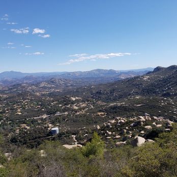


Mt. Woodson Trail will take you to the Potato Chip Rock~ * YES - Approx. 7-mile roundtrip hike, majority is only INCLINES from starting point * YES - Beautiful views of Poway and the lake from the top * YES - Expect 20+ minute wait for pictures on the "potato chip" * EEK - There is large space between boulder & the "chip"...may have to jump or have someone help you across * EEK - Descent from the "chip" is pretty steep in between the rocks. One of our hiking companions scraped some skin when slippin' down...be careful * YES - Pet-friendly, saw lots of small & large dogs on hike (must be leashed) * YES - Hikers are friendly...strangers are willing to help take your pic if you ask, pay-it-forward manners here * YES - Dusty, rocky hiking trail * WOA (words of advice): - Recommend starting hike before 8am, it gets really hot anytime thereafter - $5 cash large lot was about 95% full by 8am (plan accordingly) - Bathroom on-site near parking lot, only 1 port-a-pottie near start of trail - Bring LOTS of water, wear sunblock & hat, bring snacks Now...for some real potato chips to replenish... read more


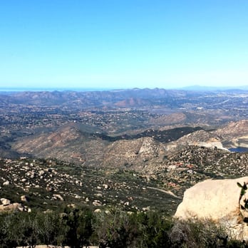


Great hike workout!~ =] Overall this hike is about 6-8 miles depending on which way you go up. The front side is the more popular hike and that's where you park from the Lake Poway side. I've been hooked lately on the back side (where you park off of the 67) which is a little shorter of a route, but with more intense inclines. The views here are beautiful and seeing mother nature from up above and the whole city is amazing. The only bummer depending on the time and season is how the "Potato Chip Rock" on the top draws long lines and crowds. If you want a "photo op" you have to wait in line, or just look for a similar rock nearby and take a flick there.. views are still nice all around. Stay hydrated and in shape with a hike on the "Mount Woodson Trail"~ read more


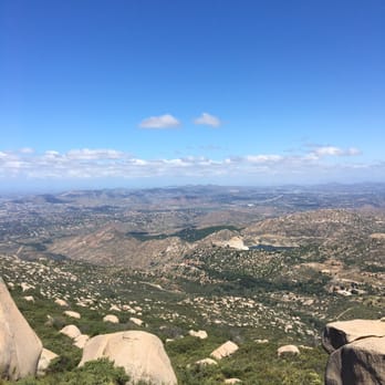

At the risk of being shunned for the rest of my life on Yelp as the nature-hater, here's my honest opinion of Mount Woodson Trail, aka the Potato Chip Rock hike. I couldn't not go after 4 years at UCSD, after all. Yes, I hopped on the bandwagon to take a picture on the potato chip rock. Yes, I've never hiked in SoCal before. Yes, I've been spoiled my whole life with beautiful, shady hikes in Northern California. It's almost painful to look back on the ill fated day that began with no breakfast. I had missed my alarm and woke up with only enough time to slather sunblock on my face before running out the door to meet up with my boyfriend & friends for this hike. Unfortunately, 11AM start-the-hike plan was probably the most ignorant idea ever, on a hot summer day in June. As we began the trek up, I couldn't help but notice the hike reminded me of the tiny street markets of Taiwan, my motherland. Elbow to below, cars strolling alongside old grandmas just two inches away. The hike was literally like a line formation - you had to walk slowly because there's someone literally two steps ahead of you. Way too crowded for my "hiking taste". The comforting nostalgia of Taiwan is a far, far stretch in the horizon from this madness. The main irritant is the amount of dust kicked up by the people in front and behind us. What, didn't your parents teach you to walk properly and not drag your feet?! FOR THIS REASON EXACTLY... yes, parents actually know the shit they're talking about. I like to think it was the lack of oxygen due to the constant inhalation of dust that led to the next embarrassing event to occur - my feeling faint and dizzy to the extent where I had to sit down. Alright, it's probably the lack of a proper breakfast and the fact my face is melting under the 90 degree sun. Thank goodness I had brought some protein bars, which turned out to be Hero of the day, helping me "save face" as the Chinese would say. Recovering quickly as the protein bar worked its magic, we finally reached the potato chip rock. We were greeted by a line of equally dust covered folks waiting for their turn to take a picture on the rock. I say the whole wait time issue is comparable to waiting for a seat at your favorite AYCE KBBQ restaurant in LA. The longer you wait, the more time you waste when it's finally your turn. If I wait an hour to get seated for my Korean BBQ dinner, I'll take extra care to eat as slow & long as possible. Its a vicious cycle, really, the human nature... Total round trip hike took around 4 hours, including picture time. If you like desert hikes, this is it for you. But for someone who grew up in NorCal, and was taken to beautiful trails with plenty of trees, plants & flowers... all I can say is this ain't for me. Just too much sun with no shade. It's thanks to my dad that I grew up with experiences of hiking in the Big Basin, Yosemite, Big Sur, Kings Canyon National Park... and so on. These are my ideal hiking spots - beautiful green mountains, trees, lakes, and even waterfalls for the end prize. I think waterfalls trump potato chip rocks. Justttt my opinion. Overall though, I can't give less than 3 stars. The view when you're at the top is beautiful, and nature is always a good thing :) read more


Thinking about going to SD today? Ready to take a bunch of fun jumping photos on the infamous potato chip? Well friends, before you get all excited I'm about to give you the skinny on what you need to know about your experience. Hands down this will be the most in-depth review you will read about this hike and the only one you need to reference! Boo-Yeah! Parking: Park in the lot. It's free Hike Duration: 2hrs up & 1 1/2-2hrs back down. 1hr wait time for a photo as well. *If you have the option of going during the weekday, I recommend it. Don't go during the weekend. It will be too crazy packed..... Cut the wait time for a photo down to 1/2 hr. Trail: It's fuckin' dusty, loose gravel everywhere, and It's a steep incline. The hike is pretty strenuous in the beginning. It's like doing a never ending stairmaster. Your quads and thighs will be sore the next time. My quads and thighs are sore as I write this review. There is no shade on this trail either. My recommendation is not to go during summer and if you do go get there super early before noon. Water/Suncreen: You gotta stay hydrated up here. There are no refillable drinking stations. Between two people I'd say 8 water bottles of up to 16 oz minimum. I'd have 5 each just to be safe. Though, 4 is good. Also, wear adequate sunscreen and bring your sunglasses/hat Bathrooms: There are none.... There are two port-a-potties in the beginning of the trail but that's it. As in if you're hydrating like a Camel and you have a small ass bladder, you're gonna be shit out of luck. Pee in the bushes. This goes for the women too. You've been warned. (Shout outs to JY) Wait: Long as FUCK... If your main focus is to get a picture on top of this potato chip then you need to know that you will be waiting for at least 1hr please just to take the photo... Sorry kids... There is no fast pass for this attraction. Most people don't know about this part but it's crucial. You just see the aftermath of the final finished product but if you're going in hotter temperatures the wait time for a photo compared to the actual hike itself may not be worth it. Depending on the time of year you go the wait could be longer or shorter. Picture taking: This is the tricky part that most people don't know until they actually reach the potato chip. There is a rock-ledge which connects to chip itself so if you want someone to take a photo for you, you have to scout about 20 people behind you to take the photo from a distance! Does that make sense? You can't ask the person behind you cause they will be directly behind you on the ledge! So therefore if you want that extremely scenic photo with your friends you have to ask other people to take the photo for you. Everyone is super friendly and willing to do some. My recommendation is to use two cameras. 1 camera films and the other one just for photos. Then if by chance if the photos come out shitty. You can just pull out stills from the video. NO STUPID ASS POSES PLEASE: 1. The Karate Kid Pose 2. The Sit-up Pose 3. The Egyptian Yoga Pose 4. Wannabe Hand-stands *All in all, it was an ok Hike/experience. It's one of those places that once you go and get your picture, you'll never ever return again. With that being said, it's a fun one time experience. *Lastly, the trail had some smoking hot ass White chicks... That would definitely have to be my favorite part of the hike. HAHA :) Happy Trails, J to the Y. read more


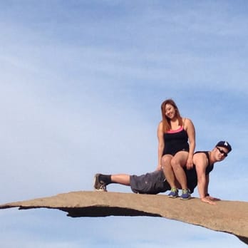

Potato Chip Rock is a must-hike if you're in the San Diego area! I've gone a handful of times and each time was great! It's not too long and the elevation climb isn't too steep. When you first get to the park, there's a $5 fee for parking. The entrance is actually a park with Lake Poway as its main feature. The overall hike is 6.7 miles roundtrip which takes about 2-3 hours depending on how quick or slow you take it. The actual longest thing is waiting in line to take a picture! Each time I've gone, it takes at least half an hour since you meed to jump across two rocks to get to the potato chip. The hike overall is very well labeled with signs and many people hike it so it's almost impossible to get lost on this trail. Plenty of pretty views of rocks, scattered shrubbery, and of course the potato chip rock. I recommend hiking in the early morning or late afternoon if you want to hike this since there's almost no shade throughout the hike. Happy hiking! read more
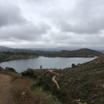


MOUNTAIN BIKING REVIEW : Wow !!! Talk about an A$$ whooping ! I just got mine kicked and a reality check too. This is a very technical ride and super steep in some areas. Don't get me wrong I really enjoyed the beating these trails dished out. I had to get off and hike in some parts the bike was losing traction due to the extreme incline and the loose soil. I think I may need to upgrade to a real mountain bike now. The scenery is beautiful ( see photos) and luckily today there was a nice cool breeze so I had pleasant conditions. I wouldn't attempt this ride midday in the summer. I wear a camel back and I suggest you do if you come up. Be careful on your way down its no problem picking up lots of speed and the ground is very loose so its easy to wash out in the turns, I almost did a few times. Have fun and be safe this is a great place to ride : ) read more


4 years ago
It will very likely be HOT, crowded and sunny with little to no shade the whole time......but so worth it. We waited in line about ten min to take a photo at the rock. The way down felt like forever, we bought gatorades at the convenience store near the lake after the hike. Beautiful park, can't wait yo go again. Take sunblock, shades, light clothing, lots of water and granola bars would be good too. read more


OMG !! Kicked my arse ! Took us about 6 hours to finish this hike. Was it worth it ? Sure damn was ! NAYS: - I wore the wrong hiking shoes. I busted out my 90's pumas - don't judge me - Not enough sunscreen. That and enough shade throughout the hike. Arm/ankle tan lines aren't pretty people - I barely could stand on the potato chip rock. Note to self: practice more bikram poses - The soreness I endured days after ! I'm a noobs to hiking so this was expected. YAYS: - My hiking group is the best ! We made the most of the hike and got to know each other more. Great time to bond ! - BEAUTFUL scenery ! #infamousbuttcrackrock #infamoustree #potatochiprock - Dog-friendly ! One of our hiking pals even carried her pet chihuahua all the way to the top ! Now that's hardcore !!! NOTE: - $5 parking for non-residents. We got lucky though and apparently it was FREE that day ! Woohoo ! - Start early in case you end up taking longer to finish. It might get too dark when coming back down. - HYDRATION ! HYDRATION ! HYDRATION ! The last thing you want happen is fainting once you get to the top and missing out on the potato chip rock photoshoot ! I'm definitely going to be better prepared to tackle this beast again ! Hopefully, I'll even have gutsier poses on the potato chip rock ! MT. WOODSON...WE WILL MEET AGAIN !!! read more

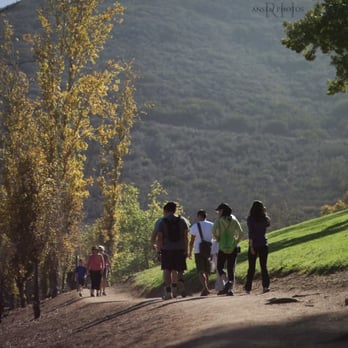


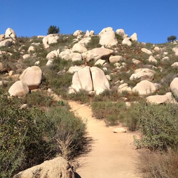


13 years ago
Go for the Potato Chip! It was a rigorous hike, but like every hike, the top is amazing and fulfilling! You get dirty. You get antsy. You become restless. You ask yourself, am I there yet? Eventually, you'll get to the top! You just have to work for it and the view is beautiful! read more


There is an admission fee (cash only) to park at the trailhead, which is inside Lake Poway recreational park. This park opens at 6AM daily and closes at sunset. This hike is rated as "Hard" on AllTrails and "Extremely Challenging" by the City of Poway. That is because the trail is straight up for 4 miles with a 2,000' elevation gain. (8 miles out and back). I would agree with this being difficult, as most hikers were in-shape and ascended quickly - starting from the trailhead at dawn to beat the heat once at the summit for the grand prize, an Instagram shot of them on Potato Chip Rock. The whole excursion takes up to 4 hours, which does not include the time spent at the top. Be warned that if you start in the later morning or afternoon, not only will the sun be beating down on you, but the line to get a picture on Potato Chip Rock will be extremely long. Even a line with only 15 people could take up to 45 minutes since there is no policing of how long each person can stay up there for their perfect Instagram shot. Retakes, special yoga poses, dog ear filters, and a general lack of self-awareness cause the queue to back up to ridiculous levels. Still, the hike is excellent cardio. I thought the trail wasn't dangerous or overly difficult. It is the right mix of tough and fulfilling. You get beautiful views of Lake Poway along with massive boulders you will recognize from the breathtaking landscape of Joshua Tree NP. read more


5 years ago
Page 1 of 21
More info about Mount Woodson Trail
14644 Lake Poway Rd
Poway, CA 92074
Directions
(858) 668-4770
Call Now
Hours
Indoor Amenities
Outdoor Amenities
Mount Woodson Trail Reviews in Other Languages
Ask the Community - Mount Woodson Trail
Where do we park or enter for the paved trail?
Address for shorter route with free parking along the side of the highway: 16200 Highway 67 Ramona, CA.…
With small toddlers, is it possible to drive to get closer than the 11 miles from the parking structure?
There's no parking structure. There's is a parking lot by one side/area of the lake with a park next to it.…
Is the longer trail too difficult to do while carrying my just over 20 pound toddler in his hiking backpack carrier? I am in good shape and have good endurance.
No I don't think so. My husband carried my 25 lbs son in the front (baby carrier) and a camel back with 3 liters of water on his back. Hope that helps!
Review Highlights - Mount Woodson Trail
You might also consider











Why does Yelp recommend reviews?
37 reviews that are not currently recommended
The reviews below are not factored into the business's overall star rating.
15 years ago

14 years ago

9 years ago

12 years ago
11 years ago

10 years ago
9 years ago

10 years ago

13 years ago

13 years ago

6 years ago

5 years ago

5 years ago

12 years ago
6 years ago

11 years ago
4 years ago

5 years ago

11 years ago
Mount Woodson Trail - hiking - Updated August 2026
Best of Poway
People found Mount Woodson Trail by searching for…
Trending Searches in Poway, CA
Barbershop For Men near Mount Woodson Trail
Bike Shop near Mount Woodson Trail
Cliff Jumping near Mount Woodson Trail
Consignment Shops near Mount Woodson Trail
Cruising Spots near Mount Woodson Trail
Dog Friendly Things To Do near Mount Woodson Trail
Ear Piercing near Mount Woodson Trail
Elementary Schools near Mount Woodson Trail
Eyebrow Threading near Mount Woodson Trail
Flower Fields near Mount Woodson Trail
Hair Braiding near Mount Woodson Trail
Kids Haircut near Mount Woodson Trail
Lakes near Mount Woodson Trail
Lookout Points near Mount Woodson Trail
Parks near Mount Woodson Trail
Pedicure near Mount Woodson Trail
Picnic Areas near Mount Woodson Trail
Preschools near Mount Woodson Trail
Public Golf Courses near Mount Woodson Trail
Public Pools near Mount Woodson Trail
Rock Quarry near Mount Woodson Trail
Running Trails near Mount Woodson Trail
Scenic Night View near Mount Woodson Trail
Scenic Overlook near Mount Woodson Trail
Sunrise View near Mount Woodson Trail
Swimming Holes near Mount Woodson Trail
Trading Card Shops near Mount Woodson Trail
Uniforms near Mount Woodson Trail
Browse Articles
Browse Nearby
BEST of Poway, California Restaurants near Mount Woodson Trail
BEST of Poway, California Coffee near Mount Woodson Trail
BEST of Poway, California Things to Do near Mount Woodson Trail
BEST of Poway, California Parks near Mount Woodson Trail
BEST of Poway, California Breakfast near Mount Woodson Trail
BEST of Poway, California Horseback Riding near Mount Woodson Trail
BEST of Poway, California Campgrounds near Mount Woodson Trail
Browse Brands
Related Searches in Poway, CA
Affordable Kayak Rental Services in Poway, California
Best Dog Hiking Trails Around Poway, California
Best Fishing Locations and Guides in Poway, California
Best Nature Trails for Hiking in Poway, California
Best Places for Horseback Riding in Poway, California
Best Sightseeing Experiences Available in Poway, California
Check Out Off Road Trails in Poway, California
Discover Dog Friendly Trails to Explore in Poway, California
Discover Easy Hiking Trails Near Poway, California
Discover Kid Friendly Hiking Trails in Poway, California
Discover Popular Bike Trails in Poway, California
Discover Scenic Mountain Bike Trails Near Poway, California
Discover Walking Parks in Poway, California Near You
Discover a Hiking Trail in Poway, California
Discover the Best Night Hike Trails in Poway, California
Dog-Friendly Hikes With Dogs in Poway, California
Enjoy Camping Adventures Around Poway, California
Enjoy Kayaking Adventures in Poway, California
Enjoy Off Leash Dog Hikes in Poway, California
Enjoy Scenic Places to Walk in Poway, California
Enjoy Tent Camping Spots Around Poway, California
Enjoy a Beautiful Waterfall Hike in Poway, California
Enjoy the Best Walking Path in Poway, California
Enjoy the Best Walking Trails in Poway, California
Explore Beautiful Parks and Green Spaces in Poway, California
Explore Easy Hikes Perfect for All in Poway, California
Explore Fun Activities to Do in Poway, California
Explore Picnic Parks Near Poway, California
Explore Popular Campgrounds Near Poway, California
Explore Top Dog Parks in Poway, California Near You
Explore the Best Beach Spots in Poway, California
Family Friendly Hiking With Kids in Poway, California
Find Top Dog Friendly Parks to Visit in Poway, California
Find the Best Parks for Picnics in Poway, California
Hiking Trails With Waterfalls in Poway, California
Off Leash Dog Hiking Trails in Poway, California
Popular Outdoor Activities to Try in Poway, California
Popular Picnic Spots to Visit in Poway, California
Popular Waterfall Hiking Trails in Poway, California
Safe River Swimming Areas in Poway, California
Safe and Fun Parks for Kids in Poway, California
Top Hiking Trails to Explore in Poway, California
Top Playgrounds for Kids to Enjoy in Poway, California
Top Running Trails to Explore in Poway, California
Top Swimming Lakes to Enjoy in Poway, California
Top Swimming Spots and Pools in Poway, California
Top-Rated Camping Sites in Poway, California


