
Pyle's Peak Photos


You might also consider


More like Pyle's Peak
Recommended Reviews - Pyle's Peak
Start your review...


Reviews With Photos


When I thought Cowles was boring it surprised me with Pyles as an extension of the hike! Plus taking the back service road and then hike Pyles then you got a good leg workout! 7.3 miles around trip. You have to make it up Cowles first then at the top you take a left to the service road and you'll find the sign for the entrance to Pyles Peak. If you are coming up the service road then continue straight you'll hit the sign. The start of Pyles is flat and downhill then it surprises you and it's uphill! The last portion to get up to the peak is all uphill get ready for it. At the half way point there is a lookout if you want to go up there for a break. Views aren't that great I wouldn't waste the time to go up there. You can see all 5 peaks from Pyles. It's a narrow trail not heavily trafficked. Mix of rocks and dirt terrain. Good for trail running or hiking. All trails rates it a moderate, the signs say difficult. I will rate it moderate to difficult. The inclines are difficult the rest I would say is moderate. Overall it's a great extension to Cowles and if you take the service road up it is a great leg workout. Nice workout, I would do it again. Bring enough water if you plan on going later in the day!


For those who love hiking and want to take on another challenge after you topped the Cowles Mountain, consider Pyle's Peak! Entrance/parking: the only way to access Pyle's Peak is from the top of Cowles Mountain. After you arrived Cowles peak, find the service road and walk toward west. You will see a sign for Pyle's Peak. Trail distance/difficulty: 1.5 miles to Pyle's peak summit but it includes multiple downward and upward hikes throughout. The hike to Pyle's peak is a difficult hike because its distance and change of elevations. Activity: This hike is much less popular than Cowles Mountain so it is excellent for hikers who want to get out there and enjoy the scenery by yourself. At the half way to the peak, there is a view point for you to enjoy the view. The trail here is smaller and less maintained than Cowles but definitely gives you more of a "real" hiking experience. When you are about to summit Pyle's peak, it can be a steep challenging hike; however, you will see the summit in no time! After that, the view is all yours! Tips: Make sure you bring enough water! With Cowles hike, you will be hiking about 3.5 miles to Pyle's peak so the hike gets long and difficult.


I did this hike this morning. We got there early (about 6:15) and found parking on Golfcrest pretty close but there were no spaces available in the small lot. We started at the Cowles mountain trailhead...there was a nasty, foul odor coming from the restrooms...no, seriously it was bad! The hike to Cowles is busy, rocky and just ok...some good views. It was 1.25 to the top. After pausing to take a picture we went to the left of the plaque and there was a little access road with a sign for the Pyle's Peak trail. I enjoyed this part much better since it has more of a natural, interesting landscape and so fewer people than the Cowles portion...a couple hundred people on Cowles and less than 2 dozen on the Pyle's trail. It is 1.5 miles from Cowles to Pyle's and took us about 2 hrs and 5 mins to complete the 5.5 miles RT.


Wow! I've done Cowles Mountain plenty of times and for some reason, I've never realized that Pyle's Peak is literally the next trail over which connects to it. If you enjoyed Cowles, Pyles Peak offers a nice addition to the hike while offering similar sweeping views of the San Diego area. And know that in order to do this trail, you have to complete one of the Cowles Mountain trails first. Pyles Peak trail is the road less traveled, but I happened to enjoy the fact that it has way less people hiking it. On my entire trip I only encountered two people and one of them was the volunteer ranger. The trail is almost entirely dirt, but there are some steps and rails to use along the way. I did it in the early morning during June bloom. With that being said, I wouldn't recommend doing it in the heat of the sun as there is very little shade to take advantage of. So dress accordingly and bring an adequate supply of water! I did encounter a snake on my last trip there, so just keep an eye out if you're hiking during the warmer months.
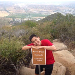

TIP: If you are doing the 5-Peak Challenge of Mission Trails, do this one subsequently after Cowles Mountain since you can do them both in one shot. The total round trip distance for both is 6 miles and the only way you can get to Pyles Peak (from Golfcrest Drive) is via the summit of Cowles Mountain. At 1379 feet, you will actually be descending 213 feet from Cowles to get to Pyles Peak but don't let that fool you in thinking this will be a leisurely stroll. The hike starts off with a nice long downhill then goes on a small incline during the 2nd half. Shortly after the overlook, the small incline turns into a steep uphill with many switchbacks for the last 0.3 miles (which seemingly takes forever). Going back, the downhill becomes the start and you end with a challenging uphill ascent with multiple switchbacks before arriving back at Cowles Mountain. Lately, there's been more people that have been scaling Pyles Peak so it is not as deserted as once before. However, it still remains far less crowded than Cowles and makes for a fun and challenging extension to the hike. The trail is clearly marked the entire way so it is a very straightforward hike and you won't get lost. It is well-maintained and although hiking shoes are preferable, you should be able to do this hike in running shoes without much problem. The view from Cowles is far superior to the view at Pyles Peak. Still, this is a hike worth checking out. I'm surprised at how often I hiked Cowles without even noticing this hidden gem!


BIG ROCK PARK TRAILHEAD ENTRANCE: As part of the 5peak challenge, we started from the Big Rock Park located on 8125 Arlette St. Santee, CA 92071. From the parking lot, the trailhead can easily be identified. The beginning of the trail is made up of flat areas, slight incline and frequent, spaced out steps. There is minimal shade here. Be careful with the portion of the hike that is visibly recovering from a fire and stay on path! Once the trail connect to the Service trail, you encounter a slight incline followed by an ascend, and lastly an intense incline for the remainder of the hike. Not the slightest tree to shade you here. It kicked my butt and I had to stop a few times before reaching Cowles Summit. The Pyles Peak trailhead is marked by signs that label it as difficult. You begin by descending the mountain for about a mile and gradually ascending the smaller mountain for the remainder of the trail. There is a small area at the top governed by a big rock you can sit on. If you're going to hike up Cowles, you'll be missing out if you don't hike up to Pyles Peak! :) Info about this hike: started 7am, about 2.5 miles to reach top of Cowles and add 1.5 to reach Pyles Peak, a high of 82 degree weather. This trail up to Cowles and Pyles Peak was less traveled than one on Navajo Rd. I'm comparison, that side provides 1.5 miles of switchbacks with rocks to slightly climb over. I enjoyed this way up way more. It is less populated and the trail changes along the way making it more entertaining.


Pyles Peak is one of the peaks in the Mission Trails Five Peak Challenge, which is aimed at directing people to trails other than Cowles. Interestingly enough, this is a continuation of the hike up to Cowels. Pyles is about 1.6 miles past the top ofCowles and is definitely a more narrow and less traveled trail, but still well maintained. Our group started from the Barker entrance and headed up on the old fire road, which definitely has a steep start. If you're looking to check this one off your challenge list and aren't an avid hiker, I recommend you head up the normal Cowels trail before heading on to Pyles. The hike there is mostly downhill and boasts some pretty beautiful scenery on a clear day. Sure it may not be as interesting as the view from the top of Cowels, but you'll see a lot more of nature on this trail. Make sure you bring plenty of water, cause the only way back from here is the way you came. If you take the fire road route, it's about 6 miles round trip.


**So there's this 5 peak challenge where you gotta hike these specific peaks and take a selfie next to the summit signs. Once you get all of those pics, you email them and you get a certificate and a pin. Not much but hey it's a bigger motivator than nothing. And you guessed it, Pyles Peak was one of them! You can reach the trailhead when you get to the top of Cowels Mountain. I have no idea if there is any other way up there. This was a considerably less busy trail and slightly narrow compared to Cowels. I passed only about 13 people (yes I kept count) on my way to Pyles Peak summit and probably a hundred billion at Cowels. The view was not as great here but nature is nature and it's amazing regardless. If you like a quiet, more secluded hike, this is the place for you. **Totally copy/pasted that part in another one of my reviews cuz lazy.


Loved it! Much quieter than Cowles Mountain and the views are always amazing. You have to climb up Cowles Mountain and there are signs pointing to Pyles Peak


My bf and I started at Big Rock park in Santee. I would definitely not recommend starting on this side, as the trail was not very interesting or strenuous and we really just thought we were lost for the first mile. Having hiked the Cowles trail, I'd recommend making that your way up. Again, quite an odd path to Pyle's Peak. It's mostly downhill from Cowles to Pyle's. The terrain is very rocky, so wear good shoes! When we got to the top, I stepped on a tarantula patch and definitely gave a pretty outrageous screech. My bf wanted to pick them up, but I just wanted to get out of there! All in all, it was a fine hike. I wouldn't do it again, or at least not the same way, but if you're looking for a moderately easy hike that takes about 3 hours, go for it.
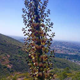

I would've given this trail 5 starts if it wasn't for the fact that you have to go up Cowles Mountain before you can get to the trailhead. (I don't like Cowles Mountain because it is to crowded) The Pyles trail is nice and peaceful it is a dramatic contrast of Cowles. This time we started our hike at the Cowles Staging Area since we were short on time. We were planing of staring from Barker trailhead but we thought it was longer. The other option was to start from Big Rock trailhead but that is not a fun hike once you get to Cowles Service Road. Once you get to the summit of Cowles the Pyles Peak will be to the left as you face the "service towers" there is a small plaque showing you the way. One thing you need to watch out for on this trail are bikes. They cannot go all they way to the peak but you may ran into them at the begging of the trail. I found that this trail have nice views and plenty of flowers and greenery, not a lot of shade throughout the trail but there were a few areas with shade. Do wear good shoes because there are a lot of loose gravel and rocky areas like the other trails of the 5-Peak Challenge. From the beginning of the trail to the end it is not a hard trail but you have to remember you have to include Cowles Mountain trail into the equation.


My friend and I hiked up Pyles Peak after conquering Cowles Mtn. Quite some foot traffic at Cowles Mtn. But once you get to the top. You see some pretty nice views. Not many hiked up to Pyles Peak. I believe going back down from the Pyles was a b*tch. Other than that, reaching the Peak was glorious, you can see San Diego at all angles. Once you finish Pyles, you have to remember that you are not done and that you still have to hike back down to Cowles. Oh maaan. It was a good workout. I know I worked up a sweat. In fact, I'm feeling a bit sore the next day. 5 stars total which includes Cowles. I combined the ratings!


The journey is hard but the view is worth it. Cowles Mountain is one of the nicest hiking trips i've been too. Going up is the hardest for it is uphill. It is about 2 miles up, zigzag lanes all the way up. Going down is easy, you can jog down to burn calories if you want or enjoy the view of Lake Murray and East Central San Diego.


1 year ago
At 1,369 ft, Pyles Peak is located near Cowles Mountain. There are a couple of ways to get to this hike, but I went through Cowles. I believe the other way is going to less trafficked route, the Barker Trail. At Cowles summit, if you follow the path near the antenna, it will lead you to Pyles Peak--a quieter 1.5+ mile out-and-back hike from Cowles summit. To get to Cowles summit you can either take the scenic route, which is a 1.5 mile hike to the summit or the service road, which is a 1 mile hike. There is a parking lot you can park in or street parking. There's restrooms at the entrance near the scenic side. There is not much shade so be aware of that. This hike is kept very clean. I just find it to be a little more on the boring side. This was the last hike I did for the five peak challenge! That could have influenced my feelings towards this hike. read more


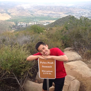
Instead of following the traditional route of hiking up the front (south) side of Cowles Mountain, I started my trek from the end of the Mesa Service Road on the east side of Mission Trials Regional Park. The Mesa Trail actually had more shade to protect you from the heat and sunlight than if you started from the main trail head at the corner of Golfcrest Drive and Navajo Road. The tough part began when you ascended west on the Cowles Service Road towards the summit of Cowles Mountain. It was nearly a mile stretch in which the incline became rather steep in a couple of spots. As soon as you pass the top of Cowles Mountain, you keep going west for a few hundred more yards before you see a sign that directs you to a trail towards Pyles Peak. From that point, it was another 1.5 miles of decline and incline before you reached the summit of Pyles Peak. About halfway into this part of the trek, there was a view point (i.e. Pyles View Peak) where you could branch off back east for maybe a 1/4 mile until the path ended in a cul de sac. At that location, you get a wonderful view looking back towards the top of Cowles Mountain. It's a nice rest stop and photo opportunity. There was about 3/4 mile left to hike before reaching Pyles Peak. A sign posted 1/4 mile from the summit warned hikers that this was a difficult climb. I actually didn't find it any worse than the ascent up the Cowles Service Road. The sign at the Pyles Peak summit indicated you were 1379 feet above sea level. After taking several pictures and eating some snacks, I started my journey back to where my vehicle was. In total, this hike took approximately 3.5 hours with breaks to cover about 6.5 miles. read more


5 years ago
We've hiked 4 of the 5 peaks in Mission Trails; Fortuna and Pyle's are our favorites (you can keep Cowles, thankyouverymuch). Our only visit to Pyle's (so far) came after hiking up to Cowles. The path to Pyle's is easy to find once you leave Cowles summit, and it was much less populated, which I admit was a relief. We only met a handful of other hikers on the path from Cowles to Pyle's and back again. It's a shame, because Pyle's offers some pretty views and scenery, and is much more calm than Cowles. Then again, the summit at Pyle's is less expansive, so I'm sure it would feel much more crowded with fewer people. There were three others at the summit by the time we huffed our tired old bones up there: a couple having a snack on the rocks and one bad-ass girl who'd run the trail between Cowles and Pyle's (I had spotted her on the trail way behind us at one point, but she beat us to the peak by about 5 minutes. That's hard core!) We were able to take a few minutes to enjoy the views, the quiet, and to try to find the 5th and final peak (Kwaay Paay, which we'll likely only visit as part of the 5 Peak Challenge.) I was going to say, "I don't know if the trek to Pyle's was difficult, or if I was just tired" but I'm going to say it is challenging. It felt like there was a lot more ascending than descending getting to that summit, but I'm sure that wasn't the case. I do know I felt the burn after hitting the top, and needed a minute to recover before turning back towards Cowles and the trip to our car. read more
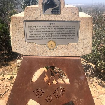


When I thought Cowles was boring it surprised me with Pyles as an extension of the hike! Plus taking the back service road and then hike Pyles then you got a good leg workout! 7.3 miles around trip. You have to make it up Cowles first then at the top you take a left to the service road and you'll find the sign for the entrance to Pyles Peak. If you are coming up the service road then continue straight you'll hit the sign. The start of Pyles is flat and downhill then it surprises you and it's uphill! The last portion to get up to the peak is all uphill get ready for it. At the half way point there is a lookout if you want to go up there for a break. Views aren't that great I wouldn't waste the time to go up there. You can see all 5 peaks from Pyles. It's a narrow trail not heavily trafficked. Mix of rocks and dirt terrain. Good for trail running or hiking. All trails rates it a moderate, the signs say difficult. I will rate it moderate to difficult. The inclines are difficult the rest I would say is moderate. Overall it's a great extension to Cowles and if you take the service road up it is a great leg workout. Nice workout, I would do it again. Bring enough water if you plan on going later in the day! read more


4 years ago


11 years ago
For those who love hiking and want to take on another challenge after you topped the Cowles Mountain, consider Pyle's Peak! Entrance/parking: the only way to access Pyle's Peak is from the top of Cowles Mountain. After you arrived Cowles peak, find the service road and walk toward west. You will see a sign for Pyle's Peak. Trail distance/difficulty: 1.5 miles to Pyle's peak summit but it includes multiple downward and upward hikes throughout. The hike to Pyle's peak is a difficult hike because its distance and change of elevations. Activity: This hike is much less popular than Cowles Mountain so it is excellent for hikers who want to get out there and enjoy the scenery by yourself. At the half way to the peak, there is a view point for you to enjoy the view. The trail here is smaller and less maintained than Cowles but definitely gives you more of a "real" hiking experience. When you are about to summit Pyle's peak, it can be a steep challenging hike; however, you will see the summit in no time! After that, the view is all yours! Tips: Make sure you bring enough water! With Cowles hike, you will be hiking about 3.5 miles to Pyle's peak so the hike gets long and difficult. read more


I did this hike this morning. We got there early (about 6:15) and found parking on Golfcrest pretty close but there were no spaces available in the small lot. We started at the Cowles mountain trailhead...there was a nasty, foul odor coming from the restrooms...no, seriously it was bad! The hike to Cowles is busy, rocky and just ok...some good views. It was 1.25 to the top. After pausing to take a picture we went to the left of the plaque and there was a little access road with a sign for the Pyle's Peak trail. I enjoyed this part much better since it has more of a natural, interesting landscape and so fewer people than the Cowles portion...a couple hundred people on Cowles and less than 2 dozen on the Pyle's trail. It is 1.5 miles from Cowles to Pyle's and took us about 2 hrs and 5 mins to complete the 5.5 miles RT. read more


7 years ago
Wow! I've done Cowles Mountain plenty of times and for some reason, I've never realized that Pyle's Peak is literally the next trail over which connects to it. If you enjoyed Cowles, Pyles Peak offers a nice addition to the hike while offering similar sweeping views of the San Diego area. And know that in order to do this trail, you have to complete one of the Cowles Mountain trails first. Pyles Peak trail is the road less traveled, but I happened to enjoy the fact that it has way less people hiking it. On my entire trip I only encountered two people and one of them was the volunteer ranger. The trail is almost entirely dirt, but there are some steps and rails to use along the way. I did it in the early morning during June bloom. With that being said, I wouldn't recommend doing it in the heat of the sun as there is very little shade to take advantage of. So dress accordingly and bring an adequate supply of water! I did encounter a snake on my last trip there, so just keep an eye out if you're hiking during the warmer months. read more


10 years ago
TIP: If you are doing the 5-Peak Challenge of Mission Trails, do this one subsequently after Cowles Mountain since you can do them both in one shot. The total round trip distance for both is 6 miles and the only way you can get to Pyles Peak (from Golfcrest Drive) is via the summit of Cowles Mountain. At 1379 feet, you will actually be descending 213 feet from Cowles to get to Pyles Peak but don't let that fool you in thinking this will be a leisurely stroll. The hike starts off with a nice long downhill then goes on a small incline during the 2nd half. Shortly after the overlook, the small incline turns into a steep uphill with many switchbacks for the last 0.3 miles (which seemingly takes forever). Going back, the downhill becomes the start and you end with a challenging uphill ascent with multiple switchbacks before arriving back at Cowles Mountain. Lately, there's been more people that have been scaling Pyles Peak so it is not as deserted as once before. However, it still remains far less crowded than Cowles and makes for a fun and challenging extension to the hike. The trail is clearly marked the entire way so it is a very straightforward hike and you won't get lost. It is well-maintained and although hiking shoes are preferable, you should be able to do this hike in running shoes without much problem. The view from Cowles is far superior to the view at Pyles Peak. Still, this is a hike worth checking out. I'm surprised at how often I hiked Cowles without even noticing this hidden gem! read more

9 years ago
BIG ROCK PARK TRAILHEAD ENTRANCE: As part of the 5peak challenge, we started from the Big Rock Park located on 8125 Arlette St. Santee, CA 92071. From the parking lot, the trailhead can easily be identified. The beginning of the trail is made up of flat areas, slight incline and frequent, spaced out steps. There is minimal shade here. Be careful with the portion of the hike that is visibly recovering from a fire and stay on path! Once the trail connect to the Service trail, you encounter a slight incline followed by an ascend, and lastly an intense incline for the remainder of the hike. Not the slightest tree to shade you here. It kicked my butt and I had to stop a few times before reaching Cowles Summit. The Pyles Peak trailhead is marked by signs that label it as difficult. You begin by descending the mountain for about a mile and gradually ascending the smaller mountain for the remainder of the trail. There is a small area at the top governed by a big rock you can sit on. If you're going to hike up Cowles, you'll be missing out if you don't hike up to Pyles Peak! :) Info about this hike: started 7am, about 2.5 miles to reach top of Cowles and add 1.5 to reach Pyles Peak, a high of 82 degree weather. This trail up to Cowles and Pyles Peak was less traveled than one on Navajo Rd. I'm comparison, that side provides 1.5 miles of switchbacks with rocks to slightly climb over. I enjoyed this way up way more. It is less populated and the trail changes along the way making it more entertaining. read more


Pyles Peak is one of the peaks in the Mission Trails Five Peak Challenge, which is aimed at directing people to trails other than Cowles. Interestingly enough, this is a continuation of the hike up to Cowels. Pyles is about 1.6 miles past the top ofCowles and is definitely a more narrow and less traveled trail, but still well maintained. Our group started from the Barker entrance and headed up on the old fire road, which definitely has a steep start. If you're looking to check this one off your challenge list and aren't an avid hiker, I recommend you head up the normal Cowels trail before heading on to Pyles. The hike there is mostly downhill and boasts some pretty beautiful scenery on a clear day. Sure it may not be as interesting as the view from the top of Cowels, but you'll see a lot more of nature on this trail. Make sure you bring plenty of water, cause the only way back from here is the way you came. If you take the fire road route, it's about 6 miles round trip. read more


13 years ago

11 years ago
**So there's this 5 peak challenge where you gotta hike these specific peaks and take a selfie next to the summit signs. Once you get all of those pics, you email them and you get a certificate and a pin. Not much but hey it's a bigger motivator than nothing. And you guessed it, Pyles Peak was one of them! You can reach the trailhead when you get to the top of Cowels Mountain. I have no idea if there is any other way up there. This was a considerably less busy trail and slightly narrow compared to Cowels. I passed only about 13 people (yes I kept count) on my way to Pyles Peak summit and probably a hundred billion at Cowels. The view was not as great here but nature is nature and it's amazing regardless. If you like a quiet, more secluded hike, this is the place for you. **Totally copy/pasted that part in another one of my reviews cuz lazy. read more


12 years ago
My bf and I started at Big Rock park in Santee. I would definitely not recommend starting on this side, as the trail was not very interesting or strenuous and we really just thought we were lost for the first mile. Having hiked the Cowles trail, I'd recommend making that your way up. Again, quite an odd path to Pyle's Peak. It's mostly downhill from Cowles to Pyle's. The terrain is very rocky, so wear good shoes! When we got to the top, I stepped on a tarantula patch and definitely gave a pretty outrageous screech. My bf wanted to pick them up, but I just wanted to get out of there! All in all, it was a fine hike. I wouldn't do it again, or at least not the same way, but if you're looking for a moderately easy hike that takes about 3 hours, go for it. read more


10 years ago
I would've given this trail 5 starts if it wasn't for the fact that you have to go up Cowles Mountain before you can get to the trailhead. (I don't like Cowles Mountain because it is to crowded) The Pyles trail is nice and peaceful it is a dramatic contrast of Cowles. This time we started our hike at the Cowles Staging Area since we were short on time. We were planing of staring from Barker trailhead but we thought it was longer. The other option was to start from Big Rock trailhead but that is not a fun hike once you get to Cowles Service Road. Once you get to the summit of Cowles the Pyles Peak will be to the left as you face the "service towers" there is a small plaque showing you the way. One thing you need to watch out for on this trail are bikes. They cannot go all they way to the peak but you may ran into them at the begging of the trail. I found that this trail have nice views and plenty of flowers and greenery, not a lot of shade throughout the trail but there were a few areas with shade. Do wear good shoes because there are a lot of loose gravel and rocky areas like the other trails of the 5-Peak Challenge. From the beginning of the trail to the end it is not a hard trail but you have to remember you have to include Cowles Mountain trail into the equation. read more
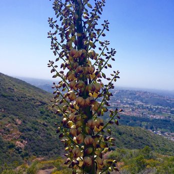

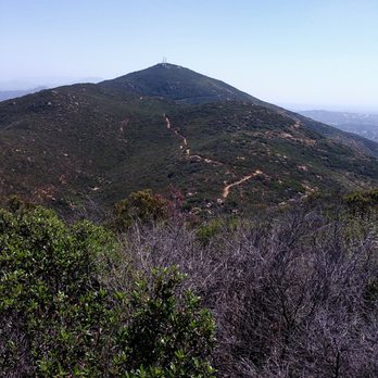


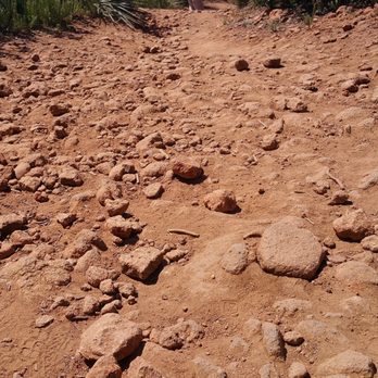


My friend and I hiked up Pyles Peak after conquering Cowles Mtn. Quite some foot traffic at Cowles Mtn. But once you get to the top. You see some pretty nice views. Not many hiked up to Pyles Peak. I believe going back down from the Pyles was a b*tch. Other than that, reaching the Peak was glorious, you can see San Diego at all angles. Once you finish Pyles, you have to remember that you are not done and that you still have to hike back down to Cowles. Oh maaan. It was a good workout. I know I worked up a sweat. In fact, I'm feeling a bit sore the next day. 5 stars total which includes Cowles. I combined the ratings! read more


5 years ago

The journey is hard but the view is worth it. Cowles Mountain is one of the nicest hiking trips i've been too. Going up is the hardest for it is uphill. It is about 2 miles up, zigzag lanes all the way up. Going down is easy, you can jog down to burn calories if you want or enjoy the view of Lake Murray and East Central San Diego. read more


10 years ago

9 years ago
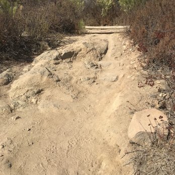
If you have found this Yelp listing then I don't need to tell you this hike is a continuation of the more popular Cowles Mountain Trail. I hiked Cowles Mt three times from Golfcrest Dr/Navajo Rd before hiking Pyles Peak from Barker Way. I never found Cowles Mt challenging enough. Pyles Peak more than doubles the total hiking distance. From Cowles Mt, head towards the communication tower. Before you get to the tower, there is a trail to your left. This trail is roughly 1.4mi from Cowles to Pyles Peak Summit (2.8 miles round trip). As you can see from my elevation pic, the first incline represents the trail from Barker Way to Cowles Mt. From there it was a constant up and down hill slope from Cowles Mt to Pyles Peak Summit which is a real challenge because you are constantly changing between your leg muscles. I won't lie, it was tough and the heat did not help. It may not have been as bad if the weather was cooler. As you approach the end, there is a wooded fenced area. Please note, this is not the end of the trail. There is another quarter mile to the summit from that point, and it is the steepest part of the whole trail from Cowles to Pyles Peak. I have a tendency to hike non-stop. Because of the change in elevation and the strain on my leg muscles compounded by the heat, I learned that I need to listen to my body and know when to rest. I would highly recommend anyone who does not find Cowles Mt challenging enough to continue their hike on Pyles Peak Trail. read more




13 years ago


7 years ago

14 years ago
A friend told me about this back trail, so I thought I would check it out. I tried out my new 2 L hydration backpack to make sure I had plenty of water. The trail had a nice terain of plants of various kinds. The trail started out at a slow decline and had a lot of rough trail that seemed to be totally vacant for most of the hike. Beautiful views to look at. I did not see any rattlesnakes just one tiny baby lizard. A very peaceful hike not strenuous until you get toward the top. I think I will try to add it to my favorite hiking trails for an early morning. Definitely worth checking out. Bring water and extra sunscreen/ hat. When the sun comes out it gets hot quick. read more


10 years ago
The hike continues after you reach Cowles Mtn. I believe it adds ~3miles out and back from the peak of Cowels Mtn. It's a great way to add more distance to your (easy) hike up Cowles. It's less populated with hikers and the trail gets more "lush" with socal green but dry bushes. I can't complain bc it was a change of scenery! Pyles Peak is part of the 5 peak challenge FYI. I think it took us around 3-4 hrs round trip. read more


14 years ago


12 years ago
The extended version of the cowel trail. I would say it was a tough hike, but I don't hike that often. Bring a lot of water because there is no alternative exits, you'll have to hike all the way back up to cowel's summit. There are some hidden trails if your looking to spice it up, but nothing to drastic. read more


12 years ago

14 years ago


18 years ago

16 years ago
More info about Pyle's Peak
Golfcrest Drive And Navajo Rd
San Diego, CA 92119
San Carlos
Directions
Hours
Outdoor Amenities
Ask the Community - Pyle's Peak
Review Highlights - Pyle's Peak
You might also consider




















Why does Yelp recommend reviews?
1 review that is not currently recommended
The reviews below are not factored into the business's overall star rating.

16 years ago
Pyle's Peak - hiking - Updated September 2026
Best of San Diego
People found Pyle's Peak by searching for…
Beautiful Views in San Diego, CA
Hiking Trails in San Diego, CA
Swimming Holes in San Diego, CA
Walking Trails in San Diego, CA
Secluded Spots in San Diego, CA
Lookout Points in San Diego, CA
Running Trails in San Diego, CA
Scenic Overlook in San Diego, CA
Full Moon Hike in San Diego, CA
Fishing Spots in San Diego, CA
Stairs Workout in San Diego, CA
Places to Walk in San Diego, CA
Trending Searches in San Diego, CA
Apple Orchards near Pyle's Peak
Apple Picking near Pyle's Peak
Bird Sanctuary near Pyle's Peak
Cliff Jumping near Pyle's Peak
Consignment Shops near Pyle's Peak
Cruising Spots near Pyle's Peak
Dog Friendly Things To Do near Pyle's Peak
Eyebrow Threading near Pyle's Peak
Eyelash Extensions near Pyle's Peak
Hair Braiding near Pyle's Peak
Private Schools near Pyle's Peak
Public Shower near Pyle's Peak
Scenic Night View near Pyle's Peak
Scenic Overlook near Pyle's Peak
Trading Card Shops near Pyle's Peak
Browse Articles
Browse Nearby
BEST of San Diego, California Coffee near Pyle's Peak
BEST of San Diego, California Restaurants near Pyle's Peak
BEST of San Diego, California Things to Do near Pyle's Peak
BEST of San Diego, California Breakfast near Pyle's Peak
BEST of San Diego, California Walking Trails near Pyle's Peak
BEST of San Diego, California Parks near Pyle's Peak
Browse Brands
Related Searches in San Diego, CA
Affordable Kayak Rental Services in San Diego, California
Best Dog Hiking Trails Around San Diego, California
Best Fishing Locations and Guides in San Diego, California
Best Nature Trails for Hiking in San Diego, California
Best Places for Horseback Riding in San Diego, California
Best Sightseeing Experiences Available in San Diego, California
Check Out Off Road Trails in San Diego, California
Discover Dog Friendly Trails to Explore in San Diego, California
Discover Easy Hiking Trails Near San Diego, California
Discover Kid Friendly Hiking Trails in San Diego, California
Discover Popular Bike Trails in San Diego, California
Discover Scenic Mountain Bike Trails Near San Diego, California
Discover Walking Parks in San Diego, California Near You
Discover a Hiking Trail in San Diego, California
Discover the Best Night Hike Trails in San Diego, California
Dog-Friendly Hikes With Dogs in San Diego, California
Enjoy Camping Adventures Around San Diego, California
Enjoy Kayaking Adventures in San Diego, California
Enjoy Off Leash Dog Hikes in San Diego, California
Enjoy Scenic Places to Walk in San Diego, California
Enjoy Tent Camping Spots Around San Diego, California
Enjoy a Beautiful Waterfall Hike in San Diego, California
Enjoy the Best Walking Path in San Diego, California
Enjoy the Best Walking Trails in San Diego, California
Explore Beautiful Parks and Green Spaces in San Diego, California
Explore Easy Hikes Perfect for All in San Diego, California
Explore Fun Activities to Do in San Diego, California
Explore Picnic Parks Near San Diego, California
Explore Popular Campgrounds Near San Diego, California
Explore Top Dog Parks in San Diego, California Near You
Explore the Best Beach Spots in San Diego, California
Family Friendly Hiking With Kids in San Diego, California
Find Top Dog Friendly Parks to Visit in San Diego, California
Find the Best Parks for Picnics in San Diego, California
Hiking Trails With Waterfalls in San Diego, California
Off Leash Dog Hiking Trails in San Diego, California
Popular Outdoor Activities to Try in San Diego, California
Popular Picnic Spots to Visit in San Diego, California
Popular Waterfall Hiking Trails in San Diego, California
Safe River Swimming Areas in San Diego, California
Safe and Fun Parks for Kids in San Diego, California
Top Hiking Trails to Explore in San Diego, California
Top Playgrounds for Kids to Enjoy in San Diego, California
Top Running Trails to Explore in San Diego, California
Top Swimming Lakes to Enjoy in San Diego, California
Top Swimming Spots and Pools in San Diego, California
Top-Rated Camping Sites in San Diego, California


