North Fortuna Summit Photos


You might also consider


More like North Fortuna Summit
Recommended Reviews - North Fortuna Summit
Start your review...


Reviews With Photos


Came here on the day of daylight savings. Arrived on site at 7:30am. Should have started early. Parked our car at 10600 Father Junipero Serra Trail. From there to the summit, round trip 6.3m My best friend and I both enjoyed the hike. Plenty of shade. Things to brings: - hiking boots - breathable hiking clothes - trekking poles - water (1 bottle was enough for me) - sunscreen and bug spray A bee kept landing on my BF. She was happy that it didn't sting her. - brimmed hat - durable day pack - first aid kit Happy hiking!


I rated this 5 because this was one of the toughest out of the 5 peak challenge (at least in my personal opinion) I'm more of an intermediate hiker. Most of my hikes are done in Hawaii where it's pretty much at sea level and in Cali it's a big difference when you're above sea level. I love the outdoors and not knowing where the path begins or what to expect to a certain extent. I loved the challenge and the views were breathtaking. If you love nature, hiking, and a challenge this is for you!


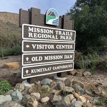
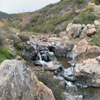
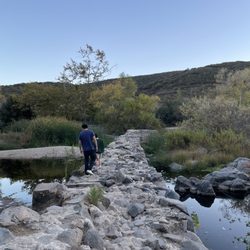
I used the AllTrails "old mission dam to north and south fortuna mountain" trail which is 5.8 miles, except I didn't hAve time to get to the portion of the trail going to south fortuna mountain since I got there late, so going just from the dam to north fortuna clocked me at 4.2 miles . Instead of parking at visitor center, we parked right by the dam but that was a much smaller lot and we were lucky to catch someone leaving a parking space . The first mile is flat, but after that the incline gets pretty steep, I definitely needed to stop for a few breaks, the thighs were burning lol. I loved that the first mile went right along the creek, the sound was peaceful and it was really beautiful . I will say that my love for hiking really began in New York and I'm used to having creeks and waterfalls everywhere I hike and it's not as prevalent in Southern California so I really liked this trail because I love to be by water. Wish I could have been visiting longer to complete the mission trails 5 peak challenge .


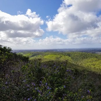
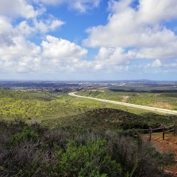
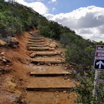
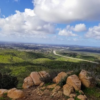
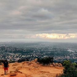
I'm almost certain I've done all the summits in Mission Trails so far, just recently I've been going over trails that I've completed before and the North Fortuna Summit is one of the more fun ones at this park in my opinion. There's two ways to reach this summit and the path I usually take is from the main trail on the Tierrasanta side called the "Rim Trail". If you follow this trail north, you'll finally end up at the petermeter trail which leads up to the Fortuna summit. This climb isn't too bad, however if you don't have good footing this trail is not for you as there's lots of rocky areas and when it rains the mud makes it very difficult to move through if you don't have proper hiking boots. It's definitely not a trail for beginners in the slightest, however the climb isn't very long and steep. Once you reach the top of the summit, you'll be met with great views of Tierrasanta, San Carlos and Santee. While the 52 does cross right near this area, the traffic noise isn't too bad in my opinion. At the top people have left tons of trash unfortunately, I wish people would stop doing this, several ammo cans filled with who knows what. If you're just visiting Mission Trails for one day, this summit is worth it in my opinion, not too long and you can take a different way back down.


Great hike with many trail options to reach the summit. The route we took was moderate with just under 1,000 feet of elevation gain. There were some steeper sections but the trail wasn't too gravely. It is a well maintained trail. read more


1 year ago
Knowing where to enter was the trickiest part to this hike. There are multiple entry points for the Fortuna trails, but I started at Gate 9, right off the road, which led me through the Grasslands, then onto the Oak Canyon Trail, and finally to the Fortuna Saddle Trail, where you could turn right to hike North Fortuna (1,291 ft) or left to hike South Fortuna (1,094 ft). I decided to start with North Fortuna, and at this summit, I arrived just as a man was kneeling to propose. I captured a few photos for them--such a special moment to witness. Both summits are about 1.2 miles out-and-back from the saddle. The full hike was roughly 7 miles round-trip. The trail was beautiful, crossing bridges and water, but also quite steep in sections. If you're doing the five peak challenge, I recommend starting with the Fortuna hikes or Kwaay hike. read more


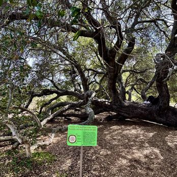


Depending on where you start, North Fortuna can be around 5-6 miles roundtrip. We start at North Fortuna Trailhead for about 5.74 miles round trip. You can start at the Portobello entrance too. The hike is not difficult, just no shade. Bring plenty of water on hot days. You really don't need anything but water and a light snack! The views of the mountains is very relaxing. Not too many people on this hike. Pretty secluded compared to like Cowles. read more

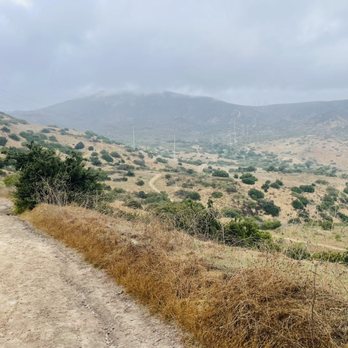


Came here on the day of daylight savings. Arrived on site at 7:30am. Should have started early. Parked our car at 10600 Father Junipero Serra Trail. From there to the summit, round trip 6.3m My best friend and I both enjoyed the hike. Plenty of shade. Things to brings: - hiking boots - breathable hiking clothes - trekking poles - water (1 bottle was enough for me) - sunscreen and bug spray A bee kept landing on my BF. She was happy that it didn't sting her. - brimmed hat - durable day pack - first aid kit Happy hiking! read more


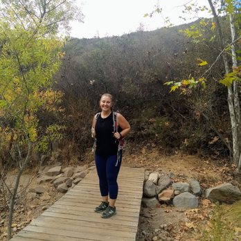


I rated this 5 because this was one of the toughest out of the 5 peak challenge (at least in my personal opinion) I'm more of an intermediate hiker. Most of my hikes are done in Hawaii where it's pretty much at sea level and in Cali it's a big difference when you're above sea level. I love the outdoors and not knowing where the path begins or what to expect to a certain extent. I loved the challenge and the views were breathtaking. If you love nature, hiking, and a challenge this is for you! read more




7 years ago
I used the AllTrails "old mission dam to north and south fortuna mountain" trail which is 5.8 miles, except I didn't hAve time to get to the portion of the trail going to south fortuna mountain since I got there late, so going just from the dam to north fortuna clocked me at 4.2 miles . Instead of parking at visitor center, we parked right by the dam but that was a much smaller lot and we were lucky to catch someone leaving a parking space . The first mile is flat, but after that the incline gets pretty steep, I definitely needed to stop for a few breaks, the thighs were burning lol. I loved that the first mile went right along the creek, the sound was peaceful and it was really beautiful . I will say that my love for hiking really began in New York and I'm used to having creeks and waterfalls everywhere I hike and it's not as prevalent in Southern California so I really liked this trail because I love to be by water. Wish I could have been visiting longer to complete the mission trails 5 peak challenge . read more




I'm almost certain I've done all the summits in Mission Trails so far, just recently I've been going over trails that I've completed before and the North Fortuna Summit is one of the more fun ones at this park in my opinion. There's two ways to reach this summit and the path I usually take is from the main trail on the Tierrasanta side called the "Rim Trail". If you follow this trail north, you'll finally end up at the petermeter trail which leads up to the Fortuna summit. This climb isn't too bad, however if you don't have good footing this trail is not for you as there's lots of rocky areas and when it rains the mud makes it very difficult to move through if you don't have proper hiking boots. It's definitely not a trail for beginners in the slightest, however the climb isn't very long and steep. Once you reach the top of the summit, you'll be met with great views of Tierrasanta, San Carlos and Santee. While the 52 does cross right near this area, the traffic noise isn't too bad in my opinion. At the top people have left tons of trash unfortunately, I wish people would stop doing this, several ammo cans filled with who knows what. If you're just visiting Mission Trails for one day, this summit is worth it in my opinion, not too long and you can take a different way back down. read more





9 years ago

More info about North Fortuna Summit
North Fortuna Mountain Summit Trl
San Diego, CA 92093
Directions
Hours
Outdoor Amenities
Ask the Community - North Fortuna Summit
You might also consider



















Why does Yelp recommend reviews?
1 review that is not currently recommended
The reviews below are not factored into the business's overall star rating.

3 months ago
North Fortuna Summit - hiking - Updated September 2026
Best of San Diego
People found North Fortuna Summit by searching for…
Hiking Trails With Waterfalls in San Diego, CA
Waterfalls and Swimming Holes in San Diego, CA
Running Trails in San Diego, CA
Off Road Trails in San Diego, CA
Beautiful Views in San Diego, CA
Secluded Spots in San Diego, CA
Walking Trails in San Diego, CA
Fun Things to Do on a Rainy Day in San Diego, CA
Natural Hot Springs in San Diego, CA
Visitor Centers in San Diego, CA
Stroller Friendly Hikes in San Diego, CA
Scenic Overlook in San Diego, CA
Trending Searches in San Diego, CA
Apple Orchards near North Fortuna Summit
Apple Picking near North Fortuna Summit
Archery near North Fortuna Summit
Barbershop near North Fortuna Summit
Beautiful Views near North Fortuna Summit
Blow Dry Bar near North Fortuna Summit
Corn Maze near North Fortuna Summit
Dog Friendly Things To Do near North Fortuna Summit
Dog Swimming near North Fortuna Summit
Eyelash Extensions near North Fortuna Summit
Haunted Houses near North Fortuna Summit
Hiking near North Fortuna Summit
Hiking Trails near North Fortuna Summit
Kids Birthday Party near North Fortuna Summit
Makeup Artists near North Fortuna Summit
Off Road Trails near North Fortuna Summit
Outdoor Activities near North Fortuna Summit
Parks near North Fortuna Summit
Photo Spots near North Fortuna Summit
Picnic Areas near North Fortuna Summit
Places To Take Pictures near North Fortuna Summit
Private Schools near North Fortuna Summit
Public Shower near North Fortuna Summit
Pumpkin Patches near North Fortuna Summit
Rock Quarry near North Fortuna Summit
Scenic Night View near North Fortuna Summit
Browse Articles
Browse Nearby
BEST of San Diego, California Coffee near North Fortuna Summit
BEST of San Diego, California Restaurants near North Fortuna Summit
BEST of San Diego, California Things to Do near North Fortuna Summit
BEST of San Diego, California Breakfast near North Fortuna Summit
BEST of San Diego, California Parks near North Fortuna Summit
BEST of San Diego, California Horseback Riding near North Fortuna Summit
BEST of San Diego, California Campgrounds near North Fortuna Summit
Browse Brands
Related Searches in San Diego, CA
Affordable Kayak Rental Services in San Diego, California
Best Dog Hiking Trails Around San Diego, California
Best Fishing Locations and Guides in San Diego, California
Best Nature Trails for Hiking in San Diego, California
Best Places for Horseback Riding in San Diego, California
Best Sightseeing Experiences Available in San Diego, California
Check Out Off Road Trails in San Diego, California
Discover Dog Friendly Trails to Explore in San Diego, California
Discover Easy Hiking Trails Near San Diego, California
Discover Kid Friendly Hiking Trails in San Diego, California
Discover Popular Bike Trails in San Diego, California
Discover Scenic Mountain Bike Trails Near San Diego, California
Discover Walking Parks in San Diego, California Near You
Discover a Hiking Trail in San Diego, California
Discover the Best Night Hike Trails in San Diego, California
Dog-Friendly Hikes With Dogs in San Diego, California
Enjoy Camping Adventures Around San Diego, California
Enjoy Kayaking Adventures in San Diego, California
Enjoy Off Leash Dog Hikes in San Diego, California
Enjoy Scenic Places to Walk in San Diego, California
Enjoy Tent Camping Spots Around San Diego, California
Enjoy a Beautiful Waterfall Hike in San Diego, California
Enjoy the Best Walking Path in San Diego, California
Enjoy the Best Walking Trails in San Diego, California
Explore Beautiful Parks and Green Spaces in San Diego, California
Explore Easy Hikes Perfect for All in San Diego, California
Explore Fun Activities to Do in San Diego, California
Explore Picnic Parks Near San Diego, California
Explore Popular Campgrounds Near San Diego, California
Explore Top Dog Parks in San Diego, California Near You
Explore the Best Beach Spots in San Diego, California
Family Friendly Hiking With Kids in San Diego, California
Find Top Dog Friendly Parks to Visit in San Diego, California
Find the Best Parks for Picnics in San Diego, California
Hiking Trails With Waterfalls in San Diego, California
Off Leash Dog Hiking Trails in San Diego, California
Popular Outdoor Activities to Try in San Diego, California
Popular Picnic Spots to Visit in San Diego, California
Popular Waterfall Hiking Trails in San Diego, California
Safe River Swimming Areas in San Diego, California
Safe and Fun Parks for Kids in San Diego, California
Top Hiking Trails to Explore in San Diego, California
Top Playgrounds for Kids to Enjoy in San Diego, California
Top Running Trails to Explore in San Diego, California
Top Swimming Lakes to Enjoy in San Diego, California
Top Swimming Spots and Pools in San Diego, California
Top-Rated Camping Sites in San Diego, California


