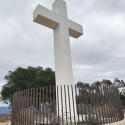
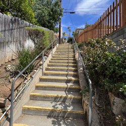
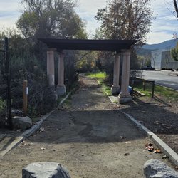
El Cajon Mountain Hiking Trail Photos


You might also consider
More like El Cajon Mountain Hiking Trail
Recommended Reviews - El Cajon Mountain Hiking Trail
Start your review...

Reviews With Photos

What goes up, must come down! I highly recommend starting this hike early. If you're there before the gate is open, you can park on the side of the road. There's restrooms by the start of the trail if you need to use them. Don't let the first two miles of this hike fool you, it's just a baby version of what's to come. These small rolling hills are nothing.. once you get around 2.5mi in the fun begins. The climbs get steeper and the terrain changes. There are rocky parts, sandy parts, and well taken care of fire road. The last .25mi or so of this hike is a quad/glute killer, like a stairmaster machine on maximum settings. Be careful as it's easy to lose footing here (even with proper shoes). The green trail signs towards the summit are such a pleasant sight, you're very close to the summit when you see them. I reached the summit in 2 hours 2 minutes. I planned to run down but didn't run it in its entirety as there are many steep sections. Definitely come to this hike prepared as there is practically no shade from the sun. There are a few spots where you can stop and sit in the shade but I would say 98% of the trail is exposed. Like I mentioned in the beginning, start early during these hotter months. Bring plenty of water (I went through about 2L), food/snacks (I had rice crisps, jerky, and trail mix), and sunblock. Bugs weren't a problem. There wasn't too much foot traffic as I made my way down but everyone I encountered was super friendly. I recommend this hike for anyone looking for a good workout/challenge!
A truly challenging hike! Clearly marked trails, even some arrows pointing the way were so helpful. Over 11 miles round trip, full of ups and downs. The weather change from the start to the top was quite drastic. Thank goodness for bringing extra layers. The views at the top were not visible for us as the clouds rolled in and temps dropped to 50 degrees. Beautiful none the less. There is a stop sign half way up to make sure you have enough water. In summer I can see this being crucial as the terrain is challenging. Expect yo be sore after this one!

Hardest hike in San Diego hands down. Difficulty: Hard Mileage: ~11.5 Pets: Dog friendly View: East County, Mountains, SD County What to bring: At least 3 liters, snacks, hat, sunblock Parking: Designated parking lot (opens at 8) or street parking along Wildcat Canyon Fee: Free Time: ~5-6 hours Fitness Level: Fit Yes this is the hardest hike in SD, it's not the highest peak but to get there is hard. It's hard because of the heat and the ascends. This is the hike to do if you are training for the SoCal Six Pack of Peaks. My advice to you is to get here early!! Keep track of the weather. We started at 6:30am, parking lot doesn't open yet so we parked on the streets. Plenty of other cars. We got extremely lucky and came when it was over cast for a good amount of our hike! On hot days, I heard it's brutal. I can't stress this enough, BRING ENOUGH WATER. You'll need at least 3 liters!! A small water bottle doesn't cut it. The hike itself, is hard because you go up then down about 4x to get to the peak. Your last mile to the peak is the hardest mile. Be prepare! When we ascended to the top, we were above the fog and clouds and it was sunny and beautiful. Sit on a rock and eat some snacks. You have to be fit to do this hike. It's not Cowles where it doesn't take any fitness level. If you've done Potato Chip/Mt Woodson in hot weather and had no problems, you can do this. But it you hate potato chip, this is 5x worst. We did this a week before we hike San Jacinto and glad we were able to train on El Cajon. It definitely was a good preparation hike for bigger, more strenuous hikes.

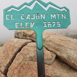
On the eve of Earth Day 2020, I decided to get in touch with Mother Nature and drove 20+ miles inland to tackle my hiking nemesis. I did this trail some three plus years ago. It's the reason why I invested in trekking poles. The parking lot is currently closed to prevent gatherings (normal opening time of 8 am), but you can park alongside Wildcat Canyon Road and walk a 1/2 mile to the trailhead. There were several vehicles already on the roadside when I arrived in the early afternoon. I recalled the entire hike lasted about six hours. The distance from the trailhead to the summit of El Cajon Mountain was about 5.3 miles. If you include the length from the parking lot, then the total round-trip mileage added up to 11.6 miles. This hike is no joke as it takes twice as long in time and is easily triple the difficulty of Mount Woodson (aka Potato Chip Rock) for reference. As a warmup, the stroll from the parking lot to the trailhead took at least 10 minutes with an elevation gain of nearly 250 feet. The first mile of the trail had a gentle slope with numerous switchbacks in mainly shaded areas. You then connected to the main trail after this initial mile by veering left (east). The next 1.5 miles marked the beginning of some steep up and down terrain which was where my poles came in handy. After all the recent rainfall, there were still lingering muddy patches, but I would say 95% of the trek was on dry footing. At each mile, there was a marker with a graphic that showed where you were including a cartoon depicting how steep the slope was (or will become). It reminded me of the old Price Is Right game of Cliffhanger in which the stick figure is ascending a peak. Near the 50% mark, there was a kiosk showing a map of the El Capitan Preserve. It was followed by a stop sign with a message above which offered congratulations that "you have made it half way." It also cautioned hikers that "if it is much past noon please do not attempt to go to the top today." LOL... I didn't even begin until well after 12 noon so I was not dissuaded from continuing. The weather happened to be mostly overcast with some occasional sunshine. The temperature probably maxed out in the low 70s which was perfect. The second half of the inbound route was when the difficulty really increased with climbs and drops along a couple of saddlebacks. The trail also became narrower and rockier so you had to be careful with your steps. At approximately the 4.8 mile spot, the rusted out hull of an old Jeep rested beside the path. I wish I knew what the story was behind that abandoned vehicle. Upon arrival at the Mile 5 marker, you could head right and explore the El Capitan Trail which added another mile out and back. I did this sidebar last time which led to a panoramic overlook of the valley below. On this occasion, I skipped that and went left to complete the final 1/3 mile ascent to the peak of El Cajon. There was a lot of boulder scaling in this penultimate approach to the summit. You're climbing on top of and along the sides of numerous rock formations. Follow the green markers as there were junctures in which the route to the top became unclear. At the peak, there was a marker indicating 'El Cajon Mtn. - Elev. 3675'. The views up there were spectacular. My duration to get here was a little over three hours which was on the slow side. I thought the journey back would be easier, however it actually took me 30 minutes longer even with the assistance of the poles. The reason was the downward portions put a lot of shock on my knees which were really hurting. The poles helped, but my pace was like a turtle. I felt like I was on crutches as I scaled my way down. It wasn't all downhill though as what made this trail extra challenging was that there were numerous steep intermediate ascents and descents. I couldn't wait to remove my shoes when I made it back to my vehicle. Pretty much every body part below my waist was sore and tight. I'm uncertain if I will tackle this beast again on a third attempt. El Cajon Mountain has kicked my arse twice so it may be time to wave the white flag. For its difficulty, duration, and elevation gain, I gave the trail a 5+ star rating. PS: The physical/social distancing was good. I encountered maybe 10 different sets of hikers, all of whom were heading in the opposite direction for their return trip.

Make sure! Let me say this louder! MAKE SURE you bring plenty of water and food! This was probably the hardest hike I've done. I underestimated what I got myself into. BUT the view at the top is beautiful! Make sure you wear proper hiking shoes and socks (by the end of my hike, had a HUGE blister on my heel) 12 miles of pure enjoyment but very rewarding! If you are looking for a challenge come to this mountain.

I've done this trail 3x and all 3 were different experiences. First time was back in April, there was mositure due to dense fog, which made it a great experience. Completed 4:55 moving time, 12.37 miles. This includes, old miners caves, ECM and El Cap. Second time, was a solo trek. Started this trail at 6:30 and oh man! I nearly died from overheating! YES! IT GETS HOT!!! Whatever little shade I found, I was in there, trying cool my body temperature. Completed in 3:55 hrs moving time, 11 miles. Third time, we started at 4:30AM! This was a fantastic experience, almost the beginning of a scary movie.."oh what's that noise ? lets check it out" NOT!!! Lots of spider webs on the trail, almost ran into an orb weaver's web...sucker was big enough to see in the dark. We were also the first to summit that morning and it was an AMAZING feeling! Completed in 4:21 hrs moving time, total 11.37 miles. Overall, no matter what time of the day you decide to start, it gets HOT in the summer time. I haven't attempted this trail in the evening or in the winter...maybe it'll make it a better experience?!? The trail isn't bad, if you're accustomed to hiking steep inclines. It's not a beginners trail, that's for sure. It's doable, don't get me wrong, but this trail may deter you from ever hiking again. If you do decide to hike in the summer, please, please, PLEASE bring enough water! I had 3l total and each time, only had a .5l left. Stay hydrated. Bring lots of snacks, you will need to fuel your body. Beat the heat and start as early as possible. My 3rd attempt we hit the summit a little after 6:30am and it was already 76 degrees! Do your research and believe what you read! Good luck and happy trails!

Location: 13500 Blue Sky Ranch Rd. Lakeside, CA 92040 Across the street from: Oakoasis 12620 Wildcat Canyon Road Lakeside, CA 92040 This was intense. There were a lot of ups and downs. For me, the hike would have been easier if I had hiking shoes on. Bring: - hat - sunblock - water (at least 3 liters if hiking to summit) and snacks - hiking poles Would not recommend this terrain to a rookie. Best to start hiking really early to avoid too much exposure to the sun. Park on Wildcat Canyon Rd. if arrive before 8 a.m. We decided only to hike up to the bench (3.2 m). It can get really hot. Stay hydrated and rest in the shade whenever possible. Happy hiking! Beware of snakes!

We did this hike back in December with a hiking group called Resilient Squad and we had a blast! But let me be clear this hike will test your endurance and willpower. Power through it and knowing you will have finished probably the hardest hike in SD and the great views at the peak will be worth it! We arrived at about 5am and parked on the side of Wildcat Canyon Rd since the gate to the parking lot doesn't open until 7 I think. You walk uphill for about .5 miles to the official start of the trail. -RT was about 12 miles -Duration about 7 hrs... started at 5 and ended at 12 with many stops for pictures, take in views, catch our breath and about 40 mins at top to eat , rest, and pictures -Elevation gain about 3,500 ft -Difficulty definitely strenuous I would recommend starting this hike early using a flashlight or headlamp since the hike is difficult, there is little to no shade, and it will take you at the minimum 4 hrs especially if you do this in warmer weather months/conditions. One of the details that makes this hike a test besides the obvious long mileage and elevation gain is the fact that there is so much up and down to the trail so that the hike back down to your car is not as easy as you would hope and you start swearing to anyone who will listen when you think you have done the last incline part and then you see another one after another one. There is some rock scrambling that is pretty steep the last 1/3 of a mile to the peak but there are markers to keep you on the trail that reassure you that you are going the right way.

El Cajon Mountain Hiking Trail (El Cajon, CA) Stats (according to Alltrails) Distance = 10.6 miles RT Elevation Gain = 3576 feet Route Type = Out & Back I have completed my share of hikes in San Diego and can honestly say that El Cajon Mountain is one of the tougher ones. What makes this hike tough is the exposed trail (barely any shade), the elevation gain over 3,500 feet, the total distance round-trip over 10 miles, and the crazy amount of up's and downs. Here are some tips... 1. Be Prepared: I recommend hiking boots or shoes with good ankle support. Don't forget snacks, sun screen, and enough hydration. It's recommended to pack at least 100 oz. of hydration, which is equivalent to about 6 bottles of water. You should know yourself and do you. I brought 5 liters and it was not enough for me. Also note that because of the heat, I wanted to start before sunrise but left my headlamps at home. I had to start at 7:00 AM and the sun reminded me that he doesn't mess around come noon. 2. The address on Yelp is spot on. Head towards Barona Casino and look for the parking lot off Wild Cat Canyon Road & Blue Sky Ranch Road to the right. The parking lot opens around 8:00 AM, sometimes as late as 8:30 AM. The gates close at a specific time too. Keep that in mind. 3. Give yourself enough time to complete this hike. Elites and the fit can complete this entire hike in less than 4 hours. It took me 2.5 hours to summit and 3 hours to descend. Overall with breaks, using the faciliTREES twice, 30 minutes at the peak, a detour to El Cap, and pictures, this hike took me 6 hours. 4. Miles 0 to 1 starts off simple and quickly becomes moderate once you pass the first mile. This is the easy part and about a quarter of this stretch is under some shade. Enjoy it while you can because the beast starts at the halfway point. 5. It starts to get steep between miles 2.5 and 3. This is the halfway point. There's even a warning sign suggesting heading back to the parking lot if you have not made it to this point by 12:00 PM. From this sign, it's steep and majority of the trail is uphill. There's barely any shade and the terrain itself is slippery dirt & gravel. There are a few short descends, but for the most part it's a mainly uphill until you reach mile 5. By far, miles 3 to 5 is the toughest part of the hike and there's no shame in heading back. The views at the halfway point are just as good and there's even a bench to sit on. Just saying. 6. Mile 5 means you're almost there. Head left if you want to summit El Cajon Mountain. Head right if you want to summit El Capitan. I decided to hit El Cajon Mountain Summit first and El Capitan on the way back. From here, it's less than .5 miles to the top and it's pretty much a bunch of steep switchbacks. Just follow the green markers and you'll be fine. 7. Once you get to the peak, you'll notice that it's not that big up there and definitely not flat. Find a safe spot to sit. Look for the elevation signage and USGS marker. Take your photos, eat your snacks, and relax your feet. 8. Usually the hike to the peak is the hard part. Maybe for some, descending is harder. In my opinion, what makes El Cajon Mountain Trail difficult is that fact that there are no "breaks" on this hike. You must hike through two mountains to get to the peak. Hiking back to the car means that you're hiking through these two mountains twice. There is a lot of up's and downs on this hike, which just adds to the challenge. 9. I started this hike as a training hike in preparation for a tougher mountain in a few months. I loaded my pack with at least 35 pounds of water, food, and miscellaneous items. I even packed a few cans of beans and two iPads just to add some weight to my bag. I also hiked Mt. Woodson and Potato Chip before coming here to add some mileage. My hike up to the top was all about training, testing my hydration, keeping my heart rate down, my pace up, and working on my breathing. My hike down was all about survival. The last hour of this hike was brutal for me. The last thing I wanted to do was slip and fall. I felt like this hike would never end. The stats state that this hike is 10.74 miles RT. My Garmin and Whoop stated that my total mileage was 13.66, which includes the extra mile to the car and detour to conquer El Cap. 10. Overall, El Cajon Mountain Trail is a tough hike and perfect if you're preparing for one of the bigger hikes in California. I would not go as far and state that this hike for experienced or fit hikers only. I think anyone can accomplish El Cajon Mountain if they come prepared and hike at their comfortable pace. I loved my journey to the top and look forward to another tough training session here.

This 12 mile hike is the literal StairMaster of your nightmare. Getting to the summit and back down requires you to overcome what seems like perpetual ups and downs. More than a couple times I caught myself wondering, does it ever end? The parking lot doesn't open until 8 AM, and since we got there at 730, we chose to park along Wildcat Canyon Rd, like many others. From the parking lot, the official trailhead is roughly half a mile further, with restrooms and picnic tables available. There are no facilities along the hike, so plan accordingly. We got to the summit in 2 hrs 40 mins and made it back down in 2 hrs 15 mins. Including the 30 minute break we took at the top and a quick detour to El Capitan, we spent just under 6 hours here. NOTE: when you get past Mile 5 and start heading to the summit, follow the green trail markers! The view from the summit may not be anything to write home about, but the hike itself is intense and gratifying. A must-do for any San Diego hiker! 8/summersteepventures

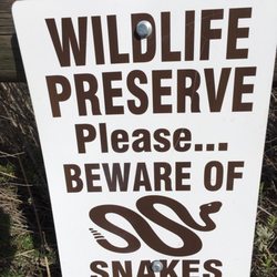
One of the toughest hikes in San Diego. Our group started up at 7 and it took almost 2 and a half hours to hike to the very top. That included some breaks for food / hydration. The way back was less time but probably as difficult as the way up, especially with fatigue, the sun coming out ( late June), and those relentless hills. The whole trip was about 6 hours including breaks, lunch at the top, picture taking, etc etc. It was a great hike, with many amazing photo opportunities. Q and A - Q - A few people are posting that this hike is easy, is that true? A - Most of those people are just boasting or went during temperate conditions. This is not an easy hike. Most hikers we ran into were well prepared with water, covering hats, and trekking poles. There were a few people hiking that were unprepared. I did fear for their safety when the sun starting coming out and they didn't seem to have enough water. The hike is a lot easier when it's overcast or during the winter. Q - Can I make it to the top? A - We passed many people on the way to the top (all ages, sexes, even solo hikers, and older families). So yes you can make it...However, please take the warnings and tips from the other hikers. If you need a break, take it. There is no speed limit on these hiking trails. If the sun is out, and it's a warm/ hot day you need to take precautions. Q - Should you go to the top? A - Shortly after mile 3, there is a lookout. Seriously think about the enjoyable walk and views you've seen up to this point. Decide if you want to continue from here. The next 2.5 miles are tougher. Again, you can do it! Q - So I'm going for it, what should I expect the rest of the way up? A - More steep hills, lots of rubble on the trails, snakes, and one hullava view from the top. Worth it? Yes! Just be very cautious on that last assent trail through the boulders. There are rattlesnakes and several other hikers cautioned us of sightings. Trail Tips - - The parking lot opens at 7. Get there at 6 and park on the street. You need to hit the trail early to avoid the blistering sun. - If you've hiked up to potato chip rock ( Mt. Woodson) and though that was fun and challenging, the El Cajon hiking trail is the next level up in difficulty from that hike. - CamelBak anyone? Also bring coconut water, apples, bars, anything. - Do not underestimate the walk back from the top. You may think it's all downhill but you're in store for RELENTLESS hills all the way back. It will kick your ass. - Weather can change frequently during your hike. It was overcast and nice on the way up. It even started raining at the top, then the sun came out during the last few miles and killed us.

When the reviews say this is one of the hardest hikes in San Diego, they aren't playing. I hiked this in September so the weather obviously did not help. Please please please bring enough water!!! If you're a person who likes A LOT of incline, I highly recommend this hike. This is one of the best hikes I've done and the insane view at the summit makes it all the while! Just a tip: after about 7-8 miles the trail kind of dies out. Not a problem on the way up, but its tricky going down especially when a clear view is hard to see from the bushes and shrubs.


A trail that isn't meant for sight seeing and fun. This trail is definitely meant for sport. 12 miles out & back you get little downtime as you will be engaged on your hike to the peak, as well as your hike back to the parking lot. The Lot does open at 8am but many hikers park on the side of the road. Start early, definitely before sunrise, the sun will definitely become a factor. Pack more water than expected. Temperature's do rise fast and there is little shade. Please wear proper hiking shoes as there are parts of the trail have a lot of loose rocks. Hiking poles are definitely a plus. I recommend using the weather app to know what kind of weather you will be in the day of your hike and so you could wear proper attire. The earlier you start your hike the better, stay safe!! read more


Completed the Memorial Day Warrior challenge and this mountain continues to be one of my favorite. It's is like a roller coaster ride with many ups and downs. I didn't take a lot of picture, but it was an absolutely gorgeous day... 73 degrees high. The rangers were out but I came too late to collect my badges. maybe next year. What a great event and it really brings together the local hiking community. Much thanks to the county of San Diego Parks! Please come and create your own adventure. read more


EL CAJON SUMMIT TRAIL MIX: ADVENTURE, ADRENALINE, ACHIEVEMENT WHAT'S THE VIBE OF THE HIKE? Free. Well-maintained. Well-marked. Openly exposed. Please don't leave your dog poop. As a matter of fact this is not a good hike for a dog or a child or smoking. Last, the last 1/3 of a mile up requires focus because of missteps, rockridge, and boulders. Keep your eye on the green posts even when you're climbing over a boulder ARE THE VIEWS WORTH IT? - Literally above the clouds. - Rare sights: lush flora, imposing boulders, and valleys. IS THIS REALLY SAN DIEGO'S HARDEST HIKE? Yesireee. - 11 miles tested limits; even well-conditioned and 'FIT"felt challenged. - Natural terrain: boulders, slick rock, scrambling. WHAT MINDFUL TIPS WOULD YOU SUGGEST? - Don't wear cotton. Stay safe uphill and downhill. - Consider poles and sturdy footwear. - Carry ample water; refill stations may not suffice. - Physical challenge more than mental. #juken123 #elcajonsummit #elcapitanpreserve #sandiegohiking #hardesthikeinsandiego #steephikinggrades #whatintheworlddidIexperience #bucketlisthike "Planning a challenge is more satisfying than doing it" read more


4 years ago
What goes up, must come down! I highly recommend starting this hike early. If you're there before the gate is open, you can park on the side of the road. There's restrooms by the start of the trail if you need to use them. Don't let the first two miles of this hike fool you, it's just a baby version of what's to come. These small rolling hills are nothing.. once you get around 2.5mi in the fun begins. The climbs get steeper and the terrain changes. There are rocky parts, sandy parts, and well taken care of fire road. The last .25mi or so of this hike is a quad/glute killer, like a stairmaster machine on maximum settings. Be careful as it's easy to lose footing here (even with proper shoes). The green trail signs towards the summit are such a pleasant sight, you're very close to the summit when you see them. I reached the summit in 2 hours 2 minutes. I planned to run down but didn't run it in its entirety as there are many steep sections. Definitely come to this hike prepared as there is practically no shade from the sun. There are a few spots where you can stop and sit in the shade but I would say 98% of the trail is exposed. Like I mentioned in the beginning, start early during these hotter months. Bring plenty of water (I went through about 2L), food/snacks (I had rice crisps, jerky, and trail mix), and sunblock. Bugs weren't a problem. There wasn't too much foot traffic as I made my way down but everyone I encountered was super friendly. I recommend this hike for anyone looking for a good workout/challenge! read more

1 year ago
A truly challenging hike! Clearly marked trails, even some arrows pointing the way were so helpful. Over 11 miles round trip, full of ups and downs. The weather change from the start to the top was quite drastic. Thank goodness for bringing extra layers. The views at the top were not visible for us as the clouds rolled in and temps dropped to 50 degrees. Beautiful none the less. There is a stop sign half way up to make sure you have enough water. In summer I can see this being crucial as the terrain is challenging. Expect yo be sore after this one! read more


3 years ago
Hardest hike in San Diego hands down. Difficulty: Hard Mileage: ~11.5 Pets: Dog friendly View: East County, Mountains, SD County What to bring: At least 3 liters, snacks, hat, sunblock Parking: Designated parking lot (opens at 8) or street parking along Wildcat Canyon Fee: Free Time: ~5-6 hours Fitness Level: Fit Yes this is the hardest hike in SD, it's not the highest peak but to get there is hard. It's hard because of the heat and the ascends. This is the hike to do if you are training for the SoCal Six Pack of Peaks. My advice to you is to get here early!! Keep track of the weather. We started at 6:30am, parking lot doesn't open yet so we parked on the streets. Plenty of other cars. We got extremely lucky and came when it was over cast for a good amount of our hike! On hot days, I heard it's brutal. I can't stress this enough, BRING ENOUGH WATER. You'll need at least 3 liters!! A small water bottle doesn't cut it. The hike itself, is hard because you go up then down about 4x to get to the peak. Your last mile to the peak is the hardest mile. Be prepare! When we ascended to the top, we were above the fog and clouds and it was sunny and beautiful. Sit on a rock and eat some snacks. You have to be fit to do this hike. It's not Cowles where it doesn't take any fitness level. If you've done Potato Chip/Mt Woodson in hot weather and had no problems, you can do this. But it you hate potato chip, this is 5x worst. We did this a week before we hike San Jacinto and glad we were able to train on El Cajon. It definitely was a good preparation hike for bigger, more strenuous hikes. read more


On the eve of Earth Day 2020, I decided to get in touch with Mother Nature and drove 20+ miles inland to tackle my hiking nemesis. I did this trail some three plus years ago. It's the reason why I invested in trekking poles. The parking lot is currently closed to prevent gatherings (normal opening time of 8 am), but you can park alongside Wildcat Canyon Road and walk a 1/2 mile to the trailhead. There were several vehicles already on the roadside when I arrived in the early afternoon. I recalled the entire hike lasted about six hours. The distance from the trailhead to the summit of El Cajon Mountain was about 5.3 miles. If you include the length from the parking lot, then the total round-trip mileage added up to 11.6 miles. This hike is no joke as it takes twice as long in time and is easily triple the difficulty of Mount Woodson (aka Potato Chip Rock) for reference. As a warmup, the stroll from the parking lot to the trailhead took at least 10 minutes with an elevation gain of nearly 250 feet. The first mile of the trail had a gentle slope with numerous switchbacks in mainly shaded areas. You then connected to the main trail after this initial mile by veering left (east). The next 1.5 miles marked the beginning of some steep up and down terrain which was where my poles came in handy. After all the recent rainfall, there were still lingering muddy patches, but I would say 95% of the trek was on dry footing. At each mile, there was a marker with a graphic that showed where you were including a cartoon depicting how steep the slope was (or will become). It reminded me of the old Price Is Right game of Cliffhanger in which the stick figure is ascending a peak. Near the 50% mark, there was a kiosk showing a map of the El Capitan Preserve. It was followed by a stop sign with a message above which offered congratulations that "you have made it half way." It also cautioned hikers that "if it is much past noon please do not attempt to go to the top today." LOL... I didn't even begin until well after 12 noon so I was not dissuaded from continuing. The weather happened to be mostly overcast with some occasional sunshine. The temperature probably maxed out in the low 70s which was perfect. The second half of the inbound route was when the difficulty really increased with climbs and drops along a couple of saddlebacks. The trail also became narrower and rockier so you had to be careful with your steps. At approximately the 4.8 mile spot, the rusted out hull of an old Jeep rested beside the path. I wish I knew what the story was behind that abandoned vehicle. Upon arrival at the Mile 5 marker, you could head right and explore the El Capitan Trail which added another mile out and back. I did this sidebar last time which led to a panoramic overlook of the valley below. On this occasion, I skipped that and went left to complete the final 1/3 mile ascent to the peak of El Cajon. There was a lot of boulder scaling in this penultimate approach to the summit. You're climbing on top of and along the sides of numerous rock formations. Follow the green markers as there were junctures in which the route to the top became unclear. At the peak, there was a marker indicating 'El Cajon Mtn. - Elev. 3675'. The views up there were spectacular. My duration to get here was a little over three hours which was on the slow side. I thought the journey back would be easier, however it actually took me 30 minutes longer even with the assistance of the poles. The reason was the downward portions put a lot of shock on my knees which were really hurting. The poles helped, but my pace was like a turtle. I felt like I was on crutches as I scaled my way down. It wasn't all downhill though as what made this trail extra challenging was that there were numerous steep intermediate ascents and descents. I couldn't wait to remove my shoes when I made it back to my vehicle. Pretty much every body part below my waist was sore and tight. I'm uncertain if I will tackle this beast again on a third attempt. El Cajon Mountain has kicked my arse twice so it may be time to wave the white flag. For its difficulty, duration, and elevation gain, I gave the trail a 5+ star rating. PS: The physical/social distancing was good. I encountered maybe 10 different sets of hikers, all of whom were heading in the opposite direction for their return trip. read more


Make sure! Let me say this louder! MAKE SURE you bring plenty of water and food! This was probably the hardest hike I've done. I underestimated what I got myself into. BUT the view at the top is beautiful! Make sure you wear proper hiking shoes and socks (by the end of my hike, had a HUGE blister on my heel) 12 miles of pure enjoyment but very rewarding! If you are looking for a challenge come to this mountain. read more

4 years ago
I've done this trail 3x and all 3 were different experiences. First time was back in April, there was mositure due to dense fog, which made it a great experience. Completed 4:55 moving time, 12.37 miles. This includes, old miners caves, ECM and El Cap. Second time, was a solo trek. Started this trail at 6:30 and oh man! I nearly died from overheating! YES! IT GETS HOT!!! Whatever little shade I found, I was in there, trying cool my body temperature. Completed in 3:55 hrs moving time, 11 miles. Third time, we started at 4:30AM! This was a fantastic experience, almost the beginning of a scary movie.."oh what's that noise ? lets check it out" NOT!!! Lots of spider webs on the trail, almost ran into an orb weaver's web...sucker was big enough to see in the dark. We were also the first to summit that morning and it was an AMAZING feeling! Completed in 4:21 hrs moving time, total 11.37 miles. Overall, no matter what time of the day you decide to start, it gets HOT in the summer time. I haven't attempted this trail in the evening or in the winter...maybe it'll make it a better experience?!? The trail isn't bad, if you're accustomed to hiking steep inclines. It's not a beginners trail, that's for sure. It's doable, don't get me wrong, but this trail may deter you from ever hiking again. If you do decide to hike in the summer, please, please, PLEASE bring enough water! I had 3l total and each time, only had a .5l left. Stay hydrated. Bring lots of snacks, you will need to fuel your body. Beat the heat and start as early as possible. My 3rd attempt we hit the summit a little after 6:30am and it was already 76 degrees! Do your research and believe what you read! Good luck and happy trails! read more


Location: 13500 Blue Sky Ranch Rd. Lakeside, CA 92040 Across the street from: Oakoasis 12620 Wildcat Canyon Road Lakeside, CA 92040 This was intense. There were a lot of ups and downs. For me, the hike would have been easier if I had hiking shoes on. Bring: - hat - sunblock - water (at least 3 liters if hiking to summit) and snacks - hiking poles Would not recommend this terrain to a rookie. Best to start hiking really early to avoid too much exposure to the sun. Park on Wildcat Canyon Rd. if arrive before 8 a.m. We decided only to hike up to the bench (3.2 m). It can get really hot. Stay hydrated and rest in the shade whenever possible. Happy hiking! Beware of snakes! read more


We did this hike back in December with a hiking group called Resilient Squad and we had a blast! But let me be clear this hike will test your endurance and willpower. Power through it and knowing you will have finished probably the hardest hike in SD and the great views at the peak will be worth it! We arrived at about 5am and parked on the side of Wildcat Canyon Rd since the gate to the parking lot doesn't open until 7 I think. You walk uphill for about .5 miles to the official start of the trail. -RT was about 12 miles -Duration about 7 hrs... started at 5 and ended at 12 with many stops for pictures, take in views, catch our breath and about 40 mins at top to eat , rest, and pictures -Elevation gain about 3,500 ft -Difficulty definitely strenuous I would recommend starting this hike early using a flashlight or headlamp since the hike is difficult, there is little to no shade, and it will take you at the minimum 4 hrs especially if you do this in warmer weather months/conditions. One of the details that makes this hike a test besides the obvious long mileage and elevation gain is the fact that there is so much up and down to the trail so that the hike back down to your car is not as easy as you would hope and you start swearing to anyone who will listen when you think you have done the last incline part and then you see another one after another one. There is some rock scrambling that is pretty steep the last 1/3 of a mile to the peak but there are markers to keep you on the trail that reassure you that you are going the right way. read more


El Cajon Mountain Hiking Trail (El Cajon, CA) Stats (according to Alltrails) Distance = 10.6 miles RT Elevation Gain = 3576 feet Route Type = Out & Back I have completed my share of hikes in San Diego and can honestly say that El Cajon Mountain is one of the tougher ones. What makes this hike tough is the exposed trail (barely any shade), the elevation gain over 3,500 feet, the total distance round-trip over 10 miles, and the crazy amount of up's and downs. Here are some tips... 1. Be Prepared: I recommend hiking boots or shoes with good ankle support. Don't forget snacks, sun screen, and enough hydration. It's recommended to pack at least 100 oz. of hydration, which is equivalent to about 6 bottles of water. You should know yourself and do you. I brought 5 liters and it was not enough for me. Also note that because of the heat, I wanted to start before sunrise but left my headlamps at home. I had to start at 7:00 AM and the sun reminded me that he doesn't mess around come noon. 2. The address on Yelp is spot on. Head towards Barona Casino and look for the parking lot off Wild Cat Canyon Road & Blue Sky Ranch Road to the right. The parking lot opens around 8:00 AM, sometimes as late as 8:30 AM. The gates close at a specific time too. Keep that in mind. 3. Give yourself enough time to complete this hike. Elites and the fit can complete this entire hike in less than 4 hours. It took me 2.5 hours to summit and 3 hours to descend. Overall with breaks, using the faciliTREES twice, 30 minutes at the peak, a detour to El Cap, and pictures, this hike took me 6 hours. 4. Miles 0 to 1 starts off simple and quickly becomes moderate once you pass the first mile. This is the easy part and about a quarter of this stretch is under some shade. Enjoy it while you can because the beast starts at the halfway point. 5. It starts to get steep between miles 2.5 and 3. This is the halfway point. There's even a warning sign suggesting heading back to the parking lot if you have not made it to this point by 12:00 PM. From this sign, it's steep and majority of the trail is uphill. There's barely any shade and the terrain itself is slippery dirt & gravel. There are a few short descends, but for the most part it's a mainly uphill until you reach mile 5. By far, miles 3 to 5 is the toughest part of the hike and there's no shame in heading back. The views at the halfway point are just as good and there's even a bench to sit on. Just saying. 6. Mile 5 means you're almost there. Head left if you want to summit El Cajon Mountain. Head right if you want to summit El Capitan. I decided to hit El Cajon Mountain Summit first and El Capitan on the way back. From here, it's less than .5 miles to the top and it's pretty much a bunch of steep switchbacks. Just follow the green markers and you'll be fine. 7. Once you get to the peak, you'll notice that it's not that big up there and definitely not flat. Find a safe spot to sit. Look for the elevation signage and USGS marker. Take your photos, eat your snacks, and relax your feet. 8. Usually the hike to the peak is the hard part. Maybe for some, descending is harder. In my opinion, what makes El Cajon Mountain Trail difficult is that fact that there are no "breaks" on this hike. You must hike through two mountains to get to the peak. Hiking back to the car means that you're hiking through these two mountains twice. There is a lot of up's and downs on this hike, which just adds to the challenge. 9. I started this hike as a training hike in preparation for a tougher mountain in a few months. I loaded my pack with at least 35 pounds of water, food, and miscellaneous items. I even packed a few cans of beans and two iPads just to add some weight to my bag. I also hiked Mt. Woodson and Potato Chip before coming here to add some mileage. My hike up to the top was all about training, testing my hydration, keeping my heart rate down, my pace up, and working on my breathing. My hike down was all about survival. The last hour of this hike was brutal for me. The last thing I wanted to do was slip and fall. I felt like this hike would never end. The stats state that this hike is 10.74 miles RT. My Garmin and Whoop stated that my total mileage was 13.66, which includes the extra mile to the car and detour to conquer El Cap. 10. Overall, El Cajon Mountain Trail is a tough hike and perfect if you're preparing for one of the bigger hikes in California. I would not go as far and state that this hike for experienced or fit hikers only. I think anyone can accomplish El Cajon Mountain if they come prepared and hike at their comfortable pace. I loved my journey to the top and look forward to another tough training session here. read more


This 12 mile hike is the literal StairMaster of your nightmare. Getting to the summit and back down requires you to overcome what seems like perpetual ups and downs. More than a couple times I caught myself wondering, does it ever end? The parking lot doesn't open until 8 AM, and since we got there at 730, we chose to park along Wildcat Canyon Rd, like many others. From the parking lot, the official trailhead is roughly half a mile further, with restrooms and picnic tables available. There are no facilities along the hike, so plan accordingly. We got to the summit in 2 hrs 40 mins and made it back down in 2 hrs 15 mins. Including the 30 minute break we took at the top and a quick detour to El Capitan, we spent just under 6 hours here. NOTE: when you get past Mile 5 and start heading to the summit, follow the green trail markers! The view from the summit may not be anything to write home about, but the hike itself is intense and gratifying. A must-do for any San Diego hiker! 8/summersteepventures read more


One of the toughest hikes in San Diego. Our group started up at 7 and it took almost 2 and a half hours to hike to the very top. That included some breaks for food / hydration. The way back was less time but probably as difficult as the way up, especially with fatigue, the sun coming out ( late June), and those relentless hills. The whole trip was about 6 hours including breaks, lunch at the top, picture taking, etc etc. It was a great hike, with many amazing photo opportunities. Q and A - Q - A few people are posting that this hike is easy, is that true? A - Most of those people are just boasting or went during temperate conditions. This is not an easy hike. Most hikers we ran into were well prepared with water, covering hats, and trekking poles. There were a few people hiking that were unprepared. I did fear for their safety when the sun starting coming out and they didn't seem to have enough water. The hike is a lot easier when it's overcast or during the winter. Q - Can I make it to the top? A - We passed many people on the way to the top (all ages, sexes, even solo hikers, and older families). So yes you can make it...However, please take the warnings and tips from the other hikers. If you need a break, take it. There is no speed limit on these hiking trails. If the sun is out, and it's a warm/ hot day you need to take precautions. Q - Should you go to the top? A - Shortly after mile 3, there is a lookout. Seriously think about the enjoyable walk and views you've seen up to this point. Decide if you want to continue from here. The next 2.5 miles are tougher. Again, you can do it! Q - So I'm going for it, what should I expect the rest of the way up? A - More steep hills, lots of rubble on the trails, snakes, and one hullava view from the top. Worth it? Yes! Just be very cautious on that last assent trail through the boulders. There are rattlesnakes and several other hikers cautioned us of sightings. Trail Tips - - The parking lot opens at 7. Get there at 6 and park on the street. You need to hit the trail early to avoid the blistering sun. - If you've hiked up to potato chip rock ( Mt. Woodson) and though that was fun and challenging, the El Cajon hiking trail is the next level up in difficulty from that hike. - CamelBak anyone? Also bring coconut water, apples, bars, anything. - Do not underestimate the walk back from the top. You may think it's all downhill but you're in store for RELENTLESS hills all the way back. It will kick your ass. - Weather can change frequently during your hike. It was overcast and nice on the way up. It even started raining at the top, then the sun came out during the last few miles and killed us. read more


10 years ago
When the reviews say this is one of the hardest hikes in San Diego, they aren't playing. I hiked this in September so the weather obviously did not help. Please please please bring enough water!!! If you're a person who likes A LOT of incline, I highly recommend this hike. This is one of the best hikes I've done and the insane view at the summit makes it all the while! Just a tip: after about 7-8 miles the trail kind of dies out. Not a problem on the way up, but its tricky going down especially when a clear view is hard to see from the bushes and shrubs. read more


3 years ago
You want to get a good workout ? Then this is the hike for you.good hiking shoes and water is a must. My brake point is after mile 3 ... Just keep going ! Don't be discourage everything u read and hear. Try it out for yourself! :) read more

7 years ago
Beware three (3) vehicles broken windows today Sunday 6/16/19. All three had minor items stolen. One vehicle battery stolen and they cut the cables to get it. They ended up having their vehicle towed. Worst pain appears to be the shattered windows. Vandalism and thievery at the trailhead. Sheriff was called report was made. Be sure not to leave anything in view. or anything in vehicle at all. Although this appears to have been more of a malicious vandalism incident. read more


Attempted this hike again with a friend. It took us 5.5 hrs to complete round trip including a significant break at the summit. I drank about 67 oz (2L) and my friend 70oz overall. Weather was a lot cooler compared to October. Last 0.5mile to the peak was a climb, but nothing compared to the inclines along the way. This hike is worth the views! p.s. There's a fork around mile 5 where you can go left for El Cajon or right for El Capitan. If you want a longer hike go right. read more


6 years ago
Awesome hike. Huge elevation gain. Little to know shade, make sure you bring plenty of water..I brought 4 liters and it was just enough but that was on a foggy day.. If it's warmer you will need considerably more water.. highly recommend hike, just make sure you start early if it's warmer weather. read more


10 years ago
Whoa, what a long hike! This hike is a not just a test of physical fitness, but mental endurance as well. This hike shares the trail to El Capitan as well, although I feel that reaching El Cap summit is easier than El Cajon Mountain. The time of year can determine the difficulty of this hike. If you go during high noon at summertime, make sure to bring LOTS of H2O (at least 2-3L). I went about a month ago at 6am. Parking on the street and it took about 2.5 hrs to El Capitan and another hour to go back down and do El Cajon. Inclines, declines, inclines again, declines over and over. It would have been nice to have some trekking poles to absorb some of the impact on my shins while going downward on loose rocks. Yup, this hike is like a LEG day to the MAX! Cut your toenails beforehand, as the weight on the declines go onto your toes. Inclines are aplenty. Bring gel units and carbs to prevent muscle cramping. Since I did the hike in the early morning, bring your headlamp. You can easily complete the hike in 6 hrs with breaks. The total distance, including both mountain summits is about 13 miles round trip. Remember that when you are done and want to go back to the car, those earlier declines will be your inclines all over again! You do not have to be a built athlete to finish this hike, but you do need to prepare yourself on what to bring, bring durable hiking shoes, WATER, and a "YOU CAN DOOO IITTTT!!!" attitude. You will be just fine, fellow Yelpers! read more


 - Hiking Near Me - El Cajon, California")


12 years ago
WHEN I WENT :: November 15. Start time 11:14 AM. End time 5:08 PM (5.8 hours including a 20 min. break at the summit). Temperature was around 70 degrees. Cool, partly cloudy, slight breeze, perfect hiking weather. WHAT I WORE :: **Wide brim hat** **Sunglasses** **Hiking shoes and socks** - really rocky on parts of the trail. You'll be glad you wore good hiking shoes or boots and cushion-y socks. **Lightweight hiking pants, Dry-fit tank top and long sleeve pullover** **CamelBak Backpack** - water, first aid kit, granola bars, sandwich WHAT I ATE :: Big breakfast of 2 eggs, toast, 2 bacon and fruit about 30 minutes before the hike. One and a half granola bar at the summit. I took a sandwich too, but didn't eat it because I was still fueling off my big breakfast. But I was hungry by the time I got back to the car. WHAT I DRANK :: about 1.5 liters of waters. On this cool day, it was enough water for me. On a hot day, it is probably nowhere near enough water. I'd probably need a full CamelBak plus extra bottle. This hike is an ASS-KICKER. OVERALL IMPRESSION :: This is an ASS-KICKER hike (I had to say it again). This is the hardest hike I've ever done and for reference, I have hiked Cowles (front and backside), South and North Fortunas, Mt. Baldy, Mt. Laguna, Torrey Pines, Mt. Woodson, Iron Mountain, and Three Sisters. Seriously, it's harder than Mt. Baldy. Very steep ascents and descents both out and back. There are about 3 smaller "summits" you climb to before you reach the final summit. After reaching the final summit, you are not home-free. You have a very difficult hike back to the car. Two days later, my poor knees and toes are still paying for the steep descents. And my calves, thighs and butt cheeks are still paying for the crazy steep ascents. A peaceful hike with very few people on it. The views at the summit are really great. 360 degree view of beautiful San Diego. Clearly defined hiking path until you get to .3 miles from the summit, at which point the trail gets a narrow and spotty. I recommend that you be in good physical shape to finish this hike. For reference, right now, I can run about 4-5 miles at an 8-9 minute/mile pace with relative ease, and this hike kicked my butt, but I made it :-) I would not recommend taking children under the age of 15 or so. IMO, It is really too long and strenuous for kids younger than that. Parking lot is closed and locked at 5PM, strictly enforced. We saw the park ranger driving up at 5:10PM to lock the gates. If you don't think you're going to make it back by 5PM, park on Wildcat Canyon Road. There is plenty of space on the side of the road. Do the hike...but do it on a cool day, when you're in good shape, and when you're in the mood for a challenge. read more


12 years ago
I'd like to think that I've made a considerable number of mountain hikes in San Diego County my bitch. At the start, my goal was to make it to the top; now I spend my uphill jaunts attempting to improve on my previous time. Mount Woodson? Iron Mountain? Pish-posh- they are but hills. El Cajon Mountain is not to be taken with such frivolous arrogance, and it will certainly never be made my bitch. It is a noble hunk of granite that demands respect and the sweaty, heaving sacrifice that is your body upon summiting its highest boulder. Getting There: Finding the trailhead is easy. It is just off of Wildcat Canyon Road with giant signs directing you to "El Capitan Preserve." Park in the dirt lot and take note of the time the gates are locked. It changes depending on the time of year, but it is never earlier than 4:30pm. It is also important to note that the trail is closed during the entire month of August due to extreme heat. You've Gotten There: Fantastic! Now take the paved road up toward Blue Sky Ranch. Look at that fucking hill. My god, why is it so steep? Soak it in. Get used to it. Climb it anyway. This is only the beginning. The Hike in Sections: Miles 0-2 are the easiest. If you are thinking about collapsing at the two mile marker, turn around. The first mile is a series of mildly ascending switchbacks, and the second is about as kind, with some uphill made more manageable by long tracts of flat, spacious trail. Mile 2-3 introduces you to the constancy of hills you are going to encounter on the remainder of your hike. They are not the worst, however; the most punishing hills are saved for mile 3-4. As soon as you hit the post for the three mile marker, your heart may sink. Every post has a topographic-style map that shows you your progress and, after chugging up a steep, sunny, and rocky section to the third mile, you would hope that would be the worst of it. The sign reveals that you are only half way finished and that the mountain has saved the hardest bit for last- just to test your mettle. Know your limits but, if you can, keep going. If this is the end for you, at least scramble up the very difficult but very short section of trail just beyond the sign to where the trail evens out and take a seat on the bench overlooking El Monte Valley. Mile four offers opportunities for you to go downhill. Do remember that this means you will be going uphill when you return. There are also very loose rocks on this part of the trail, so be aware of your footing. The final mile and a half (or two miles if you are using a GPS and not the posts) is at first a slow slog and then a rapid scramble to the top. Make sure to follow the arrows on the signs and turn left to go up the thin trail through the chaparral, otherwise you will add another three miles to your hike by going straight for the face of El Capitan. There are two paths that take you to the top. They parallel each other, but I've found the trail more to the left (if you are facing the summit) is easier to navigate. I average four hours of hiking total with at least a thirty minute break at the top. This is at a moderate 3-3.3mph pace with no breaks. You've Made It: Congratulations! You are a beast. Enjoy the views, appreciate the breeze, load up on carbo-loaded foodstuffs, and don't forget all of those downhill sections you relished in the past two-three hours, because they are now uphill. read more


13 years ago
This has to be one of the most challenging hikes in San Diego. Last year as I was getting ready for Half Dome and San Jacinto, I hiked Mt Woodson an average of at least one time a week if not two. It became a great training tool and I would bet that most people just starting to hike would find that hike challenging. This hike makes Mt Woodson look like a warm-up. It defiantly made me reevaluate the electrolyte mix I was using (cramping for the last 4 miles is not fun). If you are going to go, bring plenty of H2O, sunscreen, food, and gumption, you're going to need it. Get to the trail head early, the parking lot doesn't open up until 7, so plan on parking on the road, but you'll probably have plenty of company there, we did at 6am. This will become a new training tool as I get ready for Mt Whitney : ) read more


7 years ago
11 years ago
Do not let the reviews scare you. It is a tough hike, no doubt but it is doable. It took me 2 hours 10 minutes to reach the summit and 2 hours from the summit to my car. I went with few of my colleagues. We started off early at 7:15 AM (should have started even before, I would strongly recommend starting early if the temp is going to go above 80 that day) Mile 1: Easy(probably because you just started it) - 15 mins Mile 2: Kinda easy - 20 mins Mile 3: Little tough - 20 mins. Mile 3.5: Tough (Toughest IMO) - 30 mins Mile 4: Relaxed with mostly downhill - 10 mins Mile 5: Little tough - 20 mins Summit: The hike from the 5 mile marker to the summit is a straight uphill. The path is really small. - 15 mins Wohoo! Made it to the top in 2 hours 10 minutes which is not so bad. I had lost my colleagues at the 3 mile marker. My wait at the summit was way too long since I waited for my friends who showed up at the top 1 hour later. We spent another half hour there and started our descent at 11:00 AM. It was getting hot. The temp was already nearing 80 at 11:00 AM. The descent was really tiring. I felt the descent was tougher since you have already hiked 5.5 miles and you have got to do another 5.5 miles. Also the heat factor plays a role in the descent. Plus its not a complete downhill, it has bursts of steep uphill which will make you go "wtf" :) I made it down at 1:00 PM and had to wait for my friends who made it down by 2. I consider myself fit but this hike was tiring for me. I did not take any breaks while going up and going down except at the summit. My thighs were aching on the way down. It is a kickass hike and a great workout. But this is definitely doable even if you are a beginner. With sufficient breaks when you tired and a lot of water and few snacks, you are good to go. I will repeat myself, START EARLY IF POSSIBLE. Heat will bring you down and stop you from finishing it even if you can! Cheers. Have fun. read more

Not for the faint of heart! On a Saturday morning, I awoke with a general urge, born of my testicular/abdominal region, to go out, exert some physical energy and do some mounting.. I mean mountaining. El Cajon was one I'd always wanted to do but had never really dedicated a day to do it. Luckily, my schedule was clear, as was the sky after the previous day of continuous rain. It was definitely a test of endurance but was exactly what I needed to do a week before a half-marathon. It was 12 miles by my GPS, and there was never a dull moment, never a miscommunication. Rarely were we hiking on flat ground. And unlike many of the hikes I've conquered in SD county, this one isn't so much a steady climb up. It rides along several different peaks. The trail goes up; The trail goes down... You can't explain that. The scenery on the way up is plentiful and just enough to keep you going. Don't sell yourself short, though. Go for the tippy-top. The view gets even better. And on your way back down, you'll really enjoy the view. I am glad, as well, for doing it at this particular time of year. It was actually a bit chilly on top, and stayed cool the whole hike. We set off late in the day and finished up slightly after dark, which gave us magnificent views of the sun setting and sky changing colors. How to: Expect it to be somewhat difficult. If Cowles wears you out, do not even think about coming here. If Iron Mountain is what you consider to be challenging, again, this is not for you. Allow yourself lots of time. At a moderate pace, stopping for scenery, it took us close to 5.5 hours. Pick a good time to go. There isn't a single spot for shade on this trail once you get going. Take lots of water. I cleaned out about 2 liters of water on a cool day at a moderate pace (3mph avg). On a hot day and a faster pace, I could easily see having emptied my 3 liter. The parking lot closes at 5pm, but you can park on the road if you think you'll be there later. The trail was very easy to follow. And up until mile marker 5, it's pretty much impossible to make a wrong turn (even if you take a wrong turn, chances are you'll just join back up with the trail further down). At mile marker 5, the wider, more beaten path does not take you to the top. It seems to go to the rock face. The marker has a couple of left arrows carved onto it saying, "TOP". And the trail is easy to follow until a certain point. Then it's kinda on your own to get to the peak. But don't be discouraged. Your goal up (peak) and back down (trail) are easy to see. Enjoy the journey and conquer the peak!! P.S. This hyperlink is to the GoogleMap route that I uploaded from my phone/GPS. http://maps.google.com/maps/ms?vpsrc=1&ctz=480&ie=UTF8&msa=0&msid=207465230763674311021.0004b107d3978e3025eb9&ll=32.928157,-116.869211&spn=0.039839,0.084543&t=m&z=14&iwloc=0004b107d414edb7a03f5 read more

12 years ago
CAUTION!!!! Let the first hill from the parking lot be your warning. All of the uphill portions are as long and steep. So I am not from San Diego and didn't realize that El Cajon could be 102F when San Diego could be 85F. So in preparation I wanted to make sure it wouldn't be too hot and checked the high temp for the day.... IN SAN DIEGO. This mistake almost resulted in me and a few buddies being rescued from this GOD AWEFUL TRAIL. I had read how this hike was rough and the views weren't as good as other hikes. I was doing it for the challenge.... Well, I got what I asked for. I am 31, 5'9", 170 and it pretty good shape (my last 5 mile run was at an 8min pace). I figured this couldn't be all that bad. WRONG. We left the parking lot at 745, made it to the 5 mile marker at 1015 but weren't feeling the scramble to the top. We started "down" at 1025 and quickly realized the heat and dehydration was getting bad. We had to ration and share what water we had left which was scary. The way back had just as many hills as the trip there. When I say hills, I am talking about unrelenting, steep and long HILLS. About the 3 mile marker on the way back is where things started getting real bad. I had so little energy and was so dehydrated that I would walk about 15 feet up a hill and have to sit down, walk another 15 and sit down. I was dizzy, the tip of my nose and arms were tingling and I thought about being in the paper as an idiot who had to be rescued. Then my legs started tingling and we were only at the 2 mile marker. I am pretty sure that's where I dry heaved. We finally made it to the bathrooms at the bottom at 1245 and found that there wasn't any water to be found. They are out houses. I am not exaggerating when I say that I wasn't sure we would make it out without a rescue. Yes, it was stupid to go in the heat but it was a mistake, not intentional. Read the reviews and any suggestions that are mentioned, use them. I don't recommend this when the temp is above 75. It was absolute torture. I would recommend going to the 3 mile marker to asses your abilities and then return at a later time to go for the top. I hope this review helps some from making the same mistake we did. read more


12 years ago
Finally, a San Diego-ish trail that is challenging. 12 miles round trip of undulating and relentless hills, almost constant loose ground, dry, hot, non-shaded trail. I've done Half Dome of Yosemite, and this was an ass kicker (mostly because of the heat). AND.I.LOVED.IT! I highly recommend it for anyone training for something like Half Dome as HD is 14-16 miles at high elevation (except it is generally one big hill up and one big hill down, not much variation). I started my hike at about 7AM and ended at about 12PM with a several breaks. I think mile 2.25 to 3.75ish were the toughest and most steep. I like to enjoy my hikes... listen and see nature, drink water and sit in the shade (that was available early in the morning). Sure the views are sort of dry, but that's the beauty in nature... it's all beautiful in it's own freegin way. Off my Yogi soap box. By 10AM, there was almost no shade. I killed my 2L of water by mile 11 and I was SAD (Thankfully I always keep bottles in my trunk). As everyone else has mentioned: start early, bring plenty of water, sunscreen, snacks and protective clothing in this summer heat. Wear decent shoes because of the rolling hills that are CONSTANT. I'm not a fan of walking poles/sticks, but with all the loose ground and rock, I might consider bringing some next time. Glad I wore my FiveFinger Vibrams and I can feel when the ground is actually loose; forcing me to use more caution. I give this place four starts because there is ZERO water for refilling your bottles or camel pack anywhere (not even at the bathrooms, and for damn sure no bodies of water to possibly use a water filter). Unless I missed something that I did not read on Yelp the night before deciding to go. Also, there are maybe 2 trash cans along the entire route. At the base near the bathrooms and one at the mid point. Which leads me in to this... Pack it in...pack it the [insert expletive starting with an F] out. Nature doesn't need your sh!t. So act like a civilized human being and clean up after your self. The. End. read more

. - Hiking Near Me - El Cajon, California")


. Wow! Unrelenting - Hiking Near Me - El Cajon, California")
11 years ago
Wow! This trail kicked my butt. Not gonna lie, it took me 7 hours. While I'm young (36) I do have a hip replacement so I have to go slower on rocky areas. There is quite a bit of loose rocks in some area. It's literally up hill both ways! No easy way to do this peach, in my opinion. It was hard. HARD! It's rated difficult for good reason. I love a good butt kicking hike, this did it for me. When we went there were tons of people, so the summit was cramped. Start early, pack snacks, wear good shoes and bring tons of water. Saw lots of guys shirtless with bad shoes with no water. Good to look at, not really safe. Trekking poles also super helpful, but I can't stress good traction enough. You also need to be able to climb some rocks. I could not imagine this trail in the heat. Give it a go! read more

11 years ago
Honestly, don't let the other reviews scare you. This hike isn't as bad as it is made out to be. Though, I will admit, if you can't handle steep grades, or walk up the first 2 and a half miles without reaching fatigue, then you shouldn't probably continue... It DOES get more difficult. However, with an eye on the prize and taking some time to get there, you CAN finish it. I made it there at about 11:30am, got back down by about 3:30-4pm. That includes reaching the summit and taking a momentary break to take in the scenery. I am a long distance runner and hiking/climbing is second nature to me, so the hike itself wasn't that taxing to my body. I was hoping to feel the after effects on my thighs and that didn't seem to happen. We will see tomorrow. Supplies-wise, I brought water (2-3 liters, finished 2/3) and sunblock. I can see the need to bring more than that during incredibly hot weather, but I didn't even bother to eat my emergency snacks in case I was low on energy. However, come prepared, and a first aid kit would be useful, those steep grades are no joke. Remember: pack in, pack out. Don't ruin it for the rest of us. Just a forewarning, come with shoes with good tread, suck as hiking boots or trail running shoes. In my opinion, coming down was scarier than coming up, since the chances of slipping were super high. These hills are not friendly and chance for injury are likely if you're not cautious. Otherwise, definitely enjoy it. I know I'll definitely come back in the future. It's a great trail! read more

9 years ago
Page 1 of 4
More info about El Cajon Mountain Hiking Trail
Wild Cat Canyon Rd
El Cajon, CA 92021
Directions
Hours
Outdoor Amenities
Ask the Community - El Cajon Mountain Hiking Trail
Review Highlights - El Cajon Mountain Hiking Trail
You might also consider


Why does Yelp recommend reviews?
9 reviews that are not currently recommended
The reviews below are not factored into the business's overall star rating.
3 years ago
10 years ago
15 years ago
4 years ago
8 years ago
11 years ago
8 years ago
13 years ago
El Cajon Mountain Hiking Trail - hiking - Updated July 2026
Best of El Cajon
People found El Cajon Mountain Hiking Trail by searching for…
Campgrounds in El Cajon, California
Beautiful Views in El Cajon, California
Places to Take Pictures in El Cajon, California
Beaches in El Cajon, California
Natural Hot Springs in El Cajon, California
Scenic View in El Cajon, California
Hiking Trails in El Cajon, California
Watch Sunset in El Cajon, California
Fun Things to Do at Night in El Cajon, California
Public Shower in El Cajon, California
Hiking Club in El Cajon, California
Scenic Drive in El Cajon, California
Walking Trails in El Cajon, California
Fall Foliage in El Cajon, California
Waterfall Hike in El Cajon, California
Easy Hikes in El Cajon, California
Rock Climbing in El Cajon, California
Dog Friendly Hiking Trails in El Cajon, California
Night Hike in El Cajon, California
Running Trails in El Cajon, California
Trending Searches in El Cajon, CA
Black Owned Nail Salons in El Cajon, CA
Jet Ski Rental in El Cajon, CA
Off Road Trails in El Cajon, CA
Outdoor Activities in El Cajon, CA
Places To Walk Around in El Cajon, CA
River Swimming in El Cajon, CA
Running Trails in El Cajon, CA
Scenic Night View in El Cajon, CA
Scenic Overlook in El Cajon, CA
Secluded Spots in El Cajon, CA
Strawberry Picking in El Cajon, CA
Swimming Holes in El Cajon, CA
Browse Articles
Browse Nearby
BEST of El Cajon, California Restaurants near El Cajon Mountain Hiking Trail
BEST of El Cajon, California Coffee near El Cajon Mountain Hiking Trail
BEST of El Cajon, California Things to Do near El Cajon Mountain Hiking Trail
BEST of El Cajon, California Parks near El Cajon Mountain Hiking Trail
BEST of El Cajon, California Breakfast near El Cajon Mountain Hiking Trail
BEST of El Cajon, California Wineries near El Cajon Mountain Hiking Trail
BEST of El Cajon, California Campgrounds near El Cajon Mountain Hiking Trail
Browse Brands
Related Searches in El Cajon, CA
Affordable Kayak Rental Services in El Cajon, California
Best Fishing Locations and Guides in El Cajon, California
Best Places for Horseback Riding in El Cajon, California
Best Waterfalls and Swimming Holes in El Cajon, California
Check Out Off Road Trails in El Cajon, California
Discover Dog Friendly Trails to Explore in El Cajon, California
Discover Scenic Mountain Bike Trails Near El Cajon, California
Discover Walking Parks in El Cajon, California Near You
Discover a Hiking Trail in El Cajon, California
Discover the Best Night Hike Trails in El Cajon, California
Discover the Best Running Track in El Cajon, California
Dog-Friendly Hikes With Dogs in El Cajon, California
Enjoy Camping Adventures Around El Cajon, California
Enjoy Exciting Mountain Biking Adventures in El Cajon, California
Enjoy Kayaking Adventures in El Cajon, California
Enjoy Tent Camping Spots Around El Cajon, California
Enjoy a Beautiful Waterfall Hike in El Cajon, California
Enjoy a Peaceful Nature Walk in El Cajon, California
Enjoy the Best Picnic Spots and Ideas in El Cajon, California
Enjoy the Best Walking Path in El Cajon, California
Enjoy the Best Walking Trails in El Cajon, California
Exciting Cliff Jumping Spots in El Cajon, California
Explore Beautiful Parks and Green Spaces in El Cajon, California
Explore Easy Hikes Perfect for All in El Cajon, California
Explore Fun Activities to Do in El Cajon, California
Explore Popular Campgrounds Near El Cajon, California
Explore the Best Beach Spots in El Cajon, California
Explore the Best Trail Options in El Cajon, California
Family Friendly Hiking With Kids in El Cajon, California
Find Beautiful Views in El Cajon, California
Find Popular Ziplining Spots Around El Cajon, California
Find the Best Parks for Picnics in El Cajon, California
Find the Best Scenic View Locations in El Cajon, California
Great Places to Walk in El Cajon, California
Hiking Trails With Waterfalls in El Cajon, California
Off Leash Dog Hiking Trails in El Cajon, California
Plan a Scenic Drive Route Near El Cajon, California
Popular Outdoor Activities to Try in El Cajon, California
Popular Picnic Spots to Visit in El Cajon, California
Safe River Swimming Areas in El Cajon, California
Safe and Fun Parks for Kids in El Cajon, California
Top Climbing Spots and Gyms in El Cajon, California
Top Paddleboarding Activities in El Cajon, California
Top Places for Snorkeling in El Cajon, California
Top Running Trails to Explore in El Cajon, California
Top Swimming Lakes to Enjoy in El Cajon, California
Top Swimming Spots and Pools in El Cajon, California
Top Things to Do With Kids in El Cajon, California