Noted Indian Trail Historical Marker Photos


More like Noted Indian Trail Historical Marker
Recommended Reviews - Noted Indian Trail Historical Marker
Start your review...

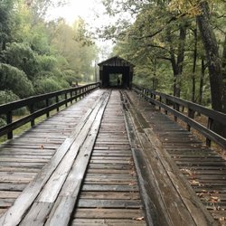
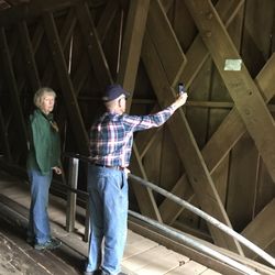
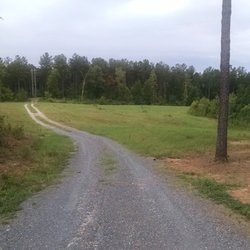
Located about two miles south of the center of town, this marker points out the history of the road that crosses over State Road 85 here in Gay. There isn't much and that other road looks like it's been here for a long time as it is little more than a dirt trail leveled through the woods. The marker has the same text on both sides. It reads, "The road from the east is a remnant of the Oakfuskee Path, main stem of the noted upper trading route from the Savannah River to the Creek Indians of Georgia and Alabama Beginning at present Augusta, it led this way via Warrenton, Eatonton, Griffin, and the Flat Shoals of Flint River to Greenville; thence to Oakfuskee Town, an early Upper Creek center on the Tallapoosa River in Alabama. White traders began using this way in the early 1700's. In time the route became an important pioneer trace and a leading stage road." There is a driveway here where you can stop to examine the sign. Or you can make the turn and drive the road that goes between Greenville and Zebulon. [Review 16695 overall - 469 in Georgia - 207 of 2022.] read more


More info about Noted Indian Trail Historical Marker


Noted Indian Trail Historical Marker - landmarks - Updated June 2026
Best of Gay
People found Noted Indian Trail Historical Marker by searching for…
Places to Take Pictures in Gay, Georgia
Hiking Trails With Waterfalls in Gay, Georgia
Walking Trails in Gay, Georgia
Plantation Tours in Gay, Georgia
Off Road Trails in Gay, Georgia
Historical Sites in Gay, Georgia
Historical Tours in Gay, Georgia
Scenic Overlook in Gay, Georgia
Tourist Attractions in Gay, Georgia
Trending Searches in Gay, GA
Browse Articles
Browse Nearby
Browse Brands
Related Searches in Gay, GA
Best Lookout Points to Visit in Gay, Georgia
Best Observation Deck Views in Gay, Georgia
Best Places for Stunning Views in Gay, Georgia
Best Spots for Star Gazing in Gay, Georgia
Discover Charming Historic Homes in Gay, Georgia
Discover Historic Sites and Places in Gay, Georgia
Discover Popular Photo Spots in Gay, Georgia
Discover Stunning Skyline View Spots in Gay, Georgia
Discover the Best Caves to Explore in Gay, Georgia
Discover the Best Night Hike Trails in Gay, Georgia
Enjoy Arts & Entertainment in Gay, Georgia
Enjoy Scenic Night View Experiences in Gay, Georgia
Enjoy the Best Night View Spots in Gay, Georgia
Explore Beautiful Castles and Landmarks in Gay, Georgia
Explore Beautiful Parks and Green Spaces in Gay, Georgia
Explore Popular Scenic Overlook Points in Gay, Georgia
Explore Popular View Points Around Gay, Georgia
Explore Scenic Lakes to Visit in Gay, Georgia
Explore Scenic National Park Locations in Gay, Georgia
Explore Sunday Fun Things to Do in Gay, Georgia
Explore Top Things to Do at Night in Gay, Georgia
Explore Venues & Event Spaces in Gay, Georgia
Find Beautiful Views in Gay, Georgia
Find Fun Things to Do at Night With Kids in Gay, Georgia
Find the Best Bridge Spots in Gay, Georgia
Find the Best Fireworks Shows in Gay, Georgia
Get Your City Pass for Attractions in Gay, Georgia
Join a Historic Homes Tour in Gay, Georgia Today
Must-See Tourist Attractions Around Gay, Georgia
Popular Kids Activities in Gay, Georgia
Popular Places to Take Pictures in Gay, Georgia
Popular Things to Do in Gay, Georgia
Popular Things to See in Gay, Georgia
See Top Fireworks Events in Gay, Georgia
Stair Climbing Activities and Gyms in Gay, Georgia
Top Entertainment Options in Gay, Georgia
Top Fun Things to Do at Night in Gay, Georgia
Top Places to Visit in Gay, Georgia for Sightseeing
Top Things to Do With Teenagers in Gay, Georgia