Nunatak Nature Trail Photos


More like Nunatak Nature Trail
Recommended Reviews - Nunatak Nature Trail
Start your review...

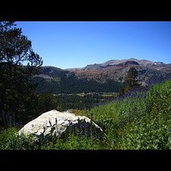
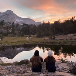
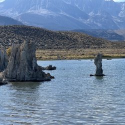
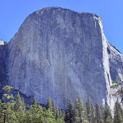
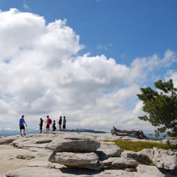
One of my favorite "hikes" in the Sierras and the most impactful. This is what I call a parking lot hike as it isnt really a hike at all. Maybe 1/2mile to the loop. 3 beautiful little lakes on this small loop but what made this impactful and different than the rest was the education I got. Small flat interpretive trail with no elevation gain at the top of Tioga Pass just before heading down into Yosemite. This explained so much to me about the area around and the valley coming up and the existence of Mono Lake. Exceptionally informative the way the signs were placed highlighting the specific mountains, animals and nature you see in front of you. If you're traveling up here it is more than worth it. For me, I drove all the way here just for this small trail. The drive is as beautiful as it gets. read more


More info about Nunatak Nature Trail


Nunatak Nature Trail - hiking - Updated June 2026
Best of Lee Vining
People found Nunatak Nature Trail by searching for…
Redwood Trees in Lee Vining, CA
Sunrise View in Lee Vining, CA
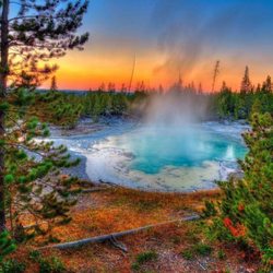
Natural Hot Springs in Lee Vining, CA
Things to Do in Lee Vining, CA
Hiking Trails in Lee Vining, CA
Off Road Trails in Lee Vining, CA
Nature Parks in Lee Vining, CA
Dog Friendly Trails in Lee Vining, CA
Scenic Overlook in Lee Vining, CA
Things to Do at Night in Lee Vining, CA
Tent Camping in Lee Vining, CA
Secluded Spots in Lee Vining, CA
Abandoned Places in Lee Vining, CA
Swimming Holes in Lee Vining, CA
Sunrise Hike in Lee Vining, CA
Trending Searches in Lee Vining, CA
Bait And Tackle Shop near Nunatak Nature Trail
Beaches near Nunatak Nature Trail
Boat Rental near Nunatak Nature Trail
Cliff Jumping near Nunatak Nature Trail
Dog Friendly Beaches near Nunatak Nature Trail
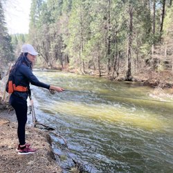
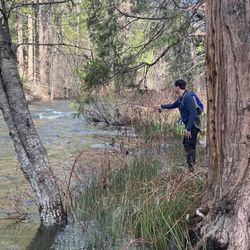
Fishing Spots near Nunatak Nature Trail
Jet Ski Rental near Nunatak Nature Trail
Kayak Rental near Nunatak Nature Trail
Lakes near Nunatak Nature Trail
Public Shower near Nunatak Nature Trail
River Tubing near Nunatak Nature Trail
Scenic Drive near Nunatak Nature Trail
Sunrise View near Nunatak Nature Trail
Swimming Holes near Nunatak Nature Trail
Browse Articles
Browse Nearby
Browse Brands
Related Searches in Lee Vining, CA
Affordable Kayak Rental Services in Lee Vining, California
Best Fishing Locations and Guides in Lee Vining, California
Best Nature Trails for Hiking in Lee Vining, California
Best Places for Horseback Riding in Lee Vining, California
Best Sledding Spots and Fun in Lee Vining, California
Discover Dog Friendly Trails to Explore in Lee Vining, California
Discover Popular Bike Trails in Lee Vining, California
Discover Scenic Mountain Bike Trails Near Lee Vining, California
Discover Scenic Waterfall Spots in Lee Vining, California
Discover Top Nature Parks to Visit in Lee Vining, California
Discover a Hiking Trail in Lee Vining, California
Discover the Best Night Hike Trails in Lee Vining, California
Dog-Friendly Hikes With Dogs in Lee Vining, California
Effective Stairs Workout Spots in Lee Vining, California
Enjoy Camping Adventures Around Lee Vining, California
Enjoy Kayaking Adventures in Lee Vining, California
Enjoy Tent Camping Spots Around Lee Vining, California
Enjoy the Best Tubing Experiences in Lee Vining, California
Enjoy the Best Walking Trails in Lee Vining, California
Exciting Cliff Jumping Spots in Lee Vining, California
Experience Thrilling White Water Rafting in Lee Vining, California
Explore Beautiful Parks and Green Spaces in Lee Vining, California
Explore Bike Rentals Throughout Lee Vining, California
Explore Easy Hikes Perfect for All in Lee Vining, California
Explore Fun Activities to Do in Lee Vining, California
Explore Popular Campgrounds Near Lee Vining, California
Explore Popular RV Parks Around Lee Vining, California
Explore Scenic Lakes to Visit in Lee Vining, California
Explore the Best Boating Spots in Lee Vining, California
Explore the Best Swimming Holes Around Lee Vining, California
Family Friendly Hiking With Kids in Lee Vining, California
Find Popular Ziplining Spots Around Lee Vining, California
Find the Best Parks for Picnics in Lee Vining, California
Find the Best Swimming Pools in Lee Vining, California Today
Hiking Trails With Waterfalls in Lee Vining, California
Locate a Public Shower Facility in Lee Vining, California
Must-See Tourist Attractions Around Lee Vining, California
Off Leash Dog Hiking Trails in Lee Vining, California
Plan a Scenic Drive Route Near Lee Vining, California
Popular Fishing Spots to Explore in Lee Vining, California
Popular Kids Activities in Lee Vining, California
Popular Outdoor Activities to Try in Lee Vining, California
Popular Picnic Spots to Visit in Lee Vining, California
Popular Things to Do in Lee Vining, California
Relax at Natural Hot Springs Near Lee Vining, California
Safe and Fun Parks for Kids in Lee Vining, California
Top Climbing Spots and Gyms in Lee Vining, California
Top Paddleboarding Activities in Lee Vining, California