Cancel

    Open app

    Search

    Oak Ridge Park

    3.0 (2 reviews)

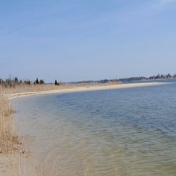
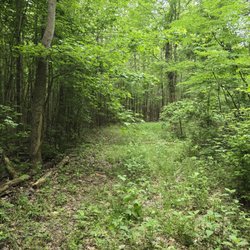
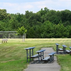
    Oak Ridge Park Photos

    You might also consider

    Recommended Reviews - Oak Ridge Park

    Your trust is our priority, so businesses can't pay to alter or remove their reviews. Learn more about reviews.
    Yelp app icon
    Browse more easily on the app
    Review Feed Illustration
    Photo of Bill J.
    3
    218
    310

    10 years ago

    Helpful 1
    Thanks 0
    Love this 0
    Oh no 0

    10 years ago

    Helpful 0
    Thanks 0
    Love this 0
    Oh no 0

    You might also consider

    Verify this business for free

    People searched for Parks 429 times last month within 15 miles of this business.

    Verify this business

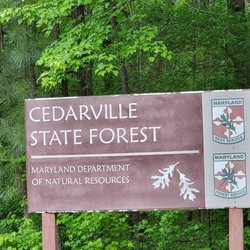
    Cedarville State Forest

    Cedarville State Forest

    3.9(25 reviews)
    10.0 mi

    For a State Forest, the park is not special; it has nice, easy to navigate flat trails which is…read morenice especially for novice hikers/trail walkers, but the park can be confusing to drive around, and during off season you need to call a park ranger for assistance. The park specializes in camping and seems like it would be nice for camping, but the park should have more signage for instructions/procedures during off season for more clarity. There are pretty trees and fall foliage to take advantage of. There should be more defined trailway and signs though for the different pathways. There is potential, but I would say that the park is average. I like the abundance of trees, (State Forests) and the pretty leaves during the fall time and the fact that this park is a lot better than Rosaryville, as the trailways are flat and not hilly and as dangerous as Rosaryville. There are regular parks that may not be state parks or forests that are more worth the experience. This is cool, if you are local to Brandywine or live in maybe Waldorf, Accokeek, Upper Marlboro or someplace, but if you are driving over half an hour coming from Bowie, Greenbelt, or other areas, than for a walking trail/hiking forget about it just not worth it. I don't know how the camping experience is never camped her but for trails nope.

    What a gem of a campgrounds, so glad I found this spot in PG County…read more The online reservation system is great and easy to use. I like how there are pictures of each campsite so we were able to select a site that was just right for us. Checking in the day of the our trip was a breeze also, since we paid ahead for the site we just had to sign a few documents and get on our way. I will say, that charging $1 for a trails map caught us a bit offguard -- $1 hardly broke the budget but why charge us for a map if we're already paying for a campsite for the weekend? All the general family campsites are found in nice sized loop towards the back of the park. We went in early October and were pleased to see a good number of families and couples also out camping for the weekend. Generally, folks abode by quiet hours so no issues there but man were the kid campers chatty in the mornings. Neighboring kids seemed to get up an sunrise full of energy which woke us up a couple of times. Our site was clean and free of debris and we were able to set up camp within an hour or two. As we were setting up, the friendly camp ranger made rounds to come say hello and to ask if we needed anything which was a nice touch. The ranger made a few rounds around the camp loop each night just to make sure things were swell. Cedarville is great in that you don't have to buy wood only from the camp ranger (as is the case with many other sites that we tried to stay at). We were allowed to use fallen wood for campfires. We did buy one bundle of wood for $5 (got about 8 pieces) just to have as backups but our site was a goldmine of fallen limbs. I had a bow saw with me, so I just spent about an hour ear day cutting wood for the morning and evening fires. Feels so much more like camping when you gather and cut your own wood! We went for a long hike on Saturday through the blue, white, and orange trail areas. Remember to pack some water and a snack for those long hikes. The trails were well cleared and decently marked -- there were a couple of times where we were unsure exactly which trail we were on but we soon figured it out (with the help of that $1 map). The views from the trails were quite nice, definitely stopped to take a photo or two! Overall, a great camping experience for a getaway weekend. Just out of the way enough to allow you to take a break from it all, but still close enough to major roads like 301 to stock up on food, drinks, ice, etc. Definitely check Cedarville out!

    Photos
    Cedarville State Forest
    Cedarville State Forest
    Cedarville State Forest

    See all

    Three Notch Trail - One of the benches on the trail. A sign with local history.

    Three Notch Trail

    4.8(4 reviews)
    3.2 mi

    My wife and I frequent this trail to ride our bicycles and enjoy it. The only trail head is…read moreactually at "John V. Baggett Park" in the parking lot near Three Notch Rd. The far end of the trail doesn't have anything, not even a bench or potty. The trail is always clean and has several locations with benches and Port-a potties. The only complaint I might have would be that there are no active watering stations. Bring your drink with you. All crossings with the roads are well marked. The crossing at Leonardtown Rd can get a little crazy as twice we waited for cars to pass and some cars would come to a screeching stop. Don't be too close to the street while waiting for cars to stop at this location. Some crossings have buttons to push so the crossing lights are activated which helps but you still need to be cautious. There are no sections of this trail as to where you have to share the road.. its a full trail. There are some spots on the trail that you might want to go see, like the Amish market at the library or the BBQ restaurant that you will eventually smell and see if you go far enough. There are a few sections of the trail that have rough surface, the Amish buggies are using the trail and you'll eventually see horse poop in the middle of the way while the ruts of the buggies are bumpy. Its a nice trail with farm, city, urban views. If you're looking for a place to exercise, or a relaxing place to ride or walk you should try this trail.

    Really good trail for biking. 11 miles long and well marked. South end is Baggett Park, north end…read moreis in Hughesville. Mostly level or easy grades. Portapotties available as are benches. Winds thru fields and farms and Forest.

    Photos
    Three Notch Trail
    Three Notch Trail - 'W'

    'W'

    Three Notch Trail

    See all

    Calvert Cliffs State Park - Limón the dog had a blast leading the humans to the beach.

    Calvert Cliffs State Park

    4.3(92 reviews)
    22.4 mi

    Shortly after getting onto the path, there was a sign that said 'Hear.' It was at that moment when…read moreone really starts to hear the birdsong. The path to the beach was so beautiful that I was looking at the surroundings more than I should have when I tripped and fell. My ankle was hurt and I couldn't put any weight on it. A big thank you the woman who helped me on one side while my husband was on my other side to the cart than could t make it to our location. A big shout out to the ranger who came in a cart that took us back to our car. Unfortunately, we didn't make it down to the beach, but looking forward to returning upon my healing. It's a sprain with a fracture.

    We randomly dropped by Calvert Cliffs park for an easy hike with our dog. The park is about…read more1.25-1.5 hours from the Silver Spring area...of course, this depends on DMV traffic, which is always unpredictable. The cost for entry for MD residents was five bucks per car. The park has free parking, but it appeared to be limited. For our trip, we managed to find a spot in the last parking area. So, I do not know if they close the park once the parking lots become full. We visited on a Sunday afternoon in early May, so I would imagine that the parking situation might be a bit more intense during the summer months. For our first visit, we hiked the easy Red trail, which is about 1.8 miles to the beach area. Also, the majority of the red trail was well-shaded so folks should not have too much of a problem with direct sun until hitting the beach. I thought this trail was pretty easy, and almost anyone from multiple age groups could complete this hike. The beach is a bit on the smaller side; however, we did not venture too far from the point where you complete the hike. So, maybe there are more spots on the beach. We though that the park was very dog-friendly. Although the park is dog-friendly, please keep your furry friends on a leash especially since families with young children use the Red trail. A couple of tips: -The park is trash-free so whatever you bring to park, you will have to dispose of it once you leave the park. I wished that the park had a few trash receptacles at the beginning and end of the trails. But I get that having these receptacles might result in visitors overfilling the receptacles with waste and/or the local wildlife eating things that they should not. -Although I'm not 100% sure, I think the entrance fee is cash only.

    Photos
    Calvert Cliffs State Park
    Calvert Cliffs State Park
    Calvert Cliffs State Park

    See all

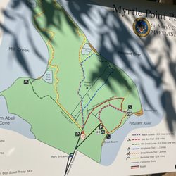
    Myrtle Point Park - Map

    Myrtle Point Park

    3.0(5 reviews)
    21.7 mi

    Went here on Labor Day, a few hours before hours before closing time. You have to pay to park since…read morethe state passport one can buy isn't covered with this county park ($6-$7). The trail didn't seem too well maintained which made it precarious at times. I wish there were more signs throughout the paths since none might get easily turned around. The views were worth the wait and uncertainty with lots of shaded areas throughout the trail as well as plenty of tables and benches to catch your breath and recover. It wasn't that busy even though it was a holiday weekend which is always a plus when trying to enjoy a hike. The tables were clean enough to have a little picnic and we saw plenty of people cooking and enjoying the open spaces which is always a plus during a pandemic. All in all, an easy path for people of any activity level, minimal inclines, and good views of the water!

    This little spot has a bit of beach territory which looks out across the Patuxent to the rather…read morespectacular bridge nearby, as well as some trails. The trails were thickly wooded and wide but unevenly surfaced. The beaches are pretty, but modest. It's nice that there's a public space here, but if you really want a beach, Elms Beach is better (no idea why my review for that place blew up). If you want a place to eat by the riverside, Greenwell is prettier. If you want to views of the river and the bridge, Solomons Island is better. So this place is fine to stop if you're around, but it's not great for anything. They charge admission only on peak days (weekends and holidays starting in May, according to the website), at which point they charge a lot. I wouldn't pay it, but if I was in the area I would stop by now and then.

    Photos
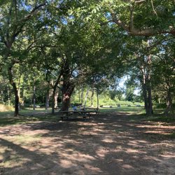
    Myrtle Point Park - Picnic area near entrance

    Picnic area near entrance

    Myrtle Point Park
    Myrtle Point Park

    See all

    Oak Ridge Park - parks - Updated September 2026

    Loading...
    Loading...
    Loading...