Observation Point Photos

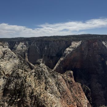
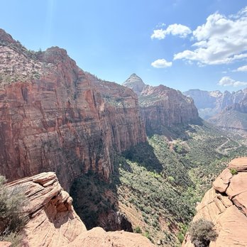

More like Observation Point
Recommended Reviews - Observation Point
Start your review...


Reviews With Photos


I don't think I even need to write about Observation Point. Just take a look at the pictures here. You do know that there is more than one way to hike to the Point, right? Those Weeping Rock and East Rim Trails do look awesome, and I'd love to hike them someday, but my wife, friends, and I decided for the trail less taken, namely the East Mesa Trail, for the following reasons: - We were staying in Orderville, only 30 minutes from the trailhead. - Fellow hikers are cool, but we wanted to be able to enjoy nature without so many other people around. - Although we recognize its necessity, we don't enjoy taking the park shuttle! Need directions? Here you go: http://www.citrusmilo.com/zionguide/eastmesatrail.cfm (No, this is not my website.) Tip: Although I highly recommend getting a week pass for Zion, there is no charge for accessing the park via the East Mesa Trail. This hike was pretty easy, fun, and scenic in its own way. Of course, the view at the Point was spectacular. Any way you get to it, it is not to be missed. Bring water! Wear sunscreen! "Leave nothing but footprints. Take nothing but photos. Kill nothing but time. Keep nothing but memories."


This place has an amazing view, highly recommend to take some pictures and enjoy the view. It was a pretty easy hike probably a mile or so long (depending how far you want to go). Like I said the view is amazing and along the way you might be lucky enough to see some rams hanging out on a cliff. Very cool place and view!


One of our favorite hikes while in Zion. The views from the top are amazing and awe inspiring. Bring binoculars ...so much to see and fun to look acrosss at the other trails and hikers. We came during June 2020 and during COVID - we were fortunate that weather was fair (in the 80s) and relatively few hikers. One suggestion...since the entrance to Zion was exceedingly crowded and parking was scarce we opted to access the Observation Point hike from OUTSIDE the park which was a huge positive. You can get to it at a trailhead near the Zion Ponderosa Ranch Resort and you can park near trailhead. The hike is gorgeous and you can do it in three hours round trip (about six miles total). Great way to get in an amazing hike when Park is overly crowded. Gorgeous views and good strenuous hike.


Was once amazing.... now- CLOSED! (Only giving 1 Star to make sure people will see and it plan there trip for what was once a glorious view) Observation Point and Hidden Canyon Hikes all closed - Rock slide Oct 2018 took out all trails :( Buses won't even stop at the bus stop. Closed 10/18 and as of 10/5/19 not open with no reopen date in sight.


8 miles round trip with 2,000 feet elevation gain, this may be the most beautiful trail at Zion National Park. Start with lots of switch backs, most of elevation gain is at the beginning. I had two layers of jackets and it didn't take too long before I had to take off both of them. Towards the end of initial switch backs, you will see Angel's landing and river looks like horseshoe. Pictures came out better in mid day when the Sun is up high. Early in the morning creates shadows. Echo Canyon was beautiful, so pretty. It was in the shade, I had to get my jacket back on. Then became kind of non spectacular for a while. Shortly after that, I noticed so many flowers and plants are growing from the wall. Looking around how the nature is surviving under harsh conditions was very interesting. View from the top is amazingly gorgeous. You see the Angel's landing so close, I was thinking did I really walk that ridge? That looks scary from distance. If you start early in the morning, not many people is there and was so peaceful for a while. If you want your pictures without shadows, wait until mid day for better pictures. Overall it was about 4 1/2 hours or so. The paper said strenuous but I thought it wasn't bad at all, it didn't quite give me the workout I hoped. I enjoyed different views throughout the 8 miles hike.


Amazing hike. It has a better view than Angel's Landing I think since it is higher up. Be prepared to hike a good amount of time. It is not a hard hike and not that scary. Bring water, wear a hat and shades, and wear hiking shoes You don't want to slip off the trail. Bring a picnic to enjoy at the top. On the way to Observation Point you can make a detour to Hidden Canyon. This one can be a bit scary.


A really underrated hike in my opinion! The view at the apex of the hike is amazing and scenic. Even the trail towards the top is scenic on its own. Got there in the early AM and took a good 2-3 hours with a few stops to get to the top. The view is spectacular and worth it. Take lots of water, snackage, and a good positive attitude and you're set! Bring your camera and a smile. It can get a bit crowded at the top but not as crowded as Angel's Landing. Do yourself a favor and come hike! Spend a good chunk of the day here and enjoy nature views at their finest!


Tired of all those folks boasting about their Angel landing hike? Well do the Observation Point hike, and you can look down on them, and thumb your nose at them at the same time. Literally. I start out at 4200 feet elevation on the Zion Canyon floor at 10am on a cool April morning. Like a lot of hikes from the floor of the Canyon, this hike has little cover, lots of switchbacks, and is going up under strenuous conditions, and then hiking back down. The first three quarters of a mile is all work, going seemingly straight up the cliff on the long innumerable switchbacks, over broken concrete and rocks. You reach a fork in the trail, at 4700 feet elevation, with the right going to Hidden Canyon, and the left fork going to Observation Point. 500 elevation gain in about 3/4 mile! The Observation Point trail continues up on long traverses up the side of the mountain, dirt trails, no cover except that it is in the shade in the morning. You do not want to do this hike in the summer, otherwise you risk becoming a permanent resident - a deceased resident! Bring a hat and plenty of liquids -I only needed two 20 ounce bottles of water, but then it was cool, with highs in the low 70s. Hiking poles would help on this hike -can't use the hiking poles on the Angel landing hike, if you are going to be pulling yourself up with the chain cables on the mountain side. At the top after the first series of switchbacks, one enters Echo canyon, with a straight path alongside a river gorge, although this gorge is for the most part dried up. There is one place where there is water, deep inside the narrow canyon, where Zion adventures suited people try out their wet equipment. We reach 5600 feet elevation, a 1300 foot elevation gain, before we encounter another set of switchbacks. Yellow colored Navajo sandstone, and then orange colored sandstone on the walls of the mountain sides of the dirt trails. Sparse forests, with tall cliffs surrounding in the distance. It is here, that one encounters narrow trails, with long steep drop-offs. The trick is to never go too close to the edge, and never look down. One reaches a plateau, where one can actually see Observation Point a mile away, a white cliff, stained red with water streaks running down the cliff. First dirt, and finally sand, as one approaches the end of the hike at 6507 feet elevation, after 3.5 hours of hiking. The last 100-200 yards is all red clay, with forests of green trees. Dozens of people here, with grandiose views of Zion Canyon, with the Virgin river meandering through the canyon, and of Angel Landing some 700 feet below, and off in a distance. You can see the entire half mile of the ridge to that trail, but can't make out the people holding for their dear lives onto the chain cables in that hike. Permanent residents these squirrels running around, but don't let them climb onto you -their claws will rip your clothes and skin to shreds. Coming down is easier than going up, but hard on the knee joints. Even at 3pm I was seeing people in the first half of the hike coming up. Don't want to stick around here when the daylight retreats around 7pm -imagine going down the trail alongside the long drop-offs in the darkness! Better hope for a full moon! I reach the trailhead and the free shuttle at 430pm, after 6 hours of hiking, 8 miles, 2148 feet of elevation gain. My knee joints are in pain going the last steps downhill, but kept at it, with the encouragement of people 40 years younger! .


When angels landing and the narrows are super busy you should head on over to Observation Point trail instead. Or, if you have done Angels Landing and The Narrows, Observation point should be your next hike inside of Zion National Park. The hiking trail is a 8 miles roundtrip hike which includes switchbacks and a beautiful trek into the canyon. I urge you to begin this trail early as currently we are in summer and it is very hot by noon. Once you reach the peak you will be amazed at how much higher in elevation you are versus Angels Landing. Keep in mind this trail does not have as many switch backs as Angels Landing does but make sure to bring a lot of water and a snack to munch on once you reach the top. Also, at the top you will be greeted by a lot of chipmunks. They are friendly.


Definitely 5 stars for this hike! It's challenging with quite a few steep inclines, but the change in landscape and geology is along the way is very impressive, and you get a stellar view of Zion Canyon at the top of an approximately 2,100 ft climb (nearly 7,000 ft above sea level!). The hike to Observation Point starts at stop #7 in the Zion Canyon shuttle. It took me about 2.5 miles on the way up (with many short stops along the way for water and photos), and a little less than 2 hours for the way back down. The hike starts off with steep switchback inclines on the face of a mountain, but after about 1.5 miles, the path levels off in a canyon-like region with towering canyon walls in both sides of you. You then emerge on the other side of the mountain and it's a totally different landscape. You go up some more inclines (it is steep for quite awhile), you pass by these amazingly different colored rocks, and for the last 3/4 of a mile, it is finally flat as you cross the top of the mesa onto Observation Point. Be on the lookout for flowers, chipmunks, and geckos along the way! There are fewer hikers on this trail (compared to say, Angel's Landing), but everyone we passed was very encouraging in helping us get up some steep inclines! You get some GREAT views at the top, and you can either squint or use binoculars to see the hikers and chains of Angel's Landing. You're approximately 500 ft above Angel's Landing and it doesn't seem so intimidating! Several people at the top asked me whether I thought this hike or Angel's Landing was better...I think they are very different hikes -- both strenuous and with great views at the top, but I think Angel's Landing is perhaps more iconic (and crowded), while the landscape changes along the Observation Point hike were very unique and memorable.


As the name suggest it, it is the best point of view in Zion National Park. It takes about 6 hours to go up and down but definitely worth it.


#32/100 yelp challenge - Moderate to strenuous hike - length: 2 mile round trip - duration: 1 hour ; depends on your pace and some play time. - not paved. Some narrow and drop off... - Not good for small children and handicap. - you don't need hiking sticks here - wear good hiking shoes since there are some rocky and slippery areas - very hot during summer, so you will need minimal 24 oz bottle water per person. You can not take the shuttle to this hike. We drove to the park. Once we passed the canyon junction, turned right to the SR 9 to the tunnel. It was about 6-7 miles up hill with nice view along the way, 1 mile through the tunnels. There are 2 small parkings each on the opposite direction right outside of the tunnel exit. The trail entrance is on the coming in direction. We went here at mid day so it is very hot but there are plenty of parkings. The beggining park is stairs and uphill. Continues for about half mile when you see the tree with tortuous exposed root crossing the trail, you are about half way to the overlook. Then pass the open cave, you are less than 1/4 mile to the top. From there, the trail becomes narrow only fit one person at the time, no rail, along the cliff wall. The view from the top is very nice of the winding road and many peaks. There are many wildlife up here. We saw many chipmonks and a small snake but did not see any ram.
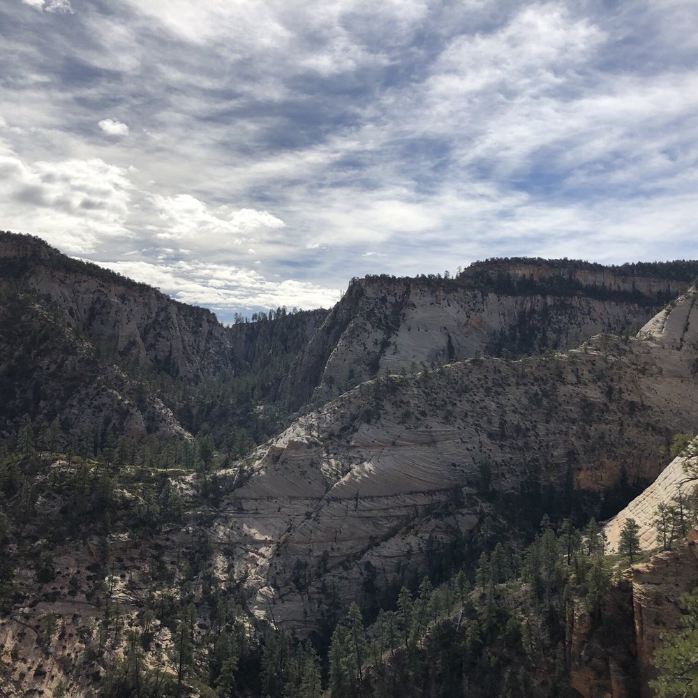

Let me just say that this was absolutely the most incredible hike I've ever been on. Everything about it was perfect. It was difficult, but not dangerous. It had a ton of diversity in terms of the areas that you're hiking and the views you get along the way. There are valleys, towering cliff walls, trenches, and then open expansive views. All will take your breath away. The view at the end was absolutely magnificent. The best view I've ever seen in my life. The pictures look great but fail to capture the magnitude and beauty that seeing it in person do. It also wasn't that packed. Nothing like Angels Landing. I'd definitely recommend this to anyone, it's for sure worth your time. Going on this hike will give you a new appreciation for nature. At least, it did for me. Anyways, if you're going to Zion, put this on your must do list. That's all I've got here, thanks for reading (yes I view myself as a famous yelp blogger), goodbye everyone.


4 months ago
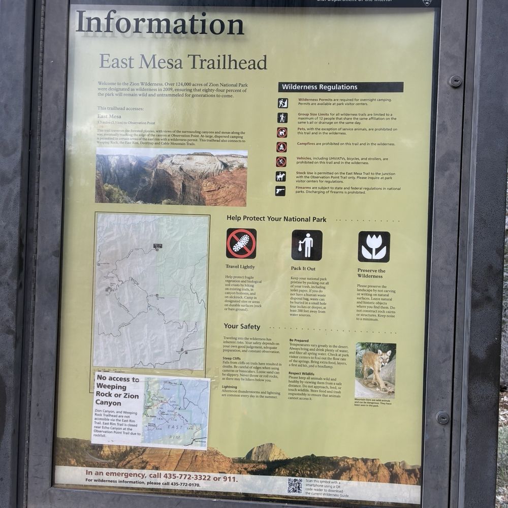
This is a unique hike to an INCREDIBLE view. I saw online people saying this is the actual best view in Zion and honestly, it is indeed one of the grandest - even more so than Angel's landing. Of note, the trail changes from roc/dirt to sand and the day I came it was chilly and SO windy, especially by the viewpoint. My allergies were absolutely killing me and I had to put on my sunglasses at the viewpoint because of how much I was tearing up with the wind and sand/dust. Nevertheless though the view was totally clear and absolutely breathtaking! I also loved the little stretch to get to the viewpoint where you can see some vistas in the distance, and feel like your kind of walking through a desert field (that's how I felt anyway). Bear in mind how CRAP the roads are to get to the trailhead (observation point/east Mesa trailhead). I 100% recommend either going in a high clearance vehicle or using the $8 per person Zion ponderosa shuttle because these are some of the worst roads I have ever seen (I took the shuttle). I was driving a rented Nissan Sentra on this trip and I have zero question I would have been sweating bullets or just trapped in a pothole ditch if I had tried to drive the car out. And if it's been raining, the 1-1.5 foot deep potholes become a mud slick - I wouldn't even try coming out at all if that's the case. read more



11 months ago
The overlook point fr9m Zion National Park in Utah is a natural marvel. From the winding road across the mountains to the tunnel until you reach the summit point for a 1.5-mile hike you'll definitely love the views. read more


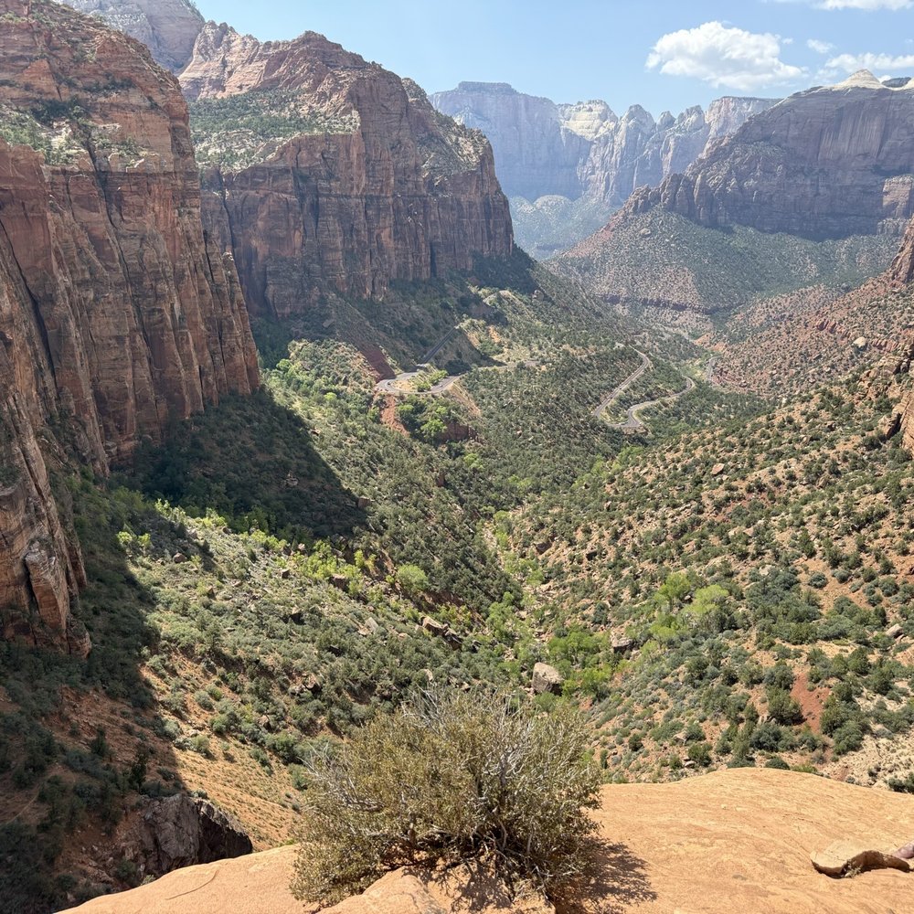
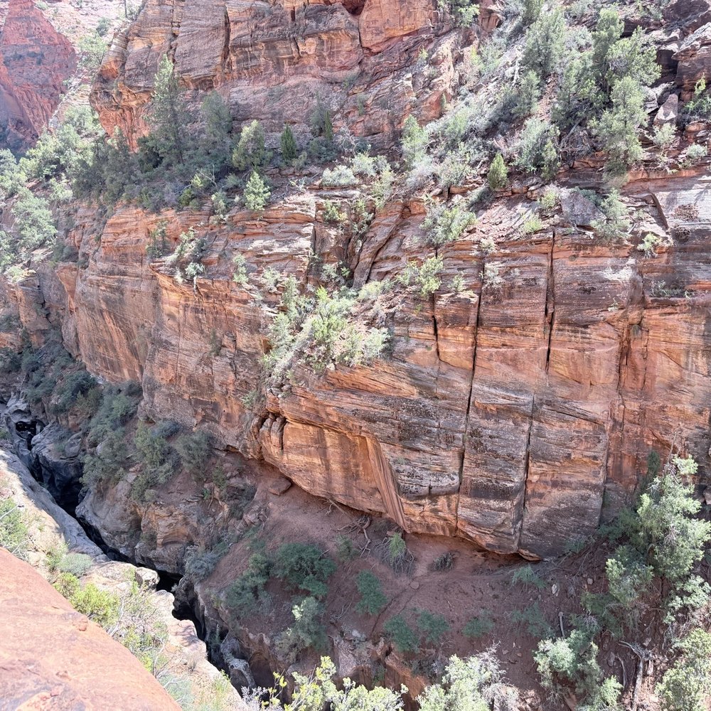
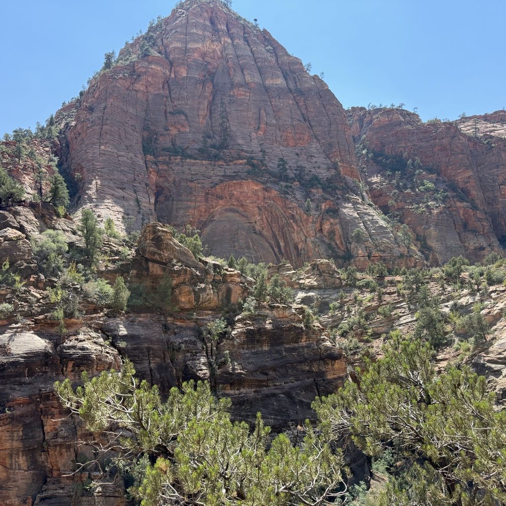


Wow. This is a four mile hike that you have to go all the way to the end to justify. Parking for only ten or so cars, but the Zion Ponderosa Ranch's East Zion Adventures, a few miles away, offers shuttle service for about $7 per person. The road to the trailhead is heavily rutted and non-four wheel vehicles will have a hard time. The shuttle driver told us that a minivan had high centered the day before. As we returned, a road grader was out filling in the ruts and greatly improving the road. Not sure how often that happens. The hike is level with a sandy path for the first three miles and then descends several hundred feet the last mile. Signs guide you so you can't get lost. When you arrive at the observation point it'll take your breath away. You look down on Zion National Park and the river that winds through it from north of the park. The view is spectacular and getting near the cliff edge is not for the faint of heart. The hike back is taxing for that first mile but there's plenty of spots to stop in the shade and rest. This is considered a moderate hike with a well maintained path and no rock climbing necessary. Totally hands free. If you bring children, watch them carefully at the view point. The ground is uneven and it's a long way down. read more
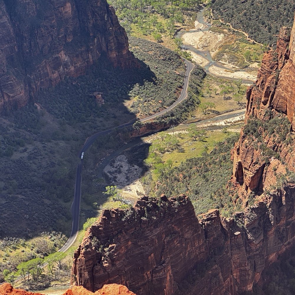


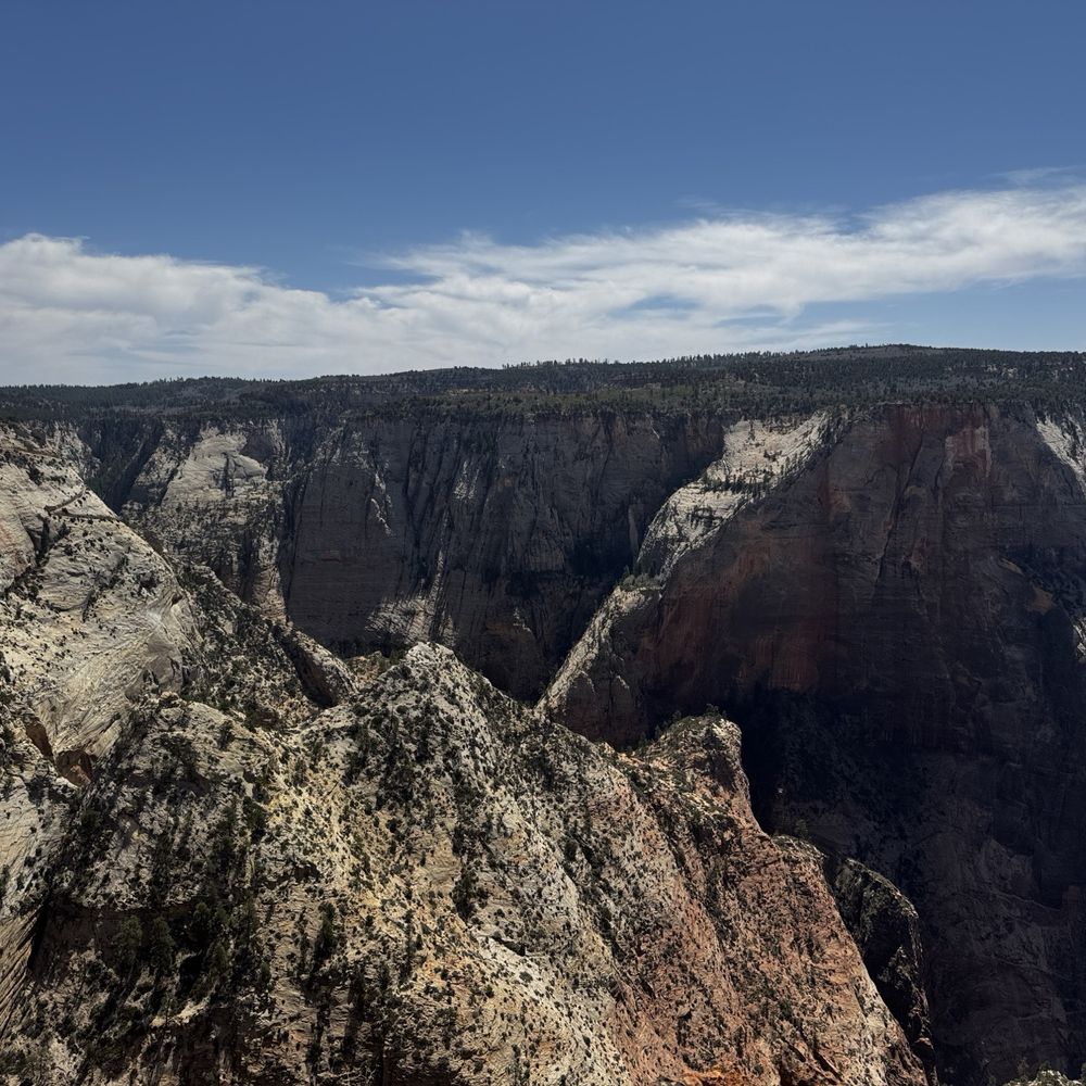


I don't think I even need to write about Observation Point. Just take a look at the pictures here. You do know that there is more than one way to hike to the Point, right? Those Weeping Rock and East Rim Trails do look awesome, and I'd love to hike them someday, but my wife, friends, and I decided for the trail less taken, namely the East Mesa Trail, for the following reasons: - We were staying in Orderville, only 30 minutes from the trailhead. - Fellow hikers are cool, but we wanted to be able to enjoy nature without so many other people around. - Although we recognize its necessity, we don't enjoy taking the park shuttle! Need directions? Here you go: http://www.citrusmilo.com/zionguide/eastmesatrail.cfm (No, this is not my website.) Tip: Although I highly recommend getting a week pass for Zion, there is no charge for accessing the park via the East Mesa Trail. This hike was pretty easy, fun, and scenic in its own way. Of course, the view at the Point was spectacular. Any way you get to it, it is not to be missed. Bring water! Wear sunscreen! "Leave nothing but footprints. Take nothing but photos. Kill nothing but time. Keep nothing but memories." read more


This place has an amazing view, highly recommend to take some pictures and enjoy the view. It was a pretty easy hike probably a mile or so long (depending how far you want to go). Like I said the view is amazing and along the way you might be lucky enough to see some rams hanging out on a cliff. Very cool place and view! read more
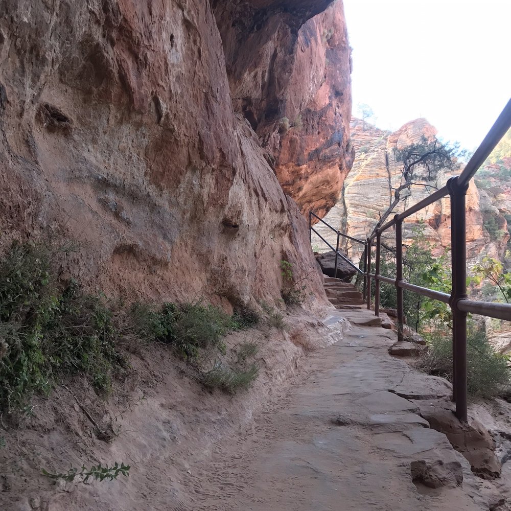


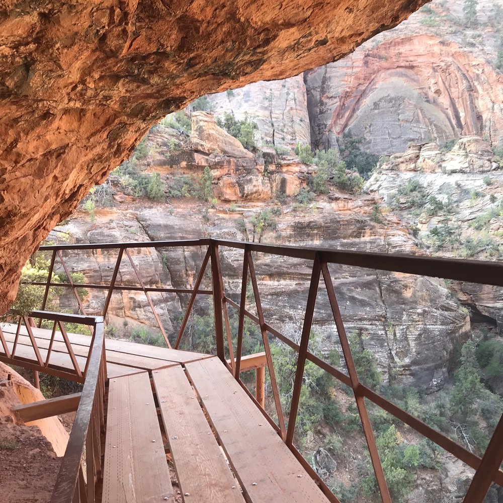


One of our favorite hikes while in Zion. The views from the top are amazing and awe inspiring. Bring binoculars ...so much to see and fun to look acrosss at the other trails and hikers. We came during June 2020 and during COVID - we were fortunate that weather was fair (in the 80s) and relatively few hikers. One suggestion...since the entrance to Zion was exceedingly crowded and parking was scarce we opted to access the Observation Point hike from OUTSIDE the park which was a huge positive. You can get to it at a trailhead near the Zion Ponderosa Ranch Resort and you can park near trailhead. The hike is gorgeous and you can do it in three hours round trip (about six miles total). Great way to get in an amazing hike when Park is overly crowded. Gorgeous views and good strenuous hike. read more

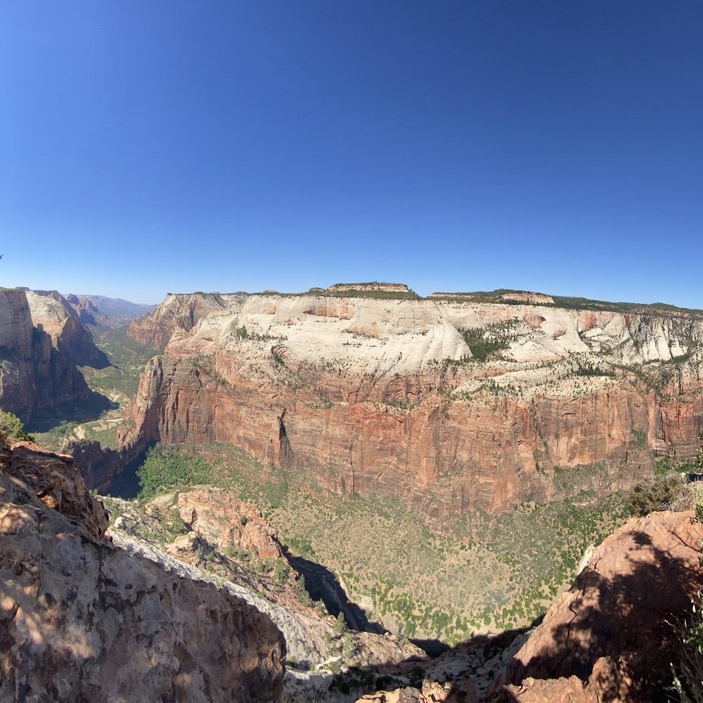


Was once amazing.... now- CLOSED! (Only giving 1 Star to make sure people will see and it plan there trip for what was once a glorious view) Observation Point and Hidden Canyon Hikes all closed - Rock slide Oct 2018 took out all trails :( Buses won't even stop at the bus stop. Closed 10/18 and as of 10/5/19 not open with no reopen date in sight. read more


8 miles round trip with 2,000 feet elevation gain, this may be the most beautiful trail at Zion National Park. Start with lots of switch backs, most of elevation gain is at the beginning. I had two layers of jackets and it didn't take too long before I had to take off both of them. Towards the end of initial switch backs, you will see Angel's landing and river looks like horseshoe. Pictures came out better in mid day when the Sun is up high. Early in the morning creates shadows. Echo Canyon was beautiful, so pretty. It was in the shade, I had to get my jacket back on. Then became kind of non spectacular for a while. Shortly after that, I noticed so many flowers and plants are growing from the wall. Looking around how the nature is surviving under harsh conditions was very interesting. View from the top is amazingly gorgeous. You see the Angel's landing so close, I was thinking did I really walk that ridge? That looks scary from distance. If you start early in the morning, not many people is there and was so peaceful for a while. If you want your pictures without shadows, wait until mid day for better pictures. Overall it was about 4 1/2 hours or so. The paper said strenuous but I thought it wasn't bad at all, it didn't quite give me the workout I hoped. I enjoyed different views throughout the 8 miles hike. read more
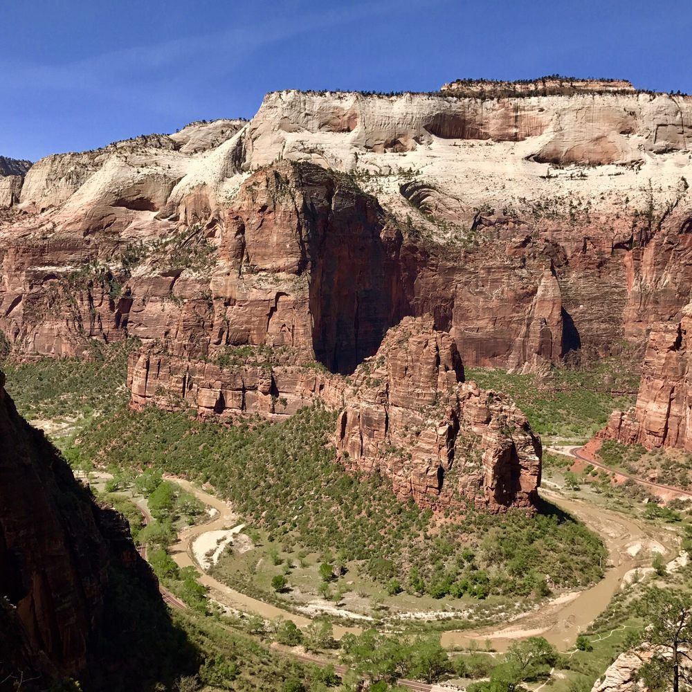


Amazing hike. It has a better view than Angel's Landing I think since it is higher up. Be prepared to hike a good amount of time. It is not a hard hike and not that scary. Bring water, wear a hat and shades, and wear hiking shoes You don't want to slip off the trail. Bring a picnic to enjoy at the top. On the way to Observation Point you can make a detour to Hidden Canyon. This one can be a bit scary. read more


A really underrated hike in my opinion! The view at the apex of the hike is amazing and scenic. Even the trail towards the top is scenic on its own. Got there in the early AM and took a good 2-3 hours with a few stops to get to the top. The view is spectacular and worth it. Take lots of water, snackage, and a good positive attitude and you're set! Bring your camera and a smile. It can get a bit crowded at the top but not as crowded as Angel's Landing. Do yourself a favor and come hike! Spend a good chunk of the day here and enjoy nature views at their finest! read more
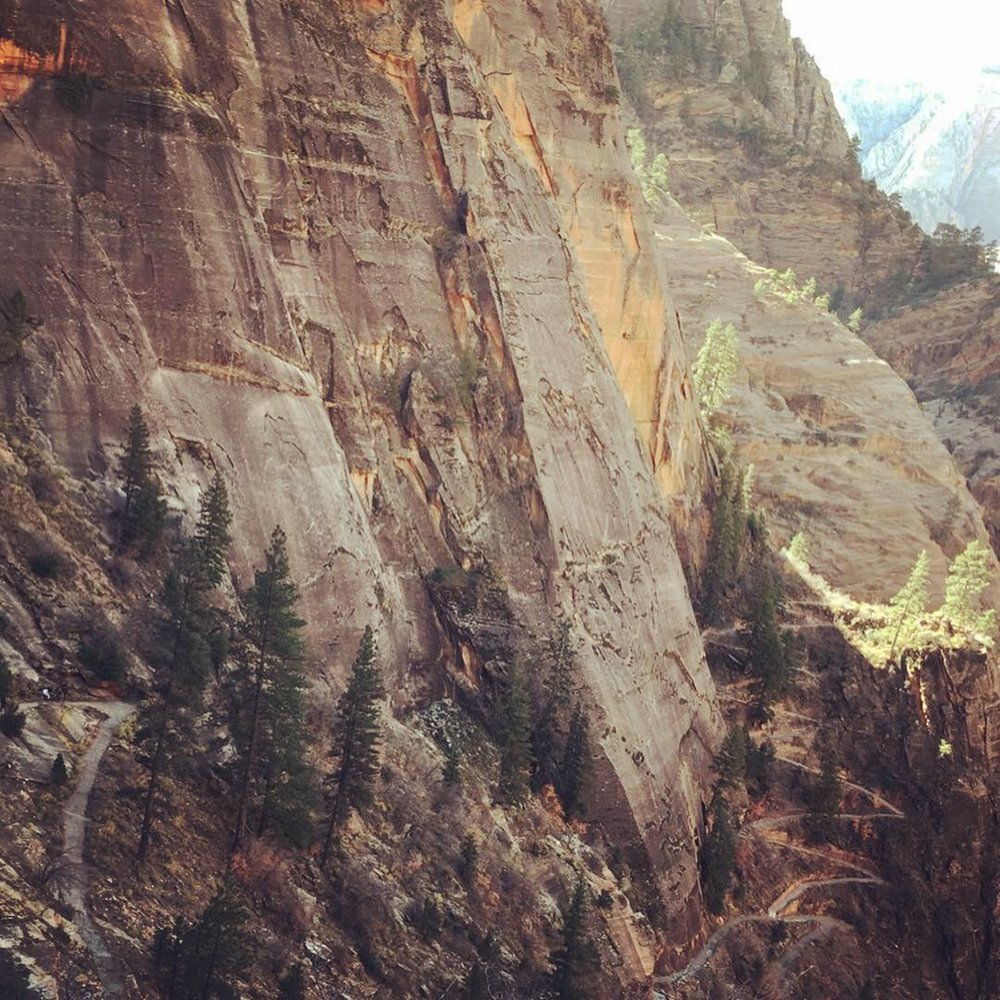


Tired of all those folks boasting about their Angel landing hike? Well do the Observation Point hike, and you can look down on them, and thumb your nose at them at the same time. Literally. I start out at 4200 feet elevation on the Zion Canyon floor at 10am on a cool April morning. Like a lot of hikes from the floor of the Canyon, this hike has little cover, lots of switchbacks, and is going up under strenuous conditions, and then hiking back down. The first three quarters of a mile is all work, going seemingly straight up the cliff on the long innumerable switchbacks, over broken concrete and rocks. You reach a fork in the trail, at 4700 feet elevation, with the right going to Hidden Canyon, and the left fork going to Observation Point. 500 elevation gain in about 3/4 mile! The Observation Point trail continues up on long traverses up the side of the mountain, dirt trails, no cover except that it is in the shade in the morning. You do not want to do this hike in the summer, otherwise you risk becoming a permanent resident - a deceased resident! Bring a hat and plenty of liquids -I only needed two 20 ounce bottles of water, but then it was cool, with highs in the low 70s. Hiking poles would help on this hike -can't use the hiking poles on the Angel landing hike, if you are going to be pulling yourself up with the chain cables on the mountain side. At the top after the first series of switchbacks, one enters Echo canyon, with a straight path alongside a river gorge, although this gorge is for the most part dried up. There is one place where there is water, deep inside the narrow canyon, where Zion adventures suited people try out their wet equipment. We reach 5600 feet elevation, a 1300 foot elevation gain, before we encounter another set of switchbacks. Yellow colored Navajo sandstone, and then orange colored sandstone on the walls of the mountain sides of the dirt trails. Sparse forests, with tall cliffs surrounding in the distance. It is here, that one encounters narrow trails, with long steep drop-offs. The trick is to never go too close to the edge, and never look down. One reaches a plateau, where one can actually see Observation Point a mile away, a white cliff, stained red with water streaks running down the cliff. First dirt, and finally sand, as one approaches the end of the hike at 6507 feet elevation, after 3.5 hours of hiking. The last 100-200 yards is all red clay, with forests of green trees. Dozens of people here, with grandiose views of Zion Canyon, with the Virgin river meandering through the canyon, and of Angel Landing some 700 feet below, and off in a distance. You can see the entire half mile of the ridge to that trail, but can't make out the people holding for their dear lives onto the chain cables in that hike. Permanent residents these squirrels running around, but don't let them climb onto you -their claws will rip your clothes and skin to shreds. Coming down is easier than going up, but hard on the knee joints. Even at 3pm I was seeing people in the first half of the hike coming up. Don't want to stick around here when the daylight retreats around 7pm -imagine going down the trail alongside the long drop-offs in the darkness! Better hope for a full moon! I reach the trailhead and the free shuttle at 430pm, after 6 hours of hiking, 8 miles, 2148 feet of elevation gain. My knee joints are in pain going the last steps downhill, but kept at it, with the encouragement of people 40 years younger! . read more

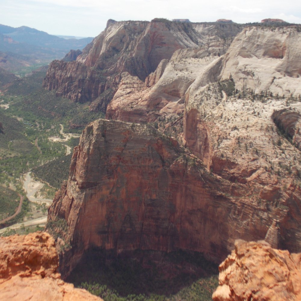


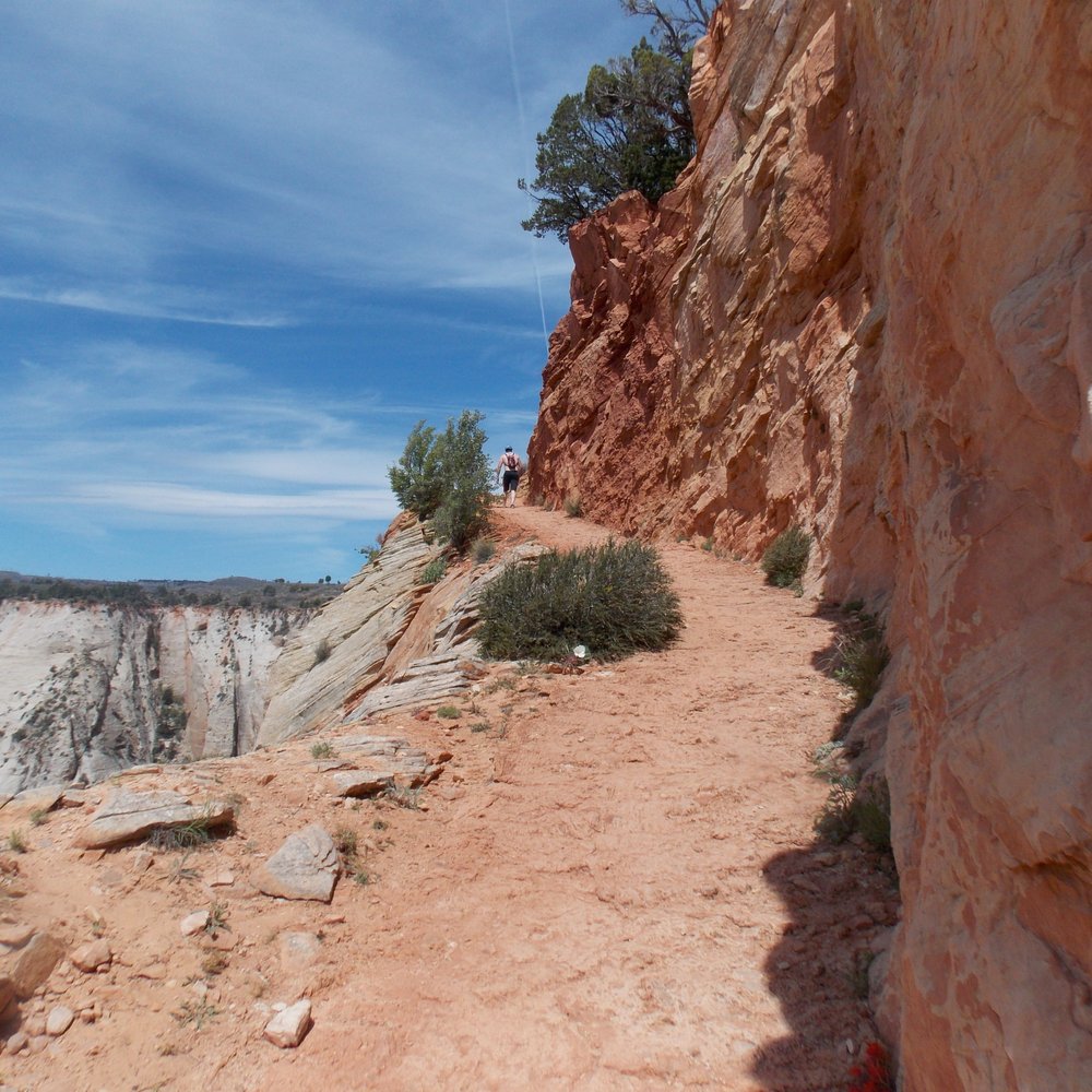


When angels landing and the narrows are super busy you should head on over to Observation Point trail instead. Or, if you have done Angels Landing and The Narrows, Observation point should be your next hike inside of Zion National Park. The hiking trail is a 8 miles roundtrip hike which includes switchbacks and a beautiful trek into the canyon. I urge you to begin this trail early as currently we are in summer and it is very hot by noon. Once you reach the peak you will be amazed at how much higher in elevation you are versus Angels Landing. Keep in mind this trail does not have as many switch backs as Angels Landing does but make sure to bring a lot of water and a snack to munch on once you reach the top. Also, at the top you will be greeted by a lot of chipmunks. They are friendly. read more


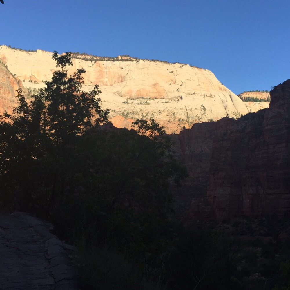
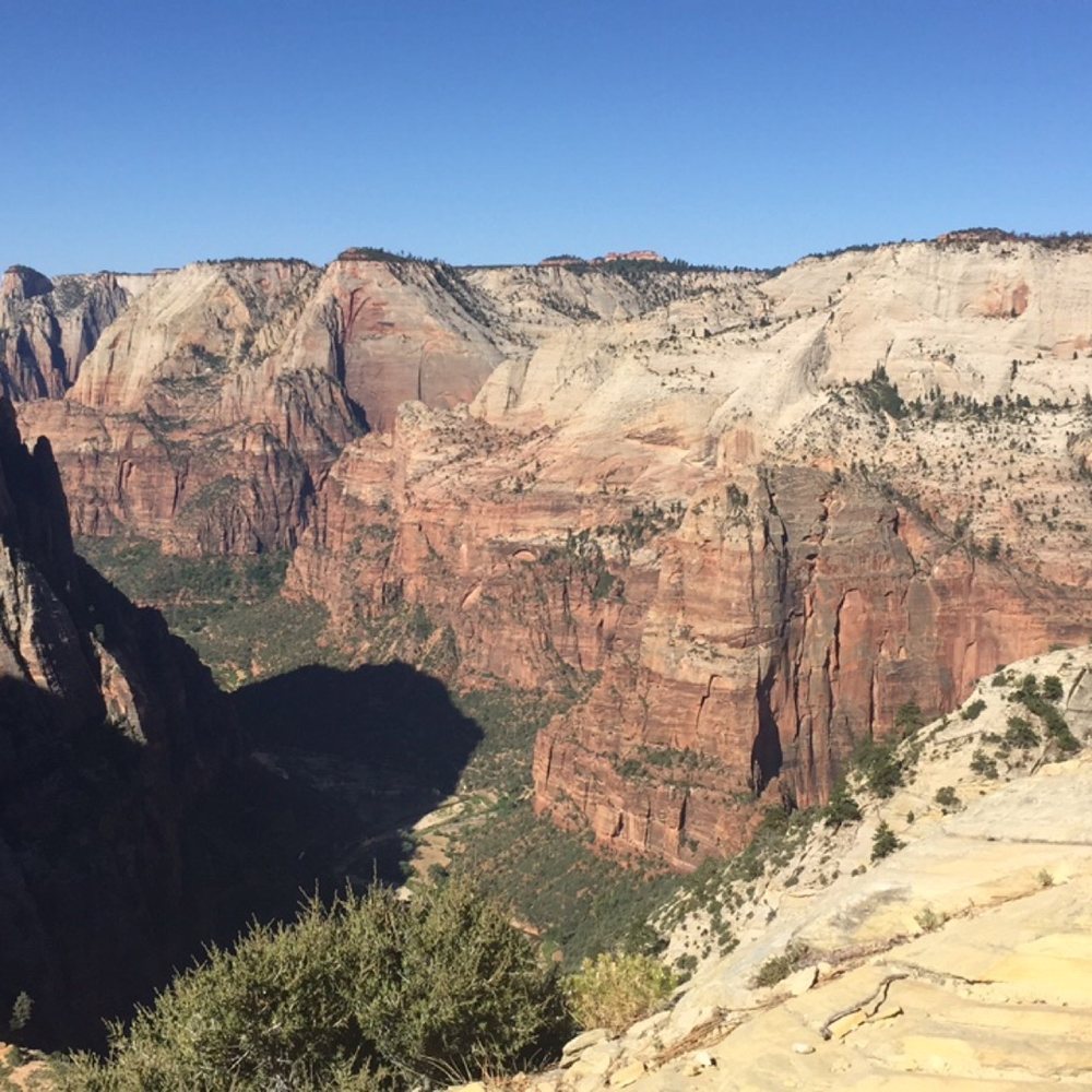

10 years ago
Definitely 5 stars for this hike! It's challenging with quite a few steep inclines, but the change in landscape and geology is along the way is very impressive, and you get a stellar view of Zion Canyon at the top of an approximately 2,100 ft climb (nearly 7,000 ft above sea level!). The hike to Observation Point starts at stop #7 in the Zion Canyon shuttle. It took me about 2.5 miles on the way up (with many short stops along the way for water and photos), and a little less than 2 hours for the way back down. The hike starts off with steep switchback inclines on the face of a mountain, but after about 1.5 miles, the path levels off in a canyon-like region with towering canyon walls in both sides of you. You then emerge on the other side of the mountain and it's a totally different landscape. You go up some more inclines (it is steep for quite awhile), you pass by these amazingly different colored rocks, and for the last 3/4 of a mile, it is finally flat as you cross the top of the mesa onto Observation Point. Be on the lookout for flowers, chipmunks, and geckos along the way! There are fewer hikers on this trail (compared to say, Angel's Landing), but everyone we passed was very encouraging in helping us get up some steep inclines! You get some GREAT views at the top, and you can either squint or use binoculars to see the hikers and chains of Angel's Landing. You're approximately 500 ft above Angel's Landing and it doesn't seem so intimidating! Several people at the top asked me whether I thought this hike or Angel's Landing was better...I think they are very different hikes -- both strenuous and with great views at the top, but I think Angel's Landing is perhaps more iconic (and crowded), while the landscape changes along the Observation Point hike were very unique and memorable. read more
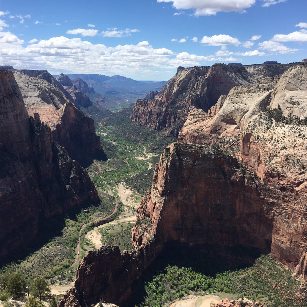


8 years ago
As the name suggest it, it is the best point of view in Zion National Park. It takes about 6 hours to go up and down but definitely worth it. read more

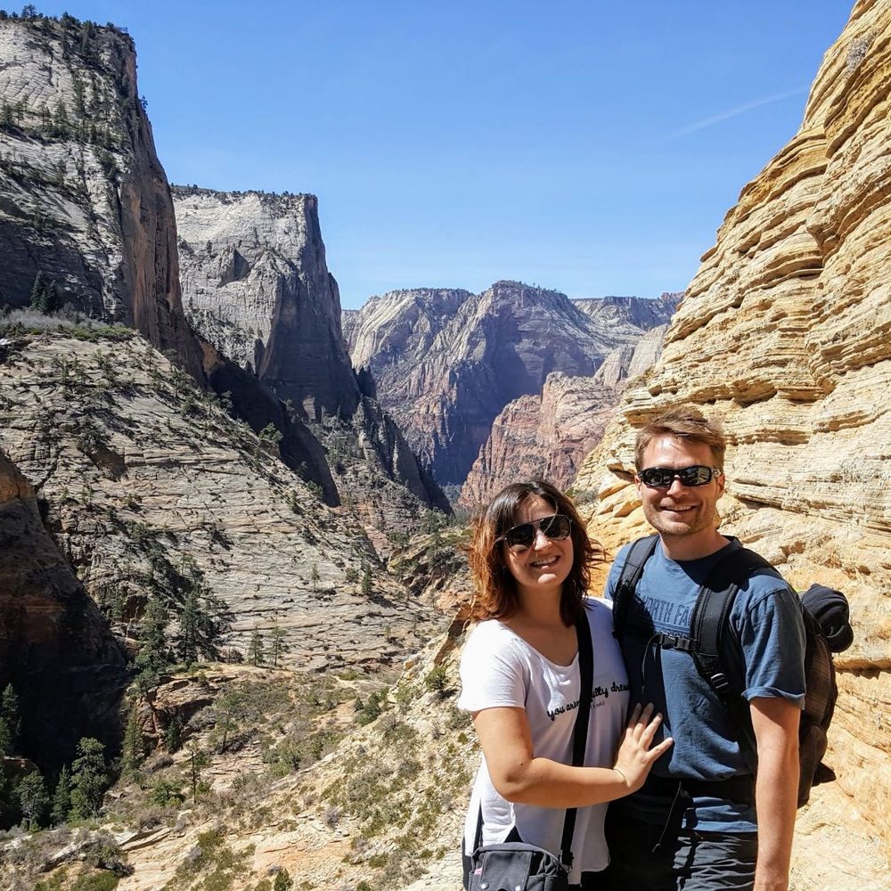

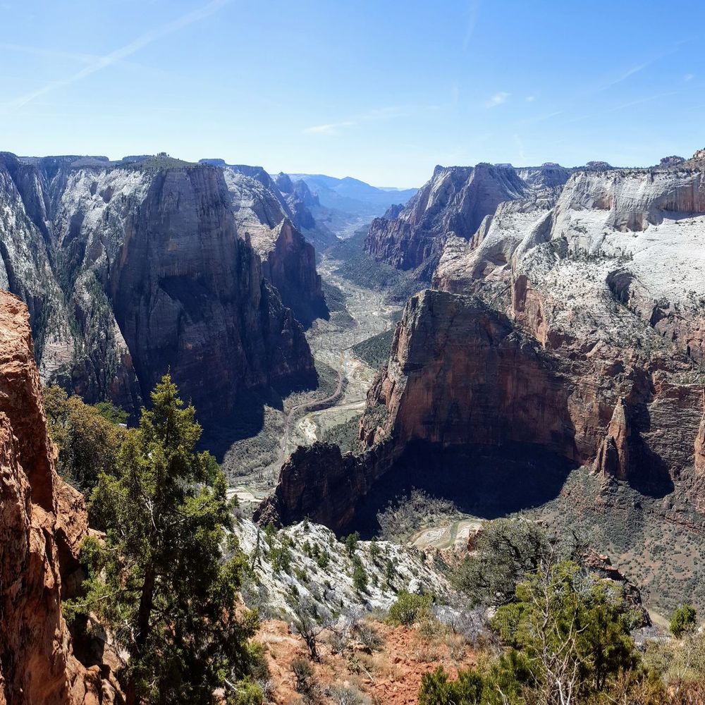
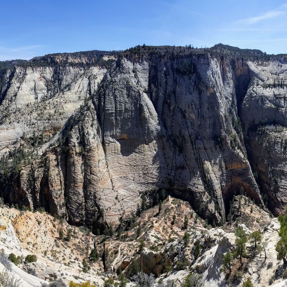

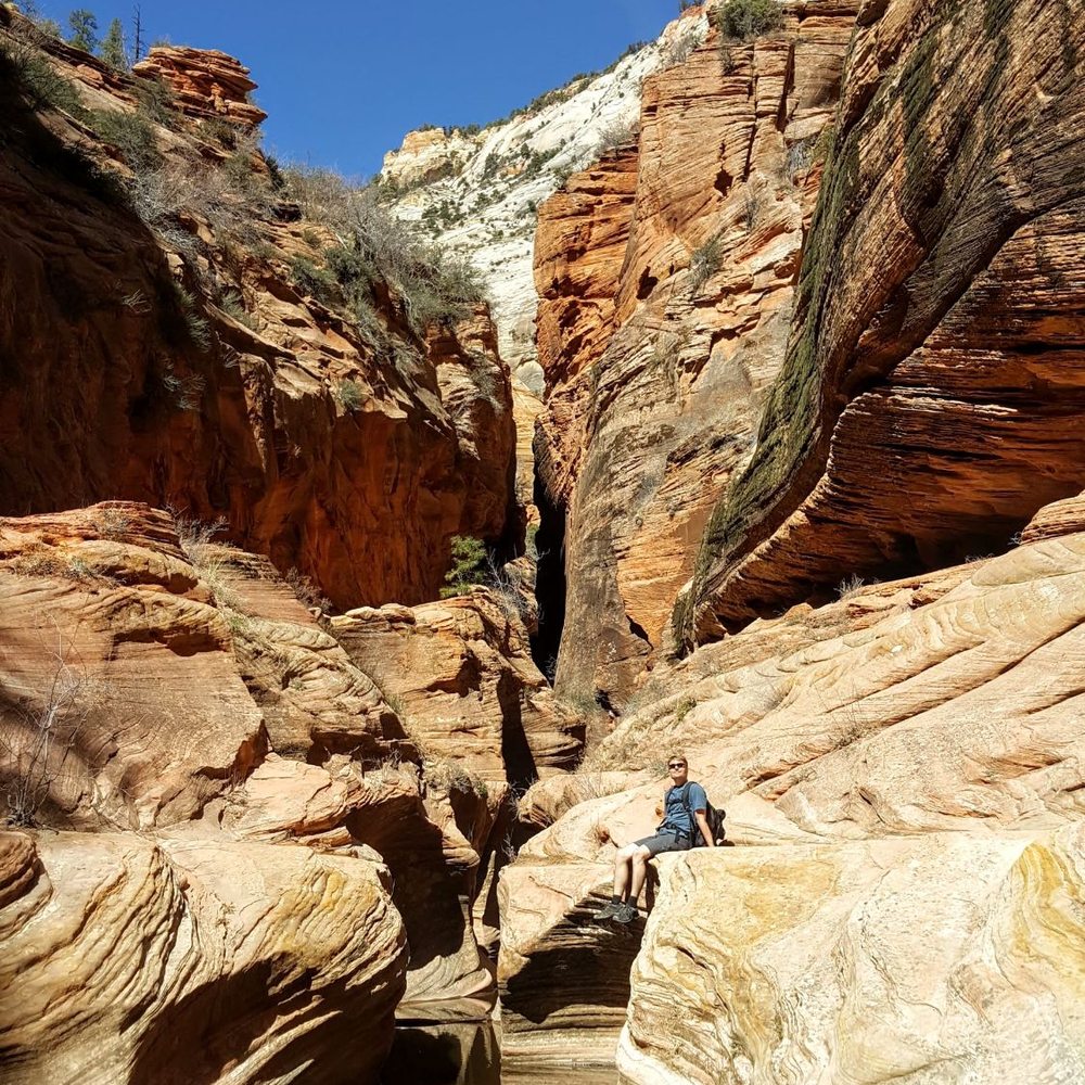


#32/100 yelp challenge - Moderate to strenuous hike - length: 2 mile round trip - duration: 1 hour ; depends on your pace and some play time. - not paved. Some narrow and drop off... - Not good for small children and handicap. - you don't need hiking sticks here - wear good hiking shoes since there are some rocky and slippery areas - very hot during summer, so you will need minimal 24 oz bottle water per person. You can not take the shuttle to this hike. We drove to the park. Once we passed the canyon junction, turned right to the SR 9 to the tunnel. It was about 6-7 miles up hill with nice view along the way, 1 mile through the tunnels. There are 2 small parkings each on the opposite direction right outside of the tunnel exit. The trail entrance is on the coming in direction. We went here at mid day so it is very hot but there are plenty of parkings. The beggining park is stairs and uphill. Continues for about half mile when you see the tree with tortuous exposed root crossing the trail, you are about half way to the overlook. Then pass the open cave, you are less than 1/4 mile to the top. From there, the trail becomes narrow only fit one person at the time, no rail, along the cliff wall. The view from the top is very nice of the winding road and many peaks. There are many wildlife up here. We saw many chipmonks and a small snake but did not see any ram. read more


Let me just say that this was absolutely the most incredible hike I've ever been on. Everything about it was perfect. It was difficult, but not dangerous. It had a ton of diversity in terms of the areas that you're hiking and the views you get along the way. There are valleys, towering cliff walls, trenches, and then open expansive views. All will take your breath away. The view at the end was absolutely magnificent. The best view I've ever seen in my life. The pictures look great but fail to capture the magnitude and beauty that seeing it in person do. It also wasn't that packed. Nothing like Angels Landing. I'd definitely recommend this to anyone, it's for sure worth your time. Going on this hike will give you a new appreciation for nature. At least, it did for me. Anyways, if you're going to Zion, put this on your must do list. That's all I've got here, thanks for reading (yes I view myself as a famous yelp blogger), goodbye everyone. read more
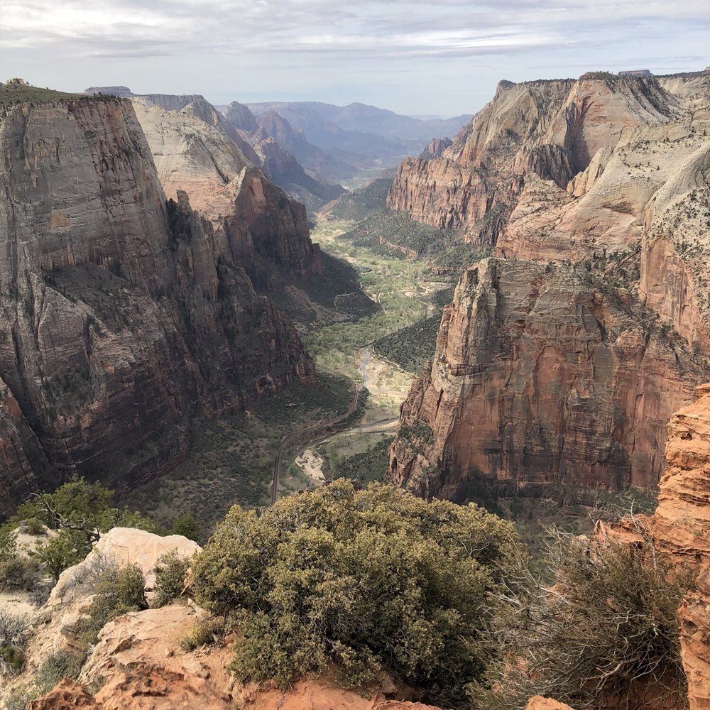


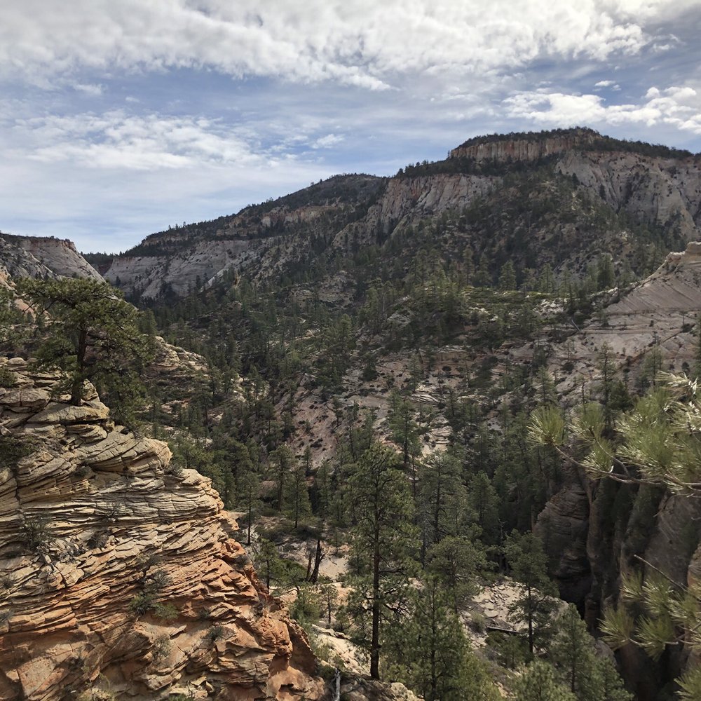

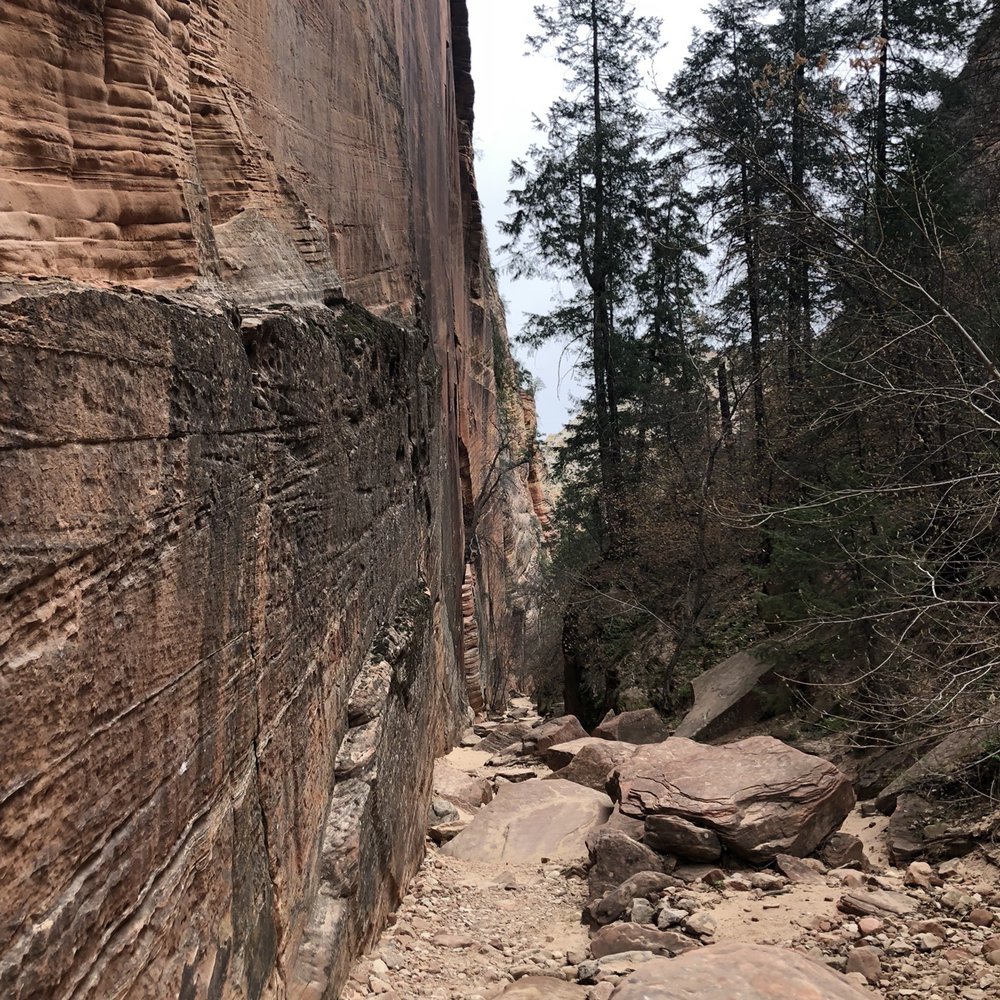
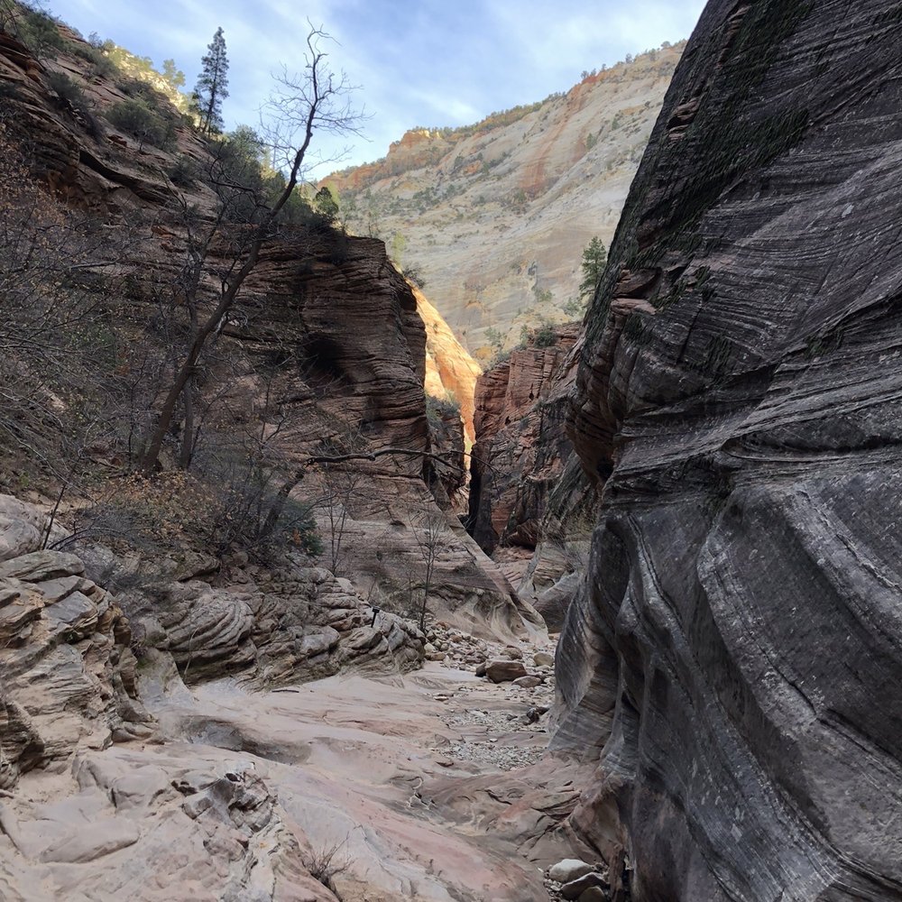

8 years ago
This is an 8 mile round trip hike starting at Weeping Rock trailhead. We visited Weeping Rock first as it's a very short hike. From there, continue the hike up. There should be signs posted but if for some reason they go missing, all splits in the trail go left. The first split in the trail, if you go right, that is to Hidden Canyon. The second split is to the east rim trail. The last split is east mesa trail. But for this review, we go left all the way to Observation Point. You can google and look up these trails if you want to try them out someday. Most of these are light traffic trails in comparison to the narrows or angel's landing. Other than that, I really enjoy the hike, but if you're short on time, and looking for beautiful views. I would skip this trail and go for the most popular hikes in the NP. That's angel's landing and the narrows. Why, because observation point doesn't have like a 360 view which angel's landing does. Everyone will have their opinion on which trail is the best in the park, but if you want a view all around, then observation point in my opinion is not it, but it's still a wondering hike. And the narrows, besides the crowd, this is a must hike. Anyone who disagree must be crazy. Now if you have more time to spend here. I say do the narrows bottom up, then do the west rim trail to angel's landing, then top it off with observation point and canyon overlook. Now if you really have more time, I would book a tour with zion adventures and do a canyoneering trip to like the subway. Then you will be satisfied with Zion NP:) As always pack accordingly to the weather and have fun out there. read more
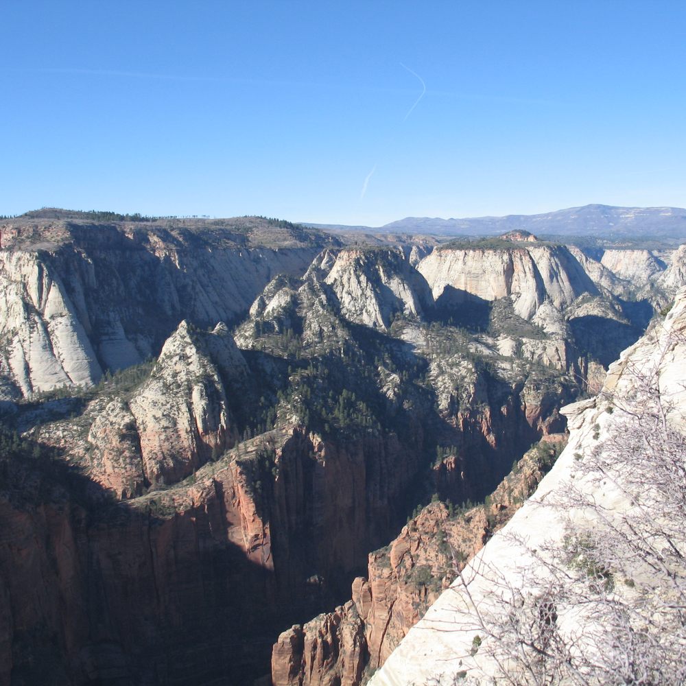
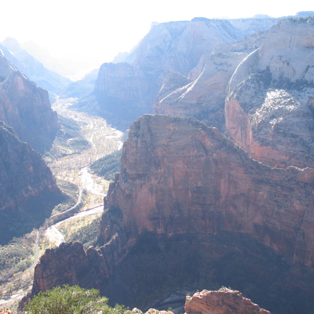

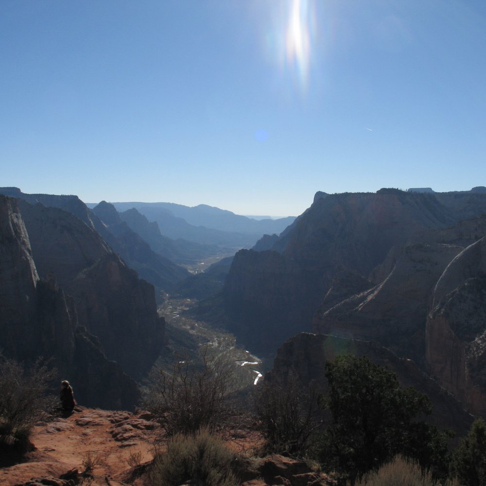


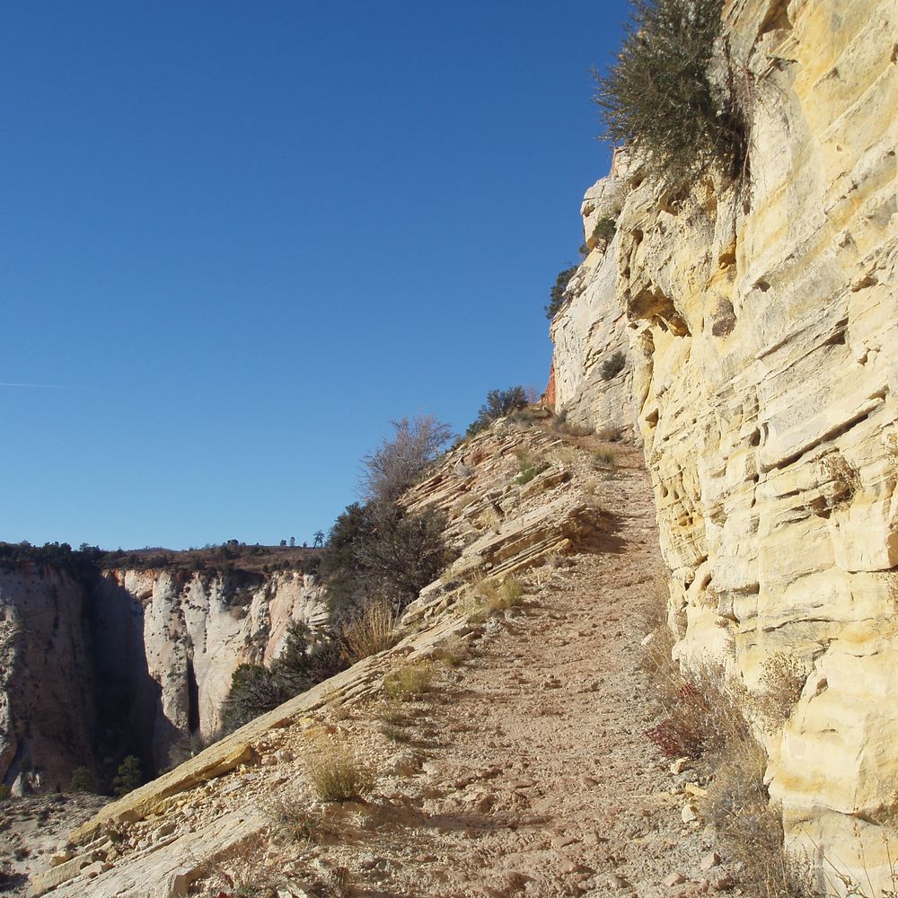


Observation Point is a whooping 8 mile round trip, but I highly recommend it. This hike is less popular than Angels Landing and I feel that it deserves more appreciation from Zion's visitors. The NPS guide rated this hike as strenuous and I agree. The hike does not involve extremely steep switchbacks in comparison to Angels Landing, but I thought it was strenuous because it requires stamina. My boyfriend and I completed the hike in a total of 5 hours round trip. The trail is mostly paved and there are very few sections where you have to maneuver over rocks. There is plenty of sun exposure throughout the hike, but there are also sections where you cool down, walking between canyon walls. After gradual switchbacks, you end up facing West. The view consists of Angels Landing, Big Bend, and the river flowing Westward. What I loved about this hike was that it was not congested. We counted a total of 8 people on this hike, excluding ourselves. Wear sunscreen, bring a lunch, and enjoy the view at Observation Point! read more


During my 1st visit to Zion, I didn't get a chance to do this hike. I made sure that I would come to this one during my 2nd visit here. The brochure they give says it takes about 6 hours - but you can very well do it within 4 hours like we did. We just didn't stop for any breaks. The view as you go up is incredible. I would say that the view is better than Angels Landing, but the hike is more straightforward. It is just a steep incline - not crazy chains to hold on for your life or anything. Overall, my 2nd favorite hike besides Angel's Landing. read more


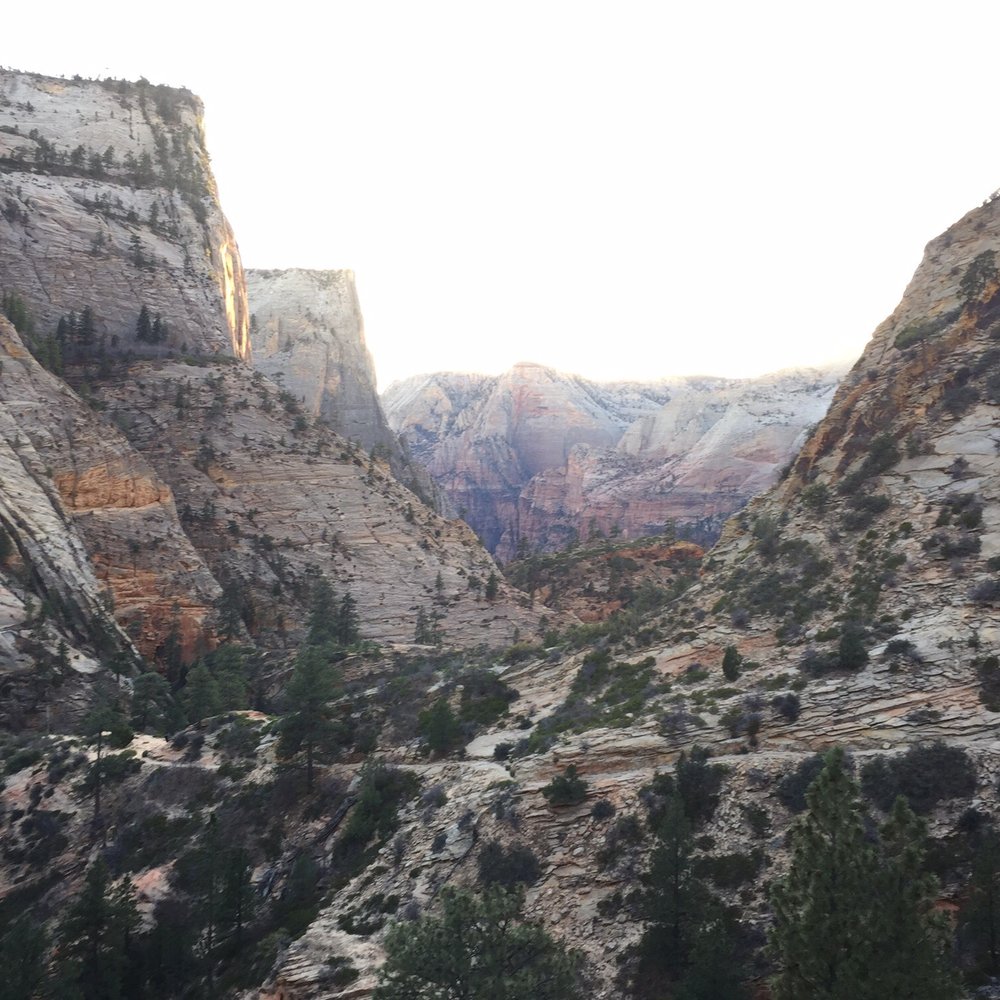


Long, strenuous, 8 mile round trip but absolutely amazing view at the top. I did this in about 4.5 hours at a moderate pace, I would give yourself at least that much time Views in my opinion are better than Angel's landing at the top, but Angel's landing was more fun for me. Must do at park along with Narrows and Angel's landing. read more


8 years ago

The hike to Observation Point is 4 miles one-way from the Weeping Rock shuttle stop. It was a bit chilly and windy, so I wanted to get going. The hike is, as I soon found out, quite unforgiving on the knees (especially going back down). Unlike Angels' Landing, the Observation Point Trail begins with uphill and more uphill. It wasn't until, I'd guess, 1.0-1.5 miles in was there any flat trail. Along the way, I passed by the Hidden Canyon trail, which unfortunately was closed for repair. What I believe to be Echo Canyon came next. It offered a brief glimpse of what I'm assuming The Narrows look like. There's a narrow path here that goes in the opposite direction, and it's something I'd like to check out in the future. I had thought about taking it on the way back down from Observation Point, but I was short on water, food, and bladder volume. Onward towards more switchbacks, which eventually took me 2,100 feet above where I started. While the hike doesn't induce the same adrenaline rush as Angels' Landing, it is harder and is definitely a decent workout. Plus, the view at the top was more than sufficient to warrant the wear and tear on the knees. Or so my younger self tells me. read more


This is a long strenuous hike. You are hiking 4 miles each way and traversing to over 2000ft above the base of the hill. Though it may seem daunting, the view is very much worth it. In comparison to Angels Landing, the hike is twice as long (but many times safer). The trail is a very doable hike with no real dangers in terms of cliffs etc. Trails are well marked and maintained so that it is very safe as you walk them. A few advice I personally would give others: - Start early: we started mid day and was able to get to the top, but we felt a bit rushed coming down to try to catch the buses. - Bring lots of food and water. You will be out on this trail for at least 5-6 hours. You will need to refuel along the way. - Wear very comfortable shoes: the hike is long with tons of uphils. Not only that, you will be coming back down so having appropriate shoes will definitely save you lots of pain later one! read more


8 years ago
Observation Point is actually at a higher elevation point than Angel's Landing. For me, it is a perfect alternative to Angel's Landing. It provides a spectacular view of the canyon and valley with significantly less danger. Moreover, you get to look down toward Angel's Landing as part of your views of the park. In addition to the magnificent payoff at the end, I thoroughly enjoyed all parts of the hike. To get to the trailhead, get off at the 7th stop for the shuttle: Weeping Rock. Continue straight, past the left turn to go to short path to Weeping Rock, on the trail until you get to the switchbacks. The initial switchbacks are very steep. However, it definitely gets better. Although the elevation increases very quickly and you are high up fast, you are not looking over a ledge. The switchbacks are indented inwards as they ascend. In other words; if you slid off one switchback, you would land on the switchback below it. Once you complete the set of switchbacks on the first mountain, the trail levels off for a bit and is flat. Eventually, you walk through a cave-like passageway to get to a hidden canyon. Next, the path links up to another set of switchbacks that run up the side of another mountain. Once you are done with the switchbacks, the final stretch of the trail is relatively flat for the last 25 minutes of the hike. However, that section of the path includes significant drop offs if you look over the side of the ledges. Obviously, falling over the ledge means certain death. For anyone with an adverse fear of heights, it may be very unnerving. I recommend walking on the inside part of the trail and away from the ledge if you are petrified of heights. There are also extreme drops over the ledges at Observation Point. Accordingly, I did not get too close to the edge when I was at the top. The views and pictures a few feet and safely back are still magnificent. In addition to the final 25 minutes of the hike, there are a few other spots on the trail with steep drops. However, it is significantly less dangerous than Angel's Landing. If you hike safely and are not reckless, serious injury or death is highly unlikely. Respect that real danger exists and do not act foolishly. I would not try this hike if it rained hard because the water would make the rocks very slippery. I also encountered points during the hike where the dirt was very smooth. As such, it was a bit slippery. Of course, just go slower and make sure you have solid footing at those sections. It took me 4 hours and 20 minutes to complete the roundtrip hike. 20 minutes of it was spent enjoying and soaking in the beauty of the park at Observation Point. Make sure you bring plenty of water for the hike because significant parts of it are completely exposed to the sun. I drank 2 liters. If you are visiting and planning a trip to Zion National Park and looking for recommendations, feel free to message me for my itinerary. You can also find the electronic copy through the link my profile. read more


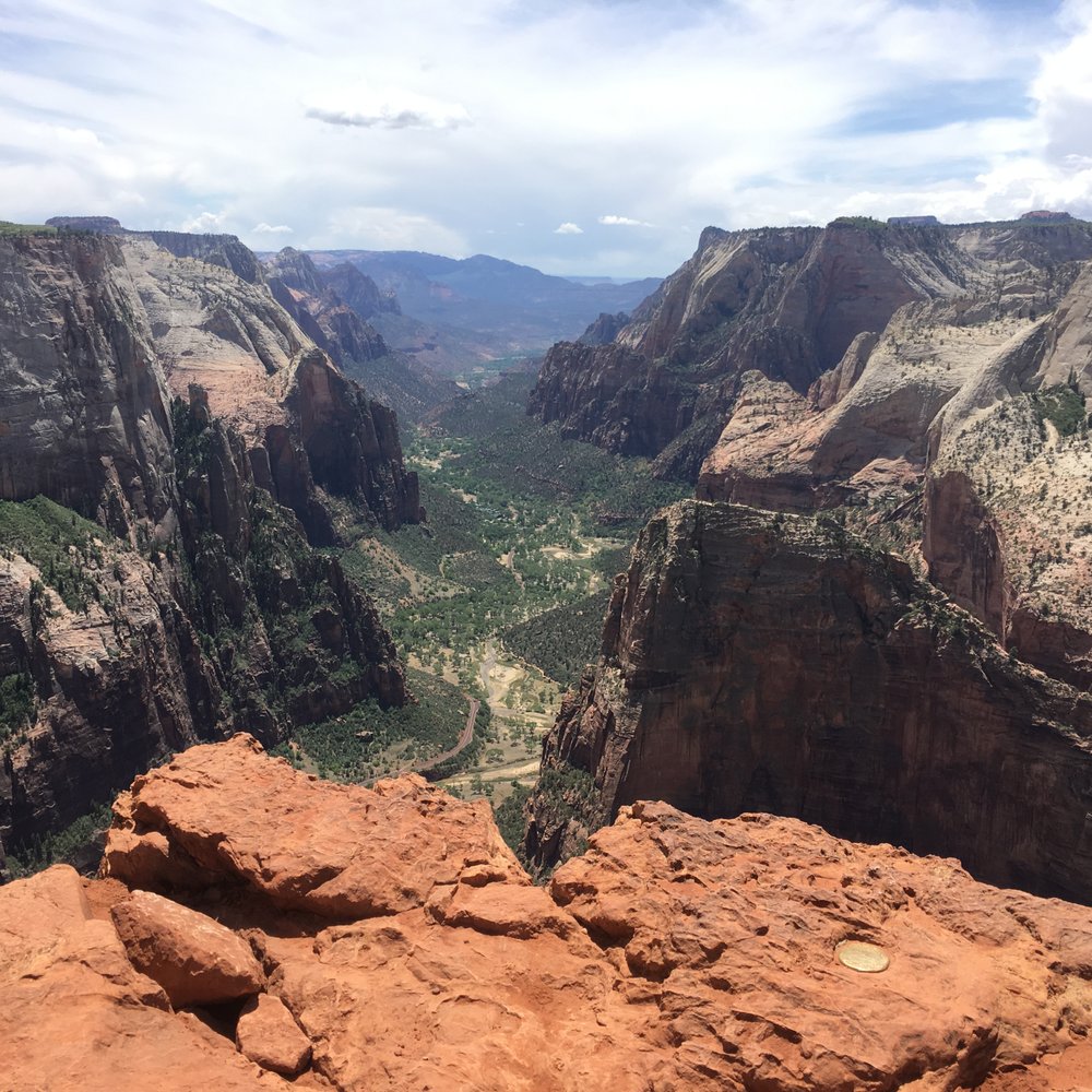


What a hike! I've never hiked that long before but it's definitely worth it. It's a breathtaking view! Make sure you take a few bottles of water and snacks while you hike up there. Believe me, it's a strenuous hike up to the top. read more


8 years ago
So I just completed this hike today after spending two days at Zion. After finishing Angels Landing one day and then doing this the next, I would have to say the view from OP is beautiful and OPs trail is very harder than AL. You are so high up you get a great view of the canyons. You can also see AL from up above. Now the hike up is totally a different topic. So this year I barely started hiking, and I did not hike often. Very beginner hiker, I've only did a handful and spaced out between months, those were considered easy and moderate I would say. So I do not hike, I don't exercise or do physical activity. This hike was very exhausting. The switchbacks are just long and treacherous. Right from the start you begin your upwards journey, and the switchbacks seem never ending. The first half of the hike, long fast incline, at one point you come to walk through the canyons and it's fairly a smooth journey. That comes to an end almost all too quickly. Once you reach the east rim trail sign, you are about half way and this is where the real fun comes. the switchback continues for a good two almost two and a half miles and these are even more brutal compared to the first half. You are exposed to the sun climbing your way to the top, but once you manage to push through this, the last portion of the hike, almost a good mile, you're just walking through sand; and then you finally reach the top. The view throughout this hike was breathtaking. So many beautiful views to take pictures of. So much to see being at this high elevation. It's absolutely amazing. This hike up and down took me 4 hours and 15 minutes. 3 hours up and 1 hour 15 down. Coming back down is pretty strenuous as well. Lots of fast decline that can be harsh on the legs. I would say to attempt this hike very early, so you aren't caught in the sun because it only makes the hike seem never ending. Lots and lots of water is needed, also snacks and a light lunch. Walking sticks do really seem to help but unfortunately I did not have one. Go at your own pace and don't over exert yourself. This hike is exhausting but if you love the natural beauty of the world, it is a must do. read more


8 years ago
Amazing hike in Zion! We managed the 8 miles round trip in about 4 hours including about 20 min at the top to take in the views. The hike itself is really beautiful and far less traveled than Angels landing, making it more enjoyable in my opinion. I could divide the hike up into four stents: incline, flat, incline, flat. The flat-ish stretches were a nice break for my lungs and knees. It's a tough hike but one of the more enjoyable ones I've done. I would totally recommend it during your visit to Zion. read more


10 years ago
Admittedly, I was nervous about doing this hike. I'm a whiny baby in steep unrelenting uphill climbs. And although that is definitely what this is, it's also very doable and well worth it. The incredible scenery throughout made the pain tolerable. Just enjoy the burn on your thighs and bask in the knowledge that your one of the few people in the world that get to see this with your own eyes. I was glad we started early and had a lot of shade (and water). And the middle part when it's mercifully gives a stretch of flat and slot canyons is awesome! Sure, lots of steep drop off ledges, but I thought the trails were always plenty wide to allow two way traffic. Do it, you'll breathe heavy, but be so glad you did. read more
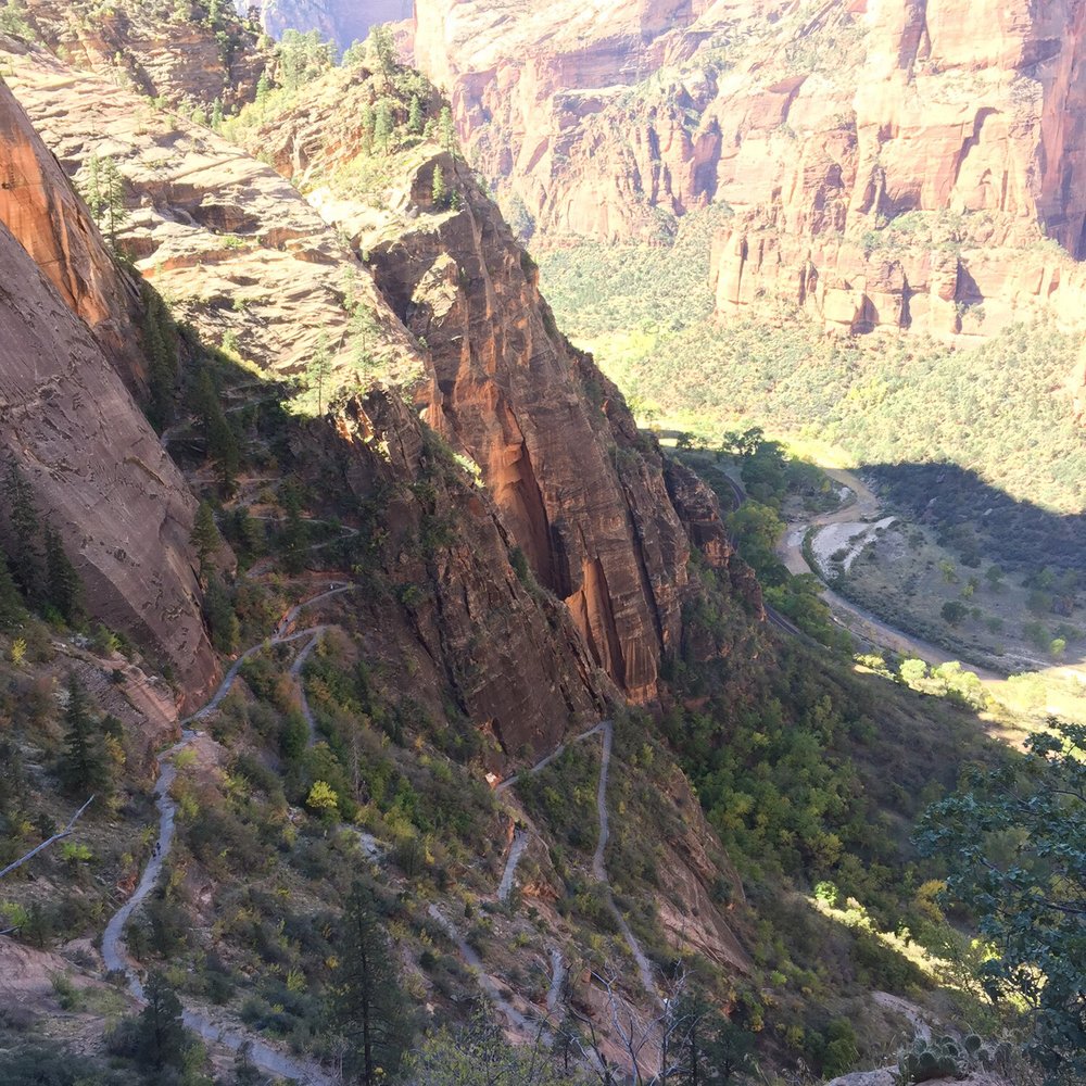


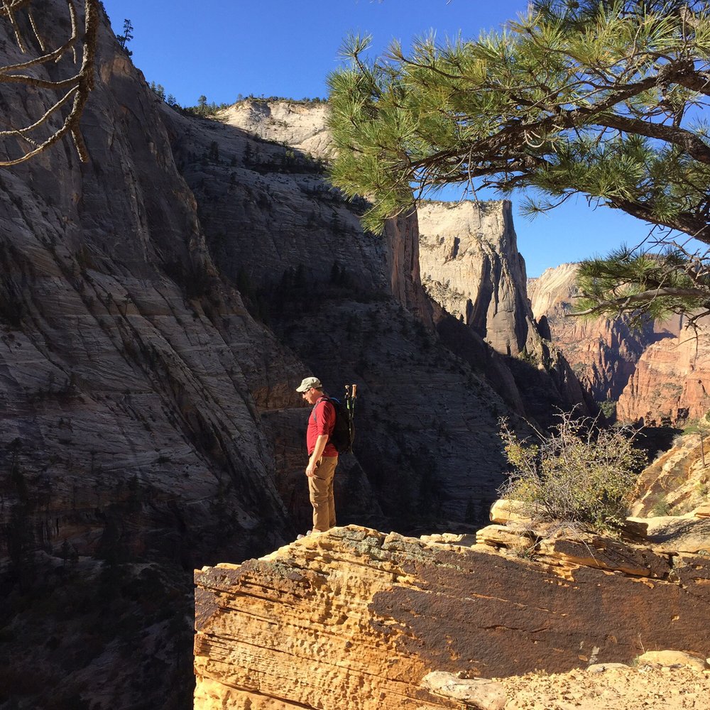

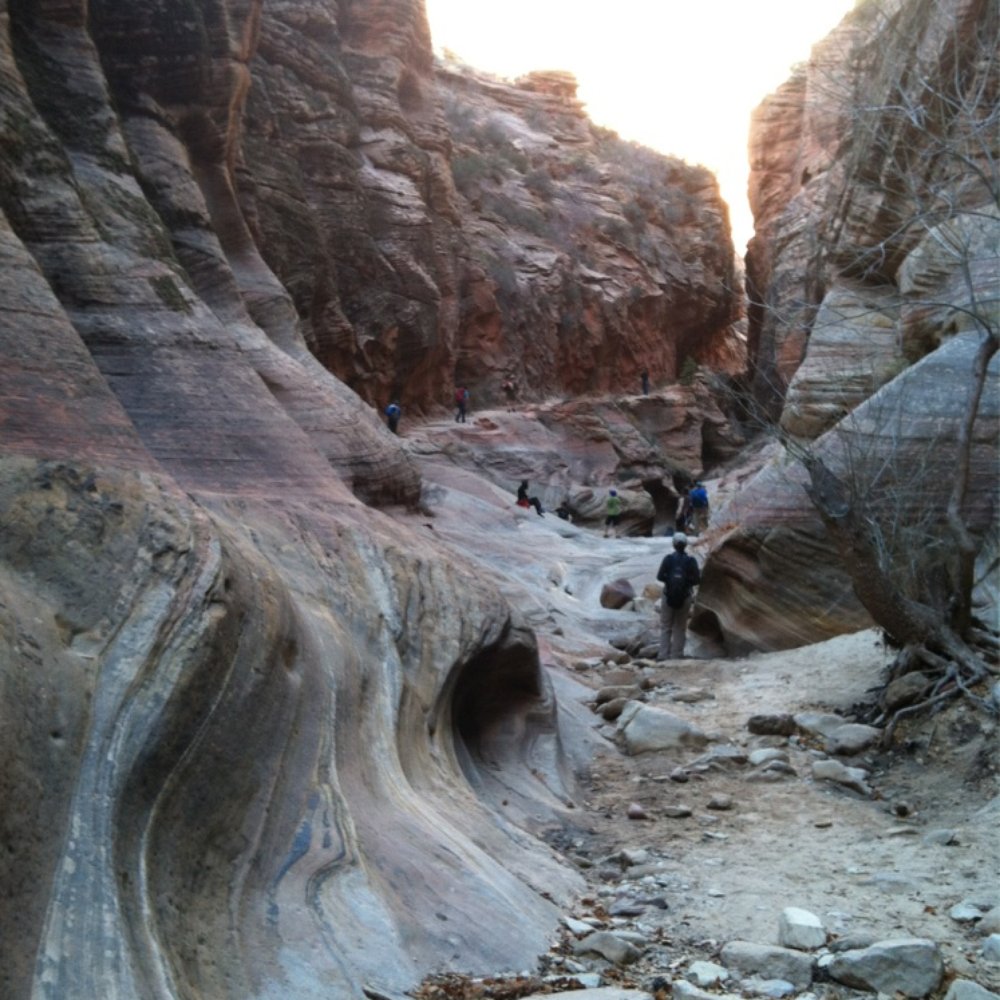
This was my very first hike I ever did in Zion at the ripe old age of 19, so this will forever hold a spot in my heart. Best summer of my life! Working for the Boy Scouts and living in Kolob Res. for summer...ahhhh the good old days. Anyways, I hadn't done this hike since then (I won't mention how long ago that was) and I was feeling nostalgic, so I decided to do it. Starting at the Weeping Rock parking lot, you can see the trail on the West side but once you pass the Hidden Canyon trailhead, this trail goes onto the backside of the mtn. This is a definite a$$ kicker I lost count at 500 switchbacks (just kidding) but seriously, it's mostly steep, hard surface trail and it gains elevation pretty quick. Once you get to the backside the terrain changes slightly, the trail is a little more rocky, but still decent. This is where you pass through Echo Canyon, which is a dry slot canyon most of the time (unless there is snow fall) which is so pretty my pictures don't even do it justice. Once you get to what you think is the home stretch, the switchbacks become a little more sketchy, they're steeper and there are steep drop offs and I found myself saying "this has to be the end" nope, keep going, once you reach what looks like a plateau, you will walk around a bizarre terrain of sand that looks like you should be at the beach. Hooray you reached the summit! From here you have AMAZING views Angels Landing and the West Rim, Cathedral Mountain, Castle Dome and the Three Patriarchs, East Rim (Cable Mountain), and Great White Throne. Watch out for the little chipmunks that are thiefs! One climbed in my camelback I set down and took my food! Stats: 8 miles RT Wear good shoes, going down is a killer on the toes and knees when they're getting jammed. 2000 ft elevation Strenuous, but I saw many different shapes and sizes doing this hike Aprox 5 hours to finish read more






11 years ago
We did this hike today and it's gorgeous. It was 78 degrees and we are strong hikers. It took us 2.5 hours to get to the top and once there it looked like a storm was coming so we booked it down in an hour and 15 minutes. The suggested time is 6 hours and I'd say to plan for 5-6 hours to do it justice. It's 2,000 feet of elevation with a lot of switch backs. There are parts that are very steep and have a cliff on the one side. Bring at least a gallon of water per person, snacks, hat, sunglasses, sunscreen, wear good hiking boots and bring your camera because the views are beautiful. Another plus is this is not a crowded hike. read more


9 years ago
I disliked this hike more than hiking out of the Grand Canyon on the South Rim after hiking from the North Rim the same day. This hike is just up up up switchback after calve killing switchback. To compare, the South Rim switch backs are more gradual incline. The view at the top is great. I didn't want to do Angel's Landing because I didn't want to hike that much elevation. Then I was duped into this hike. I thought we were doing Hidden Canyon. Then my husband was all let's see what is this way. At the top we look down and Angel's Landing is far beneath us. Make sure you cut your toenails or the pressure on the way down could cause you to lose some. I definitely slept well the night after. This hike I feel is more about the accomplishment of reaching the end than the enjoyment and cool views. Yes you are high up and it's pretty but along the way the view stays pretty similar. read more



11 years ago
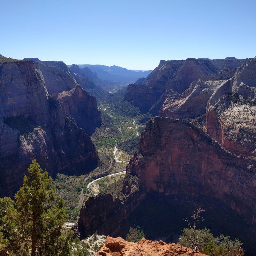
2 and a half hours up and 1 and a half back down with short breaks. Recommended to bring: At LEAST 2 liters of water. Granola/protein bars. Sun hat. Sun screen. LifeStraw. (last resort water source under the bridge where you start) Im giving this hike 5 stars based on the view you get throughout the hike. The worse part for me and my posse was that the weather was scorching hot that day. Coming from Las Vegas we knew it would be cooler so we decided on this hike (still 100 degrees at Zion). I wanted to start the hike at 7 in the morning although you should know, the more people you have, the more waiting around tends to happen. Starting the trail at 9am right off the bus, we started out with some shaded cover provided by the mountain on the east. About 1.8 miles into the hike, you will go through a little canyon that is only shaded in the morning so TAKE A BREAK and some pictures BEFORE you keep going up because there is NO SHADE besides trees after this point. At the end of the third mile, you will be able to see the point where everyone is standing and taking pictures. Once you pass these steep inclines, you're pretty much golden for the last mile since its flat. The point is very beautiful and an additional 500 feet higher than Angels Landing. If you have great eyesight (or some binoculars) you can see people hiking to the top of Angels Landing. I highly recommend doing this hike only if the high in the area is in the 80s. Other than that, be prepared because on the way down, there were many (burnt/sweaty/desperate) tourists asking me for either water or food. Something you can look forward to when you do this hike is that its not crowded full of people like Angels Landing;) (passed about approximately 30-40 hikers the whole 8 mile trip) read more
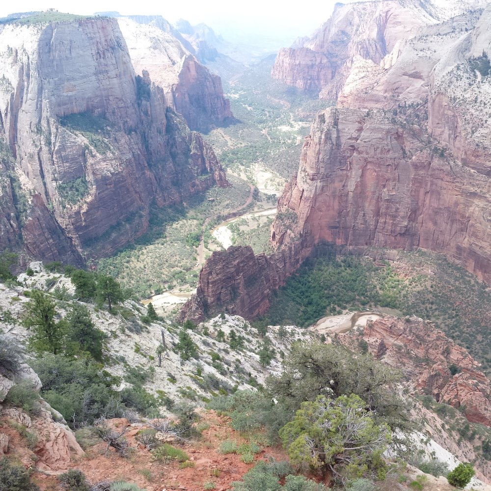

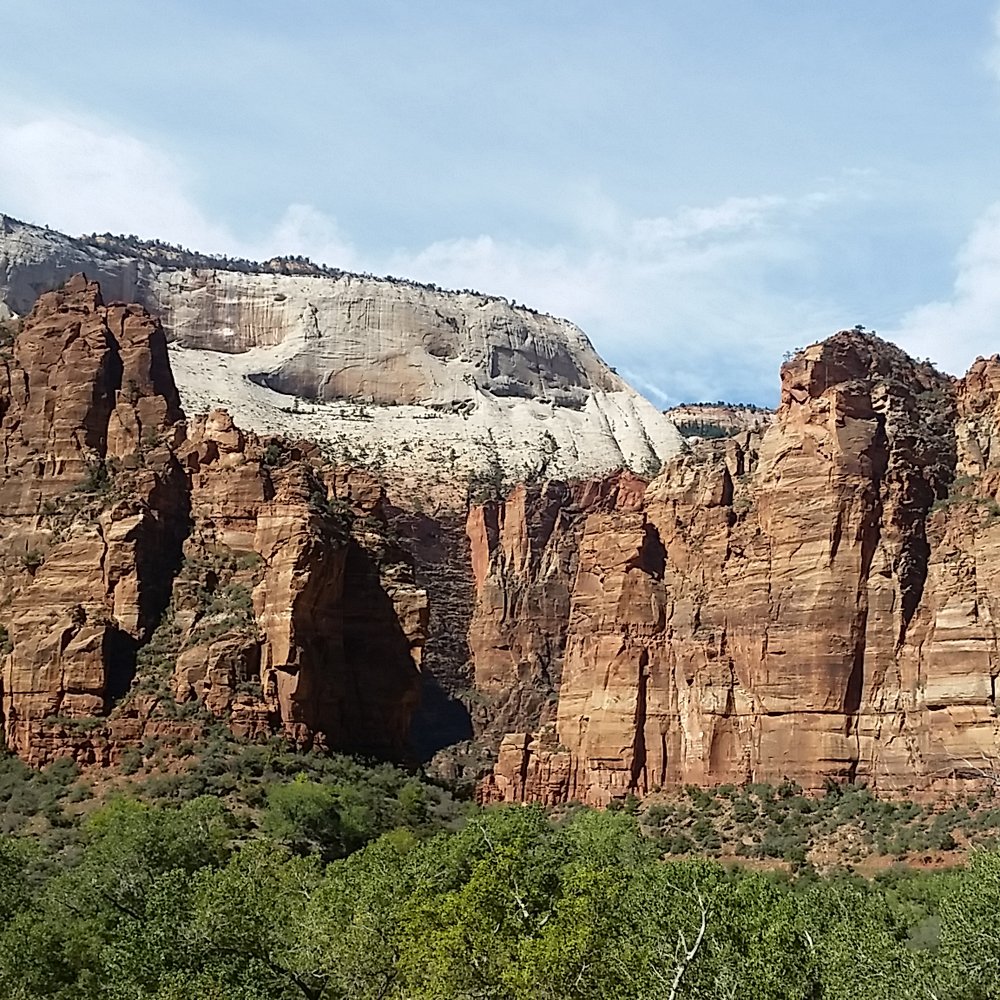
This 8 mile roundtrip hike is gnarly and strenuous! You have been warned! But was it all worth it at the top? yes yes and.... yes!! This was the first hike my friends and I did when we arrived in Zion. It is also one of the hardest hike to do and I did this hike on little to no sleep. I must have been running on adrenaline or something. Start the hike at Weeping Rock Trailhead (7th stop for the Zion Canyon Shuttle). It shares the trail with Weeping Rock and Hidden Canyon. We started our hike around 1pm and although there were a lot of people already on the hike, it was quite dispersed so it didn't feel crowded. The hike can range from 4-6 hours roundtrip depending how fast you go. It took my friend and I 5 hours to complete. From the start, the trail is already uphill and there are a lot of switchbacks from various points of the hike. The trail can go from rugged to sandy. One cool thing I liked about the hike was you get to go through this canyon-like area where you will see standing water. Be careful to not drop your things in the water. I would recommend starting this hike early since it was quite sunny throughout the hike for us. The sun definitely made itself known. Bring at least 2 liters of water!! You'll know when you're almost at the top since the trail flattens. When it flattens, you are basically at the rim of the mountain, continue hiking under you finally hit Observation Point. You'll know since you can't go anywhere else haha You can see Angel's Landing from here! Observation Point is 6,508 feet above sea level! Throughout the hike, you are surrounding by these beautiful mountains so there are plenty of great views to see as you stop and take breaks. read more



14 years ago

Wow, I love this trail! At 46, average fitness level & not exactly an avid hiker, Observation Point was definitely challenging for me - but it was totally worth it. The view from the top is, admittedly, amazing. But you're rewarded throughout this hike with all kinds of awe-inspiring scenery. The trail head is at the Weeping Rock shuttle stop; there are restrooms but no water filling station, so be sure to fill your water bottles at the Visitors' Center before boarding the shuttle. The trail starts with relatively steep switchbacks cut into the canyon wall, but it's so well maintained at this section that it's really not too bad. I just took my time & admired the surroundings. (But don't burn up your battery taking pics; it gets so much better.) By the end of this first section, you'll have gained about 1,000 feet in elevation & you'll be looking down on Angel's Landing. Next you'll go around the corner to the right & you're in another world, approaching Echo Canyon. This trail is like that, it changes dramatically at least four times. As you enter Echo Canyon, you've gone about one mile. The slot canyon is beautiful; it's a little flatter & cooler - a nice break! As you emerge from the slot, you're in the more open Upper Echo Canyon, surrounded by red Navajo sandstone. As the trail climbs higher, you'll notice that the trail change again; the red sandstone yields to lighter stone and some evergreens. When you see the sign for the East Rim Trail, there's good news and bad news. The good news is you're almost half-way there. The bad news is this is where the trail begins the relentless climb to the top. The final three, long switchbacks are cut into the white rock cliff face above Zion Canyon. On the last of these was the only place I was really nervous. Don't get me wrong, there's plenty of space, but I just got scared for some reason. (I'll post a pic of this switchback.) At the top of the white rock cliff, you're finally done climbing! The last mile (maybe a bit less) is pretty flat. There are a couple of side trails here before you reach Observation Point, in case Mother Nature calls. It's a good place to stop before you head down too. You're super close now, the hard part is over! Have fun! Tips that kept me off the Struggle Bus: *Start early. *Wear good hiking shoes/boot (obviously), layers, hat, sunglasses, sunscreen. *Have plenty of water and snacks. Electrolyte tabs to add to the water are helpful too. *A hiking staff was very helpful for me, especially on the way down. * Rest & drink water often. read more


9 years ago
Page 1 of 2
More info about Observation Point
Zion National Park
Springdale, UT 84767
Directions
Hours
Outdoor Amenities
Ask the Community - Observation Point
Review Highlights - Observation Point

















Observation Point - hiking - Updated August 2026
Best of Springdale
People found Observation Point by searching for…
Things to Do in Springdale, UT
Swimming Holes in Springdale, UT
Scenic Drive in Springdale, UT
Hiking Trails in Springdale, UT
Rock Climbing in Springdale, UT
Canyoneering in Springdale, UT
Scenic Overlook in Springdale, UT
Visitor Centers in Springdale, UT
Fishing Spots in Springdale, UT
Hiking With Kids in Springdale, UT
Secret Spots in Springdale, UT
Scenic Night View in Springdale, UT
Hiking Trails Kid Friendly in Springdale, UT
Natural Hot Springs in Springdale, UT
Free Parking in Springdale, UT
Trending Searches in Springdale, UT
Barbershop For Men near Observation Point
Bike Shop near Observation Point
Casinos near Observation Point
Cliff Jumping near Observation Point
Consignment Shops near Observation Point
Dog Friendly Things To Do near Observation Point
Elementary Schools near Observation Point
Eyebrow Threading near Observation Point
Lookout Points near Observation Point
Pedicure near Observation Point
Picnic Areas near Observation Point
Public Golf Courses near Observation Point
Public Pools near Observation Point
Scenic Overlook near Observation Point
Sunrise View near Observation Point
Browse Articles
Browse Nearby
Browse Brands
Related Searches in Springdale, UT
Affordable Kayak Rental Services in Springdale, Utah
Best Dog Hiking Trails Around Springdale, Utah
Best Fishing Locations and Guides in Springdale, Utah
Best Places for Horseback Riding in Springdale, Utah
Check Out Off Road Trails in Springdale, Utah
Discover Dog Friendly Trails to Explore in Springdale, Utah
Discover Kid Friendly Hiking Trails in Springdale, Utah
Discover Top State Parks to Visit in Springdale, Utah
Discover a Hiking Trail in Springdale, Utah
Discover the Best Night Hike Trails in Springdale, Utah
Dog-Friendly Hikes With Dogs in Springdale, Utah
Enjoy Camping Adventures Around Springdale, Utah
Enjoy Exciting Mountain Biking Adventures in Springdale, Utah
Enjoy Kayaking Adventures in Springdale, Utah
Enjoy Off Leash Dog Hikes in Springdale, Utah
Enjoy Tent Camping Spots Around Springdale, Utah
Enjoy Water Activities and Fun in Springdale, Utah
Enjoy the Best Walking Trails in Springdale, Utah
Explore Beautiful Parks and Green Spaces in Springdale, Utah
Explore Easy Hikes Perfect for All in Springdale, Utah
Explore Fun Activities to Do in Springdale, Utah
Explore Popular Campgrounds Near Springdale, Utah
Explore Popular State Park Destinations in Springdale, Utah
Explore Top Dog Parks in Springdale, Utah Near You
Explore Top Water Parks in Springdale, Utah Today
Explore the Best Swimming Holes Around Springdale, Utah
Family Friendly Hiking With Kids in Springdale, Utah
Find Popular Ziplining Spots Around Springdale, Utah
Find Top Dog Friendly Parks to Visit in Springdale, Utah
Find Top-Rated Waterfalls in Springdale, Utah Now
Find the Best Parks BBQ Grills in Springdale, Utah
Find the Best Playgrounds to Visit in Springdale, Utah
Hiking Trails With Waterfalls in Springdale, Utah
Off Leash Dog Hiking Trails in Springdale, Utah
Perfect Spots to Watch Sunset in Springdale, Utah
Plan a Scenic Drive Route Near Springdale, Utah
Popular Fishing Spots to Explore in Springdale, Utah
Safe River Swimming Areas in Springdale, Utah
Safe and Fun Parks for Kids in Springdale, Utah
Top Hiking Trails to Explore in Springdale, Utah
Top Paddleboarding Activities in Springdale, Utah
Top Playgrounds for Kids to Enjoy in Springdale, Utah
Top Running Trails to Explore in Springdale, Utah
Top Swimming Lakes to Enjoy in Springdale, Utah
Top Swimming Spots and Pools in Springdale, Utah
Top Things to Do With Kids in Springdale, Utah


