Pioneer Tree Trail Photos


You might also consider


More like Pioneer Tree Trail
Recommended Reviews - Pioneer Tree Trail
Start your review...


Reviews With Photos


This trail is really lovely! We went on a Thursday morning in late March and had the whole woods to ourselves. Parking is $8, cash or credit. The river/creek area was blocked off due to salmon spawning, but there was still plenty of beautiful nature to see. The trail was mostly shady and easy to navigate. We had a 7-year-old and two 76-year olds and they all made it out of the woods with their bones intact. It took us a little over an hour, with lots of stops along the way for photos. A little ways up the hill after you pass the sign to get on the trail, there is a fork where you can go right or keep going straight. I thought because it was a loop, we could go either direction, but if you go to the right the path just takes you alongside the parking lot. Keep going straight! You will finish the trail on the wide road to the left of where you saw the original sign. There are lots of picnic benches near the parking and bathrooms up the road just a bit.


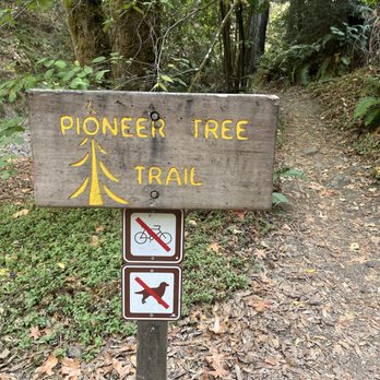
For more detailed info on Samuel Taylor Park, I wrote a separate review. This review is focused on a short but worthy hike along the Pioneer Tree Trail. I believe the whole loop is about 2 miles and most of it is shaded with misty forest cover. You can begin at the last parking area where you will cross the bridge over the creek and head down the fire trail to the left. You will see the sign for the Pioneer Tree Trail immediately on your right but I suggest to follow the creek down a bit further (less than half a mile and take the next junction on the right which is also well signed. From there you will follow a gentle grade through the forest and eventually to the main star of the trail, the Pioneer Tree itself! It's quite an impressive old growth redwood and quite a peaceful spot. I was surprised that not one other hiker was on the trail on a sunny winter Saturday, but also appreciated the solitude. Once you're done with the tree, keep following the trail down and you'll wind your way through new growth redwoods and eventually down the canyon with a cute little creek and ferns. The way the sunlight filters through the trees is quite magical and I wished it would have gone on longer. Eventually you'll come back out near the first junction you passed at the start-make a left to head back to the parking and picnic area. The entire hike was less than an hour and I would say easy to moderate and probably great for kids too! Enjoy!


The trail is around a 2-mile loop nestled in Samuel P. Taylor Park. Parking is $8 so I think this hike is better if you are already at Samuel P. Taylor Park. Not that many people are here on the weekdays so it might be worth the parking fee for some extreme calm because the trail doesn't get as busy as some other trails in Marin. I felt it was very serene, and you were really away from it all here with just the sounds of the running creek and woodpeckers. Visually it's very shaded with lots of greenery and ferns. I always get a sandwich at Lagunitas Grocery store beforehand and eat it in the park. read more
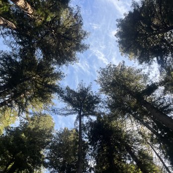


When my son suggested I hike the Pioneer Tree Trail he described it as easy and empty; he had never before seen anyone on the trail and surmised that bringing my dog, whether permitted or not (he was unsure) would thus be no problem. He had obviously never been on the Pioneer Tree Trail on a summer weekend during a pandemic. Pioneer Tree Trail is a 2.1 mile loop trail that isn't flat but neither is there any significant elevation. It winds around and back and forth through beautiful Redwood groves and it's got a lot of charm. The fact that most people enter the trail from Samuel P. Taylor Park probably accounted for its popularity during my weekend, summertime visit. Children and families and groups who I'll assume were in some sort of Covid-bubble all seemed to be enjoying this hike on a sunny day. And even though she wasn't technically allowed, my dog enjoyed the easy to follow trail as well. If all you're looking for is a mellow stroll, go ahead and enter from the park. If you want more of a challenge though still no elevation, park on Sir Francis Drake Blvd. at Inkwells, cross the bridge on the north side of the road, and follow the flat, bike-friendly Cross Marin Trail to your left. When you cross the second bridge, do a u-turn and you'll encounter the entrance to the Pioneer Tree Trail. I have it on good authority that you can have this trail to yourself at most times, but I'd not rely on it during a summer weekend when people are itching to break out of their homes after months of sheltering in place. read more
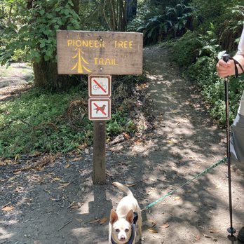

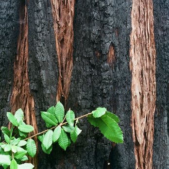
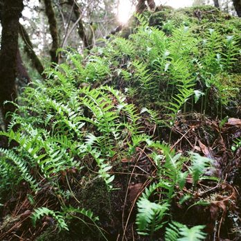
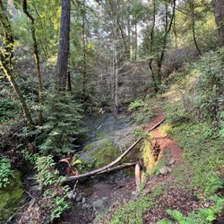
MY PHOTOGRAPHS. (1) Dinky brown-colored mushrooms growing on a log, located at the edge of the part of Pioneer Tree Trail that takes you from the campground and up, up, up through the narrow fern-coated canyon; (2) Plaque next to uphill section of the trail. The plaque is about coast redwood and Douglas fir; (3) Strawberry Shortcake posing with yellow-colored mushrooms; (4) View from central section of the trail, looking down into the narrow canyon; (5) Next to the central section is a cluster of partly burned redwood trees having a beautiful pattern consisting of charred wood (black) and non-burned wood (red); (6) Mushrooms next to a piece of tree bark covered with bright-green moss; (7) Plaque about spotted owls, winter wrens, bay laurel, tan oak, and madrone (with me wearing TOP DOG T-shirt). Sweet Pea Trail is located a few feet from this plaque; (8) Amazing giant boulder covered with hundreds of little ferns. This boulder occurs next to the final descending section of the trail. UPHILL SECTION OF PIONEER TREE TRAIL. At the west side of the parking lot at Camp Taylor is a road that crosses over a bridge, where the bridge takes you over Lagunitas Creek. This is the same road where the toll booth is, where you paid your entrance fee. Once over this bridge, turn left and walk south on Taylor Park Road to a second parking lot. The trailhead is located next to this second parking lot. This is the beginning of Pioneer Tree Trail. As soon as you start hiking, the trail goes up, up, and up through a narrow canyon, until you reach a hairpin bend in the trail, and then the trail levels off. At the bottom of this narrow canyon is a streambed. I hiked this trail on December 29, 2020 and on January 1, 2021. Thousands of bright green ferns border the path. Redwood trees grow in the canyon near the streambed, and also in the surrounding forest. Shafts of sunlight illuminate little areas of the forest in this canyon, adding touches of glory to the visual delights provided by the ferns and by the towering redwood trees. Another delight to the eye are the mushrooms. My attached photographs include pictures of dinky brown-colored mushrooms, and of larger yellow-colored mushrooms. CENTRAL SECTION OF PIONEER TREE TRAIL. Once you have hiked up through the narrow canyon, there is a hairpin turn in the trail and after that, the trail remains level until you reach a second hairpin turn. The central section of Pioneer Tree Trail is a dry area, and you will see patches of tan-colored dried ferns. The central section of the trail includes several redwood trees where parts of the bark are charred and black because it was burned a long time ago. Pioneer Tree is located towards the end of the level central section of Pioneer Tree Trail. The central section includes a plaque that mentions spotted owls and winter wrens. Next to this plaque is the trailhead to SWEET PEA TRAIL. There does not exist any sign or any marker that identifies, Sweet Pea Trail. The first five minutes on Sweet Pea Trail is very steep, and you need to be a human mountain goat in order to climb up and down this steep part. Beyond that, the trail gets level. Sweet Pea Trail is 4,500 feet long, and it ends when it reaches BOLINAS RIDGE TRAIL. FINAL SECTION OF PIONEER TREE TRAIL. The final section of the trail takes you past a huge boulder (about 8 feet high) covered with hundreds of tiny ferns. Next to this pretty fern-covered giant boulder are some smaller boulders covered with bright green moss. I took ten photographs of the giant boulder and of the smaller moss-covered boulders. The trail ends at CROSS MARIN TRAIL. Cross Marin Trail is a wide dirt road, and it runs parallel to nearby Lagunitas Creek. Your westward hike on Cross Marin Trail from the end of Pioneer Tree Trail and back to the parking lot is only 0.6 miles. read more




4 years ago
This trail is really lovely! We went on a Thursday morning in late March and had the whole woods to ourselves. Parking is $8, cash or credit. The river/creek area was blocked off due to salmon spawning, but there was still plenty of beautiful nature to see. The trail was mostly shady and easy to navigate. We had a 7-year-old and two 76-year olds and they all made it out of the woods with their bones intact. It took us a little over an hour, with lots of stops along the way for photos. A little ways up the hill after you pass the sign to get on the trail, there is a fork where you can go right or keep going straight. I thought because it was a loop, we could go either direction, but if you go to the right the path just takes you alongside the parking lot. Keep going straight! You will finish the trail on the wide road to the left of where you saw the original sign. There are lots of picnic benches near the parking and bathrooms up the road just a bit. read more


9 years ago
For more detailed info on Samuel Taylor Park, I wrote a separate review. This review is focused on a short but worthy hike along the Pioneer Tree Trail. I believe the whole loop is about 2 miles and most of it is shaded with misty forest cover. You can begin at the last parking area where you will cross the bridge over the creek and head down the fire trail to the left. You will see the sign for the Pioneer Tree Trail immediately on your right but I suggest to follow the creek down a bit further (less than half a mile and take the next junction on the right which is also well signed. From there you will follow a gentle grade through the forest and eventually to the main star of the trail, the Pioneer Tree itself! It's quite an impressive old growth redwood and quite a peaceful spot. I was surprised that not one other hiker was on the trail on a sunny winter Saturday, but also appreciated the solitude. Once you're done with the tree, keep following the trail down and you'll wind your way through new growth redwoods and eventually down the canyon with a cute little creek and ferns. The way the sunlight filters through the trees is quite magical and I wished it would have gone on longer. Eventually you'll come back out near the first junction you passed at the start-make a left to head back to the parking and picnic area. The entire hike was less than an hour and I would say easy to moderate and probably great for kids too! Enjoy! read more


4 years ago

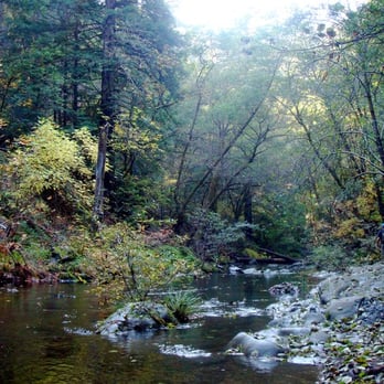
I love this hike in the fall. I love watching the falling leaves on to the river.. very beautiful. The hike is pretty much shaded, easy, and it is a loop. You will across a bridge to start the trail, and before you get to the end,and going back, you will find the Pioneer Tree with a massive trunk. It is a breeze hike but beautiful. read more



11 years ago
More info about Pioneer Tree Trail
Samuel P. Taylor State Park, CA 94938
Directions
Hours
Outdoor Amenities
Ask the Community - Pioneer Tree Trail
You might also consider





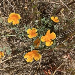


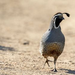






Pioneer Tree Trail - hiking - Updated August 2026
Best of Samuel P. Taylor State Park
People found Pioneer Tree Trail by searching for…
Parks in Samuel P. Taylor State Park, CA
Campgrounds in Samuel P. Taylor State Park, CA
Things to Do in Samuel P. Taylor State Park, CA
Redwood Trees in Samuel P. Taylor State Park, CA
Dog Friendly Hiking Trails in Samuel P. Taylor State Park, CA
Easy Hikes in Samuel P. Taylor State Park, CA
Hiking Trails in Samuel P. Taylor State Park, CA
Redwood Forest in Samuel P. Taylor State Park, CA
Beautiful Views in Samuel P. Taylor State Park, CA
Waterfall Hike in Samuel P. Taylor State Park, CA
Picnic Spots in Samuel P. Taylor State Park, CA
Places to Take Pictures in Samuel P. Taylor State Park, CA
Picnic Areas in Samuel P. Taylor State Park, CA
Off Road Trails in Samuel P. Taylor State Park, CA
Waterfall in Samuel P. Taylor State Park, CA
Scenic View in Samuel P. Taylor State Park, CA
Shaded Hike in Samuel P. Taylor State Park, CA
Parks for Kids in Samuel P. Taylor State Park, CA
Camping Sites in Samuel P. Taylor State Park, CA
Night Hike in Samuel P. Taylor State Park, CA
Trails in Samuel P. Taylor State Park, CA
Kids in Samuel P. Taylor State Park, CA
Browse Nearby
BEST of Samuel P. Taylor State Park, California Coffee near Pioneer Tree Trail
BEST of Samuel P. Taylor State Park, California Parks near Pioneer Tree Trail
BEST of Samuel P. Taylor State Park, California Restaurants near Pioneer Tree Trail
BEST of Samuel P. Taylor State Park, California Things to Do near Pioneer Tree Trail
BEST of Samuel P. Taylor State Park, California Breakfast near Pioneer Tree Trail
BEST of Samuel P. Taylor State Park, California Swimming Holes near Pioneer Tree Trail
BEST of Samuel P. Taylor State Park, California Campgrounds near Pioneer Tree Trail
BEST of Samuel P. Taylor State Park, California Taxis near Pioneer Tree Trail


