Cancel

Open app

Search

Sky Trail

4.7 (3 reviews)

Sky Trail Photos

You might also consider

Recommended Reviews - Sky Trail

Your trust is our priority, so businesses can't pay to alter or remove their reviews. Learn more about reviews.
Yelp app icon
Browse more easily on the app
Review Feed Illustration

9 months ago

Helpful 2
Thanks 0
Love this 2
Oh no 0

5 years ago

Helpful 21
Thanks 0
Love this 19
Oh no 0

19 years ago

Helpful 1
Thanks 0
Love this 1
Oh no 0

Verify this business for free

People searched for Hiking 1,949 times last month within 15 miles of this business.

Verify this business

Alamere Falls - Point Reyes National Seashore - Honeysuckle  on the trail of Alamere Falls

Alamere Falls - Point Reyes National Seashore

4.6(565 reviews)
9.7 km

Wow--absolutely spectacular, magical, and truly epic!…read more Alamere Falls is one of the most breathtaking hidden gems along the California coast, tucked inside Point Reyes National Seashore. What makes it so special is that it's a rare "tidefall," where the waterfall flows directly into the ocean--something you can only see in a couple of places in California, including McWay Falls. Watching the water cascade over the rugged shale cliffs onto the beach below is simply unforgettable. The surrounding landscape feels wild and untouched, adding to the sense of adventure. Upstream, the smaller cascades create a beautiful lead-up to the main falls, making the entire hike feel like a journey through nature's artwork. This spot is not just a destination--it's an experience. From the scenic hike to the dramatic ocean views, every moment feels rewarding. If you're looking for something unique, peaceful, and awe-inspiring, Alamere Falls absolutely delivers.

People who have never been to Oregon will tell you that this is one of only two tidefalls (a…read morewaterfall that flows into the ocean) on the entire West Coast. People who believe AllTrails will tell you that this is one of only two tidefalls in California. (If you use Alltrails, you aren't allowed to hike with me, by the way.) Neither of these statements are anywhere close to true. As a matter of fact, there are at least two tidefalls on this one beach, and there are many more in areas that are not easily accessible to the public. Tidefalls are common along the coasts of Oregon, Washington, and Canada. There are several tall tidefalls in Cape Perpetua alone. That being said, Alamere Falls might be the biggest, prettiest publicly accessible tidefall in Northern California. I recently hiked Alamere Falls for the first time in nearly ten years, and I couldn't believe how much had seemed to change. First of all, the road to the Palomarin trail was hell in a compact vehicle. Even going like two miles per hour, I got a little motion sickness from the thousands of deep potholes. The road is so bad that it almost seems beyond repair. At this point, it's probably only suitable for high clearance vehicles, although I did not notice any signs warning of such. Secondly, I'm pretty sure I was the only sober person on the trail. The vibes were so, so weird. Consider packing your (legal) weapon of choice. Thirdly, I was certainly the only person to take the 'legal' trail down, although I gained some new perspective on this. While the trail that I took is ostensibly the trail recommended by NPS, one does have to wonder why it is so overgrown. It feels like, "Obviously, no one ever really hikes this trail," because it's nowhere near clear or well-trodden. Certain areas of the trail were so overgrown that it was impossible to see my feet, and difficult to find my footing. These areas were chalk full of poison oak, stinging nettle, poison hemlock, and a wide variety of (harmless) snakes. By contrast, much of the "social" trail was four feet wide, flat, and clear. Which made me wonder-- which trail is really safer? The cliffs at the end of the social trail are constantly crumbling. The risk of falling, breaking a leg, or at least spraining an ankle, seems high. But by contrast, the risk of spraining an ankle on the recommended trail seems high, too. And the stinging nettle hurt a lot, but only for a few hours. My personal recommendation is to take the recommended trail, but wear solid boots, long pants, and tall, colorful socks. Tuck your pants into your socks, or wear gaiters. Use permethrin or your tick repellant of choice. While the official Palomarin Trail may be very long and difficult, it's also worth the trouble. The ocean views and wildlife were unbelievable. I actually saw a mother deer nursing two spotted fawns in the middle of the trail. On the beach, I found agates, fossils, shells, giant bull kelp, snowy plovers, and lots of by-the-wind-sailors jellyfish in multiple stages of life and decomposition. The waterfall itself is pretty-- but make sure to check the tide!! I never do, and I almost always get stranded. The first time I ever hiked this trail, I actually had to climb up a cliff in terror and wait 3 hours for the tide to recede. But that doesn't need to happen to you if you remember to check the tide before you come out, while you still have service.

Photos
Alamere Falls - Point Reyes National Seashore - Top of the falls

Top of the falls

Alamere Falls - Point Reyes National Seashore
Alamere Falls - Point Reyes National Seashore - Eucalyptus Grove at beginning of the trail

See all

Eucalyptus Grove at beginning of the trail

Cataract Falls Trail - 1.10.26

Cataract Falls Trail

4.7(257 reviews)
10.7 km

I had forgotten just how gorgeous this hike is--the scenery is incredible the entire way. Be…read moreprepared for a steady climb through most of the route, with plenty of wooden stairs, gnarly roots, and rock steps, but the stunning views make every bit of effort worth it. There are many great spots to stop for photos, take a break, or enjoy a picnic--we did all three. Thanks to the recent rain, there was still plenty of water flowing, which made the trail even more beautiful. The picnic area at Laurel Dell is especially serene, with a babbling brook nearby. There's even an outhouse, which is always a welcome sight. I actually found climbing up much easier than descending as one has to really pay attention to their footing. We were happy seeing Alpine Lake again knowing we were close to end of hike.

Went here with a friend and her dog and had such a great time. Such a beautiful, peaceful hike and…read moredefinitely one of my favorites on Mount Tam. The drive in was beautiful too, the views of Alpine Lake along the way made the whole trip feel extra special before we even got to the trail. Be prepared for a lot of stairs, so it can definitely get your legs working, but the waterfalls make it completely worth it. Hearing the water and being surrounded by all the greenery made the whole hike feel so calm and relaxing. The views throughout the hike are gorgeous, and it's such a nice escape if you're looking for something peaceful and scenic. Definitely recommend checking out Cataract Falls if you're up for a little workout with a really rewarding payoff. Definitely will be coming back :)

Photos
Cataract Falls Trail
Cataract Falls Trail - So pretty and green

See all

So pretty and green

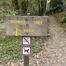
Pioneer Tree Trail

Pioneer Tree Trail

4.8(8 reviews)
2.2 km

The trail is around a 2-mile loop nestled in Samuel P. Taylor Park…read more Parking is $8 so I think this hike is better if you are already at Samuel P. Taylor Park. Not that many people are here on the weekdays so it might be worth the parking fee for some extreme calm because the trail doesn't get as busy as some other trails in Marin. I felt it was very serene, and you were really away from it all here with just the sounds of the running creek and woodpeckers. Visually it's very shaded with lots of greenery and ferns. I always get a sandwich at Lagunitas Grocery store beforehand and eat it in the park.

When my son suggested I hike the Pioneer Tree Trail he described it as easy and empty; he had never…read morebefore seen anyone on the trail and surmised that bringing my dog, whether permitted or not (he was unsure) would thus be no problem. He had obviously never been on the Pioneer Tree Trail on a summer weekend during a pandemic. Pioneer Tree Trail is a 2.1 mile loop trail that isn't flat but neither is there any significant elevation. It winds around and back and forth through beautiful Redwood groves and it's got a lot of charm. The fact that most people enter the trail from Samuel P. Taylor Park probably accounted for its popularity during my weekend, summertime visit. Children and families and groups who I'll assume were in some sort of Covid-bubble all seemed to be enjoying this hike on a sunny day. And even though she wasn't technically allowed, my dog enjoyed the easy to follow trail as well. If all you're looking for is a mellow stroll, go ahead and enter from the park. If you want more of a challenge though still no elevation, park on Sir Francis Drake Blvd. at Inkwells, cross the bridge on the north side of the road, and follow the flat, bike-friendly Cross Marin Trail to your left. When you cross the second bridge, do a u-turn and you'll encounter the entrance to the Pioneer Tree Trail. I have it on good authority that you can have this trail to yourself at most times, but I'd not rely on it during a summer weekend when people are itching to break out of their homes after months of sheltering in place.

Photos
Pioneer Tree Trail
Pioneer Tree Trail
Pioneer Tree Trail

See all

Jewell Trail - Huge boulder near Jewell Trail.

Jewell Trail

5.0(1 review)
4.1 km

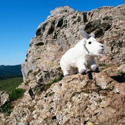
ACCESSING JEWELL TRAIL. On two occasions in February 2021, I hiked the loop trail consisting of…read moreBolinas Ridge Trail, Jewell Trail, and Cross Marin Trail. My hike was in the counterclockwise direction around this loop trail. The final stretch of this loop hike requires hiking within the narrow space between the Francis Drake Blvd. and a steep downhill slope covered with trees and with lichens called "old man's beard." Jewell Trail has two trailheads. One is located on Bolinas Ridge Trail and the other is on Cross Marin Trail. The trailhead for Bolinas Ridge Trail is next to Francis Drake Blvd., one mile east of Olema. The trailhead on Cross Marin Trail, is situated one mile to the northwest of the Camp Taylor campground. Regarding the Bolinas Ridge trailhead a mile east of Olema, typically between five and ten automobiles are parked here. They're parked on the south shoulder of Francis Drake Blvd., but additional parking places are available on a wide dirt shoulder, across the street and 50 feet to the west. The segment of Bolinas Ridge Trail leading to the Jewell Trail Trailhead provides scenery of amazing beauty. The photographs in the following list describe, by way of pictures, everything that I could possibly describe with words about Bolinas Ridge Trail and Jewell Trail: (1) Photo of wooden maze that allows passage of people, but prevents cows from passing through. The body of the cow is not flexible in the same way that snakes are flexible. If cows were flexible, they could be taught to dance the hula. But cows are unable to do hula dancing. Because cows are not flexible, they cannot pass through the wooden maze. (2) On the left side of Bolinas Ridge Trail, you can see a cluster of trees sitting on a hillock, with a row of stones embedded in the hillock. This hillock occurs about 100 feet down a grassy slope. (3) Same cluster of trees sitting on a hillock, where photo shows a tree coated with "Old Man's Beard" lichens. (4) To the right of Bolinas Ridge Trail is a deep valley. The boulder at the far left has lichen clinging to it. (5) On the right side of Bolinas Ridge Trail is a tall boulder with a stone shelf on it. On this stone shelf, I posed my mountain goat. While taking this photograph, a man and woman, in their 20's, were hiking by. I turned to them and said, "Don't worry, my permit for keeping the mountain goat is all paid up." They responded with a flurry of laughs. (6) Same boulder, with both Strawberry Shortcake and the goat. (7) Photo of deep valley to left of Bolinas Ridge Trail. Jewell Trail is just beyond this valley. (8) Photo of the sign at the trailhead for Jewell Trail. Two men were approaching, riding their mountain bikes. I was impressed by their ability to ride up the steep hill and I said, "You are certainly strong and powerful, but I know you are vulnerable to KRYPTONITE." They understood my joke and laughed. (9) After a minute of hiking down Jewell Trail there's a huge boulder to the right. Photo of the goat, California quail, and northern flicker sitting on this boulder. (10) Further down Jewell Trail, view looking uphill at the beautiful upper part of the valley. (11) Same location by Jewell Trail, with view looking downhill. Francis Drake Blvd. can be seen in the distance. (12) Further down Jewell Trail, the forest begins. Goat and Strawberry Shortcake stand near a zig-zag in the trail. (13) Further on down, the trail enters a shady area, covered with a tunnel of trees. I arranged a fallen white-colored branch, possibly from a birch tree, so that it would show up in the photograph. (14) Photo of a mossy tree covered with a few tiny ferns, located next to Jewell Trail. LICHENS. In many areas of your hike, you will find lichens hanging from trees and lichens growing on rocks. The kind of lichen that hangs from trees is "old man's beard," also called beard lichens of the genus Usnea. Photographs of beard lichens are available from, "pointreyesnature dot com/alamea-trail" and also from Kundsen and Carlberg (2005). Other kinds of lichen at Bolinas Ridge include Rimularia insularis and Rinodina falvosoralifera. Colorful lichens that grow on rocks include, Xanthoria elegans, Rhizoplaca melanopthalma, and Saxicolous lichens. REFERENCES. ( 1 ) K. Knudsen and T. Carlberg (2005) Bulletin of the California Lichen Society. Vol. 12, No. 2, page 36. ( 2 ) Tom Carlberg (2012) Bulletin of the California Lichen Society. Vol. 19. See, page 27. ( 3 ) Larry St. Clair (1999) Bulletin of the California Lichen Society. Vol. 6, No. 2. ( 4 ) Kocourkova (2012) A Checklist of the Lichenicolous Biota of California Opuscula Philolichenum. 11:64-103. ( 5 ) Lichens, surprising pioneering organisms (2019) Encyclopedia of the Environment. ( 6 ) Article by Sheela McLean, available from: "methownet dot com/grist/features/lichens.html

Photos
Jewell Trail - Goat and Strawberry Shortcake on huge boulder next to Bolinas Ridge Trail.  Trailhead to Jewell Trail is only about 20 minutes ahead.

Goat and Strawberry Shortcake on huge boulder next to Bolinas Ridge Trail. Trailhead to Jewell Trail is only about 20 minutes ahead.

Jewell Trail - Near the bottom of Jewell Trail, the trail enters a dark forested area.

Near the bottom of Jewell Trail, the trail enters a dark forested area.

Jewell Trail - Mountain goat perching on huge boulder next to Bolinas Ridge Trail.  Here, we are about half-way to the trailhead for Jewell Trail.

See all

Mountain goat perching on huge boulder next to Bolinas Ridge Trail. Here, we are about half-way to the trailhead for Jewell Trail.

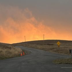
Chimney Rock - Point Reyes National Seashore - Sunset from the parking lot

Chimney Rock - Point Reyes National Seashore

4.7(32 reviews)
9.2 km

"Where is the best place to get 360 degree views of the ocean?" Someone asked me this question last…read moreweek while I was hiking out at Tomales Point, and I've decided that the answer is Chimney Rock. (I mean, technically, the answer is actually 'from a boat in the middle of the ocean,' but I'm pretty sure they meant like, 300 degree views.) Chimney Rock is a thin straight of land that peeps out into the ocean. Or, in more technical terms, according to the NPS website, it is "the Eastern spur of the Point Reyes headlands." If you think of Point Reyes as being shaped like a double-headed wrench, the lighthouse and Chimney Rock are on the same side of the wrench, but they are the tips that oppose each other. Each one juts out into the ocean on its own. Of course, you could also get great, nearly all-around views at the lighthouse, but this requires hiking down 313 stairs. As opposed to the lighthouse, Chimney Rock is a much easier hike. In fact, this hike would have been a breeze, if not for the actual breeze, which was blowing at about 45mph. (Point Reyes is the second windiest point on the West Coast. If you are not able to maintain a very strong stance against the wind, then consider a different hike.) The hike was less than a mile each way. There were not very many wildflowers, but in some ways, this is actually an advantage over Tomales Point, because it allows for better unobstructed views. There are a lot of social trails at Chimney Rock. NPS has posted signs in front of these trails that say, "Unauthorized trail, hazardous cliffs. Please stay on authorized trails." I stayed on the authorized trails, not just because I'm a goody-two-shoes as a hiker, but because, as a California native, I understand cliff geology, and the very real risks associated with it. You may be thinking, "This cliff isn't really going to crumble and drop me into the ocean," but actually, this can and does happen all the time. (In fact, this actually happened to a member of my cohort at UC Santa Barbara.) A side hike can take you down to the Historic Life Saving Station. There is not a sign that says "this way to the life saving station," but you will know which trail it is because it is *not* marked with an unauthorized trail sign. (I have not yet taken that side hike, but it looks interesting.)
Yelp has the wrong map location for this spot. A nice hike and we were close and personal with a…read morecoyote during our hike. We just kept still and it walked on by. Pretty cool! The easy walk itself is fairly short out and back with a mandatory turnaround at the end of the trail. Make sure you venture to the right toward the beginning to get that awesome sheer cliff ocean view. And be careful because that little 20 foot desire comes with some wind. Many folks miss this feature of the hike. Lots of flowers during springtime.

Photos
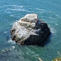
Chimney Rock - Point Reyes National Seashore - Chimney Rock

Chimney Rock

Chimney Rock - Point Reyes National Seashore - Chimney Rock

Chimney Rock

Chimney Rock - Point Reyes National Seashore - One of the cliff views

See all

One of the cliff views

Big Rock Trailhead - Big Rock Trail

Big Rock Trailhead

4.5(2 reviews)
8.1 km

What's kinda funny about this trail is how it starts on Lucas Valley Road. There's no parking lot…read more(no restrooms either), so you just park on the shoulder near a big rock. As it turns out, that big rock is the Big Rock, so the hiking-averse among us will likely take a pic and drive away. Talk about premature climax. But you should keep going as the uphill climb wasn't that strenuous, mostly a gradual incline, and it affords nice views along the way. One view you'll have is of Skywalker Ranch, George Lucas's production facility although from a distance, it looked more like an upscale private resort. You might presume Lucas Valley was named after George, especially since he donated the land that led to the formation of the back-and-forth trail. However, it's named after a 19th-century Irish immigrant unrelated to George. The meandering, gravelly trail was mostly exposed so bring water and a hat. If you make it to the radio towers, you can pat yourself on the back for reaching the second highest summit in Marin next to Mt. Tam. You also might be lonely up there as I ran into exactly one bicyclist and two hikers on my entire journey. Instead, put in your AirPods and play a song like Peter Gabriel's "Big Time". Just replace 'Time' with 'Rock'. The lyrics still work: "I'm on my way, I'm making it / I've got to make it show, yeah... Big, Big, Big, Big, Big, Big, Big, Big ROCK!" RELATED - Up for a hike? Here's a collection of trails I've walked and reviewed: https://bit.ly/2OrC8nU
This is the perfect hike. I started at 4 p.m. on an August afternoon, and finished with plenty of…read moretime to spare. The grade is perfect for some uphill cardio, without going overboard. The downhill is not slippery and dangerous. at the top, adjacent to the radio tower oh, there's even a porta potty. The view from the top is fantastic. Look toward San Pablo Bay. You'll see the Carquinez Bridge off in the distance toward the northwest. look toward the Southwest and you'll see the finger fog pushing through the San Francisco Bay toward the Richmond and Albany Hills. There's a small place for parking right off of Lucas Valley Road.

Photos
Big Rock Trailhead - Big Rock Trail

Big Rock Trail

Big Rock Trailhead - Beginning of the trail near Lucas Valley Road

Beginning of the trail near Lucas Valley Road

Big Rock Trailhead - Big Rock Trail

See all

Big Rock Trail

Carson Falls - Parking area

Carson Falls

3.9(26 reviews)
6.9 km

Carson Falls are epic! Carson Falls drops about 80 feet…read more along Carson Creek. In the winter after storms: totally amazing! The creek swells and the falls roar. You don't just see it, you feel it in your mind and heart! I love the power of water falls! In the summer, the water falls are quiet, delicate, still stunning. Your peaceful serenity moment with zero crowds makes your heart melt with smiles. Bring your lunch. Or a book. Or just simply enjoy the magic of living! It's about 3 miles round trip. 2 hours. Steady but happy climb, totally doable! The kind of "easy enough for any day of the week, rewarding enough to brag about hike. Chase this one right after a huge storm must be spectacular! Trust me. You'll see why Marin locals try to keep it quiet. Who's adding this to their hiking list?

This is a case where the journey is more important than the destination…read more Carson Falls is located in a remote part of Marin County. When I was into mountain biking, I read a book about the biking trails in Marin. On a scale of 1 to 5, 5 being the toughest, the Pine Mountain area is a 6! Pine Mountain Road is not only remote, it's rocky. If you get in trouble out here, you're REALLY in trouble. I'll stick to hiking, thankyouverymush. First stop: Carson Falls. I went in March, there had already been a few showers that year, so I wasn't worried about the lack of water. I was spectacularly underwhelmed. I think the falls are around 25 feet tall, and it wouldn't take much for the creek to run out of water. The rock where you can gaze at the falls while eating lunch is nice, and the immediate area is home to an endangered yellow-legged frog. Oh well, so much for this destination. The journey - the acreage surrounding the falls - truly is spectacular. Especially in Spring, when the grass is still green. Forests alternating with low manzanita. The last quarter mile before Carson Falls is deep redwoods. Views of canyons, ridgelines, the Meadow Club Golf Course, both Alpine and Kent Lakes, and Marin suburbia in the distance. You can even see Mt. Diablo and Mt. Tam in the same shot. I made it up to Pine Mountain, which requires bushwhacking to get to the actual summit, and found two mysterious rockwalls hidden among the manzanita. If camping was allowed here, there are plenty of nice backpacking spots, but this is an area for storage of Marin drinking water so camping is out. The Carson Falls and Pine Mountain area is really nice if you're looking for a different outdoors jaunt. It's not undiscovered by any means, but it does offer an experience that's different from most in Marin County - or the entire Bay Area, for that matter.

Photos
Carson Falls - Super windy on a sunny day

Super windy on a sunny day

Carson Falls - Trailhead

Trailhead

Carson Falls - Posting

See all

Posting

Fairfax Open Space Preserve - White Hill viewed from Azalea Hill Trail

Fairfax Open Space Preserve

4.2(6 reviews)
7.5 km

Okay, so here's my story. Film Night In The Park was showing "Rocky" one Saturday night in…read moreSeptember. Neither the Hunny nor the girl wanted to see it, so it was just me going to Central Marin to see this cheapo movie that became one of the most inspirational and biggest moneymakers of the 1970s. But I got there early so I could get some hiking in. The goal: White Hill. I drove down Glen Drive to the end, hiked for roughly half a mile, and at the fork in the trail, took the wrong fork: I went right instead of left. And ended up on this sharp uphill fire road that took me to some big, wide views of Fairfax. Nothing really special here, if you don't count the reservoirs as special. What you do have is a place to work those quads, build that cardio, and test your endurance as you attempt to get to the top of those hills to the north. And the trail does take you to the top, if you can make it. An unobstructed view of Mt. Tam, several neighborhoods of Terra Linda and San Anselmo, and the open space of San Geronimo Valley can all be seen from this trail. So really, it's typical Marin County outdoors, more unshaded grasslands than dark forest. This could be a good picnic area. Either you or your special someone can go for a few hundred feet, then down a narrow trail to your left, to come to a dense flat forest where you can spread out the blanket, pour the wine, and enjoy your vegan sandwich and organic fruit (hey, this is Marin County). Or you can huff and puff for as far up as you want, and then put out the blanket and eat something more substantial as you two enjoy the view. Fairfax Open Space Preserve is another option for outdoors lovers, but there are better choices out there. BTW, I had to turn around after an hour, the movie was about to start. But I did have that famous Bill Conti song on my mind. Because going up that hill is tougher than the staircase leading to the Philadelphia Museum of Art. That's my story, and I'm sticking to it.

Good running destination from Forest Knolls.... 8 mile round trip. It's a great start for…read moremarathon training!

Photos
Fairfax Open Space Preserve - The preserve, as seen from White Hill

The preserve, as seen from White Hill

Fairfax Open Space Preserve - View from near the top.

View from near the top.

Fairfax Open Space Preserve - Newly graded fire road.

See all

Newly graded fire road.

Sky Trail - hiking - Updated May 2026

Loading...
Loading...
Loading...