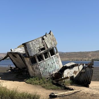
Point Reyes Shipwreck Photos

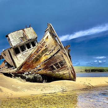
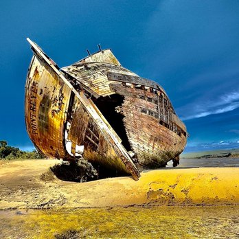
More like Point Reyes Shipwreck
Recommended Reviews - Point Reyes Shipwreck
Start your review...


Reviews With Photos


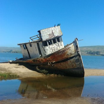
I haven't been since 2021, so it was before all of the storm damage and deterioration I've read/heard about. Not sure why, but it was a 'magical' experience for me...maybe because it reminded me of being a kid and creating a fun story in my mind about how a treacherous adventure ended in a shipwreck! (Even though it's a small boat that simply got beached. LOL) Pics I'm sharing were taken in January 2021.
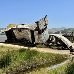

It's a really cool ship to check out if in the area. Weather was nice when I was there. Beautiful view. There is a parking lot or can park along the streets. Was there for about 10 mins. That is really all you need unless you are doing some photoshoot session :)


Wonderful! Go at low tide so you can walk out on the marsh truly experience the entire boat.


Nice quick stop on the way to Point Reyes beaches. Park at the Inverness store (buy stuff at the store as well) and head back towards the water. I'm a self-taught photographer so I find this beauty unique and interesting. This iconic landmark is definitely a photo worthy subject. There's also a portable-potty if you need to use it specially after a long drive. It is however not clean but there is toilet paper and sanitizer. I'm sure everyone carries their own sanitizer given our current situation.


"Any government has as much of a duty to avoid war as a ship's captain has to avoid a shipwreck."― Guy de Maupassant, Collected Stories of Guy De Maupassant Shipwrecked boat that's easily accessible from the road and is a stopping point for tourists, photographers and a local landmark. -Aka the SS Point Reyes, Inverness Shipwreck and Tomales Bay Shipwreck -Was originally meant to be a fixer-upper by the original owner of the property but obv never happened. -Was set to be removed by the wetlands restoration firm but was saved by the local photographers.


Great for a fun day trip in the Bay Area. Very secluded and at great sight to see especially if you are from out of town. Gotta love the california coast and all that it has to bring.


The shipwreck itself is interesting for 5-10 minutes mostly for a photographer. I even saw a couple taking their wedding photos here which was kinda weird since a decrepit ship doesn't seem like good foreshadowing for a long life together but whatever. This is a nice stop if on the way to the Lighthouse or somewhere else in West Marin but I wouldn't come all the way out here just for this. It's easiest to use the parking lot at the Inverness Store (make sure to buy something) because the ship is right behind it. On a sunny day it's not a bad idea to go for a walk along the shore (depending on how high the tide is) and there are a few picnic tables to have lunch.


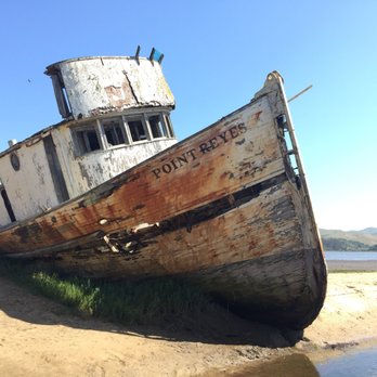
No matter what photographic skill level you have, you will get a perfect shot of this place. Not too many people know this place, hence, I'm only the 35th Yelp-elite reviewer of this place. Yasss!!! It's known as the Tomales Bay Shipwreck, the Inverness Shipwreck, or the S.S. Point Reyes, the shipwreck of a 380-foot cargo steamship that grazed the land of Inverness over 100 years ago. Today there is a small sign and trail that leads to the picturesque wreck. So you won't trespass on someone's property just like I did. LoL. It's possible to actually get on the boat, but it is not advised since the wood is rotten and riddled with holes. Because you'll piss off a lot of people including me. Once you're there you'll experience serenity and calmness. It is located in the small town of Inverness, just behind the grocery store. If you are driving North on Sir Francis Drake Blvd it will be on your right side. Parking is easy and you will see a small picnic area just footsteps away from the abandoned boat. Overall, I am glad I visited and highly recommend this site for a photoshoot.


If you're coming through Inverness, taking a moment to check out the Point Reyes Shipwreck is not a bad idea. It's photogenic and parking is easy, making it a breeze to wander over. The bay and the surrounding water makes a picturesque backdrop for this small ship. The ship itself, has seen better days (shipwreck not withstanding) in that folks have done a bit of grafitti and there has been a small fire on the back end as well. So if you come, look but don't touch so the folks that come after you can also enjoy it. It only takes a few moments but you'll get a great pic out of it. FYI--Wear waterproof shoes, getting to the back end of the ship means a bit of mud hopping.
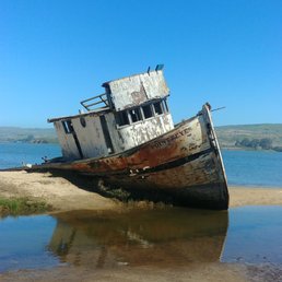

The iconic Point Reyes Shipwreck. When you visit the Point Reyes National Seashore, you have to stop and visit this iconic shipwreck. It won't take a whole of time to see the ship. Simple parking behind The Inverness Store (https://www.yelp.com/biz/inverness-store-inverness)They have a parking lot and picnic tables in case you want to have a snack there. From there you just walk the short little trail onto some private property (its ok to trespass per the land owner) to the shipwreck. If its low tide you can almost get a 360 view of the shipwreck. If its high tide you will only get a side shot and frontal view of the ship. I'd advise not to climb on the shipwreck, doing so may make the owner of the property to take away the experience for others who would like to view this shipwreck. Come out, bring your lunch and enjoy the iconic Point Reyes Shipwreck


Such a cool sight to see. Unfortunate that it got shipwrecked of course but makes for some great pics.


Point Reyes cheese tasting/brunch. Mead tasting. Oysters at Hog Island. This shipwreck. Best day ever! There are picnic tables here in case you want to pack your lunch and hang out. Or if you don't want to DIY, there are restaurants right across the street. Visit for the gram (instagram photos).


1 month ago
This is the ship wreak 8/4/26 and 4/25! It hasn't made any big changes since we were here last time read more


11 months ago
I haven't been since 2021, so it was before all of the storm damage and deterioration I've read/heard about. Not sure why, but it was a 'magical' experience for me...maybe because it reminded me of being a kid and creating a fun story in my mind about how a treacherous adventure ended in a shipwreck! (Even though it's a small boat that simply got beached. LOL) Pics I'm sharing were taken in January 2021. read more


It's a really cool ship to check out if in the area. Weather was nice when I was there. Beautiful view. There is a parking lot or can park along the streets. Was there for about 10 mins. That is really all you need unless you are doing some photoshoot session :) read more



1 year ago
Wonderful! Go at low tide so you can walk out on the marsh truly experience the entire boat. read more


Nice quick stop on the way to Point Reyes beaches. Park at the Inverness store (buy stuff at the store as well) and head back towards the water. I'm a self-taught photographer so I find this beauty unique and interesting. This iconic landmark is definitely a photo worthy subject. There's also a portable-potty if you need to use it specially after a long drive. It is however not clean but there is toilet paper and sanitizer. I'm sure everyone carries their own sanitizer given our current situation. read more


2 years ago


"Any government has as much of a duty to avoid war as a ship's captain has to avoid a shipwreck."― Guy de Maupassant, Collected Stories of Guy De Maupassant Shipwrecked boat that's easily accessible from the road and is a stopping point for tourists, photographers and a local landmark. -Aka the SS Point Reyes, Inverness Shipwreck and Tomales Bay Shipwreck -Was originally meant to be a fixer-upper by the original owner of the property but obv never happened. -Was set to be removed by the wetlands restoration firm but was saved by the local photographers. read more




4 years ago
Great for a fun day trip in the Bay Area. Very secluded and at great sight to see especially if you are from out of town. Gotta love the california coast and all that it has to bring. read more


The shipwreck itself is interesting for 5-10 minutes mostly for a photographer. I even saw a couple taking their wedding photos here which was kinda weird since a decrepit ship doesn't seem like good foreshadowing for a long life together but whatever. This is a nice stop if on the way to the Lighthouse or somewhere else in West Marin but I wouldn't come all the way out here just for this. It's easiest to use the parking lot at the Inverness Store (make sure to buy something) because the ship is right behind it. On a sunny day it's not a bad idea to go for a walk along the shore (depending on how high the tide is) and there are a few picnic tables to have lunch. read more
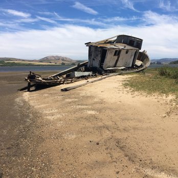


No matter what photographic skill level you have, you will get a perfect shot of this place. Not too many people know this place, hence, I'm only the 35th Yelp-elite reviewer of this place. Yasss!!! It's known as the Tomales Bay Shipwreck, the Inverness Shipwreck, or the S.S. Point Reyes, the shipwreck of a 380-foot cargo steamship that grazed the land of Inverness over 100 years ago. Today there is a small sign and trail that leads to the picturesque wreck. So you won't trespass on someone's property just like I did. LoL. It's possible to actually get on the boat, but it is not advised since the wood is rotten and riddled with holes. Because you'll piss off a lot of people including me. Once you're there you'll experience serenity and calmness. It is located in the small town of Inverness, just behind the grocery store. If you are driving North on Sir Francis Drake Blvd it will be on your right side. Parking is easy and you will see a small picnic area just footsteps away from the abandoned boat. Overall, I am glad I visited and highly recommend this site for a photoshoot. read more


8 years ago
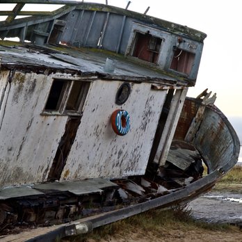
If you're coming through Inverness, taking a moment to check out the Point Reyes Shipwreck is not a bad idea. It's photogenic and parking is easy, making it a breeze to wander over. The bay and the surrounding water makes a picturesque backdrop for this small ship. The ship itself, has seen better days (shipwreck not withstanding) in that folks have done a bit of grafitti and there has been a small fire on the back end as well. So if you come, look but don't touch so the folks that come after you can also enjoy it. It only takes a few moments but you'll get a great pic out of it. FYI--Wear waterproof shoes, getting to the back end of the ship means a bit of mud hopping. read more


The iconic Point Reyes Shipwreck. When you visit the Point Reyes National Seashore, you have to stop and visit this iconic shipwreck. It won't take a whole of time to see the ship. Simple parking behind The Inverness Store (https://www.yelp.com/biz/inverness-store-inverness)They have a parking lot and picnic tables in case you want to have a snack there. From there you just walk the short little trail onto some private property (its ok to trespass per the land owner) to the shipwreck. If its low tide you can almost get a 360 view of the shipwreck. If its high tide you will only get a side shot and frontal view of the ship. I'd advise not to climb on the shipwreck, doing so may make the owner of the property to take away the experience for others who would like to view this shipwreck. Come out, bring your lunch and enjoy the iconic Point Reyes Shipwreck read more


5 years ago
Such a cool sight to see. Unfortunate that it got shipwrecked of course but makes for some great pics. read more


3 years ago

Point Reyes cheese tasting/brunch. Mead tasting. Oysters at Hog Island. This shipwreck. Best day ever! There are picnic tables here in case you want to pack your lunch and hang out. Or if you don't want to DIY, there are restaurants right across the street. Visit for the gram (instagram photos). read more


3 years ago

7 years ago
An Insta-worthy spot! The shipwreck is not difficult to find (Located behind the Inverness Store) and the location on google is accurate. There is ample parking and picnic tables if you want to grab a snack. We went on a Saturday and there were about 10 people at the spot. If you want to go close to the ship for close up shots, make sure you wear waterproof shoes. Please do not climb on the shipwreck. read more


8 years ago

Great photo op to stop at if you are in the area, but I wouldn't recommend making the trip out just for it! It is located behind the little market. The wreck is eerily majestic when it isn't too crowded. Don't wear nice shoes as it is boggy. I wouldn't recommend going into the wreck as it is quite dangerous to do so. Do it for the 'gram! read more


Know what I love about a bacon double cheeseburger? Total WYRIWYG; no surprises. And the same goes for the Point Reyes shipwreck, a preserved vessel run aground and cemented in time via photographer intervention, as it's pretty much a requirement that you snap this oddly simple and satisfying landmark whenever passing through Inverness. No admission, no rules - simply park in the market lot and walk towards the water for a surprising sentinel. Wear old shoes, though; the ground gets mighty gross. read more


5 years ago
Lovely landmark in Inverness. A pox on the careless photographer who set the boat on fire a few years ago to get a "good shot" - HE should be shot into jail! Be sure to stop at the Inverness Market and buy something - great people and if you go there you are using THEIR parking lot - so be considerate- throw a few dollars their way. read more


4 years ago

6 years ago


9 years ago
Pretty cool little landmark. Don't think I'd necessarily go out of my way to see it, but it's on the way up the coast so it was a pleasant surprise to come across. Note that it's right behind the grocery store, and if you're driving by, it's pretty easily visible. A nice pit stop. read more


12 years ago
Fun little detour if you're in the area! You can park at the market in front. There are port-a-potties near the parking area. If you're planning to explore inside the ship or get close to it, I recommend bringing good shoes that you don't mind getting muddy. Also get some snacks at the market and enjoy the view! After we went to Drake beach and saw some elephant seals! read more


This is a great little photo op. Park the car, stretch your legs and grab a snack at Saltwater across the street or the market. Then, walk towards the water and you'll see the Pt. Reyes. I'm actually surprised it's still there...but it's a fun photo stop nonetheless. read more


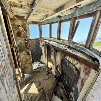
What?! I had no idea something this cool was just behind the Inverness store. An old incredibly picturesque shipwreck, perfect for exploration and photos. My kids were all over it, climbing around and exploring the few rooms that were still in tact. I was able to take some cool photos as well. It loses a star only because it is really quite graffitied and there were SO many people there trying to take pictures, but whatever. read more


11 years ago

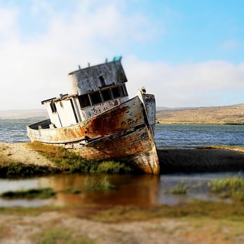
The Point Reyes Shipwreck aka Abandoned Boat aka SS Point Reyes is something that cannot be missed! Located behind the Inverness Store, this boat is a great photo opportunity for you shutterbugs out there. I recommend going during the dry season to get the full effect. read more

9 years ago
You can walk in front of the shipwreck without paying anything. This is a true look. A great view of the Tomales Bay. If you decide to stop by the Inverness Store for grocery, you can park on their lot and walk to the shipwreck. This ruined ship is so symbolic of the area because the ship was named "Point Reyes". read more


10 years ago
Did not know this place was well, in the middle of NOWHERE! haha. We drove here from SF and it was a bit of a drive, the road seemed to be leading nowhere and it was quite late. We finally arrived around 5pm. We parked in the grocery store's parking lot and went in to get some goodies (FOOD!). The grocery store attendant was very helpful and friendly, answered question we had about the place and made our cup of noodle soups :) so we walk on over to the shipwreck (it was freezing cold), and I was just in awe of the view. I've seen the ship on so many pictures and couldn't believe that I was finally there. Overall it was such a good experience, would definitely go back! read more


11 years ago
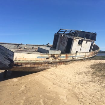
This was definitely a cool spot! Not much to do but take pictures. The wreck looked really awesome though. I just wished people hadn't graffiti the boat. Other than that it was a cool place to stop for some great pics! The convenient store in front of it had some cool and unique beverages!! read more



10 years ago
Awesome place to visit on your point Reyes trip. Feels like stepping back in time. The shipwreck is located to the left of the parking lot, about a 3min walk. Just be considerate and don't spend too long hogging it for photo ops! read more

Page 1 of 2
More info about Point Reyes Shipwreck
Ask the Community - Point Reyes Shipwreck
Review Highlights - Point Reyes Shipwreck

















Why does Yelp recommend reviews?
3 reviews that are not currently recommended
The reviews below are not factored into the business's overall star rating.

3 years ago

9 years ago

12 years ago
Point Reyes Shipwreck - landmarks - Updated September 2026
Best of Inverness
People found Point Reyes Shipwreck by searching for…
Trending Searches in Inverness, CA
Apple Orchards near Point Reyes Shipwreck
Apple Picking near Point Reyes Shipwreck
Barbershop near Point Reyes Shipwreck
Bike Shop near Point Reyes Shipwreck
Casinos near Point Reyes Shipwreck
Cliff Jumping near Point Reyes Shipwreck
Consignment Shops near Point Reyes Shipwreck
Ear Piercing near Point Reyes Shipwreck
Estheticians near Point Reyes Shipwreck
Eyebrow Threading near Point Reyes Shipwreck
Eyelash Extensions near Point Reyes Shipwreck
Flower Fields near Point Reyes Shipwreck
Gold Panning near Point Reyes Shipwreck
Hair Braiding near Point Reyes Shipwreck
Hidden Gems near Point Reyes Shipwreck
Hiking near Point Reyes Shipwreck
Kids Haircut near Point Reyes Shipwreck
Landmarks & Historical Buildings near Point Reyes Shipwreck
Lookout Points near Point Reyes Shipwreck
Picnic Areas near Point Reyes Shipwreck
Private Schools near Point Reyes Shipwreck
Public Services & Government near Point Reyes Shipwreck
Scenic Night View near Point Reyes Shipwreck
Scenic Overlook near Point Reyes Shipwreck
Secluded Spots near Point Reyes Shipwreck
Sunrise View near Point Reyes Shipwreck
Things To Do This Weekend near Point Reyes Shipwreck
Trading Card Shops near Point Reyes Shipwreck
Browse Articles
Browse Nearby
BEST of Inverness, California Restaurants near Point Reyes Shipwreck
BEST of Inverness, California Coffee near Point Reyes Shipwreck
BEST of Inverness, California Photo Spots near Point Reyes Shipwreck
BEST of Inverness, California Things to Do near Point Reyes Shipwreck
BEST of Inverness, California Scenic Drive near Point Reyes Shipwreck
BEST of Inverness, California Star Gazing near Point Reyes Shipwreck
BEST of Inverness, California Breakfast near Point Reyes Shipwreck
BEST of Inverness, California Hotels near Point Reyes Shipwreck
BEST of Inverness, California Campgrounds near Point Reyes Shipwreck
Browse Brands
Related Searches in Inverness, CA
Best Fun Things to Do in Inverness, California
Best Lookout Points to Visit in Inverness, California
Book Engaging Historical Tours in Inverness, California
Discover Charming Historic Homes in Inverness, California
Discover Historic Sites and Places in Inverness, California
Discover Lakes & Ponds to Explore in Inverness, California
Discover Popular Landmarks in Inverness, California
Discover Popular Photo Spots in Inverness, California
Discover Top Points of Interest in Inverness, California
Discover a Library Near You in Inverness, California
Discover the Best Military Museum in Inverness, California
Enjoy the Best Night View Spots in Inverness, California
Enjoy the Best Walking Trails in Inverness, California
Explore Beautiful Botanical Gardens in Inverness, California
Explore Beautiful Castles and Landmarks in Inverness, California
Explore Beautiful Parks and Green Spaces in Inverness, California
Explore Children's Museums Near Inverness, California
Explore Free Things to Do Around Inverness, California
Explore Fun Activities to Do in Inverness, California
Explore Popular Scenic Overlook Points in Inverness, California
Explore Popular View Points Around Inverness, California
Explore Top Art Galleries Located in Inverness, California
Explore Venues & Event Spaces in Inverness, California
Find Beautiful Views in Inverness, California
Find Fun Things to Do With Kids in Inverness, California
Find Parks and Recreation Activities in Inverness, California
Find Top Art Museums in Inverness, California
Find Top-Rated Waterfalls in Inverness, California Now
Find a Public Library Near You in Inverness, California
Find the Best Bridge Spots in Inverness, California
Find the Best Playgrounds to Visit in Inverness, California
Hiking Trails With Waterfalls in Inverness, California
Must-See Tourist Attractions Around Inverness, California
Plan a Scenic Drive Route Near Inverness, California
Popular Picnic Spots to Visit in Inverness, California
Popular Places to Go in Inverness, California
Popular Places to Take Pictures in Inverness, California
Popular Things to Do in Inverness, California
Popular Things to See in Inverness, California
Stair Climbing Activities and Gyms in Inverness, California
Top Hiking Trails to Explore in Inverness, California
Top Places to Visit in Inverness, California for Sightseeing
Top Things to Do With Kids in Inverness, California
Tour Famous Lighthouses Located in Inverness, California
Tour Popular Historical Sites in Inverness, California
Visit Beautiful Gardens in Inverness, California
Visit Popular Museums in Inverness, California Now


