Cancel

    Open app

    Search

    Potato River Falls

    4.7 (7 reviews)

    Potato River Falls Photos

    Recommended Reviews - Potato River Falls

    Your trust is our priority, so businesses can't pay to alter or remove their reviews. Learn more about reviews.
    Yelp app icon
    Browse more easily on the app
    Review Feed Illustration
    Photo of Molly M.
    174
    1850
    16145

    4 years ago

    Helpful 2
    Thanks 0
    Love this 2
    Oh no 0

    4 years ago

    Helpful 0
    Thanks 0
    Love this 0
    Oh no 0

    8 years ago

    Helpful 2
    Thanks 0
    Love this 0
    Oh no 0
    Photo of Esie L.
    1
    28
    18

    3 years ago

    Helpful 0
    Thanks 0
    Love this 0
    Oh no 0
    Photo of Marilyn B.
    288
    342
    1541

    6 years ago

    Helpful 0
    Thanks 0
    Love this 1
    Oh no 0

    14 years ago

    Helpful 2
    Thanks 0
    Love this 1
    Oh no 0
    Photo of Dan K.
    1
    119
    0

    7 years ago

    Helpful 0
    Thanks 0
    Love this 0
    Oh no 0

    Ask the Community - Potato River Falls

    Verify this business for free

    Get access to customer & competitor insights.

    Verify this business

    Copper Falls State Park

    Copper Falls State Park

    4.4(33 reviews)
    9.5 mi

    Copper Falls State Park is often ranked among Wisconsin's top state parks, and it's easy to see…read morewhy. Located in the Northwoods of northern Wisconsin, the park's highlight is the Doughboy Trail, a well-developed two-mile loop that offers excellent views of both Copper Falls and Brownstone Falls. The trail is easy to follow, well-maintained, and includes several scenic overlooks. Because of its distance--several hours from cities like Madison--I recommend combining a visit with other Northwoods attractions. A great option is to stop here while exploring the Apostle Islands or the Bayfield area. Once inside the park, follow the main road past the ranger station until it ends at the parking lot, where you'll find restrooms and the Doughboy Trailhead. This is a beautiful park and well worth the stop, especially if you plan it alongside other northern Wisconsin adventures.
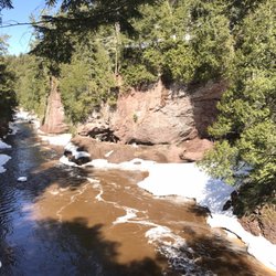
    As we traveled north, we stopped at several state parks, and Copper Falls stood out as one of the…read moreprettiest--often noted in reviews for having the highest waterfall in the area. We were able to park easily and walk a short, fairly easy loop to reach the falls. The view of the waterfall was beautiful, though the trail itself isn't very shaded. Thankfully, the weather was mild during our visit, which made for a pleasant stop. Parking was plentiful, and the park overall felt accessible and well maintained. A worthwhile stop for an hour or so if you're exploring northern Wisconsin.

    Photos
    Copper Falls State Park
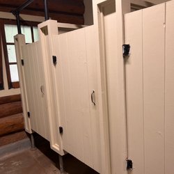
    Copper Falls State Park - Rustic (but clean) restrooms

    Rustic (but clean) restrooms

    Copper Falls State Park

    See all

    Big Bay State Park

    Big Bay State Park

    4.3(17 reviews)
    23.1 mi

    We came here on the ferry from Bayfield (super easy, but recommend having your car on the ferry if…read moreyou plan to head out here) and had a great time hiking. I was a little confused on where I was supposed to park for the trails, but there's essentially one road so you just kinda figure it out as you go (I went the wrong way the first time, maybe a 2 minute detour). We parked near the beach access area, and started off on the trails. We took the Woods Trail to the Point Trail to the Bayview Trail -- and it brings you right back to the same place. I recommend doing it in this order (which I think is counter-clockwise?) versus the reverse. While the Woods Trail is in a lovely, lush green woods, after seeing the rocks and lake sites along the other trails, the Woods Trail would be a very boring way to end. Starting with the Woods Trail, it's only better as you go along. I hiked with my senior large dog, and he did just fine on the paths. Pretty clear markings and nothing super treacherous if you don't venture out on to the rock formations. Dogs are not allowed on the beach or boardwalk (big sad face), so we went back to town after the hike. Along our way, we saw a small black bear crossing the road! Quite an adventure. Depending on date and time, might be limited food options on the island, so have a plan and check out your options ahead of time.

    Wonderful Wisconsin State Park with unbelievable views of Lake Superior! Lots of hiking (just…read moreremember to wear insect repellent), swimming or just walking along the shoreline. We biked to the park after taking the ferry-bicyclists are free at the state park! Primitive pit toilets was the ONLY drawback at this magnificent state park!

    Photos
    Big Bay State Park
    Big Bay State Park - Perfect spot for a picnic!

    Perfect spot for a picnic!

    Big Bay State Park

    See all

    Meyers Beach- Bayfield Sea Caves

    Meyers Beach- Bayfield Sea Caves

    4.8(4 reviews)
    38.3 mi

    We hiked the Lakeshore Trail from the Meyers Beach parking lot. (National Park Service. $5 parking…read morefee; $2.50 if you have a Senior Pass or Access Pass. May, 2023). As noted by others, this is a launch point for kayaks to launch for views of the sea caves and cliffs. We were at this location twice in late May, 2023, and national park Rangers were there on both days (Wednesday, Friday) ensuring that kayakers were prepared for the rough and cold waters, and to provide guidance to hikers. There are clean vault toilets at the location. Regarding the Lakeshore Hike, we did about 2.2 miles of the hike, returning on the same trail to make it about 4.4 miles roundtrip. The trail continues to a campground site (I believe NPS reservations are required) but we didn't go that far. The first 1.8 miles are largely inland, without views of Lake Superior. Of this segment, the first 0.7 miles are almost completely on a double plank boardwalk that goes over swampy land in parts. It requires some stepping up and down on planks, following terrain changes. After you cross a service road at 0.7 miles, the trail alternates between plank boards and regular trails. As you approach the crevasse at 1.8 miles, there are quite a few ascents and descents wherein you go down to a stream-bed and then back up. Some of these are steep but have logs to help with footing. The stream crossings all had sturdy boards or bridges to cross. At 1.8 miles, you reach the crevasse area with views of Lake Superior. Take a look on both sides to see sea caves and the deep crevasse. There are benches here too so it made a great lunch spot. Be careful not to get too close to the edges. It's a long way down! Beyond the crevasse, walk another 0.4 miles to the "basin". This stretch is relatively easy (flat) walking with spectacular views. My husband, who has been hiking in the Himalayas recently, found the entire trail to be easy. For me, I'd characterize it as moderately challenging. On the positive side, there is very little elevation change, so I wasn't huffing and puffing. However, I have balance issues, so I didn't particularly like the footing for the ascents/descents to the stream beds nor all of the roots on the trail. Some of the steps up and down, even on the boardwalk, were also a bit too high for my short legs! Having walked with hiking poles and an occasional hand from my husband helped. Finally, remember bug spray. The mosquitoes are active. 4-star rating overall instead of 5 due to distance required to walk to get views of the sea caves and mosquitoes. 5 stars for the Park Service.

    You have to come check out the sea caves on the shoreline of Lake Superior. Meyers beach is the…read morelaunching point for kayaks. It's also the location for the hiking trail. The views from the water are beautiful! I highly recommend the water instead of the walking trail. There are multiple vendors you can rent kayaks and wet suits from. You can even take a guided tour. We personally, have our own kayaks and decided to do our own trip. The DNR do sit at the beach and give you the whole spiel on safety and risks. It is recommended to use sea kayaks due to the rough waters of Lake Superior. We have used normal lake kayaks and used good judgement on the water/ weather conditions. Both times were just fine on the normal kayaks. Just be careful. The waters are freezing all year-round and if you do go overboard near the caves there's no good spot to pull off. Check out my pics of the stunning caves!

    Photos
    Meyers Beach- Bayfield Sea Caves
    Meyers Beach- Bayfield Sea Caves
    Meyers Beach- Bayfield Sea Caves

    See all

    Ontonagon Township Park - Beautiful sunsets

    Ontonagon Township Park

    4.7(3 reviews)
    63.5 mi

    Camping here was so amazing, site 4 on the end may be farthest from the bathhouse but along the…read morewater was magical! We stayed two nights midweek and didn't want to leave. Deb in the office was a rockstar employee, so friendly and welcoming! We enjoyed visiting with her and will return in the future!

    Township parks offering camping are off the radar and difficult to discover. This is the second one…read moreI've found and it is a gem. (First one on Madeline Island in the Apostle Islands, Wisconsin). I tripped over Ontonagon Township Park while reading a separate review of a Porcupine Mountain State Park. So, only downside, day-of-arrival reservation only. Call (no email) by 7AM and make your claim (906 884 2930). I did. It was a weekday in late June. A site was set aside for me. I wasn't thrilled with the site assigned. Together with the site operator we hopped in his golf cart and I got a complete tour of available sites. By the way, $15/night for the site I chose. On the matter of the day of arrival reservation, you might call in advance and get a sense of the level of campsite fill. It's not a guarantee but it might provide some guidance. I was tent camping generally looking for a modest amount of solitude and not hanging with the party-lights and generator RV crowd. Pleased to note that even with that constraint I had some choice. Without question, the sites directly on Lake Superior are great locations. Many are RV sites but there are a few tent-only or tent-likely sites. But strong north winds and temps down to 45 at night told me this was not the place for me. I chose a location (site 74) across the road from the lake and slightly up an incline. The strong winds diminished to a gentle breeze and the moderate temps made bugs a non-issue. I had power, which I really didn't need, but nevertheless. And water spigots were at some sites. Not mine but nearby. The vault toilet nearby was spotless. The modern restroom with coin-op showers was a short walk away. The mercury vapor street lamp lighting the access road was a little annoying and I think they could have provided a similar amount of safety without the lumens. But now I'm just picking nits. OTP was just a one night stand. Next day I back tracked 12 miles west along a lake-hugging road to the Porkies for some trail hiking and then back again through Ontonagon and up the Peninsula. By the way, for the highway freaks, Ontonagon is the head end of US Route 45 that continues south to the Gulf of Mexico. Road trip for another time.

    Photos
    Ontonagon Township Park - View of Lake Superior from across the road. Trees helped block fierce north winds.

    View of Lake Superior from across the road. Trees helped block fierce north winds.

    Ontonagon Township Park - Campsite 74. power, no water. Good for a tent

    Campsite 74. power, no water. Good for a tent

    Ontonagon Township Park - The "perfect" tent site directly on Lake Superior if the wind and weather cooperate

    See all

    The "perfect" tent site directly on Lake Superior if the wind and weather cooperate

    Potato River Falls - hiking - Updated May 2026

    Loading...
    Loading...
    Loading...