Pyramid Mountain Natural Historic Area Photos


You might also consider


More like Pyramid Mountain Natural Historic Area
Recommended Reviews - Pyramid Mountain Natural Historic Area
Start your review...


Reviews With Photos


The area features unusual glacial erratics, dramatic rock outcrops, extensive wetlands, waterfalls, and several scenic overlooks - including views of the Manhattan skyline. How about Tripod Rock, a 160-ton boulder resting atop three smaller boulders? between how it's resting on three small rocks. *thinking *. let me google, ok found it. Roughly 18,000 years ago, the receding Wisconsin Glacier shaped the unusual glacial erratics found here, like Tripod Rock (a 180-ton boulder balanced on three smaller boulders) and Bear Rock (one of the largest in New Jersey, and I have also attached a pic) The trail system here is good for beginning hikers but interesting enough for experienced ones. To create longer loops, connect the trails with Turkey Mountain, the two trailheads are across the street from the parking lot. The park's highest point is 934 feet, with a magnificent view of the New York City skyline. This hike is for all people, with all levels of fitness. The route includes some moderate elevation gain with huge rock outcroppings. You'll need the trail map for this hike, especially if it is your first time visiting the park. Start at the trail kiosk (where there are typically free trail maps) and follow the Mennen Trail (Blue) over the footbridge. My suggestion would be - stick to the trail which you are following.
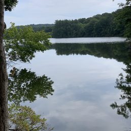

Such a beautiful place for a hike. I recently learned of pyramid mountain and got a chance to check it out this morning, and I had an amazing time here. There's many trails to choose from (although most trails connect) and you can definitely get a good workout in. Today I did the tripod rock hike (blue/yellow/white trails) to reach tripod rock (photo-worthy) and then took the white and orange trails along the lake (also beautiful) to get back to my starting point. It was a moderate hike and about 5 miles long with some rock-climbing included but definitely worth it. I arrived Sunday around 8:15am and the lot was already half full. I'll definitely be coming back on a weekday to avoid some of the crowds I saw today, but highly recommend checking out.


Landed on pyramid mountain after our first choice was closed. Packed parking lot with a ton of inexperienced hikers. Walked the path and was getting slightly frustrated when people wouldn't move to the side. So be prepared for a crowd in the beginning. We followed the blue trail up to Pyramid and then back the red/white. All in all it was a 4.5 mile loop. One overlook (high tension wires in the distance) and the pyramid Rock were pretty cool. Other than that typical woods. There were some areas that would be difficult for someone without some experience and the trails were hard to follow especially later in the hike.


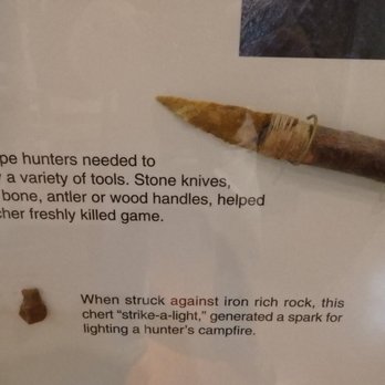
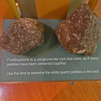
Their Visitor Center provides a great over view of the historical, geological and cultural significance of the area. Information, artifacts, rocks and minerals, taxidermy, fauna and flora enhance the hiking experience. Additionally, trail maps outlining each of the 6 trails in terms of the degree of difficulty, distance of the hike and approximate time it takes to complete the hike are displayed on the wall in a professionally created information board. A naturalist is on hand to answer any other questions you might have. The maximum elevation is 932 feet. The major rock formation on the surface is composed of gneiss, granite and puddingstone. Glacial erratics like Tripod rock and Bear rock, one of the largest erratics in NJ can be seen on the trail. Also enjoy water falls, a view of the NYC skyline, a quartz quarry, glacial melt water channels, ruins, streams lakes and swamps. It's amazing to know that the rocks which are now on the surface were once 13 miles below the surface. Equally amazing is the fact that 12,000 years ago, the Wisconsin glacier in this area was 10,000 feet high.


I am really glad I stumbled upon Pyramid Mountain! My husband and I stopped for a hike here before heading to Conklin Farm. There are a few different (clearly marked) trails you can hike to different parts of the mountain. We hiked up the blue trail which had a bit of an incline, but nothing too difficult. There are many rocks and exposed roots so be careful where you step. There are some overlook spots on the blue trail that are beautiful to see. You can even see the NYC skyline. If you take the blue trail to the white trail you'll come across Tripod Rock. Tripod Rock is a large rock that balances on 3 smaller rocks. It's pretty cool to see. When we arrived at the rock there was a crowd of people but everyone took turns taking pictures and enjoying the sight. For our journey back, we walked further up the white trail which met up with the orange trail. The orange trail is parallel with the reservoir and it's beautiful to see, especially in the fall! The orange trail meets up with the yellow, then the blue, and then you are back at the visitor center parking lot. Our hike was a leisurely 2 hours and there were so many different sights to see. I can't wait to go back and check out the other trails and see Bear Rock!


Looking to enjoy the beautiful weather and some fall foliage headed to Pyramid Mountain with my family. If you've never been here make sure to stop in the visitors center first. The people that work here are awesome and so helpful. They can help you plan a route and let you know about the wildlife that's been hanging around. There are bear and rattlesnakes everywhere in the area so keep your eyes open. We started out on the blue trail to see Bear Rock and switched to the white trail to see Tripod Rock. From the parking lot to Tripod Rock is about a mile and a half. I know a lot of reviews mention this is a beginner hike but I think it was slightly challenging. There are lots of rocks to walk over and some pretty steep spots to climb up and down. That being said my 6 year old had no problem getting through any of it. We stayed on the blue trail to head back to the car because we were told the yellow trail can get challenging in some spots. Definitely wear good shoes. Preferably hiking shoes because there are so many rocks even on the flattest areas that you can trip over. Walking sticks are also a plus. If you don't have one there are plenty of good sized branches laying around as you walk. We'll definitely be back to check out the other trails.


Decent hiking experience. It is just perfect for beginner hikers. My friends and I tried the Blue Trail. It was mostly trees and rocks. Be careful! Make sure your eyes are opened at all times looking ahead for the color stamps on the tree. View is okay. Trails do merge with one another so feel free to explore.
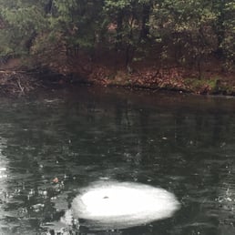

I came here for a winter hike and even if the terrain was very muddy from the previous rain it was still very pretty. The trails are very well marked so it's easy to keep track of your hike and not get lost. There weren't that many people hiking but I'm guessing it had to do with the prior rain.


Great place to hike, with well marked trails and excellent trail maps. Come during the week and you'll have the trails to yourself. If you're visiting on a weekend and opt to hike to Pyramid Rock, be prepared to have a bit of company along the way. This place can get some trail traffic (hikers) on weekends and the parking lot fills up quickly. The staff in the visitor center are extremely knowledgeable, friendly & helpful. The displays inside are great for kids of all ages. There is also a restroom here, which is great for before or after your hike. I prefer hiking on the Turkey Mountain side of the park - solitude, quiet and nature awaits. Please leave no trace, the beauty of this hidden gem so close to NYC needs to be preserved in its natural state for others to enjoy.


Probably one of the better hikes I've been on in north Jersey. Unfortunately, I didn't choose the best time to come (I went on a Saturday afternoon in January)... brrrr! But I would like to come back again in the fall. We followed the blue path. I'm a beginner and was able to get through just fine. There were a couple challenging parts but nothing too bad. Listen to other Yelpers when they say the area is very rocky because it is. Hiking shoes or sneakers are a must! My favorite part was the overlook that gives you a fairly clear view of the NYC skyline. Pretty neat if you ask me! Other notable things you may want to check out: a swamp, tripod rock, and Lucy's overlook. Good luck and happy hiking!


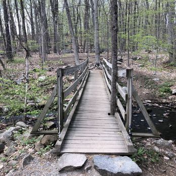
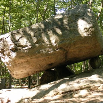
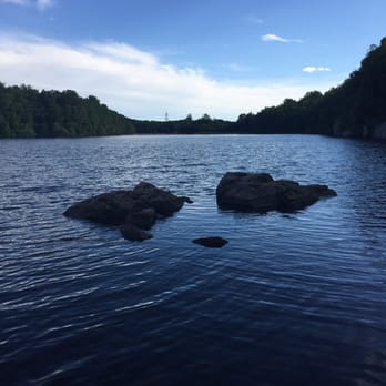
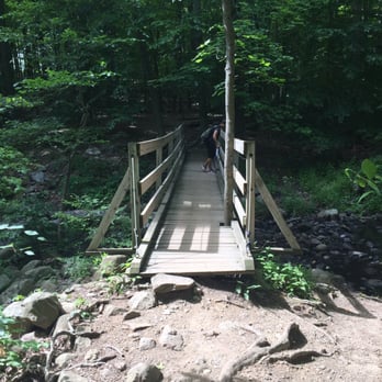
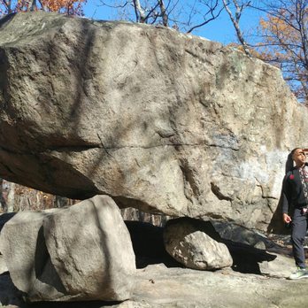
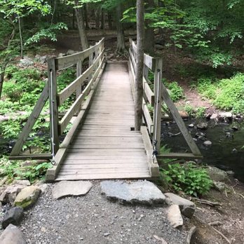
Pyramid Mountain Natural Historic Area in Boonton, NJ (http://www.nynjtc.org/park/pyramid-mountain-1) features more than 1,500 acres of open space -- including fields, forests, streams and ponds -- and nearly 30 miles of marked hiking trails with moderate trail surface and elevation gain in the rugged New Jersey Highlands. Pyramid Mountain rises as high as 920 feet above sea level. To get to the park, take I80 West to I287 North. Take Exit 45 (Wootton St). From the ramp, take the first LEFT TURN onto Wootton St. Take Wootton St uphill and make a RIGHT TURN onto Boonton Ave (County Road 511). Follow Boonton Ave for approximately 4 miles. Pyramid Mountain Visitor Center and parking on the LEFT. Don't forget to take a free map at the visitor's center. Although the trails are well-marked, the map (http://www.morrisparks.net/maps/pdfs/06PyramidMtn.pdf) is one of the more detailed trail maps available in the Morris County parks. I recommend the following 2-hour, ~3.5 mile hike.. From the parking lot, follow the Blue trail which crosses a stream via wooden bridge and begins a short, but moderate climb to the top of the Pyramid Mountain. On a clear day, there are beautiful views of the Manhattan skyline in the distance to the east. Continue on the Blue trail as it flattens out and passes through a mixed hardwood forest until you come to the junction with the White trail. Take the White trail to see Tripod Rock -- an enormous 11-12 foot high boulder resting on three smaller rocks, each in a 3-4 feet in diameter. Continue past Tripod Rock on the White trail, until it intersects with the Orange trail. Take the Orange Trail. You'll quickly find yourself at a large flat rock with a fantastic view of the Reservoir -- which is a terrific spot for a brief rest. The Orange trail then descends quickly through a series of steps to the shoreline of the Reservoir. The Orange trail follows the shoreline - from being right at the waterline to finding yourself fifteen feet above the lake on a rocky ledge - and eventually intersects with the Yellow trail. Make a right onto the Yellow trail and follow the Yellow trail back to the Blue trail which you can follow back to the parking lot.
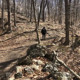

This is an amazing hike! It's almost all shaded and once you climb the rocks, straight up on blue, it's quite an easy hike. Guys we hiked blue to purple to blue to orange (which comes back to blue and the parking lot) and it took 2 hours and 3 miles. We met people who thought the whole thing took 45 minutes and had the water to go with that. This is an intermediate hike and you really need the water, as well as trail map or at least pic of trail map, to make it happily. We met so many lost people on the trail. It's not marked as well as you think. Also we took the pup who thought lake at first sight, meant jump. Pro tip; keep them out of the lake. It's full of stagnant water and stinking mud. Your nose will thank me. Instead enjoy the bubbly creek crossing before and after the hike. read more

The fam was looking to take advantage of this beautiful fall weather that we have been having. I recalled doing this hike a number of years ago and enjoyed it, so decided to give it another try. The parking lot was not the biggest, but there seemed to be many spots on the street. Fortunately we were able to find a spot in the lot though. It is dog friendly, so we brought our little guy too. Since the my younger son is only 7 we decided to do the hike (blue trail) to Tripod rock and back, which is about 3 miles. It does have some incline, but didn't receive any complaints about this from the fam. Also there are a bunch of stones on the hiking path, so be careful not to trip. The trail is marked well (apart from one point towards the tripod rock where it splits) so we were able to get to our destination fairly easily. It wasn't too crowded, which was nice. read more

Great dog friendly mountain with a few different options for hiking. I was using a different app to find a trail which provided some contrary info so I ended up just following the blue trail. The parking lot held plenty of cars and there were a few porto-potties. It starts off really pretty and takes you up and down the mountain. A few areas required some agility so I don't think I'd recommend for seniors or kids. It comes down the mountain and you can see a lake or a reservoir. I was able to see some joggers on the lower path. The whole thing took me about an hour and 15 minutes. I was looking at the map when I was done and saw that I could have followed a different path that had ruins. I would have liked to see that but I probably would have gotten lost that way! read more






4 years ago
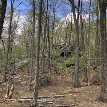
Since they've changed trail blaze, it's not as good as it was. Everything is a blue trail. And not as fun /challenging as it used to be where you can do all combos to make it a good hike. Wish they would bring back the old trails. Why was it changed to begin with? read more


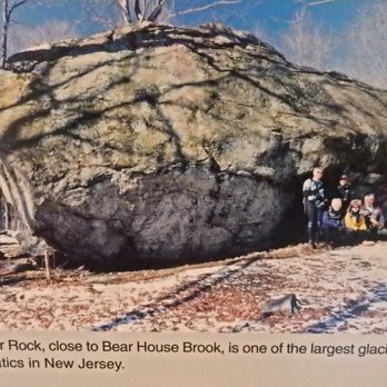
The area features unusual glacial erratics, dramatic rock outcrops, extensive wetlands, waterfalls, and several scenic overlooks - including views of the Manhattan skyline. How about Tripod Rock, a 160-ton boulder resting atop three smaller boulders? between how it's resting on three small rocks. *thinking *. let me google, ok found it. Roughly 18,000 years ago, the receding Wisconsin Glacier shaped the unusual glacial erratics found here, like Tripod Rock (a 180-ton boulder balanced on three smaller boulders) and Bear Rock (one of the largest in New Jersey, and I have also attached a pic) The trail system here is good for beginning hikers but interesting enough for experienced ones. To create longer loops, connect the trails with Turkey Mountain, the two trailheads are across the street from the parking lot. The park's highest point is 934 feet, with a magnificent view of the New York City skyline. This hike is for all people, with all levels of fitness. The route includes some moderate elevation gain with huge rock outcroppings. You'll need the trail map for this hike, especially if it is your first time visiting the park. Start at the trail kiosk (where there are typically free trail maps) and follow the Mennen Trail (Blue) over the footbridge. My suggestion would be - stick to the trail which you are following. read more


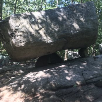
Such a beautiful place for a hike. I recently learned of pyramid mountain and got a chance to check it out this morning, and I had an amazing time here. There's many trails to choose from (although most trails connect) and you can definitely get a good workout in. Today I did the tripod rock hike (blue/yellow/white trails) to reach tripod rock (photo-worthy) and then took the white and orange trails along the lake (also beautiful) to get back to my starting point. It was a moderate hike and about 5 miles long with some rock-climbing included but definitely worth it. I arrived Sunday around 8:15am and the lot was already half full. I'll definitely be coming back on a weekday to avoid some of the crowds I saw today, but highly recommend checking out. read more




6 years ago
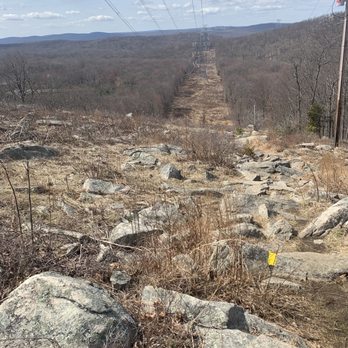
Landed on pyramid mountain after our first choice was closed. Packed parking lot with a ton of inexperienced hikers. Walked the path and was getting slightly frustrated when people wouldn't move to the side. So be prepared for a crowd in the beginning. We followed the blue trail up to Pyramid and then back the red/white. All in all it was a 4.5 mile loop. One overlook (high tension wires in the distance) and the pyramid Rock were pretty cool. Other than that typical woods. There were some areas that would be difficult for someone without some experience and the trails were hard to follow especially later in the hike. read more



8 years ago
Their Visitor Center provides a great over view of the historical, geological and cultural significance of the area. Information, artifacts, rocks and minerals, taxidermy, fauna and flora enhance the hiking experience. Additionally, trail maps outlining each of the 6 trails in terms of the degree of difficulty, distance of the hike and approximate time it takes to complete the hike are displayed on the wall in a professionally created information board. A naturalist is on hand to answer any other questions you might have. The maximum elevation is 932 feet. The major rock formation on the surface is composed of gneiss, granite and puddingstone. Glacial erratics like Tripod rock and Bear rock, one of the largest erratics in NJ can be seen on the trail. Also enjoy water falls, a view of the NYC skyline, a quartz quarry, glacial melt water channels, ruins, streams lakes and swamps. It's amazing to know that the rocks which are now on the surface were once 13 miles below the surface. Equally amazing is the fact that 12,000 years ago, the Wisconsin glacier in this area was 10,000 feet high. read more



I am really glad I stumbled upon Pyramid Mountain! My husband and I stopped for a hike here before heading to Conklin Farm. There are a few different (clearly marked) trails you can hike to different parts of the mountain. We hiked up the blue trail which had a bit of an incline, but nothing too difficult. There are many rocks and exposed roots so be careful where you step. There are some overlook spots on the blue trail that are beautiful to see. You can even see the NYC skyline. If you take the blue trail to the white trail you'll come across Tripod Rock. Tripod Rock is a large rock that balances on 3 smaller rocks. It's pretty cool to see. When we arrived at the rock there was a crowd of people but everyone took turns taking pictures and enjoying the sight. For our journey back, we walked further up the white trail which met up with the orange trail. The orange trail is parallel with the reservoir and it's beautiful to see, especially in the fall! The orange trail meets up with the yellow, then the blue, and then you are back at the visitor center parking lot. Our hike was a leisurely 2 hours and there were so many different sights to see. I can't wait to go back and check out the other trails and see Bear Rock! read more


10 years ago
Looking to enjoy the beautiful weather and some fall foliage headed to Pyramid Mountain with my family. If you've never been here make sure to stop in the visitors center first. The people that work here are awesome and so helpful. They can help you plan a route and let you know about the wildlife that's been hanging around. There are bear and rattlesnakes everywhere in the area so keep your eyes open. We started out on the blue trail to see Bear Rock and switched to the white trail to see Tripod Rock. From the parking lot to Tripod Rock is about a mile and a half. I know a lot of reviews mention this is a beginner hike but I think it was slightly challenging. There are lots of rocks to walk over and some pretty steep spots to climb up and down. That being said my 6 year old had no problem getting through any of it. We stayed on the blue trail to head back to the car because we were told the yellow trail can get challenging in some spots. Definitely wear good shoes. Preferably hiking shoes because there are so many rocks even on the flattest areas that you can trip over. Walking sticks are also a plus. If you don't have one there are plenty of good sized branches laying around as you walk. We'll definitely be back to check out the other trails. read more


10 years ago
Decent hiking experience. It is just perfect for beginner hikers. My friends and I tried the Blue Trail. It was mostly trees and rocks. Be careful! Make sure your eyes are opened at all times looking ahead for the color stamps on the tree. View is okay. Trails do merge with one another so feel free to explore. read more

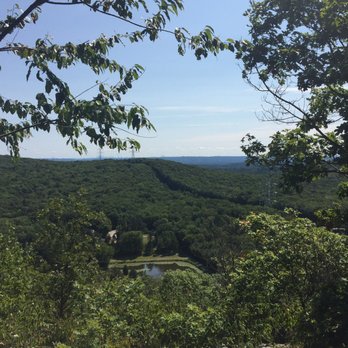

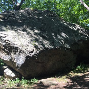


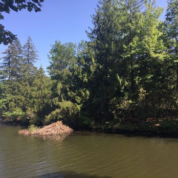

I came here for a winter hike and even if the terrain was very muddy from the previous rain it was still very pretty. The trails are very well marked so it's easy to keep track of your hike and not get lost. There weren't that many people hiking but I'm guessing it had to do with the prior rain. read more
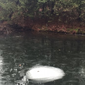


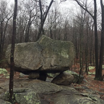

Great place to hike, with well marked trails and excellent trail maps. Come during the week and you'll have the trails to yourself. If you're visiting on a weekend and opt to hike to Pyramid Rock, be prepared to have a bit of company along the way. This place can get some trail traffic (hikers) on weekends and the parking lot fills up quickly. The staff in the visitor center are extremely knowledgeable, friendly & helpful. The displays inside are great for kids of all ages. There is also a restroom here, which is great for before or after your hike. I prefer hiking on the Turkey Mountain side of the park - solitude, quiet and nature awaits. Please leave no trace, the beauty of this hidden gem so close to NYC needs to be preserved in its natural state for others to enjoy. read more


6 years ago
Really enjoyed this hiking spot. Good views, pretty lake, overlook and not crowded. There is also tripod rock which is really interesting. I would definitely check this place out read more


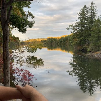


4 years ago

Probably one of the better hikes I've been on in north Jersey. Unfortunately, I didn't choose the best time to come (I went on a Saturday afternoon in January)... brrrr! But I would like to come back again in the fall. We followed the blue path. I'm a beginner and was able to get through just fine. There were a couple challenging parts but nothing too bad. Listen to other Yelpers when they say the area is very rocky because it is. Hiking shoes or sneakers are a must! My favorite part was the overlook that gives you a fairly clear view of the NYC skyline. Pretty neat if you ask me! Other notable things you may want to check out: a swamp, tripod rock, and Lucy's overlook. Good luck and happy hiking! read more

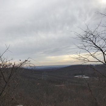

Pyramid Mountain Natural Historic Area in Boonton, NJ (http://www.nynjtc.org/park/pyramid-mountain-1) features more than 1,500 acres of open space -- including fields, forests, streams and ponds -- and nearly 30 miles of marked hiking trails with moderate trail surface and elevation gain in the rugged New Jersey Highlands. Pyramid Mountain rises as high as 920 feet above sea level. To get to the park, take I80 West to I287 North. Take Exit 45 (Wootton St). From the ramp, take the first LEFT TURN onto Wootton St. Take Wootton St uphill and make a RIGHT TURN onto Boonton Ave (County Road 511). Follow Boonton Ave for approximately 4 miles. Pyramid Mountain Visitor Center and parking on the LEFT. Don't forget to take a free map at the visitor's center. Although the trails are well-marked, the map (http://www.morrisparks.net/maps/pdfs/06PyramidMtn.pdf) is one of the more detailed trail maps available in the Morris County parks. I recommend the following 2-hour, ~3.5 mile hike.. From the parking lot, follow the Blue trail which crosses a stream via wooden bridge and begins a short, but moderate climb to the top of the Pyramid Mountain. On a clear day, there are beautiful views of the Manhattan skyline in the distance to the east. Continue on the Blue trail as it flattens out and passes through a mixed hardwood forest until you come to the junction with the White trail. Take the White trail to see Tripod Rock -- an enormous 11-12 foot high boulder resting on three smaller rocks, each in a 3-4 feet in diameter. Continue past Tripod Rock on the White trail, until it intersects with the Orange trail. Take the Orange Trail. You'll quickly find yourself at a large flat rock with a fantastic view of the Reservoir -- which is a terrific spot for a brief rest. The Orange trail then descends quickly through a series of steps to the shoreline of the Reservoir. The Orange trail follows the shoreline - from being right at the waterline to finding yourself fifteen feet above the lake on a rocky ledge - and eventually intersects with the Yellow trail. Make a right onto the Yellow trail and follow the Yellow trail back to the Blue trail which you can follow back to the parking lot. read more



5 years ago
Absolutely Beautiful! It's a bit of a hike *badum dshhh* depending on where you start and end, but it is definitely worth it! read more




12 years ago
Very enjoyable hike. 1) Must visit if you live in NJ. For us New Jerseyans, this is one of our 7 natural wonders. 2) The hike is relatively easy. But if you want to reach the tripod rock, the distance MIGHT be SOMEWHAT of a challenge for the average person. However, trust me, I found it easy. 3) Use the blue trail to reach the tripod rock. Personally, I found it to be the best trail. But you have to use the little section of the white trail to see the tripod rock. 4) Use the orange trail to turn it into a loop, then the yellow and blue to come back to your car. Come and enjoy. read more


10 years ago
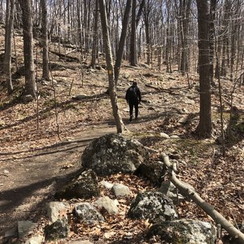
Amazing hike for beginners! Took the blue trail first, second white trail, then orange trail and finally, yellow blue trail for exit. The pictures say it all! read more





5 years ago

10 years ago

6 years ago

This place is awesome. Several trails spin off from the parking lot. Trails are well marked and most free of clutter. You can tell the trail association maintains the trail often. You should expect several options - most trails offer a moderately challenging 3-6 mile hike, round trip. This trail is popular among locals so don't expect to be the only one enjoying nature here. There are overlooks, rivers, ponds, rock sculptures to enjoy on the trail. Don't forget to bring your dog! read more




9 years ago
This was really nice hiking trail! Enjoyed it so much. Didn't know beautiful places existed near me! The New York Skyline can be seen from the peak! It was just so beautiful and serene. read more



12 years ago

13 years ago

9 years ago


10 years ago


11 years ago


12 years ago

8 years ago
Page 1 of 2
More info about Pyramid Mountain Natural Historic Area
472A Boonton Ave
Boonton, NJ 07005
Directions
(973) 334-3130
Call Now
Hours
Outdoor Amenities
Ask the Community - Pyramid Mountain Natural Historic Area
Review Highlights - Pyramid Mountain Natural Historic Area
You might also consider




























Why does Yelp recommend reviews?
4 reviews that are not currently recommended
The reviews below are not factored into the business's overall star rating.
11 years ago

7 years ago


7 years ago
Pyramid Mountain Natural Historic Area - hiking - Updated August 2026
Best of Boonton
People found Pyramid Mountain Natural Historic Area by searching for…
Trending Searches in Boonton, NJ
Blueberry Picking near Pyramid Mountain Natural Historic Area
Cinema near Pyramid Mountain Natural Historic Area
Cliff Jumping near Pyramid Mountain Natural Historic Area
Cruising Spots near Pyramid Mountain Natural Historic Area
Day Trips near Pyramid Mountain Natural Historic Area
Dog Friendly Beaches near Pyramid Mountain Natural Historic Area
Dog Friendly Things To Do near Pyramid Mountain Natural Historic Area
Flower Fields near Pyramid Mountain Natural Historic Area
Fun Things To Do With Kids near Pyramid Mountain Natural Historic Area
Indoor Dog Park near Pyramid Mountain Natural Historic Area
Indoor Mini Golf near Pyramid Mountain Natural Historic Area
Jet Ski Rental near Pyramid Mountain Natural Historic Area
Kayak Rental near Pyramid Mountain Natural Historic Area
Kids Activities Indoor near Pyramid Mountain Natural Historic Area
Lakes near Pyramid Mountain Natural Historic Area
Outdoor Activities near Pyramid Mountain Natural Historic Area
Parks near Pyramid Mountain Natural Historic Area
Peach Picking near Pyramid Mountain Natural Historic Area
Picnic Areas near Pyramid Mountain Natural Historic Area
Playgrounds near Pyramid Mountain Natural Historic Area
Public Running Track near Pyramid Mountain Natural Historic Area
Rainy Day Activities near Pyramid Mountain Natural Historic Area
River Swimming near Pyramid Mountain Natural Historic Area
Rock Quarry near Pyramid Mountain Natural Historic Area
Scenic Night View near Pyramid Mountain Natural Historic Area
Scenic Overlook near Pyramid Mountain Natural Historic Area
Shopping Malls near Pyramid Mountain Natural Historic Area
Sports Card Shops near Pyramid Mountain Natural Historic Area
Sunrise View near Pyramid Mountain Natural Historic Area
Things To Do On A Rainy Day near Pyramid Mountain Natural Historic Area
Trading Card Shops near Pyramid Mountain Natural Historic Area
Used Book Stores near Pyramid Mountain Natural Historic Area
Watch Sunset near Pyramid Mountain Natural Historic Area
Water Parks For Kids near Pyramid Mountain Natural Historic Area
Waterfalls And Swimming Holes near Pyramid Mountain Natural Historic Area
Browse Nearby
BEST of Boonton, New Jersey Restaurants near Pyramid Mountain Natural Historic Area
BEST of Boonton, New Jersey Coffee near Pyramid Mountain Natural Historic Area
BEST of Boonton, New Jersey Things to Do near Pyramid Mountain Natural Historic Area
BEST of Boonton, New Jersey Parks near Pyramid Mountain Natural Historic Area
BEST of Boonton, New Jersey Lakes near Pyramid Mountain Natural Historic Area
BEST of Boonton, New Jersey Breakfast near Pyramid Mountain Natural Historic Area
Browse Brands
Related Searches in Boonton, NJ
Best Dog Hiking Trails Around Boonton, New Jersey
Best Fishing Locations and Guides in Boonton, New Jersey
Best Off Leash Dog Parks in Boonton, New Jersey
Best Parks for Parties and Events in Boonton, New Jersey
Best Places for Horseback Riding in Boonton, New Jersey
Best Sightseeing Experiences Available in Boonton, New Jersey
Best Water Parks for Kids in Boonton, New Jersey
Check Out Great Playgrounds in Boonton, New Jersey
Check Out Off Road Trails in Boonton, New Jersey
Discover Baseball Fields Around Boonton, New Jersey
Discover Dog Friendly Trails to Explore in Boonton, New Jersey
Discover Fun Toddler Parks in Boonton, New Jersey for Your Little One
Discover Kid Friendly Hiking Trails in Boonton, New Jersey
Discover Lakes & Ponds to Explore in Boonton, New Jersey
Discover Popular Bike Trails in Boonton, New Jersey
Discover Scenic Mountain Bike Trails Near Boonton, New Jersey
Discover Soccer Fields in Boonton, New Jersey Near You
Discover Top Nature Parks to Visit in Boonton, New Jersey
Discover Top State Parks to Visit in Boonton, New Jersey
Discover a Hiking Trail in Boonton, New Jersey
Discover the Best Beaches in Boonton, New Jersey
Discover the Best Kids Park Spots in Boonton, New Jersey
Discover the Best Night Hike Trails in Boonton, New Jersey
Dog-Friendly Hikes With Dogs in Boonton, New Jersey
Enjoy Camping Adventures Around Boonton, New Jersey
Enjoy Exciting Mountain Biking Adventures in Boonton, New Jersey
Enjoy Kayaking Adventures in Boonton, New Jersey
Enjoy Off Leash Dog Hikes in Boonton, New Jersey
Enjoy Scenic Places to Walk in Boonton, New Jersey
Enjoy Tent Camping Spots Around Boonton, New Jersey
Enjoy a Beautiful Waterfall Hike in Boonton, New Jersey
Enjoy the Best Picnic Spots and Ideas in Boonton, New Jersey
Enjoy the Best Walking Path in Boonton, New Jersey
Enjoy the Best Walking Trails in Boonton, New Jersey
Explore Beautiful Parks and Green Spaces in Boonton, New Jersey
Explore Easy Hikes Perfect for All in Boonton, New Jersey
Explore Family-Friendly Zoos and Wildlife in Boonton, New Jersey
Explore Free Picnic Areas Around Boonton, New Jersey
Explore Fun Activities to Do in Boonton, New Jersey
Explore Parks With Pull Up Bars in Boonton, New Jersey
Explore Picnic Parks Near Boonton, New Jersey
Explore Popular Campgrounds Near Boonton, New Jersey
Explore Popular Dog Walking Trails in Boonton, New Jersey
Explore Popular Picnic Areas Around Boonton, New Jersey
Explore Popular RV Parks Around Boonton, New Jersey
Explore Scenic Lakes to Visit in Boonton, New Jersey
Explore Top Dog Parks in Boonton, New Jersey Near You
Explore Top Trampoline Parks in Boonton, New Jersey
Browse Articles
People who viewed Pyramid Mountain Natural Historic Area also viewed

Apshawa Preserve
7 reviews

South Mountain Reservation
90 reviews

Morristown National Historical Park
8 reviews

New Jersey Audubon's Scherman Hoffman Wildlife Sanctuary
6 reviews

Eagle Rock Reservation
78 reviews

Freedom Park
2 reviews

Mountain Way Park
4 reviews

Black River County Park
4 reviews

High Mountain Park Preserve
5 reviews

Silas Condict Park
18 reviews