Rio Bosque Wetlands Park Photos


You might also consider

More like Rio Bosque Wetlands Park
Recommended Reviews - Rio Bosque Wetlands Park
Start your review...



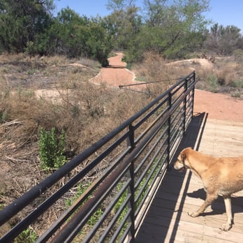
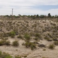
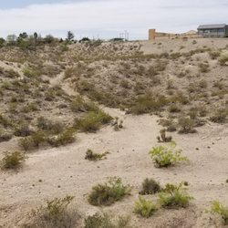
I've had this bookmarked for years. Literally, years! The longing I had to come here was insufferable. But when I did some research I found out it was bone-dry and had been for years. That really took the fun out of a "bosque" or "wetland". Then, my boyfriend recently attempted to remember the name of a park that just opened up a canal that would filter water into the surrounding canals... could it be, could it really be the Rio Bosque Wetlands Park? It could. There was one thing that we learned from using GPS to get to this secret location... screw GPS! Sure, open it up on your GPS app, but do not follow the directions. It turns out their physical address will not lead you to a road that can be taken by car. The best way I can explain it is to exit Zaragosa (from North Loop), take a right on Panemerican, and take Panemerican all the way down until you pass the canal. There will be a RBWP sign immediately in front of you. We unfortunately followed GPS and wound up trying to navigate a way in ourselves off of dirt roads, eventually we hit the border fence and decided to turn back and somehow stumbled upon a dirt road that lead us to the right place. We try to take our pack of dogs to different places around the city so they can explore and more importantly, get extremely tired and not bother us for the rest of the day. So of course our pack came along for this trip and they absolutely loved it! The paths were all well maintained and even though our dogs hopped off the trails once or twice (which made my heart drop into my butt because I feared they would get bit by a snake... although we didn't see any snakes) they always hopped back on the trail (after being yelled at) unharmed. The entire day we only pulled out a single thorn that our larger dog had the unfortunate luck of meeting while off the trails. I also loved the amount of markers and signage in the area. It made the already interesting hour and a half walk even more enjoyable. After the initial RBWP sign with all the park info, the first sign we came to was The Burrowing Owls sign. We read all the information and I thought aloud "Wouldn't it be cool if we actually got to see the owls?" We hadn't taken ten steps and we immediately saw one sitting on a post. Turns out their burrows were only a few feet behind the sign. Our dogs were oblivious to the owl perched only ten or fifteen feet away, but their noses were going a mile a minute. Luckily, our dogs are good listeners for the most part so we didn't have to worry about them dragging us on a owl hunt (although they seemed more curious, than ready to hunt), but the owl's home isn't that far from the start of the trail so if your dog is a puller be prepared. The markers were a great help and also gave us a good laugh. There are three different major trails: the Rio Trail, Bosque Trail, and Wetlands Trail. Each one is represented, one by a duck, one by a frog, and one by a dragonfly. Even though this is clearly outlined on the sign with all the information about RBWP, we somehow missed that and followed each sign with the anticipation of seeing each creature. This way to the ducks, this way to the frogs, this way to the dragonflies. Somewhere along the way, I actually asked, "Do you want to see ducks or frogs first?" As fate would have it, we actually did see each of these creatures on their respective trails. The Bosque Trail (aka Frog Trail) was the only trail that didn't follow water, but it appeared as though water was slowly trickling to this part of the park so maybe in a few months it will be filled with water. And frogs. The Wetland Trail (aka Duck Trail) was my favorite. Throughout the duration of the trail there are benches in great condition that are shaded under large trees. The whole thing follows a little creek, if you will, that's home to many wild ducks. There are even a couple of spots on the trail where you can cross the creek on a well-designed bridge. And last, but not least... The Rio Trail (aka Dragonfly Trail). This one is immediately to your left at the trail-head. We didn't follow this one completely so we could've missed something totally amazing, but we did stop about fifteen feet into it to take a seat on the bench that was cloaked by a large, yet somehow whimsical tree. It made me feel like I was in a piece of a real life Secret Garden. The dragonflies that were swarming around were some of the prettiest I've ever seen. Although I did see some larger dragonflies, a vast majority of them were these tiny baby blue things, no bigger than my thumb. These canals have just been opened up and are now pumping water, but already they've attracted a large amount of wildlife back to the area! I really think we'll be back multiple times to explore more of the area. And I really can't wait to see this place after a good rain in EP. This is one of the coolest walking trails in El Paso and we need more places like this! read more




10 years ago
Rio Bosque Wetlands Park is a lovely little getaway, right within the city limits! Even though you don't have to travel far, it feels like you've completely left El Paso behind and travelled to some foreign land, filled with peacefully chirping birds and gently bubbling waterways. A drive or walk along the levees will allow you to see countless little critters, from frogs and dragonflies to a wide range of different types of birds. Depending on how far you continue, you may even find yourself right up against the border fence! This gave my fiancé and me an interesting, up-close view of something we drive by all the time, but have never been quite this close to before. While there, my fiancé and I saw several people fishing, walking their dogs, and running. This truly is quite the hidden oasis! read more


8 years ago

8 years ago
More info about Rio Bosque Wetlands Park
























Rio Bosque Wetlands Park - hiking - Updated August 2026
Best of El Paso
People found Rio Bosque Wetlands Park by searching for…
Trending Searches in El Paso, TX
Barbershop For Men near Rio Bosque Wetlands Park
Baseball Card Shop near Rio Bosque Wetlands Park
Bird Sanctuary near Rio Bosque Wetlands Park
Cinema near Rio Bosque Wetlands Park
Cliff Jumping near Rio Bosque Wetlands Park
Cruising Spots near Rio Bosque Wetlands Park
Fishing Spots near Rio Bosque Wetlands Park
Fun Things To Do With Kids near Rio Bosque Wetlands Park
Hair Stylists near Rio Bosque Wetlands Park
Kids Haircut near Rio Bosque Wetlands Park
Lakes near Rio Bosque Wetlands Park
Movie Theatre near Rio Bosque Wetlands Park
Parks near Rio Bosque Wetlands Park
Pedicure near Rio Bosque Wetlands Park
Picnic Areas near Rio Bosque Wetlands Park
Piercing near Rio Bosque Wetlands Park
Places To Take Pictures near Rio Bosque Wetlands Park
Playgrounds near Rio Bosque Wetlands Park
Public Pools near Rio Bosque Wetlands Park
Rock Quarry near Rio Bosque Wetlands Park
Scenic Drive near Rio Bosque Wetlands Park
Shopping Malls near Rio Bosque Wetlands Park
Souvenir Shops near Rio Bosque Wetlands Park
Splash Pad near Rio Bosque Wetlands Park
Sports Card Shops near Rio Bosque Wetlands Park
Star Gazing near Rio Bosque Wetlands Park
Sunrise View near Rio Bosque Wetlands Park
Trading Card Shops near Rio Bosque Wetlands Park
Uniforms near Rio Bosque Wetlands Park
Used Furniture Stores near Rio Bosque Wetlands Park
Browse Nearby
Browse Brands
Related Searches in El Paso, TX
Best Dog Hiking Trails Around El Paso, Texas
Best Fishing Locations and Guides in El Paso, Texas
Best Off Leash Dog Parks in El Paso, Texas
Best Parks for Parties and Events in El Paso, Texas
Best Places for Horseback Riding in El Paso, Texas
Best Sightseeing Experiences Available in El Paso, Texas
Best Water Parks for Kids in El Paso, Texas
Check Out Great Playgrounds in El Paso, Texas
Check Out Off Road Trails in El Paso, Texas
Discover Baseball Fields Around El Paso, Texas
Discover Dog Friendly Trails to Explore in El Paso, Texas
Discover Fun Toddler Parks in El Paso, Texas for Your Little One
Discover Kid Friendly Hiking Trails in El Paso, Texas
Discover Lakes & Ponds to Explore in El Paso, Texas
Discover Popular Bike Trails in El Paso, Texas
Discover Popular Photo Spots in El Paso, Texas
Discover Soccer Fields in El Paso, Texas Near You
Discover Top Nature Parks to Visit in El Paso, Texas
Discover Top State Parks to Visit in El Paso, Texas
Discover a Hiking Trail in El Paso, Texas
Discover the Best Beaches in El Paso, Texas
Discover the Best Night Hike Trails in El Paso, Texas
Dog-Friendly Hikes With Dogs in El Paso, Texas
Enjoy Camping Adventures Around El Paso, Texas
Enjoy Exciting Mountain Biking Adventures in El Paso, Texas
Enjoy Kayaking Adventures in El Paso, Texas
Enjoy Off Leash Dog Hikes in El Paso, Texas
Enjoy Tent Camping Spots Around El Paso, Texas
Enjoy the Best Walking Trails in El Paso, Texas
Experience Stunning Sunset Views in El Paso, Texas
Explore Beautiful Parks and Green Spaces in El Paso, Texas
Explore Easy Hikes Perfect for All in El Paso, Texas
Explore Free Picnic Areas Around El Paso, Texas
Explore Fun Activities to Do in El Paso, Texas
Explore Picnic Parks Near El Paso, Texas
Explore Popular Campgrounds Near El Paso, Texas
Explore Popular Kids Parks Throughout El Paso, Texas
Explore Popular Picnic Areas Around El Paso, Texas
Explore Popular RV Parks Around El Paso, Texas
Explore Popular Scenic Overlook Points in El Paso, Texas
Explore Scenic Lakes to Visit in El Paso, Texas
Explore Top Dog Parks in El Paso, Texas Near You
Explore Top Trampoline Parks in El Paso, Texas
Explore Top Water Parks in El Paso, Texas Today
Family Friendly Hiking With Kids in El Paso, Texas
Find Parks and Recreation Activities in El Paso, Texas
Find Top Skate Parks in El Paso, Texas for All Skill Levels
Find Top-Rated Waterfalls in El Paso, Texas Now


