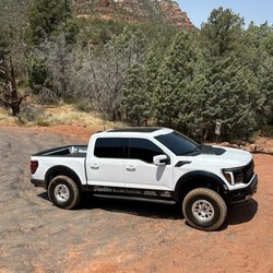
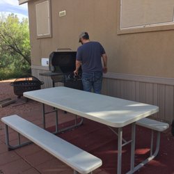
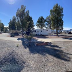
Rockin’ River Ranch State Park Photos


You might also consider
More like Rockin’ River Ranch State Park
Recommended Reviews - Rockin’ River Ranch State Park
Start your review...

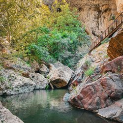
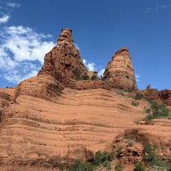
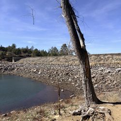
This is a very nice, clean and relatively new state park, open only 2 years and as such the restrooms were very clean for vault toilets and the hiking trails were in good shape. There are many places along the river to fish and several short hiking trails. We enjoyed the White cliffs trail the best with its view of the cliffs and proximity to the water. We also did the pasture loop trail and the short Shady acres trail by the river for a total of about 3 miles of easy walking. We had lunch at a picnic table near the Ranch house - which is a beautiful home but not open to the public. It was February when we went and the trees were bare but I imaging this would be beautiful in the spring and fall. We will plan to go back during one of those seasons to enjoy the trees along the waterway. read more


More info about Rockin’ River Ranch State Park


Rockin’ River Ranch State Park - hiking - Updated June 2026
Best of Camp Verde
People found Rockin’ River Ranch State Park by searching for…
River Swimming in Camp Verde, Arizona
Fishing Spots in Camp Verde, Arizona
Hiking Trails With Waterfalls in Camp Verde, Arizona
Scenic Drive in Camp Verde, Arizona
Things to Do in Camp Verde, Arizona
Scenic View in Camp Verde, Arizona
Cliff Diving in Camp Verde, Arizona
Fishing Trips in Camp Verde, Arizona
Picnic Areas in Camp Verde, Arizona
Picnic Spots in Camp Verde, Arizona
Bait and Tackle in Camp Verde, Arizona
State Park in Camp Verde, Arizona
Photo Spots in Camp Verde, Arizona
View Points in Camp Verde, Arizona
Fishing Ponds in Camp Verde, Arizona
Parks for Picnics in Camp Verde, Arizona
Ranches in Camp Verde, Arizona
Live Bait in Camp Verde, Arizona
What to Do in Camp Verde, Arizona
Fly Fishing Shop in Camp Verde, Arizona
Easy Hikes in Camp Verde, Arizona
Trending Searches in Camp Verde, AZ
Baseball Fields near Rockin’ River Ranch State Park
Black Owned Nail Salons near Rockin’ River Ranch State Park
Boat Rental near Rockin’ River Ranch State Park
Cliff Jumping near Rockin’ River Ranch State Park
Creeks near Rockin’ River Ranch State Park
Dog Friendly Trails near Rockin’ River Ranch State Park
Dog Swimming near Rockin’ River Ranch State Park
Fishing Spots near Rockin’ River Ranch State Park
Fishing Supplies near Rockin’ River Ranch State Park
Free Picnic Areas near Rockin’ River Ranch State Park
Kayak Rental near Rockin’ River Ranch State Park
Lakes near Rockin’ River Ranch State Park
Lakes & Ponds near Rockin’ River Ranch State Park
Outdoor Activities near Rockin’ River Ranch State Park
Pick Your Own Farms near Rockin’ River Ranch State Park
Picnic Spots near Rockin’ River Ranch State Park
Public Shower near Rockin’ River Ranch State Park
River Swimming near Rockin’ River Ranch State Park
River Tubing near Rockin’ River Ranch State Park
Rock Quarry near Rockin’ River Ranch State Park
Scenic Drive near Rockin’ River Ranch State Park
Scenic Night View near Rockin’ River Ranch State Park
Scenic Overlook near Rockin’ River Ranch State Park
Secluded Spots near Rockin’ River Ranch State Park
Splash Pad near Rockin’ River Ranch State Park
Strawberry Picking near Rockin’ River Ranch State Park
Sunrise View near Rockin’ River Ranch State Park
Swimming Holes near Rockin’ River Ranch State Park
Swimming Lakes near Rockin’ River Ranch State Park
Swimming Pools near Rockin’ River Ranch State Park
Watch Sunset near Rockin’ River Ranch State Park
Water Parks near Rockin’ River Ranch State Park
Waterfalls And Swimming Holes near Rockin’ River Ranch State Park
Browse Nearby
Browse Brands
Related Searches in Camp Verde, AZ
Affordable Kayak Rental Services in Camp Verde, Arizona
Best Fishing Locations and Guides in Camp Verde, Arizona
Best Fun Things to Do in Camp Verde, Arizona
Best Off Leash Dog Parks in Camp Verde, Arizona
Best Parks for Parties and Events in Camp Verde, Arizona
Best Places for Horseback Riding in Camp Verde, Arizona
Best Spots for Star Gazing in Camp Verde, Arizona
Best Water Parks for Kids in Camp Verde, Arizona
Best Waterfalls and Swimming Holes in Camp Verde, Arizona
Check Out Great Playgrounds in Camp Verde, Arizona
Check Out Off Road Trails in Camp Verde, Arizona
Discover Baseball Fields Around Camp Verde, Arizona
Discover Beautiful Garden Spots in Camp Verde, Arizona
Discover Dog Friendly Trails to Explore in Camp Verde, Arizona
Discover Exciting Adventure Options in Camp Verde, Arizona
Discover Fun Activities to Do in Camp Verde, Arizona
Discover Fun Toddler Parks in Camp Verde, Arizona for Your Little One
Discover Kid Friendly Hiking Trails in Camp Verde, Arizona
Discover Lakes & Ponds to Explore in Camp Verde, Arizona
Discover Scenic Mountain Bike Trails Near Camp Verde, Arizona
Discover Scenic Waterfall Spots in Camp Verde, Arizona
Discover Top Boat Tours in Camp Verde, Arizona for All Ages
Discover Top Nature Parks to Visit in Camp Verde, Arizona
Discover Top Scenic Spots to Visit in Camp Verde, Arizona
Discover a Hiking Trail in Camp Verde, Arizona
Discover the Best Beaches in Camp Verde, Arizona
Discover the Best Fishing Lake in Camp Verde, Arizona
Discover the Best Kids Park Spots in Camp Verde, Arizona
Discover the Best Night Hike Trails in Camp Verde, Arizona
Dog-Friendly Hikes With Dogs in Camp Verde, Arizona
Enjoy Camping Adventures Around Camp Verde, Arizona
Enjoy Exciting Mountain Biking Adventures in Camp Verde, Arizona
Enjoy Fishing With Kids in Camp Verde, Arizona Safely
Enjoy Hiking Adventures in Camp Verde, Arizona
Enjoy Kayaking Adventures in Camp Verde, Arizona
Enjoy River Tubing Adventures in Camp Verde, Arizona
Enjoy Tent Camping Spots Around Camp Verde, Arizona
Enjoy Water Activities and Fun in Camp Verde, Arizona
Enjoy the Best Family Activities in Camp Verde, Arizona
Enjoy the Best Picnic Spots and Ideas in Camp Verde, Arizona
Enjoy the Best Tubing Experiences in Camp Verde, Arizona
Enjoy the Best Walking Trails in Camp Verde, Arizona
Exciting Cliff Jumping Spots in Camp Verde, Arizona
Experience Thrilling White Water Rafting in Camp Verde, Arizona
Experienced Fishing Guides Available in Camp Verde, Arizona
Explore Beautiful Parks and Green Spaces in Camp Verde, Arizona
Explore Bike Rentals Throughout Camp Verde, Arizona
Explore Easy Hikes Perfect for All in Camp Verde, Arizona
Explore Family-Friendly Zoos and Wildlife in Camp Verde, Arizona