Cancel

    Open app

    Search

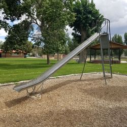
    Salina City Park

    5.0 (3 reviews)

    Salina City Park Photos

    Recommended Reviews - Salina City Park

    Your trust is our priority, so businesses can't pay to alter or remove their reviews. Learn more about reviews.
    Yelp app icon
    Browse more easily on the app
    Review Feed Illustration

    1 year ago

    Helpful 0
    Thanks 0
    Love this 0
    Oh no 0
    Photo of Latisha P.
    121
    42
    111

    3 years ago

    Helpful 0
    Thanks 0
    Love this 0
    Oh no 0
    Photo of Jeffrey S.
    3070
    2527
    8098

    5 years ago

    Helpful 5
    Thanks 0
    Love this 4
    Oh no 0

    Verify this business for free

    Get access to customer & competitor insights.

    Verify this business

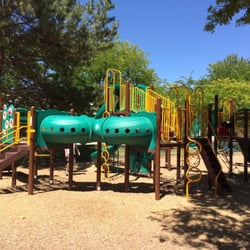
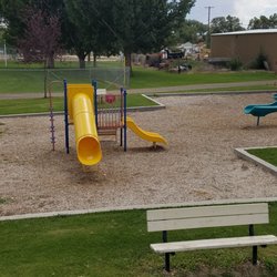
    Lions Park - The play structure at Lions Park

    Lions Park

    4.7(3 reviews)
    17.5 mi

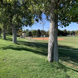
    I was looking for a place to take a nap and later a walk. I found Lions Park and it is nice. I love…read moreto report on parks, (maybe I like the naps and walks??) so here is the Lions Park report: Volleyball, Baseball, Big Fire pit that could seat 35 in two circles around the pit Nice lawns, Well kept Restrooms Deep Shade so brink a blanket to enjoy the lawn for that nap Group area are there to enjoy as well with a sign up right there in the park Oh and a playground for the little ones too!

    Note: Map App sent us to the wrong place!!!…read more But first: This is a great little park for a summer picnic lunch on the way to Moab. The first reviewer described it well, and is the reason why we chose to stop here. We're enjoying the shaded picnic tables, playground, and big grassy field for kicking a soccer ball around. There's also a basketball court, volleyball net on the grass, a little "skate park" with ramps, a drinking water fountain. It was pure luck that we found it, though, because the map app sent us up a gravel road for 4 miles in the wrong direction!!! We turned around after a driving a few hundred yards and the road started to climb (and a group of guys on ATVs gave us curious looks as they drove by) and decided to drive into town in hopes of finding a shady bench, when we stumbled upon it! I'm attaching a photo of the CORRECT location in the map app (Apple, I'm so disappointed in you, your map app is STILL cr*p!)

    Photos
    Lions Park - The CORRECT location of Lions Park -

    The CORRECT location of Lions Park -

    Lions Park
    Lions Park

    See all

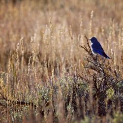
    Fish Lake National Forest - Mountain Bluebird taking off!! They're known as the "bluest of the Bluebirds"!!

    Fish Lake National Forest

    4.8(4 reviews)
    38.8 mi

    I've heard a few different people tell me about Fish Lake National Forest and encouraged me to…read morevisit. So I expected it to be much busier than it was on a holiday weekend. Surprising, and happily, I found it to be almost void of any people, with the exception of a few stragglers by the water and recreating about. There are beautiful trees throughout and plenty of viewing points along the road to get some lovely pictures. Watch out for cattle-I was purely delighted to come across a large herd making their way across the road.

    The ranger at the ranger station was very nice. Inside the station are bathrooms and informational…read morepamphlets about the area, as well as maps and a small corner with swag for purchase. Aside from Fish Lake (from which the forest takes its name), there are mountains and meadows that are equally beautiful. If you're interested, you can visit Pando. Pando is a quaking aspen that has multiple stems but they're all connected by a root system and all the "trees" have the same DNA. Pando is more like a iceberg where the below the surface portion is the significant bit. It is the world's largest tree (and perhaps organism) by mass. It is estimated to be at least several thousand years old, with some estimates being 16,000 years old. It feels so humbling to be visiting the forest since you feel like you're just a speck of dust compared to Pando around you. Mind blowing.

    Photos
    Fish Lake National Forest - Mountain Bluebirds were everywhere!!

    Mountain Bluebirds were everywhere!!

    Fish Lake National Forest - Views of Fish Lake while walking around Pando

    Views of Fish Lake while walking around Pando

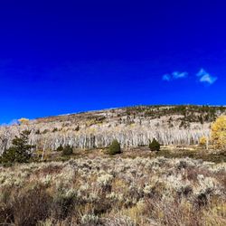
    Fish Lake National Forest - Views of Pando spreading up onto the mountains

    See all

    Views of Pando spreading up onto the mountains

    Goblin Valley State Park

    Goblin Valley State Park

    4.8(72 reviews)
    66.2 mi

    We took this as a side trip and we really should have given this more time. If you are thinking of…read morecoming here, I recommend looking at all the activities offered to see how much is here to do so you won't feel as though you missed out on some of what makes this park FUN! As for us, we ran around the valley, played hide and seek, marveled at how these "goblins" were made and just had a great adventure with the time we had.

    A triumph of both western topography and federalism. This is one of those awesome parks that would…read morein some ways be less special if it were "upgraded" to a national park. It's great the way it is. Just a few notes: -- the campsite is just amazing; you are nestled in among caves and washes, and your kids can merrily wander off "to the kids cave" or climb up onto a crest and watch the sunset or the rhythm of the campsite. They do have a shared bathroom with running water, which keeps the place just civilized enough for moderately experienced car campers. -- at the same time, this place is really remote. If you realize at campside that your propane stove doesn't work, you would have to drive an hour each way to Green River to get more. Instead, you will just have to figure out how to boil coffee and macaroni and cheese over a campfire. -- the stars. The city lights are far far far away, and the desert sky is clear, so you can see so so many stars. And if you sit and stare at them you see more. The only place I have ever seen so many stars in my life is standing on the side of the road outside Marfa, TX. -- two decades ago this was one of the first camping trips of my life, and it remains a special place in my heart.

    Photos
    Goblin Valley State Park
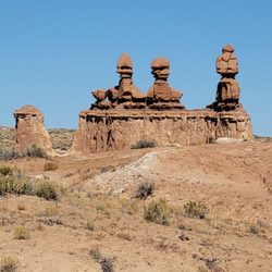
    Goblin Valley State Park - Close up of the Three Sisters.

    Close up of the Three Sisters.

    Goblin Valley State Park - The start of Valley 1. Valley of the Goblins basin has 3 total sections for you to explore however you want.

    See all

    The start of Valley 1. Valley of the Goblins basin has 3 total sections for you to explore however you want.

    Goosenecks Overlook - Information panel

    Goosenecks Overlook

    5.0(4 reviews)
    53.2 mi

    Definitely cool overlook that lets you take in the unique landscape of a very squiggly Sulphur…read moreCreek that is slowly and surely carving out the canyon it meanders over. It's such an amazing view, as the canyons have bands of yellow, red, and browns. They denote (from descending order) the Moenkopi formation, Kaibab limestone, and the White Rim sandstone. It's such a dramatic vista. It was also snowing a little bit when I visited, so everything was capped with a thin layer of white snow too. Such a beautiful view. It's an easy hike with a roundtrip distance of 0.6 mi and minimal elevation gain. The hardest part was the unpaved road to get to the trailhead! I did it in a 2WD sedan, but there were some pits in the road I had to navigate around. Not too hard though, just go slow.

    Such a dope vista point! The Goosenecks Overlook is located just a couple miles before you reach…read morethe Capitol Reef National Park Visitor's Center. Goosenecks Canyon is filled with limestone and sandstone dating back to over 270 million years old! You will have a clear view of the millions of years of erosion right from this viewpoint. The canyon is about 800 feet deep and Sulphur Creek runs along the bottom. It's almost like a mini Grand Canyon. In fact, some of the oldest rock layers of this canyon are the same rock layers that you'll find within the Grand Canyon (Kaibab Limestone). You'll have to drive a short distance up a rough and unpaved road to get here, but it's absolutely worth it for the views. From the parking lot, it's a short little hike up to the actual vista point. There's lot of room to roam around and explore the areas beyond the vista point. You'll be presented with stunning views with each and every turn. 360 degrees of pure bliss right before your eyes. If you're planning a trip to Capitol Reef National Park, this is an excellent place to stop on your way into and out of the park.

    Photos
    Goosenecks Overlook - Landscape

    Landscape

    Goosenecks Overlook - View of the river

    View of the river

    Goosenecks Overlook - Landscape

    See all

    Landscape

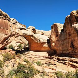
    Capitol Reef National Park - Hickman's Bridge

    Capitol Reef National Park

    4.8(166 reviews)
    55.5 mi

    As part of our quest to visit all 63 U.S. national parks, we set off on a six week road trip. I…read morehave a personal rule: I only count a national park as "visited" if I actually spend time there, hike or walk through it, and truly experience it. On this trip, we visited 14 national parks, and Capitol Reef National Park became one of the most beautiful surprises of the entire journey. The drive from Death Valley to Capitol Reef was already an adventure, with constantly changing landscapes along the way. But nothing prepared us for the moment we arrived. Suddenly, the desert opened up into an incredible world of red rock formations, towering cliffs, and colors that seemed almost impossible. It was breathtaking. Capitol Reef is a smaller national park compared to some of the giants we visited, but it has a beauty and personality all its own. In fact, it became my husband's favorite park of the entire trip. There is something about the combination of landscapes, colors, history, and peacefulness that makes this park truly special. The scenery changes dramatically throughout the park. One area is filled with the famous red rock formations, cliffs, and sandstone walls that look like they were painted by nature. Then, as you explore other areas, the landscape changes into lighter limestone formations, with shades of yellow, cream, and gray. Everywhere you look there is a different view, a different texture, and a different color. One of the unique things about Capitol Reef is the historic Fruita area, where early settlers planted orchards along the Fremont River. Today, visitors can still see these beautiful fruit groves, which feel almost magical surrounded by the desert landscape. There is also a historic building in the Fruita area where they sell homemade fruit pies, and it is incredibly popular for a reason. The pies are absolutely delicious. We could not resist and enjoyed having pie and ice cream one morning for breakfast. When you are traveling, sometimes breakfast rules become a little more flexible! The park also has fascinating history, including ancient petroglyphs left by the Fremont people. Seeing these markings carved into the rock walls was a powerful reminder that people have been connected to this landscape for thousands of years. The hiking was another highlight. I especially enjoyed hiking through the Narrows, where I was able to explore on my own and experience the beauty and quiet of the canyon. Walking through the towering walls, surrounded by the colors and textures of the desert, was unforgettable. Capitol Reef feels like nature's own painting. The reds, oranges, yellows, blues, turquoise, and greens all come together to create a landscape that is constantly changing depending on the light. It is a park that invites you to slow down, look around, and appreciate the incredible creativity of the natural world. Capitol Reef may not always get the same attention as Utah's more famous parks, but it deserves it. It is beautiful, peaceful, full of history, and absolutely worth the visit.

    This is an amazing national park. One thing I noted about the park is that it offers things for…read morepeople to do regardless of their activity level. If you're super fit and want to do hikes, good for you as there's plenty of strenuous hikes! If you aren't as active or use a mobility assistive device, you can travel on the very, very scenic drive and also learn about the ghost town of Fruita (although the NPS employees live there). If you time your visit right, you can even pick fruits from the orchards. I combined the Rim Overlook trail with the trail to Hickman Bridge to get amazing views, as well as hiked the Cassidy Arch trail. The trails weren't too crowded, so it was a great place to listen to nature and focus on hiking. You're rewarded with amazing views. Definitely hit up Gifford Homestead for fruit pies. They often sell out in the afternoon.

    Photos
    Capitol Reef National Park - Some of the amazing petroglyphs!

    Some of the amazing petroglyphs!

    Capitol Reef National Park - Some of the amazing petroglyphs!

    Some of the amazing petroglyphs!

    Capitol Reef National Park - Gifford Homestead Pie

    See all

    Gifford Homestead Pie

    Salina City Park - parks - Updated September 2026

    Loading...
    Loading...
    Loading...