San Bruno Mountain State & County Park Photos


You might also consider


More like San Bruno Mountain State & County Park
Recommended Reviews - San Bruno Mountain State & County Park
Start your review...


Reviews With Photos


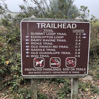
Beautiful county/state park located just south of the city. The park has plenty of trails, a nice big grassy area, and some picnic tables. With so many different trails to choose from it's easy to choose your own adventure and difficulty for the day. We did the summit loop trail which was a little over 3 miles and took us just over two hours. We started at the park entrance parking lot, but there is a lot a little closer to the trailhead. While there was a bit of incline, it wasn't anything too hard for someone in good/moderate shape. This trail was mostly sun exposed no matter which way you went, excluding some trees at the start and finish. We went clockwise which seemed to have a steeper incline quicker. The park is lush with plants, bushes, and trees, though the trees seem to be concentrated to certain areas like the grassy field and the lower part of the mountain on some of the trails. Though it is a county and state park, they do not accept state park passes, so you do need to pay an entrance fee unless you have a San Mateo county park pass. The kiosk was closed when we arrived, but they had a pay station at the entrance that accepts credit cards.


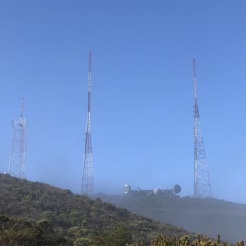
This is the place for great views of the city and the bay. The views are quite expansive, it's not as tall as Mt. Tam or Mt. Diablo but much closer and easier to get to. There are many different trails. The easiest is the Saddle Loop trail which is about 2.5 miles which loops around the southern part of the park. The Bog Trail intersects this which I'd recommend because it feels a little marshy and woodsy. This trail gets lots of wildflowers in the spring. For more of a hike with elevation the Summit Loop trail is better and not too strenuous because there are a lot of switchbacks. The last few times I went the beginning half of this trail was very overgrown with vegetation, not sure why. You can hike up to the radio towers or continue down the ridge. It doesn't look far but roundtrip it's about 9 miles to go to add the end of the ridge and back. Parking is $6 and there are bathrooms and picnic tables next to the lot.


Tourists should hike here. There are few better hikes in the San Francisco Bay region for a tourist to get an amazing view of the city of San Francisco and an amazing view of the South San Francisco Bay. San Bruno mountain is that mountain that everyone sees when driving northbound on highway 101 from San Francisco International Airport. Just south of San Bruno mountain is that hillside with the words "South San Francisco." It costs around $7 to enter and there's plenty of parking. Do the Ridgeline Pike combined with the loop and you'll be blown away by the views.


Big State park, several hiking trails. The trails up the mountain are suitable for strong mountain bikers and hikers- the reward is great 360 degree views of the mountains, bay, ocean, and several cities. No dogs allowed. Paved trail and packed earthen trails. Big parking lot on main entrance- $6 entrance fee - but annual state/ federal park pass can be used.


What an interesting hike, albeit treacherous at some points, with beautiful views. Did this hike yesterday with a friend, starting at the trailhead at Mills Montessori, up a very steep incline making it to the Ridge Trail up on top. The trailhead starting from Mills Montessori doesn't appear to be named, but it offered some amazing views going uphill. The hike up was unshaded, rocky and felt dangerous. Hiking poles would have been useful (which we didn't have). It took around an hour to get from the base to the top of the Ridge Trail. From there we walked along the Ridge Trail to the summit of San Bruno Mountain, which offered even better views as the day was sunny (and NOT foggy). After exploring the summit, we had bypassed our original trail that we came up by, so instead of going all the way back, we went on a different trail (which was marked on Alltrails and on Google Maps). It was unnamed (it leads to Greenpark Terrace), so for the purpose of this review, I shall call it the Greenpark Terrace Trail. We eventually made our way down...but it was much more dangerous, unkempt, and extremely narrow compared to where we originally started from. I don't recommend the Greenpark Terrace trail. At the end of this trail, it was fenced off due to being on private property. So, instead, so we had to walk on this narrow path around the fence, go through a bunch of shrubs/grass, and hop around on a concrete water duct. What an adventure at the end... My friend and I were worried that we would need to hop over a fence, or worse yet, turn back around to go back all the way to the summit and go back the same way we came from. I find it interesting that despite the Greenpark Terrace trail being marked on Alltrails, none of the suggested hikes recommend coming this way. Gee whiz, I wonder why? Well now I know (and all you on Yelp know!). More of the story? Go back from where you started. Not sure if we saved time by going the alternate route, but it was definitely a hike to remember. Also, bring hiking poles if you decide to go trek up the mountain from Mills Montessori, for balance and support. Other items to bring are plenty of water/electrolytes, a hat, long pants/shirts (due to tick and poison oak risk!), and plenty of sunscreen!


If you've ever seen the famous car chase scene in "Bullitt", you've probably noticed how Steve McQueen criss-crosses San Francisco at breakneck speed in his 1968 Ford Mustang GT. If you look hard, you notice how his route would be impossible to repeat in your 2015 Prius. Well, the chase ends in what I now know is San Bruno Mountain. Having never visited before, I recognized Guadalupe Parkway as where the car explosion occurred, and given how fast the more selfish motorists were driving, I wouldn't be overly surprised at the possibility again. What did surprise me was the $6.25 car entrance fee. I didn't mind paying it as much as I had to deal with a highly uncooperative cash machine that flat out refused my currency. Five minutes later, it finally was willing to overcome the crimp in my five-dollar bill, and I could park for roughly the hour left before the lot closed. Once on my way, it was quite nice though I had to be careful not to go too far up the mountain and find myself in an inadvertent overnight camping situation. I decided to follow the inner Summit Loop Trail and double back on the Dairy Ravine Trail. The shortened route still gave me panoramic views of the bay and full immersion in the flora and foliage. At first, I thought it seemed anal to make the trails one way, but I figured out it was due to the likely trampling of otherwise innocent wildflowers. As it turned out, I had enough time to walk the Saddle Loop Trail on the other side of the parkway. This was a much wider path with more immediate views of San Francisco in the distance. Granted the elevation makes it a more windswept situation than your baseball cap will likely be able to handle. RELATED - Up for a hike? Here's a collection of trails I've walked and reviewed: https://bit.ly/2OrC8nU


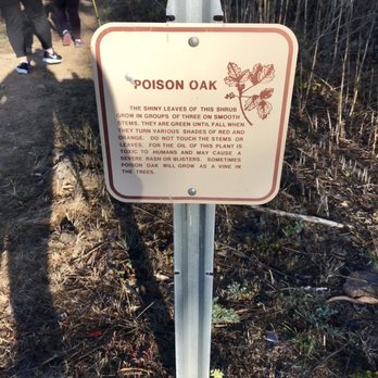
The San Bruno Mountain Park is a hidden gem! + Not too crowded + Great views of the bay and the ocean + Parts of the trail are woodsy and shaded + Plenty of parking: 1 parking by the gate and an overflow parking down the road + Restroom by the overflow parking + Many trail options: The trail I did was the Summit Loop and Dairy Ravine Trail which was about 3.6 miles. Although it was 717 ft elevation gain, the climb was gradual and not super steep. - Poison oak present - Parts of the trail are narrow from plants growing into the trail - Most of the trail is uneven and 1 part was really muddy (luckily I had walking poles) - Weather can be a hit or miss, sometimes the fog can obscure the view Tip: * Bring $6 or a card to pay for vehicle entry at the gate * Wear long pants, proper footwear, and maybe bring walking poles * Check the weather before you go


Our semi weekly e-bike group rode over from San Francisco this past Sunday. We were on an quest for sunshine. We biked over. No sunshine here. It was very misty. We came in through the Crocker Gate onto the paved path. The canopy of trees was awesome. This was my first visit here. Lots of walkers. We made a stop at the restroom. Then we exited through the parking lot onto Guadalupe Canyon Parkway and headed down into Brisbane.
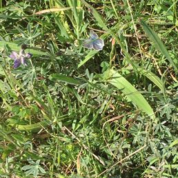

After enjoying many hikes on the numerous trails atop San Bruno mountain, my husband and I finally got to see the endangered mission blue butterfly. It was just as beautiful as others have described it. We kept our feet solidly on the trail, but enjoyed admiring its beauty. The lovely thing about this state park is the mission blues are only one of many activities to enjoy. There are picnic areas, steep hikes, easy inclines, and views of downtown SF as well as the Bay. It really is a special place so close to the city. It's special when you walk down a trail and find yourself surrounded by seasonal wildflowers and butterflies. They have a small parking lot, so if it's a weekend you may want to avoid the high traffic times. At 6 dollars for parking, it's definitely reasonable and the park staff will give you a trail map upon entrance if you ask them.


Visiting a cousin who lived in the area, she suggested we take hike in the nearby San Bruno Mountain State Park before dinner. We parked on Crocker Ave next to a trailhead and we started on our 3.2 mi hike. Starting on the Old Guadalupe Trail, we then went on the Saddle Trail, which were hiking/biking trails for some amazing views. Though it was overcast, it was clear looking west and we got a view of the Farallon Islands, Downtown San Francisco and the East Bay. We then went Bog Trail, which was a hiking only trail, before connecting back to the Old Guadalupe Trail and to the trailhead. It was a nice easy hike with minimal elevation. The trails were well maintained. Being more familiar with the East Bay parks for hikes, this was my first hike in a West Bay park. Hope to hike more of the trails in San Bruno Mountain State Park.


Hiked Sun 10.11.20 to do a short 2.7 mile loop hike. We paid the $6, but check Yelp tip on residential parking and walk-in. Will have to try that another time. Separate Flushed toilets with soap and hand dryer open during Covid19, masks on in restrooms. We did Saddle Trail & Guadalupe Trail. Nice views on a clear Spare The Air Day.


Some of the trails are covered with lush greenery. I love a good loop trail that has some decent incline for thigh burn. As someone who suffers from a small bladder, I'm happy to report that there is one main bathroom available in the middle of this park. First time I came, I paid $6 to park my car at the main entrance but I discovered many side streets through the neighborhoods to access these trails. The best is off of Crocker Ave -- Old Guadalupe Trail feeds into Saddle Trail nicely. There are 3 main trails here: Saddle about 2 miles, Summit about 3 miles, and Ridge about 2.5 miles. My favorite is the Summit because it has a variety of incline, shaded trees and views. If you like single track trails where you won't run into too many people, this will be your favorite too. Just be prepared for a less maintained tighter trail with lots of rocks as your terrain. The ridge is pretty boring because it's a straight line with no shade -- on a windy or hot day, this can be brutal -- but this might work if you're looking for extra miles to add to your hike. Most people seem to loop around Saddle and that's bi-directional. Dress in layers as the temperature can vary from one area to another. The worst way to access San Bruno mountains is by Quarry Road -- heavily graveled, just awful, especially coming down. The most challenging and possible treacherous way is through Firth Park Canyon in Brisbane -- straight cliff climbing. Lastly a very hidden path is accessing Old Ranch Trail through the residential area of Brisbane. I discovered all these access points by studying Google map and it's been an interesting challenge to find different access points! Weekends will draw more families around here but weekdays are pretty quiet, especially on the Summit side. I saw 2 snakes on the trails Summit trails and got a couple of bug bites so definitely wear long pants!


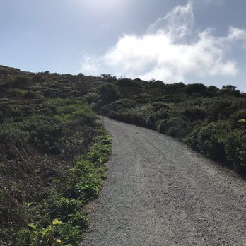
What a hike! What a view! San Bruno Mountain State Park is truly breathtaking. Did a 10 mile out and back hike up to San Bruno Mountain and it was an excellent workout! There are two parking lots near the entrance. If the first one is full, drive down and around the hill and park at the other lot. The first lot is closest to the recreational area and the second lot is closer to the hiking trails. It costs $6 to enter and can be paid with either card or cash (bring exact cash if using this payment method). Apparently there are frequent car break-ins, so please don't leave anything visible or of value in your vehicle. There are tons of different trails to choose from and all of them are well marked with the difficultly level and distance. We started on the Summit Loop Trail which measures 3 miles one way. It's categorized as "hard" but I'd say that it's moderate with some difficult inclines involved. This trail starts off as a narrow dirt ridge trail that inclines gradually. We came during the end of September and there was so much greenery! About a 1.5 miles into the Summit Loop Trail, the path widens and turns into a paved path. It also starts to really incline. Some of these stretches are on the steeper side but nothing too gnarly. As you ascend up the hill, you'll see some amazing city views. We ended up connecting to the Ridge Trail for about 2 miles. I'm a sucker for Ridge Trails, so I really enjoyed this one. Not much inclining here, but the views of San Francisco are pretty wild. Even from here you'll be able to see some of the city's most famous skyscraper buildings. When you reach the end of the trail, you'll have 360 degree views of SF, Brisbane, San Bruno, and daily city. It was freezing at the top and super windy, so I suggest that you dress in layers and bring a heavy sweater if you plan on staying up there for a while. We took the Ridge Trail back and took a small shortcut through the Dairy Ravine Trail. If you plan on taking this trail back, beware of poison oak. As a matter of fact, poison oak may be common on any of the trails, but we noticed it a lot more during this particular trail. Also, this trail wasn't maintained as well as the others so watch your footing on the way down. The park is full of pretty wildflowers and vibrant ferns. There is no shortage of greenery here. Such a lovely hike with stellar views! I'd definitely come back again to explore some other trails.


6 months ago

1 year ago
Love this park! This is a great park with many well maintained trails. The Trail up to the highest point starts from the more remote parking lot, walk on the paved road under Guadalupe Canyon Pkwy. You'll see Signal hill, (transmission towers) and paths are narrow and steep with fantastic views. The Guadalupe trail is lovely with views of the bay, and Bay Bridge, Oakland -Berkeley and San Francisco too. The Bog trail is full of water-loving trees, vines and a creek runs through it after rains. Lots of native plants and birds. To learn more about this large open space area look up when there are guided hikes, or read the bulletin boards. read more




1 year ago
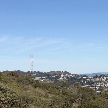
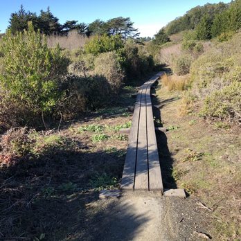
This is one of the few places where you can see the Sutro Tower, downtown San Francisco, the Bay Bridge, the Peninsula, a glimpse of the Pacific ocean, the San Francisco Bay, and much of the East Bay. There are television towers at several peaks. This mountain is mainly for the regulars to cross from the eastern San Francisco/Daly City border to Colma. The trail feels a bit overgrown, where there was a good bit of poison oak around. Perhaps in summer/fall it's easier to walk here, but then you miss out on all the beautiful flowers. Overall, a great place for a nice hike/walk with great views. read more


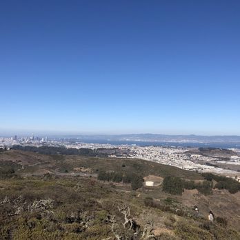

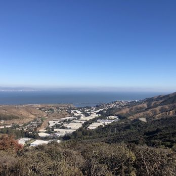
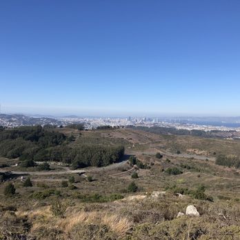


Beautiful county/state park located just south of the city. The park has plenty of trails, a nice big grassy area, and some picnic tables. With so many different trails to choose from it's easy to choose your own adventure and difficulty for the day. We did the summit loop trail which was a little over 3 miles and took us just over two hours. We started at the park entrance parking lot, but there is a lot a little closer to the trailhead. While there was a bit of incline, it wasn't anything too hard for someone in good/moderate shape. This trail was mostly sun exposed no matter which way you went, excluding some trees at the start and finish. We went clockwise which seemed to have a steeper incline quicker. The park is lush with plants, bushes, and trees, though the trees seem to be concentrated to certain areas like the grassy field and the lower part of the mountain on some of the trails. Though it is a county and state park, they do not accept state park passes, so you do need to pay an entrance fee unless you have a San Mateo county park pass. The kiosk was closed when we arrived, but they had a pay station at the entrance that accepts credit cards. read more


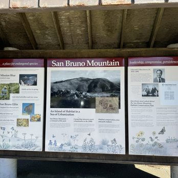

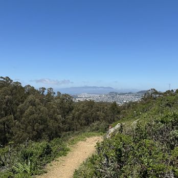
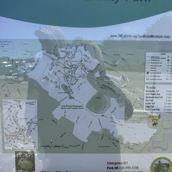


This is the place for great views of the city and the bay. The views are quite expansive, it's not as tall as Mt. Tam or Mt. Diablo but much closer and easier to get to. There are many different trails. The easiest is the Saddle Loop trail which is about 2.5 miles which loops around the southern part of the park. The Bog Trail intersects this which I'd recommend because it feels a little marshy and woodsy. This trail gets lots of wildflowers in the spring. For more of a hike with elevation the Summit Loop trail is better and not too strenuous because there are a lot of switchbacks. The last few times I went the beginning half of this trail was very overgrown with vegetation, not sure why. You can hike up to the radio towers or continue down the ridge. It doesn't look far but roundtrip it's about 9 miles to go to add the end of the ridge and back. Parking is $6 and there are bathrooms and picnic tables next to the lot. read more

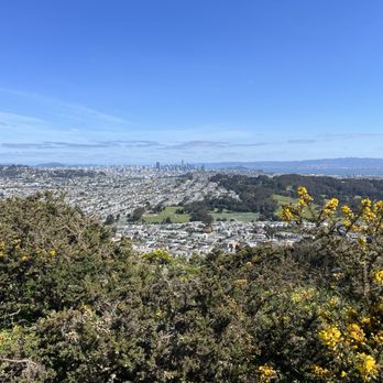


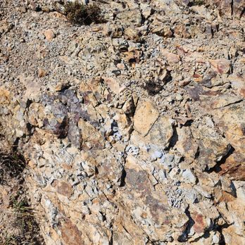
Tourists should hike here. There are few better hikes in the San Francisco Bay region for a tourist to get an amazing view of the city of San Francisco and an amazing view of the South San Francisco Bay. San Bruno mountain is that mountain that everyone sees when driving northbound on highway 101 from San Francisco International Airport. Just south of San Bruno mountain is that hillside with the words "South San Francisco." It costs around $7 to enter and there's plenty of parking. Do the Ridgeline Pike combined with the loop and you'll be blown away by the views. read more





2 years ago
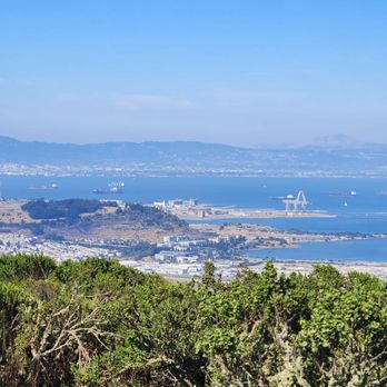
Big State park, several hiking trails. The trails up the mountain are suitable for strong mountain bikers and hikers- the reward is great 360 degree views of the mountains, bay, ocean, and several cities. No dogs allowed. Paved trail and packed earthen trails. Big parking lot on main entrance- $6 entrance fee - but annual state/ federal park pass can be used. read more



3 years ago
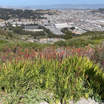
What an interesting hike, albeit treacherous at some points, with beautiful views. Did this hike yesterday with a friend, starting at the trailhead at Mills Montessori, up a very steep incline making it to the Ridge Trail up on top. The trailhead starting from Mills Montessori doesn't appear to be named, but it offered some amazing views going uphill. The hike up was unshaded, rocky and felt dangerous. Hiking poles would have been useful (which we didn't have). It took around an hour to get from the base to the top of the Ridge Trail. From there we walked along the Ridge Trail to the summit of San Bruno Mountain, which offered even better views as the day was sunny (and NOT foggy). After exploring the summit, we had bypassed our original trail that we came up by, so instead of going all the way back, we went on a different trail (which was marked on Alltrails and on Google Maps). It was unnamed (it leads to Greenpark Terrace), so for the purpose of this review, I shall call it the Greenpark Terrace Trail. We eventually made our way down...but it was much more dangerous, unkempt, and extremely narrow compared to where we originally started from. I don't recommend the Greenpark Terrace trail. At the end of this trail, it was fenced off due to being on private property. So, instead, so we had to walk on this narrow path around the fence, go through a bunch of shrubs/grass, and hop around on a concrete water duct. What an adventure at the end... My friend and I were worried that we would need to hop over a fence, or worse yet, turn back around to go back all the way to the summit and go back the same way we came from. I find it interesting that despite the Greenpark Terrace trail being marked on Alltrails, none of the suggested hikes recommend coming this way. Gee whiz, I wonder why? Well now I know (and all you on Yelp know!). More of the story? Go back from where you started. Not sure if we saved time by going the alternate route, but it was definitely a hike to remember. Also, bring hiking poles if you decide to go trek up the mountain from Mills Montessori, for balance and support. Other items to bring are plenty of water/electrolytes, a hat, long pants/shirts (due to tick and poison oak risk!), and plenty of sunscreen! read more


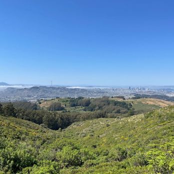


If you've ever seen the famous car chase scene in "Bullitt", you've probably noticed how Steve McQueen criss-crosses San Francisco at breakneck speed in his 1968 Ford Mustang GT. If you look hard, you notice how his route would be impossible to repeat in your 2015 Prius. Well, the chase ends in what I now know is San Bruno Mountain. Having never visited before, I recognized Guadalupe Parkway as where the car explosion occurred, and given how fast the more selfish motorists were driving, I wouldn't be overly surprised at the possibility again. What did surprise me was the $6.25 car entrance fee. I didn't mind paying it as much as I had to deal with a highly uncooperative cash machine that flat out refused my currency. Five minutes later, it finally was willing to overcome the crimp in my five-dollar bill, and I could park for roughly the hour left before the lot closed. Once on my way, it was quite nice though I had to be careful not to go too far up the mountain and find myself in an inadvertent overnight camping situation. I decided to follow the inner Summit Loop Trail and double back on the Dairy Ravine Trail. The shortened route still gave me panoramic views of the bay and full immersion in the flora and foliage. At first, I thought it seemed anal to make the trails one way, but I figured out it was due to the likely trampling of otherwise innocent wildflowers. As it turned out, I had enough time to walk the Saddle Loop Trail on the other side of the parkway. This was a much wider path with more immediate views of San Francisco in the distance. Granted the elevation makes it a more windswept situation than your baseball cap will likely be able to handle. RELATED - Up for a hike? Here's a collection of trails I've walked and reviewed: https://bit.ly/2OrC8nU read more


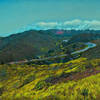


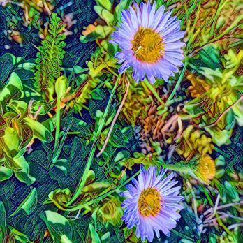


The San Bruno Mountain Park is a hidden gem! + Not too crowded + Great views of the bay and the ocean + Parts of the trail are woodsy and shaded + Plenty of parking: 1 parking by the gate and an overflow parking down the road + Restroom by the overflow parking + Many trail options: The trail I did was the Summit Loop and Dairy Ravine Trail which was about 3.6 miles. Although it was 717 ft elevation gain, the climb was gradual and not super steep. - Poison oak present - Parts of the trail are narrow from plants growing into the trail - Most of the trail is uneven and 1 part was really muddy (luckily I had walking poles) - Weather can be a hit or miss, sometimes the fog can obscure the view Tip: * Bring $6 or a card to pay for vehicle entry at the gate * Wear long pants, proper footwear, and maybe bring walking poles * Check the weather before you go read more


5 years ago
Our semi weekly e-bike group rode over from San Francisco this past Sunday. We were on an quest for sunshine. We biked over. No sunshine here. It was very misty. We came in through the Crocker Gate onto the paved path. The canopy of trees was awesome. This was my first visit here. Lots of walkers. We made a stop at the restroom. Then we exited through the parking lot onto Guadalupe Canyon Parkway and headed down into Brisbane. read more


After enjoying many hikes on the numerous trails atop San Bruno mountain, my husband and I finally got to see the endangered mission blue butterfly. It was just as beautiful as others have described it. We kept our feet solidly on the trail, but enjoyed admiring its beauty. The lovely thing about this state park is the mission blues are only one of many activities to enjoy. There are picnic areas, steep hikes, easy inclines, and views of downtown SF as well as the Bay. It really is a special place so close to the city. It's special when you walk down a trail and find yourself surrounded by seasonal wildflowers and butterflies. They have a small parking lot, so if it's a weekend you may want to avoid the high traffic times. At 6 dollars for parking, it's definitely reasonable and the park staff will give you a trail map upon entrance if you ask them. read more
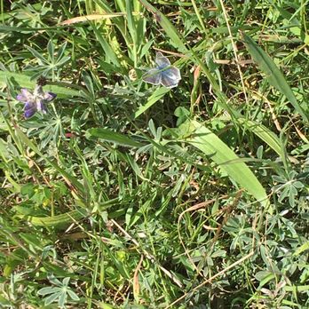

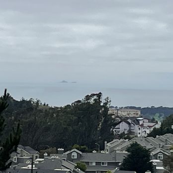
Visiting a cousin who lived in the area, she suggested we take hike in the nearby San Bruno Mountain State Park before dinner. We parked on Crocker Ave next to a trailhead and we started on our 3.2 mi hike. Starting on the Old Guadalupe Trail, we then went on the Saddle Trail, which were hiking/biking trails for some amazing views. Though it was overcast, it was clear looking west and we got a view of the Farallon Islands, Downtown San Francisco and the East Bay. We then went Bog Trail, which was a hiking only trail, before connecting back to the Old Guadalupe Trail and to the trailhead. It was a nice easy hike with minimal elevation. The trails were well maintained. Being more familiar with the East Bay parks for hikes, this was my first hike in a West Bay park. Hope to hike more of the trails in San Bruno Mountain State Park. read more



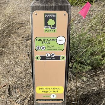

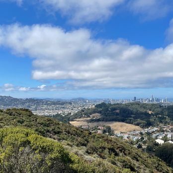


Hiked Sun 10.11.20 to do a short 2.7 mile loop hike. We paid the $6, but check Yelp tip on residential parking and walk-in. Will have to try that another time. Separate Flushed toilets with soap and hand dryer open during Covid19, masks on in restrooms. We did Saddle Trail & Guadalupe Trail. Nice views on a clear Spare The Air Day. read more





6 years ago
Some of the trails are covered with lush greenery. I love a good loop trail that has some decent incline for thigh burn. As someone who suffers from a small bladder, I'm happy to report that there is one main bathroom available in the middle of this park. First time I came, I paid $6 to park my car at the main entrance but I discovered many side streets through the neighborhoods to access these trails. The best is off of Crocker Ave -- Old Guadalupe Trail feeds into Saddle Trail nicely. There are 3 main trails here: Saddle about 2 miles, Summit about 3 miles, and Ridge about 2.5 miles. My favorite is the Summit because it has a variety of incline, shaded trees and views. If you like single track trails where you won't run into too many people, this will be your favorite too. Just be prepared for a less maintained tighter trail with lots of rocks as your terrain. The ridge is pretty boring because it's a straight line with no shade -- on a windy or hot day, this can be brutal -- but this might work if you're looking for extra miles to add to your hike. Most people seem to loop around Saddle and that's bi-directional. Dress in layers as the temperature can vary from one area to another. The worst way to access San Bruno mountains is by Quarry Road -- heavily graveled, just awful, especially coming down. The most challenging and possible treacherous way is through Firth Park Canyon in Brisbane -- straight cliff climbing. Lastly a very hidden path is accessing Old Ranch Trail through the residential area of Brisbane. I discovered all these access points by studying Google map and it's been an interesting challenge to find different access points! Weekends will draw more families around here but weekdays are pretty quiet, especially on the Summit side. I saw 2 snakes on the trails Summit trails and got a couple of bug bites so definitely wear long pants! read more


What a hike! What a view! San Bruno Mountain State Park is truly breathtaking. Did a 10 mile out and back hike up to San Bruno Mountain and it was an excellent workout! There are two parking lots near the entrance. If the first one is full, drive down and around the hill and park at the other lot. The first lot is closest to the recreational area and the second lot is closer to the hiking trails. It costs $6 to enter and can be paid with either card or cash (bring exact cash if using this payment method). Apparently there are frequent car break-ins, so please don't leave anything visible or of value in your vehicle. There are tons of different trails to choose from and all of them are well marked with the difficultly level and distance. We started on the Summit Loop Trail which measures 3 miles one way. It's categorized as "hard" but I'd say that it's moderate with some difficult inclines involved. This trail starts off as a narrow dirt ridge trail that inclines gradually. We came during the end of September and there was so much greenery! About a 1.5 miles into the Summit Loop Trail, the path widens and turns into a paved path. It also starts to really incline. Some of these stretches are on the steeper side but nothing too gnarly. As you ascend up the hill, you'll see some amazing city views. We ended up connecting to the Ridge Trail for about 2 miles. I'm a sucker for Ridge Trails, so I really enjoyed this one. Not much inclining here, but the views of San Francisco are pretty wild. Even from here you'll be able to see some of the city's most famous skyscraper buildings. When you reach the end of the trail, you'll have 360 degree views of SF, Brisbane, San Bruno, and daily city. It was freezing at the top and super windy, so I suggest that you dress in layers and bring a heavy sweater if you plan on staying up there for a while. We took the Ridge Trail back and took a small shortcut through the Dairy Ravine Trail. If you plan on taking this trail back, beware of poison oak. As a matter of fact, poison oak may be common on any of the trails, but we noticed it a lot more during this particular trail. Also, this trail wasn't maintained as well as the others so watch your footing on the way down. The park is full of pretty wildflowers and vibrant ferns. There is no shortage of greenery here. Such a lovely hike with stellar views! I'd definitely come back again to explore some other trails. read more







4 years ago
Love hiking here. My niece and nephew loves it here. We came here quite a few times. We walk up from our house (by Crocker Amazon park) Still haven't gotten a chance to finish all the trails. You get a great top of the hill view over SF. It smells amazing of fresh trees! Found little mushrooms but nothing exotic or rare. Even better! There are pokestops and Gyms! My nephew and I were soooo overjoyed! read more


3 years ago

2 years ago

4 years ago
Need to Knows: TICKS, POISON OAK, No Dogs. Visited in the spring. Nice views with native plants on the steeper trails. Safe hiking! read more


2 years ago

6 years ago
One of the best views that you can get of the city. On a clear day, you can see the city and the Bay. There's two main loops that you can take: 1) Saddle Loop on the north side, that had views of Cow Palace, San Bruno and the city and lots of flowers and bird life. The trail is quite wide and flat without much incline, and quite family friendly. 2) Summit Loop on the south side, this takes you up to the peak where you also get great views of the surrounding area. There are parts that are more narrow and poison oak/ivy so I recommend wearing long pants. There's some incline so may not be ideal for some hikers. Not much shade on both trails so bring sunscreen a sunny day. Parking is $6. Pro Tip: if you'd like to access the park with paying, consider parking near the Crocker Trail Head on the NW side to get access to Saddle Trail or near Royce Way to access the Summit Loop. I would only recommend the latter for people who are in decent shape and not afraid of heights as its quite steep for about 30min before meeting the main trail and coming down can be sli read more


6 years ago
Loved it here! Great views and a few trails you can choose from. It can get quite busy on weekends, so going during weekday might be better. read more


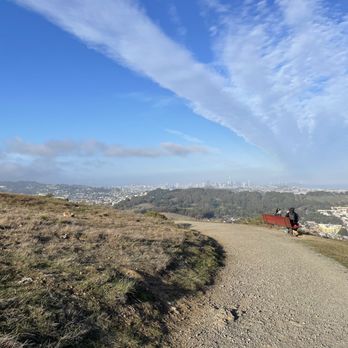


5 years ago

Went hiking in San Bruno Mountain State Park on Saturday afternoon. The views are beautiful, but the trail itself could be improved and the one-way signs need to come down. Quality: Not sure if you are going to get a better panoramic view of San Francisco and the surrounding area. The only thing missing is the Golden Gate Bridge, which is blocked by some of the higher terrain in the middle of the city. Still, the majority of the Summit Loop Trail provides breathtaking views in nearly every direction around the mountain. The trail is pretty simple with a slow incline rather than any quick jumps in elevation. It is fairly exposed, so it got a little warm on a sunny day. And while the plant life is not the most exciting, you tend to forget about it once you get to the views. Quantity: About 2,500 acre park with around 12 miles of trails. Value: $6 for the Vehicle Fee. Ambiance: San Bruno Mountain State Park is located just south of San Francisco, California. The trails start a good way up the mountain, so do not worry about having to hike the whole thing. We selected the Summit Loop Trail, which was just about 4 miles, slowly climbing to the top before declining into a small ridge. About a mile into the hike the views begin and they continue until you are close to the end, which keeps up the excitement throughout the hike. However, if you are low on time, you can absolutely drive higher up mountain and take a shorter summit trail to catch the highlights. Crowd: The parking lot was about half full on a beautiful Saturday afternoon. We would occasionally run into people on the trail, but not too frequently. Service: The park ranger was extremely nice and provided helpful information about the hike. However, it is impossible to ignore how poor the new signs are throughout the trail. To try and keep everyone moving in the same direction, one-way signs were placed throughout the trail, but they fail to consider the use of multiple trails, leaving most folks confused rather than safe. Parking: A decent sized parking lot by the trailheads towards the middle of the mountain. read more


Activity Type: Hiking Nearby City: San Francisco Length: 4.6 total miles Elevation Gain: 1,200 feet Trail Type: Loop Skill Level: Moderate to strenuous Duration: 2 to 4 hours Season: Year-round Top Elevation: 1,314 feet Local Contacts: San Bruno Mountain County Park Amid the Bay Area's most prominent landmarks (San Francisco skyscrapers, Bay Bridge, Candlestick Park, and the airport), San Bruno Mountain is a large bread loaf-shaped slice of open space. The views are as special as can be imagined, but pack a windbreaker: cool breezes off of the ocean, San Francisco Bay, and the East Bay buffet the mountain from three directions. Looking down on all this water from the vantage point of a red-tailed hawk epitomizes this hike. The price is some sweat equity required in climbing to the ridge and beyond to San Bruno Mountain, where an avid wanderer can spend hours staring at the bays and ocean. The entire park is home to the rare Montara manzanita and the protected and endangered San Bruno elfin butterfly. read more


I was looking forward to hiking here but I chose the wrong day. The day I went it was cold, windy and foggy. Parking was $6.00 paid via self pay parking that accepts credits cards. Theres a picnic area and a great hike/walk thats pretty flat. The paths around the summit are pretty wide but a hiking area down lower was very tight so social distancing would be a challege. I would come here again on a clear day to enjoy the view that I missed. read more


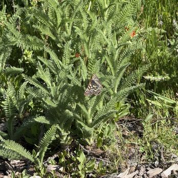
Today is a wonderful experience! Though I barely drive, I manage to walk on Crocker Ave. and go all the way to the entrance of the San Bruno Mountain State Park. I completely break a sweat before I spend one hour coming up here. That's a lot of exercise and it's worth it! Strolling into the Old Guadalupe Trail in search of the Summit Loop Trail, here's what I realize since the day I hike in Glen Canyon Park: weak winds are blowing, birds are chirping, bumblebees are buzzing. I can see the ravens flying from tree to tree. After I make it pass the highway, I end up at the Summit Loop Trail ahead. I'm hoping to find one of the 3 endangered butterfly species. That small butterfly, so small and distant, flutters so quickly that I barely snap a picture or video of it. When I look at its colorful wings, that doesn't look like a Mission Blue Butterfly I'm looking for. But I do take pictures of the flowers that the butterflies have been in, especially ones passed the poison oak. Before leaving the trail, I noticed what's rattling behind the bushes, it's a rabbit! I haven't completed the entire Summit Loop Trail, nor I have gone to other trails. But I be good and ready to come back in the same park next year during the Spring Equinox. It's good to ask the hikers whenever I am lost. Plus, I came prepared with bottles of water and juices. read more
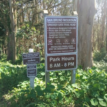


We took the Guadalupe Canyon Pkwy to the trailhead/ Park ranger station. You pay $6 at the self pay machine. There's pretty clean flush toilet restroom and nice picnic tables just north of the parking lot. Ample parking space which is nice. The trails are well marked and well maintained. Hard to get lost on those trails. We took the summit loop trail up to eucalyptus trail and turned around. Before we got there, we had already done another hike so we were kind of tired already at that point. We returned to the car and drove up to the peak on the Radio Road. Since it was a clear day , we could see the city ( San Francisco), Pacific Ocean , Daly City, Colma , Brisbane, San Francisco Bay, San Bruno, South San Francisco. Beautiful view of the city and lots of different wild flowers in full bloom this time of the year. Absolutely gorgeous place. Be respectful of HCP area ( habitat Conservancy preserve ). There are some native plants in those area. Some plants are endangered and disappearing. Don't step on the plants and stay on the trail. Also, this place had no trash on/off trail and I was happy and impressed. read more


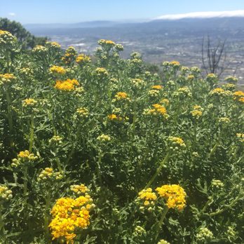


8 years ago
What a great find. Park was empty at 10AM on a Saturday morning. - bring $1 bills for $6 Park Fee or risk an expensive ticket. We saw a few cars being ticketed as we were leaving. - lock the car, put everything in trunk, there were some sketchy people getting High in the lot. - bring plenty of water. - wear the Right shoes. The trails are steep and rocky. - the higher you go, the more spectacular the views of SF & the north bay. - On a clear day, you can see for miles. The views are truly amazing. - the trails are virtually untouched. It's like we live in an area with 10M people & nobody knows about this place. - layer up, when the fog starts rolling thru the San Bruno gap, it gets cold. FAST. Might be back, there are so many great hiking trails that options are unlimited. read more


7 years ago
A great park to hike and run! Every time I've been here, it hasn't been crowded so I feel like I'm the only one there. Beautiful 360 degree views of SF, the Bay, and South. read more


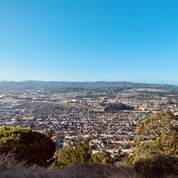

$6.00 for a vehicle day pass??? Paying to hike and get in touch with nature always baffles me, but San Bruno Mountain State & County Park is well maintained with ample parking, clean bathrooms, clearly marked trails and most importantly obvious conservation efforts! We hiked Summit Loop Trail as a family hike and the Ridge Trail as an adult only hike on two different days. Both trails offered gorgeous panoramic views of the Bay Area and from my understanding all trails in the park have similar views. Summit Loop Trail: Easy 3mi on a packed dirt trail. Perfect for families and beginner hikers or beginner runners. The lack of elevation and dimension in trail left it rather flat and boring for this avid hiker. Ridge Trail: Easy/Moderate 4.8-5mi hike on loose gravel trail. While this is a ridge line, the trail is wide and safe making this a family friendly trail for the kids who have good endurance. The trail slopes up and down along the ridge, but nothing I would consider steep. There was obvious signs (tracks and scats) of wildlife so I would definitely stay on trail and keep your small dogs at home. The park technically says no dogs, but we saw quite a few dog walkers out there. San Bruno Mountain is definitely a must for Daly City/Colma residents or visitors who want some fresh air, exercise and awesome views! read more

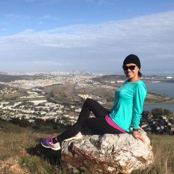

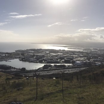


11 years ago
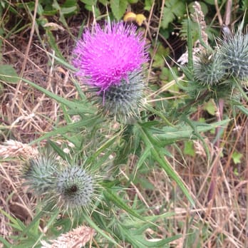
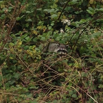
We attempted to head across the bridge but has fate would have it traffic was gnarly so we stumbled upon San Bruno Mountain State park. Getting though the gates will cost you $6. There was plenty of parking on a Saturday afternoon. There isn't much shade at this park, so we appreciated the foggy/windy/misty weather we had while we were there. We ended up doing two loop hikes, one directly in front of the parking gates and one you had to walk under the highway to get to. Hikes were nice and paths were well maintained. We only encountered one mountain biker while we were there and he was going slow enough we didn't feel like we'd get run over. It was lovely to see a variety of wild flowers, cacti and even a raccoon midday. While I'm not sure we'd come out of our way to come here, if we were in the area and wanting a hike we may consider it. I prefer more shade especially during the summer months. read more

Page 1 of 5
More info about San Bruno Mountain State & County Park
555 Guadalupe Canyon Pkwy
Brisbane, CA 94005
Directions
(650) 589-5708
Call Now
Visit Website
http://parks.smcgov.org/san-bruno-mountain-state-county-park
Hours
Indoor Amenities
Outdoor Amenities
Ask the Community - San Bruno Mountain State & County Park
Review Highlights - San Bruno Mountain State & County Park
You might also consider
















Why does Yelp recommend reviews?
7 reviews that are not currently recommended
The reviews below are not factored into the business's overall star rating.

11 years ago
10 years ago

13 years ago

12 years ago
5 years ago

12 years ago

18 years ago
San Bruno Mountain State & County Park - parks - Updated September 2026
Best of Brisbane
People found San Bruno Mountain State & County Park by searching for…
Trending Searches in Brisbane, CA
Apple Orchards near San Bruno Mountain State & County Park
Apple Picking near San Bruno Mountain State & County Park
Archery near San Bruno Mountain State & County Park
Barbershop near San Bruno Mountain State & County Park
Baseball Fields near San Bruno Mountain State & County Park
Blow Dry Bar near San Bruno Mountain State & County Park
Cliff Jumping near San Bruno Mountain State & County Park
Consignment Shops near San Bruno Mountain State & County Park
Corn Maze near San Bruno Mountain State & County Park
Dog Friendly Things To Do near San Bruno Mountain State & County Park
Dog Parks near San Bruno Mountain State & County Park
Dress Shops near San Bruno Mountain State & County Park
Eyebrow Threading near San Bruno Mountain State & County Park
Eyelash Extensions near San Bruno Mountain State & County Park
Hiking near San Bruno Mountain State & County Park
Kids Birthday Party near San Bruno Mountain State & County Park
Makeup Artists near San Bruno Mountain State & County Park
Photo Spots near San Bruno Mountain State & County Park
Picnic Areas near San Bruno Mountain State & County Park
Places To Take Pictures near San Bruno Mountain State & County Park
Playgrounds near San Bruno Mountain State & County Park
Private Schools near San Bruno Mountain State & County Park
Public Running Track near San Bruno Mountain State & County Park
Public Shower near San Bruno Mountain State & County Park
River Swimming near San Bruno Mountain State & County Park
Scenic Overlook near San Bruno Mountain State & County Park
Sunrise View near San Bruno Mountain State & County Park
Volleyball Courts near San Bruno Mountain State & County Park
Browse Articles
Browse Nearby
BEST of Brisbane, California Coffee near San Bruno Mountain State & County Park
BEST of Brisbane, California Restaurants near San Bruno Mountain State & County Park
BEST of Brisbane, California Things to Do near San Bruno Mountain State & County Park
BEST of Brisbane, California Breakfast near San Bruno Mountain State & County Park
BEST of Brisbane, California Playgrounds near San Bruno Mountain State & County Park
BEST of Brisbane, California Picnic Areas near San Bruno Mountain State & County Park
BEST of Brisbane, California Star Gazing near San Bruno Mountain State & County Park
BEST of Brisbane, California Campgrounds near San Bruno Mountain State & County Park
BEST of Brisbane, California Sightseeing near San Bruno Mountain State & County Park
Browse Brands
Related Searches in Brisbane, CA
Best Off Leash Dog Parks in Brisbane, California
Best Parks for Parties and Events in Brisbane, California
Best Water Parks for Kids in Brisbane, California
Check Out Great Playgrounds in Brisbane, California
Discover Baseball Fields Around Brisbane, California
Discover Fun Toddler Parks in Brisbane, California for Your Little One
Discover Lakes & Ponds to Explore in Brisbane, California
Discover Popular Bike Trails in Brisbane, California
Discover Popular Photo Spots in Brisbane, California
Discover Soccer Fields in Brisbane, California Near You
Discover Top Nature Parks to Visit in Brisbane, California
Discover Top State Parks to Visit in Brisbane, California
Discover Walking Parks in Brisbane, California Near You
Discover the Best Beaches in Brisbane, California
Discover the Best Kids Park Spots in Brisbane, California
Enjoy Scenic Places to Walk in Brisbane, California
Enjoy the Best Picnic Spots and Ideas in Brisbane, California
Enjoy the Best Walking Trails in Brisbane, California
Explore Free Picnic Areas Around Brisbane, California
Explore Fun Activities to Do in Brisbane, California
Explore Parks With Pull Up Bars in Brisbane, California
Explore Picnic Parks Near Brisbane, California
Explore Popular Campgrounds Near Brisbane, California
Explore Popular Kids Parks Throughout Brisbane, California
Explore Popular Picnic Areas Around Brisbane, California
Explore Popular RV Parks Around Brisbane, California
Explore Scenic Lakes to Visit in Brisbane, California
Explore Top Dog Parks in Brisbane, California Near You
Explore Top Water Parks in Brisbane, California Today
Find Great Places to Feed Ducks in Brisbane, California
Find Parks and Recreation Activities in Brisbane, California
Find Top Dog Friendly Parks to Visit in Brisbane, California
Find Top Skate Parks in Brisbane, California for All Skill Levels
Find a Kids Birthday Party Park in Brisbane, California
Find a Park With BBQ Pits in Brisbane, California
Find the Best Parks BBQ Grills in Brisbane, California
Find the Best Parks for Picnics in Brisbane, California
Find the Best Playgrounds to Visit in Brisbane, California
Have Fun at a Splash Pad in Brisbane, California
Locate Tennis Courts Around Brisbane, California
Picnic Areas With BBQ Pits Available in Brisbane, California
Play at a Splash Pad Park in Brisbane, California
Popular Picnic Spots to Visit in Brisbane, California
Relax in Parks With Shade Areas in Brisbane, California
Safe and Fun Parks for Kids in Brisbane, California
Top Hiking Trails to Explore in Brisbane, California
Top Playgrounds for Kids to Enjoy in Brisbane, California
Top Running Trails to Explore in Brisbane, California


