San Gabriel River Bike Path Photos


You might also consider


More like San Gabriel River Bike Path
Recommended Reviews - San Gabriel River Bike Path
Start your review...


Reviews With Photos


I never knew bike paths were a thing nonetheless even realizing this area existed, so when my friend suggested going for a ride this past weekend, I was super excited! I havent been biking since I was a kid so I wasn't sure what to expect but this is honestly such a nice activity to do either by yourself, as a pair, or in a group. The path is nice and wide and the ground is pretty flat for the most part. In my opinion, I think anyone of any level could ride on this path without too many problems. When I went, we didn't encounter many people so you don't need to worry about feeling unsafe or being in anyone else's way. You will occasionally pass by some people walking along the side or hanging out down by the dam, and even some homeless people but everyone minds their own business. We only went down about 5 miles (10 miles round trip) before turning back due to time constraints, but next time we go, we're going all the way down to Long Beach. This is a really great way to get some exercise in while enjoying nature and its beauty all at the same time. I felt so at peace going on this ride, so if you ever feel like you need a break, this is the way to go. Have fun and stay safe! :)


64/100 Bike-O'-lishious Reviews Challenge for 2017 Maaaan Europe has the Tour da France but we in the hood have tour da ghetto! I've been riding this river bed for 20 years and have enjoyed all my adventures. From the start of smelly smoged filled air in El Monte to the crisp salty sweet beach winds of seal beach it's an enjoyable ride. A solid 5/5 Stars for an excellent ride 5/5 Stars***** Ride 5/5 Stars*****Adventure 5/5 Stars***** accessibility It's a fun bike ride along the 605 from the ghetto to the beach, it is a must for any bike enthusiast whom wants to challenge him or her self! The ride starts from either Azusa or El Monte and ends at seal Beach and Marina del Rey Here's a few safety tips that may help. Equipment and safety: Here's a few items I recommend you take: A good bike, 2 water bottels, snacks with protein, inner tubes, patches, tools, Co2 cartridges, an air pump, helmet, bike gloves, knee brace, Phone, first aid kit, ipod, flashlight, sweater, sun glasses, sun tan lotion, mace, knife, or retractable baton. (Optional Gun, flame thrower, attack dogs or grenade launcher!) Lol On them hot days you'll be happy you took plenty of water and snacks to keep hydrated, an energy levels up!. God forbid you get a flat or a malfunction but if you do, the patches and tools will help your journey continue. Sun glasses and lotion are needed it's bright out there and the sweater will come in handy. The knife, mace, and baton are for safety. As much as this is an enjoyable ride, there are plenty of unscrupulous characters wandering around the wash. An, one never knows when or where trouble will occur. Especially and not recommended, if you have to ride back home at night. Women I highly suggest you go with a male companion or a group. But ladies if you're gonna ride alone, do it early morning because most bums and punks are asleep! Bicycle: I have a Trek navigator but after this ride Im gonna go buy a Cannondale road bike. JOURNEY: I started my adventure early morning around 6:30 a.m. from my house in La Puente to El Monte, which is 7 miles and the start of the river ride for me. Once I got to El Monte, I jumped onto the bike path at Valley blvd and 605 freeway. Not much to look from this starting point, because there's no water in the wash but weeds and dirty diapers! Surprising there were a lot of pro bike riders and novice riding the trail ( made me feel like I was that dope head Lance Armstrong, riding in the ghetto version of the tour da France!) It seemed to get a little more packed when I reached around the Durate area about 15 miles south of El Monte. The road leading up to Durate is pretty bad and seriously in need of re-paving. One cool thing is, there's numbers on the ground every mile letting you know how much farther until you get to seal Beach. I took a quick break at a place called golf and stuff which is funny, because the original film the Karate Kid was filmed there. I'm really shocked it still exist, an I hear Ralph Macchio works there. lmao. After Golf n stuff 10 miles to go and around the I-5 still following the 605 the scene gets pretty nice. If you want a shorter ride my tip would be to drive your car and park at Golf n Stuff, then ride your bike to the beach, because it's only like 10 miles from there. As you start reaching the beach its really nice, you cross a steel bridge and you start seeing the seagulls and smell the ocean air. Marina del Rey starts to come into focus as you see the boats coming in and out of the harbor, and then you finally reach Seal Beach. I had a couple bumps on my crusade because construction was being done on the road itself. Forcing me to walk my bike down to the bottom of the wash and then walk back up, which became annoying. I'm pretty proud of myself that I reached the beach, road around the town, then road back home. Total miles 81. FINALLY: A great ride with plenty of little parks and side trailers one can stop and rest. Pictures always speak volumes to me so I'm posting a few of my journey, an I hope you can get a clear picture of what to expect. Be safe and have fun on your quest along the ghetto tour da Hood! 8)


Based on the address, this is the 17-mile bike path beginning/ending at Peck Road Conservation Water Park ending/beginning at Whittier Narrows. On Google Maps, it's listed as "Rio Hondo Bike Path." I really only use the bike path for running so I don't have to worry about cars, traffic, street lights and stop signs. Every quarter mile, there's a marker so you can keep track your mileage. Along the path, there are several parks along the way for rest breaks like Peck Rd Park, Pioneer Park, Rio Vista Park. After Peck Rd Park, there's a separate loop around the "lake" that takes you past Arcadia Golf Course to Live Oak Ave in Arcadia. Some times you'll see people walking their dogs, kids fooling around and homeless under the overpasses. And of course bicyclists. Only major problem I've had was an aggressive stray dog who chased after me while riding a bike or attacked dogs being walked by their owners. Thankfully, I haven't seen that dog in the last 1.5 years. My favorite part is along the El Monte Airport runway where you see planes landing and arriving. Even better at night when you see only the lights on the plane and along the runway for dramatic effect. There are benches where you can see the planes and some times you'll see a large man telling passerbyers "Jesus loves you." For another sort of workout, you can run up and down the walls of the wash along which the bike path runs. There's also a flight of stairs past the gate near Peck Rd Park you can get a good stair workout. Overall, the bike path is well-maintained. Not many potholes nor major cracks I've noticed. Happy biking or running!


There is, perhaps, no better way to truly appreciate urban life than riding down a bicycle path. There are many in SoCal--some nicer, some prettier, some cleaner--but none like this one. I have ridden the entire thing numerous times, both in sections and as a single long ride. Over time, you begin to notice themes and trends... When the flowers are in bloom, when the water runs in the river, when the clouds of gnats gather, and when the locals are active. There are times when it is scary, serene, scenic, scented, but always satisfying. AZUSA CYN TO ARROW HIGHWAY: Starting from the northernmost point, there is a turn-around dead-end where the trail enters Azusa canyon. Most folks don't start here, but for the purpose of explanation, this is the top of the trail. Nestled well in the foothills of the San Gabriels and adjacent to some upper end gated track housing, the trail here is relatively clean, save for the occasional pile of sand or gravel. Heading south, the trail runs along the east side of the San Gabriel "river"-- an historic watershed that is largely concreted on its way to the ocean. This stretch is one of the more natural areas, with chaparral and semi-arid plants like yucca, sage, buckwheat, willow, prickly pear and cholla cactus growing amidst the rocky soil and Boulder-strewn expanse of the flat river bed. It is here that many enter the river trail at Lario or by parking near Encanto park and riding across the bridge. This desert beauty, interrupted by the 210 freeway and the occasional kid on a big wheel, continues down past the Miller brewing plant into the Santa Fe Dam area (see my review for more information!)-- in summary, many recreational opportunities, a nature center or two, and a beautiful desert plant path to walk... Rabbits, roadrunners, coyotes, snakes, lizards, and ground squirrels frequent the area. The trail continues along the top of the dam for a couple of miles, then crosses Arrow Hwy. ARROW HWY TO PICO RIVERA GOLF COURSE: The trail switches to the west side of the river below Arrow Hwy. starting with one of several rest stops for bikers. This first one is a concrete area with some benches, a shaded area, and a map or two of the area. Heading south, the scene is mostly industrial for a mile or so. Passing behind neighborhoods and schools, the homeless population starts to show up under bridges and road overpasses. Graffiti becomes common. Occasional broken glass and garbage keeps your eyes on the path. There are a few places where it seems water collects most of the year; local subsistence fishermen ply the waters here for carp, and the occasional catfish or stocked trout that got trapped here when the waters recede seasonally. There are several horse and livestock properties along the last few miles above the Pico Rivera golf course/dam area. Watch for the roosters in cages-- I'm sure they're just part of a breeding program, and couldn't possibly be involved in any kind of cock fighting operation.... Just above the Pico dam, the SGR trail meets the terminus of the Rio Hondo trail, which heads essentially north back to Arcadia via Whittier Narrows regional park and past El Monte Airport. Pico Rivera Golf Course is biker-friendly, and has restrooms, a snack bar, and a parking lot that seems to be used by many cyclists as an endpoint. PICO RIVERA GOLF COURSE TO I-5 FWY Just south of the golf course, you switch back to the east side of the river. This stretch prompted me to make a pepper spray purchase, and rig a holder for it in my handlebars. It is also good motivation to keep pedaling! Shoals of people-- some homeless, some harmless, and some homeys--wandering about or living under the bridges in communities. I once had a guy try to stop me holding a broomstick that I was sure was going in my front wheel as I sped by. If you time your ride when other cyclists are in the area or go with a group... And don't go looking for trouble... You just get through here. Backyard farms, horses, some illegal dumping, and urban rattle-can art highlight this stretch. Keep moving. Rest stops and small parks are overrun by homeless and weirdos. Respeto, Papi. I-5 TO SEAL BEACH As if someone hit a switch or waved a magic wand, the trail improves, and the scenery changes. Two big parks-- Wilderness Park and Liberty Park-- are decent rest stops with relative safety. Things continue to improve the closer you get to the ocean, but the crowds increase. Watch for kids, joggers, and pedestrians! Use your voice to let people know you're behind them. Within a few miles of the beach, the river is filled with water year-round, and you can see mullet jumping out of the water near the power plant warm water outfalls. Anglers try to snag mullet and tilapia here. Numerous waterfowl and wading birds can be seen here. Prettier and prettier... In Seal Beach, the last stretch heads down to the River's End cafe, and some beach restrooms, and a short ride to downtown and the pier. Happy cycling!


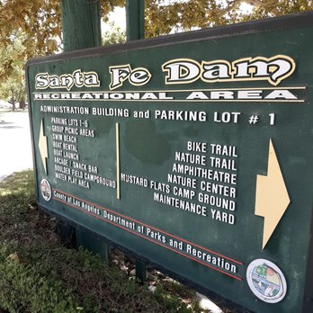
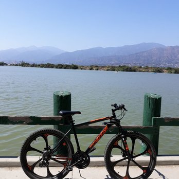
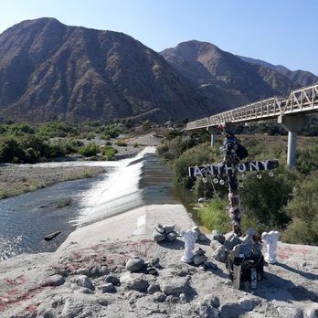
I took off from azuza near the mountains and followed the river all the way down to santa fe dam in irwindale it was really hot and i didnt prepare for it so i got sunburnt from yesterdays ride and todays i did bring plenty of water but both my friends were dying and stopped to rest like 100 times. i definitely need a new parter that will keep up with me. Hopefully ill replace this PAN. soon LOL.

I took this bike path from the entrance in Lakewood past Artesia High school and took the trek on my Gravel bike all the way to the end of the trail, It was a very new and fun experience for me. Make sure you got a high quality reliable and fast bike, preferably a gravel, or road bike, and come prepared, bring a bike multi tool two spare tubes, an other multi tool with pliers like a Gerber, a pump, water or Gatorade, snacks, bike lights, power bank, and a First aid kit, I haven't experienced any problem with homeless people, but in case bring something like pepper spray, and a pocket knife. Put some tire sealant in your tires, check your tire pressure before going the trip I was in Whittier past Washington blvd nearly two hours bike ride from my home, and one of my tires was low, and it was getting dark which is extremely sketchy to be riding this trail at night, especially at the mountain area with barely any lighting I I pumped my tire replaced the tube and that slowed me down an hour, but if I didn't brought tools with me I would of been stranded, except for like 4 nice people who offered help. Other than that the view is very nice, just follow the signs and you'll be fine I'll show the pictures I took of the view I saw when there


i saw horses. i saw ostriches. i saw bulls. i saw cows. i saw one zebra. the river was flowing. it was a gorgeous day. the trail was smooth. up until maybe, three miles south of ramona. cracks running perpendicular to the trail. nothing major, but if you're on a roadie, it gets old quick. they were a bit bigger than last time. besides that, there's always something to distract you while you're on your quest for health. which is a good thing, i think. spicy.


2 years ago
This trail was an absolute CF. I've been on better primitive trails. It is one way in and one way out no other options. There are NO maps and little trail indicators. You'd be better off walking barefoot on a coral reef. You cannot actually enjoy the trail because you have to always look down so that you don't trip and break your neck. I do not recommend, do so at your own risk. read more


I've pretty much always lived near a sewer line/bike path. Growing up in Hawaiian Gardens it was near the 605. When I lived on the outskirts of Cypress it was still right there next to me across the street. Now that I live in Whittier I've discovered this wonderful path that goes all the way from Baldwin Park at one end to the beach at the other. This path spans about 30 miles and it is both scenic, horrifying, and polarizing when it comes to how the conditions for the ride goes. When you go east towards the Santa Fe Dam the winds are with you and the riding isn't too difficult. But when you go west towards Long Beach the winds are hitting you in the face like palm strikes. It is a bit of a doozy but if you want that workout it is a great one. The surroundings can go from beautiful rivers that lead to the ocean to dry river banks filled with trash and homeless settlements. It can even have something in between where nature has taken back the area and lush fields of grass and trees occupy the space. It goes near highways and homes and really gives you a journey you never expected. I love finding new things every time I ride, from the houses that are built right next to it to the horse trails running parallel. If you want to stay socially distanced but still want to explore in a manner away from populated streets and spaces I highly recommend getting on a bike and going down this wonderful riverway. read more

3 years ago

I never knew bike paths were a thing nonetheless even realizing this area existed, so when my friend suggested going for a ride this past weekend, I was super excited! I havent been biking since I was a kid so I wasn't sure what to expect but this is honestly such a nice activity to do either by yourself, as a pair, or in a group. The path is nice and wide and the ground is pretty flat for the most part. In my opinion, I think anyone of any level could ride on this path without too many problems. When I went, we didn't encounter many people so you don't need to worry about feeling unsafe or being in anyone else's way. You will occasionally pass by some people walking along the side or hanging out down by the dam, and even some homeless people but everyone minds their own business. We only went down about 5 miles (10 miles round trip) before turning back due to time constraints, but next time we go, we're going all the way down to Long Beach. This is a really great way to get some exercise in while enjoying nature and its beauty all at the same time. I felt so at peace going on this ride, so if you ever feel like you need a break, this is the way to go. Have fun and stay safe! :) read more

5 years ago

3 years ago

10 years ago
64/100 Bike-O'-lishious Reviews Challenge for 2017 Maaaan Europe has the Tour da France but we in the hood have tour da ghetto! I've been riding this river bed for 20 years and have enjoyed all my adventures. From the start of smelly smoged filled air in El Monte to the crisp salty sweet beach winds of seal beach it's an enjoyable ride. A solid 5/5 Stars for an excellent ride 5/5 Stars***** Ride 5/5 Stars*****Adventure 5/5 Stars***** accessibility It's a fun bike ride along the 605 from the ghetto to the beach, it is a must for any bike enthusiast whom wants to challenge him or her self! The ride starts from either Azusa or El Monte and ends at seal Beach and Marina del Rey Here's a few safety tips that may help. Equipment and safety: Here's a few items I recommend you take: A good bike, 2 water bottels, snacks with protein, inner tubes, patches, tools, Co2 cartridges, an air pump, helmet, bike gloves, knee brace, Phone, first aid kit, ipod, flashlight, sweater, sun glasses, sun tan lotion, mace, knife, or retractable baton. (Optional Gun, flame thrower, attack dogs or grenade launcher!) Lol On them hot days you'll be happy you took plenty of water and snacks to keep hydrated, an energy levels up!. God forbid you get a flat or a malfunction but if you do, the patches and tools will help your journey continue. Sun glasses and lotion are needed it's bright out there and the sweater will come in handy. The knife, mace, and baton are for safety. As much as this is an enjoyable ride, there are plenty of unscrupulous characters wandering around the wash. An, one never knows when or where trouble will occur. Especially and not recommended, if you have to ride back home at night. Women I highly suggest you go with a male companion or a group. But ladies if you're gonna ride alone, do it early morning because most bums and punks are asleep! Bicycle: I have a Trek navigator but after this ride Im gonna go buy a Cannondale road bike. JOURNEY: I started my adventure early morning around 6:30 a.m. from my house in La Puente to El Monte, which is 7 miles and the start of the river ride for me. Once I got to El Monte, I jumped onto the bike path at Valley blvd and 605 freeway. Not much to look from this starting point, because there's no water in the wash but weeds and dirty diapers! Surprising there were a lot of pro bike riders and novice riding the trail ( made me feel like I was that dope head Lance Armstrong, riding in the ghetto version of the tour da France!) It seemed to get a little more packed when I reached around the Durate area about 15 miles south of El Monte. The road leading up to Durate is pretty bad and seriously in need of re-paving. One cool thing is, there's numbers on the ground every mile letting you know how much farther until you get to seal Beach. I took a quick break at a place called golf and stuff which is funny, because the original film the Karate Kid was filmed there. I'm really shocked it still exist, an I hear Ralph Macchio works there. lmao. After Golf n stuff 10 miles to go and around the I-5 still following the 605 the scene gets pretty nice. If you want a shorter ride my tip would be to drive your car and park at Golf n Stuff, then ride your bike to the beach, because it's only like 10 miles from there. As you start reaching the beach its really nice, you cross a steel bridge and you start seeing the seagulls and smell the ocean air. Marina del Rey starts to come into focus as you see the boats coming in and out of the harbor, and then you finally reach Seal Beach. I had a couple bumps on my crusade because construction was being done on the road itself. Forcing me to walk my bike down to the bottom of the wash and then walk back up, which became annoying. I'm pretty proud of myself that I reached the beach, road around the town, then road back home. Total miles 81. FINALLY: A great ride with plenty of little parks and side trailers one can stop and rest. Pictures always speak volumes to me so I'm posting a few of my journey, an I hope you can get a clear picture of what to expect. Be safe and have fun on your quest along the ghetto tour da Hood! 8) read more

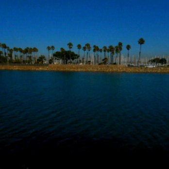
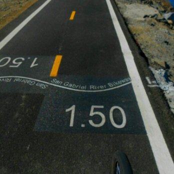
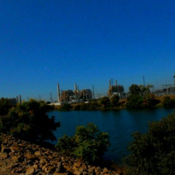

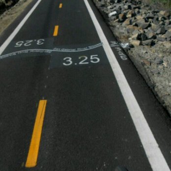


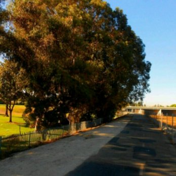


Based on the address, this is the 17-mile bike path beginning/ending at Peck Road Conservation Water Park ending/beginning at Whittier Narrows. On Google Maps, it's listed as "Rio Hondo Bike Path." I really only use the bike path for running so I don't have to worry about cars, traffic, street lights and stop signs. Every quarter mile, there's a marker so you can keep track your mileage. Along the path, there are several parks along the way for rest breaks like Peck Rd Park, Pioneer Park, Rio Vista Park. After Peck Rd Park, there's a separate loop around the "lake" that takes you past Arcadia Golf Course to Live Oak Ave in Arcadia. Some times you'll see people walking their dogs, kids fooling around and homeless under the overpasses. And of course bicyclists. Only major problem I've had was an aggressive stray dog who chased after me while riding a bike or attacked dogs being walked by their owners. Thankfully, I haven't seen that dog in the last 1.5 years. My favorite part is along the El Monte Airport runway where you see planes landing and arriving. Even better at night when you see only the lights on the plane and along the runway for dramatic effect. There are benches where you can see the planes and some times you'll see a large man telling passerbyers "Jesus loves you." For another sort of workout, you can run up and down the walls of the wash along which the bike path runs. There's also a flight of stairs past the gate near Peck Rd Park you can get a good stair workout. Overall, the bike path is well-maintained. Not many potholes nor major cracks I've noticed. Happy biking or running! read more


There is, perhaps, no better way to truly appreciate urban life than riding down a bicycle path. There are many in SoCal--some nicer, some prettier, some cleaner--but none like this one. I have ridden the entire thing numerous times, both in sections and as a single long ride. Over time, you begin to notice themes and trends... When the flowers are in bloom, when the water runs in the river, when the clouds of gnats gather, and when the locals are active. There are times when it is scary, serene, scenic, scented, but always satisfying. AZUSA CYN TO ARROW HIGHWAY: Starting from the northernmost point, there is a turn-around dead-end where the trail enters Azusa canyon. Most folks don't start here, but for the purpose of explanation, this is the top of the trail. Nestled well in the foothills of the San Gabriels and adjacent to some upper end gated track housing, the trail here is relatively clean, save for the occasional pile of sand or gravel. Heading south, the trail runs along the east side of the San Gabriel "river"-- an historic watershed that is largely concreted on its way to the ocean. This stretch is one of the more natural areas, with chaparral and semi-arid plants like yucca, sage, buckwheat, willow, prickly pear and cholla cactus growing amidst the rocky soil and Boulder-strewn expanse of the flat river bed. It is here that many enter the river trail at Lario or by parking near Encanto park and riding across the bridge. This desert beauty, interrupted by the 210 freeway and the occasional kid on a big wheel, continues down past the Miller brewing plant into the Santa Fe Dam area (see my review for more information!)-- in summary, many recreational opportunities, a nature center or two, and a beautiful desert plant path to walk... Rabbits, roadrunners, coyotes, snakes, lizards, and ground squirrels frequent the area. The trail continues along the top of the dam for a couple of miles, then crosses Arrow Hwy. ARROW HWY TO PICO RIVERA GOLF COURSE: The trail switches to the west side of the river below Arrow Hwy. starting with one of several rest stops for bikers. This first one is a concrete area with some benches, a shaded area, and a map or two of the area. Heading south, the scene is mostly industrial for a mile or so. Passing behind neighborhoods and schools, the homeless population starts to show up under bridges and road overpasses. Graffiti becomes common. Occasional broken glass and garbage keeps your eyes on the path. There are a few places where it seems water collects most of the year; local subsistence fishermen ply the waters here for carp, and the occasional catfish or stocked trout that got trapped here when the waters recede seasonally. There are several horse and livestock properties along the last few miles above the Pico Rivera golf course/dam area. Watch for the roosters in cages-- I'm sure they're just part of a breeding program, and couldn't possibly be involved in any kind of cock fighting operation.... Just above the Pico dam, the SGR trail meets the terminus of the Rio Hondo trail, which heads essentially north back to Arcadia via Whittier Narrows regional park and past El Monte Airport. Pico Rivera Golf Course is biker-friendly, and has restrooms, a snack bar, and a parking lot that seems to be used by many cyclists as an endpoint. PICO RIVERA GOLF COURSE TO I-5 FWY Just south of the golf course, you switch back to the east side of the river. This stretch prompted me to make a pepper spray purchase, and rig a holder for it in my handlebars. It is also good motivation to keep pedaling! Shoals of people-- some homeless, some harmless, and some homeys--wandering about or living under the bridges in communities. I once had a guy try to stop me holding a broomstick that I was sure was going in my front wheel as I sped by. If you time your ride when other cyclists are in the area or go with a group... And don't go looking for trouble... You just get through here. Backyard farms, horses, some illegal dumping, and urban rattle-can art highlight this stretch. Keep moving. Rest stops and small parks are overrun by homeless and weirdos. Respeto, Papi. I-5 TO SEAL BEACH As if someone hit a switch or waved a magic wand, the trail improves, and the scenery changes. Two big parks-- Wilderness Park and Liberty Park-- are decent rest stops with relative safety. Things continue to improve the closer you get to the ocean, but the crowds increase. Watch for kids, joggers, and pedestrians! Use your voice to let people know you're behind them. Within a few miles of the beach, the river is filled with water year-round, and you can see mullet jumping out of the water near the power plant warm water outfalls. Anglers try to snag mullet and tilapia here. Numerous waterfowl and wading birds can be seen here. Prettier and prettier... In Seal Beach, the last stretch heads down to the River's End cafe, and some beach restrooms, and a short ride to downtown and the pier. Happy cycling! read more


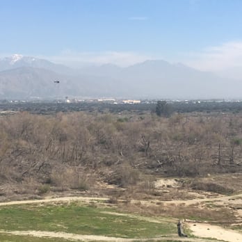
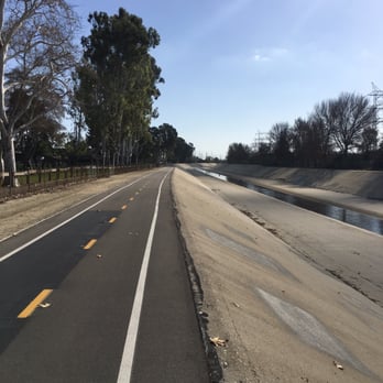


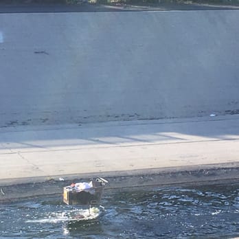


7 years ago
I took off from azuza near the mountains and followed the river all the way down to santa fe dam in irwindale it was really hot and i didnt prepare for it so i got sunburnt from yesterdays ride and todays i did bring plenty of water but both my friends were dying and stopped to rest like 100 times. i definitely need a new parter that will keep up with me. Hopefully ill replace this PAN. soon LOL. read more
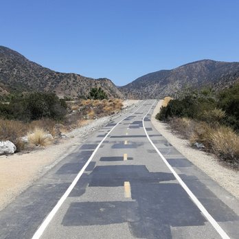
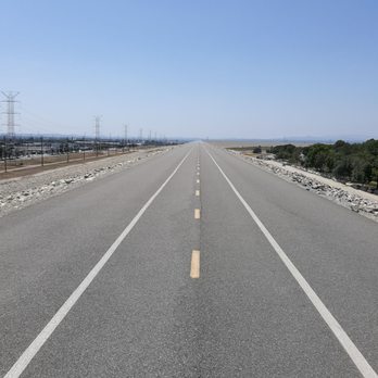
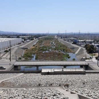
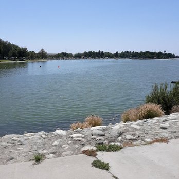



5 years ago
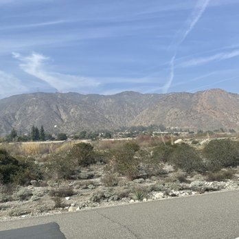
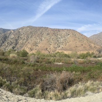
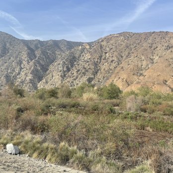
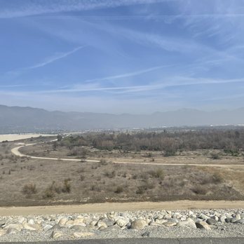
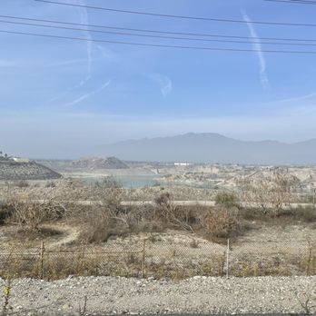
I took this bike path from the entrance in Lakewood past Artesia High school and took the trek on my Gravel bike all the way to the end of the trail, It was a very new and fun experience for me. Make sure you got a high quality reliable and fast bike, preferably a gravel, or road bike, and come prepared, bring a bike multi tool two spare tubes, an other multi tool with pliers like a Gerber, a pump, water or Gatorade, snacks, bike lights, power bank, and a First aid kit, I haven't experienced any problem with homeless people, but in case bring something like pepper spray, and a pocket knife. Put some tire sealant in your tires, check your tire pressure before going the trip I was in Whittier past Washington blvd nearly two hours bike ride from my home, and one of my tires was low, and it was getting dark which is extremely sketchy to be riding this trail at night, especially at the mountain area with barely any lighting I I pumped my tire replaced the tube and that slowed me down an hour, but if I didn't brought tools with me I would of been stranded, except for like 4 nice people who offered help. Other than that the view is very nice, just follow the signs and you'll be fine I'll show the pictures I took of the view I saw when there read more






6 years ago


15 years ago

i saw horses. i saw ostriches. i saw bulls. i saw cows. i saw one zebra. the river was flowing. it was a gorgeous day. the trail was smooth. up until maybe, three miles south of ramona. cracks running perpendicular to the trail. nothing major, but if you're on a roadie, it gets old quick. they were a bit bigger than last time. besides that, there's always something to distract you while you're on your quest for health. which is a good thing, i think. spicy. read more


7 years ago

12 years ago

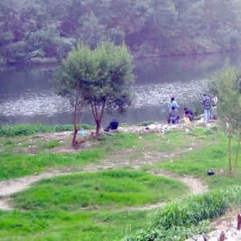
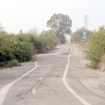
Lordy, is this long overdue, or what? I did an extensive review of this trail , with photos, on my old bike blog, in 2007,& this review takes from that, sharing some photos. The reason for yelping about a 9 year old bike ride is to encourage more cyclists to ride this 40.85 mi. trail that begins at, its northern end, at the base of the San Gabriel Mtns, in Azusa, near San Gabriel Canyon Rd. & runs south to the beach in Long Beach. At the point where Highway 39 (San Gabriel Canyon Rd.) hangs a right, near the Ranger Station, to begin its journey into the mountains, there is a parking lot on the north side of the road near a new entrance to the bike trail. You will be surrounded by Mother Nature in all her glory along many stretches of the trail Look around as you ride. Stop, get off your bike, & explore your surroundings a little, especially in the natural areas. Take pictures. Man encased these mighty rivers in concrete, not just to try to tame their violent flooding tendencies, but because he was putting down roots in suburbs further & further from the coast. Did he win the battle completely? That is a question you will have to decide for yourself as you explore. Follow the signs, when encountered, & you can't get lost. You will pass a ticket booth as the trail takes you above & around the Santa Fe Dam Recreation Area, in Irwindale. This is a huge property with boating & fishing opportunities, as well as the access to the various hiking, horseback & cycling trails. On a clear day you can see the majesty of the San Gabriels to the north. The landscape will change with less vegetation in the river. as you head into El Monte, You will find a Horse Trail is running next to the path for a while Soon the vegetation in the river took on a new & crowded appearance. Lush trees & shrubs are everywhere. When it's not raining walkers & horseback riders can be seen in these areas of the river Some of those who live next to the river could care less that travelers occasionally stop to ogle them. Barnyards & stables in the suburbs? Amazing. Horse stables are a major feature to be seen along most of the trail. I no sooner pass the row of barnyards than I discover the reason for all the greenery. Where San Jose Creek comes out of the east & meets the river I can see the natural glory of the areas past at the Thienes Ave. entrance to the trail. The fishing is good along here. Around 18 miles I enter, briefly, the trail system around Legg Lake, at Whittier Narrows, at the border with Pico Rivera. The trail soon heads above, down, around & past a corner of the Pico Rivera Golf Course. Soon I have a flowing river on my right & a railroad track on my left. In the next few miles the river runs dry again, only supporting trees on the side of the river closest to the trail. Finally, at 23 miles, Mother Nature appears to pretty much give up the ghost, saying "I surrender!" & the railroad is replaced by a freeway. But, has Mother Nature truly given up the fight? Is there nothing left for her but to surrender to the whims of Man? Passing under Telegraph Rd. I come to Santa Fe Springs Park where I can leave the trail & find a bathroom! I know that the trail is heading back into civilization not just because of the lack of nature, but because of the graffiti, covered, & uncovered, that is beginning to appear beneath my wheels. Mother Nature still has a little fight in her as a few Squirrels cross the trail heading into the river & a few trees return. I even pass Wilderness Park, in Downey, & a pond with Ducks & Geese. Yes, the signs of Suburbia are all around me. I can see it. I can smell it. I can hear it. After nearly 26 mi. Man claims the river, seemingly for good... Around 30 mi. I notice a long forgotten piece of history. For a short distance the Trail actually ran in the river channel for some reason. If you ride from the beach this novelty (Guilty pleasure?) can be experienced, (During the "Dry Season"!) just beyond the 10 mi. point. \ I pass 2 huge stretches of parkland, along Studebaker Rd. in Cerritos & Lakewood, that have walking & horse trails, & are also bike accessable from the river trail. At 37 mi. the river meets Coyote Creek. Coyote Creek bike trail heads up river for miles into Whittier. As I find myself riding on the edges of two counties, with Long Beach/LA County briefly interrupted by a stretch of Seal Beach/Orange County, & the river begins the last leg of its journey to the ocean... Mother Nature reminds me that Man doesn't always completely take over her space. The water & the animal kingdom return in full force, concrete be damned! The water level picks up as I head into the last 2 1/2 mi.. I pass marinas on the west side of the river. The trail officially ends at Marina Dr., in Long Beach, with the island community of Naples to the west & Seal Beach to the east. You can cross the street & enter a paved trail the last short distance to the shores of the Pacific itself, at the famous River's End Cafe read more





6 years ago


10 years ago

12 years ago
This is the Rio Hondo Bike Path, the San Gabriel River Trail runs along the San Gabriel River parallel to the 605 freeway. On Google maps you can see where both trails run along. read more


11 years ago
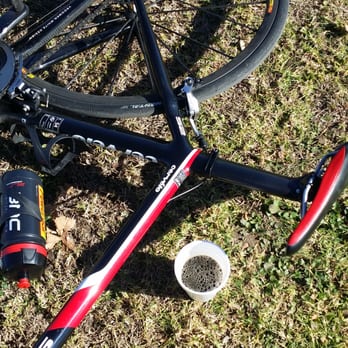
I LOOOOOOOOOOOOOOOOOOOOOOOOOVE this bike path specially when it meets up right before the dam and have some coffee with Chalan as I'm about to hit that climb to crystal lake..... read more




13 years ago
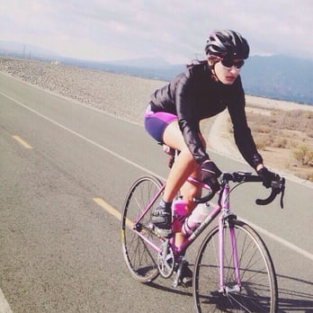
I love this bike path but as a girl, who constantly rides this alone, I wouldn't feel safe here without carrying pepper spray. I've had a few situations here and if I wasn't as fast as I am on my bike, I wouldn't be riding here alone. I've had an older man on a mountain bike, once he realized I was alone, yell and attempt to chase me down. Screaming, "get back over here! Do you hear me!" I've also stopped half way to long beach, at the park in Bell Gardens, to refill my water bottles. Two guys kept staring at me and my bike and when I was getting ready to leave, one started walking besides me and following me out. Luckily I got on my bike and took off before he had the chance to do anything. I stayed away for awhile after that incident but I always seem to come back because it's an awesome place to train and get away from the traffic lights and cars. My last complaint is the group of homeless people that live under the 10 and 60 fwy. Currently there is a huge group of men who like to hang out by the Rosemead exit. If you're a male cyclist, I doubt you'll have any problems here. If you're a female, try and always be aware of your surroundings and carry protection. Oh and I would never ride here past sunset. There was a murder a few years back on this trail and a month ago a body was found with no head. read more


15 years ago

11 years ago

13 years ago

9 years ago
12 years ago

15 years ago


14 years ago

17 years ago
My starting point is the Foothill Transit Center in El Monte, CA. A bike path entry point is on East end of the facility past the parking structure. Going south you can ride up to Arcadia about 7 miles. Go north and you can go as far as Seal Beach about 40+ miles. If you want to put a lot of miles on your bike and not worry about cars and traffic this is the place to do it. Don't forget to bring your air pump and tube patches as I wouldn't want to get stuck in this area after dark. It's amazing how much empty land exists along this path. So far I have only gotten as far down south as the city of Norwalk. The path is in good condition and I haven't seen many people riding or walking on weekends. Makes me wonder how many people even know this path exists. You could easily ride all out in some areas without worrying about running into anyone. There isn't much too see except the river beds and the homes along river. A few horse stables and couple large nurseries are along the path. read more


15 years ago

10 years ago

11 years ago

14 years ago

11 years ago
More info about San Gabriel River Bike Path
3501 Santa Anita Ave
El Monte, CA 91731
Directions
(626) 899-3753
Call Now
Hours
Outdoor Amenities
Ask the Community - San Gabriel River Bike Path
Where can I park around San Gabriel Bike path?
I like to park my car at Liberty Park in Cerritos... bathroom, water fountain, opening in fence onto bike trail
Review Highlights - San Gabriel River Bike Path
You might also consider







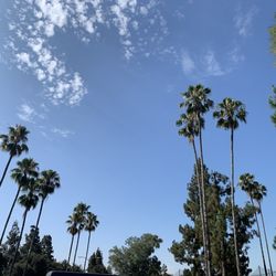
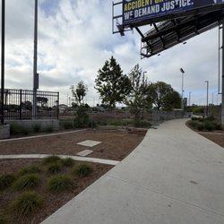
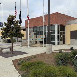

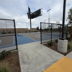










Why does Yelp recommend reviews?


San Gabriel River Bike Path - parks - Updated September 2026
Best of El Monte
People found San Gabriel River Bike Path by searching for…
Trending Searches in El Monte, CA
Apple Orchards near San Gabriel River Bike Path
Apple Picking near San Gabriel River Bike Path
Archery near San Gabriel River Bike Path
Barbershop near San Gabriel River Bike Path
Baseball Fields near San Gabriel River Bike Path
Beautiful Views near San Gabriel River Bike Path
Blow Dry Bar near San Gabriel River Bike Path
Corn Maze near San Gabriel River Bike Path
Dog Friendly Things To Do near San Gabriel River Bike Path
Dog Parks near San Gabriel River Bike Path
Eyelash Extensions near San Gabriel River Bike Path
Haunted Houses near San Gabriel River Bike Path
Hiking near San Gabriel River Bike Path
Kids Birthday Party near San Gabriel River Bike Path
Makeup Artists near San Gabriel River Bike Path
Photo Spots near San Gabriel River Bike Path
Picnic Areas near San Gabriel River Bike Path
Places To Take Pictures near San Gabriel River Bike Path
Playgrounds near San Gabriel River Bike Path
Private Schools near San Gabriel River Bike Path
Public Running Track near San Gabriel River Bike Path
Public Shower near San Gabriel River Bike Path
Public Tennis Courts near San Gabriel River Bike Path
Pumpkin Patches near San Gabriel River Bike Path
Scenic Night View near San Gabriel River Bike Path
Scenic Overlook near San Gabriel River Bike Path
Browse Articles
Browse Nearby
BEST of El Monte, California Coffee near San Gabriel River Bike Path
BEST of El Monte, California Restaurants near San Gabriel River Bike Path
BEST of El Monte, California Things to Do near San Gabriel River Bike Path
BEST of El Monte, California Breakfast near San Gabriel River Bike Path
BEST of El Monte, California Playgrounds near San Gabriel River Bike Path
BEST of El Monte, California Picnic Areas near San Gabriel River Bike Path
BEST of El Monte, California Campgrounds near San Gabriel River Bike Path
BEST of El Monte, California Sightseeing near San Gabriel River Bike Path
BEST of El Monte, California Restroom near San Gabriel River Bike Path
Browse Brands
Related Searches in El Monte, CA
Best Nature Trails for Hiking in El Monte, California
Best Off Leash Dog Parks in El Monte, California
Best Parks for Parties and Events in El Monte, California
Best Water Parks for Kids in El Monte, California
Check Out Great Playgrounds in El Monte, California
Discover Baseball Fields Around El Monte, California
Discover Fun Toddler Parks in El Monte, California for Your Little One
Discover Lakes & Ponds to Explore in El Monte, California
Discover Popular Bike Trails in El Monte, California
Discover Soccer Fields in El Monte, California Near You
Discover Top Nature Parks to Visit in El Monte, California
Discover Top State Parks to Visit in El Monte, California
Discover Walking Parks in El Monte, California Near You
Discover the Best Kids Park Spots in El Monte, California
Enjoy Scenic Places to Walk in El Monte, California
Enjoy the Best Picnic Spots and Ideas in El Monte, California
Enjoy the Best Walking Trails in El Monte, California
Explore Easy Hikes Perfect for All in El Monte, California
Explore Free Picnic Areas Around El Monte, California
Explore Fun Activities to Do in El Monte, California
Explore Parks With Pull Up Bars in El Monte, California
Explore Picnic Parks Near El Monte, California
Explore Popular Campgrounds Near El Monte, California
Explore Popular Kids Parks Throughout El Monte, California
Explore Popular Picnic Areas Around El Monte, California
Explore Popular RV Parks Around El Monte, California
Explore Scenic Lakes to Visit in El Monte, California
Explore Top Dog Parks in El Monte, California Near You
Explore Top Water Parks in El Monte, California Today
Find Great Places to Feed Ducks in El Monte, California
Find Parks and Recreation Activities in El Monte, California
Find Top Dog Friendly Parks to Visit in El Monte, California
Find Top Skate Parks in El Monte, California for All Skill Levels
Find a Kids Birthday Party Park in El Monte, California
Find a Park With BBQ Pits in El Monte, California
Find the Best Parks BBQ Grills in El Monte, California
Find the Best Parks for Picnics in El Monte, California
Find the Best Playgrounds to Visit in El Monte, California
Have Fun at a Splash Pad in El Monte, California
Locate Tennis Courts Around El Monte, California
Picnic Areas With BBQ Pits Available in El Monte, California
Play at a Splash Pad Park in El Monte, California
Popular Picnic Spots to Visit in El Monte, California
Relax in Parks With Shade Areas in El Monte, California
Safe and Fun Parks for Kids in El Monte, California
Top Hiking Trails to Explore in El Monte, California
Top Playgrounds for Kids to Enjoy in El Monte, California
Top Running Trails to Explore in El Monte, California


