Satwiwa Trail Photos


You might also consider
More like Satwiwa Trail
Recommended Reviews - Satwiwa Trail
Start your review...

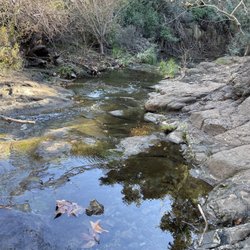
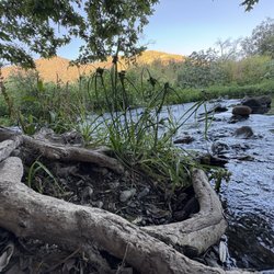
The first plus about this place is that they have a restroom. They are clean which is nice. We took an impromptu hike and it was honestly so beautiful. At first it felt like a lot because I didn't know what to expect. They have a couple of different trails you can take and we took the easier one. It's still kicked my butt but it was definitely worth it. Now that I know what to expect I'd definitely come back on the regular. A lot of poison oak along the trails. So be aware of what plants you're touching. Some trails you go through some flower areas and there are a lot of bees but honestly they don't bother you. Make sure to take plenty of water. It's a beautiful view. read more


5 months ago
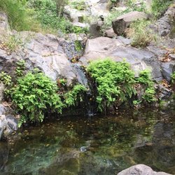
It was such a beautiful hike! So easy to get lost in all the greenery. Everyone on the trail was so friendly as well! I can't wait to return ^_^ read more

7 years ago
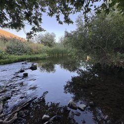
This is a pretty cool place the Satwiwa Native American Indian Natural Area is a nice little trail with a cool view there is parking at the beginning of the hike and there are bathrooms halfway on to the route there do seem to be a lot of snakes and bugs in the summer time so you definitely want to be careful there when you go but otherwise it's a cool place to check out read more


More info about Satwiwa Trail
You might also consider


Satwiwa Trail - hiking - Updated July 2026
Best of Newbury Park
People found Satwiwa Trail by searching for…
Beautiful Views in Newbury Park, California
Hiking Trails in Newbury Park, California
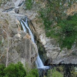
Waterfall Hike in Newbury Park, California
Sunset View in Newbury Park, California
Secret Spots in Newbury Park, California
Lakes & Ponds in Newbury Park, California
Sand Dunes in Newbury Park, California
Off Road Trails in Newbury Park, California
Free Things to Do in Newbury Park, California
Running Trails in Newbury Park, California
Beach Fire Pits in Newbury Park, California
Scenic View in Newbury Park, California
Nature in Newbury Park, California
Rock Quarry in Newbury Park, California
Scenic Overlook in Newbury Park, California
Walking Trails in Newbury Park, California
Hiking Groups in Newbury Park, California
Redwood Trees in Newbury Park, California
Caves in Newbury Park, California
Free Campgrounds in Newbury Park, California
Trail in Newbury Park, California
Stairs Workout in Newbury Park, California
Browse Nearby
BEST of Newbury Park, California Things to Do near Satwiwa Trail
BEST of Newbury Park, California Coffee near Satwiwa Trail
BEST of Newbury Park, California Restaurants near Satwiwa Trail
BEST of Newbury Park, California Parks near Satwiwa Trail
BEST of Newbury Park, California Breakfast near Satwiwa Trail
Browse Brands
Browse Articles
People who viewed Satwiwa Trail also viewed
Satwiwa to Tri Peaks
14 reviews
Lizard Rock via Canyon Overlook Trail
11 reviews
Boney Mountain Overlook
23 reviews
Two Trees
15 reviews
Camarillo Grove Park
23 reviews
Ventura River Preserve
14 reviews
Ventura to Ojai Paved Bike Path
12 reviews
Nordhoff Ridge Road
4 reviews
Central Park
3 reviews
La Jolla Valley Natural Preserve
2 reviews