Shi Shi Beach Photos


You might also consider

More like Shi Shi Beach
Recommended Reviews - Shi Shi Beach
Start your review...


Reviews With Photos


After my other shoes floated away by the rising tide, I had to walk the trail to and from Shi Shi Beach in my water shoes. It turned out to be a blessing in disguise because that trail was an absolute muddy mess. While there are some constructed walkways, the vast majority of the trail is dirt and/or mud. The mess was well worth the beautiful beach though. I loved the tide pools and views of the pacific. Just dress for mud


A must do hike. It's muddy so wear good shoes. It's about a 9 mile round trip hike. Bring lots of water, food and sunscreen. We had a picnic at the end of the beach and explored the tide pools and cave.


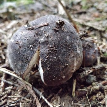
Even when the sky is grey and the weather isn't too warm, Shi Shi Beach was definitely worth the 4hr drive from Seattle. If you're looking for a family friendly hike or something causal to do, I recommend coming here. To get to the actual beach, you will have to go on an adventure (aka Shi Shi Beach Trail). The hike itself isn't too strenuous from the beginning to middle. Towards the end of the trail, when you begin the descent down to the beach, the trail does get super steep. Afterwards, the trail flattens out and you'll hit the beach soon after. Hiking boots aren't required but I highly suggest wearing them for ankle support. Parts of the trail was super muddy and having boots on helped. Also, keep in mind that you'll be walking on wooden planks along the way, so do be careful since some of the wooden pieces are loose / unsteady. Things to take sight of: -On the trail, look at the plants! Tons of interesting mushrooms. -On the beach, if you hike at least 1-2miles to the far end of the beach, you should see some pretty cool haystacks + tidepools. Make sure to check the tide report since the water level can rise pretty quickly. As for restrooms, there's not a lot of private areas.....So make sure to keep an eye out since there are quite a few campers and such. Overall, definitely enjoyed my time here. :) Can't wait to revisit when it's sunny with blue skies!


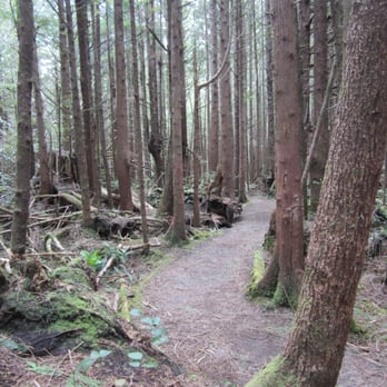
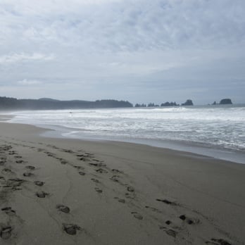
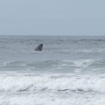
My wife and I enjoyed this gorgeous hike. A National Forest Pass or America the Beautiful Pass is required for this hike. The parking lot holds about 10-15 cars (day use only). If you plan to stay overnight, there are two private parking lots along the way that can be parked at for $10 (cash only). At the trail-head, there are two large outhouses to use before and after your hike. This hike showcases several cool bridges and boardwalks. Some parts of the trail are muddy but can be navigated around for the most part. Navigation made for a fun game for us. It's still a good idea to bring some plastic bags to place muddy shoes in when completed. There is a steep descent that needs to be completed in order to actually get to the beach. There are several ropes tied to trees to assist those that need it. If you don't work for it, you don't deserve it. The reward, is long stretches of clean sandy beach. The sound of crashing waves. Sightings of a variety of birds. And in our case, we were also lucky enough to witness a pod of Hunchback Whales frolicking in the sea. Reminder, if you pack it in, pack it out. Respect Mother Nature in her glorious beauty.


NPS's Shi Shi beach is unforgettable, amazing, and breathtaking. The NPS land has well maintained trails with basic campsite amenities (privy at each site) and amazing views. The beach is amazing and Point of the Arches is out of control breathtaking. The Makah Reservation owns the land for the roughly 2 mile hike to get to NPS Shi Shi areas. Their trail is a miserable slosh of mud that is horrifically maintained and is gutted out by ATV tracks. We get that this is a rainy place, but we have been hiking for 1 week on NPS land without anything even remotely close to this messy, and there was no recent rain. What makes it even more pathetic is that you have to buy a $10 permit to hike the trail and then they have the audacity to charge $10 per day for overnight parking. Total racquet!!! All that being said, NPS Shi Shi is a 100% must see. Just hike up the coast from Ozette or further North to avoid the Makah racquets and fees, and their pathetically maintained trails.
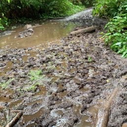

Mudddy- overgrown. Bugs. It's a long walk to a nice beach but the mud is constant. An easy hike if you don't mind getting dirty. Buy a $10 parking pass


DISTANCES: The hike TO Shi Shi Beach is about 2 miles through beautiful dense forest. Part of the walk is regular forest floor and small areas have well-built quality boardwalks that take you over small streams or gullies. The hike ON Shi Shi Beach is about 2 more miles to the Point of the Arches. We added about a mile onto our hike because we chose to pay a $10 fee and park on the property of a nearby resident (about 1/2 mile away) who provided space for those not wanting to park at the trailhead. Reports of vehicle vandalism kept us from wanting to chance having our car windows broken. TIDES: One needs to check on the tide tables to be able cross the streams that run from the forest to the ocean. Otherwise you may get stuck on the wrong side of the stream at high tide. The day we went in early September, I think high tide was at about noon. We started our hike around 11am, and though we had no problems, we probably could have benefited from starting later to experience the lowest of low tides (around 530pm). SHOES & MUDDY TRAIL: Based on what we'd read, we had a hard time deciding what kind of shoes to wear because we'd heard that part of the trail is very muddy. Verdict: it is. Though the day we went was forecast to be rainy, we went anyway and it was sunny and beautiful. But a large portion of the approximate 2-mile trail--maybe about the last 1/4-mile--was very muddy. However, for much of it, if you look closely, there is a trail directly off to the side that is a bit higher and perfectly useable and keeps you out of the mud. I wore Keen waterproof sandals (no socks) and my husband wore regular hiking boots. Both worked fine. The benefit to mine was that they were easily removable for walking barefoot on the beach and crossing the little streams mentioned above. Also, I accidentally in deep mud once and those shoes washed off easily. FINAL DESCENT TO BEACH: The final part of the trail, after the mud, is fairly steep. You just have to watch your step. Someone(s) has tied sturdy long ropes around tree trunks that are great to hang onto and work your way, hand over hand, down the trail using the ropes as a sort of handrail. It works great going down and coming up again. Shi Shi is a beautiful beach. Sadly, it is somewhat marred by debris from the Japanese tsunami, so there is quite a bit of junk washed up mostly at the top of the shoreline--rope, fishing line/hooks, boat bumpers, huge styrofoam chunks. But it is still stunning. Because of the effort it takes to get to it, it isn't crowded, though we did go on an off-day (school back in session; not on a weekend). There were a couple of tents pitched with overnight campers; a few backpackers; and a few people like us just there for the day.
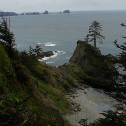

After reading hike reviews on other sites, I thought that this would be a lot cooler considering the 7 hours in the car that day. I was a bit boned that the tides were wrong when I arrived. Try not to make the same mistake that I did and refer to a tidal reference. Like this one, perhaps: http://www.mobilegeographics.com:81/locations/4085.html I thought that it was a bit strangely maintained. No ranger or crew had been through in a while. There was some maniac putting up a large monument to a friend or something consisting of parts of a boat, a huge cross, some sailing lines and a main sheet all on a large cross. Freaky. The trails are also very muddy in parts, so you had better dress for it. When we were leaving, the Neah Bay cops were entering the trail with someone else and looked pissed. Sketchy business. Seems like there are lots of desperate people out here and quite a bit of broken auto glass where people park their cars to enter the park. I suggest planing accordingly.

No ranger or crew present. Odd parking lot. Windy, long drive. Sketchy town (Neah Bay) BUT, SO WORTH IT. Prepare to ruin any shoes you are wearing in mud! A walking stick or two may be a good addition if you want to get through the trail quicker but my boyfriend and I enjoyed trudging through or making ways around it! There are a lot of overnight campers (and these campers should really pick up their bottles/cans upon departure!) Anyhow, have a good camera handy, water, snacks, a sweater, and be ready to get dirty! :)


A must visit beach if you are exploring the Olympic NP! Although it's associated with the park, the beach is on reservation land, so an additional $20 entrance fee is required. The hike to the beach is about 2 miles, very muddy, but it truly feels like you are walking through a rainforest. It's also the best trail to spot banana slugs! The beach itself is incredible, especially during low tide with amazing tide pools. It's much less crowded than other beaches in the area, giving you plenty of space to explore. You can walk along the shoreline for miles. Overnight camping on the beach is also allowed! read more

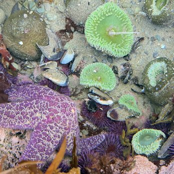

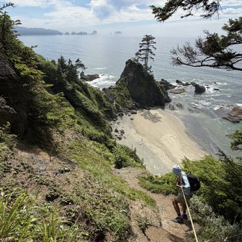

Came here after hobuck beach, which is like an 8 minute drive away. Much prettier with the sunset just over the water body. Couple of parking spots to the side. No hiking trails around here. But, still so pretty when I first entered. No one else on the beach, so I was just running around and splashing on the water. Got to easily see the thunderstorm and lightning with my own eyes over the tall and green trees. I was not scared, but more so in awe at how cool the sight looked. Sand here much nicer than the one at hobuck beach, too Trailhead had a cute, wooden boardwalk at the start that were in the shade of the tall and skinny treescovered in moss. It was so nice to breathe the air here and there is so much side street parking no matter what time you come. I came during prime hours that were later in the day, but not too late...still was able to park! Just watch your step for the muddy parts and the change in elevation with the boardwalk steps read more


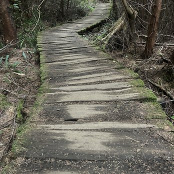

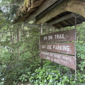


Firstly, you need to pay $20 to get on reservation land. It's almost like a mafia style shakedown and extortion event; no service was really provided and despite being inside a national park, you need to pay for more entrance fees; this is lame to start with. The 2 mile hike is extremely muddy and fairly annoying to go back and forth through. The interior of the rainforest is extremely moist with plenty of slugs. The beach however is fantastic and the tide pooling is 5/5 and the best available in the area. Plenty of beachside camping is happening and it was a very wild hike. read more


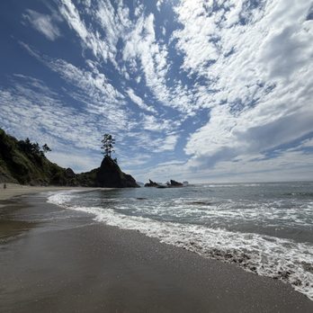


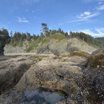



1 year ago
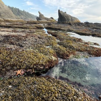
After my other shoes floated away by the rising tide, I had to walk the trail to and from Shi Shi Beach in my water shoes. It turned out to be a blessing in disguise because that trail was an absolute muddy mess. While there are some constructed walkways, the vast majority of the trail is dirt and/or mud. The mess was well worth the beautiful beach though. I loved the tide pools and views of the pacific. Just dress for mud read more


1 year ago
A must do hike. It's muddy so wear good shoes. It's about a 9 mile round trip hike. Bring lots of water, food and sunscreen. We had a picnic at the end of the beach and explored the tide pools and cave. read more


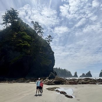

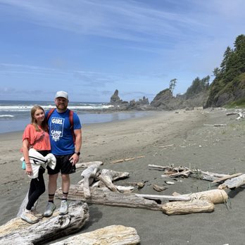


Even when the sky is grey and the weather isn't too warm, Shi Shi Beach was definitely worth the 4hr drive from Seattle. If you're looking for a family friendly hike or something causal to do, I recommend coming here. To get to the actual beach, you will have to go on an adventure (aka Shi Shi Beach Trail). The hike itself isn't too strenuous from the beginning to middle. Towards the end of the trail, when you begin the descent down to the beach, the trail does get super steep. Afterwards, the trail flattens out and you'll hit the beach soon after. Hiking boots aren't required but I highly suggest wearing them for ankle support. Parts of the trail was super muddy and having boots on helped. Also, keep in mind that you'll be walking on wooden planks along the way, so do be careful since some of the wooden pieces are loose / unsteady. Things to take sight of: -On the trail, look at the plants! Tons of interesting mushrooms. -On the beach, if you hike at least 1-2miles to the far end of the beach, you should see some pretty cool haystacks + tidepools. Make sure to check the tide report since the water level can rise pretty quickly. As for restrooms, there's not a lot of private areas.....So make sure to keep an eye out since there are quite a few campers and such. Overall, definitely enjoyed my time here. :) Can't wait to revisit when it's sunny with blue skies! read more




My wife and I enjoyed this gorgeous hike. A National Forest Pass or America the Beautiful Pass is required for this hike. The parking lot holds about 10-15 cars (day use only). If you plan to stay overnight, there are two private parking lots along the way that can be parked at for $10 (cash only). At the trail-head, there are two large outhouses to use before and after your hike. This hike showcases several cool bridges and boardwalks. Some parts of the trail are muddy but can be navigated around for the most part. Navigation made for a fun game for us. It's still a good idea to bring some plastic bags to place muddy shoes in when completed. There is a steep descent that needs to be completed in order to actually get to the beach. There are several ropes tied to trees to assist those that need it. If you don't work for it, you don't deserve it. The reward, is long stretches of clean sandy beach. The sound of crashing waves. Sightings of a variety of birds. And in our case, we were also lucky enough to witness a pod of Hunchback Whales frolicking in the sea. Reminder, if you pack it in, pack it out. Respect Mother Nature in her glorious beauty. read more





8 years ago
NPS's Shi Shi beach is unforgettable, amazing, and breathtaking. The NPS land has well maintained trails with basic campsite amenities (privy at each site) and amazing views. The beach is amazing and Point of the Arches is out of control breathtaking. The Makah Reservation owns the land for the roughly 2 mile hike to get to NPS Shi Shi areas. Their trail is a miserable slosh of mud that is horrifically maintained and is gutted out by ATV tracks. We get that this is a rainy place, but we have been hiking for 1 week on NPS land without anything even remotely close to this messy, and there was no recent rain. What makes it even more pathetic is that you have to buy a $10 permit to hike the trail and then they have the audacity to charge $10 per day for overnight parking. Total racquet!!! All that being said, NPS Shi Shi is a 100% must see. Just hike up the coast from Ozette or further North to avoid the Makah racquets and fees, and their pathetically maintained trails. read more


7 years ago
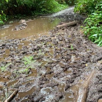
Mudddy- overgrown. Bugs. It's a long walk to a nice beach but the mud is constant. An easy hike if you don't mind getting dirty. Buy a $10 parking pass read more


13 years ago
DISTANCES: The hike TO Shi Shi Beach is about 2 miles through beautiful dense forest. Part of the walk is regular forest floor and small areas have well-built quality boardwalks that take you over small streams or gullies. The hike ON Shi Shi Beach is about 2 more miles to the Point of the Arches. We added about a mile onto our hike because we chose to pay a $10 fee and park on the property of a nearby resident (about 1/2 mile away) who provided space for those not wanting to park at the trailhead. Reports of vehicle vandalism kept us from wanting to chance having our car windows broken. TIDES: One needs to check on the tide tables to be able cross the streams that run from the forest to the ocean. Otherwise you may get stuck on the wrong side of the stream at high tide. The day we went in early September, I think high tide was at about noon. We started our hike around 11am, and though we had no problems, we probably could have benefited from starting later to experience the lowest of low tides (around 530pm). SHOES & MUDDY TRAIL: Based on what we'd read, we had a hard time deciding what kind of shoes to wear because we'd heard that part of the trail is very muddy. Verdict: it is. Though the day we went was forecast to be rainy, we went anyway and it was sunny and beautiful. But a large portion of the approximate 2-mile trail--maybe about the last 1/4-mile--was very muddy. However, for much of it, if you look closely, there is a trail directly off to the side that is a bit higher and perfectly useable and keeps you out of the mud. I wore Keen waterproof sandals (no socks) and my husband wore regular hiking boots. Both worked fine. The benefit to mine was that they were easily removable for walking barefoot on the beach and crossing the little streams mentioned above. Also, I accidentally in deep mud once and those shoes washed off easily. FINAL DESCENT TO BEACH: The final part of the trail, after the mud, is fairly steep. You just have to watch your step. Someone(s) has tied sturdy long ropes around tree trunks that are great to hang onto and work your way, hand over hand, down the trail using the ropes as a sort of handrail. It works great going down and coming up again. Shi Shi is a beautiful beach. Sadly, it is somewhat marred by debris from the Japanese tsunami, so there is quite a bit of junk washed up mostly at the top of the shoreline--rope, fishing line/hooks, boat bumpers, huge styrofoam chunks. But it is still stunning. Because of the effort it takes to get to it, it isn't crowded, though we did go on an off-day (school back in session; not on a weekend). There were a couple of tents pitched with overnight campers; a few backpackers; and a few people like us just there for the day. read more

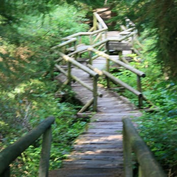


After reading hike reviews on other sites, I thought that this would be a lot cooler considering the 7 hours in the car that day. I was a bit boned that the tides were wrong when I arrived. Try not to make the same mistake that I did and refer to a tidal reference. Like this one, perhaps: http://www.mobilegeographics.com:81/locations/4085.html I thought that it was a bit strangely maintained. No ranger or crew had been through in a while. There was some maniac putting up a large monument to a friend or something consisting of parts of a boat, a huge cross, some sailing lines and a main sheet all on a large cross. Freaky. The trails are also very muddy in parts, so you had better dress for it. When we were leaving, the Neah Bay cops were entering the trail with someone else and looked pissed. Sketchy business. Seems like there are lots of desperate people out here and quite a bit of broken auto glass where people park their cars to enter the park. I suggest planing accordingly. read more
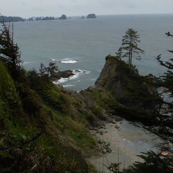

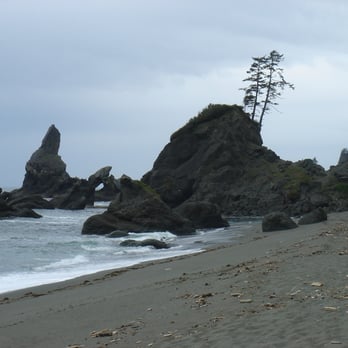
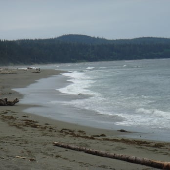


No ranger or crew present. Odd parking lot. Windy, long drive. Sketchy town (Neah Bay) BUT, SO WORTH IT. Prepare to ruin any shoes you are wearing in mud! A walking stick or two may be a good addition if you want to get through the trail quicker but my boyfriend and I enjoyed trudging through or making ways around it! There are a lot of overnight campers (and these campers should really pick up their bottles/cans upon departure!) Anyhow, have a good camera handy, water, snacks, a sweater, and be ready to get dirty! :) read more

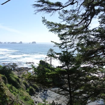


10 years ago
Fun, beautiful hike that my family took in the morning. The final destination to the beach was very steep. Be prepared for a workout. Scenic view was worth it. read more


8 years ago

9 years ago

13 years ago
More info about Shi Shi Beach
Olympic National Park
Neah Bay, WA 98357
Directions
Hours
Outdoor Amenities
Ask the Community - Shi Shi Beach
Review Highlights - Shi Shi Beach











Why does Yelp recommend reviews?
1 review that is not currently recommended
The reviews below are not factored into the business's overall star rating.

13 years ago
Shi Shi Beach - parks - Updated August 2026
Best of Neah Bay
People found Shi Shi Beach by searching for…
Trending Searches in Neah Bay, WA
Cliff Jumping near Shi Shi Beach
Fishing Spots near Shi Shi Beach
Lighthouses near Shi Shi Beach
Picnic Areas near Shi Shi Beach
Public Shower near Shi Shi Beach
Souvenir Shops near Shi Shi Beach
Star Gazing near Shi Shi Beach
Sunrise View near Shi Shi Beach
Swimming Holes near Shi Shi Beach
Browse Articles
Browse Brands
Related Searches in Neah Bay, WA
Affordable Kayak Rental Services in Neah Bay, Washington
Affordable Long Term RV Parking in Neah Bay, Washington
Best Fun Things to Do in Neah Bay, Washington
Best Parks for Parties and Events in Neah Bay, Washington
Best Water Parks for Kids in Neah Bay, Washington
Browse Top Hotels in Neah Bay, Washington for Your Stay
Browse Vacation Rentals to Book in Neah Bay, Washington
Check Out Great Playgrounds in Neah Bay, Washington
Discover Dog Friendly Beaches Near Neah Bay, Washington
Discover Dog Friendly Trails to Explore in Neah Bay, Washington
Discover Kid Friendly Beaches to Visit in Neah Bay, Washington
Discover Popular Photo Spots in Neah Bay, Washington
Discover Public Beaches to Visit in Neah Bay, Washington
Discover Scenic Beach Camping Sites in Neah Bay, Washington
Discover Top Boat Tours in Neah Bay, Washington for All Ages
Discover Top Nature Parks to Visit in Neah Bay, Washington
Discover the Best Beaches in Neah Bay, Washington
Discover the Best Fishing Lake in Neah Bay, Washington
Discover the Best Tide Pools in Neah Bay, Washington
Enjoy Arts & Entertainment in Neah Bay, Washington
Enjoy Hiking Adventures in Neah Bay, Washington
Enjoy Surfing Adventures in Neah Bay, Washington
Enjoy Tent Camping Spots Around Neah Bay, Washington
Enjoy a Dog Beach Day in Neah Bay, Washington
Enjoy the Best Picnic Spots and Ideas in Neah Bay, Washington
Experience Stunning Sunset Views in Neah Bay, Washington
Explore Beautiful Botanical Gardens in Neah Bay, Washington
Explore Beautiful Parks and Green Spaces in Neah Bay, Washington
Explore Easy Hikes Perfect for All in Neah Bay, Washington
Explore Free Picnic Areas Around Neah Bay, Washington
Explore Fun Activities to Do in Neah Bay, Washington
Explore Picnic Parks Near Neah Bay, Washington
Explore Popular Campgrounds Near Neah Bay, Washington
Explore Popular Picnic Areas Around Neah Bay, Washington
Explore Popular RV Parks Around Neah Bay, Washington
Explore Popular View Points Around Neah Bay, Washington
Explore Scenic Lakes to Visit in Neah Bay, Washington
Explore Top Dog Parks in Neah Bay, Washington Near You
Explore Top Gyms in Neah Bay, Washington Now
Explore Top Marinas Near Neah Bay, Washington
Explore Venues & Event Spaces in Neah Bay, Washington
Explore the Best Swimming Holes Around Neah Bay, Washington
Find Beautiful Views in Neah Bay, Washington
Find Top Skating Rinks in Neah Bay, Washington for All Ages
Find Top-Rated Waterfalls in Neah Bay, Washington Now
Find the Best Parks for Picnics in Neah Bay, Washington
Find the Best Playgrounds to Visit in Neah Bay, Washington
Find the Best Swimming Pools in Neah Bay, Washington Today


