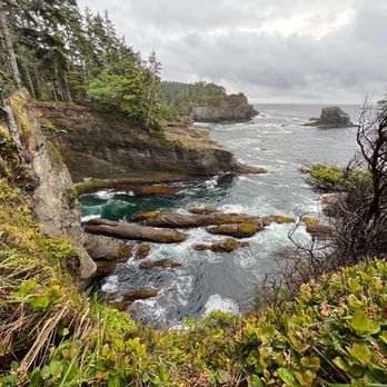
Cape Flattery Photos


More like Cape Flattery
Recommended Reviews - Cape Flattery
Start your review...


Reviews With Photos
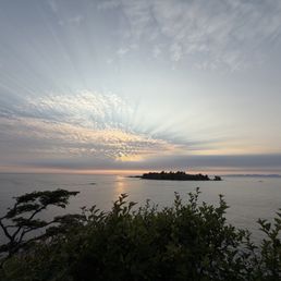

Majestic and quite epic. Short hike after you pay your tolls to the Indian Reservation to get here. The views are great!


This is SO worth your time if you want to see incredible views of the Washington Coastline. It's a pretty easy hike with walkways, bridges, and foot paths. (Do stay on the main paths or you could risk falling in some areas) There's no charge. Just a winding drive up the mountain to get to the cape. Absolutely beautiful


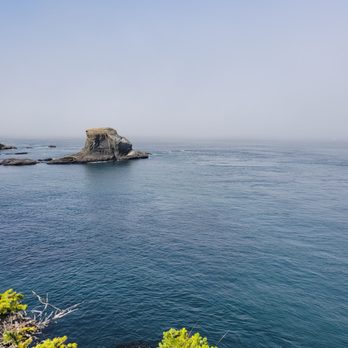
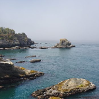
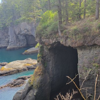
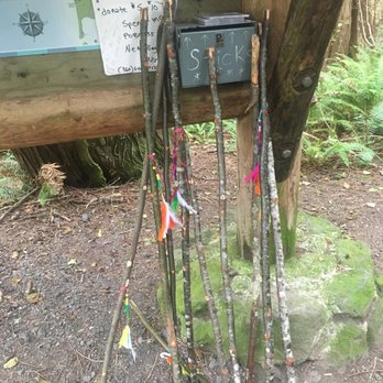
Such a beautiful location! We visited on a day trip. I recommend staying a few days to enjoy the area. The area has the typical park style (outhouse) restrooms and garage bins just outside the restroom. The trail path was clean, muddy and recommend hiking shoes. Please keep on path as stated. Several slippery spots. The path has areas with wooden walkways, some with exposed roots and observation view points to keep you safe. Dogs were on trail and area clean. Parking could be scarce but we went on a weekday and was not busy. Cute large chair for photo (added in pictures) and walking sticks were on left side of trail from the chair. At the end of this trail: Right takes you to the beautiful rock formations and small cave image. Left takes takes you to several views of Caves and beyond that takes you to viewpoint of Tatoosh Island. I would not consider this an easy hike due to exposed roots and elevation. Would depend on your experience. Also extra cautious with little one due to end of trail has direct drop down. You will need to stop at the visitors center for a $20 pass. This covers this location and Shi-Shi Beach (no dogs allowed so we didn't go). You can purchase the pass at other locations but the center was super cute. Staff were so helpful and we plan on coming back.
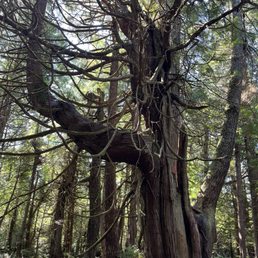

This is the farthest point west on the Mainland. A lighthouse. Offshore from the lookout point. We have been to the East coast point as well so a nice touch to do both. Not every day can you see the lighthouse off the point. FOG. We didn't, THIS TIME. But waiting, we saw sea otter, sea lion , and Porpoise. It was a great wait. See the pics. Easy 30 minute walk to the point. Mostly covered by trees. So, Shady....


We have been wanting to visit Cape Flattery for a while now, and finally made it on this visit to the Olympic National Park. It's a short relatively easy hike to get to the north western point of continuous United States. The hike has some boardwalks, a few lookout points and some incline on the way back. The views from the various lookout points were stunning, we got lucky the rain held off until we finished our hike and got back.


It's not often I find myself at an iconic spot on the map of our nation. I believe the last time I had this honor was when I stood in line for an hour at the legendary "Southernmost Point" in Key West several years ago. But this summer, we made the long, windy drive out to Neah Bay to conquer another geographical landmark: Cape Flattery. For the uninitiated, Cape Flattery is that big point that pretty much defines the northwest coast of Washington. In fact, it is the actual northwesternmost point in the continental US. Can you get farther west? Yes, but you have to go south. Can you get farther north? Yes, but you have to go east. (At least, I think that's how it works.) The hike to the epic and oft-photographed overlook isn't super strenuous, but it's not a flat/easy hike either. It also has a lot of narrow boardwalks as well as twists and turns. We saw several people who had to abandon their children's strollers along the way; and I would NOT recommend this for anyone with major mobility issues unless you are a seasoned hiker. One you arrive at the end, though, all trail annoyances magically disappear as the epic views await. You are, indeed, at a legendary spot. With views out over the Straight of Juan de Fuca, this is a great place to spot everything from birds to cruise ships. There's also a beautiful lighthouse across the way at Tatoosh Island, so bring your binocs. We spotted a lot of bald eagles on the island, too! We were here on a weekend, so it was pretty crowded. And there are no restrooms or services along the trail, so plan accordingly. Whatever you do, don't forget to stop in Neah Bay and pic up your required Recreation Permit, which is $30 and lasts for the entire year.


Cape Flattery is absolutely beautiful - we came here to visit the most northwestern portion of the contiguous US, and it was worth the drive. The little hike they set up through the forest is gorgeous and relatively easy - a couple areas of a bit of incline, but we saw everyone out there doing this hike. A decent portion of this hike is boardwalk-style with "pull-outs" to stop and soak in the view. Stop at them all! Enjoy the beauty from multiple viewpoints - you'll even be able to get a view of Cape Flattery Lighthouse. It's about 1.5 miles round trip, but we spent about an hour here just enjoying it all. Cape Flattery is part of the Makah Reservation, and they require a Makah Recreation Pass to visit. Pass is $20, and someone was selling them on the road there. Make sure you have one because they can give you a ticket for being there without one. The passes are good for the calendar year. Parking area can get congested (and we weren't there during peak season). So be patient, and take a spot if you find it. The bathrooms were disgusting, so I'd recommend stopping beforehand and avoiding them if possible. No sign at the end of the hike signaling the most northwestern portion. So if you want a picture, grab one with the sign at the trailhead. When you're finished, grab some food over in Neah Bay. We had a delicious meal at Calvin's Crab House with a beautiful view of the water. Overall, worth the drive and a nice way to spend the day.


Cape Flattery is a must-do experience if you're visiting the Olympic Peninsula. Accessed by an easy, short hike, the views from the cape lookout are outstanding. You may even catch some whales as the enter of leave the strait. Much of the trail is improved with wood boardwalks that make it easier and protect the forest from over-hiking. Highly recommended.


Drove 30+ hours to experience this place and man is it really life changing! This is the Northwesternmost point in the United States. You have to visit the visitor center and pay 20 dollars for a permit before you visit here so don't forget. When you are there too there a nice clean bathrooms and a cool museum you can look through. Then from there it's a bit more driving till you are up in the cliffs then a decent hike. There is a bit of an incline at some points so I would recommend a walking stick. But other than that it's pretty easy and boy does it pay off once you reach the first look out. If you are ever given the chance to visit. DO NOT miss out on it!


We just visited this place over Labor Day weekend and it is absolutely stunning view! Easy hike, elderly can do the hike even the dogs love it too! I highly recommend this and will do it again.
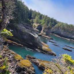

I haven't been to this corner of Washington state ever until this year and don't go to the peninsula as much as I should on top of that. I guess it kind of makes sense as the road is windy and lengthy as well as the trip in general. But not only that for years we had a huge bucket list of places to go but this year it it was Cape Flattery's turn! Cape Flattery is the most Northwestern point to the continental United States and it certainly is a beautiful point that is worth taking in. It's on the Macah Reservation so you will need to buy a recreation permit in order to park your car to get to this point and any other leisure activities around Neah Bay. Definitely come very early as the parking area gets full and there may be a wait if the parking is full so you can avoid all that but coming here in the morning, 7 am, 8 am is a good start because of you wait until 10 or 11 am you will encounter possible parking issues. The path down to the Cape is beautiful and fairly manageable as it's not too terribly steep in either direction. There are a couple of scenic points and there you can admire the view of the water, the cliffs with caves and islands. Our timing here was perfect as we saw otters frolicking and jumping into the water and we saw gray whales in the distance. You can see mountains of Vancouver Island also in the distance. The scenery is so beautiful and breathtaking that I highly recommend making the trip here and enjoying this wonderful piece of nature!


Easy hike down to the cliffs. Definitely worth the $20 permit. 2 bathrooms in the parking lot at the start of the hike. Not the cleanest restrooms but I've seen worse


An amazing place to view whales. A very small parking lot and a gross bathroom, make sure to bring hand sanitizer if you're going to use the facilities before walking to the point. The walk is downhill and has plenty of signs advising to stay on the trail. The way back is uphill. You find yourself navigating roots and a wooden walkway at times. The end result is absolutely one of the most beautiful views I have ever seen. A beautiful area. Two whales were just swimming around in front of the viewpoint. Stunning! Several platforms for views are around. No guard rails and it is very high up, be careful! The beauty will astound your senses. The current from the Salish sea connected to the Pacific Ocean can be seen clearly and it's just gorgeous. Add whales to the mix and you will not be disappointed! Happy travels and SYOY!


1 month ago
We were excited for this hike!! And we were also prepared for the weather...summer in July is wonderful but when we visited, it was early 60 degree weather with clouds and rain :/ So experiencing the northwestern tip of the U.S. -- that is pretty special! And our first rainy drenched hike, also an experience to never forget! Not a bad hike; 1.5 miles round trip. We started at 12:30pm and finished around 1:30pm so about an hour. Many tourists for this rainy weekend so be prepared to pass by a lot of ppl, it's a very popular hike!! The views are spectacular, even in the rain! Beautiful in site. read more
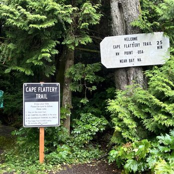
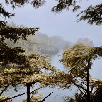

1 month ago
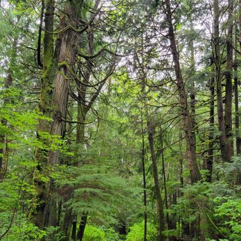
Cape Flattery is one of the most breathtaking places we've ever visited. From the moment we stepped onto the trail, we knew this stop was going to be special. The hike is relatively short and well maintained, winding through a beautiful coastal forest filled with towering evergreens, ferns, and wooden boardwalks. It's an easy walk for most people and builds excitement with every step. The reward at the end is absolutely incredible. Standing at the northwesternmost point of the contiguous United States, you're greeted with panoramic views of dramatic sea cliffs, crashing Pacific waves, rugged sea stacks, and the historic Tatoosh Island. Every overlook offers a different perspective, and it's worth taking your time to enjoy each one. We also appreciated learning that Cape Flattery is located on the Makah Reservation, adding an important cultural and historical connection to an already remarkable destination. Be sure to purchase your Makah Recreation Pass before visiting, as it helps support access to this beautiful area. Bring a camera because the scenery is unforgettable, and keep an eye out for wildlife--you may spot bald eagles, seals, sea otters, or even migrating whales depending on the season. If you're exploring Washington's Olympic Peninsula, Cape Flattery is an absolute must-see. It's one of those rare places that truly lives up to the hype, and we'd happily make the trip again. Highly recommended! Check out our video on our socials @reessroots read more


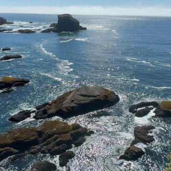
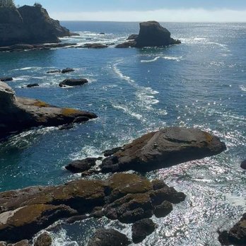


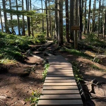


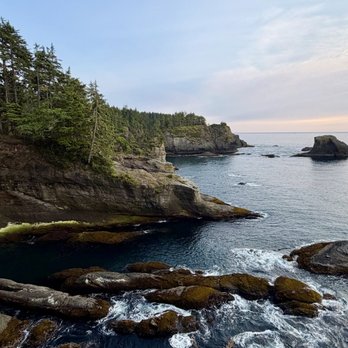
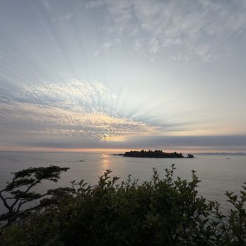
The Northwest corner of the continuous United States! It's a bit more out of the way than any other beaches/ viewpoints in the area, but definitely worth the visit. Since it's located on reservation land, there's a $20 entrance fee (the same permit used for Shi Shi beach if you are visiting both). The short trail to the shoreline is well maintained and easy to follow. The view is pretty epic, everything you'd hope for from the Pacific Northwest. You should definitely make a stop here while in the area! read more




1 year ago
This is SO worth your time if you want to see incredible views of the Washington Coastline. It's a pretty easy hike with walkways, bridges, and foot paths. (Do stay on the main paths or you could risk falling in some areas) There's no charge. Just a winding drive up the mountain to get to the cape. Absolutely beautiful read more


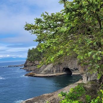
Such a beautiful location! We visited on a day trip. I recommend staying a few days to enjoy the area. The area has the typical park style (outhouse) restrooms and garage bins just outside the restroom. The trail path was clean, muddy and recommend hiking shoes. Please keep on path as stated. Several slippery spots. The path has areas with wooden walkways, some with exposed roots and observation view points to keep you safe. Dogs were on trail and area clean. Parking could be scarce but we went on a weekday and was not busy. Cute large chair for photo (added in pictures) and walking sticks were on left side of trail from the chair. At the end of this trail: Right takes you to the beautiful rock formations and small cave image. Left takes takes you to several views of Caves and beyond that takes you to viewpoint of Tatoosh Island. I would not consider this an easy hike due to exposed roots and elevation. Would depend on your experience. Also extra cautious with little one due to end of trail has direct drop down. You will need to stop at the visitors center for a $20 pass. This covers this location and Shi-Shi Beach (no dogs allowed so we didn't go). You can purchase the pass at other locations but the center was super cute. Staff were so helpful and we plan on coming back. read more


1 year ago
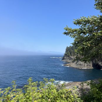
This is the farthest point west on the Mainland. A lighthouse. Offshore from the lookout point. We have been to the East coast point as well so a nice touch to do both. Not every day can you see the lighthouse off the point. FOG. We didn't, THIS TIME. But waiting, we saw sea otter, sea lion , and Porpoise. It was a great wait. See the pics. Easy 30 minute walk to the point. Mostly covered by trees. So, Shady.... read more




1 year ago
We have been wanting to visit Cape Flattery for a while now, and finally made it on this visit to the Olympic National Park. It's a short relatively easy hike to get to the north western point of continuous United States. The hike has some boardwalks, a few lookout points and some incline on the way back. The views from the various lookout points were stunning, we got lucky the rain held off until we finished our hike and got back. read more



2 years ago
It's not often I find myself at an iconic spot on the map of our nation. I believe the last time I had this honor was when I stood in line for an hour at the legendary "Southernmost Point" in Key West several years ago. But this summer, we made the long, windy drive out to Neah Bay to conquer another geographical landmark: Cape Flattery. For the uninitiated, Cape Flattery is that big point that pretty much defines the northwest coast of Washington. In fact, it is the actual northwesternmost point in the continental US. Can you get farther west? Yes, but you have to go south. Can you get farther north? Yes, but you have to go east. (At least, I think that's how it works.) The hike to the epic and oft-photographed overlook isn't super strenuous, but it's not a flat/easy hike either. It also has a lot of narrow boardwalks as well as twists and turns. We saw several people who had to abandon their children's strollers along the way; and I would NOT recommend this for anyone with major mobility issues unless you are a seasoned hiker. One you arrive at the end, though, all trail annoyances magically disappear as the epic views await. You are, indeed, at a legendary spot. With views out over the Straight of Juan de Fuca, this is a great place to spot everything from birds to cruise ships. There's also a beautiful lighthouse across the way at Tatoosh Island, so bring your binocs. We spotted a lot of bald eagles on the island, too! We were here on a weekend, so it was pretty crowded. And there are no restrooms or services along the trail, so plan accordingly. Whatever you do, don't forget to stop in Neah Bay and pic up your required Recreation Permit, which is $30 and lasts for the entire year. read more




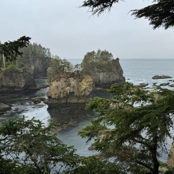
Cape Flattery is absolutely beautiful - we came here to visit the most northwestern portion of the contiguous US, and it was worth the drive. The little hike they set up through the forest is gorgeous and relatively easy - a couple areas of a bit of incline, but we saw everyone out there doing this hike. A decent portion of this hike is boardwalk-style with "pull-outs" to stop and soak in the view. Stop at them all! Enjoy the beauty from multiple viewpoints - you'll even be able to get a view of Cape Flattery Lighthouse. It's about 1.5 miles round trip, but we spent about an hour here just enjoying it all. Cape Flattery is part of the Makah Reservation, and they require a Makah Recreation Pass to visit. Pass is $20, and someone was selling them on the road there. Make sure you have one because they can give you a ticket for being there without one. The passes are good for the calendar year. Parking area can get congested (and we weren't there during peak season). So be patient, and take a spot if you find it. The bathrooms were disgusting, so I'd recommend stopping beforehand and avoiding them if possible. No sign at the end of the hike signaling the most northwestern portion. So if you want a picture, grab one with the sign at the trailhead. When you're finished, grab some food over in Neah Bay. We had a delicious meal at Calvin's Crab House with a beautiful view of the water. Overall, worth the drive and a nice way to spend the day. read more


Cape Flattery is a must-do experience if you're visiting the Olympic Peninsula. Accessed by an easy, short hike, the views from the cape lookout are outstanding. You may even catch some whales as the enter of leave the strait. Much of the trail is improved with wood boardwalks that make it easier and protect the forest from over-hiking. Highly recommended. read more




3 years ago
Drove 30+ hours to experience this place and man is it really life changing! This is the Northwesternmost point in the United States. You have to visit the visitor center and pay 20 dollars for a permit before you visit here so don't forget. When you are there too there a nice clean bathrooms and a cool museum you can look through. Then from there it's a bit more driving till you are up in the cliffs then a decent hike. There is a bit of an incline at some points so I would recommend a walking stick. But other than that it's pretty easy and boy does it pay off once you reach the first look out. If you are ever given the chance to visit. DO NOT miss out on it! read more


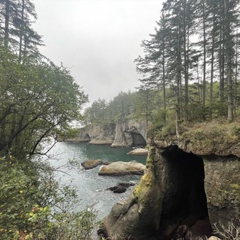

I haven't been to this corner of Washington state ever until this year and don't go to the peninsula as much as I should on top of that. I guess it kind of makes sense as the road is windy and lengthy as well as the trip in general. But not only that for years we had a huge bucket list of places to go but this year it it was Cape Flattery's turn! Cape Flattery is the most Northwestern point to the continental United States and it certainly is a beautiful point that is worth taking in. It's on the Macah Reservation so you will need to buy a recreation permit in order to park your car to get to this point and any other leisure activities around Neah Bay. Definitely come very early as the parking area gets full and there may be a wait if the parking is full so you can avoid all that but coming here in the morning, 7 am, 8 am is a good start because of you wait until 10 or 11 am you will encounter possible parking issues. The path down to the Cape is beautiful and fairly manageable as it's not too terribly steep in either direction. There are a couple of scenic points and there you can admire the view of the water, the cliffs with caves and islands. Our timing here was perfect as we saw otters frolicking and jumping into the water and we saw gray whales in the distance. You can see mountains of Vancouver Island also in the distance. The scenery is so beautiful and breathtaking that I highly recommend making the trip here and enjoying this wonderful piece of nature! read more






1 year ago
Easy hike down to the cliffs. Definitely worth the $20 permit. 2 bathrooms in the parking lot at the start of the hike. Not the cleanest restrooms but I've seen worse read more


2 years ago
An amazing place to view whales. A very small parking lot and a gross bathroom, make sure to bring hand sanitizer if you're going to use the facilities before walking to the point. The walk is downhill and has plenty of signs advising to stay on the trail. The way back is uphill. You find yourself navigating roots and a wooden walkway at times. The end result is absolutely one of the most beautiful views I have ever seen. A beautiful area. Two whales were just swimming around in front of the viewpoint. Stunning! Several platforms for views are around. No guard rails and it is very high up, be careful! The beauty will astound your senses. The current from the Salish sea connected to the Pacific Ocean can be seen clearly and it's just gorgeous. Add whales to the mix and you will not be disappointed! Happy travels and SYOY! read more


Stop for your permit! Take in the gorgeous views as you drive in AND at the end of the trail as you stare at the NW most point of the contiguous US. Try to visit on weekdays, as it gets crowded on the weekends. The trail is an out & back and utilizes narrow boardwalks and steps much of the way, so prepare to practice some patience. The forest is lovely throughout, and there are multiple viewpoints near and at the end to check out the simply stunning waters and rocky coastal cliffs. Really a fun adventure! read more


A must see location if you make your way into the Neah Bay area. There is a parking lot and toilets at the trailhead. Cape Flattery trail is just about 1.5 miles round trip and an easy walk. The trail is primarily made of narrow wooden planks and there are some stairs too. It can be challenging to pass people coming the other direction due to that. Also, the wood and rocks can get very slippery so use caution. At the end of the trail there are several viewpoints with breathtaking scenery. If you're fortunate to catch it on a clear day, the blue skies and glittering water can be mesmerizing. But on cloudy days it's still amazing and worth the trip. This land is owned by the Makah Tribe. Be sure to purchase a recreation permit before visiting this trail. You can purchase a permit at multiple locations in Neah Bay. I recommend stopping in the Makah Museum to purchase your permit and see the exhibits. The museum also has a restroom available. read more


3 years ago


Assuming you can nail down a parking spot with low/no drama, the ratio of epic views relative to hiking effort is off-scale here, esp. if you are with toddlers or little ones with limited stamina. Absolutely gorgeous views. read more


2 years ago

7 years ago
Stunning views, and a fairly easy hike. Dogs are allowed on the trail, but BEWARE. Much of the trail is a wooden boardwalk. The boardwalk is uneven and there are spaces between the boards that paws slip through. We walked our dogs off the boardwalk as much as we could, but in some places you have no choice but to use the boardwalk. Towards the end of the path there are huge gaps between boards, so we opted to take turns to walk to the viewing platforms while one of us stayed back with the pups. read more



3 years ago

9 years ago
My trip to Cape Flattery was amazing. Yes, it's a bit away from Seattle, but the drive is definitely worth it. You have some pretty nice views along the way, but the views at Cape Flattery are so breathtaking. The hike down is pretty easy, and the hike back up was surprisingly quick. I think it's only a mile and half round trip, so it's very doable. There are a lot of view points, so if one is crowded, just keep walking until the next one. read more
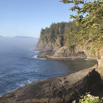


We went in April and had no idea there would still be snow and bitter cold by the coast obviously we didn't do any research. I had been other place out west but had no idea that Washington and Oregon were just stunning .. we decided to visit the most northwestern spot of continental U.S. didn't realize it was on native American land .. but it was worth the drive and the hike. The hike wasn't far but got our blood pumpin on the walk back up. The water was a gorgeous color. If you look closely or use binoculars you can see lots of colorful starfish on the rocks. Unfortunately when we were there i didn't have my real camera and the sky wasn't blue .. the light wasn't great. But it was still very impressive and glad we went. It's not wheelchair or stroller friendly and the walking stick was helpful. read more


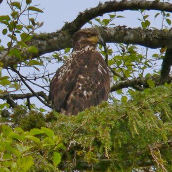


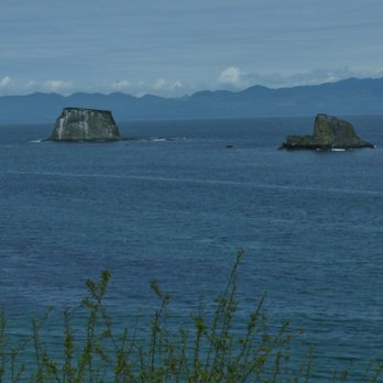

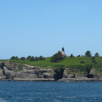
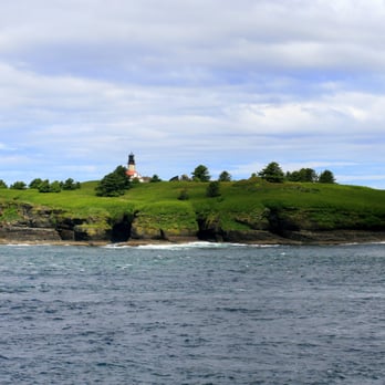
Words are totally inadequate to describe this place! It is also worth every bit of the long drive over a narrow windy road and the moderately difficult hike to get to one of the most beautiful places on earth. For anyone over the age of 50 it will probably qualify as moderately strenuous. For anyone with health problems or mobility issues, it may not be an option. Small children will need a lot of assistance. The drive up is beautiful and winds along a paved two lane road through the coastal forest. The road is steep and windy with may switchbacks, but the scenery is amazing with glimpses of ocean and cliffs through the trees. There is a fairly large parking area with a pit toilet. There is no drinking water or other amenities. The path out to the cape is well marked. The half mile hike is a winding trail of dirt, mud gravel, planks, stone and wooden steps, and root covered slopes. Parts are steep and most of the path in is downhill. This is no way is a handicapped accessible trail. But it is a half mile of some of the most exquisite forest I have ever seen. You finally reach a large wooden platform with steep stairs to access it. Once you pull and heave yourself up the ladder like stairs, you are rewarded with a view that is nothing less than exhilarating. The blue water, the white foam, the grey cliffs, and the emerald foliage all come together in a visually stunning array of natural beauty. Directly west of the cape is a small emerald island with a red roofed light house. If I could fly, I would now be a permanent resident in that idyllic spot. We sat for quite a while, ate our snack, and visited with a lovely young lady who grew up in Neah Bay, before we headed back up the trail. The coming out is much more strenuous then getting down, but is only a half mile - really! There are only a few short stretches that are steep. I would take this hike again without hesitation. It was tiring, it took me a while to get out and back, but it was worth every step. read more


Beautiful view! Pretty easy path going down that included stepping on/over stumps, stairs and wet path at downward angle. Coming up was harder obviously (going up ward) but there are benches along the way if you do need to rest. Sign says about 1/2 mile one direction. read more


Took my first trip to Cape Flattery today. I've always wanted to visit since I used to go fishing at nearby Neah Bay frequently in my youth. It was a bit chilly but it was a sunny Saturday so it was nice. It was a long drive there from south Seattle. Especially going back home afterwards. The mini hike down to the beach area is easy. Same with the return hike back to the parking lot, I wouldn't even really call it a hike. It's about 1 mile total. I had a bad hangover though so that 1 mile seemed like 3 miles. Haha. Otherwise it'd be a breeze. The vista from the viewpoints is pretty darn nice. I'd imagine it's even nicer during spring and summertime. read more


4 years ago

7 years ago

13 years ago
It's difficult to take a bad picture of Cape Flattery. I mean, you'd have to drop the camera in the mud, close your eyes, tilt sidewise, and laugh uncontrollably while pressing the shutter, and - still! - I'll bet that the shot wouldn't be half bad. Why? Well, being the Northwestern most tip of the lower 48 has something to do with it, but also it's on Makah land, and they take good care - very good care - of their ancestral home where the ocean and land meet in one of those memorable mergers of liquid and solid essences. http://www.yelp.com/biz_photos/cape-flattery-neah-bay?select=VQUzTQ1K75RZkLqpRIKxqw#7v4IsXuGGeO8_dngR4dtEQ http://www.yelp.com/biz_photos/cape-flattery-neah-bay?select=VQUzTQ1K75RZkLqpRIKxqw#AzNoRNPan4nwWuiXXmvSxw http://www.yelp.com/biz_photos/cape-flattery-neah-bay?select=VQUzTQ1K75RZkLqpRIKxqw#UN7JI6c8pw9ke5DwpMwbbQ Plus, it's so amazingly green, lush, and dripping most of the year that the plant understory is remarkable. http://www.yelp.com/biz_photos/cape-flattery-neah-bay?select=VQUzTQ1K75RZkLqpRIKxqw#8_1YdVV5_i2Veq9-XfWXZA http://www.yelp.com/biz_photos/cape-flattery-neah-bay?select=VQUzTQ1K75RZkLqpRIKxqw#7zo_JuNTF3X1686TkJ2sCg http://www.yelp.com/biz_photos/cape-flattery-neah-bay?select=VQUzTQ1K75RZkLqpRIKxqw#Nr59bK_9fq-S1dv6s2u7kg Oh, and then there is the island, the lighthouse, the eroding cliffs, and the tree-covered seastacks, all of which practically take pictures of the themselves. http://www.yelp.com/biz_photos/cape-flattery-neah-bay?select=VQUzTQ1K75RZkLqpRIKxqw#5EdC2Fk7BsuXDXIOme3X6A http://www.yelp.com/biz_photos/cape-flattery-neah-bay?select=VQUzTQ1K75RZkLqpRIKxqw#T1-h8IjyQNoYzwHVOhLqfw Getting to Cape F isn't easy, but nothing in life this beautiful ever is. And the path is planked, moderate in grade, and has multiple impressive viewing platforms. Even if the whales don't show, you'll find it hard to stop looking. I know I did! This cape deserves all the flattery it can get. And then some! read more




4 years ago

Upon having a weekend out of the city, we drive to Cape Flattery - the furthest northwest point of the contiguous of the US. Driving from Neah Bay to the parking lot of Cape Flattery consisted of a drive on a gravel/dirt road for a good portion. Surprisingly we did not get a flat (those potholes are awful) and we were on our way. From the parking lot to the end of the trail is a walk, mostly with boardwalks. Those that aren't boardwalks are normal trail material - which on this day, was very flooded. The view was great, albeit it was super rainy so the weather could have been better. I'm glad I went, but doubt I'd ever make the drive up there again. read more


The rainy chilly and dark day surprisingly made for one of my best hikes ever. You really felt part of the wilderness and the beauty of the woods meeting the ocean was a chapter in a classic novel. Seeing the siege of the ocean, admiring the eagles (all you have to do is look up along the trees. We counted at least 6, such amazing creatures! I can't wait to come back in days with blue skies!! The drive from Port Angeles is 2.5 hrs with inclement weather. Still really a great drive on Hwy 112. We came back on 101 to stop at Marymere falls. All these sites are great short hikes for all ages. read more


4 years ago
3 years ago
Page 1 of 3
More info about Cape Flattery
Cape Loop Rd
Neah Bay, WA 98357
Directions
Visit Website
https://www.wta.org/go-hiking/hikes/cape-flattery
Hours
Indoor Amenities
Outdoor Amenities
Ask the Community - Cape Flattery
Review Highlights - Cape Flattery













Why does Yelp recommend reviews?
5 reviews that are not currently recommended
The reviews below are not factored into the business's overall star rating.

2 years ago

1 year ago

9 years ago

2 years ago
15 years ago
Cape Flattery - hiking - Updated September 2026
Best of Neah Bay
People found Cape Flattery by searching for…
Trending Searches in Neah Bay, WA
Browse Articles
Browse Brands
Related Searches in Neah Bay, WA
Affordable Kayak Rental Services in Neah Bay, Washington
Affordable Long Term RV Parking in Neah Bay, Washington
Best Dog Hiking Trails Around Neah Bay, Washington
Best Fishing Locations and Guides in Neah Bay, Washington
Best Fun Things to Do in Neah Bay, Washington
Best Places for Horseback Riding in Neah Bay, Washington
Best Sightseeing Experiences Available in Neah Bay, Washington
Discover Dog Friendly Trails to Explore in Neah Bay, Washington
Discover Top Boat Tours in Neah Bay, Washington for All Ages
Discover a Hiking Trail in Neah Bay, Washington
Discover the Best Beaches in Neah Bay, Washington
Discover the Best Fishing Lake in Neah Bay, Washington
Discover the Best Night Hike Trails in Neah Bay, Washington
Dog-Friendly Hikes With Dogs in Neah Bay, Washington
Enjoy Camping Adventures Around Neah Bay, Washington
Enjoy Exciting Mountain Biking Adventures in Neah Bay, Washington
Enjoy Off Leash Dog Hikes in Neah Bay, Washington
Enjoy Tent Camping Spots Around Neah Bay, Washington
Experience Stunning Sunset Views in Neah Bay, Washington
Explore Beautiful Parks and Green Spaces in Neah Bay, Washington
Explore Bike Rentals Throughout Neah Bay, Washington
Explore Easy Hikes Perfect for All in Neah Bay, Washington
Explore Fun Activities to Do in Neah Bay, Washington
Explore Popular Campgrounds Near Neah Bay, Washington
Explore Popular RV Parks Around Neah Bay, Washington
Explore Popular View Points Around Neah Bay, Washington
Explore Scenic Lakes to Visit in Neah Bay, Washington
Explore Top Dog Parks in Neah Bay, Washington Near You
Explore the Best Beach Spots in Neah Bay, Washington
Explore the Best Swimming Holes Around Neah Bay, Washington
Family Friendly Hiking With Kids in Neah Bay, Washington
Find Beautiful Views in Neah Bay, Washington
Find Popular Ziplining Spots Around Neah Bay, Washington
Find Top-Rated Waterfalls in Neah Bay, Washington Now
Find the Best Playgrounds to Visit in Neah Bay, Washington
Find the Best Scenic View Locations in Neah Bay, Washington
Hiking Trails With Waterfalls in Neah Bay, Washington
Locate a Public Shower Facility in Neah Bay, Washington
Perfect Spots to Watch Sunset in Neah Bay, Washington
Popular Fishing Spots to Explore in Neah Bay, Washington
Popular Picnic Spots to Visit in Neah Bay, Washington
Popular Things to Do in Neah Bay, Washington
Top Hiking Trails to Explore in Neah Bay, Washington
Top Playgrounds for Kids to Enjoy in Neah Bay, Washington
Top Things to Do With Kids in Neah Bay, Washington
Top-Rated Camping Sites in Neah Bay, Washington
Walk Dog Friendly Hiking Trails in Neah Bay, Washington
Where to Catch the Best Sunrise View in Neah Bay, Washington


