Cancel

    Open app

    Search

    Skyline Trail

    3.0 (1 review)

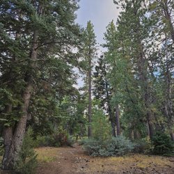
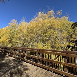
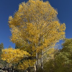
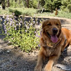
    Skyline Trail Photos

    You might also consider

    Recommended Reviews - Skyline Trail

    Your trust is our priority, so businesses can't pay to alter or remove their reviews. Learn more about reviews.
    Yelp app icon
    Browse more easily on the app
    Review Feed Illustration
    Photo of Brian U.
    0
    2129
    128

    5 years ago

    Helpful 0
    Thanks 0
    Love this 0
    Oh no 0

    You might also consider

    Verify this business for free

    People searched for Hiking 1,231 times last month within 15 miles of this business.

    Verify this business

    Gray's Peak Trail - The lush side of the forest

    Gray's Peak Trail

    4.7(20 reviews)
    5.3 mi

    First, on a Sunday afternoon at the end of October, no parking by noon. My second reason for…read moreremoving a star is that the "female" restroom was out of order, the "male" restroom didn't have a trash can (which I understand, partly, being in the forest). But why have a girls and boys restroom, why not just two bathrooms. And the last reason I kept a star, only one trash reciprocal in the entire parking lot. I believe we should continue to encourage Visitors to "pack it in, pack it out" plus some. How do we do that if we expect then to put it in their car and take it with them? Trailhead has a very descriptive sign, provides lots of good information. Trail is 6.4 miles, 1,174 altitude gain (out/back), dogs allowed on lead, near Fawnskin. This trail offers AMAZING views of Big Bear Lake, bikes also share the trail. (Dog bags provided at trailhead, pls pick up after yourself, and your doggie;) There's so much to explore, get up, and get out there.
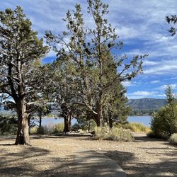
    A nice escape, I think it's probably less-trafficked because it's on the North Shore (away from the…read moremain crowds) and a bit away from the Discovery Center. At the top is a rock outcropping where you can get a good view of the lake, albeit partially obstructed. I saw a cinnamon-furred black bear near the top the last time I hiked (June 27, 2017 around 6:15pm), so be on the lookout, keep your distance, and make your presence know (I stomped my feet, and he took notice and slowly went about his business in a different direction than where I was). July 13, 2017: did an evening hike and saw 2 deer, along with a pair of yellow eyes and green eyes (more deer?) at night, and three scorpions along the trail. You will need an Adventure Pass to park in the lot, but alternatively you can park along the road (a good spot is by the Eagle habitat warning sign).

    Photos
    Gray's Peak Trail - Only a few nice views in the begining and the end of the hike.

    Only a few nice views in the begining and the end of the hike.

    Gray's Peak Trail - Hanna Rocks at sunset, seen about 2/3 of the way up the trail.

    Hanna Rocks at sunset, seen about 2/3 of the way up the trail.

    Gray's Peak Trail

    See all

    Belleville - Ghost Town - We brought a m2 off roading  Had to stop here as road got to bad.

    Belleville - Ghost Town

    3.6(9 reviews)
    5.0 mi

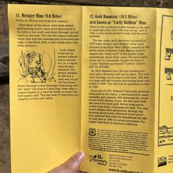
    The best way to see what's left of Belleville is the Gold Fever Trail, so stop by the Big Bear…read moreDiscovery Center first and pick up this yellow pamphlet. Please be warned that when it says "dirt roads" they mean it!! We were not prepared for how VERY rocky it is in most sections. The worst starts around stops 9 & 10, and the rest of the road has the biggest rocks you have to maneuver around. We were super lucky in my Toyota Corolla to make it out unscathed by driving VERY slowly and carefully, but it took a LONG time and we were so stressed. If you have a jeep, truck, or other off-roading vehicle you'll probably be ok. But any other vehicle I would NOT recommend (not even an SUV), or turn around after stop 10 at the latest! The scale of the map in the pamphlet is a bit misleading, because the stops are decently father apart than they seem. I had maps open on my phone to constantly compare with the paper map. Most of the stops along the way are marked with a sign post and number, so look out for those. We came in April when there was no snow or rain, good weather for hiking around. If you're into Gold Rush history, it's interesting to see the few ruins of the town. But most of the stops along the Trail require a bit of imagination (there's not a lot to see). Overall, it was kinda fun for the first half, but the second half of the drive was lowkey hell :)

    roads aren't maintained well which is fine. AWD is recommended, especially after rains. pretty…read morequiet place with benches at some spots to chill and hang out, lots of mountain bikes to watch out from. overall pretty nice place to relax and enjoy the view, the self guided car tour is cool too if you grab a pamphlet from the Big Bear Discovery Center beforehand.

    Photos
    Belleville - Ghost Town
    Belleville - Ghost Town - Guide to Gold Fever Trail stops

    Guide to Gold Fever Trail stops

    Belleville - Ghost Town - Guide to stops 11 and 12

    See all

    Guide to stops 11 and 12

    Town Trail

    Town Trail

    4.8(4 reviews)
    2.4 mi

    We have a place at Snow Summit that backs right up to the trail. It's a beautiful way you can start…read morethe day and go into town for breakfast. At 8am on a Saturday in July it was very quiet and gorgeous views, not too hot yet. I saw just a handful of hikers. I had been warned about the number of bikers whizzing by. On my way back at 10:30 there were indeed loads of bikers headed to snow summit. I have to say though, without exception, they all were gracious and said good morning and alerted me they were approaching. In turn I politely stepped to the side. It's all about sharing the road or trail and maybe go out early to avoid bikes. On another visit my husband and I took our French Mastiff for an evening walk and had him off leash. BAD idea! First of all evening is feeding time for lots of wildlife. Second, we didn't have him on leash. At one point we couldn't see him and called out. From around a bush comes our dog flanked by two female wolves three inches taller than him. We were able to coerce him away and get him on leash but it was a super scary situation. If he had been a small dog I'm not sure what would have happened.

    Easy access to this trail. We went from the end of Summit…read moreBlvd passing by the back of Snow Summit Townhouse Rentals. But from the other direction trailhead is at the junction of Forest Ranger Rd and 2N08 2.8 mile out and back. 300+ ft elevation. So little up/down hills. You can see Big Bear Lake at one point of the trail. Came during the fall after a small snowfall. Note: there may be some bikers on this trail as it converges with the bottom of a mountain biking only path.

    Photos
    Town Trail
    Town Trail - Groomed trails with stepping blocks over water areas.

    See all

    Groomed trails with stepping blocks over water areas.

    Skyline Trail - hiking - Updated July 2026

    Loading...
    Loading...
    Loading...