Steelhead Falls Trail Photos


More like Steelhead Falls Trail
Recommended Reviews - Steelhead Falls Trail
Start your review...


Reviews With Photos


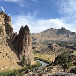
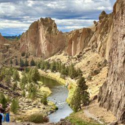
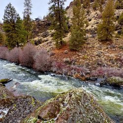
What's not to like about a scenic falls on the Deschutes River? Steelhead is one of the more accessible places you can get down to the river, which cuts a steep, spectacular gorge along this run (and along much of its length) as it seeks to join the Crooked and Metolius rivers not far downstream. An easy half-mile walk from the parking lot gets you to the falls. You can go quite a bit further, too. Don't forget to look up at the cliffs which provide a good display of central Oregon volcanic geology.


a deer trail before the falls is a place to take a swim and cool off from the summer heat! Such a peaceful & relaxing way to spend time. I recommend this river, swimming, fishing, or just dipping the feet in.
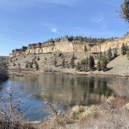


The hotel concierge recommended this fall which was easy drive from Redmond and short 1/2 mile trail to the fall. The view around the trailhead was stunningly beautiful; especially when the sun shone on the water in Deschutes River down below! To our great disappointment was that the trail to the fall had some slopes with loose sand which could be slippery that did not offer good secure footing. We therefore decided to turn around half way. If we had brought our hiking sticks we'd probably go ahead! Maybe another time!?


It was a nice .5 mile hike it is a hike down to the falls and steep hike back out but it is do able and very pretty. Their is not a lot of shade though so bring sun screen

Great for cliff jumpers! An easy 1/2 mile hike (steep and rocky in some places) that leads you to a beautiful waterfall. If you wish to continue your hike further it goes in parallel with Deschutes river and has a spot that you can get into the water if you are not a cliff-jumper. Further down it's another smaller cliff located, used by kids for jumping into the river. Even at 95+ degrees summer temperature the water was too cold for some of us to swim. The waterfall is not tall, but spread through the beautiful cascades horizontally. Seeing several rainbows in the mist of the rushing waters of the fall was so beautiful! And, of course, it was so much fun for those in our group, who were fearless to jump off the cliff!


Steelhead Falls is one of the most beautiful canyon locations in Central Oregon. It is really hard to get to, and in the past has not been labeled. But now It is pretty well marked and identified. The hike itself is pretty mellow but a little nerve racking due to the cliff it travels along. So be sure to have a good pair of shoes for your journey. The trail itself is about 2 miles long and takes you to the destination Steelhead Falls. The falls are in some kind of half moon shape and create an open pool in the Deschutes River. The pool itself is pretty deep in appearance. The trail ends at the cliffs here and I have witnessed many people jumping off of them. Though they appear deep I would use caution and good judgment before jumping into the water. Often time you may find people jumping off of the waterfall in a kayak or just by themselves. I am not sure how safe this is but it is fun to watch for sure.This is a great spot on a hot day to visit and have a snack. The sound of the falls and the spray of the mist are simply majestic. If you are here on a hot day, why not head on over and check this place out. Reception may be spotty out here, so have the route screenshotted just in case you lose cell service. Here is a good link to a map of this location https://www.alltrails.com/trail/us/oregon/steelhead-falls Here is a link to the land management agency that manages this location https://www.blm.gov/download/file/fid/11693


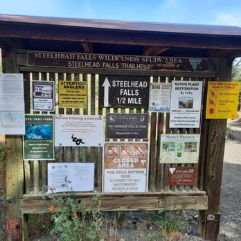
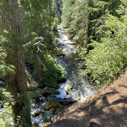
Gorgeous falls! The trail out to the falls is about a half mile. Parts of the trail are steep and rocky, so make sure you wear decent shoes. The trail has many trees that provide a decent amount of shade. The falls are absolutely gorgeous! They aren't tall, but wide and cascading. Such an amazing view! We really enjoyed our time here. Would definitely recommend. read more


3 years ago
This trail is an easy .5 hike to the Steelhead Waterfall with breathtaking views. It goes further, but we just went to the Falls and back. It is a bit narrow in some areas and you must walk in a single line, but it's comfortable and maintained. The trail also has a few flat rock steps that both decline and incline at times. We did encounter other hikers and everyone was courteous and happy to be there. Not a single piece of litter in sight! It is a bit out of the way, but we would definitely return to this beautiful trail and maybe jump in next time! read more


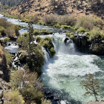


We stopped by on a sunny, windy Sunday mid-morning. It had been dry lately, so due to the wind the trailhead and parts of the trail were really dusty. The trailhead has a decent amount of parking with good signage along the way. It's a 2 mile out and back hike, but only 1/2 mile to the falls, should that be the goal. It's a bit steep going down at the start, but the trail is stepped down to help in that section. There are many designated short/steep side trails available to get down to the waters edge. Warning though, in the dry conditions that day the nature of the soil on those short jaunts made for tricky, very loose footing. The scenery is gorgeous start to finish. The falls were running spectacularly with such a beautiful pool. You can definitely see the summer swimming potential. Honestly just a great short hike for anyone. Such a beautiful setting and impressive falls. Recommend! read more


1 year ago

What's not to like about a scenic falls on the Deschutes River? Steelhead is one of the more accessible places you can get down to the river, which cuts a steep, spectacular gorge along this run (and along much of its length) as it seeks to join the Crooked and Metolius rivers not far downstream. An easy half-mile walk from the parking lot gets you to the falls. You can go quite a bit further, too. Don't forget to look up at the cliffs which provide a good display of central Oregon volcanic geology. read more


3 years ago
a deer trail before the falls is a place to take a swim and cool off from the summer heat! Such a peaceful & relaxing way to spend time. I recommend this river, swimming, fishing, or just dipping the feet in. read more
4 years ago
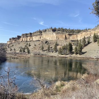
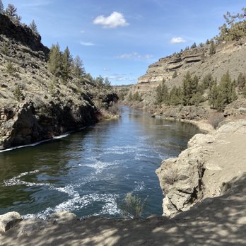
Such an amazingly beautiful place! I hiked out about 3 miles, most of which was right adjacent to the river but some of which is near a cliff. Some small bouldering is required. The sights were just incredible! A new Central Oregon favorite read more


9 years ago
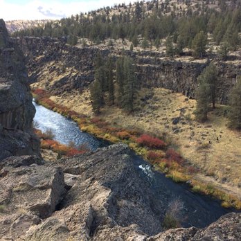
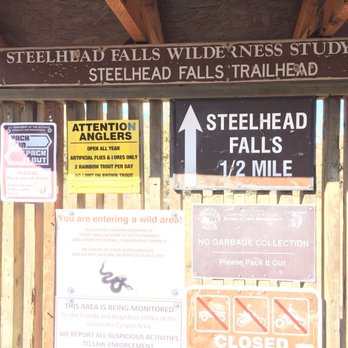
The hotel concierge recommended this fall which was easy drive from Redmond and short 1/2 mile trail to the fall. The view around the trailhead was stunningly beautiful; especially when the sun shone on the water in Deschutes River down below! To our great disappointment was that the trail to the fall had some slopes with loose sand which could be slippery that did not offer good secure footing. We therefore decided to turn around half way. If we had brought our hiking sticks we'd probably go ahead! Maybe another time!? read more



4 years ago


7 years ago
It was a nice .5 mile hike it is a hike down to the falls and steep hike back out but it is do able and very pretty. Their is not a lot of shade though so bring sun screen read more


8 years ago
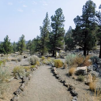
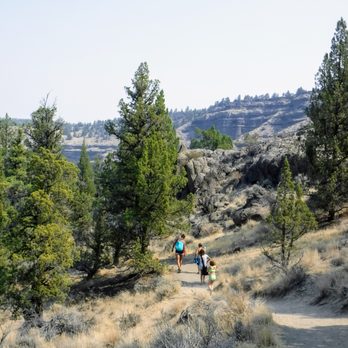
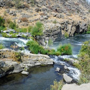
Great for cliff jumpers! An easy 1/2 mile hike (steep and rocky in some places) that leads you to a beautiful waterfall. If you wish to continue your hike further it goes in parallel with Deschutes river and has a spot that you can get into the water if you are not a cliff-jumper. Further down it's another smaller cliff located, used by kids for jumping into the river. Even at 95+ degrees summer temperature the water was too cold for some of us to swim. The waterfall is not tall, but spread through the beautiful cascades horizontally. Seeing several rainbows in the mist of the rushing waters of the fall was so beautiful! And, of course, it was so much fun for those in our group, who were fearless to jump off the cliff! read more






9 years ago
Steelhead Falls is one of the most beautiful canyon locations in Central Oregon. It is really hard to get to, and in the past has not been labeled. But now It is pretty well marked and identified. The hike itself is pretty mellow but a little nerve racking due to the cliff it travels along. So be sure to have a good pair of shoes for your journey. The trail itself is about 2 miles long and takes you to the destination Steelhead Falls. The falls are in some kind of half moon shape and create an open pool in the Deschutes River. The pool itself is pretty deep in appearance. The trail ends at the cliffs here and I have witnessed many people jumping off of them. Though they appear deep I would use caution and good judgment before jumping into the water. Often time you may find people jumping off of the waterfall in a kayak or just by themselves. I am not sure how safe this is but it is fun to watch for sure.This is a great spot on a hot day to visit and have a snack. The sound of the falls and the spray of the mist are simply majestic. If you are here on a hot day, why not head on over and check this place out. Reception may be spotty out here, so have the route screenshotted just in case you lose cell service. Here is a good link to a map of this location https://www.alltrails.com/trail/us/oregon/steelhead-falls Here is a link to the land management agency that manages this location https://www.blm.gov/download/file/fid/11693 read more


9 years ago
Beautiful place to fish & hike to see the falls. There's so much gorgeous scenery around. We've caught a few trout & crayfish and seen a baby otter today We spend hours fishing and hiking, the kids love it too. read more


8 years ago
7 years ago
More info about Steelhead Falls Trail
SW River Rd
Terrebonne, OR 97760
Directions
Hours
Outdoor Amenities
Ask the Community - Steelhead Falls Trail
Review Highlights - Steelhead Falls Trail

















Why does Yelp recommend reviews?
1 review that is not currently recommended
The reviews below are not factored into the business's overall star rating.

4 years ago


