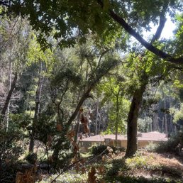
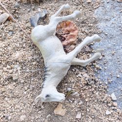
Chantry Flat Recreation Area Photos


You might also consider
More like Chantry Flat Recreation Area
Recommended Reviews - Chantry Flat Recreation Area
Start your review...

Reviews With Photos

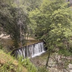
Get an adventure pass at big 5 or REI or the closest liquor store down the main street. Available for daily use $5 or annual pass $35 Overall nice trail the beginning is downhill so remember that is the incline on the way back. Nice little waterfall at the end couple miles in overall 4 miles round

+ Mt Wilson is a great hike. + Mt Zion is nice too. + These trails have good amounts of shade and opportunities to see animals. I encountered a family of deer during my ascent, and a big bear right on my trail during my descent! :o + Nice thing about this hiking area is there's a restaurant both at the base (Adams Pack Station) and at the summit (Cosmic Café). - These trails are often overrun with flies. Two flew into my mouth during my hike. Tasted bitter. . Decent parking lot size. I found a spot right away around 10am, likely because it was a hot weekday. - Parking lot has limited shade. - The people here are impatient. Pedestrians cross the road without looking both ways, expecting you to do their job for them. And when you stop to let the slow unaware pedestrian cross, a car will show up behind you and cut around you while you're still waiting for the pedestrian to finish crossing. That other driver should've been more observant and patient. Just a few seconds more and we'd all be on our way, no cutting needed. - Restrooms lacking amenities and dilapidated. No hand-washing sink or hand sanitizer available. - Required parking pass ($5/day).

Love, love Chantry Flat Trail I have done many different trails Sturtevant Falls around 3m Sturtevant Camp around 9m Mt Wilson Peak around 16m Has many waterfalls and views. Recommend hiking shoes, there are some rocks around, better safe than sorry. Need a parking national forest pass or you can go to the Cosmic Cafe to buy one for $5.00 for a day pass or $30 for a yearly pass. Recommended it has a bathroom at the entrance and a campground before getting to Sturtevant Camp.

If you get car sick easily, note that the drive up is windy, with a good amount of twists and turns along the way. It isn't too long of a drive up (about 10 minutes, but it feels longer!), but once you reach the parking lot you will be rewarded. This hike is so fun. You will get a good amount of steps in with some incline and you will definitely want to reach the waterfall area for soothing views and sounds. Parts of the well-marked trail are sun exposed but there are also some shady areas. In the fall/winter you will have to cross some streams, but it is doable. There are restrooms and a cute little place to eat too! I am so happy to be able to visit Chantry Flat again since it's been closed for four years due to the fire!

My parents have lived in their home for nearly 30 years, and they found it because we drove by it on our nearly weekly hikes at Chantry Flats. We lived in Pasadena for the first few years of my life, and did the waterfall hike often, before moving to a house a few blocks down from the entrance gate. I have very early and frequent memories of the hike down into the valley, the bridge, crossing the stream a few times, and my dad occasionally spotting fish in the stream and telling me to come over very quietly so as to not scare them away. The hike along the stream to the waterfall is very pleasant, with shade, and some good stopping places to sit. As I grew up, my birthday parties would involve hiking here; we'd all pack into my parents cars (shout out to the trunk seats of the Camry station wagon), followed by pizza at our house. We'd go up from the parking lot occasionally. There are a lot of trail options, but we've mainly focused on the waterfall for a morning hike, so that we could get back in time for lunch (usually dim sum). This past holiday break we came back for the first time in a while. My parents haven't taken us as much recently because it's a very popular trail, so it can be hard to find parking. We had a fun time; I especially enjoyed seeing my daughter bravely cross a log bridge over the stream. Lots of good memories here, excited to come back again soon.

I am so heartbroken to hear about chantry flats!!! Chantry flats was recently burned in the 2020 bobcat fire. At the time of this review there is no word on the trails, the 80 cabins in the Santa Anita canyon or the wildlife that called this home. The Adams Pack station was however able to be saved. Chantry Flats is a great introduction to the outdoors for anyone! Here you can find many trails that connect all over the Angeles National Forest. You have the more popular trails, Sturtevant Falls as well as Hermit Falls. I prefer Hermit Falls, it is not only a longer hike but also offers a swimming hole at the end. My go to would be Chantry Flags to Mt Wilson. This is roughly a 17 mile hike. When you leave Chantry Flats you would be able to take a steep trail to the bottom of the canyon. Once there you can really see how the terrain changes, it's like you're some else else completely. The Forest begins to blossom as you follow a stream down the canyon. You also begin to run into old cabins that are still homes for some. Once you hit Sturtevant Trail you gain some elevation and begin to become surrounded by more trees. Eventually you hit Sturtevant Camp. Here you find hammocks, a swing and a water supply. The camp was available to rent out for large groups. Leaving the camp it's a steady 3mi elevation gain until you reach the top of the peak, Mt Wilson. At the top you will find a historic observatory that holds more history than you can even imagine. Chantry Flats and Mt Wilson was/is my favorite place in SoCal. It's heartbreaking to hear that in my lifetime this place will never be the same. I cherish all the backpacking trips I have made in this area.

I've heard about this hiking trail for years but never bothered to try it. Finally we went with my neighbor who knows the area very well. Instead of going on the short hike to the falls we hiked the Upper Winter Creek Trail loop which is 5 miles long. The area is amazing and beautiful and you don't have to wear a hat because the trees keep you in the shade.

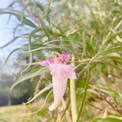
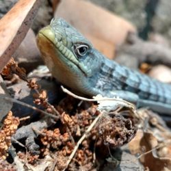
I have been visiting Chantry Flats since I was a little kid. As a Cub Scout and Boy Scout, I came here with my friends to hike pretty frequently. Over the years, I came to know every little corner, switch back, and meander of the small creek that runs along the bottom of Santa Anita Canyon. Way back when, no one thought of charging parking up here or ever closing the road at 8 p.m. for that matter. The descent into Santa Anita Canyon from the parking lot was still paved as far back as I can remember, but somehow, the area was a little more wild. No one would think to come here with their CrossFit team, carrying a wireless speaker blaring some god-awful music and destroying the ambience of the creek and bird music for everyone that passes by on the trail. There were not nearly as many eyesores of graffiti on rocks and signs like there are today. Despite being close to civilization, this really was not a weekend hang out spot for people who like to leave lots of trash and crap behind. But those days are gone now, and lest I sound like an old fart at 41, they're not coming back anytime soon, even with the five dollar parking fee, and the limited parking spaces available most of the time. The other modern crisis here is that the gates are locked from 8 PM to 6 AM, yet this is a crossroads, of sorts, for many of the trails that head deep into the Angeles National Forest. No sense in parking here after 6 AM if you're going on a really long hike. If your plans change, you get delayed, or something happens, you're getting locked in. And not that I'm much of an early bird, but if I'm going on a long hike, I'm not leaving after 6 AM... More like 4:30. All that to say, you are pretty much limited to some of the shorter loops, which are nice, but don't really get you very far away from other people and signs of civilization. Still, there are some pretty places here in Santa Anita Canyon. The canopy of native pines, oaks, and laurel trees provides a mostly shaded walk alongside the creek. In the spring, wildflowers are abundant, and wildlife is still present here if you look for it. Everything from hummingbirds and butterflies to black bears and mountain lions can be found here. Somewhere in the middle of that spectrum, the California Newt calls this canyon home. They have the distinction of being one of the cutest and most poisonous creatures on earth. Just under the skin, they have glands that create a potent neurotoxin called tetrodotoxin, similar to that found in puffer fish and poison arrow frogs. Luckily, handling the creatures is not dangerous, and you will die only if you consume or ingest them. Sadly, there used to be a lot more of them here. I suspect that over the years, they were captured, taken home in water bottles, and lived out the rest of their short lives in aquariums and goldfish bowls. Like most wild things, they don't do very well in captivity. Definitely look for them and quiet waters, snap a few pictures of these cute little critters, and then let them go where you found them. Along the same lines, there are posted signs at the waterfall asking folks not to take the "shortcut" up the hillside, to join the Gabrielino trail. Several thoughtless conquistadors roundly ignore the sign, and some idiot chose to share his feelings on the rule by writing "F--K YOU" on the sign. I guess he told them! Unfortunately, he also told everyone who visits here, including my Cub Scout group, my kids... you get the idea. Anyway, we're generally not lucky enough to watch people ignoring the sign fall to their deaths or get mauled by local bears; but people walking on the hillside do quite a bit of erosion damage in the waterfall area below. Over the years, this has gotten several trails in the Angeles National Forest closed, when people climb up switchbacks, or go off trail and cause damage. On today's visit, I watched unassuming folks walk right past the sign, and on their way up, one of them kicked a small rock that gathered speed coming down the hill, and narrowly missed hitting my three-year-old in the face, who was sitting on the rocks near the waterfall. Luckily, someone left an old dirty towel on the ground, which slowed the rock down. Our little Cub Scout group walked around and picked up some trash, including an old pair of Ray-Ban's , several plastic baggies, chips and cookie bags, a tuna can, that old beach towel, and someone's hat. Maybe you don't care either? But I think if everyone cared just a little more, visiting this place and others like it, it would be a lot nicer. The attitudes that "I don't need to pick up my trash" or "I don't need to clean up after my dog " or "this bathroom already stinks like hell, so I can trash it" ... do nothing to improve this place for future visitors. There's enough beauty here to mitigate the human impact, even the discourteous and self-righteous. But it just isn't what it used to be. Most things aren't I guess.

The drive here is pretty steep, you go up a windy road that hugs the mountain. The views are pretty great because you can see over everything. I came here at 9:30am hoping to do one of the hikes, but the parking lot was already full. We drove down the mountain a bit and found some parking on the side of the road. I read on Yelp that you could get a parking pass in "the green shack," which is actually called the pack station. I decided to do this so I didn't have to make an extra stop to buy an adventure pass somewhere else. This was the wrong decision. If you have a chance to buy the adventure pass from 7-eleven or one of the sports stores, do that! You can only park in a small parking lot of the pack station store, even if you pay $5.00. I actually gave a $5 donation since I didn't read until later that you can't park on the side of the mountain without an adventure pass or you'll get ticketed. At the pack station, there are signs that warn you about taking your dog on this hike. A little pug ended up dying because of heat exhaustion and burnt paws. In the end, we couldn't find parking so we didn't do this hike. Do yourself a favor by getting here early and don't rely on getting a pass here. Random: it was pretty animal smelly at the pack station. There are goats near the pack station and there are horse crossing signs, so you definitely get a whiff of that.

We went here on a weekday to do the Sturtevant Falls Hike. There are multiple hikes in this recreation area including Hermit Falls, Mt. Wilson, Upper Winter Creek and a couple campground bikes. Once we exited the 210 freeway Santa Anita Ave, there is a park station immediately to the right of the exit where you can buy an adventure pass for $5. Unfortunately at the time we came, they were out or lunch so we just paid at the top of Chantry Flats. Go up Santa Anita Avenues windy roads to reach the top parking lot. There may be some light construction at the bottom of the mountain, but no traffic on a weekday. There is a pack station where you can pay the $5. You must have an adventure pass to hike here. If there is no personnel at the pack station, park your car in the graveled lot and leave the $5 in a donation mailbox. You'll see the sign. The pack station has donkeys and goats, so don't be alarmed by animal noises. Trailhead is below the pack station. Signs will lead you to Sturtevant Falls, Hermit Falls etc. The first portion of the hike is a downhill paved road (which is harder on the way back up) but then turns into gravel pathways down to the falls. It's not a hard hike at all, you'll at most see a squirrel. You have 2 very very small river crossings - you'll most likely stay dry the whole time unless you take a little swim in the falls which is nice during summer.

Great hiking spot. The shorter trails are easy to medium difficulty. Most of the trail is shaded by trees and has the nice sound of water flowing by. Some areas are pretty rocky though, so be prepared for that. The hardest part is probably walking back up to the parking lot, because it is steep and doesn't have a lot of shade. Parking costs $5 and is pretty limited, especially if you come on the weekend. Overall, it was a great experience and I would visit again.

Great place to experience several different hiking trails in the San Gabriel Mountains. I arrived very early on a weekday morning, so plenty of parking was available; however, supposed to be rough on weekends. Make sure you have an Adventure Pass! If not, one can be purchased at Adams Pack Station (but they don't open until 9 am?). Trails are well-maintained and there are many signs, keeping you from being lost. Well worth a visit! read more


 - Parks Near Me - Sierra Madre, California")


Get an adventure pass at big 5 or REI or the closest liquor store down the main street. Available for daily use $5 or annual pass $35 Overall nice trail the beginning is downhill so remember that is the incline on the way back. Nice little waterfall at the end couple miles in overall 4 miles round read more


+ Mt Wilson is a great hike. + Mt Zion is nice too. + These trails have good amounts of shade and opportunities to see animals. I encountered a family of deer during my ascent, and a big bear right on my trail during my descent! :o + Nice thing about this hiking area is there's a restaurant both at the base (Adams Pack Station) and at the summit (Cosmic Café). - These trails are often overrun with flies. Two flew into my mouth during my hike. Tasted bitter. . Decent parking lot size. I found a spot right away around 10am, likely because it was a hot weekday. - Parking lot has limited shade. - The people here are impatient. Pedestrians cross the road without looking both ways, expecting you to do their job for them. And when you stop to let the slow unaware pedestrian cross, a car will show up behind you and cut around you while you're still waiting for the pedestrian to finish crossing. That other driver should've been more observant and patient. Just a few seconds more and we'd all be on our way, no cutting needed. - Restrooms lacking amenities and dilapidated. No hand-washing sink or hand sanitizer available. - Required parking pass ($5/day). read more


Love, love Chantry Flat Trail I have done many different trails Sturtevant Falls around 3m Sturtevant Camp around 9m Mt Wilson Peak around 16m Has many waterfalls and views. Recommend hiking shoes, there are some rocks around, better safe than sorry. Need a parking national forest pass or you can go to the Cosmic Cafe to buy one for $5.00 for a day pass or $30 for a yearly pass. Recommended it has a bathroom at the entrance and a campground before getting to Sturtevant Camp. read more


2 years ago
If you get car sick easily, note that the drive up is windy, with a good amount of twists and turns along the way. It isn't too long of a drive up (about 10 minutes, but it feels longer!), but once you reach the parking lot you will be rewarded. This hike is so fun. You will get a good amount of steps in with some incline and you will definitely want to reach the waterfall area for soothing views and sounds. Parts of the well-marked trail are sun exposed but there are also some shady areas. In the fall/winter you will have to cross some streams, but it is doable. There are restrooms and a cute little place to eat too! I am so happy to be able to visit Chantry Flat again since it's been closed for four years due to the fire! read more


5 months ago
1 year ago
2 years ago
Glad it's opened up again! The waterfall was a bit overcrowded but it went well! Its not as green as it used to be but it's still just as beautiful read more


My parents have lived in their home for nearly 30 years, and they found it because we drove by it on our nearly weekly hikes at Chantry Flats. We lived in Pasadena for the first few years of my life, and did the waterfall hike often, before moving to a house a few blocks down from the entrance gate. I have very early and frequent memories of the hike down into the valley, the bridge, crossing the stream a few times, and my dad occasionally spotting fish in the stream and telling me to come over very quietly so as to not scare them away. The hike along the stream to the waterfall is very pleasant, with shade, and some good stopping places to sit. As I grew up, my birthday parties would involve hiking here; we'd all pack into my parents cars (shout out to the trunk seats of the Camry station wagon), followed by pizza at our house. We'd go up from the parking lot occasionally. There are a lot of trail options, but we've mainly focused on the waterfall for a morning hike, so that we could get back in time for lunch (usually dim sum). This past holiday break we came back for the first time in a while. My parents haven't taken us as much recently because it's a very popular trail, so it can be hard to find parking. We had a fun time; I especially enjoyed seeing my daughter bravely cross a log bridge over the stream. Lots of good memories here, excited to come back again soon. read more


 - Parks Near Me - Sierra Madre, California")

2 years ago
6 years ago
I am so heartbroken to hear about chantry flats!!! Chantry flats was recently burned in the 2020 bobcat fire. At the time of this review there is no word on the trails, the 80 cabins in the Santa Anita canyon or the wildlife that called this home. The Adams Pack station was however able to be saved. Chantry Flats is a great introduction to the outdoors for anyone! Here you can find many trails that connect all over the Angeles National Forest. You have the more popular trails, Sturtevant Falls as well as Hermit Falls. I prefer Hermit Falls, it is not only a longer hike but also offers a swimming hole at the end. My go to would be Chantry Flags to Mt Wilson. This is roughly a 17 mile hike. When you leave Chantry Flats you would be able to take a steep trail to the bottom of the canyon. Once there you can really see how the terrain changes, it's like you're some else else completely. The Forest begins to blossom as you follow a stream down the canyon. You also begin to run into old cabins that are still homes for some. Once you hit Sturtevant Trail you gain some elevation and begin to become surrounded by more trees. Eventually you hit Sturtevant Camp. Here you find hammocks, a swing and a water supply. The camp was available to rent out for large groups. Leaving the camp it's a steady 3mi elevation gain until you reach the top of the peak, Mt Wilson. At the top you will find a historic observatory that holds more history than you can even imagine. Chantry Flats and Mt Wilson was/is my favorite place in SoCal. It's heartbreaking to hear that in my lifetime this place will never be the same. I cherish all the backpacking trips I have made in this area. read more


6 years ago
6 years ago
I've heard about this hiking trail for years but never bothered to try it. Finally we went with my neighbor who knows the area very well. Instead of going on the short hike to the falls we hiked the Upper Winter Creek Trail loop which is 5 miles long. The area is amazing and beautiful and you don't have to wear a hat because the trees keep you in the shade. read more

I have been visiting Chantry Flats since I was a little kid. As a Cub Scout and Boy Scout, I came here with my friends to hike pretty frequently. Over the years, I came to know every little corner, switch back, and meander of the small creek that runs along the bottom of Santa Anita Canyon. Way back when, no one thought of charging parking up here or ever closing the road at 8 p.m. for that matter. The descent into Santa Anita Canyon from the parking lot was still paved as far back as I can remember, but somehow, the area was a little more wild. No one would think to come here with their CrossFit team, carrying a wireless speaker blaring some god-awful music and destroying the ambience of the creek and bird music for everyone that passes by on the trail. There were not nearly as many eyesores of graffiti on rocks and signs like there are today. Despite being close to civilization, this really was not a weekend hang out spot for people who like to leave lots of trash and crap behind. But those days are gone now, and lest I sound like an old fart at 41, they're not coming back anytime soon, even with the five dollar parking fee, and the limited parking spaces available most of the time. The other modern crisis here is that the gates are locked from 8 PM to 6 AM, yet this is a crossroads, of sorts, for many of the trails that head deep into the Angeles National Forest. No sense in parking here after 6 AM if you're going on a really long hike. If your plans change, you get delayed, or something happens, you're getting locked in. And not that I'm much of an early bird, but if I'm going on a long hike, I'm not leaving after 6 AM... More like 4:30. All that to say, you are pretty much limited to some of the shorter loops, which are nice, but don't really get you very far away from other people and signs of civilization. Still, there are some pretty places here in Santa Anita Canyon. The canopy of native pines, oaks, and laurel trees provides a mostly shaded walk alongside the creek. In the spring, wildflowers are abundant, and wildlife is still present here if you look for it. Everything from hummingbirds and butterflies to black bears and mountain lions can be found here. Somewhere in the middle of that spectrum, the California Newt calls this canyon home. They have the distinction of being one of the cutest and most poisonous creatures on earth. Just under the skin, they have glands that create a potent neurotoxin called tetrodotoxin, similar to that found in puffer fish and poison arrow frogs. Luckily, handling the creatures is not dangerous, and you will die only if you consume or ingest them. Sadly, there used to be a lot more of them here. I suspect that over the years, they were captured, taken home in water bottles, and lived out the rest of their short lives in aquariums and goldfish bowls. Like most wild things, they don't do very well in captivity. Definitely look for them and quiet waters, snap a few pictures of these cute little critters, and then let them go where you found them. Along the same lines, there are posted signs at the waterfall asking folks not to take the "shortcut" up the hillside, to join the Gabrielino trail. Several thoughtless conquistadors roundly ignore the sign, and some idiot chose to share his feelings on the rule by writing "F--K YOU" on the sign. I guess he told them! Unfortunately, he also told everyone who visits here, including my Cub Scout group, my kids... you get the idea. Anyway, we're generally not lucky enough to watch people ignoring the sign fall to their deaths or get mauled by local bears; but people walking on the hillside do quite a bit of erosion damage in the waterfall area below. Over the years, this has gotten several trails in the Angeles National Forest closed, when people climb up switchbacks, or go off trail and cause damage. On today's visit, I watched unassuming folks walk right past the sign, and on their way up, one of them kicked a small rock that gathered speed coming down the hill, and narrowly missed hitting my three-year-old in the face, who was sitting on the rocks near the waterfall. Luckily, someone left an old dirty towel on the ground, which slowed the rock down. Our little Cub Scout group walked around and picked up some trash, including an old pair of Ray-Ban's , several plastic baggies, chips and cookie bags, a tuna can, that old beach towel, and someone's hat. Maybe you don't care either? But I think if everyone cared just a little more, visiting this place and others like it, it would be a lot nicer. The attitudes that "I don't need to pick up my trash" or "I don't need to clean up after my dog " or "this bathroom already stinks like hell, so I can trash it" ... do nothing to improve this place for future visitors. There's enough beauty here to mitigate the human impact, even the discourteous and self-righteous. But it just isn't what it used to be. Most things aren't I guess. read more


The drive here is pretty steep, you go up a windy road that hugs the mountain. The views are pretty great because you can see over everything. I came here at 9:30am hoping to do one of the hikes, but the parking lot was already full. We drove down the mountain a bit and found some parking on the side of the road. I read on Yelp that you could get a parking pass in "the green shack," which is actually called the pack station. I decided to do this so I didn't have to make an extra stop to buy an adventure pass somewhere else. This was the wrong decision. If you have a chance to buy the adventure pass from 7-eleven or one of the sports stores, do that! You can only park in a small parking lot of the pack station store, even if you pay $5.00. I actually gave a $5 donation since I didn't read until later that you can't park on the side of the mountain without an adventure pass or you'll get ticketed. At the pack station, there are signs that warn you about taking your dog on this hike. A little pug ended up dying because of heat exhaustion and burnt paws. In the end, we couldn't find parking so we didn't do this hike. Do yourself a favor by getting here early and don't rely on getting a pass here. Random: it was pretty animal smelly at the pack station. There are goats near the pack station and there are horse crossing signs, so you definitely get a whiff of that. read more


8 years ago
We went here on a weekday to do the Sturtevant Falls Hike. There are multiple hikes in this recreation area including Hermit Falls, Mt. Wilson, Upper Winter Creek and a couple campground bikes. Once we exited the 210 freeway Santa Anita Ave, there is a park station immediately to the right of the exit where you can buy an adventure pass for $5. Unfortunately at the time we came, they were out or lunch so we just paid at the top of Chantry Flats. Go up Santa Anita Avenues windy roads to reach the top parking lot. There may be some light construction at the bottom of the mountain, but no traffic on a weekday. There is a pack station where you can pay the $5. You must have an adventure pass to hike here. If there is no personnel at the pack station, park your car in the graveled lot and leave the $5 in a donation mailbox. You'll see the sign. The pack station has donkeys and goats, so don't be alarmed by animal noises. Trailhead is below the pack station. Signs will lead you to Sturtevant Falls, Hermit Falls etc. The first portion of the hike is a downhill paved road (which is harder on the way back up) but then turns into gravel pathways down to the falls. It's not a hard hike at all, you'll at most see a squirrel. You have 2 very very small river crossings - you'll most likely stay dry the whole time unless you take a little swim in the falls which is nice during summer. read more


Great hiking spot. The shorter trails are easy to medium difficulty. Most of the trail is shaded by trees and has the nice sound of water flowing by. Some areas are pretty rocky though, so be prepared for that. The hardest part is probably walking back up to the parking lot, because it is steep and doesn't have a lot of shade. Parking costs $5 and is pretty limited, especially if you come on the weekend. Overall, it was a great experience and I would visit again. read more

7 years ago
Such a beautiful place. If you're an amateur hiker, then this is a good place to go hiking. It is amazing here if you love nature and the fresh breeze of pure air. Parking is a bit hard to find if your coming on a weekend. It is similar to the parking in Griffith Observatory, where you have to drive down the hill to find parking. If you want to park in the main entrance parking lot, you'll have to buy an Adventure Pass which is $5. I always have a great time here. You don't have to be well-fit and active. It's a medium-type hike. Not too easy, but not too hard. Walking down the hill to go to Chantry Flats is easy. The only hard part is when your walking back up. Once you go down, you then arrive where the hiking trail starts and you see green, luscious trees with the view of the creek. Your going to have to cross rivers if there is a lot of water, but it is very easy, nothing risky at all. It is quite fun actually. The waterfall is breathtaking once you are at the end. It makes it worth the hike. This place is a hidden gem in LA. It feels nice to get out of the city and enjoy nature. read more


Want to work off some holiday calories? Chandry Flat is a great place. Located at the end of Santa Anita Avenue, it's literally just at the edge of town. On weekends, it's crazy busy and parking is difficult to say the least. I have parking tickets as evidence. You also need to purchase a pass for parking. The pass is available at a general store at the edge of the lot, if they're open, or at REI and other sporting goods stores. Alternatively, there is a dirt lot at the general store which is privately owned and you can park their for a fee ($5). As for the trails, there are many many options. The most popular is the hike to Sturtevant Falls, which is around 4 miles round trip. It's a moderate hike but the accent back to the parking may be tougher for the coach potatoes. This route is also the most crowded. For those seeking a more strenuous workout, there are other trails that are longer and provide more seclusion. I strongly recommend ascending on the Gabrielino trail simply because this trail is almost entirely in the canyon under the canopy so it is entirely shaded and stays cool even on hot days. This way, you're descending on the Zions and Wintercreek trails which are much more exposed to sun. For being so close to the city, the Chandry Flats recreational area is an oasis away from the stress of city life. read more


8 years ago
Chantry Flat is honestly one of my favorite hike! There's more than one hike trail but this review is based off my experience on the way toward Sturtevant Falls. The view starting up from the top, going all the way down, leading you into a Disney type of forest setting. You'll be amazed by the scenery once you're surrounded underneath all the trees. The aura that's presence in this hike will blow you away! Into the hike there's cute little cabin areas. I'm not sure on the situation on that, always check out the website for more FYI on the park. I've gone on this hike maybe two or three times now. It's easy, and enjoyable. You'll get rewarded with a beautiful waterfall at the end, which in my opinion, I think is better than Eaton's canyon view (still love Eaton Canyon though). This trail is just more fun scenic wise, and so many photography spots and potential. Open your eyes and let that creativity pour! Or just simply enjoy all of nature's surrounding! I also remember seeing some deers too. Gotta love those beautiful animals. The only difficulty of this hike is on the way back going back up to where you came from. It's a steep uphill but your legs, glutes, and thighs will thank you! -1 star because parking is so difficult. you can get an adventure pass for $5 before hand. Other than that if there's no parking near the top, you'll have to look for a spot among more further down the mountain and in hidden little mountain corner stops or along the edge of the cliff rail read more


I've gone on quite a few backpacking trips out of this spot. And I will say that this has some good hikes stemming from it. None of my trips have resulted in mind blowing views or anything like that, but it doesn't feel like a short drive from LA. So I'm really appreciative of this nature get away that is so close to the city. Where do I start? First, the parking. It's a mess. There's not a ton of parking spots, so you have three main options. One, get here extremely early, around sunrise, to get a parking lot spot. Two, park on the windy road leading up to it. You might be in the road a little bit, but everyone does it. If you're looking to camp or backpack, that's probably not the call for you. Third, show up late enough in the day to catch someone as they're leaving the parking lot. You might have to drive a few circles and wait a little bit, but this is generally a pretty safe bet. One note is that you have to have a parking pass or the annual adventure pass to avoid a ticket. This goes for people parking on the street as well, so don't overlook that. The trails themselves are initially pretty packed. You can go to hermit falls or Sturtevant falls on short hikes, and I would recommend visiting both. But just be aware that you're not really going to get any nature seclusion that way. You're going to have to go up and over Sturtevant falls (the turn off is about .25 miles before the falls themselves). If you're looking at that turn off and see the upper and lower creek trails, take lower creek. Upper is a horse path with limited views. Lower creek puts you on top of the falls, and follows a stream the whole way. It's a no brainer. Past the falls, you start to hit the secluded nature aspects you probably made this trip for. There is a campsite about 3.5 miles out. After the campsite there is a split. Go right to see literally no other humans. You'll hit some campsites about 6 miles further if you want to backpack. Veer left to go through Sturtevant Camp and have a few options. One is Mount Zion. This can turn into a loop that will eventually take you back to your car. The other is Mount Wilson. For those that don't know, at the top of Mount Wilson is an old observatory. On weekends they have a cafe open, and there is also a bathroom and running water to refill. Also, there are huge telescopes that make you feel like you've entered another world. The first time that I hiked Mount Wilson, I had no idea there was an observatory up there. I was just backpacking and decided to climb the mountain, and when I saw these huge white telescopes emerging out of the earth at the top it gave me a sense of wonderment that I'd never experienced before. I felt like an old time explorer, discovering an abandoned city. That was of course because I had no idea to expect, but it still made for a cool experience. There's a lot of stuff to do from Chantry Flats. If you want to get away from LA, come here. That's all I've got now, bye. read more


I really enjoyed this hike. At first I was kinda confused as to where we were going because we had to go up the mountain but after paying for the parking pass which is $5.00 it was pretty simple. The hike is beautiful. You start off with a cement pavement that eventually leads you to a trail that goes into the mountains. Lots of sight seeing and places you can take pictures at. Leads you to a waterfall. Must say that I truly enjoyed the 1.8 mile hike. So I'll give it 5 stars!!! read more

4 years ago
8 years ago
Amazing hiking trail. Lots of nice sights out here. Come early as parking usually gets crowded. Weekdays much easier as opposed to weekends. Dogs are welcomed (keep them on a leash, however). Many trails to choose from. The Sturtevant Falls is an nice sight to see, long trail about 2 miles north so be prepared to walk for some time but you'll see lots of nice sights of old cabins built 100 years back. It is alot easier than the First Water trail. Another trail , the First Water trail, leads to Hermit Falls which I heard has a area to jump and swim in , didnt get to that part of the area (first time here, didnt want to wander off and get lost). But I was going into the right direction. This path is a bit narrow so proceed with caution especially going down certain spots. *CAUTION* Always be aware of your surroundings , you are entering an undisturbed area of nature , so there is wildlife out there. Encountered a rattlesnake , backed away a couple feet to give it time to go away and luckily it went away on its own as taught to do so. Other than that, you get to see alot of birds and reptiles roaming around and I got to see a pack of mules making a journey down the trail!! *Update* GET THE ADVENTURE PASS. Its $5 and you need it to park or else you'll get ticketed. read more


9 years ago
Hiked Sturtevant Falls Trail. It was a very easy hike, great trail for families with kids and fun and adventurous enough for your pet. If you do a stop and go and a stroll like hike, should take you 2 hours or less round trip. Parking during the weekend (especially on Xmas day) was packed. Albeit we arrived around 11:30AM. You can buy your parking pass $5 from the Arco Gas Station before you continue your drive up to the trail or at the Packing Station which is a short drive up above the parking area at the trail site. Once your parking is situated, you will walk down a paved road for about 5-7mins. Enjoy the scenery and mountainous backdrop. You will cross a small bridge, which is the starting point of the trail. This area is where the bathroom and garbage is located. There is also one before the hike next to the parking lot. **WARNING!!** the restrooms are disgusting. Aside from the nasty bathroom, this trail is beautiful. One of my favorites. Nicely shaded with enormous and various trees. We will definitely come back and probably be more daring and do Mt. Wilson.....probably... lol read more


6 years ago
It's very unfortunate what has become of this place . Over crowded . The trash was horrible ! It's like they stopped picking up trash . The restrooms were horrible I can't even explain how dirty they were.I can't believe how people litter here no respect for nature. Good luck with parking.cars badly parked all the way up the road .Come early it's over crowded . read more

8 years ago
I use to like going to this location for hikes as there is quite a few trails in this area from easy to hard level of hiking distance. From sturtevant falls, upper falls and hike to mount wilson from here. To name a few, but there is a lot of different trails you can come back another time to knock out. You can pick up an adventure pass here at the pack station or REI. If you go hiking enough, don't buy a $5 pass, just go for it and pick up the $30 annual pass. There is a restroom right before the trail starts near the parking lot area. The reason I dislike going here is not because the trails are terrible. It's really crowded and the parking fills quick on the weekend. It will force you to park down the hill which forces you to extend your hike even further than necessary. I would think it be nice on the weekdays. We did hike here when it rained, and that was fun, no one hikes in the rain:). We did, only a few hikers will do this. Unless, you really want to see Sturtevant falls, there are quite a few other trails nearby without the $5 adventure pass and crowd. For one, check out echo mountain is also crowded with plenty of street parking, but it's free and the hike is beautiful or bailey canyon to jones peaks, which is also free. Or unless you're an early bird, then this won't be an issue for you to find parking:) read more


9 years ago
I'm an avid hiker who is constantly looking for new hikes to conquer. We chose to try this hike due to hearing about the awesome waterfall at the end of the hike. Overall, the hike is is easy/medium hike. The most difficult part for some people might be towards the end of the hike, when you have to hike back up a steep part of the mountain. We enjoyed seeing some wild life, walking parallel to a beautiful creek, shade from the trees, and seeing the little cabins that reside along the trail. Parking might be difficult, so on a weekend be prepared to have to park far from the trail. read more


8 years ago
7 years ago
Great area in Sierra Madrid to Hike! I have been hitting this trail for the past 10 years and it's always a great little workout. Spring is the best time to go, there is more running water and bigger waterfalls. Summer is pretty good but water is dried up everywhere. There is a pretty nice trickle though from some falls. They have short trails that are about a mile and a half all the way to 15 miles. Great place. - Restrooms are disgusting in recreational area though. Prepare to puke if you need to use them when you get back from a hike. They need to be serviced and cleaned better. read more


4 years ago
Page 1 of 7
More info about Chantry Flat Recreation Area
Santa Anita Canyon Rd
Sierra Madre, CA 91025
Directions
Visit Website
http://www.bigsantaanitacanyon.com/chantryflats.htm
Hours
Payment methods
Indoor Amenities
Outdoor Amenities
Ask the Community - Chantry Flat Recreation Area
Is hermit falls and chantry in general back open yet?
Any update? Is it closed?
It's scheduled to open April 1, 2022, but the road up (Santa Anita) is still being worked on until at least October 2022.
Anyone know the update on this place? Is it still closed or is it open now?
Still closed as of 12/19/2011.
Is chantry flats open?
Its been closed since the BOBCAT FIRE since last year 2020 really closed down a bunch of places but this isn't closed for good I guess the fires just made the place very unsafe
Is this place open now?
No, not open because of too many crowds and no social distancing.
Is this place open?
My parents live down the hill. They told me it was open for a while but closed again due to crowds.
When will Chantry open again because of Covid-19?
It's closed because of the Bobcat fire until April 1, 2022, although the road up will continue to be closed at least until October 2022 while they work on it.
Has anybody go this place recently?
My parents live nearby and said that the gates to drive in are closed.
I have the America the Beautiful annual pass (the national parks and federal recreational lands pass). Will this cover the parking fee or do I still need to pay parking?
Technically no. However, you can buy a parking pass but there was a lawsuit several years ago that allowed for free parking for the public at chantry flats. You can buy an annual pass for $30 or $35 for all of the local national forests or $5/$10… Read more
Is there multiple restroom stops? Like every 20 mins walk or so there's restroom?
No. Only restrooms is at the main parking lot.
Is there water in the stream or in the waterfall, was dry last year?
Yes especially in the Hermit Falls area. You can wade/swim in that area
Can you camp overnight here or nearby?
Yes - overnight camping is available at two hike-in trail camps, first come first serve, in the Big Santa Anita Canyon. Spruce Grove at 4 miles from Chantry has 7 sites w/ tables, fire rings and wood-burning stoves. Shady year round with perennial… Read more
Review Highlights - Chantry Flat Recreation Area
You might also consider


Why does Yelp recommend reviews?
21 reviews that are not currently recommended
The reviews below are not factored into the business's overall star rating.
17 years ago
12 years ago
9 years ago
17 years ago
6 years ago
1 month ago
14 years ago
5 years ago
13 years ago
10 years ago
6 years ago
1 year ago
11 years ago
10 years ago
15 years ago
12 years ago
4 years ago
11 years ago
14 years ago
Chantry Flat Recreation Area - parks - Updated June 2026
Best of Sierra Madre
People found Chantry Flat Recreation Area by searching for…
Hiking in Sierra Madre, California
River Swimming in Sierra Madre, California
Campgrounds in Sierra Madre, California
Hiking Trails in Sierra Madre, California
Beaches in Sierra Madre, California
Waterfalls and Swimming Holes in Sierra Madre, California
Fishing Spots in Sierra Madre, California
Places to Take Pictures in Sierra Madre, California
Swimming Pools in Sierra Madre, California
Star Gazing in Sierra Madre, California
Beautiful Views in Sierra Madre, California
Dog Parks in Sierra Madre, California
Free Campgrounds in Sierra Madre, California
Snow Park in Sierra Madre, California
Indoor Water Park in Sierra Madre, California
Creeks in Sierra Madre, California
National Parks in Sierra Madre, California
Scenic Drives in Sierra Madre, California
Youth Track & Field in Sierra Madre, California
Scenic Spots in Sierra Madre, California
Public Pools in Sierra Madre, California
Community Centers in Sierra Madre, California
Trending Searches in Sierra Madre, CA
Aquatic Center near Chantry Flat Recreation Area
Bait And Tackle Shop near Chantry Flat Recreation Area
Baseball Fields near Chantry Flat Recreation Area
Black Owned Nail Salons near Chantry Flat Recreation Area
Boardwalk near Chantry Flat Recreation Area
Boat Rental near Chantry Flat Recreation Area
Cliff Jumping near Chantry Flat Recreation Area
Day Trips near Chantry Flat Recreation Area
Dog Friendly Beaches near Chantry Flat Recreation Area
Fishing Spots near Chantry Flat Recreation Area
Free Swimming Pool near Chantry Flat Recreation Area
Indoor Bounce House near Chantry Flat Recreation Area
Jet Ski Rental near Chantry Flat Recreation Area
Kayak Rental near Chantry Flat Recreation Area
Kids Activities Indoor near Chantry Flat Recreation Area
Kids Activities Outdoor near Chantry Flat Recreation Area
Lakes near Chantry Flat Recreation Area
Open Gym Volleyball near Chantry Flat Recreation Area
Outdoor Basketball Courts near Chantry Flat Recreation Area
Parks With Pull Up Bars near Chantry Flat Recreation Area
Pick Your Own Farms near Chantry Flat Recreation Area
Picnic Spots near Chantry Flat Recreation Area
Playgrounds near Chantry Flat Recreation Area
Public Beaches near Chantry Flat Recreation Area
Public Shower near Chantry Flat Recreation Area
River Swimming near Chantry Flat Recreation Area
Senior Fitness near Chantry Flat Recreation Area
Soccer Fields near Chantry Flat Recreation Area
Soccer Store near Chantry Flat Recreation Area
Splash Pad near Chantry Flat Recreation Area
Strawberry Picking near Chantry Flat Recreation Area
Swimming Holes near Chantry Flat Recreation Area
Swimming Lakes near Chantry Flat Recreation Area
Swimming Pools near Chantry Flat Recreation Area
Tennis Courts near Chantry Flat Recreation Area
View Fireworks near Chantry Flat Recreation Area
Watch Sunset near Chantry Flat Recreation Area
Water Parks near Chantry Flat Recreation Area
Waterfalls And Swimming Holes near Chantry Flat Recreation Area
Browse Nearby
BEST of Sierra Madre, California Coffee near Chantry Flat Recreation Area
BEST of Sierra Madre, California Things to Do near Chantry Flat Recreation Area
BEST of Sierra Madre, California Restaurants near Chantry Flat Recreation Area
BEST of Sierra Madre, California Hiking near Chantry Flat Recreation Area
BEST of Sierra Madre, California Breakfast near Chantry Flat Recreation Area
BEST of Sierra Madre, California Campgrounds near Chantry Flat Recreation Area
BEST of Sierra Madre, California Thrift Stores near Chantry Flat Recreation Area
Browse Brands
Related Searches in Sierra Madre, CA
Best Gymnastics for Kids Activities in Sierra Madre, California
Best Gyms With Swimming Pools in Sierra Madre, California
Best Indoor Basketball Gym Facilities in Sierra Madre, California
Best Nature Trails for Hiking in Sierra Madre, California
Best Off Leash Dog Parks in Sierra Madre, California
Best Parks for Parties and Events in Sierra Madre, California
Best Water Parks for Kids in Sierra Madre, California
Celebrate Kids Pool Party Fun in Sierra Madre, California
Check Out Great Playgrounds in Sierra Madre, California
Discover Baseball Fields Around Sierra Madre, California
Discover Beautiful Garden Spots in Sierra Madre, California
Discover Fun Recreation Activities in Sierra Madre, California
Discover Fun Toddler Parks in Sierra Madre, California for Your Little One
Discover Indoor Swimming Pool Options in Sierra Madre, California
Discover Kids Indoor Play Area Venues in Sierra Madre, California
Discover Lakes & Ponds to Explore in Sierra Madre, California
Discover Popular Photo Spots in Sierra Madre, California
Discover Public Pools Open in Sierra Madre, California
Discover Scenic Bike Paths in Sierra Madre, California
Discover Soccer Fields in Sierra Madre, California Near You
Discover Top Nature Parks to Visit in Sierra Madre, California
Discover Top State Parks to Visit in Sierra Madre, California
Discover Walking Parks in Sierra Madre, California Near You
Discover the Best Beaches in Sierra Madre, California
Discover the Best Kids Park Spots in Sierra Madre, California
Enjoy Indoor Lap Pool Facilities in Sierra Madre, California
Enjoy Open Gym Volleyball Leagues in Sierra Madre, California
Enjoy a Refreshing Lap Pool in Sierra Madre, California
Enjoy the Best Picnic Spots and Ideas in Sierra Madre, California
Enjoy the Best Walking Trails in Sierra Madre, California
Explore Beautiful Parks and Green Spaces in Sierra Madre, California
Explore Community Centers Available in Sierra Madre, California
Explore Easy Hikes Perfect for All in Sierra Madre, California
Explore Family-Friendly Zoos and Wildlife in Sierra Madre, California
Explore Free Picnic Areas Around Sierra Madre, California
Explore Indoor Tennis Courts in Sierra Madre, California
Explore Parks With Pull Up Bars in Sierra Madre, California
Explore Pickleball Courts in Sierra Madre, California
Explore Popular Campgrounds Near Sierra Madre, California
Explore Popular Picnic Areas Around Sierra Madre, California
Explore Popular RV Parks Around Sierra Madre, California
Explore Popular Recreation Centers Around Sierra Madre, California
Explore Scenic Lakes to Visit in Sierra Madre, California
Explore Senior Centers Near You in Sierra Madre, California
Explore Top Dog Parks in Sierra Madre, California Near You
Explore Top Trampoline Parks in Sierra Madre, California
Explore Top Water Parks in Sierra Madre, California Today
Explore Volleyball Courts Available in Sierra Madre, California
Explore the Best Rock Climbing Areas in Sierra Madre, California
Browse Articles
People who viewed Chantry Flat Recreation Area also viewed
Monrovia Canyon Park
329 reviews
Eaton Canyon Natural Area
1330 reviews
Bailey Canyon To Hastings Peak
54 reviews
Mount Zion Trail
24 reviews
Hillside Wilderness Preserve Trail
5 reviews
Arcadia Wilderness Park
12 reviews
Ben Overturff Trail
24 reviews
Lower Arroyo Seco Recreation Area
40 reviews
Tad Williams Trail
7 reviews
Monrovia Hillside Preserve
7 reviews