Teapot Hill Trail Photos


More like Teapot Hill Trail
Recommended Reviews - Teapot Hill Trail
Start your review...

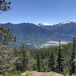
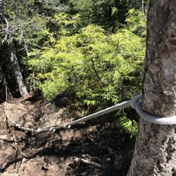
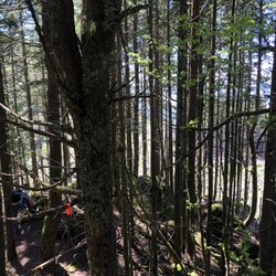
This trail is not for everyone as it is almost all uphill.. it really lives up to its "Teapot HILL" name. However, we enjoyed the shady route with random teapots hidden along the way. The teapot searching distracted from the never ending incline. Limited but free parking. Toilet just a couple minutes up from the parking lot. No real view at the end. Suggest to bring a teapot or teacup u don't need anymore for some fun :-) read more


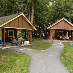
Did a short camping trip at Cultus Lake along with a visit to the waterpark, and decided why not end it with a nice leisure hike nearby at Teapot Hill Trail. The hike begins immediately with an uphill trail trek and feels like you are always going uphill with intermittent flat patches all the way to the top of the hill. All along the hike you will see an assortment of teapots hence the name of the trail that past hikers have left for present and future visitors to enjoy. Our group did encounter a couple of signs warning of active hornet's nest in the area, but never saw or encountered any hornets during our entire ascent and descent of the trail. I would rate the hike as semi-easy consisting of 5 kms round trip in length 250 meters in elevation that took our group just under 2 hours to complete. Our group arrived at 13:00 on a weekday and there were 2 available parking spots out of 10 at the parking lot located just adjacent to the beginning of the hiking trail. Parking is also available on the side of the highway when lot is full. read more


More info about Teapot Hill Trail
Columbia Valley Rd
Cultus Lake, BC V2R 5A3
Canada
Directions
Hours
Outdoor Amenities


Teapot Hill Trail - hiking - Updated July 2026
People found Teapot Hill Trail by searching for…
Lakes in Cultus Lake, British Columbia
Fun Things to Do in Cultus Lake, British Columbia
Hiking Trails in Cultus Lake, British Columbia
Tent Camping in Cultus Lake, British Columbia
Waterfalls and Swimming Holes in Cultus Lake, British Columbia
Waterfalls in Cultus Lake, British Columbia
Dog Friendly Beaches in Cultus Lake, British Columbia
Walking Trails in Cultus Lake, British Columbia
Scenic View in Cultus Lake, British Columbia
Easy Hikes in Cultus Lake, British Columbia
Picnic Areas BBQ Pits in Cultus Lake, British Columbia
Lakes & Ponds in Cultus Lake, British Columbia
Camping Sites in Cultus Lake, British Columbia
Browse Brands
Browse Articles
People who viewed Teapot Hill Trail also viewed
Mike Lake
1 review
Bridal Veil Falls Provincial Park
10 reviews
Sumas Mountain Regional Park
1 review
Cheam Lake Wetlands Regional Park
1 review
Vedder Mountain Ridge Trail
1 review
Great Blue Heron Nature Reserve
6 reviews
Slesse Memorial Trail
1 review
Yellow Aster Butte
1 review
Fraser River Heritage Park
3 reviews
Chilliwack Corn Maze
11 reviews