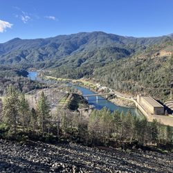
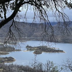
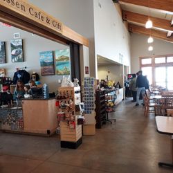
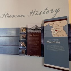
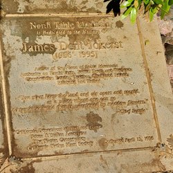
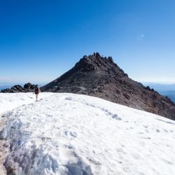
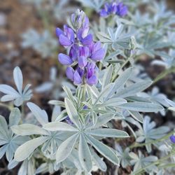
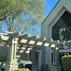
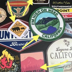
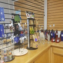
Tehama Country Visitor Center Photos


You might also consider
More like Tehama Country Visitor Center
Recommended Reviews - Tehama Country Visitor Center
Start your review...

10 years ago


More info about Tehama Country Visitor Center
250 Antelope Blvd
Red Bluff, CA 96080
Directions
(530) 529-0133
Call Now
Hours
Other Amenities
From the Business
Ask the Community - Tehama Country Visitor Center


Tehama Country Visitor Center - visitorcenters - Updated July 2026
Best of Red Bluff
People found Tehama Country Visitor Center by searching for…
Walking Trails in Red Bluff, California
Transportation in Red Bluff, California
Rest Area in Red Bluff, California
Travel Services in Red Bluff, California
Must See in Red Bluff, California
Scenic View in Red Bluff, California
Public Transportation in Red Bluff, California
Attractions in Red Bluff, California
Views in Red Bluff, California
Hiking Trails in Red Bluff, California
Tourist Attractions in Red Bluff, California
Places to Visit in Red Bluff, California
Things to See in Red Bluff, California
Hotels & Travel in Red Bluff, California
Places to Take Pictures in Red Bluff, California
Rest Stops in Red Bluff, California
What to Do in Red Bluff, California
Wedding Venues in Red Bluff, California
Romantic Restaurants With a View in Red Bluff, California
Lodging in Red Bluff, California
Tent Camping in Red Bluff, California
Cabins in Red Bluff, California
Trending Searches in Red Bluff, CA
Boat Rental near Tehama Country Visitor Center
Cliff Jumping near Tehama Country Visitor Center
Day Trips near Tehama Country Visitor Center
Fireworks near Tehama Country Visitor Center
Jet Ski Rental near Tehama Country Visitor Center
Kayak Rental near Tehama Country Visitor Center
Public Pools near Tehama Country Visitor Center
River Swimming near Tehama Country Visitor Center
Soccer Store near Tehama Country Visitor Center
Splash Pad near Tehama Country Visitor Center
Strawberry Picking near Tehama Country Visitor Center
Swimming Holes near Tehama Country Visitor Center
Swimming Lakes near Tehama Country Visitor Center
Browse Articles
Browse Nearby
BEST of Red Bluff, California Coffee near Tehama Country Visitor Center
BEST of Red Bluff, California Restaurants near Tehama Country Visitor Center
BEST of Red Bluff, California Things to Do near Tehama Country Visitor Center
BEST of Red Bluff, California Hotels near Tehama Country Visitor Center
BEST of Red Bluff, California Photo Spots near Tehama Country Visitor Center
BEST of Red Bluff, California Breakfast near Tehama Country Visitor Center
BEST of Red Bluff, California Attractions near Tehama Country Visitor Center
BEST of Red Bluff, California Caves near Tehama Country Visitor Center
BEST of Red Bluff, California Gold Panning near Tehama Country Visitor Center
Browse Brands
Related Cost Guides
Related Searches in Red Bluff, CA
Best Lookout Points to Visit in Red Bluff, California
Best Nature Trails for Hiking in Red Bluff, California
Best Waterfalls and Swimming Holes in Red Bluff, California
Check Out Off Road Trails in Red Bluff, California
Discover Historic Sites and Places in Red Bluff, California
Discover Majestic Redwood Trees in Red Bluff, California
Discover Popular Landmarks in Red Bluff, California
Discover Romantic Views in Red Bluff, California
Discover Scenic Mountain Bike Trails Near Red Bluff, California
Discover the Best Campground Spots in Red Bluff, California
Discover the Best Caves to Explore in Red Bluff, California
Discover the Best Lake Spots in Red Bluff, California
Discover the Best Night Hike Trails in Red Bluff, California
Enjoy the Best Night View Spots in Red Bluff, California
Enjoy the Best Picnic Spots and Ideas in Red Bluff, California
Enjoy the Best Walking Trails in Red Bluff, California
Exciting Cliff Jumping Spots in Red Bluff, California
Explore Courthouses Available in Red Bluff, California
Explore Free Picnic Areas Around Red Bluff, California
Explore Nature Spots Around Red Bluff, California
Explore Popular Picnic Areas Around Red Bluff, California
Explore Rest Stops Available in Red Bluff, California
Explore Scenic National Park Locations in Red Bluff, California
Explore Scenic Water Falls in Red Bluff, California Today
Explore the Best Swimming Holes Around Red Bluff, California
Explore the Best Trail Options in Red Bluff, California
Explore the Rich History in Red Bluff, California
Find Parks and Recreation Activities in Red Bluff, California
Find Top Dog Swimming Spots in Red Bluff, California
Find the Best Bridge Spots in Red Bluff, California
Find the Best Parks for Picnics in Red Bluff, California
Find the Best Scenic View Locations in Red Bluff, California
Must-See Tourist Attractions Around Red Bluff, California
Off Leash Dog Hiking Trails in Red Bluff, California
Perfect Spots to Watch Sunset in Red Bluff, California
Plan Nature Center Visits in Red Bluff, California
Plan a Scenic Drive Route Near Red Bluff, California
Popular Fishing Spots to Explore in Red Bluff, California
Popular Places to Take Pictures in Red Bluff, California
Relax at Natural Hot Springs Near Red Bluff, California
Safe River Swimming Areas in Red Bluff, California
Stair Climbing Activities and Gyms in Red Bluff, California
Top Hiking Trails to Explore in Red Bluff, California
Top Must See Attractions and Spots in Red Bluff, California
Top Places for Stargazing in Red Bluff, California
Top Running Trails to Explore in Red Bluff, California
Top Swimming Lakes to Enjoy in Red Bluff, California
Top-Rated Hikes in Red Bluff, California to Explore
People who viewed Tehama Country Visitor Center also viewed
99 West RV Park
76 reviews
Mt Lassen Motor Transit Inc Tcp 96B
6 reviews
Herbert S. Miles Safety Rest Stop Northbound
5 reviews
$
Sycamore Grove Campground
11 reviews
Rivers Edge RV Resort
7 reviews
John C Helmick Rest area - Northbound
4 reviews
$
Herbert S Miles Rest Area
13 reviews
$
Red Bluff RV Park
30 reviews
John C Helmick Rest Area Southbound
14 reviews
$
Blue Frog Approved Travel
2 reviews