Lake Oroville Vistor Center Photos


More like Lake Oroville Vistor Center
Recommended Reviews - Lake Oroville Vistor Center
Start your review...



8 years ago

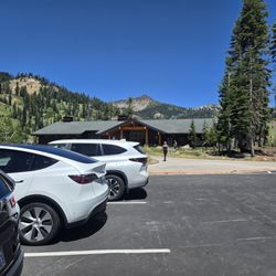
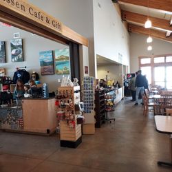
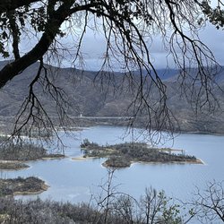
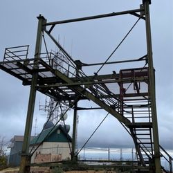
I'll keep this very nice and simple: The folks at the Lake Oroville Visitor Center are SO NICE! Basically, a few weeks ago my friends and I were planning a perilous trip to Feather Falls and Oroville. The only reason why we were so hesitant about going was because of the raging fires happening throughout NorCal. We decided to go anyway, because we weren't going to pass up on the opportunity. A week before, I called the Lake Oroville Visitor Center because I wanted to see whether it was possible to head down to the Oroville Damn, or at least what's remaining of it. If you haven't been living under a rock, you'll know that the damn spillway cracked in half in 2017 because of the extreme flooding and they've been repairing it since then. Well, a lovely park ranger on the phone told us that we could definitely drive NEARBY the damn and grab pictures. She also recommended we stop by the visitor's center for recommendations around the area. And that's exactly what we did. After surviving an intense, 8 mile hike to and from the gorgeous Feather Falls (https://www.yelp.com/biz/feather-falls-trail-oroville), we made a pit stop the next day at the Lake Oroville Visitor Center. It was only about 45 or so minutes from where we stayed in Marysville and all we had to do was drive up Highway 70 and then east on Highway 162. The visitor center had a pretty big parking lot, there was a large picnic area, and we saw deer roaming around! Not knowing what to expect, we bravely went inside the visitor's center. I honestly believe that the woman who approached us was the same as the one who talked to me on the phone because this lady was SUPER NICE. She eagerly ushered us into the theater room and showed us a zoomed-in image of the Oroville Damn. She discussed the history of the damn and then proceeded to walk us through how to drive to the road nearest the damn that just opened up! Afterwards, she suggested we check out the tower structure that's at the visitor's center. I highly recommend it because that 3 story tower provided AMAZING 360 degree views of the surrounding area. Before we left, we asked if she had any other places we should go to and she also directed us to Bidwell Bridge - supposedly the oldest suspension bridge in the U.S.? We would eventually go there, and had a really fun time! Need to give a major shout-out to the people at the Lake Oroville Visitor Center because they gave us a few awesome things to do for our Sunday morning in the Butte County area. We could have totally just gone home after our hike, but instead had some fun exploring! I give the folks here an "Omg, I'd travel 2 hours for this" rating. have fun and prosper, read more


7 years ago
Beautiful place! Perfect for pictures. I stop by every time I am in town to visit family. It's so relaxing and peaceful full of tranquility that living in the city does not give you. If you are in the area it's a must see. read more

More info about Lake Oroville Vistor Center























Why does Yelp recommend reviews?


Lake Oroville Vistor Center - visitorcenters - Updated August 2026
Best of Oroville
People found Lake Oroville Vistor Center by searching for…
Trending Searches in Oroville, CA
Cinema near Lake Oroville Vistor Center
Cliff Jumping near Lake Oroville Vistor Center
Indoor Mini Golf near Lake Oroville Vistor Center
Kids Activities Indoor near Lake Oroville Vistor Center
Kids Haircut near Lake Oroville Vistor Center
Lakes near Lake Oroville Vistor Center
Movie Theatre near Lake Oroville Vistor Center
Peach Picking near Lake Oroville Vistor Center
Rainy Day Activities near Lake Oroville Vistor Center
Shopping Malls near Lake Oroville Vistor Center
Sports Card Shops near Lake Oroville Vistor Center
Things To Do On A Rainy Day near Lake Oroville Vistor Center
Trading Card Shops near Lake Oroville Vistor Center
Browse Articles
Browse Nearby
BEST of Oroville, California Restaurants near Lake Oroville Vistor Center
BEST of Oroville, California Things to Do near Lake Oroville Vistor Center
BEST of Oroville, California Coffee near Lake Oroville Vistor Center
BEST of Oroville, California Hotels near Lake Oroville Vistor Center
BEST of Oroville, California Breakfast near Lake Oroville Vistor Center
BEST of Oroville, California Hiking near Lake Oroville Vistor Center
BEST of Oroville, California Shopping near Lake Oroville Vistor Center
Browse Brands
Related Cost Guides
Related Searches in Oroville, CA
Best Lookout Points to Visit in Oroville, California
Best Nature Trails for Hiking in Oroville, California
Best River Access Points in Oroville, California
Best Waterfalls and Swimming Holes in Oroville, California
Discover Free Campgrounds in Oroville, California Area
Discover Kid Friendly Hiking Trails in Oroville, California
Discover Majestic Redwood Trees in Oroville, California
Discover Popular Photo Spots in Oroville, California
Discover Top Fishing Lakes in Oroville, California for Your Next Trip
Discover Top Nature Parks to Visit in Oroville, California
Discover Urban Exploration Spots in Oroville, California
Discover the Best Campground Spots in Oroville, California
Discover the Best Lake Spots in Oroville, California
Enjoy Hiking Adventures in Oroville, California
Enjoy Stroller Walk Routes and Parks in Oroville, California
Enjoy the Best Night View Spots in Oroville, California
Enjoy the Best Walking Trails in Oroville, California
Enjoy the Scenic Boardwalk Attractions in Oroville, California
Explore Easy Hikes Perfect for All in Oroville, California
Explore Free Picnic Areas Around Oroville, California
Explore Popular Picnic Areas Around Oroville, California
Explore Popular Scenic Views Near Oroville, California
Explore Popular State Park Destinations in Oroville, California
Explore Rest Stops Available in Oroville, California
Explore Scenic National Park Locations in Oroville, California
Explore Scenic Sunset Hike Trails Around Oroville, California
Explore Top Dog Parks in Oroville, California Near You
Explore the Best Swimming Holes Around Oroville, California
Explore the Scenic River Walk in Oroville, California
Family Friendly Hiking With Kids in Oroville, California
Find Beautiful Views in Oroville, California
Find Picnic Tables for Outdoor Fun in Oroville, California
Find Romantic Picnic Secluded Spots in Oroville, California
Find the Best State Parks Camping Spots in Oroville, California
Hiking Trails With Waterfalls in Oroville, California
Plan Nature Center Visits in Oroville, California
Plan a Scenic Drive Route Near Oroville, California
Popular Fishing Spots to Explore in Oroville, California
Safe and Fun Parks for Kids in Oroville, California
See Breathtaking Sunset Views in Oroville, California
Stair Climbing Activities and Gyms in Oroville, California
Top Hiking Trails to Explore in Oroville, California
Top Must See Attractions and Spots in Oroville, California
Top Spots for Night Hiking in Oroville, California
Top Swimming Lakes to Enjoy in Oroville, California
Top-Rated Camping Sites in Oroville, California
Top-Rated Hikes in Oroville, California to Explore
Tour Famous Lighthouses Located in Oroville, California


