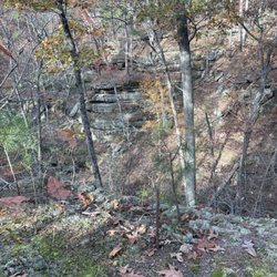
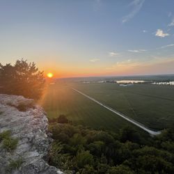
Tiemann Shut-ins Photos


More like Tiemann Shut-ins
Recommended Reviews - Tiemann Shut-ins
Start your review...

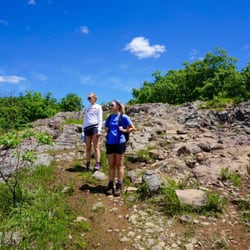
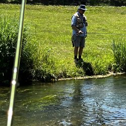
Such a great place to come here to hike. The view of the water was so peaceful. We saw some people canoe here and swim here as well. There were some people that came here to camp. Some people were fishing here too. Such a beautiful place. I definitely want to come back here again just to relax for a day trip or a weekend getaway. read more


More info about Tiemann Shut-ins
Ironton, MO 63650
Directions
Hours
Outdoor Amenities


Tiemann Shut-ins - hiking - Updated June 2026
Best of Ironton
People found Tiemann Shut-ins by searching for…
Things to Do in Ironton, Missouri
Swimming Lakes in Ironton, Missouri
Day Trips in Ironton, Missouri
Waterfalls in Ironton, Missouri
Beautiful Views in Ironton, Missouri
Hiking Trails in Ironton, Missouri
Off Road Trails in Ironton, Missouri
Walking Trails in Ironton, Missouri
Jogging Trails in Ironton, Missouri
Lakes & Ponds in Ironton, Missouri
Running Trails in Ironton, Missouri
Tent Camping in Ironton, Missouri
Attractions in Ironton, Missouri
Camping Sites in Ironton, Missouri
Places to Visit in Ironton, Missouri
Trending Searches in Ironton, MO
Browse Articles
Browse Brands
Related Searches in Ironton, MO
Best Nature Trails for Hiking in Ironton, Missouri
Best Off Leash Dog Parks in Ironton, Missouri
Best Parks for Parties and Events in Ironton, Missouri
Best Places for Horseback Riding in Ironton, Missouri
Best Spots for Star Gazing in Ironton, Missouri
Best Water Parks for Kids in Ironton, Missouri
Discover Dog Friendly Trails to Explore in Ironton, Missouri
Discover Scenic Mountain Bike Trails Near Ironton, Missouri
Discover Top Nature Parks to Visit in Ironton, Missouri
Discover a Hiking Trail in Ironton, Missouri
Discover the Best Night Hike Trails in Ironton, Missouri
Dog-Friendly Hikes With Dogs in Ironton, Missouri
Enjoy the Best Night View Spots in Ironton, Missouri
Enjoy the Best Picnic Spots and Ideas in Ironton, Missouri
Explore Beautiful Parks and Green Spaces in Ironton, Missouri
Explore Popular Campgrounds Near Ironton, Missouri
Explore Popular RV Parks Around Ironton, Missouri
Explore Popular View Points Around Ironton, Missouri
Explore Secret Spots Worth Visiting in Ironton, Missouri
Explore Top Dog Parks in Ironton, Missouri Near You
Explore the Best Trail Options in Ironton, Missouri
Family Friendly Hiking With Kids in Ironton, Missouri
Find Fun Kids Activities Outdoor in Ironton, Missouri
Find Top Skate Parks in Ironton, Missouri for All Skill Levels
Find the Best Parks BBQ Grills in Ironton, Missouri
Find the Best Parks for Picnics in Ironton, Missouri
Find the Best Playgrounds to Visit in Ironton, Missouri
Find the Best Scenic View Locations in Ironton, Missouri
Great Places to Swim in Ironton, Missouri
Have Fun at a Splash Pad in Ironton, Missouri
Must-See Tourist Attractions Around Ironton, Missouri
Off Leash Dog Hiking Trails in Ironton, Missouri
Perfect Spots to Watch Sunset in Ironton, Missouri
Picnic Areas With BBQ Pits Available in Ironton, Missouri
Plan Nature Center Visits in Ironton, Missouri
Plan a Scenic Drive Route Near Ironton, Missouri
Popular Fishing Spots to Explore in Ironton, Missouri
Popular Kids Activities in Ironton, Missouri
Popular Picnic Spots to Visit in Ironton, Missouri
Popular Places to Take Pictures in Ironton, Missouri
Popular Things to Do in Ironton, Missouri
Popular Things to See in Ironton, Missouri
Relax at Natural Hot Springs Near Ironton, Missouri
Safe River Swimming Areas in Ironton, Missouri
Safe and Fun Parks for Kids in Ironton, Missouri
Top Playgrounds for Kids to Enjoy in Ironton, Missouri
Top Running Trails to Explore in Ironton, Missouri
Top Things to Do With Teenagers in Ironton, Missouri
People who viewed Tiemann Shut-ins also viewed
Taum Sauk Mountain State Park
4 reviews
Parks Bluff Campground
7 reviews
Johnson's Shut-Ins State Park
43 reviews
Taum Sauk Mountain State Park
6 reviews
Marble Creek Camp Grounds
1 review
Taum Sauk Mountain State Park
1 review
Shepherd Mountain Bike Park
1 review
Dayspring Bible Camp
1 review
Madison County Senior Center
1 review
Dhamma Sukha Meditation Center
3 reviews