
Tom's Thumb Trailhead Photos


More like Tom's Thumb Trailhead
Recommended Reviews - Tom's Thumb Trailhead
Start your review...


Reviews With Photos


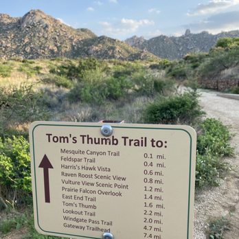
A year ago completing Tom Thumb Trailhead was not something I could do, but now I an say I HIKED THAT! Tom Thumb Trailhead is rated strenuous. It starts out easy & you will come to intersection of Feldspar Trail continue and start feeling the incline and the trail starts winding and then come up to Harris Hawk Vista. Now you will be hitting the switchbacks and the climb starts to get serous. You will pass more vistas/trail intersections and lot offer some great views. I went off trail for a second along Prairie Falcon Overlook to check out the Kissing Boulders, and if being honest catching my breath haha. After a few pics I got back on the trail and made my way up to Tom Thumb. Tom Thumb Trailhead is apx 5 miles round trip. It kicks my butt but I cant wait to climb back up!


Great hike! A drive out there to get to it but it's a beautiful drive. The trail head has bathrooms and tons of parking. Well marked and maintained. Some good elevation for a good workout but amazing views and totally do about


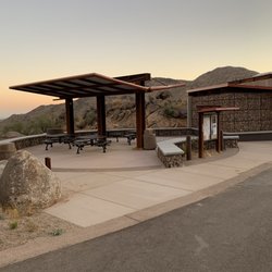
Beautiful trailhead building that blends with the scenery and provides ample shade. There is no water available in the building so make sure you bring some. The trail is challenging. After one mile, you swear it still can't be another mile to the peak. Keep going, though, because the views are worth it. The trail is excellently maintained, no issues knowing where to go. We went on a Sunday afternoon and there were tons of people on the trail. Everyone was great about moving aside to let others pass. The elevation is what makes it hard. There are a few boulder areas in the trail but not too difficult to maneuver. Great workout with high reward for views.


So, this may be more of a PSA than a review but for those like myself I hope it'll be a valuable contribution: If you are looking for a casual hike and your super athletic adventuresome partner convinces you that Tom's Thumb or East End Ridge is an easy hike...amateur hour...to be tackled in 48 minutes, show them this review. Also, if your partner breaks out their head to toe REI gear, trail shoes, hiking pack with water bladder, and hiking poles, know that this will not be a "leisurely hike". Thankfully I was donned with trail shoes and my partner brought...well...everything else, but it's incredible important to read the trail markers here. Tom's Thumb is labelled extremely difficult...for good reason! The switchbacks are no joke, they're frequent, steep, and for those of us who are lovingly under 5 feet tall, the hike will require a bit of jumping. Everyone we passed was dressed in REI, many carried hiking poles, and most held a beloved REI backpack with a water bladder. You've been warned. The trail distance is 3 ish miles. My moderately athletic, asthmatic self made it 1.7 miles in 48 minutes with an elevation gain of over 1000 ft, so I highly encourage parties to give themselves time, grace, proper equipment, and plenty of water. But, apart from my complaining, here's why this is a trail with hiking for any adventurer: *The view (particularly at sunset is breathtaking). We arrived around 5ish, and shared the trail with only about 13 others. Everyone had their space, and we encountered a passerby about every 10-20 minutes *the trail is meticulously maintained *even for those who are moderately athletic, it's a mental and physical journey that allows you to connect with all senses (except taste that is) *the plant life is labeled *there are many beautiful relief points to stop, take in the beauty and savor the scenery *if you're not feeling an "extremely difficult" challenge, there are plenty of other trails to explore. P.S. just a note- although they look plush from the exterior, the potties at the head of the trail or port-a-potties. I highly recommend you go before you head up to the trail :)
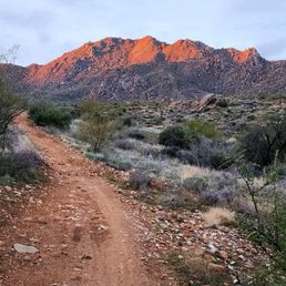

This is another great trailhead trailhead at the McDowells. Very clean. Restrooms are clean. There is ample parking. No issues at all. It's set back in quite a ways so it's not a straight shot off the interstate. No volunteers here like at some of the trailheads at the McDowells. This is definitely one of the more popular trailheads at the McDowells as it's the primary trailhead for Tom's Thumb. Today I opted to do the less popular Rock Knob x Pemberton 18-mile loop.


What an amazing hike! We did a little over 10 miles on a couple of trails. The terrain was great and offered a bunch of variety. Just about 3000 feet elevation gain. Make sure you take plenty of water.


My grandpa did this so I thought it would be easy- the first mile is not!! Basically straight up the mountain. Had to take multiple breaks. Once you reach the half point (1.3mi) it is pretty flat til the thumb. Going down is tricky if you dont have boots- gravel and loose rock. Super beautiful & I loved it! NO water at the trailhead- fill up before There are bathrooms at the trailhead.
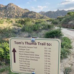

Beautiful. One of my favorite hikes of our entire trip. This is a challenging hike - with 1,000 feet of elevation gain in the first 1.5 miles or so. It's well traveled and smooth but does have loose gravel almost like crush-n-run and some small boulders and climbs. If you have the right shoes, you'll be fine, but this isn't a trail I would do smooth running-type shoes on. People always seem to think those are "fine" but if you are going downhill and need the traction, it's actually how people fall easily. We completed this hike around sunset and saw all the markers for the gate closing but if you are there past dark you just pull up and it will open. It was amazing - I love the light rocky terrain. We hiked 3 days in Sedona and saw the beautiful red rocks and this was a nice transition and change from that. Lots of wildlife (we saw rodents, snakes and tarantulas) on the trail and tons of catcti and other greenery. It's 100% worth it but I could see it being very hot as there is no shade at all if you did it during the middle of the day.
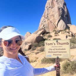

Another fun hike right in Phoenix! This trail gives you spectacular views of the valley all around. The hike is an incline all the way up so come prepared with good grip shoes as there are sections with lose gravel/dirt, especially on the descent. Get your cardio on!


Steep 3 mile hike that gains over 1,000 ft in elevation. Bring plenty of water and possibly a hat. The Arizona sun can be unrelenting. I've done this hike twice and every time I get very winded. Still a very cool experience! The views are spectacular! You can see almost all of Phoenix in the distance.


What a great day for a hike! The views from here are great and it is wonderful how close to the city you are. Plenty of opportunities to stop and take photos. As many have mentioned (and I am glad that I read other Yelp reviews before going!), you need to bring your own water before you arrive. I was a little surprised by this since there is an information desk here. Restrooms are available and information about the surrounding rock climbing areas, day hikes, and desert knowledge about the flora and fauna. Perhaps the ONLY complaint that I did have was the trail is crowded. When you arrive, the full parking lot looms like a warning. Basically, the entire time you are on the trail, you have someone hot on your tail. Even if you walk/hike fast (or run as some do), you won't ever get a feeling of being alone with nature. If someone is coming with you who doesn't move at a fast pace, constantly moving to the side or feeling someone nipping at your heels doesn't create the most positive experience. For a quick two-hour hike near the city, this is still a solid choice. But if you are craving something more authentic, I would not recommend coming here. This is firmly on the tourist trail. Granted, the weather in February is perfect to take advantage of the trail. I'm not sure how busy it is off-peak season. The trail climbs at a low steady grade to the ridgeline along a well-maintained, smooth gravel trail. Just over the ridge, the landscape starts to fill with house-sized boulders and takes on an almost moon-like landscape. Follow the well-marked signs toward Tom's Thumb. Pay attention to the passing signs directing you to off-shoot trails and rock climbing areas to plan out your next adventure here. After just under two miles of hiking, you will reach the signed junction for the East End Trail and the base of Tom's Thumb. Make a right and head towards the summit. This final section of the trail is not as well marked and will require a bit of scrambling, but the trail is still easy to follow - just head towards the largest rock you see! Once to the top, you are finally greeted by the giant granite tower that is Tom's Thumb. The summit area is riddled with small alcoves and caves to explore. This is a straightforward out-and-back trail, for a total of approximately four miles round trip with about a 1,000-foot elevation gain. There are warning signs about rattlesnakes and scorpions but as long as you do not deviate from the established paths, these do not seem like something you or your party will encounter. Cell phone and Internet service are a bit spotty even during the drive up. Definitely plan ahead!


This was a fun and challenging hike. Ample parking, facilities at the trail head, excellent signage and spectacular scenery and hikes. The hike up to Tom's Thumb is a strenuous ascent of 1363' to the namesake rock formation. It's a five mile round trip. There are a few view points where you can take a break. It's a busy trail, so use some etiquette and share the trail. Also, pack some damn headphones if you must listen to music and don't disturb the serenity of nature for others. Good shoes, sunblock and lots of water or you're gonna have a bad time.


Hiked on 5/6 & other trails during a Phoenix/Sedona trip & posted a vlog! Search "Nikko Gandia Travels Phoenix Vlog". Would label as moderate vice hard. Restrooms available near trailhead/parking lot. Great views throughout the hike & at the summit!


This incredibly beautiful trail is one that shouldn't be missed if you're around Scottsdale. It should be noted that this full hike (approx 2.2 miles one way or 4.4 round trip) isn't a beginner trail by any means, but it's doable. All of the cutbacks, significant incline in elevation, minimal shade & loose gravel in areas should be factored in when considering the time of year you want to go. However, if you want to do it (and I strongly suggest doing it) you'll experience views, terrains & serenity that's unlike anything else. Not only is there a main trail that'll take you directly to Tom's Thumb, there are a good handful of side trails that'll lead you to other awesome areas. I can't remember the specific one I stopped at but it led to an overlook of a massive valley where I saw some rock climbers on a the face of a huge mountain. Basically anywhere you stopped there was a 360 degree view of mountains, gigantic cacti, the surrounding cities & all of the beautiful dessert you're fully immersed in. It was my 1st time visiting AZ & wanted to get the full outdoor experience so I'd say this hike let me accomplish that. There were times I was focused on just making it through the trail but every time I stopped to take it all in, I was truly blown away. I can't suggest it enough to check it out, it's well worth a trip out of your way to make it happen. Just be sure to bring lots of water & take rest when you get to shaded areas. Have fun & safe hiking! read more

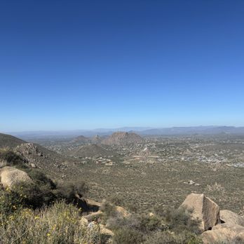


This is a great hike! About 2.2 miles each way, and it definitely gains altitude. So bring water. I live in the northwest and it's been too cold to hike, so I'm definitely not in prime shape, but made it and had a great time, too. The view is amazing. Worth the trip if you're in Scottsdale! read more


5 months ago
This is my go to Saturday morning breakfast spot. Michelle at the counter there is amazing general manager, Joe rocks. Can't beat this place for some barbecue. read more


A year ago completing Tom Thumb Trailhead was not something I could do, but now I an say I HIKED THAT! Tom Thumb Trailhead is rated strenuous. It starts out easy & you will come to intersection of Feldspar Trail continue and start feeling the incline and the trail starts winding and then come up to Harris Hawk Vista. Now you will be hitting the switchbacks and the climb starts to get serous. You will pass more vistas/trail intersections and lot offer some great views. I went off trail for a second along Prairie Falcon Overlook to check out the Kissing Boulders, and if being honest catching my breath haha. After a few pics I got back on the trail and made my way up to Tom Thumb. Tom Thumb Trailhead is apx 5 miles round trip. It kicks my butt but I cant wait to climb back up! read more


2 years ago
Great hike! A drive out there to get to it but it's a beautiful drive. The trail head has bathrooms and tons of parking. Well marked and maintained. Some good elevation for a good workout but amazing views and totally do about read more


Beautiful trailhead building that blends with the scenery and provides ample shade. There is no water available in the building so make sure you bring some. The trail is challenging. After one mile, you swear it still can't be another mile to the peak. Keep going, though, because the views are worth it. The trail is excellently maintained, no issues knowing where to go. We went on a Sunday afternoon and there were tons of people on the trail. Everyone was great about moving aside to let others pass. The elevation is what makes it hard. There are a few boulder areas in the trail but not too difficult to maneuver. Great workout with high reward for views. read more


4 years ago
So, this may be more of a PSA than a review but for those like myself I hope it'll be a valuable contribution: If you are looking for a casual hike and your super athletic adventuresome partner convinces you that Tom's Thumb or East End Ridge is an easy hike...amateur hour...to be tackled in 48 minutes, show them this review. Also, if your partner breaks out their head to toe REI gear, trail shoes, hiking pack with water bladder, and hiking poles, know that this will not be a "leisurely hike". Thankfully I was donned with trail shoes and my partner brought...well...everything else, but it's incredible important to read the trail markers here. Tom's Thumb is labelled extremely difficult...for good reason! The switchbacks are no joke, they're frequent, steep, and for those of us who are lovingly under 5 feet tall, the hike will require a bit of jumping. Everyone we passed was dressed in REI, many carried hiking poles, and most held a beloved REI backpack with a water bladder. You've been warned. The trail distance is 3 ish miles. My moderately athletic, asthmatic self made it 1.7 miles in 48 minutes with an elevation gain of over 1000 ft, so I highly encourage parties to give themselves time, grace, proper equipment, and plenty of water. But, apart from my complaining, here's why this is a trail with hiking for any adventurer: *The view (particularly at sunset is breathtaking). We arrived around 5ish, and shared the trail with only about 13 others. Everyone had their space, and we encountered a passerby about every 10-20 minutes *the trail is meticulously maintained *even for those who are moderately athletic, it's a mental and physical journey that allows you to connect with all senses (except taste that is) *the plant life is labeled *there are many beautiful relief points to stop, take in the beauty and savor the scenery *if you're not feeling an "extremely difficult" challenge, there are plenty of other trails to explore. P.S. just a note- although they look plush from the exterior, the potties at the head of the trail or port-a-potties. I highly recommend you go before you head up to the trail :) read more

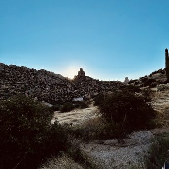


This is another great trailhead trailhead at the McDowells. Very clean. Restrooms are clean. There is ample parking. No issues at all. It's set back in quite a ways so it's not a straight shot off the interstate. No volunteers here like at some of the trailheads at the McDowells. This is definitely one of the more popular trailheads at the McDowells as it's the primary trailhead for Tom's Thumb. Today I opted to do the less popular Rock Knob x Pemberton 18-mile loop. read more
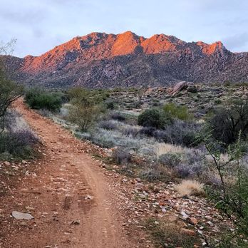


My grandpa did this so I thought it would be easy- the first mile is not!! Basically straight up the mountain. Had to take multiple breaks. Once you reach the half point (1.3mi) it is pretty flat til the thumb. Going down is tricky if you dont have boots- gravel and loose rock. Super beautiful & I loved it! NO water at the trailhead- fill up before There are bathrooms at the trailhead. read more


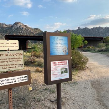
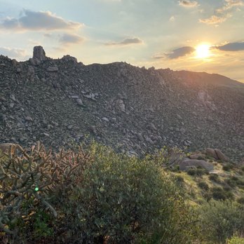
Beautiful. One of my favorite hikes of our entire trip. This is a challenging hike - with 1,000 feet of elevation gain in the first 1.5 miles or so. It's well traveled and smooth but does have loose gravel almost like crush-n-run and some small boulders and climbs. If you have the right shoes, you'll be fine, but this isn't a trail I would do smooth running-type shoes on. People always seem to think those are "fine" but if you are going downhill and need the traction, it's actually how people fall easily. We completed this hike around sunset and saw all the markers for the gate closing but if you are there past dark you just pull up and it will open. It was amazing - I love the light rocky terrain. We hiked 3 days in Sedona and saw the beautiful red rocks and this was a nice transition and change from that. Lots of wildlife (we saw rodents, snakes and tarantulas) on the trail and tons of catcti and other greenery. It's 100% worth it but I could see it being very hot as there is no shade at all if you did it during the middle of the day. read more





4 years ago
Another fun hike right in Phoenix! This trail gives you spectacular views of the valley all around. The hike is an incline all the way up so come prepared with good grip shoes as there are sections with lose gravel/dirt, especially on the descent. Get your cardio on! read more


Steep 3 mile hike that gains over 1,000 ft in elevation. Bring plenty of water and possibly a hat. The Arizona sun can be unrelenting. I've done this hike twice and every time I get very winded. Still a very cool experience! The views are spectacular! You can see almost all of Phoenix in the distance. read more


What a great day for a hike! The views from here are great and it is wonderful how close to the city you are. Plenty of opportunities to stop and take photos. As many have mentioned (and I am glad that I read other Yelp reviews before going!), you need to bring your own water before you arrive. I was a little surprised by this since there is an information desk here. Restrooms are available and information about the surrounding rock climbing areas, day hikes, and desert knowledge about the flora and fauna. Perhaps the ONLY complaint that I did have was the trail is crowded. When you arrive, the full parking lot looms like a warning. Basically, the entire time you are on the trail, you have someone hot on your tail. Even if you walk/hike fast (or run as some do), you won't ever get a feeling of being alone with nature. If someone is coming with you who doesn't move at a fast pace, constantly moving to the side or feeling someone nipping at your heels doesn't create the most positive experience. For a quick two-hour hike near the city, this is still a solid choice. But if you are craving something more authentic, I would not recommend coming here. This is firmly on the tourist trail. Granted, the weather in February is perfect to take advantage of the trail. I'm not sure how busy it is off-peak season. The trail climbs at a low steady grade to the ridgeline along a well-maintained, smooth gravel trail. Just over the ridge, the landscape starts to fill with house-sized boulders and takes on an almost moon-like landscape. Follow the well-marked signs toward Tom's Thumb. Pay attention to the passing signs directing you to off-shoot trails and rock climbing areas to plan out your next adventure here. After just under two miles of hiking, you will reach the signed junction for the East End Trail and the base of Tom's Thumb. Make a right and head towards the summit. This final section of the trail is not as well marked and will require a bit of scrambling, but the trail is still easy to follow - just head towards the largest rock you see! Once to the top, you are finally greeted by the giant granite tower that is Tom's Thumb. The summit area is riddled with small alcoves and caves to explore. This is a straightforward out-and-back trail, for a total of approximately four miles round trip with about a 1,000-foot elevation gain. There are warning signs about rattlesnakes and scorpions but as long as you do not deviate from the established paths, these do not seem like something you or your party will encounter. Cell phone and Internet service are a bit spotty even during the drive up. Definitely plan ahead! read more


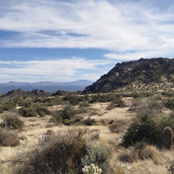


This was a fun and challenging hike. Ample parking, facilities at the trail head, excellent signage and spectacular scenery and hikes. The hike up to Tom's Thumb is a strenuous ascent of 1363' to the namesake rock formation. It's a five mile round trip. There are a few view points where you can take a break. It's a busy trail, so use some etiquette and share the trail. Also, pack some damn headphones if you must listen to music and don't disturb the serenity of nature for others. Good shoes, sunblock and lots of water or you're gonna have a bad time. read more


3 years ago
Hiked on 5/6 & other trails during a Phoenix/Sedona trip & posted a vlog! Search "Nikko Gandia Travels Phoenix Vlog". Would label as moderate vice hard. Restrooms available near trailhead/parking lot. Great views throughout the hike & at the summit! read more

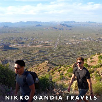


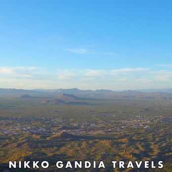


Wooowee! This trail left my calves & hammies feeling the BURN! I have been doing a lot of hiking lately and came to this location with confidence...but after about a mile of steep inclines, I was questioning my stamina. I had to stop multiple times to take a few "breathers". Use caution: Going down was also a little challenging, due to loose gravel. I came close to biffing it! There's prickly bushes, cacti and other foliage that can scrape you if you get too close. This is one of my new favorite hikes! Beautiful rock structures and the views by the "thumb" are rewarding. *Approx. 4 miles out/back. read more


3 years ago
What a great hike, pretty challenging on the way up, a great workout. I went mid week, mid day. Pro tip, don't go mid day, lol it was hot. Take a decent sized bottle of water, wear good shoes. Oh yes, I had sweat pouring sunscreen into my eyes, take a headband or small towel. Didn't see any snakes thankfully. Super peaceful, there is a washroom at the base, no running water here though. Took about 2 hrs 10 min roundtrip with a nice break at the top. So many cool rock formations along the way. Good trail, some steep sections, would be difficult if you have limited mobility, we'll worth the effort, hope to do this again one day! read more


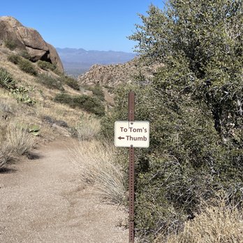


This was my 1st hike this year and man was it tough for me. Coming off a knee and shoulder injury, I figured I was ready. For the most part I did ok making it to the top and once there the view was amazing! Coming back down was the hardest for me but whoo hoo I did it! Now it's getting a little too hot and the critters are out... Glad I didn't see any!! Ugh! Definitely looking forward to hiking when we get back to cooler temperatures. read more


6 years ago
Tom's Thumb is one of the best hikes in the Valley of the Sun. The first 1/2 mile is pretty easy and relatively flat. From there, the next mile plus is a huge vertical climb. There are countless trails and paths to take. Whether you are looking for some hard trails to hike or looking for some climbing/scrambling/rappelling routes, Tom's has a little something for everyone. THIS IS NOT A BEGINNER'S TRAIL - PACK PLENTY OF WATER. There is a ton of wildlife in this area. Here are a few that I have encountered while on the trail: Bees: We were hiking to the top all the way up to Tom's Thumb when a swarm of bees blocked the only route down. As it was a few minutes before dusk, we had no choice but to walk through the bees. We were forced to not swat at the bees, as they flew around and on us. Luckily, we were able to walk through without getting stung. Coyotes: this is their natural habitat so expect to see coyotes in the early morning or late afternoon. Rattlesnakes: I've seen countless rattlesnakes on the trail. They like to sun themselves and we have to remember that this is their habitat and not ours. Peregrine Falcon: We were on a trail that most never use. As we got to the top of the peak we were greeted by a Peregrine Falcon. This was a majestical treat to see this spectacular species. As we got to the top, the Peregrine Falcon took flight into a valley between 2 peaks and let out a few calls that sounded like kik-kik-kik... it was incredible to see and hear. Lizards: they are everywhere. I've seen so many different species, including the poisonous Gila monster. There is so much to see and hear. My suggestion is take your headphones out or turn the sound way down so you don't miss too much. Happy trails read more


6 years ago
Here's another trail with stunning views Arizona has so many great spots all equally stunning it's difficult to be partial to one But Tom's Thumb feels less crowded than the popular ones like camelback or hole in the rock trail The hike itself is not too bad it's moderately difficult We love this hike because the drive to and back home is quite scenic It's the perfect way to spend the weekend getting some fresh air while practicing social distancing Cheers! read more


Love this trail! The trail is well maintained, great for all ages and has easy to follow signs. Tom's Thumb trail is one of my new favorites! The trail was pretty crowded, we saw two bikers and many people brought their dogs. Make sure to bring water for your pups (and yourself) because there is no water at the trailhead. The parking lot by the trailhead has ample parking and restroom facilities. The restrooms do not have running water but they do have hand sanitizer. There is no entrance or parking fee. The hike took us about 2 hours but we stopped to eat and take photos at the top. If you get cold easily, I recommend bringing a hat or ear warmers because the hike is windy towards the top. Overall, we had a great time and will definitely be back! read more


Marcus Landslide is a lesser used trail in the McDowell Sonoran Preserve trail network. You access the trail from the Tom Thumb parking lot and find the trailhead on the southeast end of the lot. The trail has numerous interpretive signs describing the geology and includes a couple of view finders to observe the landslide, which is the second largest landslide in Arizona. It is a nearly flat trail with a few short up and down sections in the small loop at the turnaround point. You will have excellent views of the Verde River Valley and Fountain hills, plus the base of the mountains and the landslide to the west. The trail is only 3.7 miles and thus suitable for almost anyone and is especially good for out of town visitors due to the numerous interpretive signs and lookout points. Mountain bike trails branch off at a couple of locations heading over to the adjoining McDowell Mountain park, but hikers are unlikely to encounter many cyclists. Features of this trail include unique mushroom rocks, beautiful wildflowers when there has been a wet winter, very large boulders including the Submarine Rock at the turnaround point, plus the landslide. In early April the hedgehog cactus were starting to bloom with bright fuchsia flowers and soon the plentiful cholla will start. An additional feature of the hike is avoidance of the crowds at Tom Thumb (which is also a great trail with fantastic views and a nice workout due to the elevation gain). There is no shade on this trail so bring plenty of water and hike early. Often there is a breeze to keep you cool. read more



2 years ago

4 years ago
Yeh it's pretty nice and beautiful. I personally hate people, that's why I like Toms Thumb Trail because there's not that many people. Be careful with the cactus, my dog stepped on one, but he's all good. It was just a tiny little prick. I'll probably buy him little dog shoes that the classy people buy. read more



4 years ago
Amazing hike, incredible views, big granite boulders perfect weather. My favorite hike in the phoenix area read more


If you're looking to burn some calories, this is the trail to head to! The climb was exhausting, but so worth it. I gained about 1000 ft in elevation and the total hike was 4.5 miles in and out. The trail itself is easy to follow, however the continuous steep incline made this hike difficult for my friends and I. Be careful of where you step, and definitely wear the correct hiking shoes as this steep slope will cause you to slip and fall. I've seen many people bring hiking sticks, which my friends and I should've done because one of us was injured towards the end of the hike. This isn't your usual waterfall or forest hike-- you're hiking alongside cacti, birds and in dry heat, so please bring lots of water with you and sunscreen! It was a beautiful 60 degrees out and the sun was still beating down on us! However when we got to the top, the view was definitely worth it! The bathroom at the bottom of the hike was well maintained, but there are no sinks or running water for you to wash your hands, so I recommend bringing hand sanitizer or baby wipes with you if you plan on heading out to Tom's Thumb! read more


This is a lovely hike! One thing I love is how plentiful the parking is. The anxiety of trying to find parking at a busy trailhead sucks, but if you arrive even a few hours after the trailhead opens you'll have no trouble finding a place to park. On a weekend during COVID less than half the hikers were wearing masks. I wore my mask the entire way (as I am used to wearing a mask all day anyway at work) and found that it was actually useful keeping my face warm and keeping the wind off my face once I arrived at Tom's Thumb. It is VERY windy near the rock! The first half of this hike is moderate and then second half is pretty easy. There is a ton of loose gravel so be careful with your footing. There are bathrooms at the entrance of the trail that are very well maintained. read more


I came here with a friend on a Monday morning, and the parking lot had ample parking at 7:15AM. We started the hike and it was long but pretty good! The way up goes up for a while but it's not too bad, pretty rocky the whole way as people have said. Take AllTrails with you as there are a lot of intersections, but they're all signed which is great if you know where you're going. We got up to Tom's Thumb at around 10AM, and it was slightly windy up there with alright views. The hike down was a bit monotonous and we got back to our cars around 12:30PM. During the entire hike, we saw probably about 30 people, most wearing masks. read more


3 years ago

6 years ago
This was such a great hike! Took me and my mother in law just at 2 hours up and down. We kept a pretty brisk walk. We started early so the sun was hid behind the rocks until the way down the sun was on us. I would recommend starting before 9am so you don't warm up too quick. Especially in the summer! The trail has quite a few steep set backs, that will get your heart rate going! Once you get to the top, the view is amazing. The rumor is, you have to complete the hike and actually touch "Toms thumb" or it's bad luck! read more


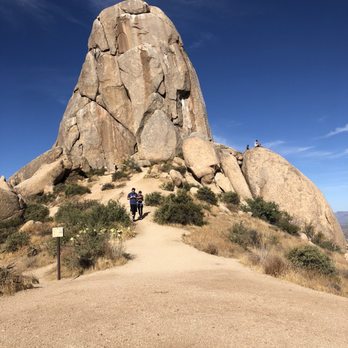


Very well maintained trail. It's not a difficult hike (so good hike for all fitness levels and kids too) and a good distance as well (about 2 miles each way) so you will get your heart pumping for sure. I will definitely be back the next time I am in Phoenix. read more


7 years ago
Loved this hike. We took the pups for a beautiful afternoon out. Be aware that it is STEEP! While not a "difficult" hike, you should be prepared for the incline. Gorgeous views from multiple view points throughout the hike. We did this early afternoon on a weekend and it was not crowded, we were able to bring both of our dogs without issues. The dogs loved the hike and we loved how tired they were after! Definitely a good one when you only have a few hours and want some great views and some cardio. If you have bad knees, take it slow coming down but we saw hikers of all skill levels along the way. Adding some photos for reference. Bring lots of water and a camera. This has a well organized trail head with bathrooms but now water, paved parking lot and the full road out is paved, any car would be able to make it out here. read more


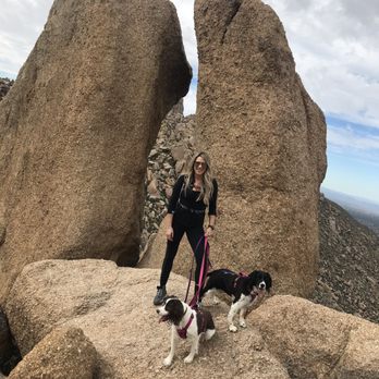

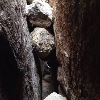
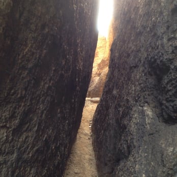
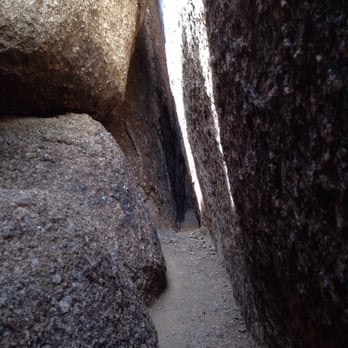
I knew Tom's Thumb was a hiking destination loved by many, but I had absolutely no clue what kind of adventure was in store for me! Getting there is a fun time in and of itself, as the paved road dips up and down in waves like a roller coaster. You finally arrive at the trailhead and while it was midday on a Saturday, I was able to find parking without issue. NOTE: As many others have stated, there is NO WATER here, so be sure to fill up before you arrive. As you hit the trail, the uphill at first is gradual but then transforms into a dramatic incline of many switchbacks. The trail is well defined/labeled with signs telling you the distance to trail intersections and of course the thumb. When you get to the thumb, be sure to touch it for good luck! ;) Then go explore the various caves and boulders in the surrounding area. I was able to find the Ogre's Den which was a cool cave with a nice view and little trinkets left by other hikers. I also shimmied through some tight boulder crevices to end up on the other side of the hill (can't really call it a cave lol) which was one of the craziest things I've ever done! I'll definitely be back here in the future to do more exploring! read more






13 years ago
When my adventurous hiking friend told me this hike was very difficult, I was expecting the worst but I guess since I've spent so much time running daily, I guess my endurance has improved and I really didn't think the hike was that difficult. It's not covered with "stairs" like Piestewa Peak, and it is much longer, but man! Was this hike gorgeous! Even the drive in was unique. It was similar to being on a small roller coaster, hilly as can be! This hike, at least the 5 mile one we did today, promises tighter butt and quad muscles! You gain an elevation of about 1,200 feet, the trail guide at the entrance said. There are plenty of switchbacks and areas where the gravel is loose but the scenery is so breath taking that you are distracted and almost don't even think about the hike's difficulty. There is no water around as other hikers have mentioned, so please bring water with you just in case when you hike. This trail is definitely worth trying at least once and who knows? You might become addicted to always coming here, because I know I will! read more


McDowell mountain preserve offers several hiking trails and Tom's Thumb is one of them. From the north parking, you will gain about 1,100 feet in altitude to the 3,925 feet. Trail is well marked and it is rated moderate but it was relatively easy for those who hike other moderate trails every week. We started shortly before 6am. We were the first one to park as it was raining until a couple minutes ago. Rumor said touching the TT will bring you good luck, so we all touched it. Boulders are larger than south side of the McDowell Mountain preserve and I thought I saw more wild flowers on North side than south side. On the way back, I couldn't keep my camera in my backpack as there were too many beautiful flowers, I couldn't' help myself but take lots of pictures. After you make it to the Tom's Thumb, I highly recommend going to the lookout (TL3) for a very nice view of the valley. We are so close to the city but the view from the lookout, you feel like you are so far away from the city. As many other reviewers said, be sure to bring plenty of water, wear good hiking shoes (my friend slipped on the way back despite of very good hiking boots she had), hats, hiking poles (to help you going down). I think I consumed about 1.0 litter of water while my friend consumed almost 3.0 litter of water during our three hours/ five miles hike in the very cold morning. Hike itself may be easy for those who hikes all the time but the views were amazingly beautiful. The distance is just right to get good amount of workout. We took Dynamite to 128th street and kept going on gravel road as we had SUV. The other way to get there is from Pima to right on Happy Valley road, right on Ranch Gate road, then to right on 128th. Plenty of parking and not as nearly as crowded as others around the valley. read more


Great hike. Loved the up and down road going into this parking lot that is hidden behind Pinnacle Peak. Who knows the straight up hike on the left ridge that goes straight up to the ridge to connect you to the other ridge. I was trail running and it kicked my butt getting up that first hill. Once you are on the ridge, it is a perfect hike. Loved the views and seeing the sun set on Phoenix. read more


3 years ago

5 years ago
Page 1 of 4
More info about Tom's Thumb Trailhead
23015 N 128th St
Scottsdale, AZ 85255
Directions
(480) 998-7971
Call Now
Visit Website
https://www.mcdowellsonoran.org/toms
Hours
Indoor Amenities
Outdoor Amenities
Ask the Community - Tom's Thumb Trailhead
What time does Tom's thumb open on a weekend?thanks
https://www.scottsdaleaz.gov/preserve/preserve-hours?
Review Highlights - Tom's Thumb Trailhead


























Why does Yelp recommend reviews?
8 reviews that are not currently recommended
The reviews below are not factored into the business's overall star rating.

7 years ago

10 years ago

4 years ago

9 years ago
3 years ago

11 years ago

14 years ago

12 years ago
Tom's Thumb Trailhead - hiking - Updated September 2026
Best of Scottsdale
People found Tom's Thumb Trailhead by searching for…
Hiking Trails With Waterfalls in Scottsdale, AZ
Scenic Drive in Scottsdale, AZ
Scenic Overlook in Scottsdale, AZ
Places to Take Pictures in Scottsdale, AZ
Sunrise Hike in Scottsdale, AZ
Stairs Workout in Scottsdale, AZ
Paved Walking Trails in Scottsdale, AZ
Things to Do in Scottsdale, AZ
Watch Sunset in Scottsdale, AZ
Picnic Spots in Scottsdale, AZ
Lookout Points in Scottsdale, AZ
Rock Climbing in Scottsdale, AZ
Sunrise View in Scottsdale, AZ
Dog Friendly Parks in Scottsdale, AZ
Trending Searches in Scottsdale, AZ
Antiques near Tom's Thumb Trailhead
Apple Orchards near Tom's Thumb Trailhead
Apple Picking near Tom's Thumb Trailhead
Barbershop near Tom's Thumb Trailhead
Beautiful Views near Tom's Thumb Trailhead
Bike Shop near Tom's Thumb Trailhead
Bird Sanctuary near Tom's Thumb Trailhead
Casinos near Tom's Thumb Trailhead
Cliff Jumping near Tom's Thumb Trailhead
Consignment Shops near Tom's Thumb Trailhead
Cruising Spots near Tom's Thumb Trailhead
Dog Friendly Things To Do near Tom's Thumb Trailhead
Dog Friendly Trails near Tom's Thumb Trailhead
Dog Swimming near Tom's Thumb Trailhead
Estheticians near Tom's Thumb Trailhead
Eyebrow Threading near Tom's Thumb Trailhead
Eyelash Extensions near Tom's Thumb Trailhead
Free Picnic Areas near Tom's Thumb Trailhead
Furniture Stores near Tom's Thumb Trailhead
Hiking near Tom's Thumb Trailhead
Kids Haircut near Tom's Thumb Trailhead
Lookout Points near Tom's Thumb Trailhead
Mattresses near Tom's Thumb Trailhead
Night Hike near Tom's Thumb Trailhead
Off Road Trails near Tom's Thumb Trailhead
Outdoor Activities near Tom's Thumb Trailhead
Parks near Tom's Thumb Trailhead
Picnic Areas near Tom's Thumb Trailhead
Picnic Spots near Tom's Thumb Trailhead
Private Schools near Tom's Thumb Trailhead
Public Shower near Tom's Thumb Trailhead
River Swimming near Tom's Thumb Trailhead
Rock Quarry near Tom's Thumb Trailhead
Scenic Night View near Tom's Thumb Trailhead
Scenic Overlook near Tom's Thumb Trailhead
Star Gazing near Tom's Thumb Trailhead
Sunrise View near Tom's Thumb Trailhead
Trading Card Shops near Tom's Thumb Trailhead
Watch Sunset near Tom's Thumb Trailhead
Browse Nearby
BEST of Scottsdale, Arizona Coffee near Tom's Thumb Trailhead
BEST of Scottsdale, Arizona Restaurants near Tom's Thumb Trailhead
BEST of Scottsdale, Arizona Parks near Tom's Thumb Trailhead
BEST of Scottsdale, Arizona Things to Do near Tom's Thumb Trailhead
BEST of Scottsdale, Arizona Lakes near Tom's Thumb Trailhead
BEST of Scottsdale, Arizona Breakfast near Tom's Thumb Trailhead
BEST of Scottsdale, Arizona Ski Resorts near Tom's Thumb Trailhead
Browse Brands
Related Searches in Scottsdale, AZ
Affordable Bike Repair Services in Scottsdale, Arizona
Affordable Cheap Bike Tune Up Services in Scottsdale, Arizona
Affordable Kayak Rental Services in Scottsdale, Arizona
Affordable Road Bike Rental in Scottsdale, Arizona
Best Dirt Bike Riding Spots in Scottsdale, Arizona
Best Dog Hiking Trails Around Scottsdale, Arizona
Best Electric Bike Rental Services in Scottsdale, Arizona
Best Fishing Locations and Guides in Scottsdale, Arizona
Best Nature Trails for Hiking in Scottsdale, Arizona
Best Places for Horseback Riding in Scottsdale, Arizona
Best Sightseeing Experiences Available in Scottsdale, Arizona
Check Out Off Road Trails in Scottsdale, Arizona
Convenient Bike Sharing Programs in Scottsdale, Arizona
Discover Dog Friendly Trails to Explore in Scottsdale, Arizona
Discover Easy Hiking Trails Near Scottsdale, Arizona
Discover Kid Friendly Hiking Trails in Scottsdale, Arizona
Discover Popular Bike Tours in Scottsdale, Arizona
Discover Popular Bike Trails in Scottsdale, Arizona
Discover Scenic Bike Paths in Scottsdale, Arizona
Discover Scenic Mountain Bike Trails Near Scottsdale, Arizona
Discover Walking Parks in Scottsdale, Arizona Near You
Discover a Hiking Trail in Scottsdale, Arizona
Discover the Best Night Hike Trails in Scottsdale, Arizona
Dog-Friendly Hikes With Dogs in Scottsdale, Arizona
Enjoy Camping Adventures Around Scottsdale, Arizona
Enjoy Hiking Adventures in Scottsdale, Arizona
Enjoy Kayaking Adventures in Scottsdale, Arizona
Enjoy Off Leash Dog Hikes in Scottsdale, Arizona
Enjoy Scenic Dirt Bike Trails Around Scottsdale, Arizona
Enjoy Scenic Places to Walk in Scottsdale, Arizona
Enjoy Tent Camping Spots Around Scottsdale, Arizona
Enjoy a Beautiful Waterfall Hike in Scottsdale, Arizona
Enjoy the Best Tubing Experiences in Scottsdale, Arizona
Enjoy the Best Walking Path in Scottsdale, Arizona
Enjoy the Best Walking Trails in Scottsdale, Arizona
Explore BMX Bike Shops Near Scottsdale, Arizona
Explore Beautiful Parks and Green Spaces in Scottsdale, Arizona
Explore Bike Rentals Throughout Scottsdale, Arizona
Explore Easy Hikes Perfect for All in Scottsdale, Arizona
Explore Electric Bikes Available in Scottsdale, Arizona
Explore Fun Activities to Do in Scottsdale, Arizona
Explore Mountain Bike Rentals Available in Scottsdale, Arizona
Explore Popular Campgrounds Near Scottsdale, Arizona
Explore Popular Scenic Overlook Points in Scottsdale, Arizona
Explore Popular Scenic Views Near Scottsdale, Arizona
Explore Top Dog Parks in Scottsdale, Arizona Near You


